Our last episode ended in Morgan Hill, CA, where we visited friends and relatives before heading south along the Pacific coast. Here’s a summary of what’s happened since then.
January 28-30 (Monday-Wednesday): We departed from Morgan Hill, feeling a bit like drowned rats and hoping for a respite from the excessive rain we experienced in the Bay Area. The weather was fairly cooperative, as the sky constantly changed from partly cloudy to heavy overcast to partly sunny and back again. After a bit of freeway driving, we soon found ourselves on the famous Pacific Coast Highway (PCH), officially known as California State Highway 1. We passed through Carmel without making a side trip up the Monterey Peninsula to Pebble Beach – it would have been nice to see the iconic golf links there, but we wanted to get to our next destination before 2 PM. Besides, the fashion police may well have demanded that I put on my new pants just to drive by the course, and I was in no mood for that.
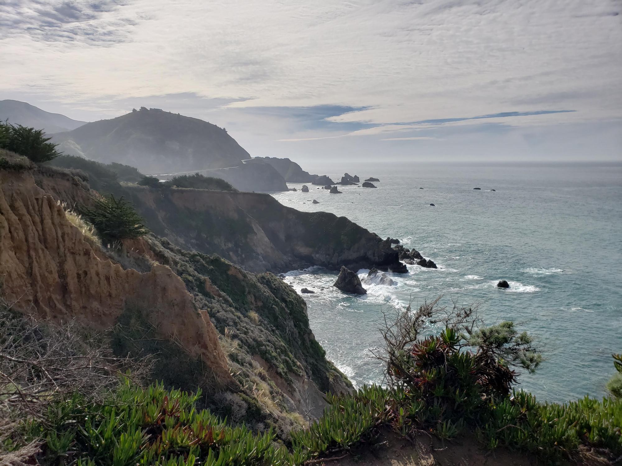
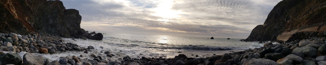
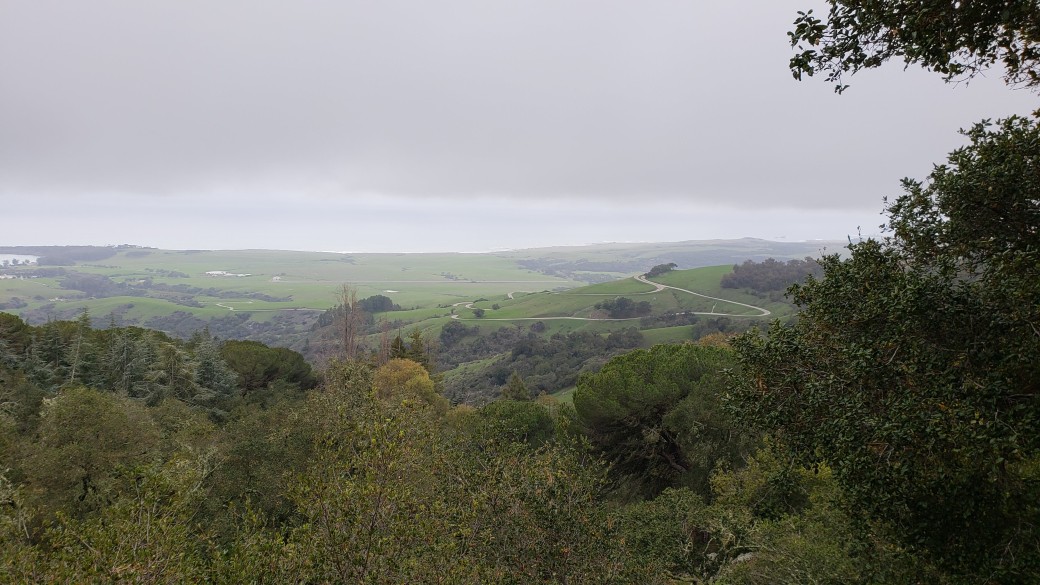
The scenery along the PCH was absolutely stunning. Luckily the traffic was very light, so I didn’t need to pull the RV over too often to let cars pass. We did see signs stating that we were REQUIRED to pull over at various points if there were more than four cars backed up behind us, but that never happened. I had to constantly remind myself that open gawking at the scenery could result in a plunge to a watery grave, so we stopped at a few of the so-called Vista Points to take photos and wait for my head to clear and my hands to stop shaking. My past teasing of Pat for getting queasy on some of the other treacherous roads was forgotten; I was just as nervous as she was. When we passed by the entrance to the infamous Esalen Institute, I briefly considered a quick stop for some new age counseling to calm our nerves, but who knows what might have become of us had we done that.
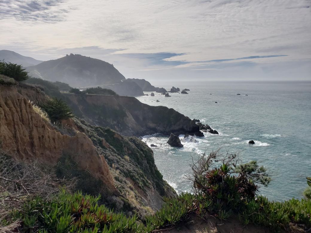
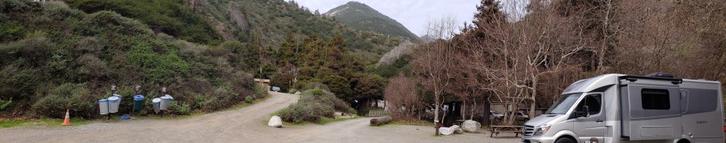
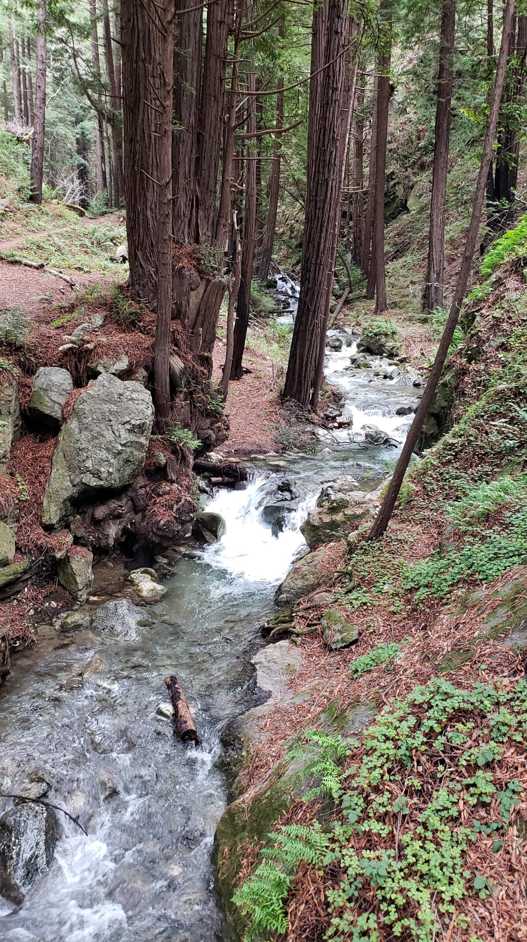
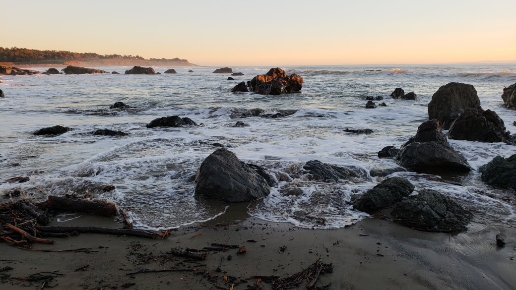
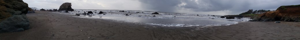
At any rate, we made it safely to our next destination, Limekiln State Park, located in a steep ravine along the Big Sur coast. The park did not allow RVs greater than 25 ft in length, because the entrance road has a very sharp turn and the 10-12 sites where RVs can stay will only accommodate small rigs. (This was another example of why we are so happy with our 24-foot RV, along with the fact that a longer one would almost certainly have found that watery grave alongside the PCH.) The park consisted of two parts – the inland side was a beautiful redwood forest with crystal clear creeks, and the ocean side opened onto a rocky cove with stunning views of the Pacific, with hundreds of birds soaring in the sky and nestling on the rocks. On Monday afternoon, we hiked along one of the trails through the redwoods to see some 1880’s vintage lime kilns (the source of the park’s name) and then enjoyed the evening sunset over the ocean. There was no cell service in the park and no electricity or water hookups for the RV, so our time there was very relaxing and enjoyable. Except that, after another somewhat decent day on Tuesday that included more hiking in the redwoods and another nice sunset, it started to rain again. With overcast skies on Tuesday afternoon and rain on Wednesday, our solar panels could not keep the RV batteries sufficiently charged, so we needed to run our generator for an hour each evening. Who knew the life of the modern RV camper could be so hard?
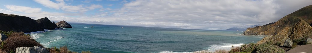
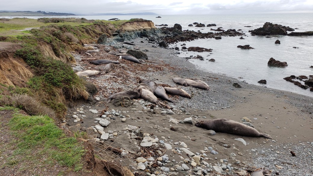
January 31-February 2 (Thursday-Saturday): Having thoroughly enjoyed Limekiln, but again feeling very soggy, we motored off on Thursday along the PCH toward San Simeon. This stretch of highway was even rougher and more dramatic than Monday’s drive. Add in the off-and-on rain and heavy overcast conditions and my anxiety level was literally through the roof, to the point where I had to stop the RV at a tiny little town called, very fittingly, Ragged Point. I pulled off the PCH into a parking lot to find, as if heaven-sent, a tiny general store, into which I staggered to purchase a bottle of Dr. Pepper. After retreating to the RV, taking several long slugs of soda pop and many deep breaths, I looked into Pat’s barely focused eyes and promised her that, if we made it to San Simeon, I would never tease her again about being nervous on scary roads. Thankfully, shortly after we departed Ragged Point, the PCH transformed from a ferocious monster to a tame, but still beautiful, kitten. We still had many gorgeous views of the Pacific, but the road was now situated on a wide expanse of flat land between the ocean and the nearby hills, in stark contrast to what felt like a three- or four-foot path carved into the cliffside between Limekiln and Ragged Point. We stopped at a Vista Point along the way to admire the elephant seals lolling about on the beach. The signs there explained that this region of the coast is the largest elephant seal rookery in the world, and that the seals collect there in large numbers in January and February to mate and give birth to their young.
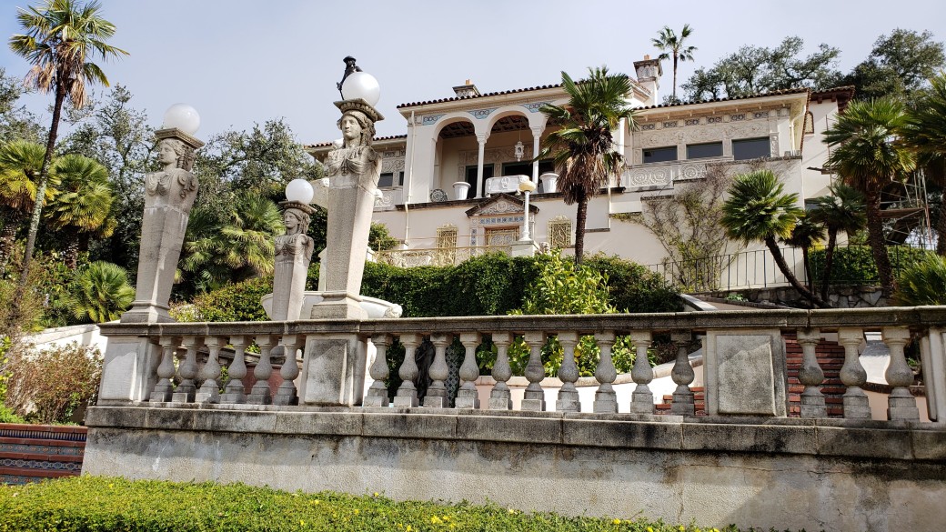
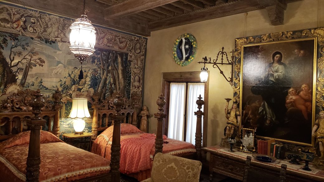
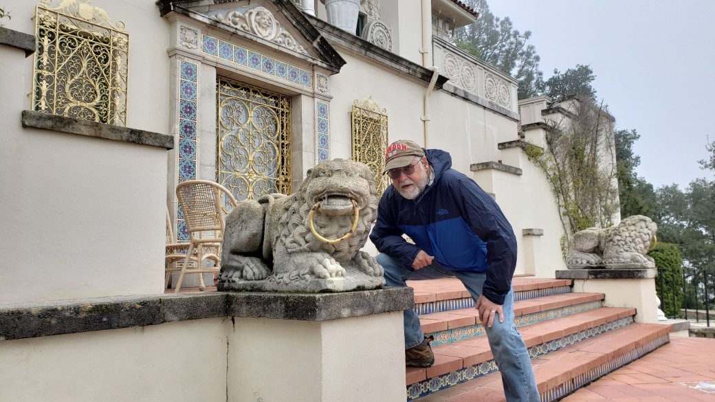
Shortly after the elephant seal area, we stopped the RV at the Hearst Castle Visitor Center just north of San Simeon. Hearst Castle is the name now given to the world-famous estate of William Randolph Hearst, the muckraking journalist and media mogul of the early 20th century. Hearst and his architect, Julia Morgan, built this amazing place over the period from 1919 to 1947. It is on top of a hill overlooking the Pacific to the west and beautiful valleys formed by the mountains to the east. To me, it felt like America’s version of the great castles of Europe. The architecture evokes a Mediterranean village, with a main mansion surrounded by several guest houses. The main house is filled with amazing artworks, including paintings, statuary, even entire Renaissance-era ceilings procured in Spain and transported to California specifically for Hearst’s project. On Thursday we took the so-called Grand Rooms tour, after which we intended to spend some time strolling the grounds, but guess what? By the time our two-hour tour ended, it was pouring rain again. So we took the bus back to the Visitor Center and sat in the RV for an hour (where we were able to get cell signals) until the rain stopped.
Once the rain let up, off we trundled to the Hearst San Simeon State Park, about five miles south of the Castle. We were able to get settled into our camp site, again with no electricity or water hookups and no cell signal, and walk along a very short trail to another beautiful Pacific beach, before it started to rain again. It rained off-and-on all night and into the morning.
On Friday morning, as we drove back to Hearst Castle for another two-hour tour, this one called the Upper Rooms Tour, we saw a sign stating that the PCH was closed to the north due to the excessive rain. This time when we finished our tour it wasn’t raining, though the heavy overcast kept us from enjoying what would normally have been spectacular views of the surrounding scenery. At any rate, we wandered the grounds for another hour or so, then bussed back to the Visitor Center to watch a movie about the building of the Castle before returning to the State Park.
As we were settling the RV back in to our site, a funny thing happened. It started to rain yet again. Within an hour, it was absolutely pouring, and it poured all evening and most of the night. On Saturday morning when I walked over toward the beach, the nearby creek had overflowed its banks and I had to turn back. But by afternoon the creek had receded, and we were able to have a nice walk along the beach. Again, we had to run the generator for cooking supper and to recharge the batteries.
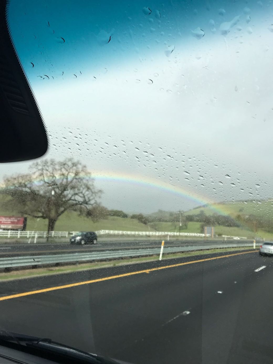
February 3-6 (Sunday-Wednesday): Despite all the rain, we enjoyed our stays at Limekiln and Hearst San Simeon State Parks, but after six days of boondocking we were ready to stay at an RV Park with electricity and laundry facilities while we hoped for a break in the weather. So, we headed inland toward Paso Robles. As we drove along a winding road through the mountains, the fog became so thick that I was only able to go 35-40 mph, causing a backup of about seven cars behind me. Unlike the PCH, the highway had no turnout spots, so I couldn’t pull over to let them by. Naturally, I stressed out about this – seems I can’t drive anywhere without undue anxiety. As we started to descend toward Paso Robles, the fog lifted a bit, and a large pickup decided to pass the entire line of cars – while driving uphill and ignoring the double yellow line on the road. Right after he passed us, there was a stop sign. A hundred yards past that, the impatient truck driver turned off the highway and raced up a long driveway. Did he realize he’d been lucky there were no cars going the other way? Did he care? Who knows. Just before we reached Paso Robles, we saw a lovely rainbow, which I took as a good sign of things to come.
After stopping in town for groceries, we found a nice place to stay, the Wine Country RV Resort. I was surprised to learn that Paso Robles is a well-regarded wine region, with over 300 wineries in the area surrounding the town. In fact, we learned that the RV Park offered a winery tour. That sounded fun, so after spending Sunday afternoon doing laundry, I went to the park office on Monday to sign up for it. It turned out there wasn’t another winery tour until Wednesday, and we were planning on heading back to the coast again on Tuesday. But, wouldn’t you know it, it rained again on Monday and Tuesday, so we decided to extend our stay and go on the Wednesday winery tour. We were rewarded for this decision with a beautiful, sunny day on Wednesday and had a great time on the tour. We were chauffeured by a friendly woman named Kat to four different wineries – Lone Madrone, Whalebone, Treana, and Eberle. At each one, we sampled six or more wines and bought two bottles from among the selections we had tasted (eight bottles in total). The tour included a nice lunch of crackers and cheese after the second winery, and Kat was very informative and entertaining as she ferried us around the area. When we got back to the RV, I was pleased to find I was still upright, but I was definitely not feeling anxious in any way.
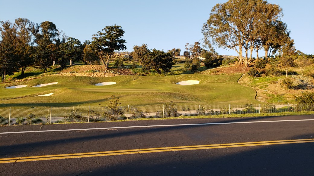
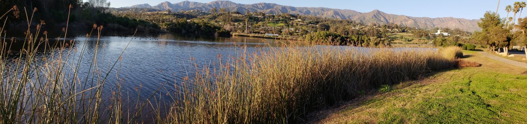
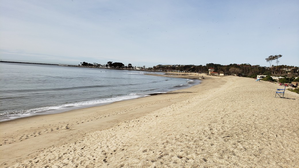
February 7-10 (Thursday-Sunday): On Thursday, we drove to Santa Barbara, where we had reserved a site at the Sunrise RV Park, a small park just off the Highway 101 freeway. Once there, I rode my bike to the Santa Barbara harbor to check out the lay of the land and inquire at the Visitor Center about tours of the nearby Channel Islands National Park. My route took me past a lovely golf course, through a bird refuge, and along the Pacific Ocean beachfront.
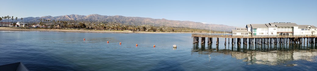
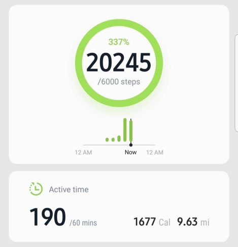
At the Visitor Center, I learned that the only boats to the Islands sail from Ventura or Oxnard, so we decided to book a Channel Islands Whale Watching cruise out of Ventura for the coming Sunday. On Friday morning, Pat had a business conference call, so I went for a walk around the neighborhood of the RV Park. Once Pat was done with her call and we’d eaten lunch in the RV, we walked the route I’d biked the day before. Our walk included an excursion to Stearns Wharf, an old steamboat pier now sporting several shops and restaurants. I got a waffle cone and Pat had a latte before we walked back to the RV. By this time my feet were complaining loudly, and I told Pat I was sure I’d covered at least 20,000 steps that day. I’ve only been using the step-counting feature on my phone since last July, shortly after my 68th birthday, but my previous high daily total since then was just over 18,000. I’ve walked far more than that in a single day many times during my younger days, before there were such things as step counters, but as a peripheral neuropathy sufferer over the past 15 years or so walking has become somewhat hard on my feet. Now, fishing out my phone, I saw that my step total was 19,800, a modern era personal record. But I’d just claimed to have walked 20,000 steps and was not about to be called a liar, so I headed out for another walk around the RV Park and returned to see that my new total was 20,245 (supposedly 9.63 miles). Take that, you pathetic, complaining feet!
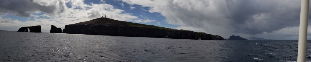
Guess what happened next. It started raining Friday night and rained most of the day on Saturday. It was still sputtering as we drove down to Ventura on Sunday. The rain had stopped, but it was overcast and windy when we arrived at the Island Packers boat dock. Our cruise departed at 9:30 AM, and we encountered brief periods of both sun and rain as we sailed out to and around the Channel Islands. On the way, we encountered humpback whales, gray whales, dolphins, sea lions, pelicans, and gulls – what an absolutely delightful trip it was! I got some good videos of leaping dolphins and whales and am trying to learn how to edit them and make gifs. The images below do not do justice to what we actually saw on the trip. Let me just say that this venture to our seventh National Park was one of the real highlights of our Excellent Adventure.
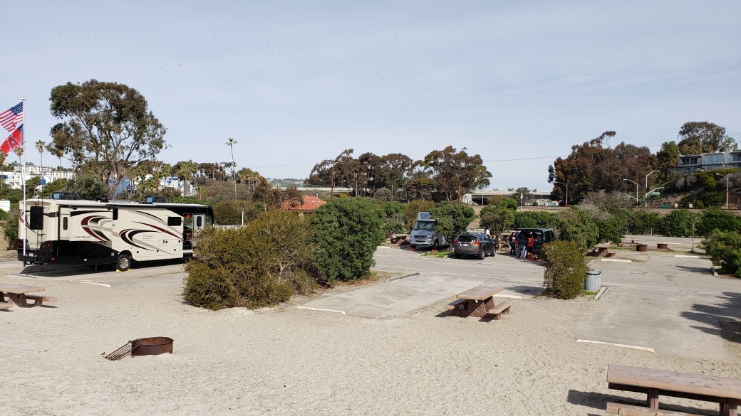
February 11-12 (Monday-Tuesday): On Monday, we pulled up stakes in Santa Barbara and headed south again along the coast. The weather was quite nice this time as we drove to and beyond Ventura, so we were able to fully enjoy the beautiful coastal scenery. That lovely drive gradually turned into a mind-numbing slog as we reached the greater Los Angeles area and traversed from one gigantic freeway to another, often coming to a near stop amidst a sea of cars and trucks. Thank goodness we weren’t traveling during the rush hour. Eventually we emerged from the concrete jungle and once again began to enjoy the Pacific coast as we made our way to Dana Point. We stayed Monday and Tuesday nights at Doheny State Beach, literally a hundred yards from the ocean in a nice campground with no electric or water hookups. We made good use of the bikes both days, exploring the pricey real estate along a local road to the south on Monday and riding into town for a nice lunch on Tuesday (we ate at the Harbor Grill in Dana Point, where I had the best crab cakes I’ve ever eaten). And, yes, it rained again on Monday night. Will it ever end?
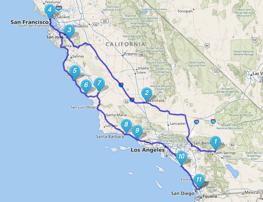
Below is a map of our travels since leaving Palm Springs in early January. (Click here for maps of the entire trip so far.) After Doheny State Beach, we headed off toward San Diego. Check back in a couple of weeks for a report on our activities there and wherever else we may have found ourselves by then.

Wow, we are amazed by the dramatic and beautiful photos. The real thing, with all the scary driving, must have been astounding. We are enjoying your travel posts ever so much. Pat, we got your card from the Hearst Castle. “Just shows you what God could have done if he had money.” (an impression from Dorothy Parker, maybe?). M&M
LikeLike
Thanks so much for your excellent and enjoyable travel blog.
Happy and safe travels on the rest of your journey.
LikeLike