Pat and Dave’s Excellent Adventure – PART 6: California Dreaming

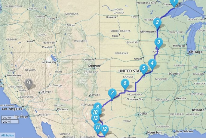
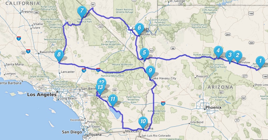
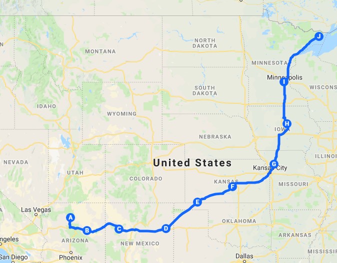
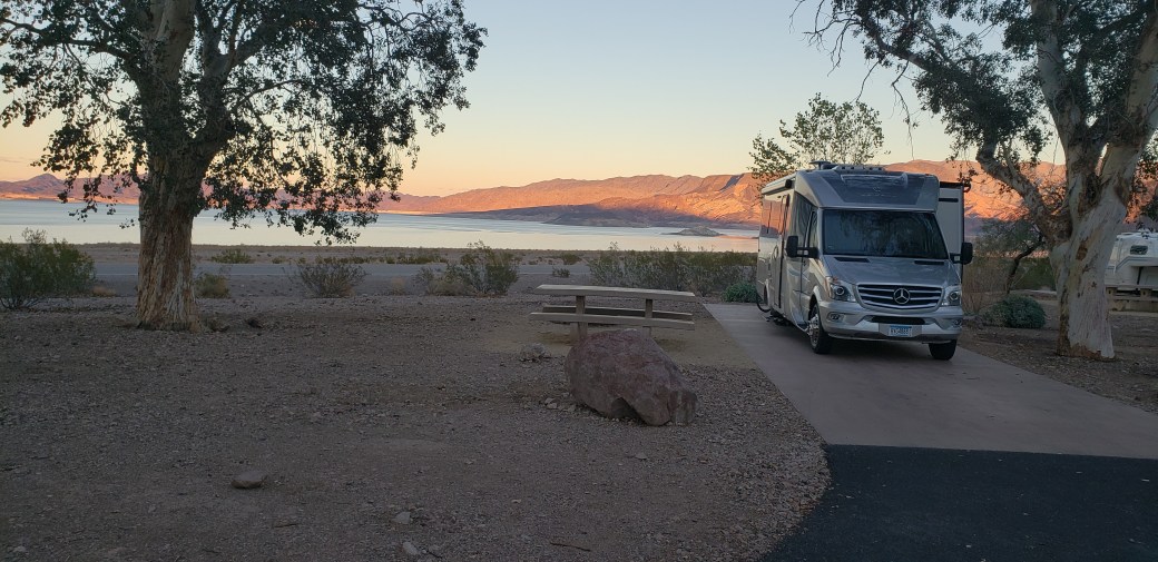
Our last episode ended in Mojave, CA, after three nights in Death Valley National Park. From there we headed east toward the Colorado River again. Be sure to check the Maps post – Map 3 now includes the places where we stopped during the remainder of 2018.

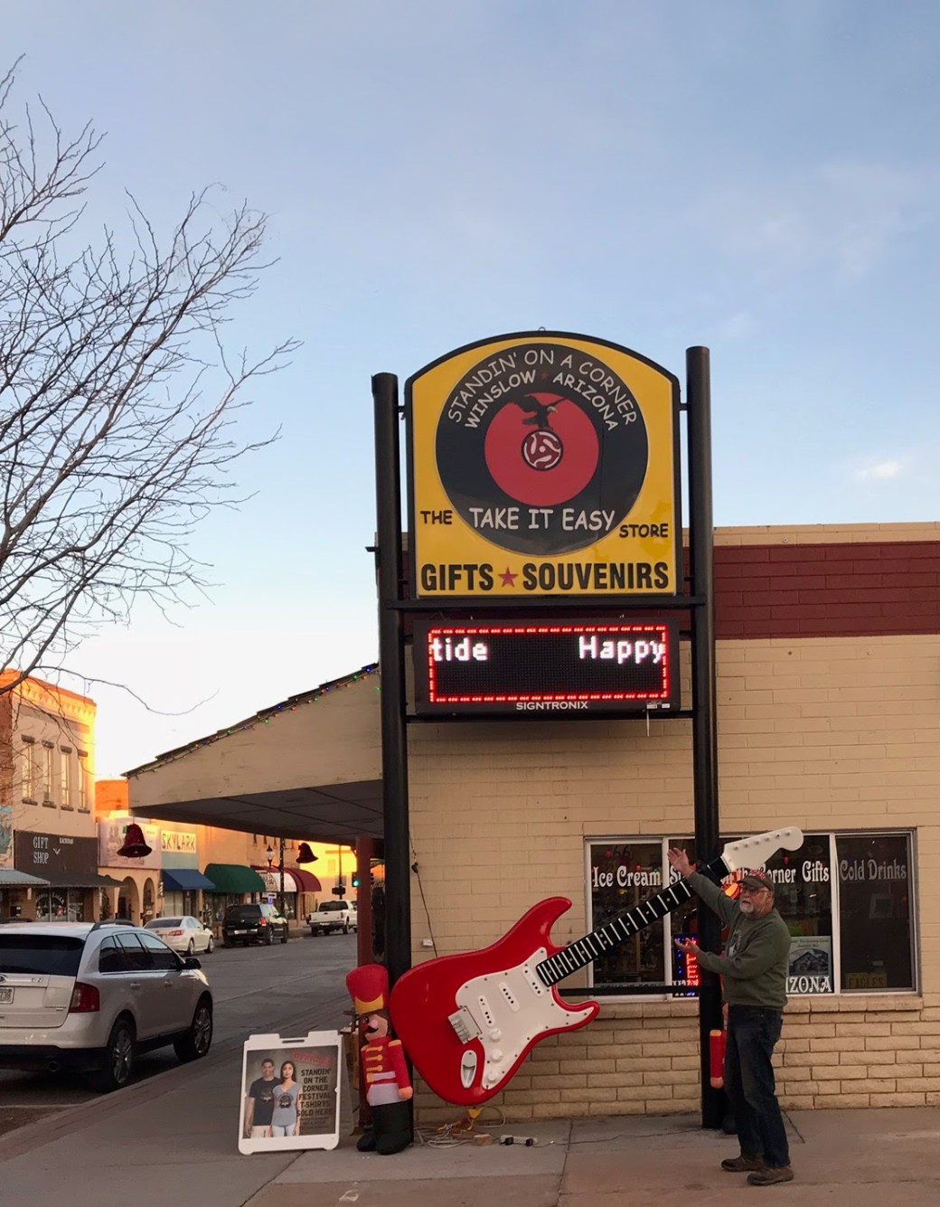
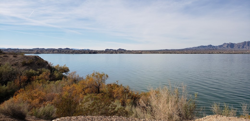
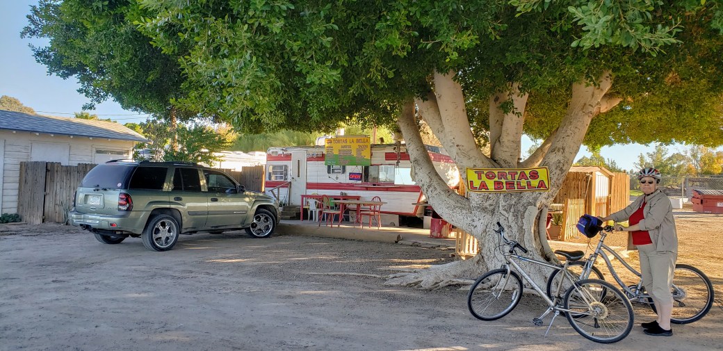
Dec 8-10 (Saturday-Monday): We drove east across the Mojave Desert in central California, and we noticed a few Joshua trees among the desert scrub during the first 20 or 30 miles. (There will be much more about Joshua trees below.) We also saw some enormous solar arrays. Eventually we wound through the Sacramento Mountains to the Colorado River, crossing over into Arizona and then heading south to Lake Havasu City. Once there, we booked a 3-night’s stay at the Campbell Cove RV Resort ($24 per night with Passport America discount) with full hookups, restrooms and showers, laundry, clubhouse and lots of other stuff, but the Wi-Fi only worked near the office and not at our site, and you needed a cable box for cable TV, which we didn’t want to bother with. We did get a whole bunch of TV stations through our antenna, mostly featuring reruns of old programs like Star Trek and its progeny (which I found oddly addictive). Interspersed with some loafing about, we went for several bike rides around the area. This is the place where some clever folks relocated London Bridge when the Brits decided to replace it in the 1970s, so naturally we had to bike over to see that. To be honest, it didn’t look like much, and I wouldn’t be all that surprised if only a few of the original bridge’s stones actually made the 5,280-mile trip from London – you just can’t trust these marketers and real estate developers to tell the truth, at least the whole truth and nothing but the truth. Anyway, it was kind of fun to see.

20181209_145110

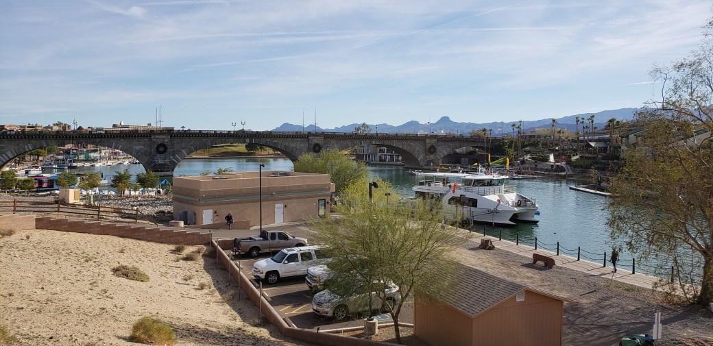
One day, we rode across the bridge and around a roughly 5-mile hiking/biking loop on a peninsula that juts into the Colorado River.

20181209_142130

Another day, we rode to the local library (where we used the Wi-Fi since we couldn’t get it at the RV resort). The library just happened to be next door to a golf equipment shop, which we just happened to visit before proceeding to a cute little seafood and burger emporium in the tourist mecca adjacent to London Bridge. (I also just happened to order those new irons I’ve been pining over while we just happened to be visiting the golf shop.)

Dec 11-13-(Tuesday-Thursday): Tuesday morning we headed south, following a highway on the Arizona side of the Colorado River. For much of the first 40 miles, the road was very close to the river, winding up and down and around through some fascinating rock formations, affording some excellent scenery. Near Parker, we passed by a gorgeous golf course called Emerald Canyon, and I nearly stopped to play. But I had decided to forgo golf until the new clubs arrived so instead vowed to come back on our return journey. After Parker, the road veered south, away from the river and through the dull, drab desert until we reached Yuma, AZ. Our final entry into Yuma followed interstate highway I8 – as we exited the freeway to head into town, we entered California for roughly two minutes before finding ourselves back in Arizona again. After leaving the freeway, we meandered through Yuma to our next destination, Rolle’s Lynda Vista RV Park ($15 per night, cash only, with Passport America discount for full hookups, nice restrooms and showers, and the cheapest laundry facilities we’ve found yet — $0.75 for the washers and $0.25 for the dryers). This place is located in what some North Dakotan described in an on-line review as a “bad neighborhood,” but I found the surroundings quite fascinating as I biked around to explore the area and to get stuff at a nearby grocery store. There were at least 7 RV parks within a half mile, ranging from super fancy to rather seedy, and countless permanent resident mobile home parks with trailers that were for the most part, shall we say, less than pristine. Many of the mobile home park residents had pet kennels and chicken coops, and one even had an enclosure with half a dozen cattle. There was also a sizable farm stuck in the middle of all this which I think was growing lettuce. Our site was visited several times by chickens, cats, and dogs from the park immediately to our west. At about 3:30 PM each day, school buses disgorged scores of school kids throughout the neighborhood, and at about 4 PM an ice cream truck began trolling the park next door, blaring a tinny, annoying but addictive tune that made me want to jump the chain link fence and buy an Eskimo Pie. If I weren’t so old and feeble, I probably would have done it. But the place was very relaxing, we got excellent Wi-Fi and good TV reception (though half the stations were Spanish language) so I could watch more episodes of Star Trek and Star Trek TNG. Perhaps the highlight of our stay at Rolle’s was a bike ride to a tiny taco stand, set back in the trees alongside a busy street a few blocks to the south. The proprietress had limited English, and I have limited Spanish, but we managed to order and consume three delicious pork tacos that she fried up fresh on her grill.

20181213_154811

Dec 14-15 (Friday, Saturday): On Friday, we headed west again, back into California, and drove to the Salton Sea State Recreation Area. I was surprised to learn that the Salton Sea has only existed since 1905. In the early 1900’s, the concept of using the Colorado River for irrigation of farm land in California was in its infancy. One of the early irrigation canals proved to be insufficiently engineered to handle flood waters when the river swelled from rains and springtime snow melt, and the river flow poured through the primitive lock system and into the Salton Sink, a depression in the desert second only to Death Valley in terms of its below-sea-level elevation. Essentially the entire flow of the river poured into this depression for two years, creating the immense lake. While its contours have fluctuated considerably over its 100+ years of existence, the Salton Sea is currently 30 miles long by 13 miles wide, with an average depth of 25 feet (two areas are over 50 feet in depth). The Colorado River has subsequently been tamed by massive flood control projects such as the Hoover Dam, which created Lake Mead, and its waters are carefully controlled and distributed for agricultural use in California, Arizona, and Mexico. As a result, there is basically no inflow to the lake any more except agricultural runoff and some minor melt waters from the nearby mountains. Evaporation now exceeds inflow, so the lake is becoming continuously saltier. Its salinity is now 60% greater than the Pacific Ocean, though it is still less than the Great Salt Lake. In short, the Salton Sea is dying. Many of the fish species have disappeared, though the hardy tilapia still flourishes, and the bird species that feed on the fish are also disappearing. However, it is still a hauntingly beautiful place.

20181215_125024

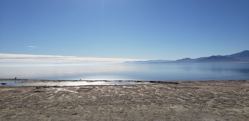
We stayed for two nights at an RV campsite near the main Visitor Center ($28 per night with Senior discount for full hookups, nearby restrooms but no showers, Wi-Fi, or other amenities). Of the 40+ campsites available, only 4 or 5 were occupied, so we practically had the place to ourselves. In addition to the campers, there were some day visitors, but all in all it was nearly deserted. There were nice paved roads and an accessible nature trail loop for biking, which we explored on Saturday. There was also a hiking path that was too sandy for bikes. We rode out to the beach area on the accessible loop, parked our bikes and walked along the beach for a mile or so, then walked back along the inland hiking trail.

20181214_154032

20181215_135436

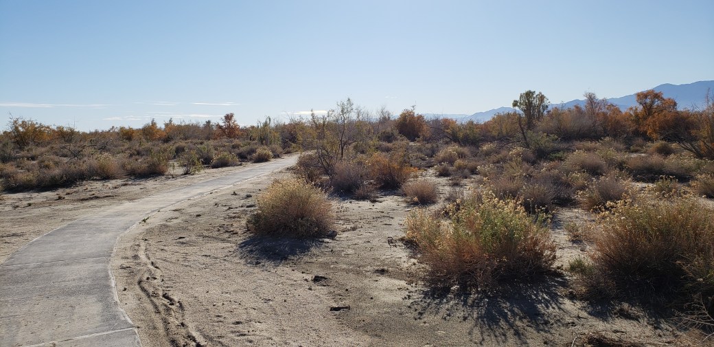
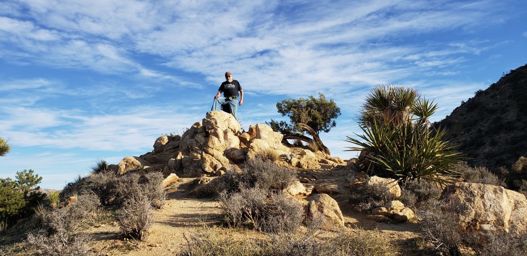
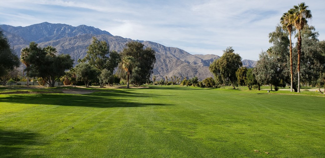
Dec 16-19 (Sunday-Wednesday): On Sunday we drove to the Joshua Tree National Park, where we had reserved a campsite for three nights at the Black Rock Canyon Campground ($10 per night with Senior Pass for boondocking – no electricity, water, or sewer hookups). The entire area was very sandy and unsuitable for biking, so our main physical activity here was hiking. On Monday, we walked the 4.1-mile so-called “Short Loop” located a half-mile from our campsite. On Tuesday we hiked the “High View Nature Trail,” which was only 1.5 miles long but required another mile each way to get there and back from our campsite. Each of these hikes had significant elevation changes, from 4000 ft at the campground to high points of 4500 ft on the Short Loop and 4900 ft on the High View trail. The scenery was fantastic, with fascinating rock formations, thousands of the unusual Joshua trees, and beautiful vistas of the surrounding mountains and valleys. Interestingly, the campground was very sparsely occupied with perhaps 10-20% of the sites occupied.

20181218_150021

20181217_132640

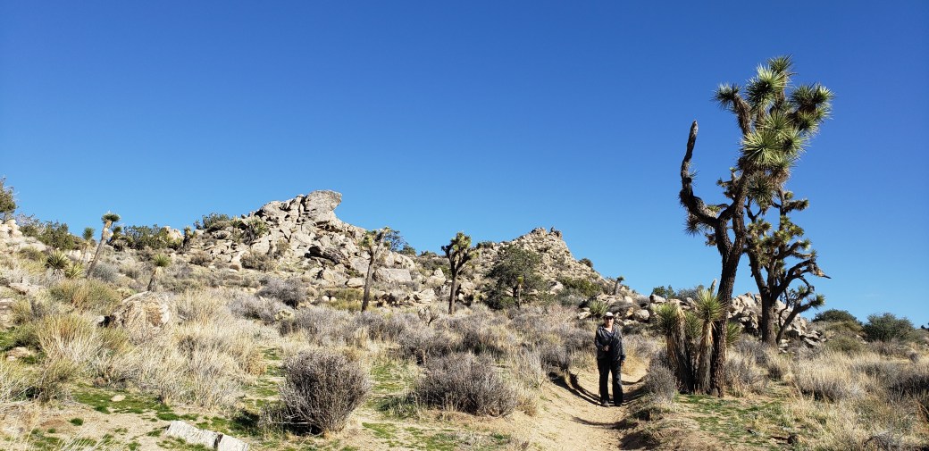
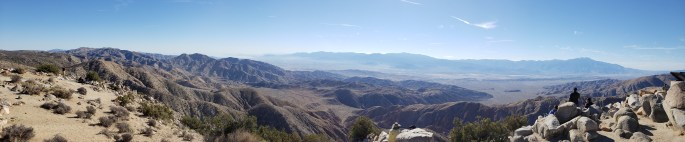
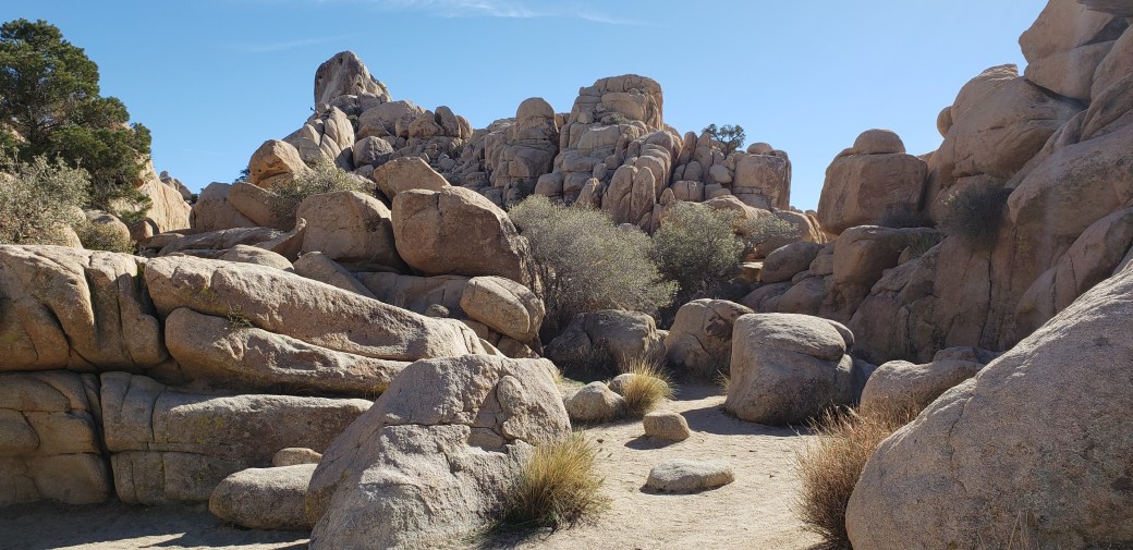
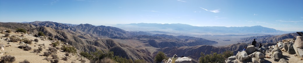
On Wednesday we left the campground and drove to the Visitor Center in nearby Yucca Valley, then drove into the main part of the Park to explore some of the highlights accessible from the main road. In contrast to the campground, there was a long line of cars waiting to get in through the main gate (where we obtained free entry with my Senior Pass), and we encountered throngs of people at all our stops. These included Quail Springs and Hidden Valley, two areas with amazing rock formations that make for a rock climber’s paradise. We stayed on the main trails, though, lacking the skills and the courage (or insanity) to join the myriad climbers we observed. Our final visit in the Park was to the Keys View overlook, which at 5185 ft elevation provided a stunning overlook of the Coachella Valley and the surrounding mountains. As we drove out of the park we both agreed that, like virtually every place we’ve gone so far on this trip, Joshua Tree National Park was a beautiful and rewarding place to see.

20181219_122923

20181219_131924

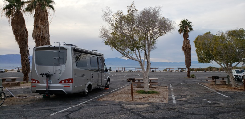
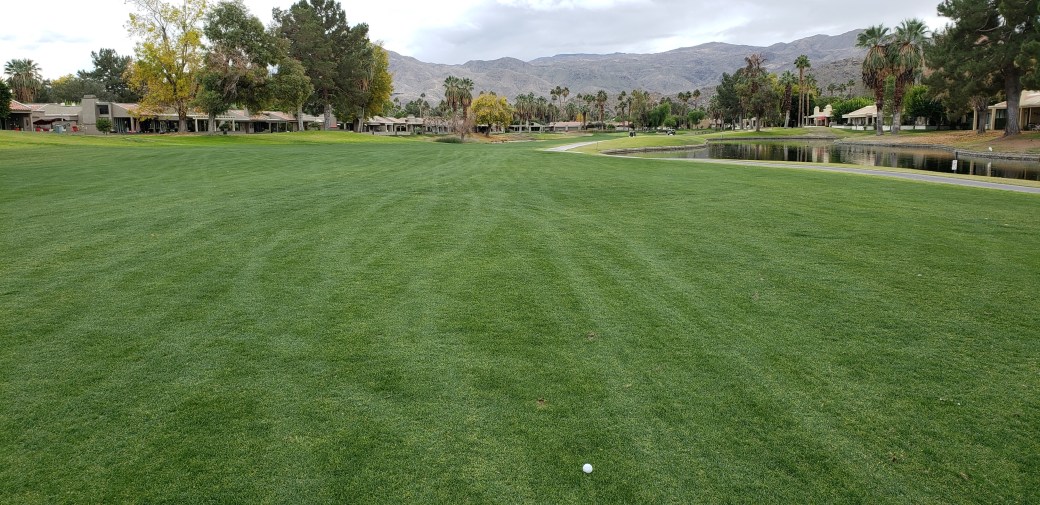
Dec 19-Jan 8: From Joshua Tree, we headed west and down into the Coachella Valley to our next destination, the Catalina Spa RV Resort in Desert Hot Springs. The RV Park and the municipality get their names from the hot water springs that bubble up through the desert floor in this area. The RV Park is one of those places where people come to stay for long periods – it has some 450 sites for RVs and several permanent cabins and many amenities including two naturally heated pools with adjacent hot tub/spa mineral baths, nice restrooms and showers, mail delivery, a store, pickleball courts, a mini golf course, a ballroom/dining hall, etc. We chose it because we were able to get a good price ($24 per night including Passport America discount for full hookup site plus the aforementioned amenities) for a three-week stay. The only disappointment was the somewhat falsely advertised Wi-Fi – not only is it not free, but we could barely even get a signal at our site, so we had to just rely on mobile data.

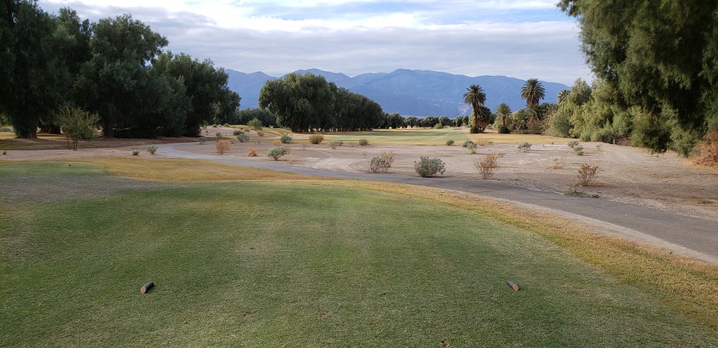
We wanted a long term stay for two reasons: 1) Pat needed to go back to Minnesota for a couple of weeks to deal with issues related to sale of the family farm, and 2) I wanted to stay somewhere I could golf my brains out. The new golf clubs were waiting for me when we checked in, so I took the old, poorly performing ones to a local used club store and sold them for $25. I dropped Pat at the airport on December 23 and immediately went to the Mesquite Country Club for my first round with the new irons. As of December 26, I’ve also played at the Cathedral Canyon Country Club and the Date Palm Country Club. (They may be called Country Clubs, but they all have let me play in my blue jeans, so they’re the super exclusive kind of country clubs, although at the last one I was told not to wear blue jeans if I come back again. Harrumph!) While I won’t bore readers with details, I will say I am very pleased with the new irons. And since my brains have not as yet fallen out, I must play more – much more – in the days to come.

20181223_132526

20181225_120406

So here we sit (actually only I am sitting here) in Desert Palm Springs until we depart for places yet undecided on January 9, 2019. Since we won’t be doing much of anything worth reporting until then, don’t look for another blog update until late January. Until then, I wish all my readers a happy holiday season. Moreover, I hope each and every one is also having an Excellent Adventure!

Pat and Dave’s Excellent Adventure – Travel Maps

I’ve been trying to find a way to map out the entire trip so far but have been stymied by the limitations of Google Maps, which doesn’t allow more than 10 stops on a map, and other free software tools which have similar limitations. (Heaven forbid that I would actually buy some mapping software!) After considerable fussing, I abandoned the idea of a single map and started creating partial maps using the online Rand McNally Trip Maker tool. I’ll periodically add new maps as I reach the limit for stops (either 25 per the Rand McNally software limit or fewer when the giant numbers on the maps begin to obscure the actual trip line. Be sure to check in on this post as you read through the others describing our activities.

MAP 1:

Map1

MAP 1 LEGEND:

1: Home
2: Nick’s place
3: Pine Lake State Park, IA
4: Watkins Woolen Mill State Park, MO
5: Eisenhower State Park, KS
6: Boiling Springs State Park, OK
7: Palo Duro Canyon State Park
8: Artesia RV Park, Artesia, NM
9: Carlsbad Caverns National Park
10: Guadalupe Mountains National Park
11: Loma Paloma RV Park, Presidio, TX
12: Big Bend National Park

MAP 2

Map2

MAP 2 LEGEND:

1: Big Bend National Park
2: Desert Willow RV Park, Van Horn, TX
3: Ft. Willcox RV Park, Willcox, AZ
4: Chiricahua Mountains National Monument
5: I10 RV Park, Benson, AZ
6: Picacho Peak State Park, AZ
7: Sentinel Peak RV Park, Tucson, AZ
8: Sunflower RV Resort, Surprise, AZ
9: Leaf Verde RV Resort, Buckeye, AZ
10: Meteor Crater RV Park, Meteor City, AZ
11: Petrified Forest National Park

MAP 3:

Map3

MAP 3 LEGEND:

1: Petrified Forest National Park
2: Winslow, AZ
3: Arizona Meteor Crater
4: Walnut Canyon National Monument
5: Silver View RV Resort, Bullhead City, AZ
6: Lake Mead National Recreation Area
7: Death Valley National Park
8: Sierra Trails RV Park, Mojave, CA
9: Campbell Cove RV Resort, Lake Havasu City, AZ
10: Rolle’s Lynda Vista RV Park Yuma, AZ
11: Salton Sea State Recreation Area
12: Joshua Tree National Park
13: Catalina Spa RV Resort, Desert Hot Springs, CA

MAP 4

Map 4a


MAP 4 LEGEND:

1: Catalina Spa RV Resort, Desert Hot Springs, CA
2: Shady Haven RV Park, Bakersfield, CA 
3: Coyote Canyon RV Resort, Morgan Hill, CA
4: San Francisco, CA
5: Limekiln State Park, CA
6: Hearst San Simeon State Park, CA
7: Wine Country RV Park, Paso Robles, CA
8: Sunrise RV Park, Santa Barbara, CA
9: Channel Islands National Park (Visitor Center), Ventura, CA
10: Doheny State Beach, Dana Point, CA
11: Sunland RV Resort, La Mesa, CA
12: Rolles Lynda Vidta RV Park, Yuma, AZ
13: Oasis Palms RV Park, Thermal, CA
14: Joshua Tree National Park, Cottonwood Campground
15: Catalina Spa RV Resort, Desert Hot Springs, CA

Rand McNally is not working out, so I’m reverting to Google. As a result, there is a change in format starting with Map 5.

MAP 5:

Map 5

MAP 5 LEGEND:

A: Catalina Spa RV Resort, Desert Hot Springs, CA
B: Pirates Den RV Resort, Parker, AZ
C: Silver View RV Resort, Bullhead City, AZ
D: Temple View RV Resort, St. George, UT
E: Zion Canyon RV Campground, Springdale, UT
F: Redcliff Dune Trail (way stop)
G: Lake Mead National Recreation Center, Boulder Beach Campground
H: Grand Canyon Camper Village, Tusayan, AZ

MAP 6:

Map 6

MAP 6 LEGEND:

A: Grand Canyon Camper Village, Tusayan, AZ
B: Homolovi Ruins State Park, Winslow, AZ
C. Lavaland RV Park, Grants, NM
D. Blaze-In-Saddle RV Park, Tucumcari, NM
E: Seward County Park, Liberal, KS
F. Sand Hills State Park, Buehler, KS
G. Wallace State Par, Cameron, MO
H. Pine Lake State Park, Eldora, IA
I. Nick’s Place
J. Home
 

Pat and Dave’s Excellent Adventure – PART 5: Back to the Boonies

We last left off in Phoenix, having dropped off our rental car and heading away after our 2-week stay in primarily urban settings.

Nov 26-27 (Monday, Tuesday): We drove north from Phoenix, past Flagstaff and on toward Winslow, AZ. The drive was very interesting as the highway climbed into the mountains, leaving the cactus plants behind in favor of Douglas fir and ponderosa pine. It was tough going for the RV – we would pass a truck lumbering along at a snail’s pace on the uphill sections only to have it barrel past at lightning speed on the next downhill – and we got about the worst mileage of any stretch yet at just under 14 mpg. (On relatively level stretches traveling at 70 mph or less we’ve regularly topped 16 mpg, and occasionally have exceeded 17.) As we left Flagstaff behind, the terrain once again reverted to the type of desert we’ve been seeing for the most part, sparsely populated with scrub brush and cactus. Our day’s destination was the Meteor Crater RV Park, where we booked a spot for two nights ($36 per night with Good Sam discount for full hookup, wi-fi, and shower facilities – probably the best showers we’ve had yet).

On Tuesday we drove about 75 miles to the Petrified Forest National Park, once again being admitted for free with my Senior Pass. Here we found yet another stunning display of Mother Nature’s artwork. We drove through the large park on the main road, stopping for several overlooks and two nice hikes. The first hike was a short, easy walk along the Giant Logs trail, near the Rainbow Forest Visitor Center. Beautiful, stone trees, 2-3 feet in diameter, their former fibrous materials transformed into agates millions of years ago, litter the desert floor. Most have broken into nearly uniform lengths of about 4 feet, giving the impression of having been sawn into stone logs by some giant, prehistoric mason. There are also several longer, unbroken segments, however, including one measuring 35 feet. Our second hike followed the Blue Mesa Trail, a 2-mile round trip down into and around a gorgeous canyon, featuring stunning vistas of blue-tinted sandstone badlands surrounding a floor which sports a number of petrified logs. We also stopped to see Newspaper Rock, which consists of two large boulders featuring hundreds of petroglyphs, and the remnants of an ancestral Puebloan village from about 1380, called Puerco Pueblo. Our brief visit to this amazing National Park was truly fascinating.

20181127_110137

20181127_123110

On the way back to the RV Park, we stopped for dinner in Winslow. Naturally, I had to spend a moment “standing on a corner,” but apparently I was NOT “such a fine sight to see,” as there was no “girl … in a flatbed Ford slowing down to take a look at me”. (Are there any Eagles fans reading this?) Pat and I commiserated over this sad reality with excellent hamburgers at the RelicRoad Brew Pub, where my spirits were once again lifted by a Nitro Polygamy Stout, a specialty of the pub. As a side note, I have never seen as many semitrailer trucks as we encountered while driving on I40 to and from the National Park. The trucks made up at least 90% of the traffic, and the rest stop near Winslow was crammed with 50 or more parked trucks. This busy road used to be the famous Route 66 from Florida to California, and this history was prominently featured in Winslow.

IMG_1762

It got a bit chilly overnight at the RV Park – not that 22 degrees should frighten any true Minnesotan, but we have to be somewhat careful about freezing the water in the RV’s tanks. We also saw that snow was forecast for the area in the coming days, so we decided to hightail it out of there and head west in the morning.

Nov 28-29-(Wednesday, Thursday): Wednesday morning dawned to reveal clear, beautiful, bright blue skies. Before heading for warmer climes, we drove 6 miles to the famous Arizona Meteor Crater. This giant depression was formed about 50,000 years ago by a house-sized meteor that crashed into the desert. An impressive museum has been erected at the site, with extensive displays explaining the crater’s history. After viewing the various exhibits and watching a 20-minute movie, we went outside to see the giant hole and were duly impressed.

20181128_094635

As we drove west again after our crater visit, the wind began to howl, nearly blowing the RV off the highway a few times. Feeling somewhat rattled from the drive, we stopped for a two-hour visit at the Walnut Canyon National Monument just outside Flagstaff. This beautiful, steep-walled canyon was home to hundreds of cliff dwelling Pueblo people some 800 years ago. We took an excellent trail from the Visitor Center down into the canyon, where we enjoyed the spectacular scenery and explored remnants of the ancient village homes. (As with so much of the infrastructure in the National Parks and Monuments, the trail and Visitor Center were very well built by CCC workers in the 1930s.)

20181128_113404

20181128_111511

After vising Walnut Canyon, we headed west again to our revised destination, Bullhead City, AZ. On the way from Flagstaff (6900 ft elevation) we drove through many mountain passes, descending and climbing and descending again, eventually dropping to 540 ft in Bullhead City. This relatively sleepy city lies along the banks of the Colorado River, directly across from Laughlin, NV, home to 8 or 10 hotel casinos and an 1880s style riverboat casino. We checked into the Silver View RV Resort, situated on a hill overlooking the river, and the bright lights of Laughlin were very pretty at night. The RV resort ran us $22 per night complete with full hookups (50% Passport America discount), showers, and a nice on-site deli. It was easy to bike around to the restrooms and the deli, where I enjoyed a Nathan’s hot dog on Thursday before it started raining. We loafed around all day on Thursday, pleased to be getting only rain rather than the snow that fell back in the Winslow area.

Nov 30-Dec 3 (Friday – Monday): On Friday, we took off for the Lake Mead National Recreation Area, about 65 miles NNW from Bullhead City. While sitting around in the rain on Thursday, we had booked three nights at the Lake Mead RV Village ($35 a night with Good Sam discount for full RV hookups, showers, laundry, on-site store, wi-fi, and 40 channels of cable TV). It was a nice enough place, but upon arrival we discovered an NPS campground right next door, with beautiful sites but no power, water, or other amenities, where we could boondock for only $10 a night with my Senior Pass. So, after doing laundry at the RV Village on Saturday, we cancelled out of the third night and moved next door.

20181202_160908

We made very good use of our bikes, as there was a bike trail running along the main entrance road and the campgrounds were located between that road and another paved road. We rode a couple of miles on the bike trail Saturday, all uphill, seemingly both ways, and we had to ride into a near gale force wind, again seemingly both ways. I know that couldn’t really be true, but my aching legs sure felt like it. On Sunday we took the other road and went to the marina/harbor to catch a Lake Mead boat cruise. This involved a very loooong, thrilling downhill coast after riding about a mile parallel to the lakeshore. That part was great fun; unfortunately, we paid for it ten times over coming back up the hill – my legs resembled spaghetti noodles for an hour after we got back. But the cruise was well worth the pain, with stunning views of the lake, the surrounding mountains, and a unique view of the Hoover Dam.

20181202_124229

Dec 4-6 (Tuesday-Thursday): After loafing around at Lake Mead for another day on Monday, we pulled up stakes and headed west again, winding our way up and down through lovely mountain passes, making for a very pleasant 150-mile drive to Death Valley National Park. We stayed for two nights at the Furnace Creek campground ($11 per night with Senior Pass for a flat, paved boondocking site) and another night at the Stovepipe Wells campground ($7 per night with Senior Pass for a flat, gravel site). Death Valley was the biggest surprise of the trip so far. I’d envisioned a flat, sand covered wasteland – after all, the place barely gets 4 inches of rain per year. (Interestingly enough in this arid land, it rained for much of the day on Thursday.) We weren’t prepared for the beauty and the contrasts we actually found there. On the way in, we descended from a 3000 ft mountain pass to the valley itself, at sea level ad below, over a 10-mile stretch. There sat the huge, 130-mile long valley nestled between majestic peaks rising on all sides. During our visit we saw many beautiful and surprising things: the intricately formed badlands at Zabriskie Point; the salty, mineral-rich desert at Badwater Basin (the lowest point in North America at 280 feet below sea level), where hexagonal crystalline patters of salt adorn the floor; the stark contrast offered by the nearby, snow-capped, 11,049-foot Telescope Peak; the beautiful pastel-colored hills along Artist Drive; ruins of the borax mining operations made famous by the 20-mule teams in the 1880s; the sculpted sand dunes at Mesquite Flat – as I said, much more than we imagined. Artist Drive was limited to vehicles no longer than 25 feet due to the sharp, hairpin turns and dramatic dips – that stunning drive alone was probably enough of a reason to justify our purchase of a 24-foot RV.

20181205_101215

20181205_111928

Perhaps most surprising of all, however, was the Oasis at Death Valley, a newly-renovated resort with a nice restaurant, store, plenty of lodging for visitors, and even – A GOLF COURSE! Despite the paltry annual rainfall, the water collects in springs which provide plenty of water to irrigate the grass and the palm trees in the resort area, so it truly lives up to its name. The golf course was only half a mile from our campsite at Furnace Creek, so I walked over with my clubs on Wednesday afternoon and played my lowest round ever – 190 feet below sea level. My score was definitely not my lowest ever as I topped and shanked my irons like the complete duffer I’ve apparently become. (This may be my last round until I get my coveted new irons.) But the course was very pretty, challenging, and it was an all-around fun experience.

20181205_140325

Dec 7 (Friday): Having arrived through the eastern entrance, we left Death Valley on Friday using the western route. The roads we followed were clearly less travelled than the ones we came in on, resembling a strip of tar thrown down fifty years ago and simply forgotten (I’m guessing they don’t need too much maintenance). I felt a little uneasy as we drove for mile after mile through a vast nothingness, the surrounding desert containing nothing but a few dinky, scrubby bushes. For a long time we didn’t even see any power poles, though some of those finally appeared as we neared the mountains on the wets side of the park. We drove for two and a half hours to Mojave, where we stayed the night at the Sierra Trails RV Park ($20 cash only with Passport America discount for full hookups, a nice shower and laundry facility, and achingly slow Wi-Fi).

We’ve now visited five National Parks, two National Monuments, and one National Recreation Area during our adventure so far. Each and every one has been awesome, albeit in different and unique ways. We haven’t had to pay a nickel to get in to any of them, thanks to my Senior Pass, and have received many great discounts as well. Awesome Adventure, indeed!!!

Now we’re ready to swing back east and south for a while. Stop back for an update in a couple of weeks. In my next post, I hope to be ready with a map showing the entire journey, which I will update with each successive post.