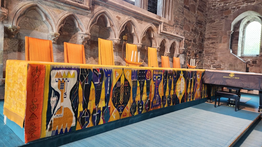
Blog

Pat and Dave’s Vibrant Viking Voyage – PART 4: Poland, Estonia, and Sweden

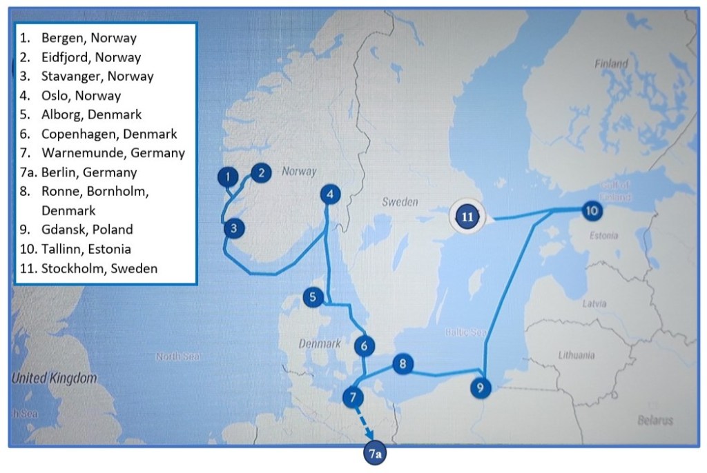
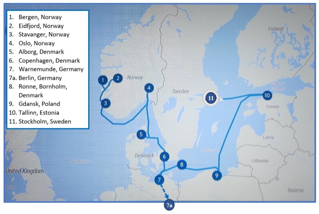
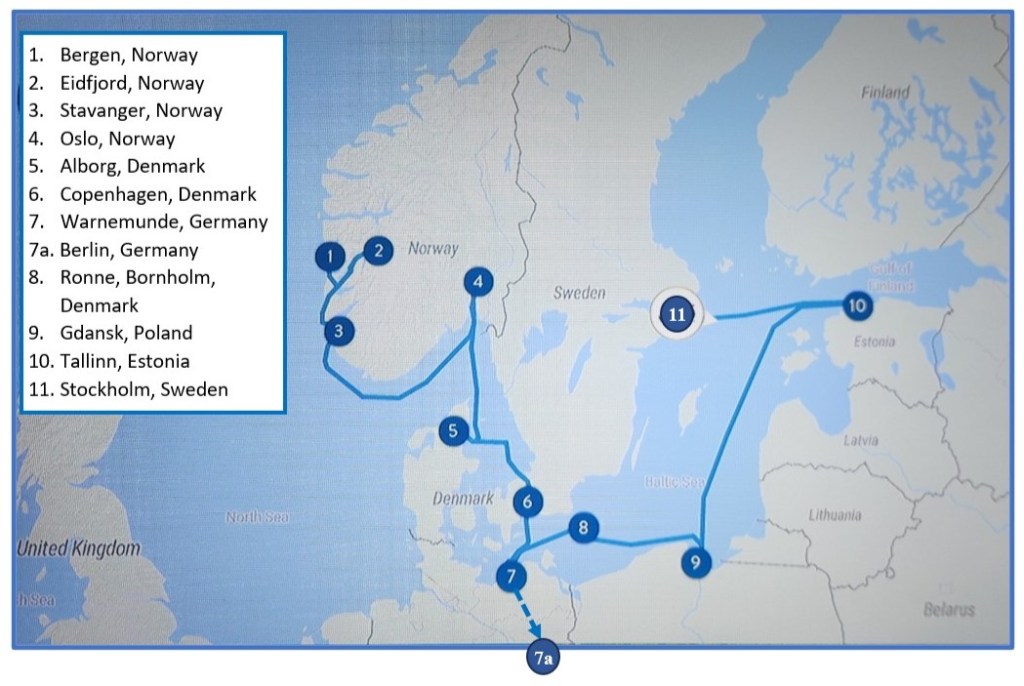
Welcome back for Part 4 of my travelogue describing our recent Viking Ocean Cruise entitled “Viking Homelands.” Part 3 left off as we were departing from Bornholm, Denmark. This episode will cover our stops in Poland, Estonia, and Sweden, including locations 9, 10, and 11 on the map of our itinerary.
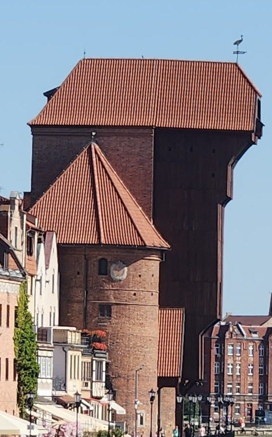
Gdansk, Poland (Saturday, June 27, 2026): Our ship docked at the port in Gdansk at 8 AM, and we were soon off on a motorcoach for a tour of the city’s old town. I didn’t know what to expect in Gdansk, since I knew that the city suffered extensive damage during World War II – 95% of the old town, then known as Danzig, was reduced to rubble. I was surprised and delighted to see how well the old town has been restored. Our guide explained that the immediate, post-war restoration work was primarily done by volunteer city dwellers, since Poland was unable to fund a major restoration project. (She described the situation as “grandmothers hauling bricks.”) Up until the war, the city was populated largely by German descendants of the 19th century Prussians, but most of the Germans either left or were expelled after the war and were replaced by Polish settlers eager to rebuild the city. The restoration recreated the pre-Prussian Gothic, Renaissance, and Baroque styles of architecture to bring back the old town as it existed in medieval times, when it was one of the most prosperous cities in the Hanseatic League. Here was my first view of the old town waterfront on the Motlawa River as we left the bus and headed toward the city. The large block-like structure in the distance (on the left side of the river) is a fascinating treadwheel crane, a 14th-century human-powered device that helped the medieval port load and unload cargo.
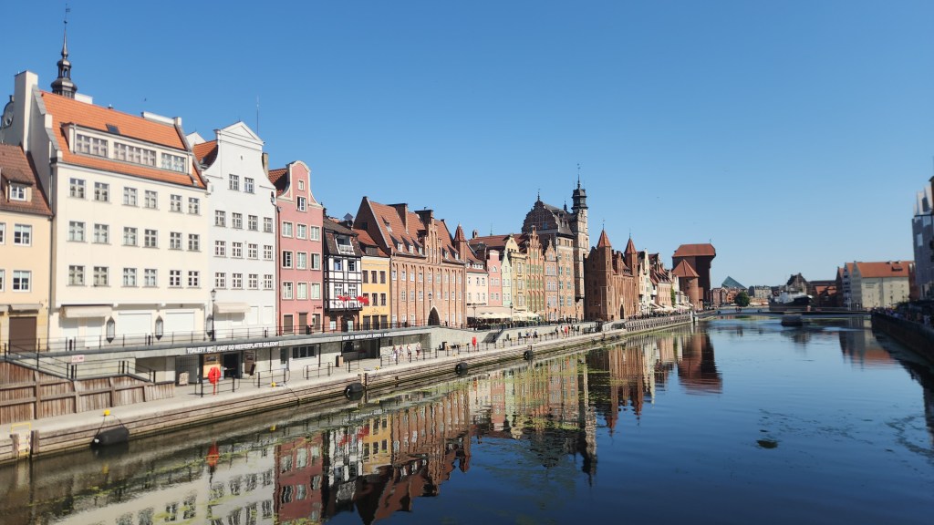
Gdansk Old Town Riverfront
Treadwheel Crane

We entered the old town through the Green Gate, which was built in 1571 to be the formal residence of Poland’s monarchs – although no Polish king ever actually lived there – and now houses the National Museum.
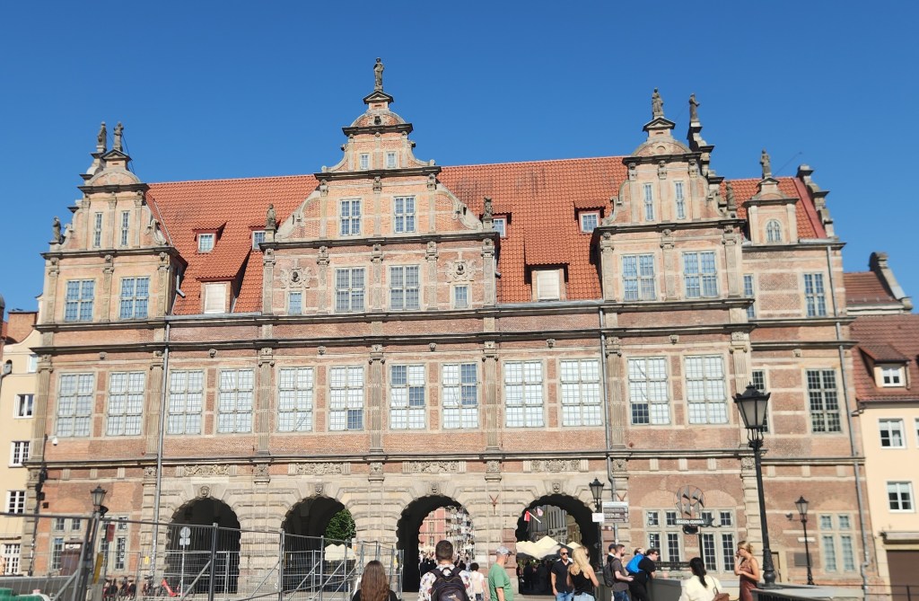
The Green Gate

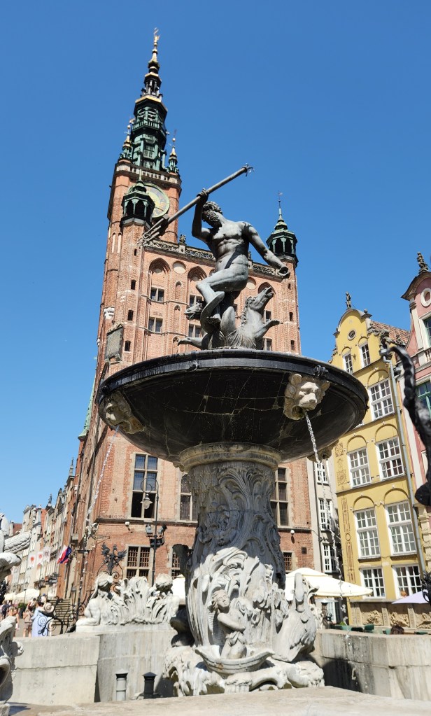
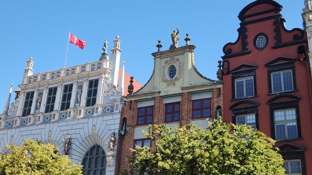
Passing through the Green Gate, we entered Long Market Street, a pedestrian plaza full of beautiful structures including the 15th-century Artus Court (a merchant’s palace), Neptune’s Fountain from the 17th century, and the Gothic-Renaissance Town Hall, which has a tall brick tower featuring a distinct spire and clock face.
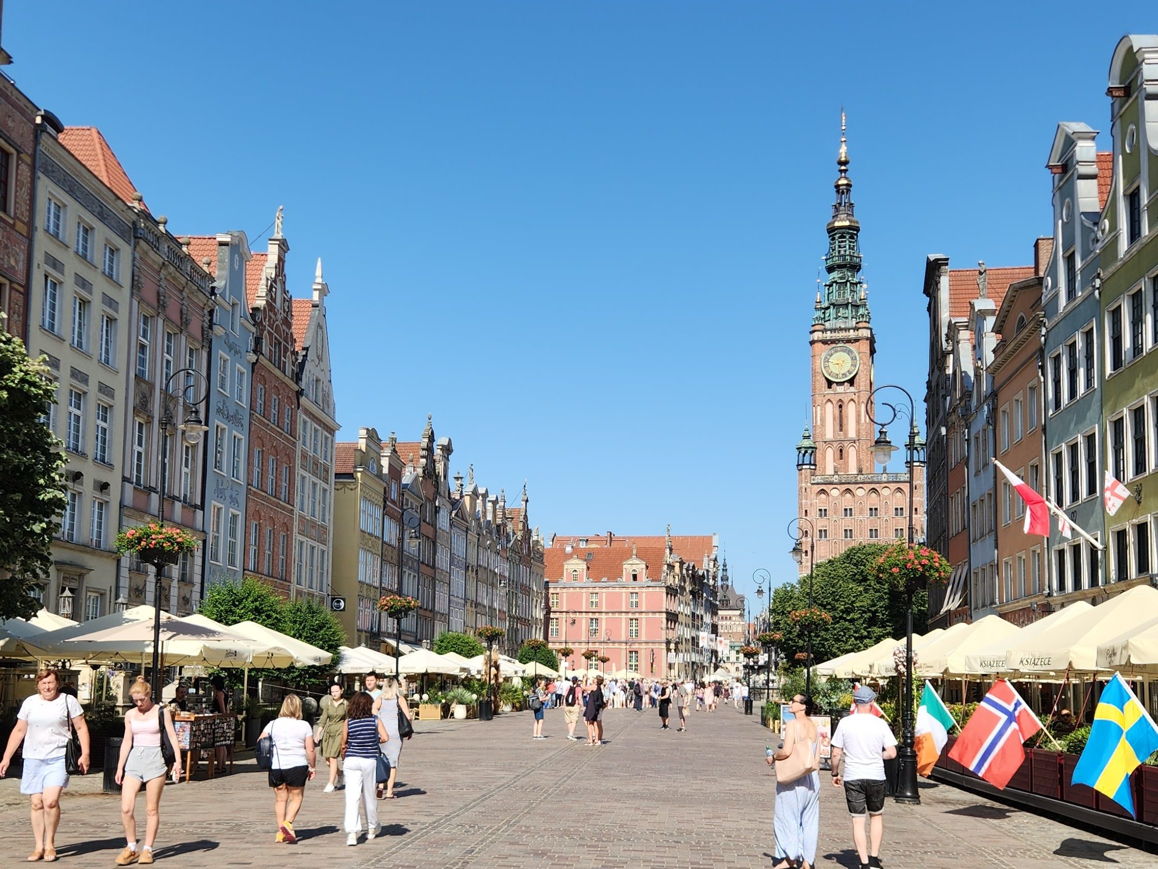
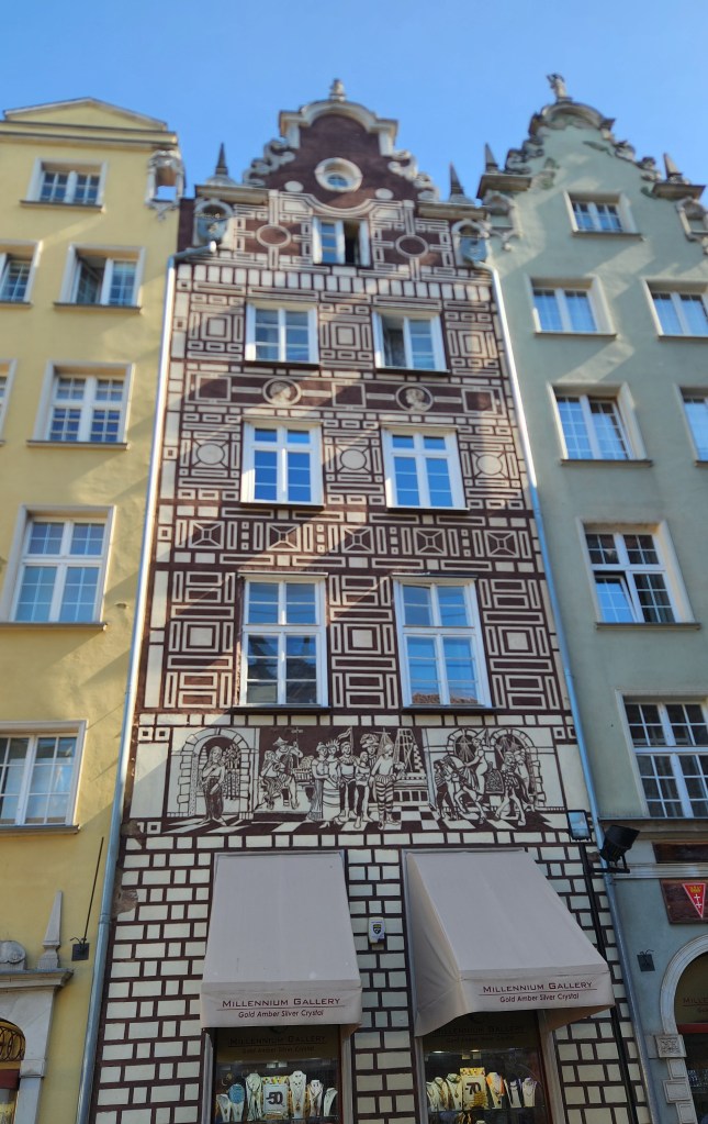
Long Market Street
Artus Court
Neptune’s Fountain and Town Hall
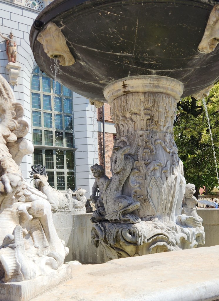
Example of Incredible Detail on Neptune’s Fountain
Buildings on Long Market Street
Interesting Handrails
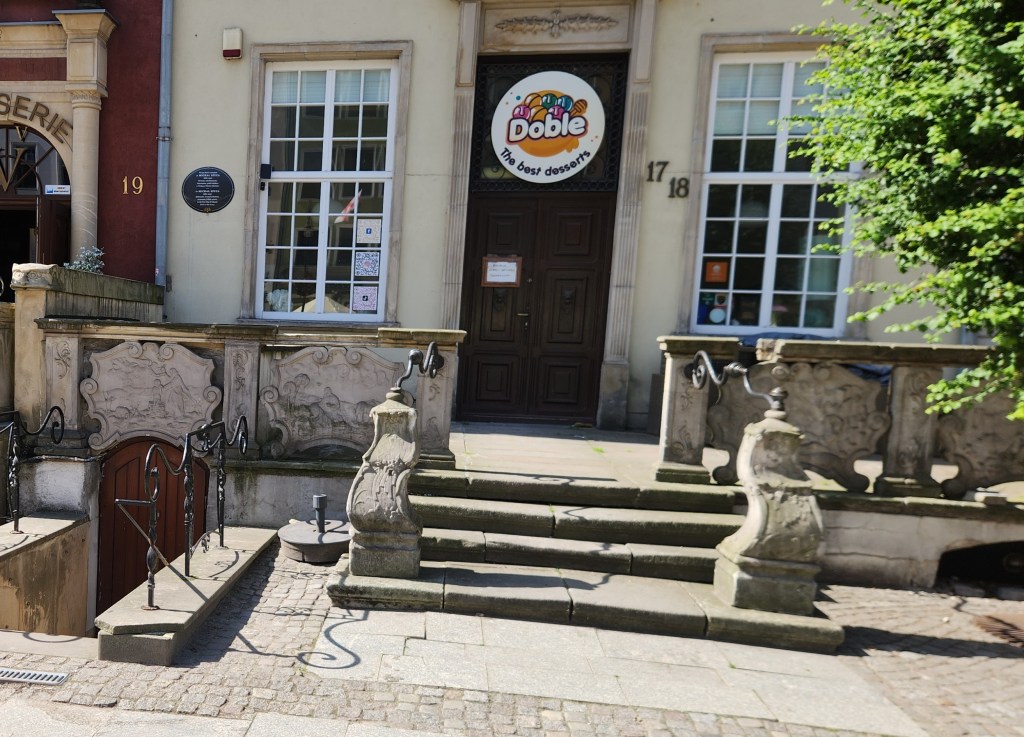
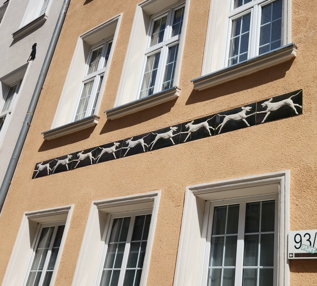
Home of a Dog Lover?

As we strolled along the street, we heard the delightful chimes of the clock tower.

Clock Tower Chimes

We also stopped to see a display case dedicated to Daniel Fahrenheit, the city resident who invented the Fahrenheit temperature scale and whose house has been preserved on a street one block away from the Long Street.
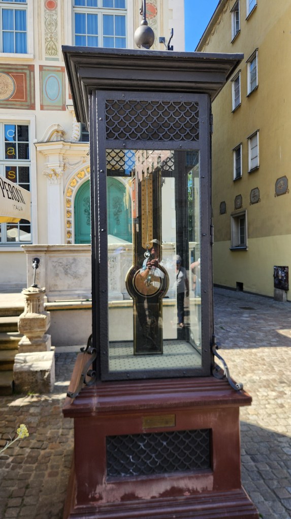
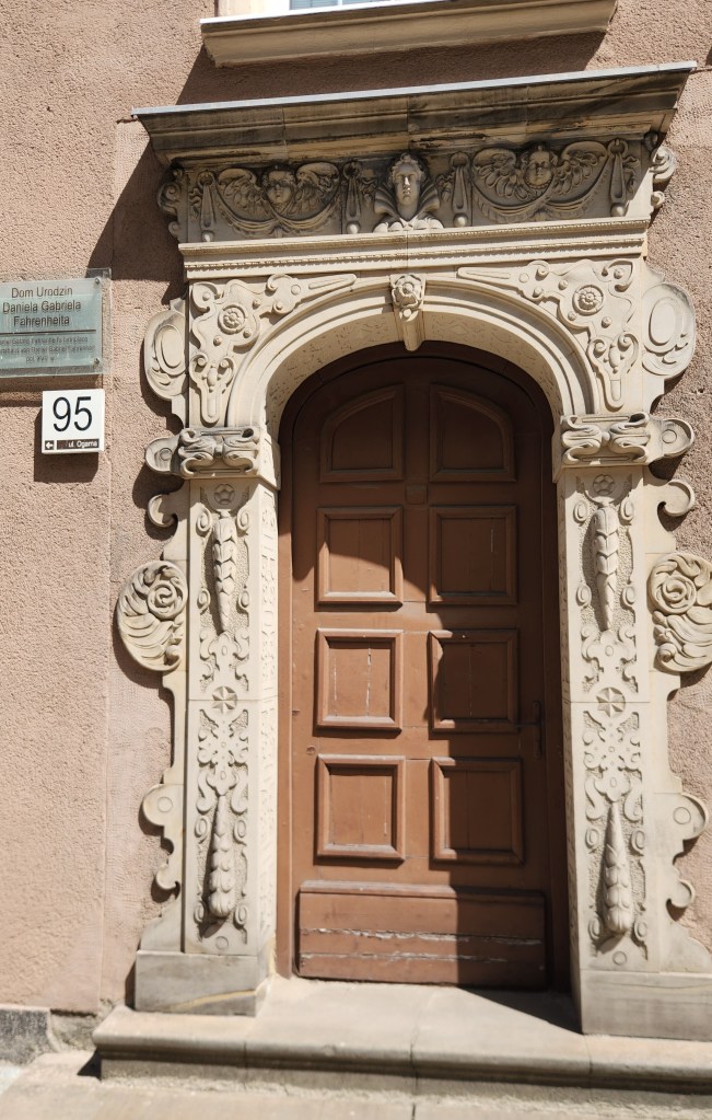
Daniel Fahrenheit Display
Fahrenheit’s Home

Next, we saw the Great Armory, built between 1600 and 1605, the finest example of Flemish Mannerist architecture in Gdansk.
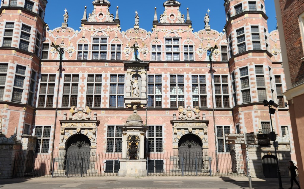
The Great Armory

After the armory, we walked back toward the river on a parallel street, where we came to the Chlebnicka Gate, a well-preserved medieval Gothic gate dating back to the 15th century. The gate is commonly called either the Bread Gate, named for the medieval bread stalls and benches that used to line the nearby street, or the Lily Gate, named for the carved lily symbol of the Dukes of Pomerania displayed on the river-facing side.
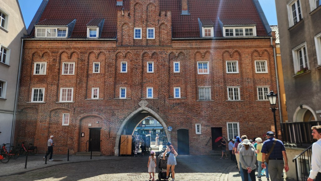
The Bread Gate, or The Lily Gate

Another famous structure near the entrance to the Long Street is the Prison Tower and Torture House, built in the 14th century as part of the Main Town’s medieval defensive walls and gate complex. It still looked foreboding to me, though no tortured prisoners are housed there anymore.
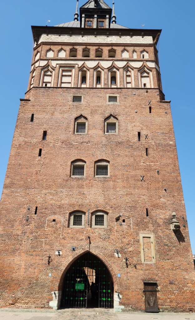
Prison Tower and Torture House

The tower once held a branch of the Gdansk Amber Museum, as the city is well-known as a supplier of amber jewelry. Rather than the museum, we stopped in a jewelry shop specializing in amber, and Pat picked up some very nice earrings. While there, we learned that the way to determine whether a purported amber item is real is to toss it in water. If it doesn’t burn or float, it’s not real.
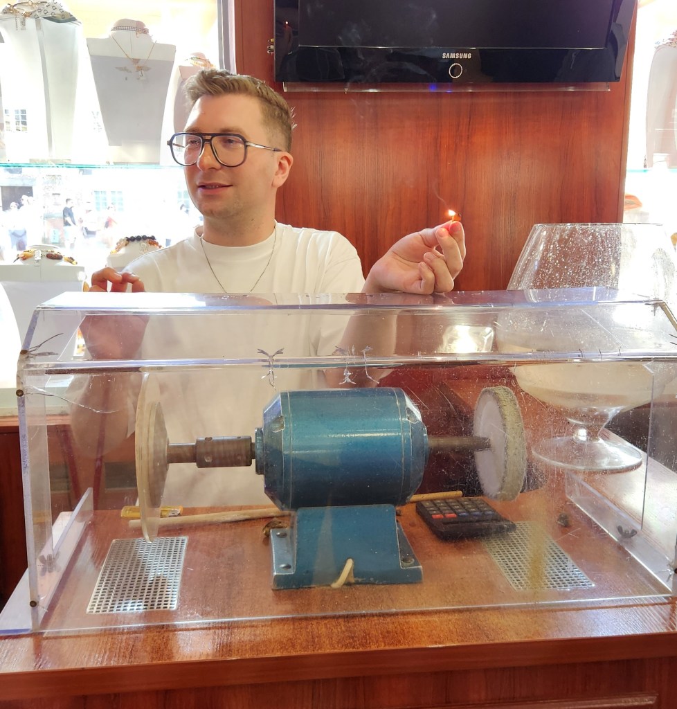
Shop Proprietor about to test for authentic amber

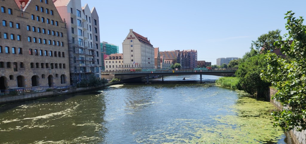
As we left the old town to get back on our bus, we passed by an impressive bank building, which now operates as a branch of BNP Paribas Bank Polska. I also got another photo of the river as we crossed a bridge departing the Old Town.
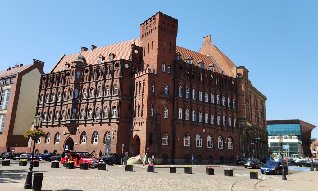
BNP Paribas Bank Polska
Last Look at the Old Town Riverfront

On the bus again, we headed for our final destination, and although we passed by several other Gdansk landmarks, the only one I managed to get a decent photo of was the railway station, built in a Renaissance Revival and baroque style with red brick and a prominent 160-foot clock tower.
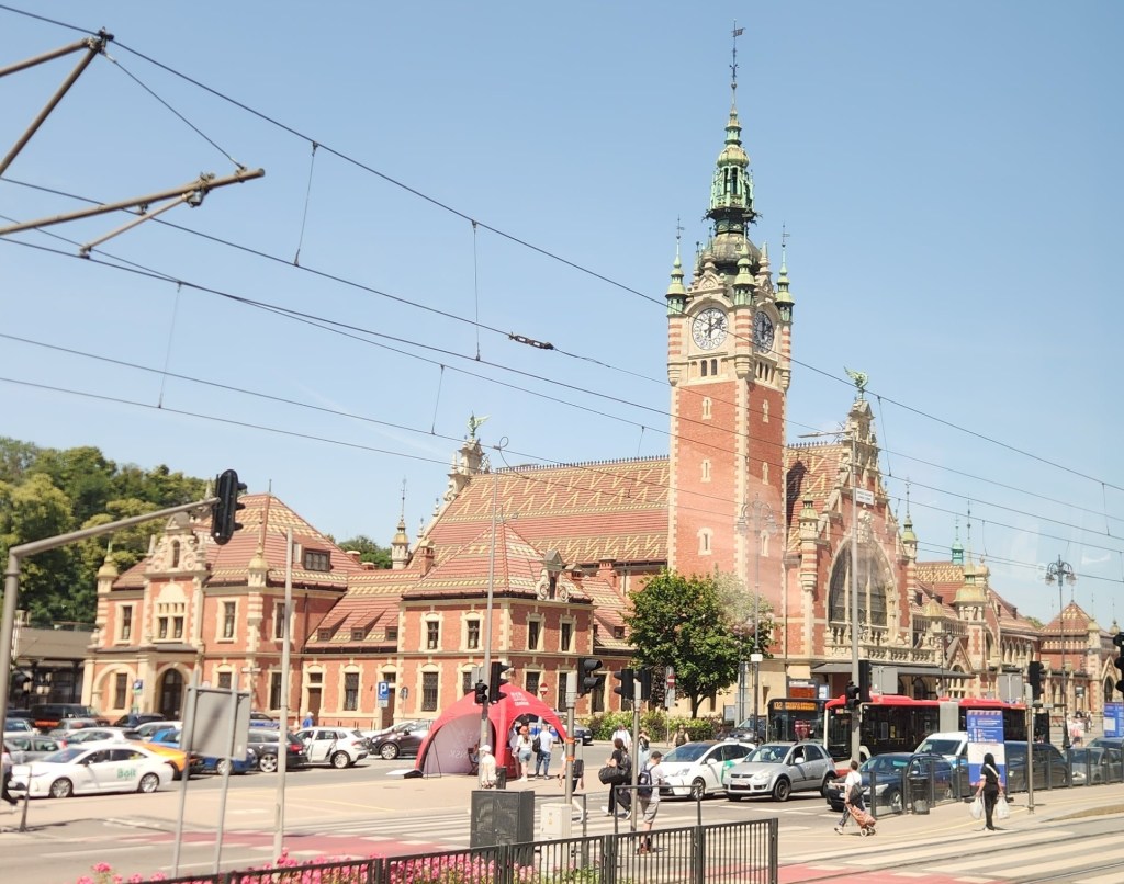
Railway Station

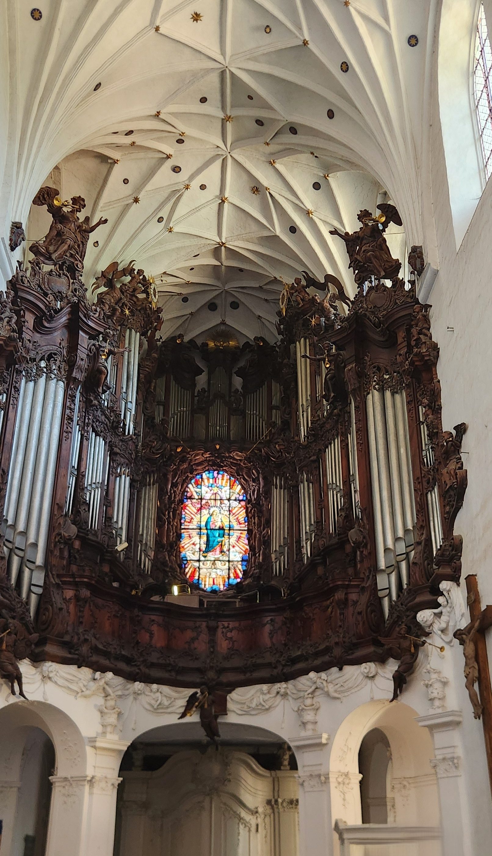
Our final visit of the day was to the Oliwa Cathedral, Poland’s longest church, completed in 1594. The church features brick Gothic architecture with Baroque and Rococo interior elements and is famous for its massive 18th-century pipe organ that features moving wooden figures and angels. After touring the church, we sat in the pews and listened to a 20-minute organ concert. Unfortunately, I was unable to capture any of the moving figures, but I’ve included a snippet from the concert anyway.
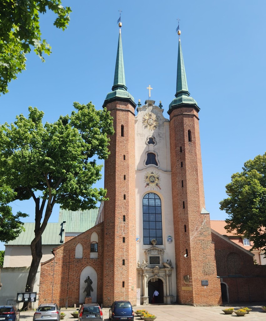
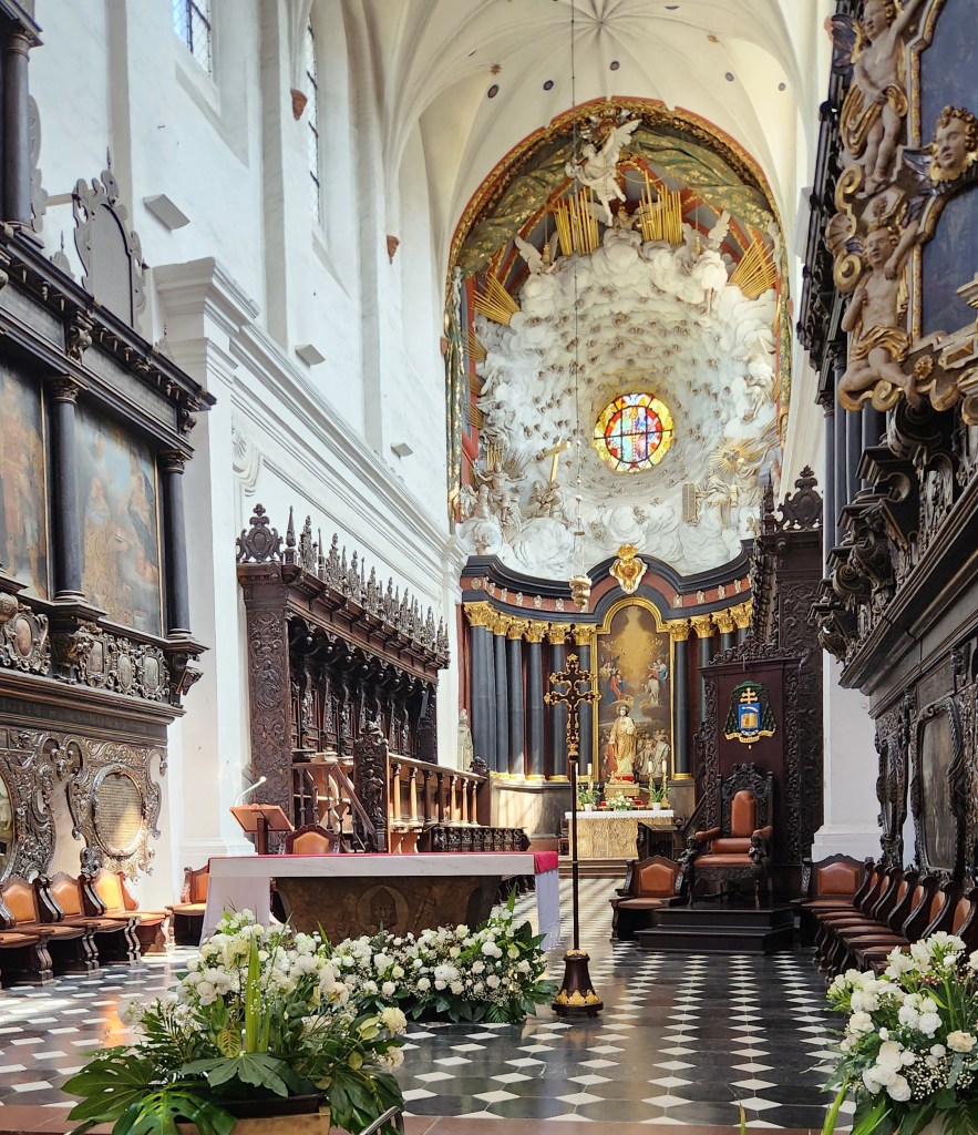
Oliwa Cathedral
Oliwa Cathedral
The Organ
The Organ Recital

Heading back to the sip, I tried to get a photo as we passed by the Lenin Shipyard, where Lech Walesa led the worker’s protest that eventually led to the fall of Poland’s USSR-supported communist regime in 1989, but I never got an unobstructed view. Back on the ship again, we sailed off in the evening toward Estonia.

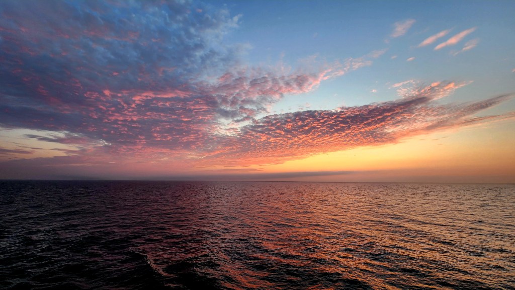
Sailing the Baltic Sea (Sunday, June 28, 2026): As you can see from the map above, the journey from Gdansk to Tallinn was the longest segment of the trip – so long, in fact, that we spent all day Sunday sailing. We enjoyed loafing about on the ship, watching the sea pass by as we reached sunset, and even took in one of the many on-board entertainment events, a British singer channeling the great divas of pop.
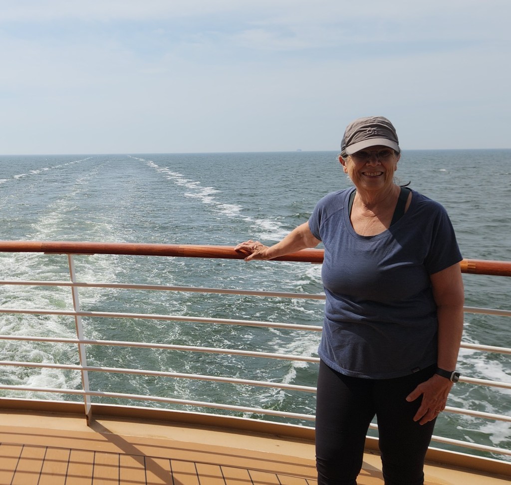
Sailing, sailing, over the open sea …
… and leaving the sunset behind
One of the Entertainments Aboard the Viking Sky

As we retired after the restful day, we were eager to get off the ship at our next interesting place.

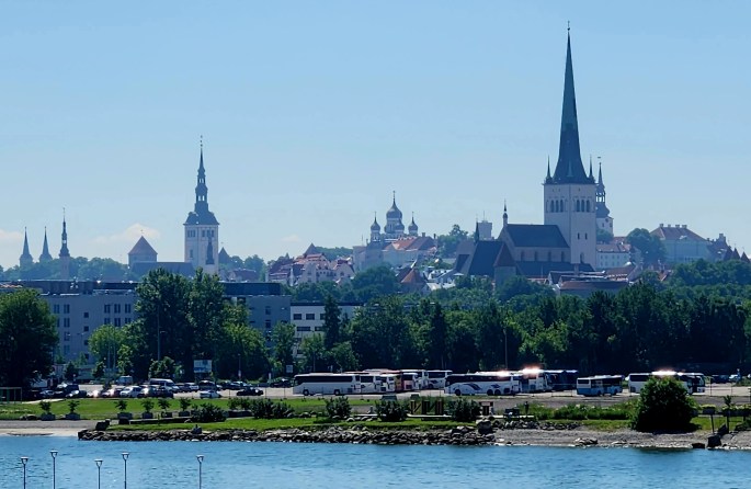
Tallinn, Estonia (Monday, June 29, 2026): The ship docked at the Tallinn Old City Harbor Cruise Terminal at 7 AM on Monday, and I got a nice photo of the Old City from our stateroom balcony.
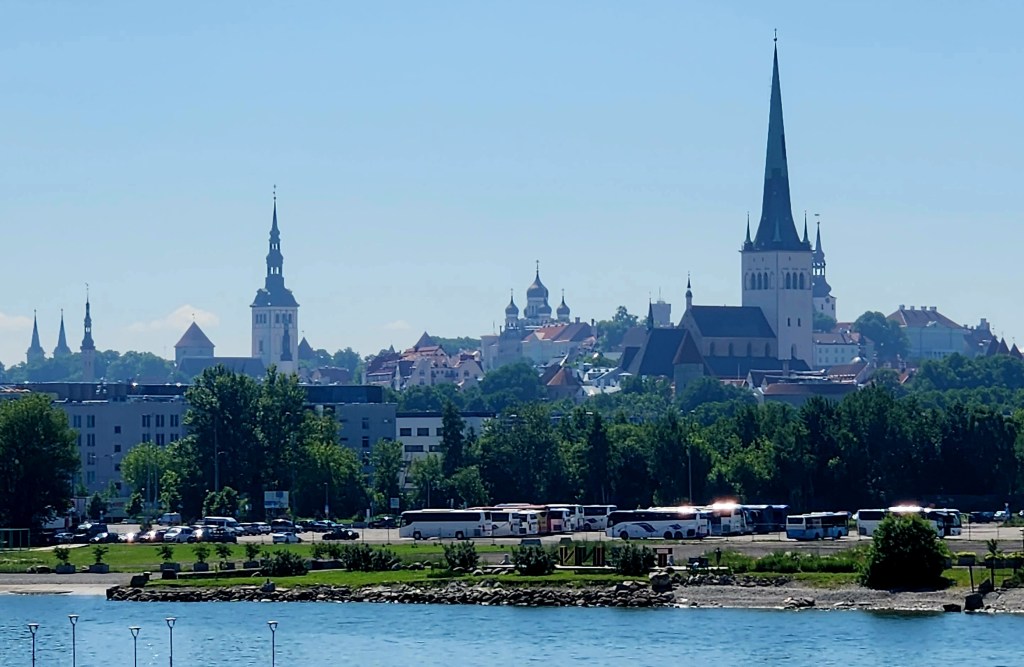
View of Tallinn from our Stateroom Balcony

I later learned that the photo had captured a number of historic landmarks: St. Olaf’s Church is the tall, needle-like gothic spire on the right side of the skyline, historically one of the highest structures in the world; St. Nicholas’s Church is the distinct slender tower with a baroque spire located towards the left-middle; and Alexander Nevsky Cathedral has the characteristic Russian Revival onion domes rising near the center of the horizon behind the trees.

After breakfast, we were off for the day’s tour of Old Town Tallinn. As we walked to the bus parking are, we passed by some interestingly shaped concrete structures piled along the oceanfront. The most loyal readers of my blogs may recognize that these are similar to those used in Crescent City, CA – tetrapods, designed by the US Army Corps of Engineers in the 1950s to serve as protection against heavy ocean waves – that I reported on in an earlier travelogue: Pat and Dave’s West Coast Wayfaring – PART 2: Points of Interest.
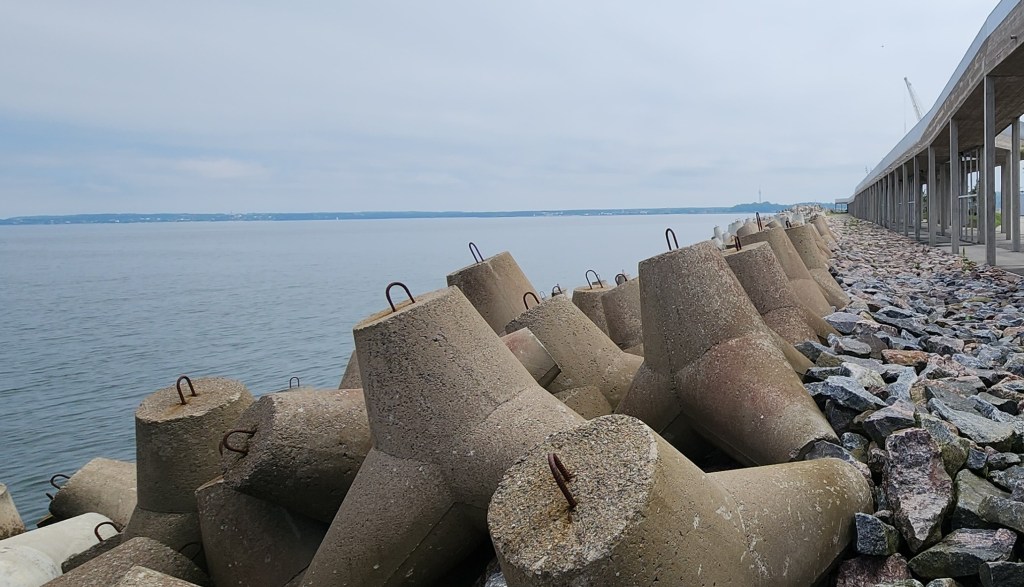
Concrete Structures to Protect the Wharf from Heavy Sea Waves

Tallinn is the capital of Estonia, and its well-preserved old town, a UNESCO World Heritage Site, is surrounded by a ring of 17th-century historic walls that were built to protect the city from invaders. Our bus dropped us off just outside the walls, and we proceeded with or guide to tour the Old Town. On our way, we passed by a stone fountain and the “Woman with a Basin” sculpture located in the Towers’ Square Park.
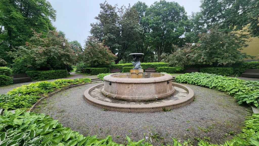
Fountain in Towers’ Square Park

The old walls have been preserved and fitted with walkways which probably provide some fantastic views, but they are not open to the public.
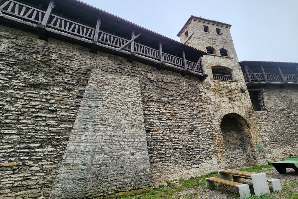
Tallinn Old Town Walls

Once inside the walls, we began our tour in the upper part of town. Our guide pointed out the different cobblestones: The roundish ones are from the 13th century, before stone cutting was practical, and the flatter ones are from the 16th century. As you can see, they have been very well maintained.
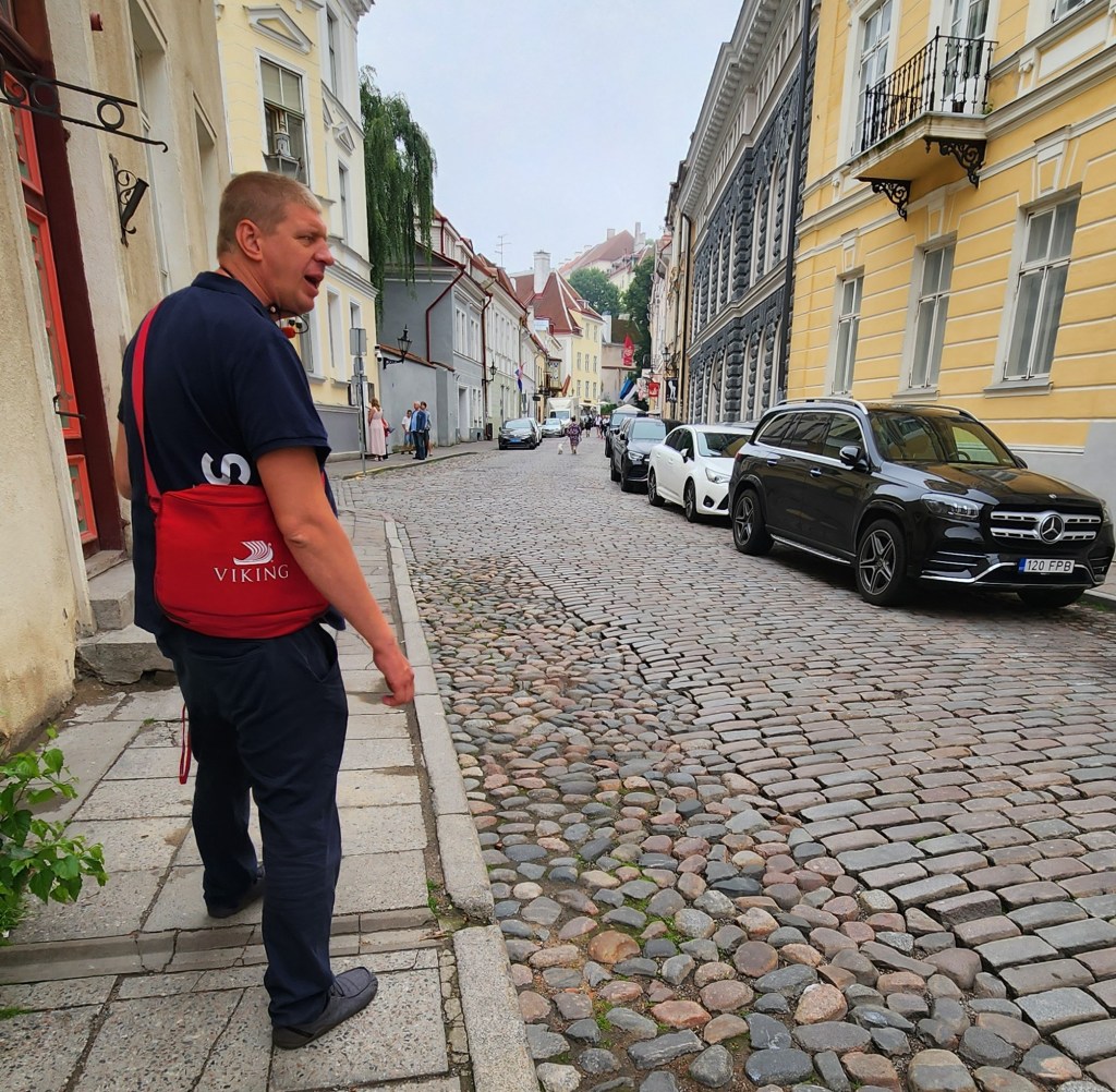
Walking Tour of Tallinn Old Town

ASIDE: The guide also told us some very interesting stories about recent Estonian history. Estonia first became independent of Russia in 1918, but was then annexed as one of the Soviet Socialist Republics. Independence from the USSR came on August 20, 1991, following decades of peaceful resistance in Estonia. The protests are now known as the Singing Revolution due to spontaneous night-singing demonstrations in Tallinn as well as a massive 1988 gathering of 300,000 people at the Song Festival Grounds and a historic 1989 Baltic Way human chain which stretched across the entire country. However, prior to 1991, under Soviet rule, foreign travel was strictly controlled and monitored. One requirement was that a traveler could not bring anything back to Estonia that they did not take with them when they left. Our guide’s mother once traveled to the US, bringing with her and declaring two toy pianos that she had labelled “Yamaha” with paste-on letters. When she returned with two actual Yamaha pianos, the customs inspectors were fooled by her exit declaration ad allowed the pianos in. Talk about ingenious and daring!

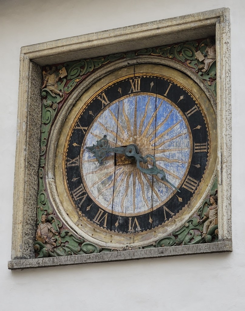
Anyway, back to the tour. We passed by the Church of the Holy Ghost, which included a famous clock face, built in the 17th century, the oldest public clock in Tallinn. It features a hand-carved wooden dial with a striking blue and gold sunburst motif and traditional Roman numerals.
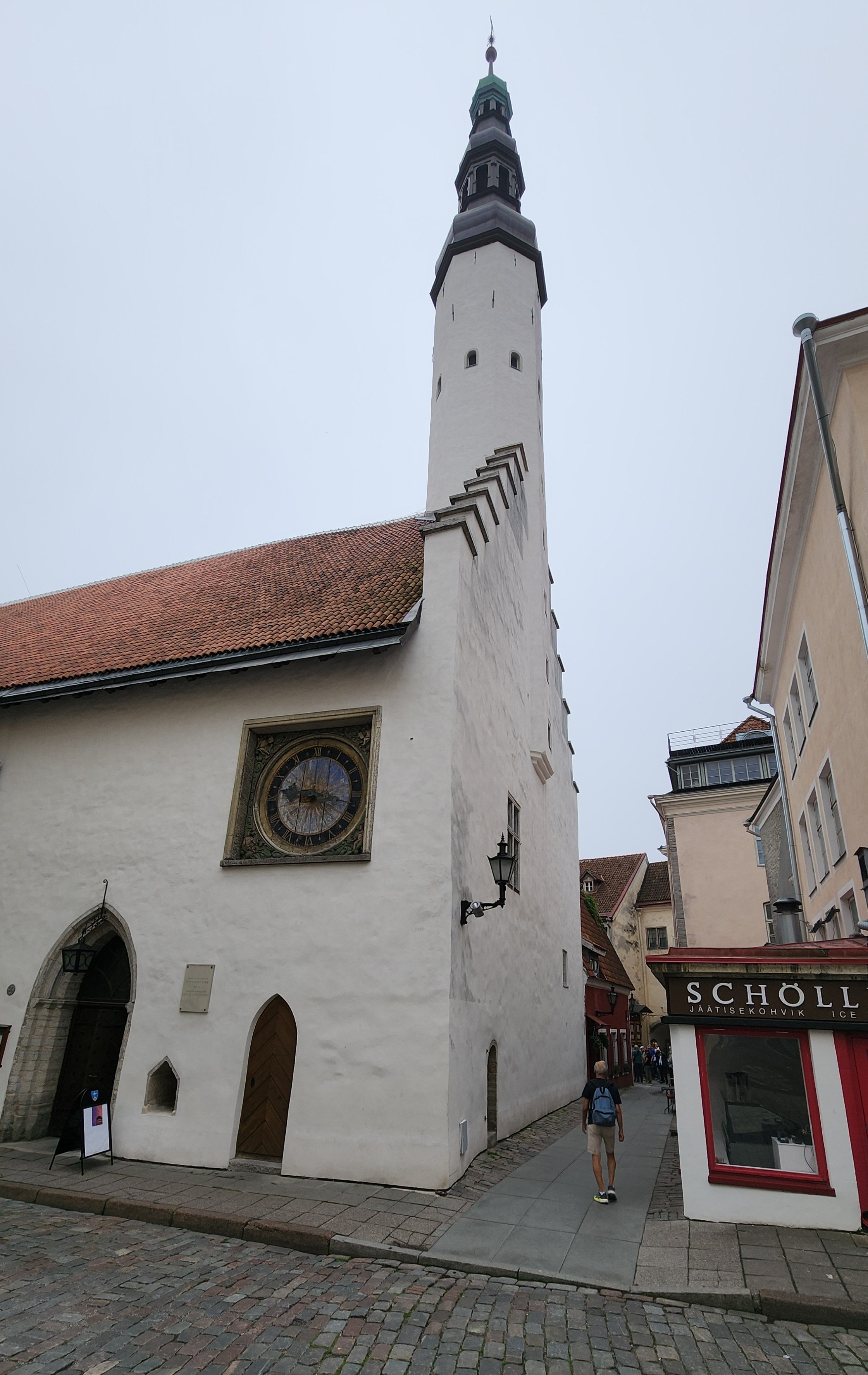
Church of the Holy Ghost
The Church Clock Face

Next came the Gothic-style Tallinn Town Hall, completed in 1404. It is the oldest surviving town hall in Scandinavia and the Baltic Sea region.
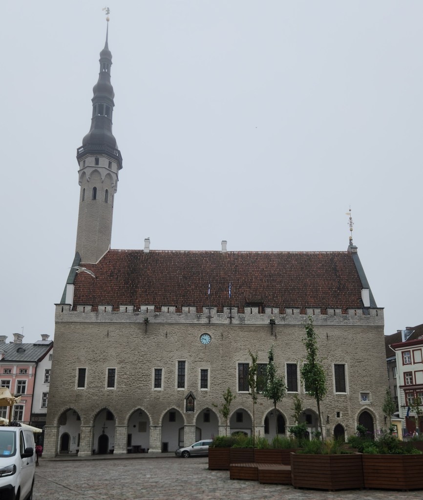
Tallinn Town Hall

Adjacent to the Town Hall is the appropriately named Town Hall Square, with many merchant kiosks and restaurants. It was also set up with temporary wooden planters and integrated benches designed to bring greenery and public seating into the historic square.
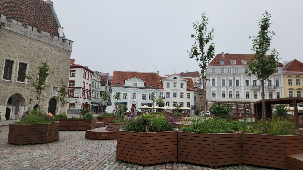
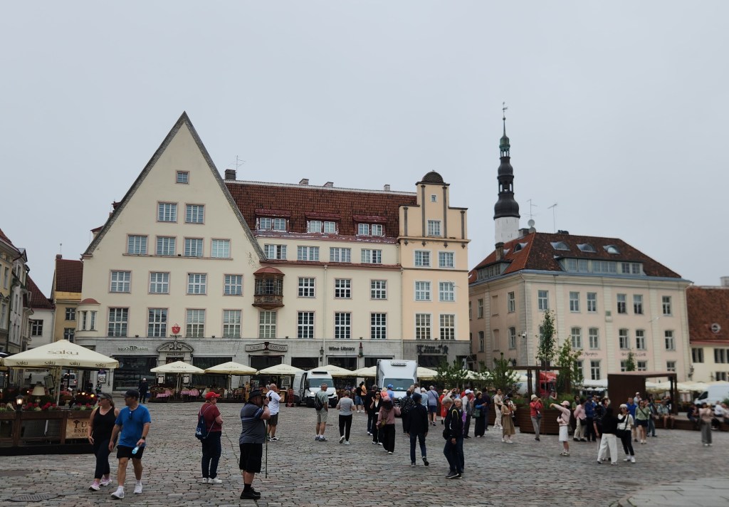
Town Hall Square
Town Hall Square

The Town Hall Pharmacy is one of the oldest continuously operating pharmacies in Europe, having been in operation since at least 1422. The pharmacy features a museum room displaying medieval and early modern medical instruments, drugs, and historical documents.
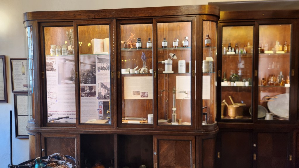
Tow Hall Pharmacy

I was impressed to see that the proprietors of one business in the square were not shy about expressing their opinion of the Russian invasion of Ukraine.
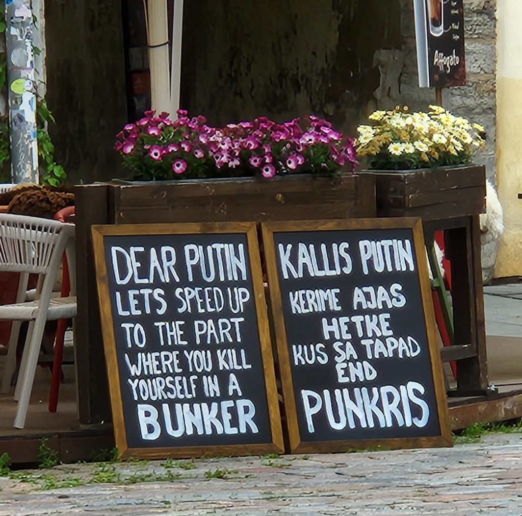
Not the nicest thought, but I surely agree with the sentiment

Pat also met a new friend in the square and had a brief chat about world affairs.
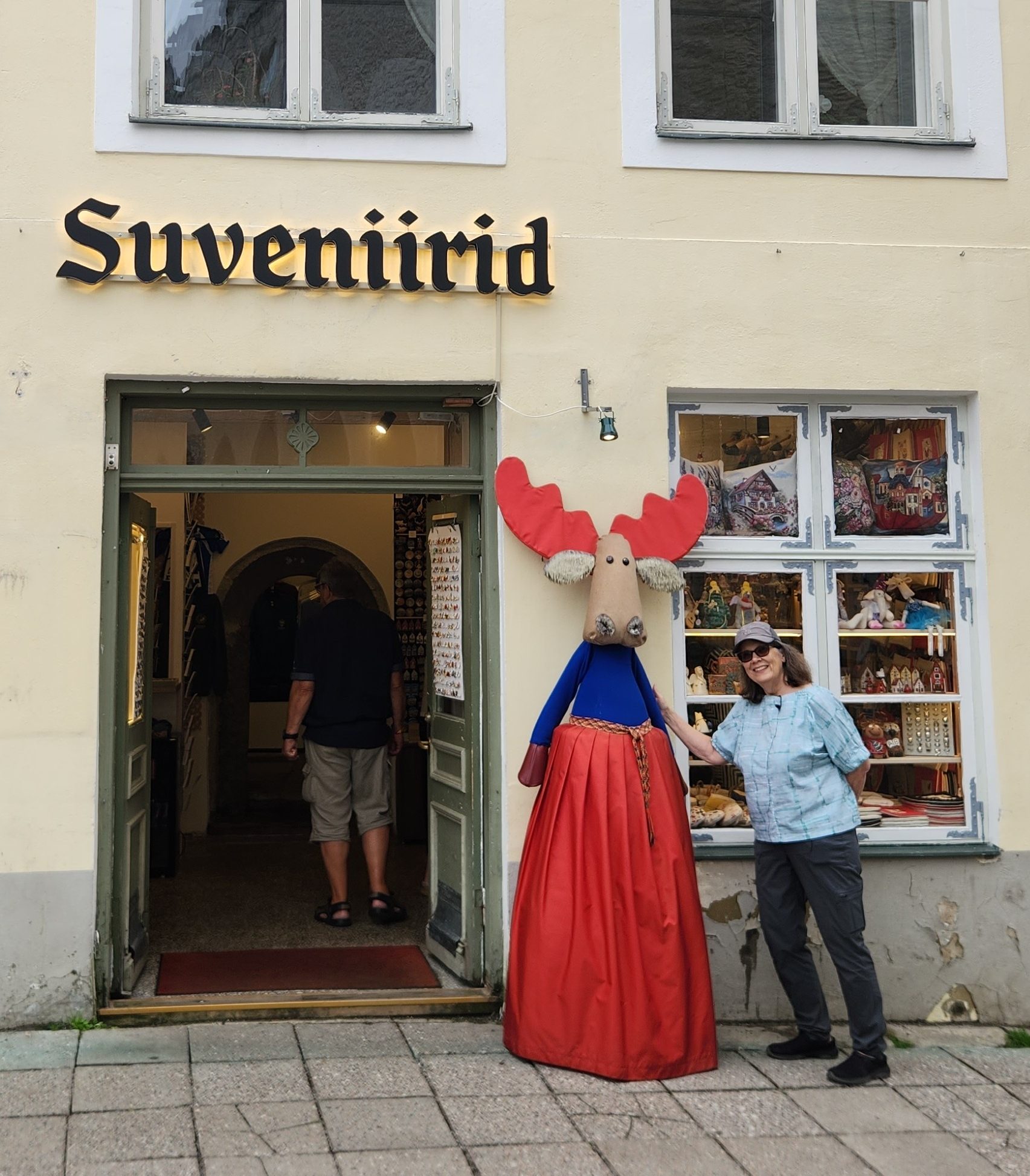
Friendly Conversation

Another well-known place near the square is the Olde Hansa restaurant, a popular medieval-themed restaurant designed to recreate a 15th-century Hanseatic merchant house experience, featuring staff in period costumes and traditional recipes.
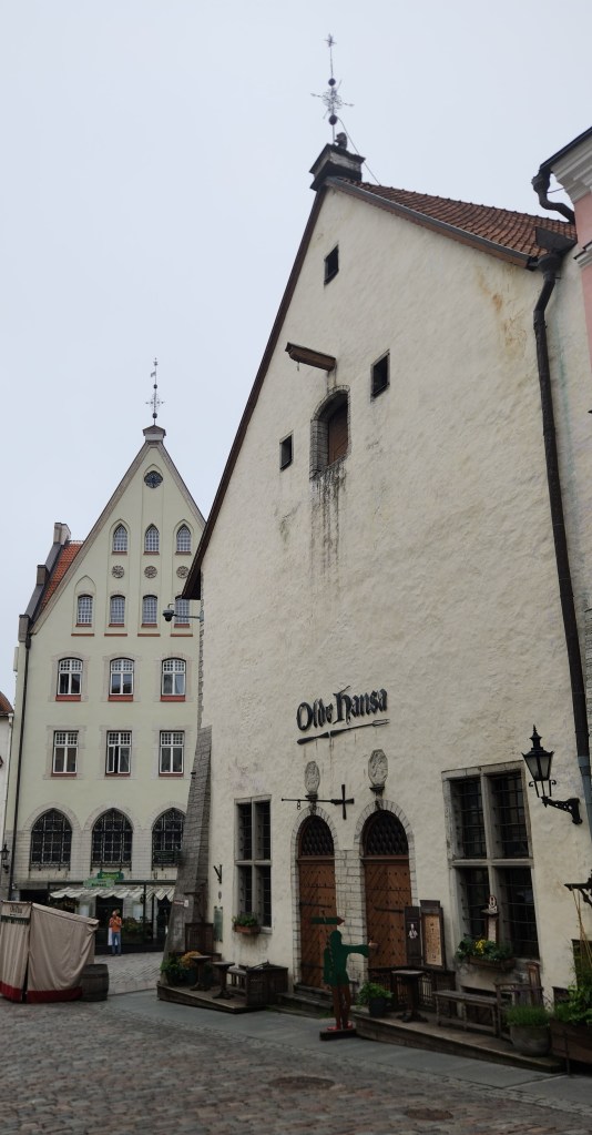
The Olde Hansa Reataurant

From the square, we passed along a courtyard passage known as “The Path of History.” This paved walkway features dates and key events from Estonian history etched directly into the stone.
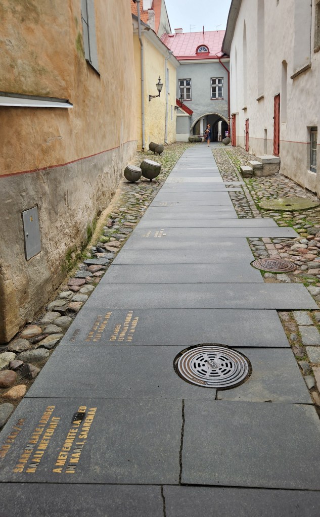
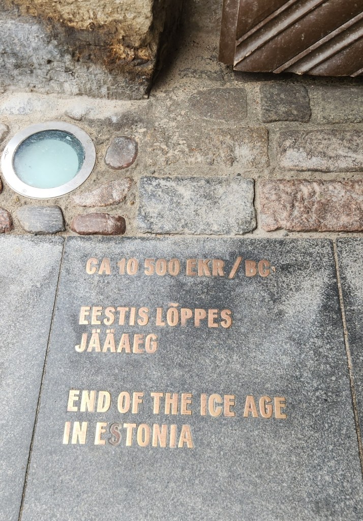
The Path of History
Key Event along the Path of History

We emerged onto St. Catherine’s Passage, which includes a display of ancient 14th- to 15th-century limestone tombstones mounted on the stone wall. These grave markers were collected from the ruins of the adjacent medieval St. Catherine’s Dominican Monastery, which dates back to the 13th century.
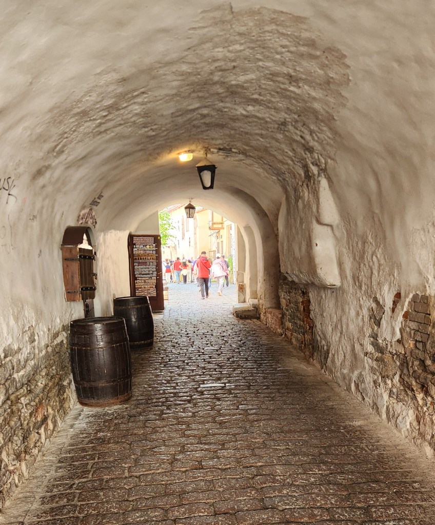
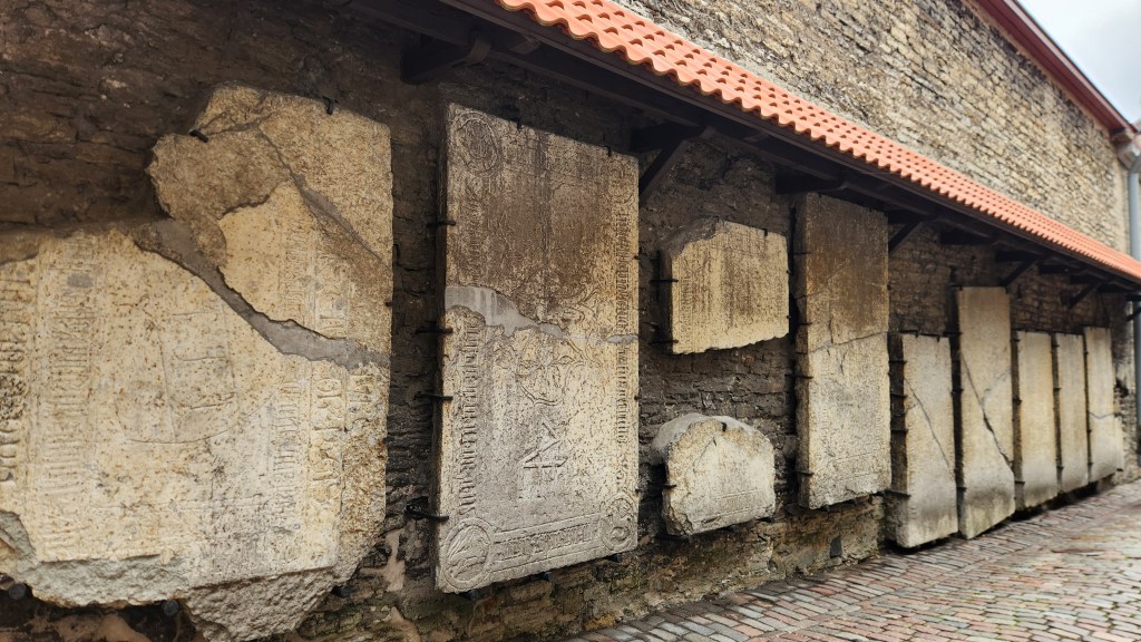
St. Catherine’s Passage
14th- to 15th-Century Tombstones

After St. Catherine’s Passage, we moved through the lower part of the Old Town, filled with shops and merchant guilds, including one of the earliest guilds formed by and for women.
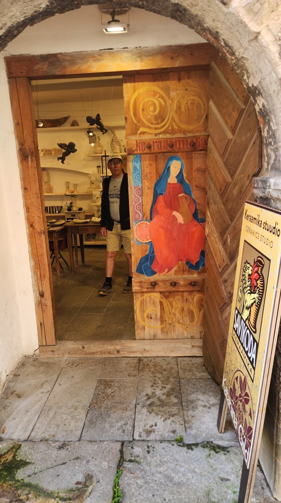
Women’s Craft Guild Building

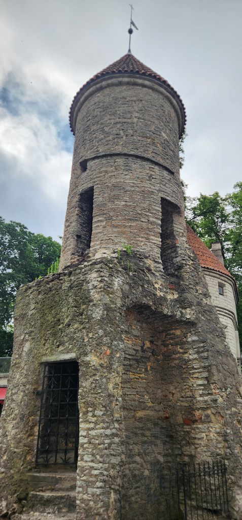
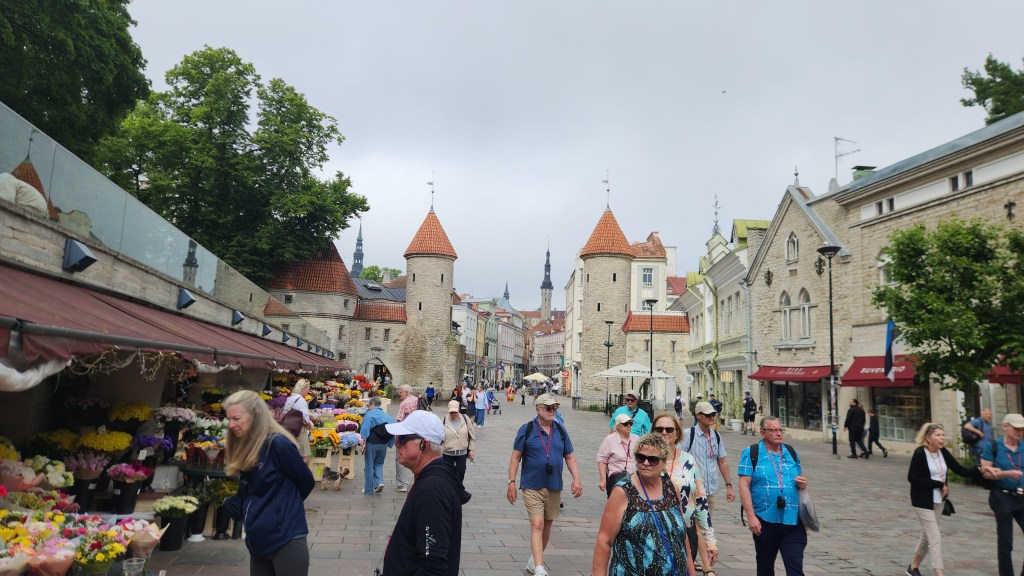
Next, we walked along the fortification walls to the historic Viru Gate, a famous pair of 14th-century stone defense towers serving as an eastern entrance to the UNESCO-listed Old Town. The vibrant outdoor Tallinn Flower Market sits just outside the stone towers.
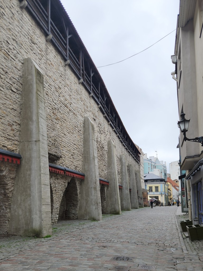
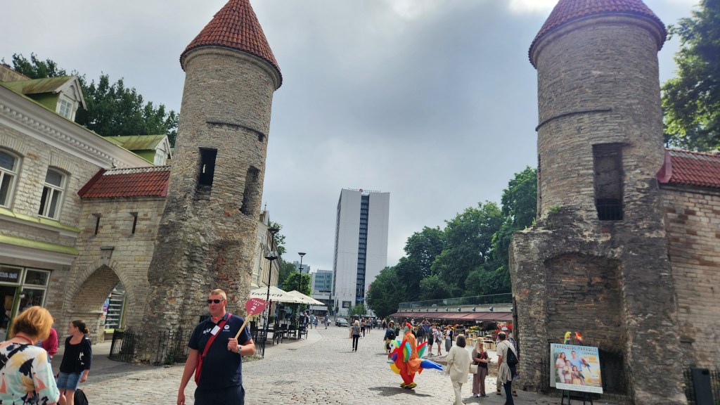
Route by the Old Town Walls
Viru Gate and Flower Market
One of the Viru Gate Towers
Flower Market and Viru Gate

After touring the old town, we had some free time, so we stopped for a coffee and a hot chocolate at an open-air restaurant. We could have stopped at a nearby world-famous famous restaurant, but we opted to pass on that one.
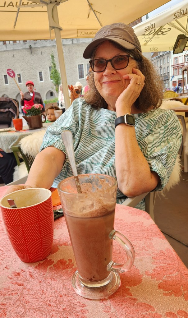
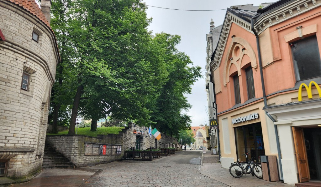
Restaurant in Old Town Square
The Old and the New …

Another place that caught my eye, and my breath, as a notably introverted Finnlander, was this Finnish karaoke bar. I had a hard time imagining any Finnlanders that I know being gregarious enough to do karaoke, but there must be some!
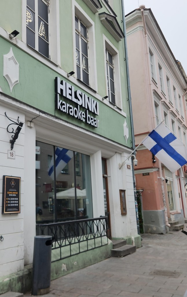
Finnish Karaoke!!??

Speaking of Finnlanders …

We had some time to speak one-on-one with our guide during the free time. His English was excellent, but he spoke with the exact same accent I’ve heard from many Finnish-American acquaintances. I asked how similar the Estonian language is to Finnish, which was my parents’ native language that I never managed to learn. While both languages are in the same group (Finno-Ugric) and share core vocabulary and grammar rules such as lacking prepositions and grammatical gender, he told us they differ significantly in sound systems, and have many words that sound the same but have very different meanings. He said he can understand simple phrases in Finnish, but anything complicated leaves him without a clue.

As a final photo from Tallinn, here’s an area that was used for the boating competitions in the 1980 Moscow Olympics.
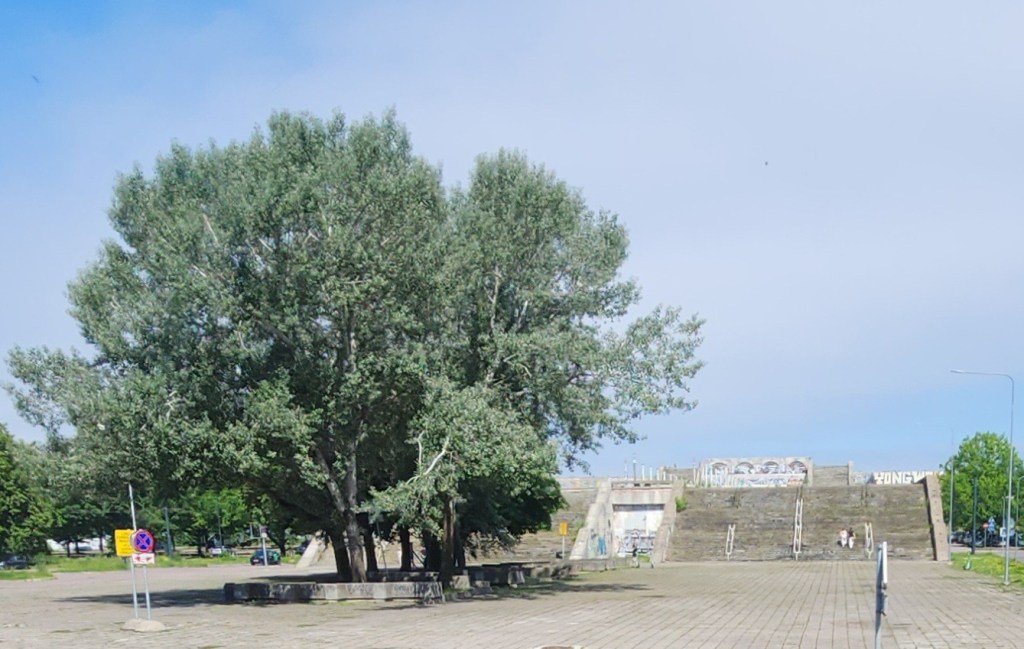
Site of Boating Competitions for 1980 Olympics

Stockholm, Sweden (Tuesday, June 30, 2026): Stockholm is situated within an archipelago containing the incredible number of 30,000 islands. Since the ship began passing through the archipelago early Tuesday morning, I got up at 5 AM to take photos. Here are some worth sharing:
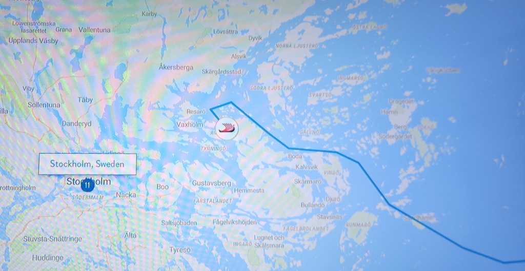
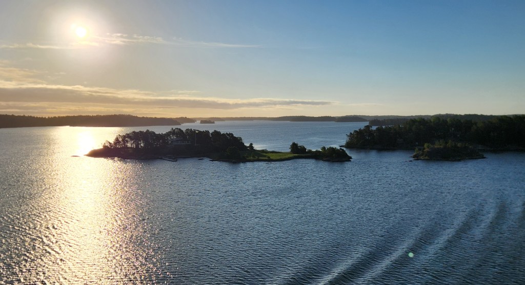
We Sailed Through the Stockholm Archipelago with its 30,000 Islands
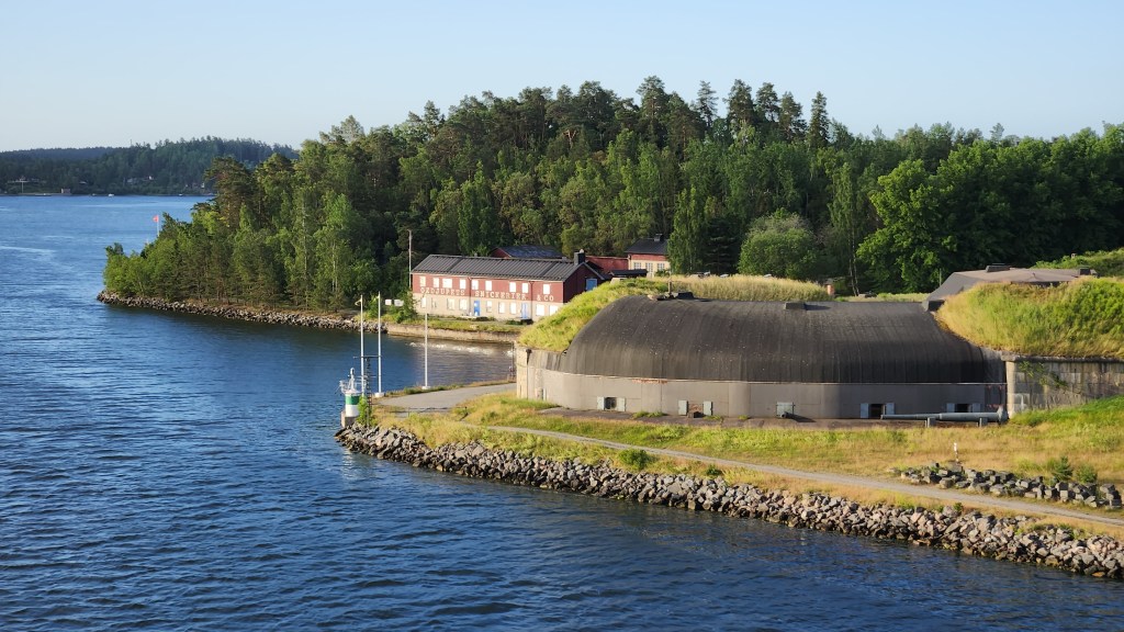
Islands in the Stockholm Archipelago
Interesting Buildings in the Stockholm Archipelago
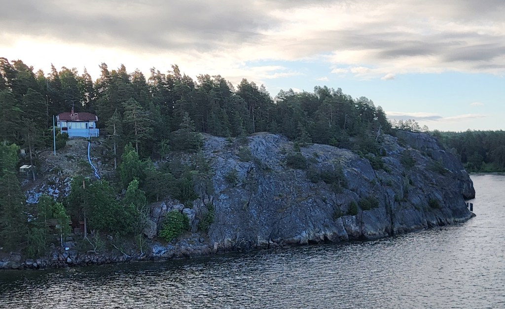
These Rocks are Very Similar to those on Minnesota’s North Shore of Lake Superior
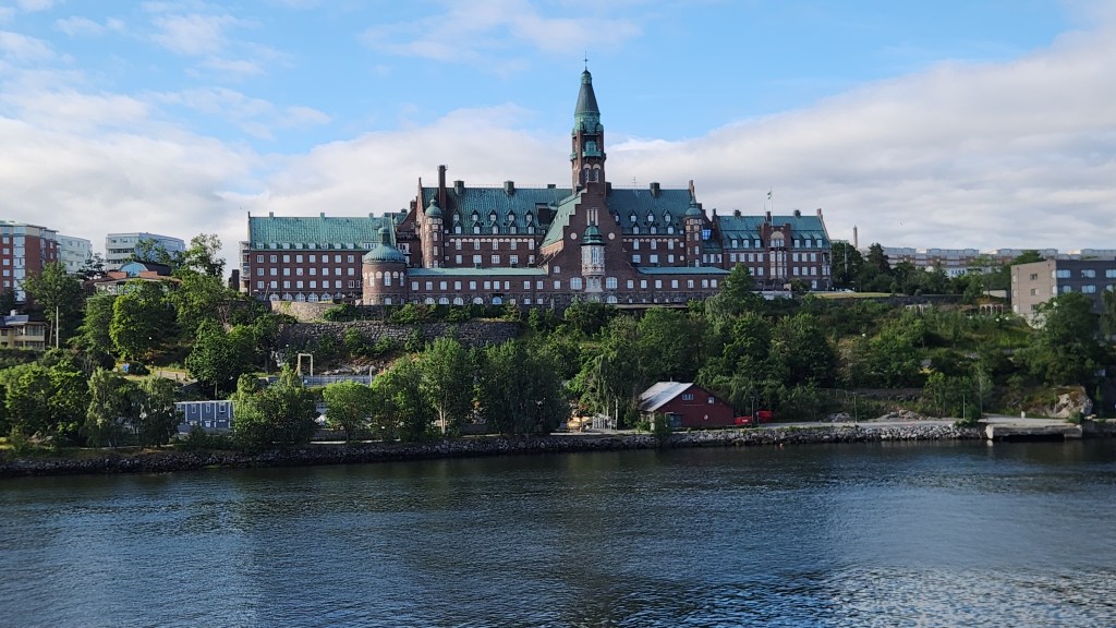
Danvikshem, a monumental historic building located on Finnbodaberget in Nacka, just east of Stockholm

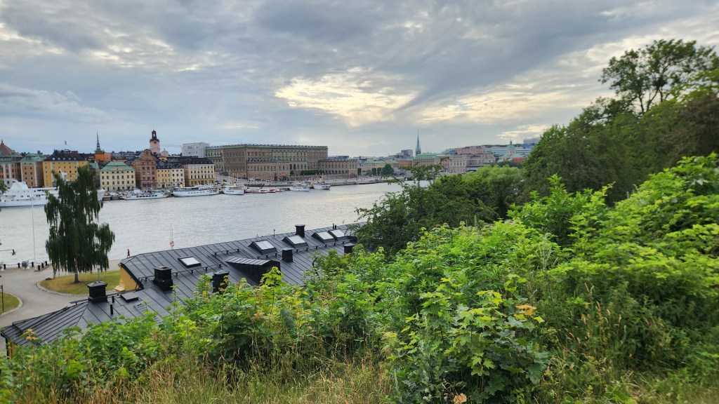
We docked at the pier at 8 AM and were soon off for a busy day of touring by bus and on foot. Our first stop was on a hill just above the ship’s location on the pier, providing a good look at the city. We learned that Stockholm extends over 14 islands linked by 57 bridges. Within the city, water from the freshwater Lake Mälaren flows into the Baltic Sea, and a lock system allows boat traffic into and out of the lake. The first, 5-foot-high lock was built in 1642, and has been periodically rebuilt many times to accommodate shipping needs. In addition, since the land is still rising after being pressed down by massive glaciers that once covered the area, the locks must be rebuilt every century or so to accommodate the increased height of the lake above the sea.
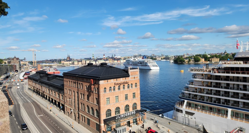
View of Stockholm (with Viking Sky to the right)

The bus then took us to Gamla Stan, the old town of Stockholm, which sits primarily on the island of Stadsholmen. The old town was founded in 1252 and is the oldest section of the city. The tour began at the Stockholm Palace, the official residence and major royal palace of the Swedish monarch.
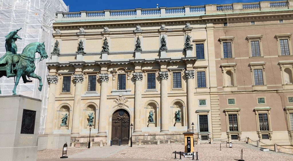
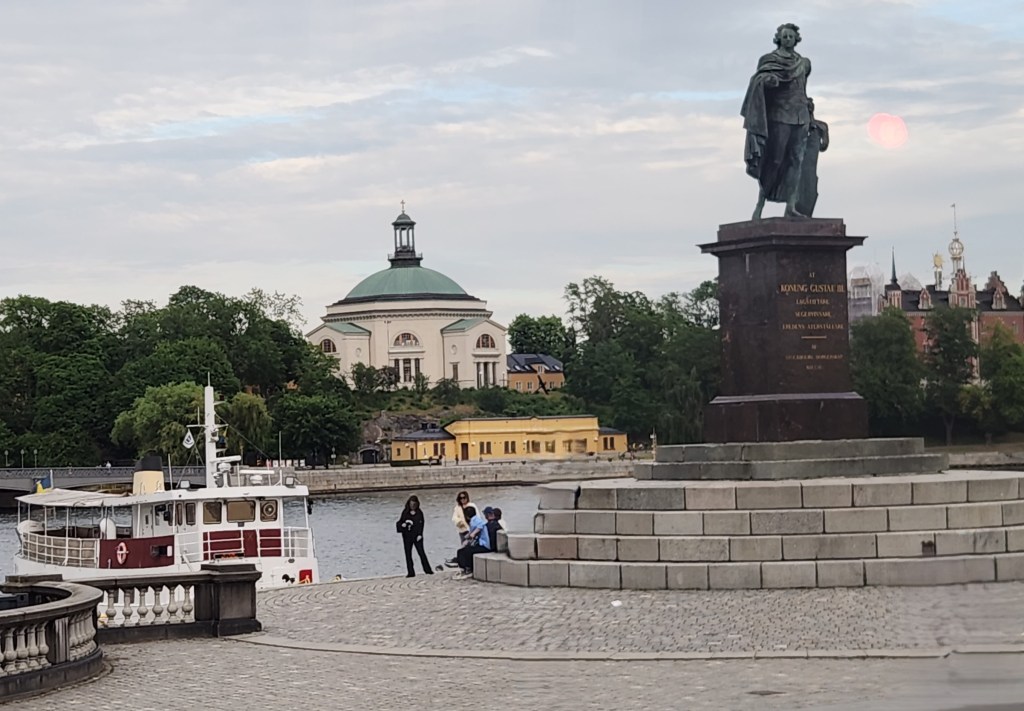
Stockholm Palace and Statue of King Charles Gustav

We then strolled the narrow, cobblestone streets to Stortorget, a historic square surrounded by old merchant homes built in the North German style.
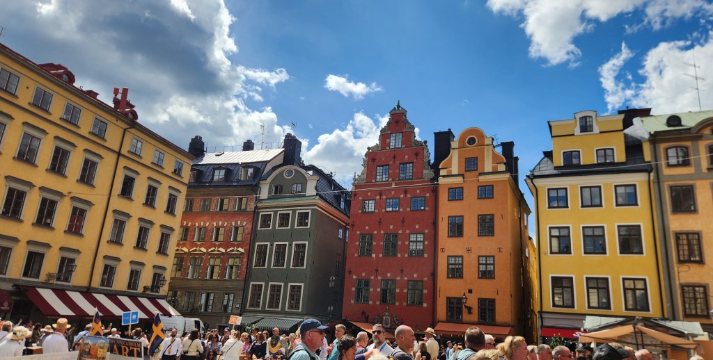
Stortorget Square

Near the square is the Finnish Church, a small, simple structure with a small, simple statue in its front yard. I managed to get a picture of the statue, but not one of the church, which was quite unremarkable anyway.
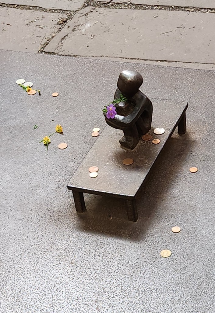
The Smallest Public Statue I’ve Ever Seen

Along the way, we stopped at a restaurant that felt like a throwback to a previous century for a mid-morning snack.
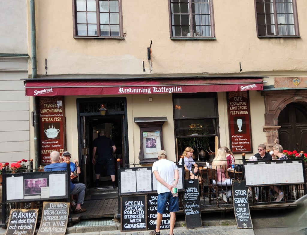
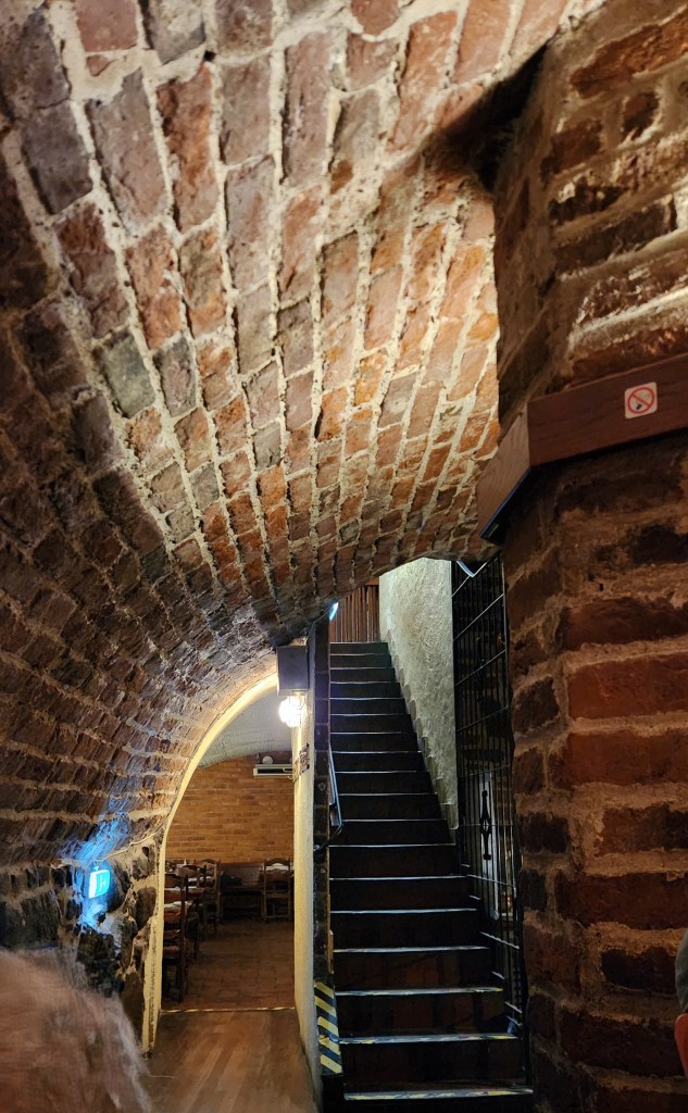
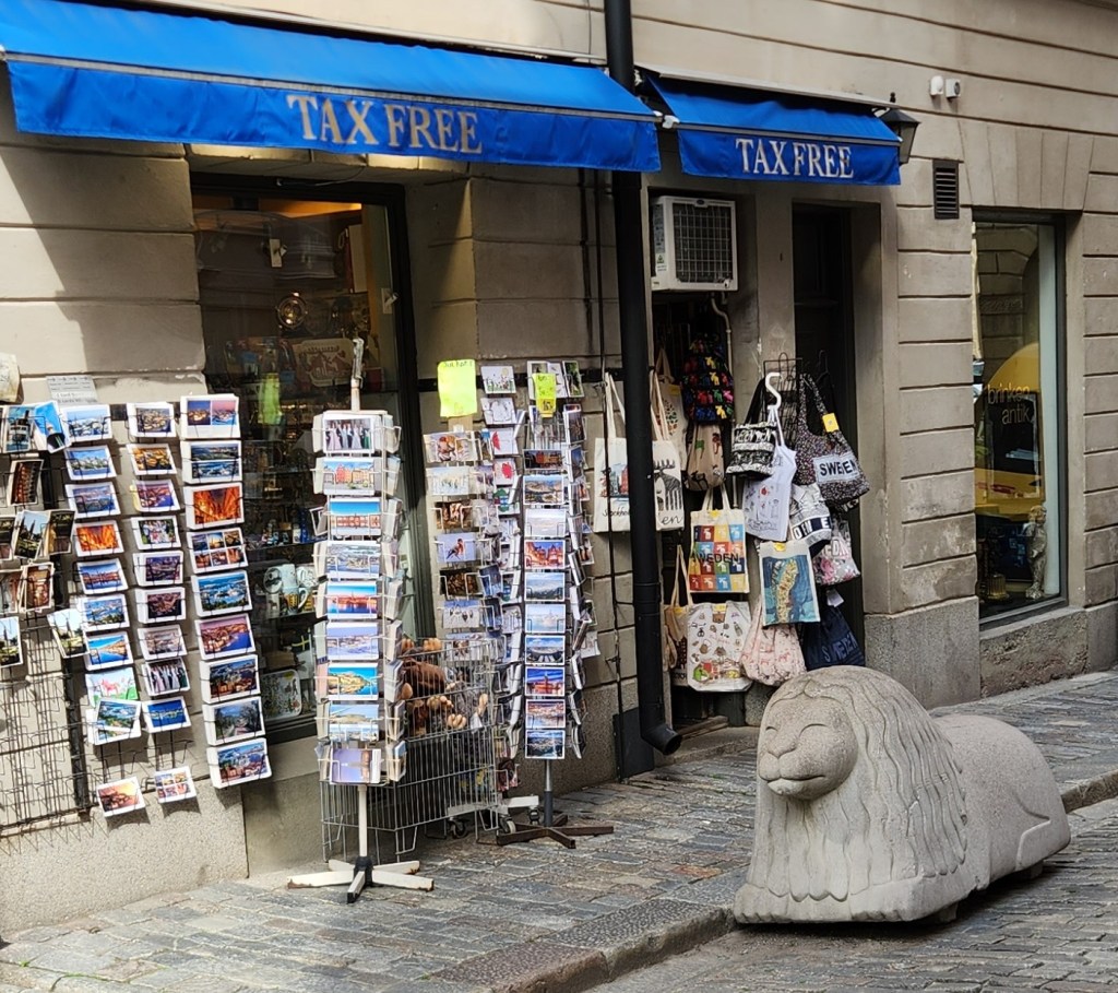
Looks fairly modern from the outside …
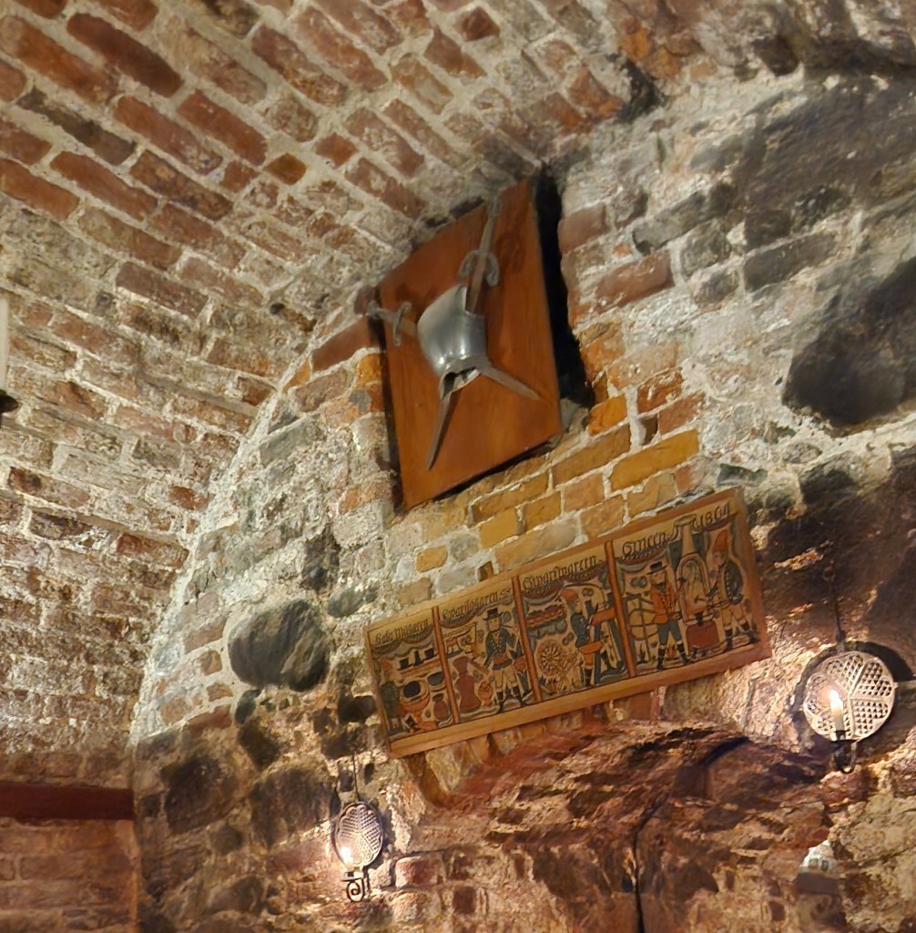
… but not inside!
Another Photo Inside the Restaurant
Interesting Street Statue near the Restaurant
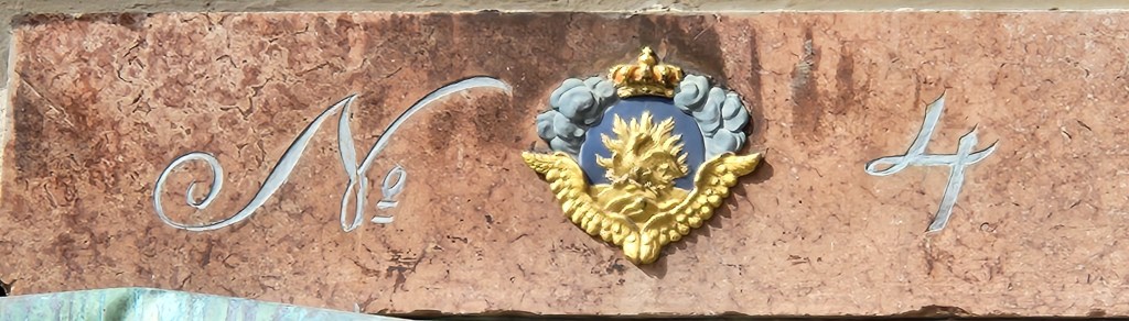
A Decorative Building Number

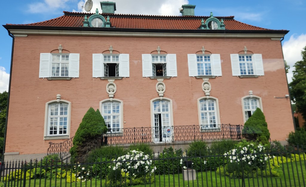
Our bus took us into a less bustling the part of Stockholm around Lake Mälaren and through the Diplomatstaden, or “Embassy Row.” We saw several intersting buildings before being dropped off at the Stockholm City Hall.
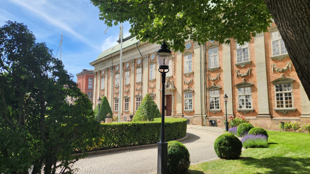
The House of Nobility (Riddarhuset), a historic 17th-century baroque palace
Republic of Korea Embassy in Stockholm’s

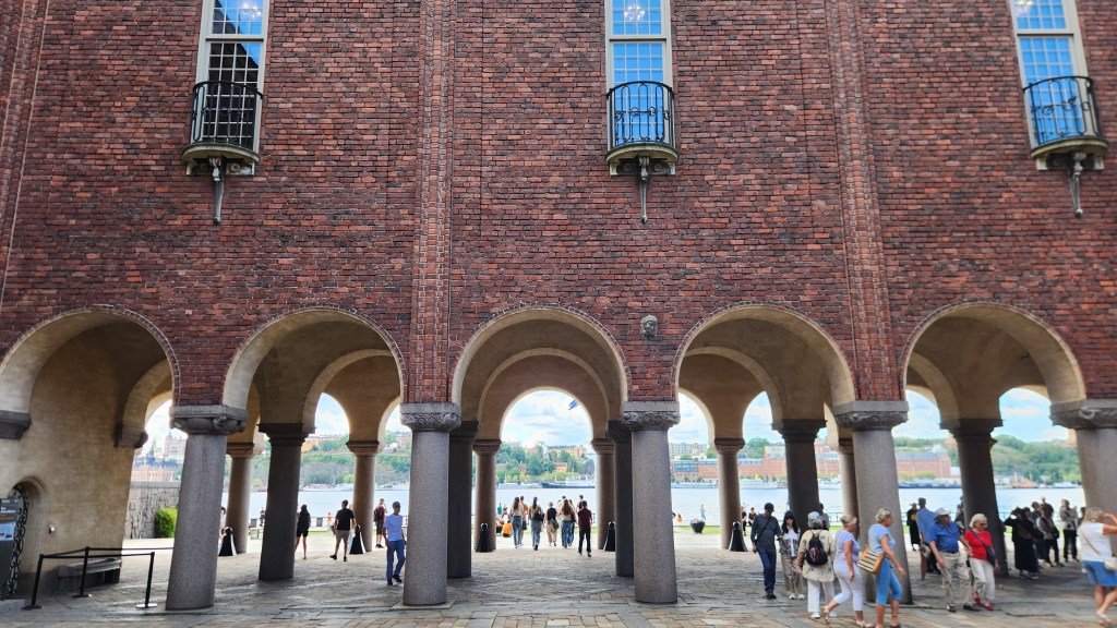
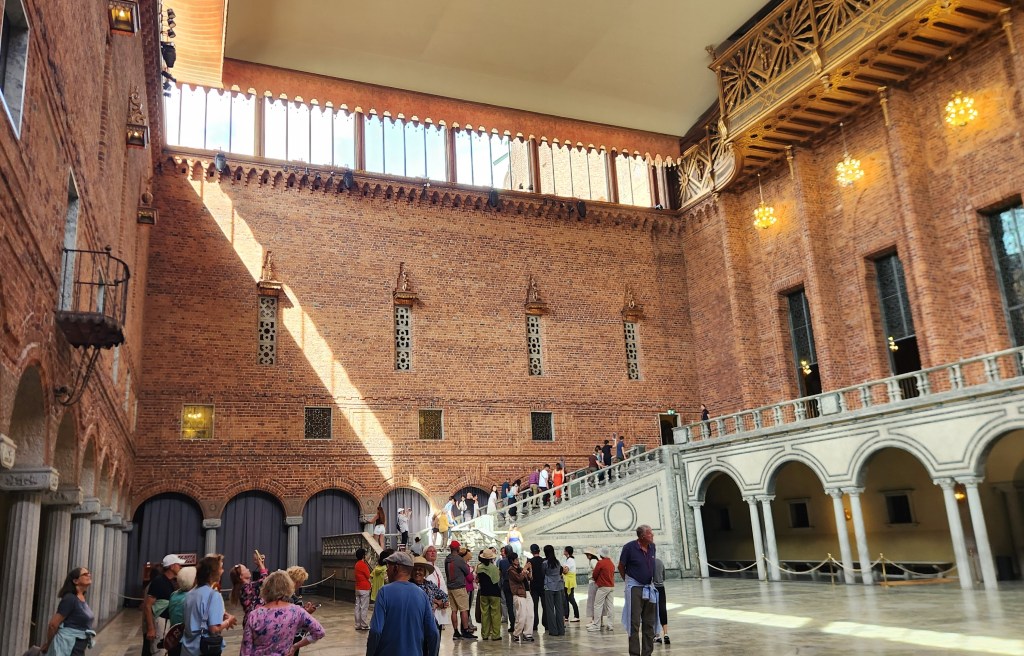
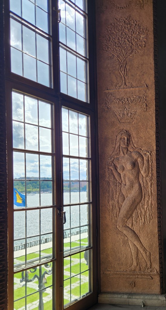
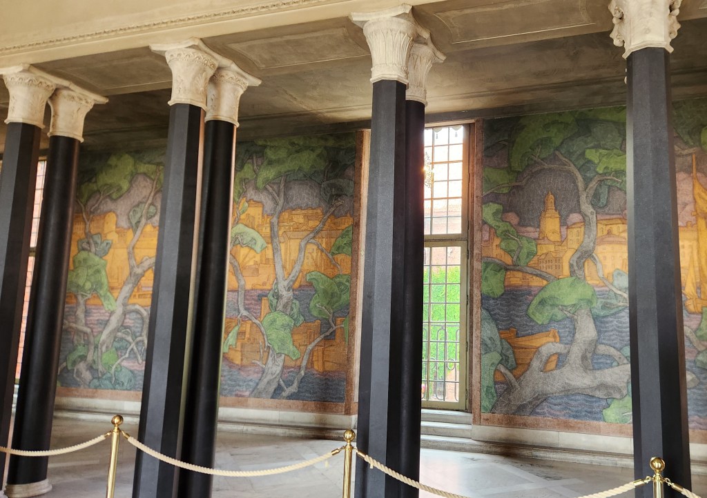
The City Hall, located on the shore of Lake Mälaren, is an amazing building. We actually visited there twice – once for a look around the exterior of the building and again later for a tour of the interior. While its official purpose is as the seat of the city government, it is famous as the location for the annual Nobel Awards dinner, where each year’s laureates are celebrated.
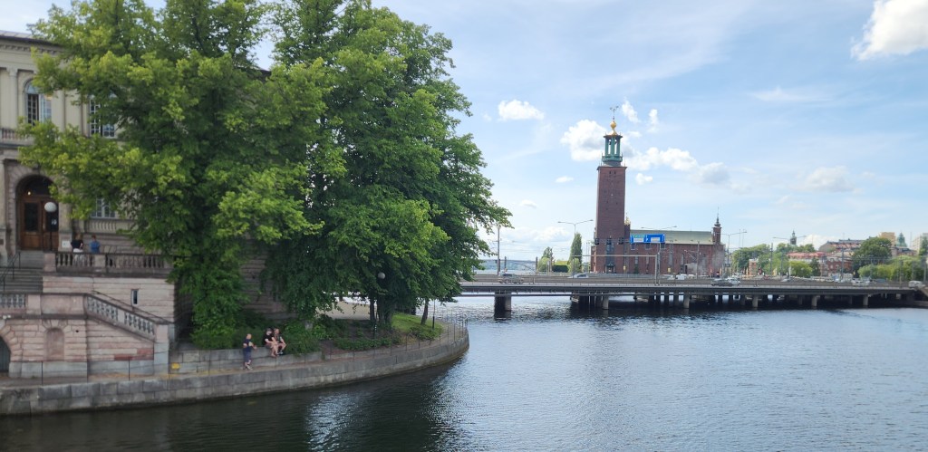
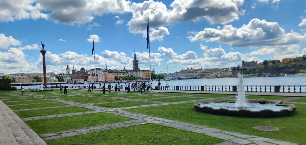
City Hall viewed from the Old Town
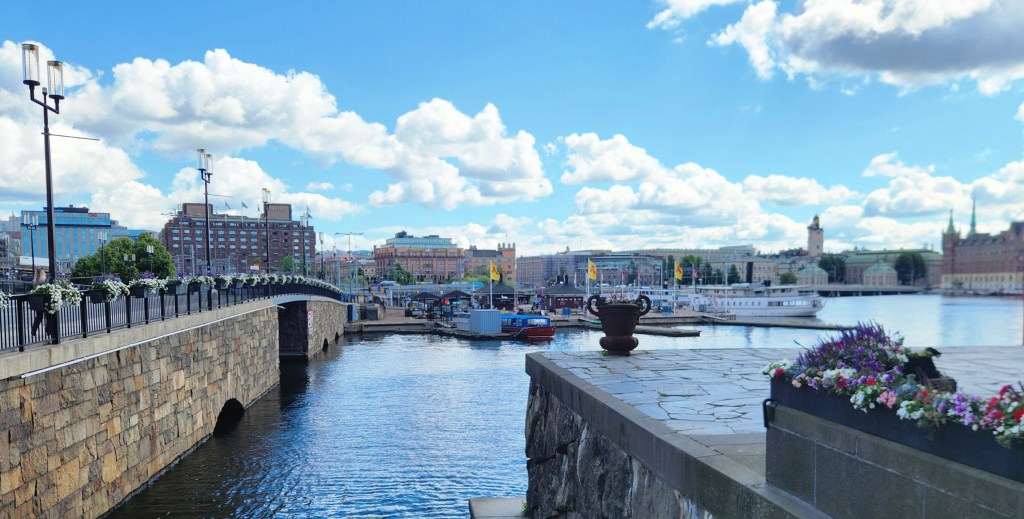
City Hall Plaza and Lake Mälaren
City Hall and Lake Mälaren
View from Rear of City Hall
City Hall Atrium
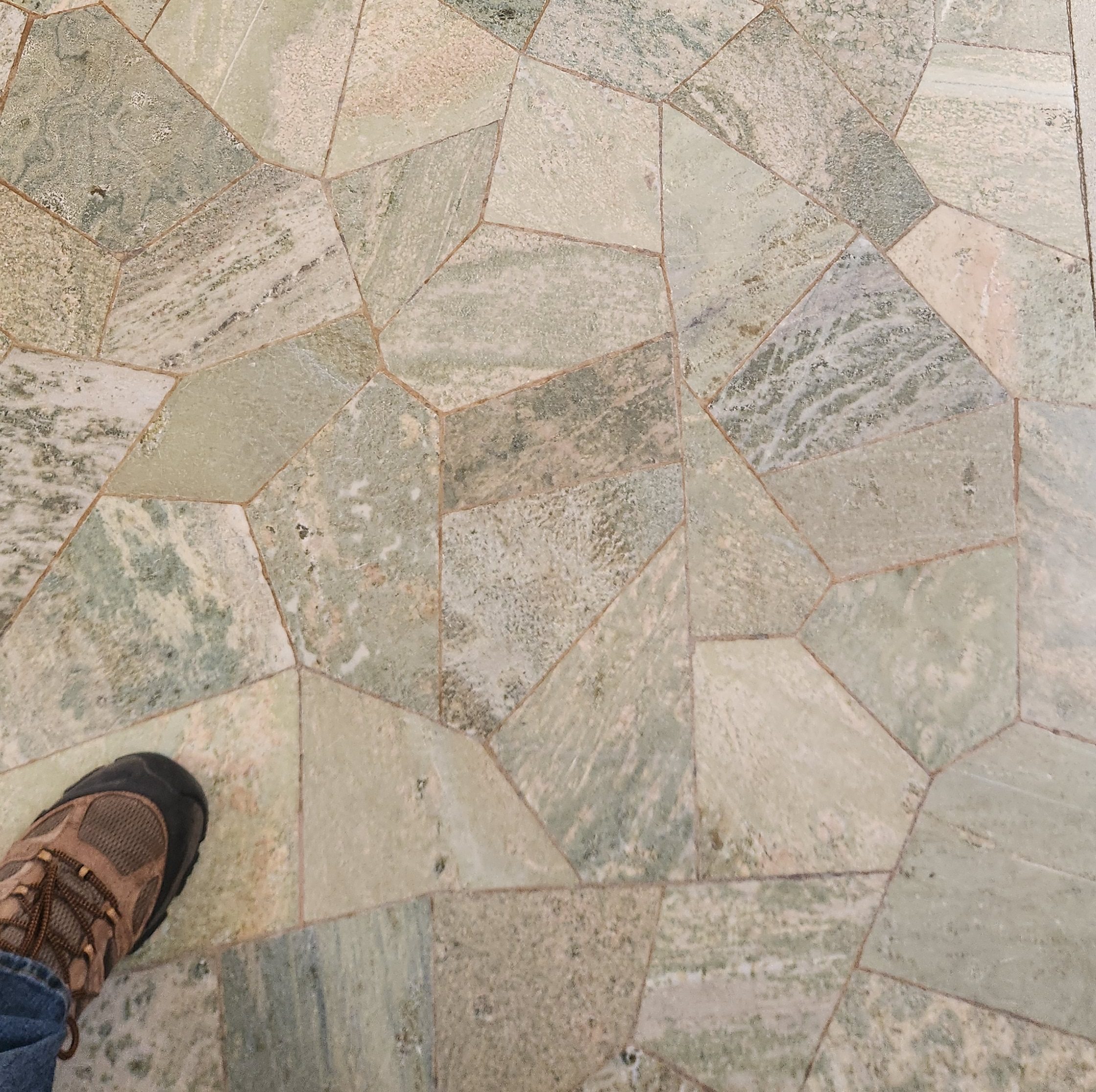
Floor of City Hall Atrium
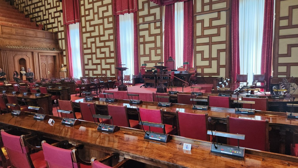
The City Meeting Room
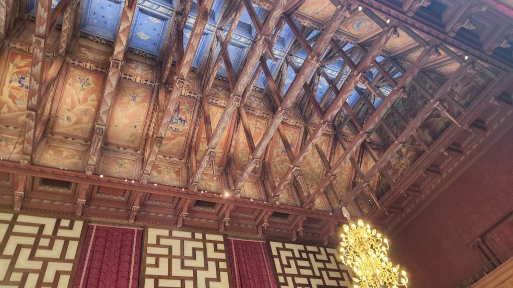
Here’s what the elected representatives see if they look upward
Example of Intricate Window Decorations
Hallway in the City Hall
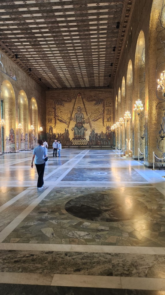
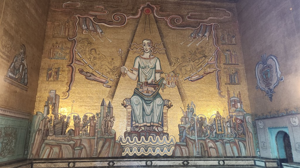
Grand Ballroom in City Hall
Hard not to be impressed …
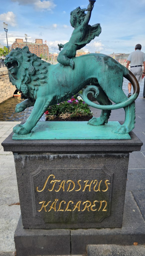
Statue outside City Hall
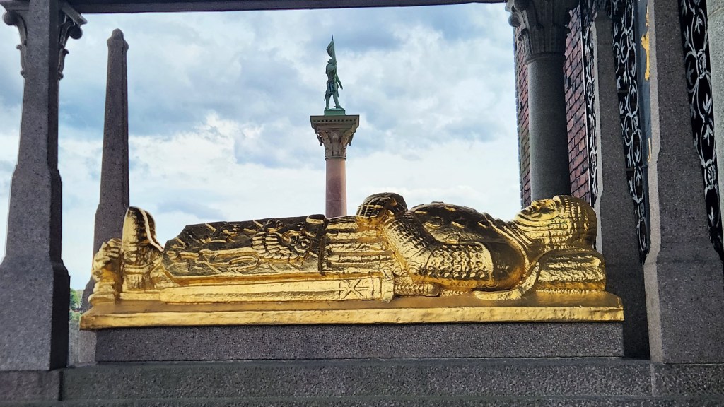
Mummy Displayed outside City Hall

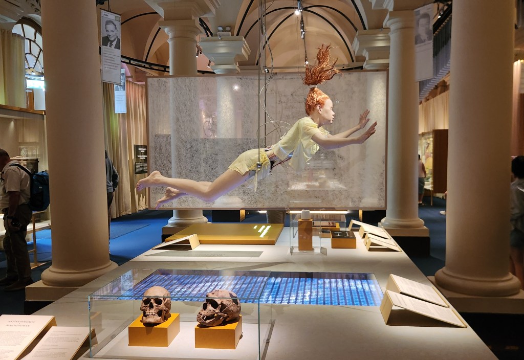
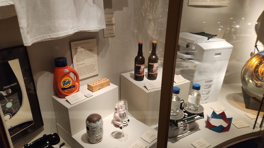
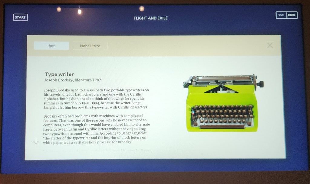
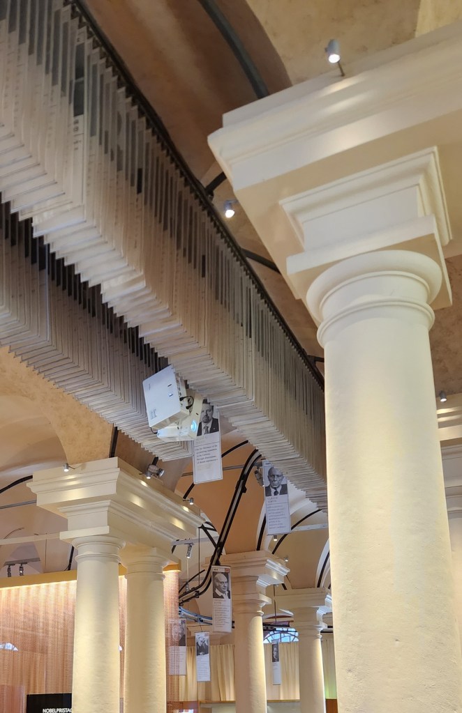
In between the two visits to City Hall, we visited the Nobel Prize Museum. This amazing place showcases every Nobel laureate since the first ones were awarded in 1901. Various exhibits provide information in many forms: plaques with written information, short videos highlighting the various awardees, statues, and a labyrinthine system on which a page describing every single laureate passes continuously through the entire building. We learned that Alfred Nobel was inspired to establish the Nobel Prize Foundation when he read an erroneously published obituary in a newspaper that deemed him “the merchant of death,” due to his invention of dynamite. Shocked by this characterization, as dynamite was only one of his several hundred inventions and was only intended to make heavy construction more efficient, he wanted his legacy to be very different from that characterized by the newspaper.
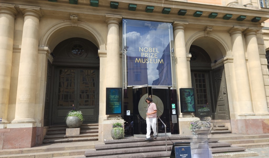
The Nobel Prize Museum
Pages for Every Nobel Laureate Continuously Travel through the Entire Museum
Exhibit in the Nobel Museum
Display of Items that Inspired some of the Laureates
Example of Exhibit for One of the Laureates
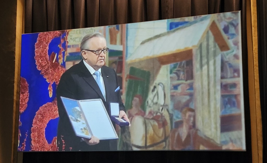
One of a Series of Videos, this one honoring 2008 Peace Prize winner Martti Ahtisaari of Finland

As usual, we tried to snap photos of the various sights we saw from our buses during the tours, with limited success. Here are a few that actually sort of turned out.
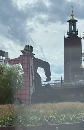
The Mr. Walker sculpture depicting the alter ego of the comic book hero The Phantom
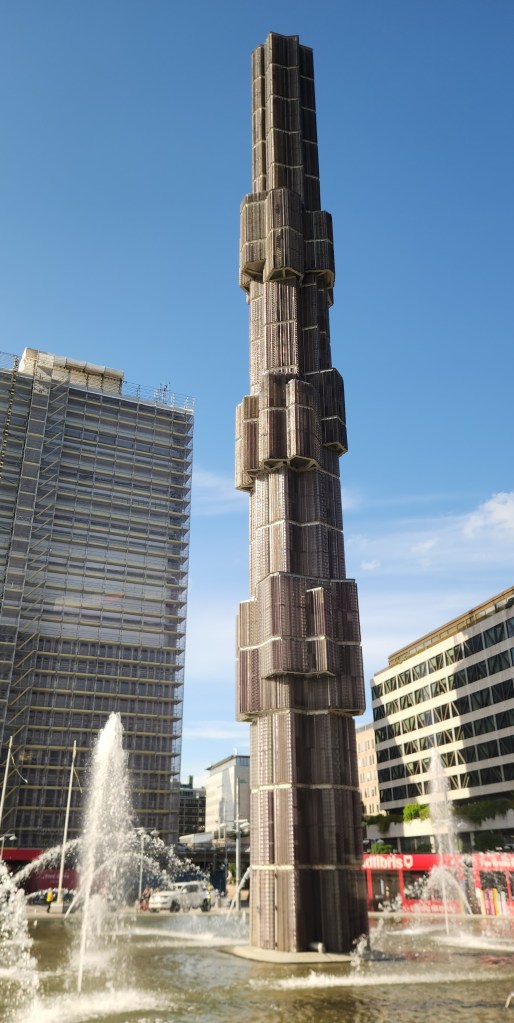
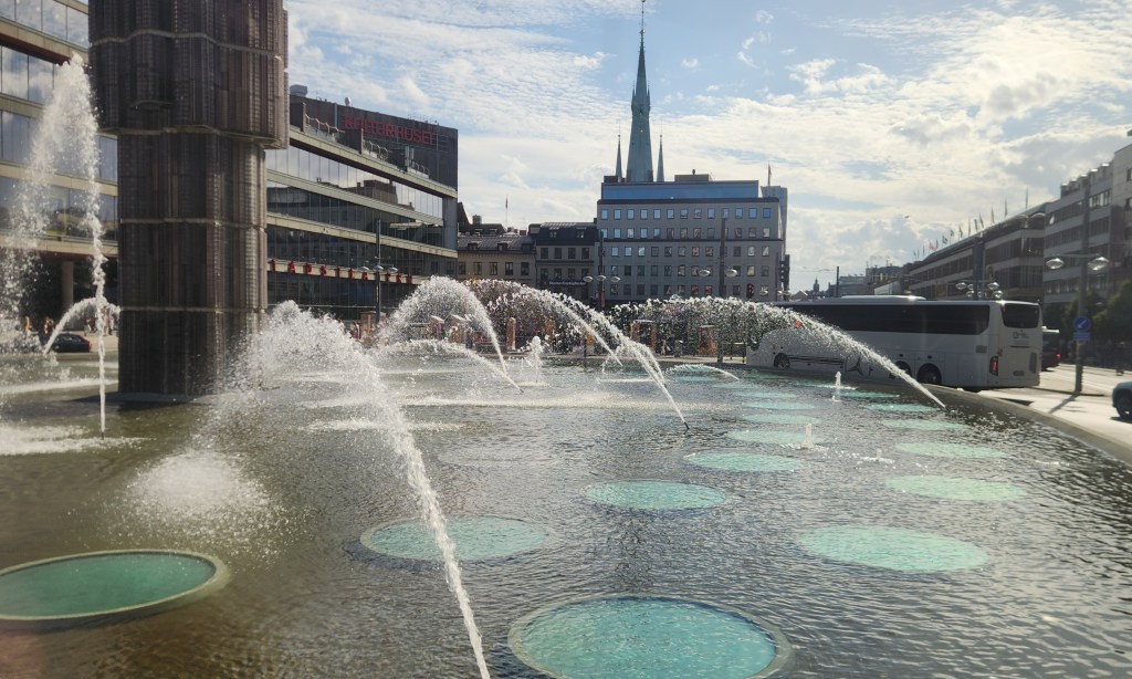
Sergels Torg, a famous public square in central Stockholm
120-Foot Glass Column at Sergels Torg
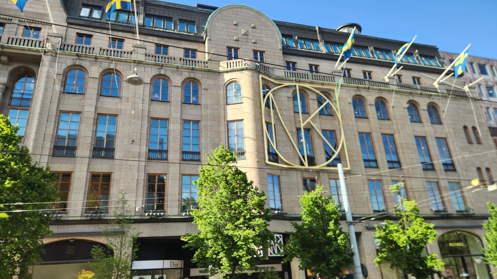
The historic Nordiska Kompaniet (NK) luxury department store built in 1915

As evening approached and we returned to the ship from the second of our two bus and walking tours, Pat and I actually each did something on our own. I went on yet a third tour to visit the Carl Johan church, located on the island of Skeppsholmen which was originally used as a base for the Swedish navy. Constructed between 1823 and 1842, it has now been deconsecrated as a church and converted into a vibrant cultural venue and concert hall renamed Eric Ericsonhallen.
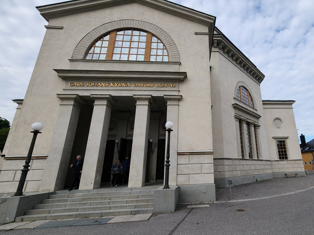
View of Concert Hall located on Skeppsholmen Island
Closeup View of Concert Hall
Looking back toward Old Town from Skeppsholmen Island
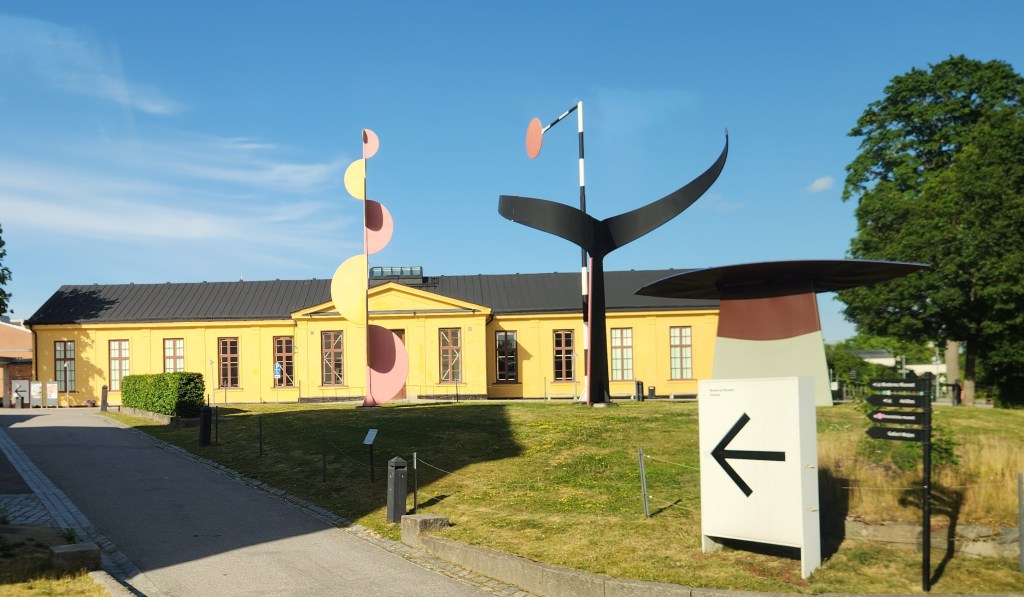
Museum of Modern Art located on Skeppsholmen Island

Upon arrival, we were treated to a glass of sparkling cider before settling in for a performance of Vivaldi’s The Four Seasons by some of Sweden’s leading musicians from the Stockholm Philharmonic Orchestra. Here are some photos and a brief video clip of the performance. I was too polite to stand up when taking the video, with the unfortunate result that it features the guests in the front row more prominently than the musicians. Oh, well … During the intermission, I joined the other guests in enjoying a tasting of locally made, seasonally inspired pralines.
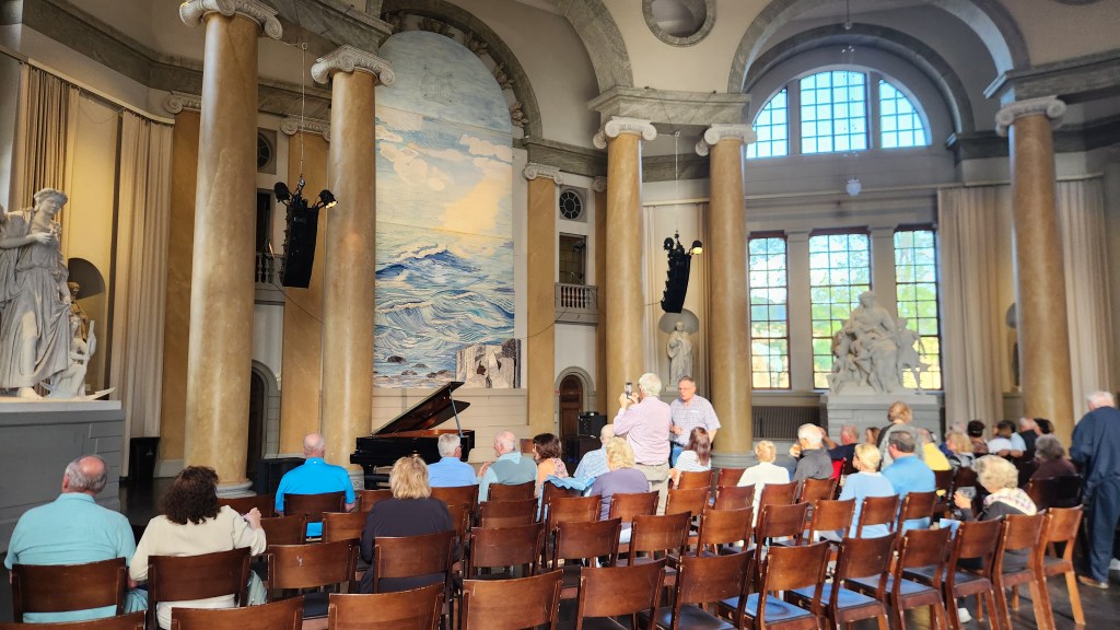
Interior View of Concert Hall
A Clip Fom the Concert

So, what did Pat do while I attended the concert? She got a massage at the shipboard spa. I presume she didn’t get any photos of that, which might have spiced up this blog post a bit, but I didn’t ask and she didn’t tell.

After dinner, we retired early since we needed to depart the ship at 3 AM Wednesday to head for the airport and begin our journey home. We had three flights – Stockholm to London, London to Chicago, and Chicago back to our home sweet home in Minneapolis. Fortunately, the trip was uneventful, and we were once again very pleased with our Global Entry membership as we sailed through customs at Chicago O’Hare.

Okay, that wraps up this travelogue. I hope you enjoyed it, and I also hope you’ll keep an eye out for future episodes as we gallivant off yet again to some very exotic locales in January and August of 2027. Not to give too much away, but they will involve travel to South America and Egypt!!

Thanks for reading, and farewell until next time …
Pat and Dave’s Vibrant Viking Voyage – PART 3: Denmark and Germany

Welcome back for Part 3 of my travelogue describing our recent Viking Ocean Cruise entitled “Viking Homelands.” Part 2 left off as we were departing from Oslo, Norway. This episode will cover our stops in Denmark and Germany, including locations 5, 6, 7, 7a, and 8 on the map of our itinerary:

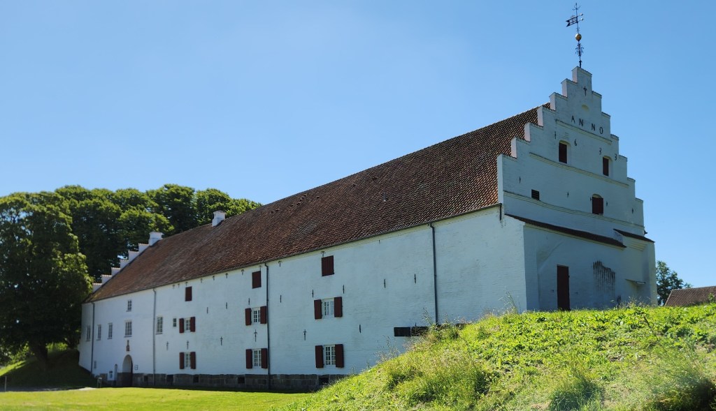
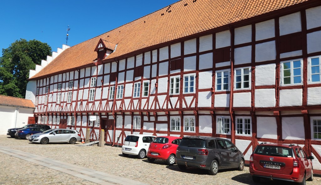
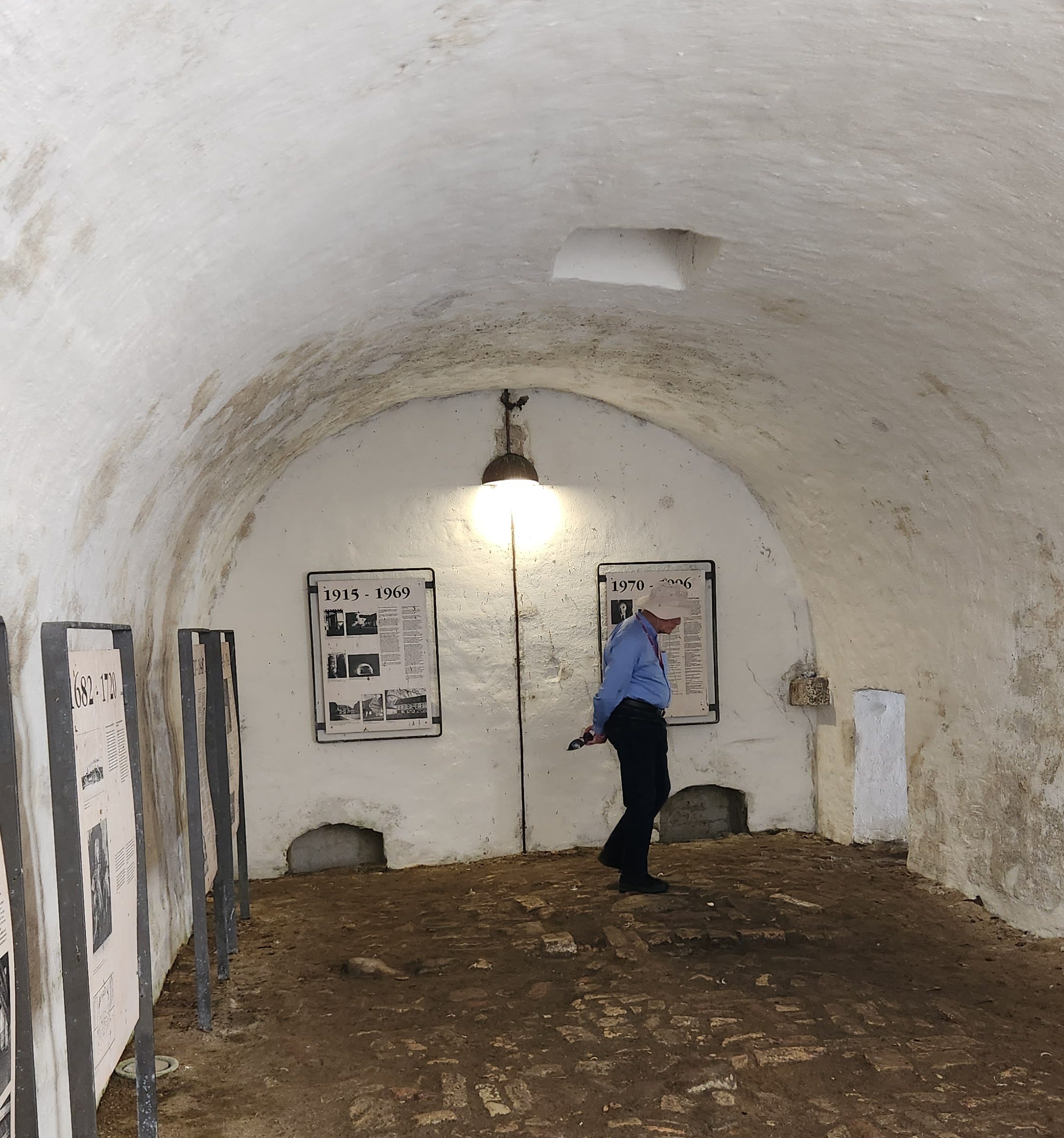
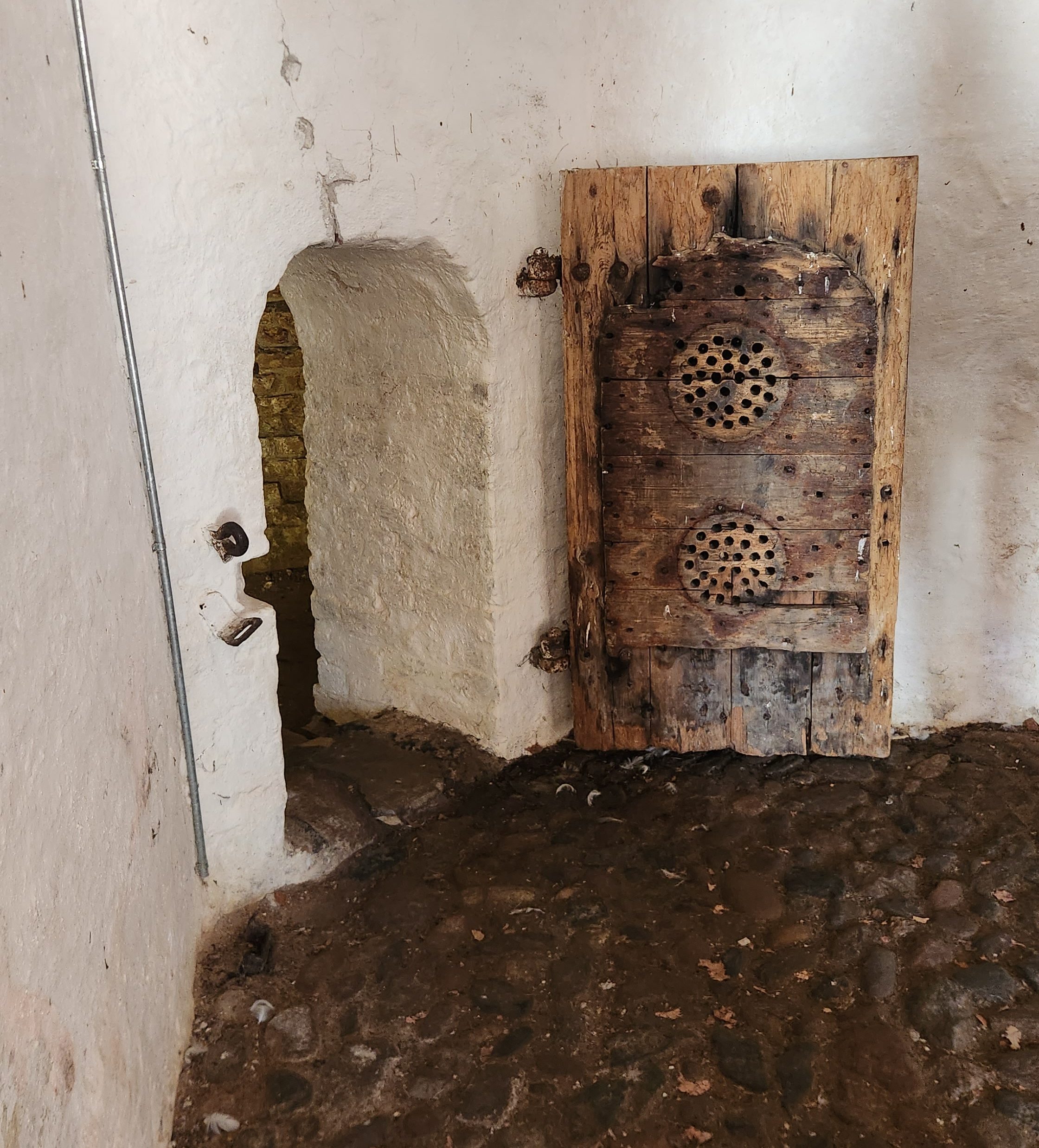
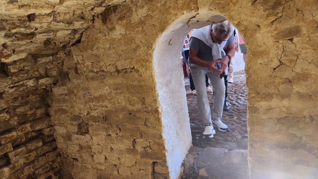
Ålborg, Denmark (Tuesday, June 23, 2026): Our ship arrived in the Ålborg harbor at 10 AM Tuesday, and we were soon off on a walking excursion through the old town to discover its trade roots and Viking heritage. Ålborg is the fourth largest city in Denmark, dating back to its founding as a Viking trading post during the late 900s. Our tour first took us to the Ålborghus Castle, a 14th-century fortress built using the traditional half-timber technique. Some of the dungeons have been preserved to provide visitors with a feel for the conditions in the old fortress, and a series of placards describes the castle’s history.

Ålborghus Castle seen from the back
Ålborghus Castle seen from the front
Storage Room in Ålborghus Castle
Exterior of Dungeon Cell
Looking out from the cell

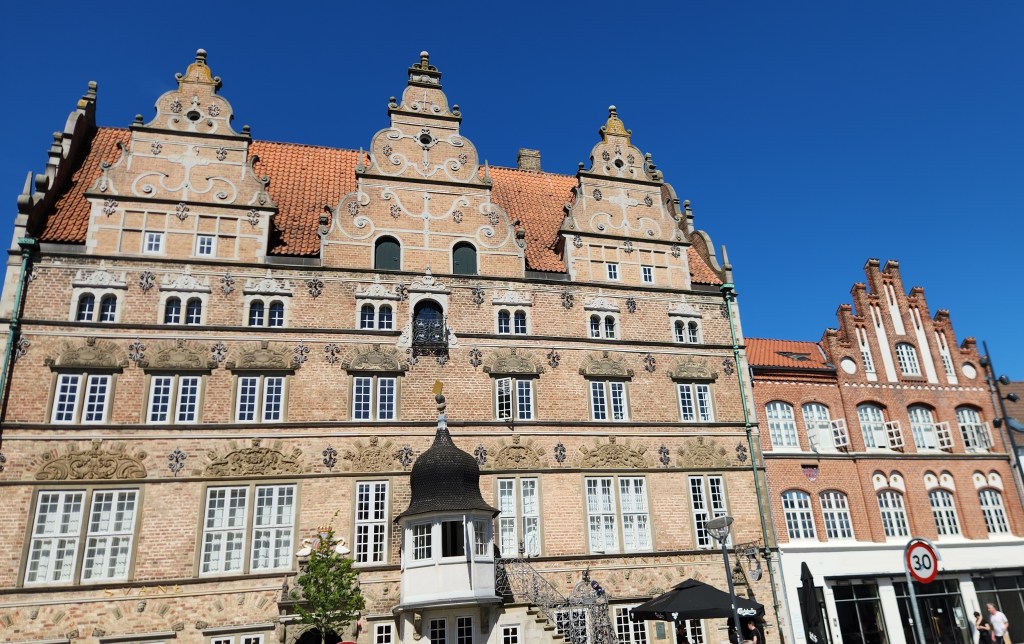
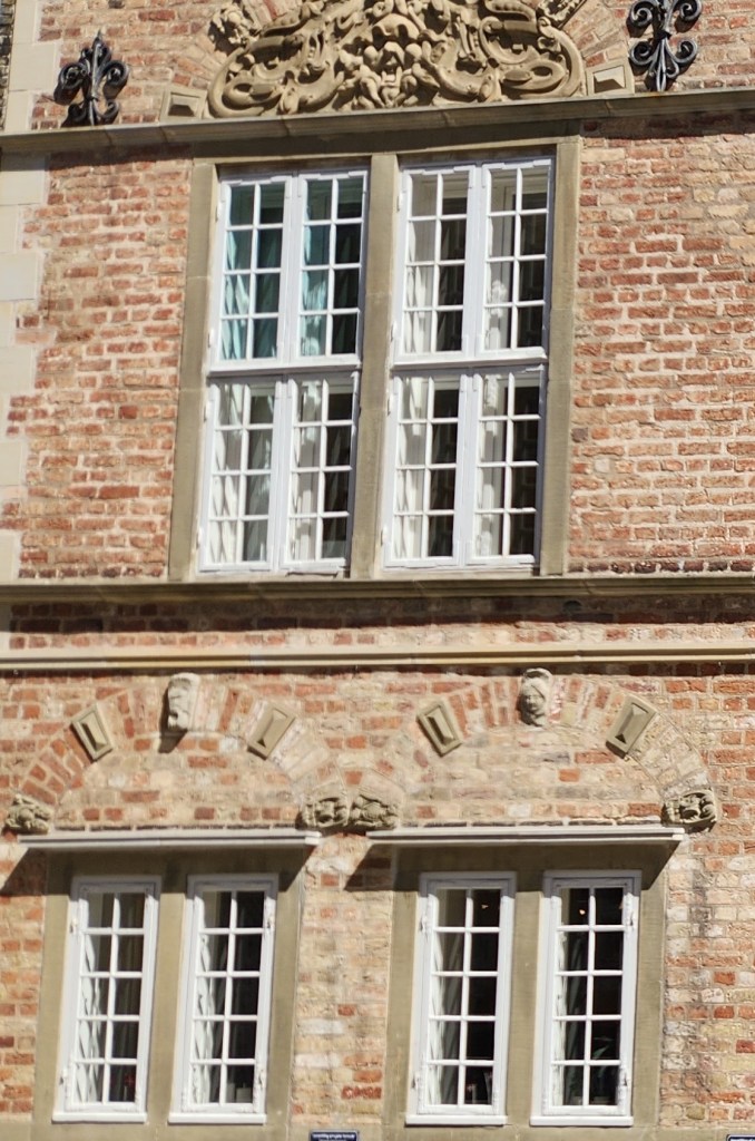
We then passed on to the Nytorv Square, a pedestrian plaza established in 1604 in the historic center of the old town. The Jens Bang house, built in the Nytorv Square in 1624 and noted for its gables, sculpted window décor, gargoyles, and a sculpture of Bang sticking out his tongue, is considered the finest privately owned Renaissance building in Denmark. Bang was famously snubbed by the town’s government and his statuesque renaissance home was never approved by the local gentry. The house has also housed the city’s oldest pharmacy for more than 300 years.

Jens Bang House
Details of Jens Bang House

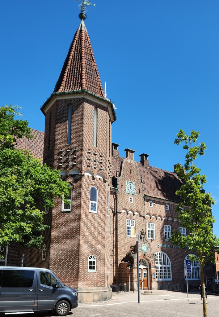
We passed by many other historic buildings located in the central part of the old town, including the Old City Hall (built in 1762 in a Baroque and Rococo style), the Post Office/Telegraph building (1908), and the Budolfi Church or Ålborg Cathedral (dating from the 16th century) which now serves as the seat of the Lutheran Bishop.

Central Square of Old Town
Old City Hall
Budolfi Church
Budolfi Church
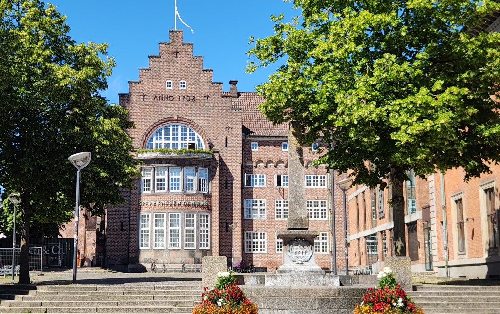
Post Office/Telegraph Building

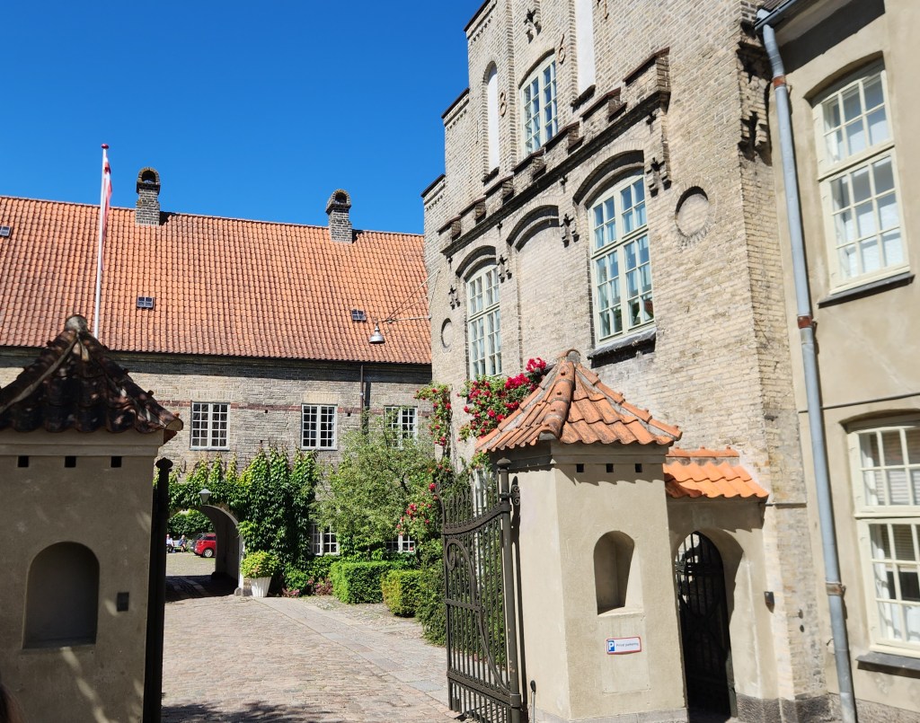
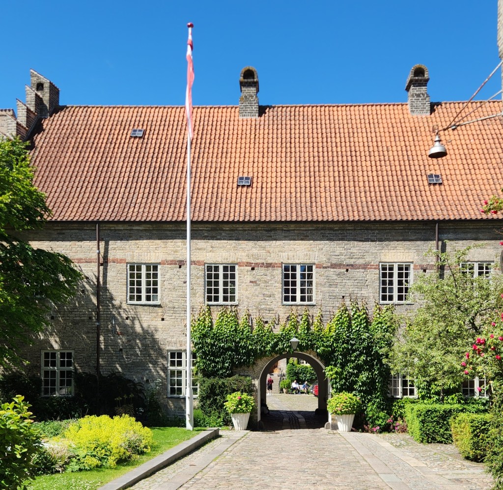
We spent a fair amount of time learning about the Monastery of the Holy Ghost, a medieval monastery dating back to 1431 which also served as a hospital for more than 500 years until the 1950s. While most of the monastery buildings have been converted to modern housing for senior citizens, the oldest part – the School Wing – has been preserved in its original state from the 15th century.

Monastery of the Holy Ghost

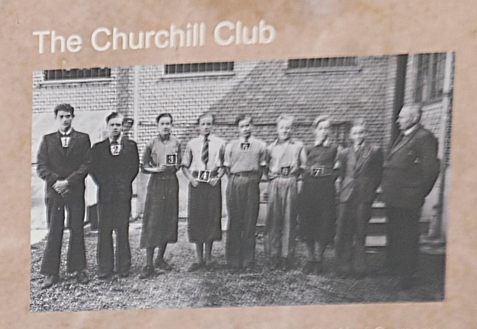
During World War II, a group of eleven grammar school students formed the Churchill Club, a secret resistance movement. Two of the boys lived in the monastery as their father was the vicar at the Budolfi church. The students used the monastery to plan sabotage missions against the occupying Nazi forces and to hide weapons stolen from the German Army, inspired by the acts of Norwegian resistance soldiers. They succeeded in carrying out 25 acts of sabotage before they were arrested by the Danish police on May 8, 1942, as Denmark’s official position was to cooperate with the German occupiers. Some of those acts of sabotage included stealing weapons and destroying vehicles, blueprints, and plane parts. The boys were fined and sentenced to prison terms ranging from one-and-a-half to five years. Even during their imprisonment, some of the boys managed to escape at night to continue their sabotage activities for some time, then sneak back into their cells before sunrise.

Members of the Churchill Club Secret Resistance

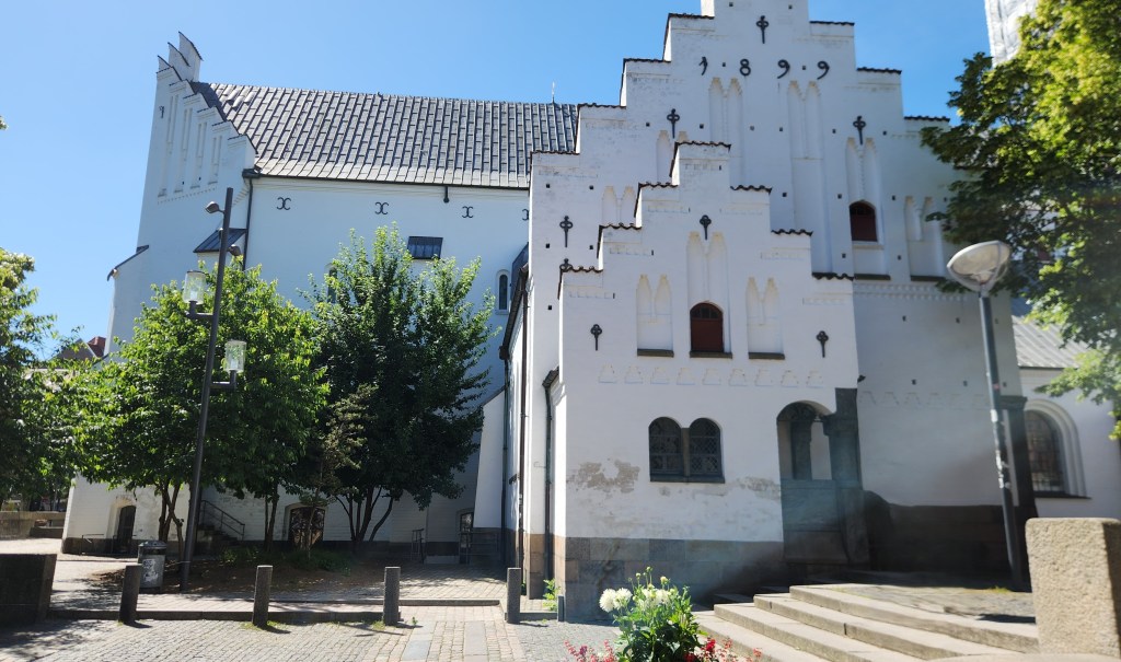
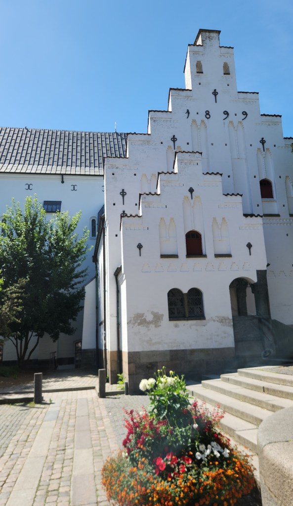
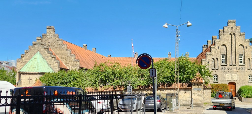
One amusing thing was an inscription on a hospital building reading “Anno 1506.” We learned that it originally read “Anno 1905” following a renovation to the hospital, but historians felt that was inappropriate for such a historic place and so the digits were rearranged.

Monastery of the Holy Ghost

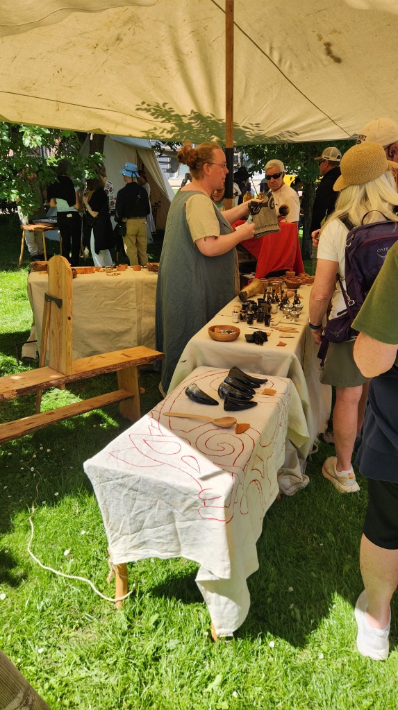
After the monastery, we walked through an area of residences and small shops and visited a local Viking market, a somewhat goofy place where people dressed in old-time garb made music and sold various Viking-themed foods and merchandise.

The Viking Village
The Village Piper

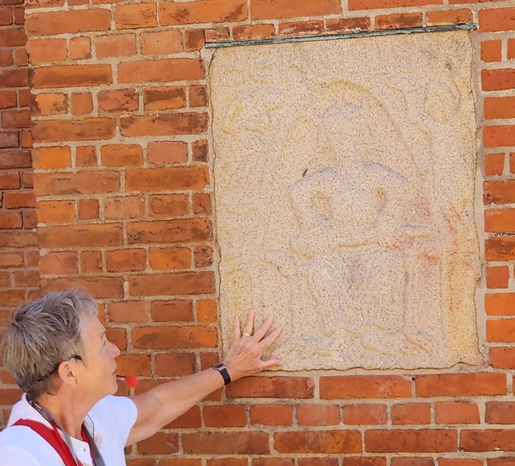
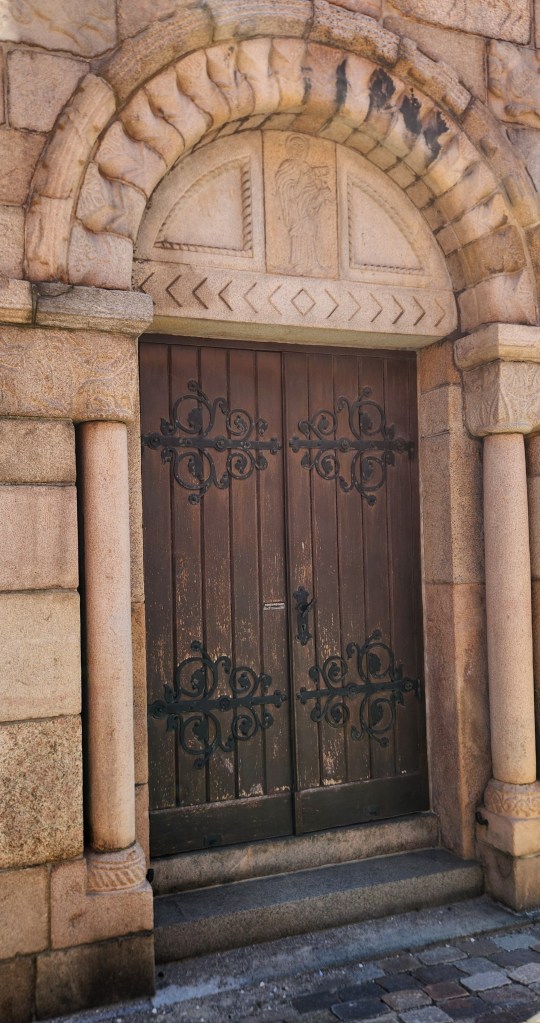
Next, we passed by the Church of Our Lady (Vor Frue Kirke), a Lutheran church built in 1878 on the site of a much older Benedictine monastery. The church is constructed in red brick and includes sandstone relief art and Romanesque portals which may have been preserved from the original monastery. The bell tower also houses one of the original church bells dating back to the 12th century.

The Church of Our Lady
Sandstone Relief
Romanesque Portal

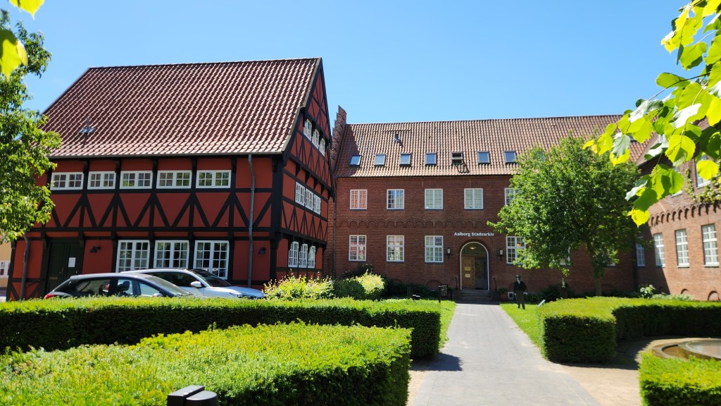
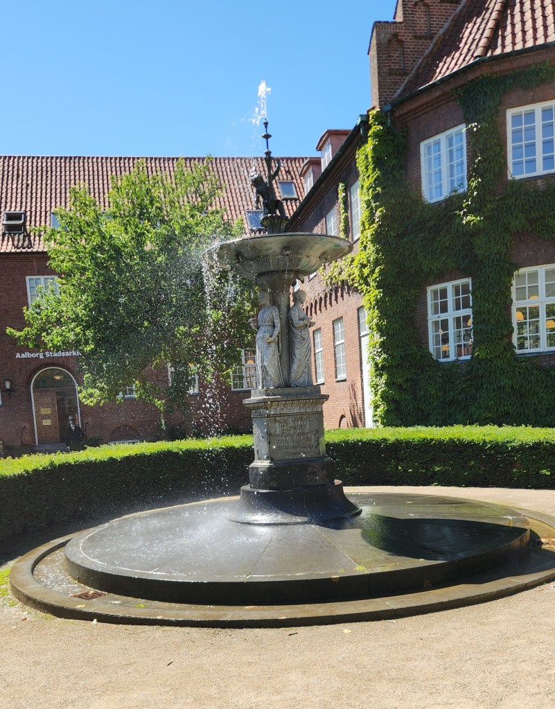
Heading back toward the harbor, we passed by the City Archives, featuring historic timber-framed architecture alongside red brick buildings and a lovely fountain.

City Archives
City Archives Fountain

I’ll also share a few photos I took of interesting sculptures and murals we saw at various points during the walking tour.

Sculpture in the Old Town
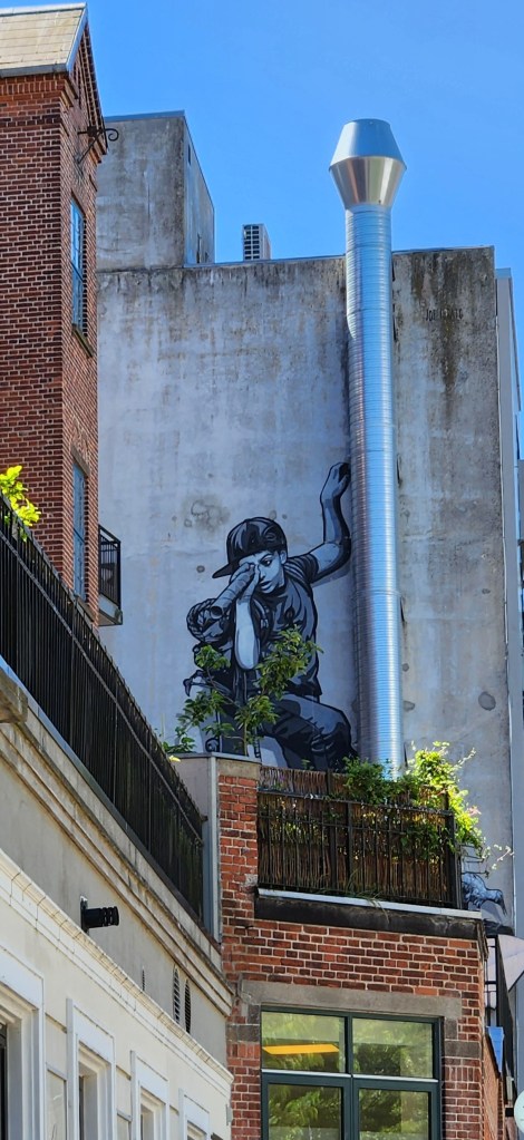
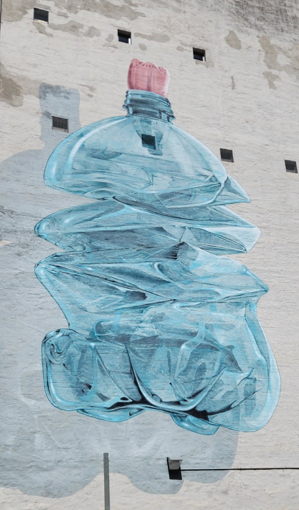
Building Artwork
Building Artwork

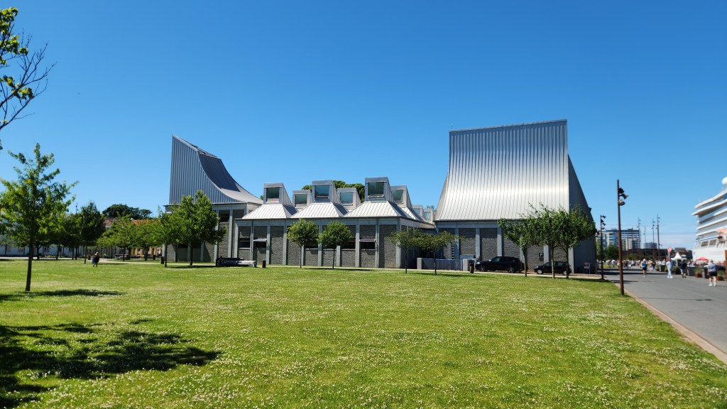
As we returned to the modern, renovated waterfront district, we passed by the Utzon Center. This ultramodern building was designed Jørn Utzon, the architect behind the Sydney Opera House. The center is directed towards promoting the significance of Utzon’s work and approach by organizing workshops, conferences and exhibitions and disseminating the results for the benefit of the architecture profession and the general public.

Utzon Center

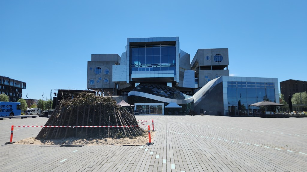
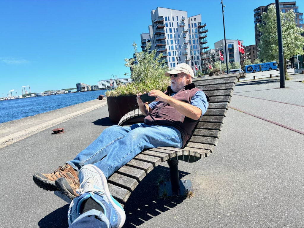
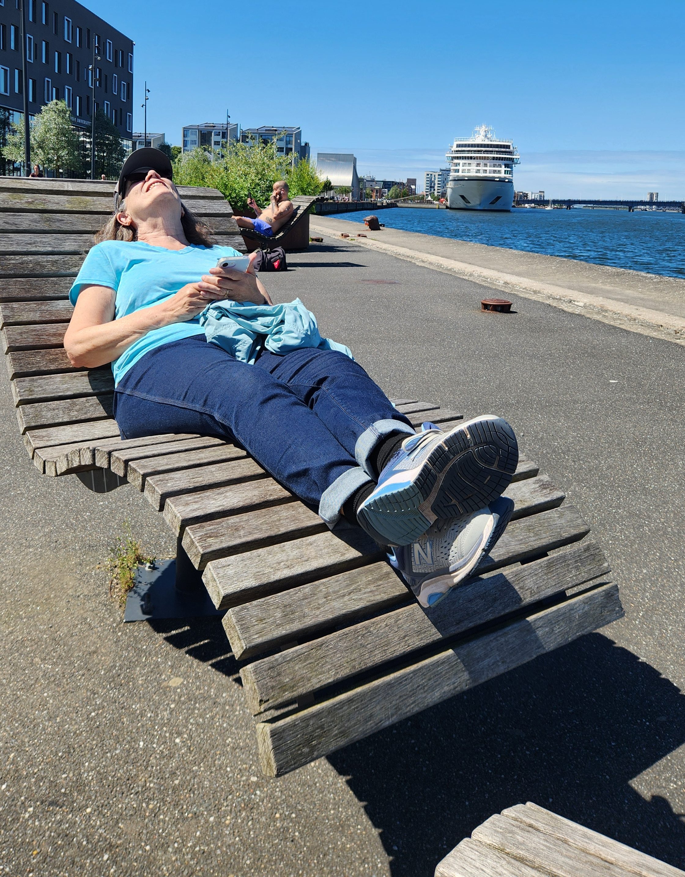
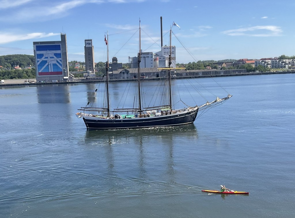
After the tour, we spent some time walking along the waterfront admiring the surroundings, including the Musikkens Hus, a major concert hall and music venue built in 2014 as home to the Ålborg Symphony; it also provides space for the Royal Academy of Music and the Ålborg University. We also sat in some interesting and very comfortable public chairs and admired the boat traffic in the harbor before returning to our ship.

Musikkens Hus, with Bonfire Setup for Summer Solstice Celebration
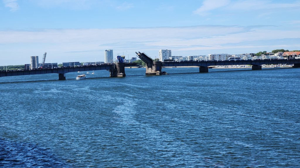
Boat Traffic in the Harbor

Copenhagen, Denmark (Wednesday, June 24, 2026): Our ship arrived in the Copenhagen harbor at 7 AM, and after the usual excellent breakfast on board we departed on a walking tour. The tour began on the Langelinie Pier where the ship was docked, and we soon came to a couple of nice statues. I’m sure every single reader will know exactly what the second one is.

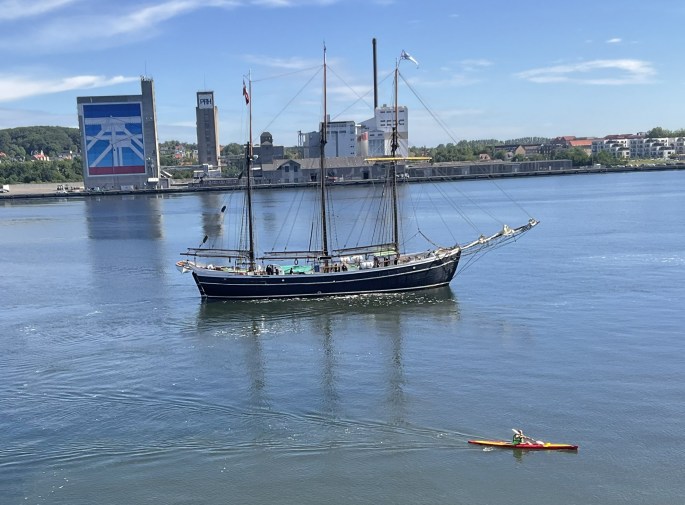
Copenhagen Harbor
Statue of Bear on Langelinie Pier
The Little Mermaid

Our guide told us that we were very lucky to have an unobstructed view of the Little Mermaid statue, still sitting serenely in the harbor since its unveiling in 1913, since more than a million people stop to see the statue every year. (In fact, when we passed by her again at the end of the tour the area was thronged with a hundred or more gawkers.) I’m quite disappointed in the quality of my photos – somehow the lighting conditions didn’t allow me to get a good one – but at least the statue commemorating Hans Christian Andersen’s fairy tale was all there.  At various times, since 1964, vandals have: decapitated her twice (the first head was never recovered, and a new one had to be made in 1968); sawn off an arm in 1984; used explosives to blow her off the stone base and into the harbor in 2003; drenched her in red paint protesting whale hunting in the Faroe Islands in 2017; painted her blue and white with the words “Free Abdulle” in 2017; tagged her with the words “Racist Fish” during global protests in 2020; and painted her with the white, blue, and red stripes of the Russian flag in an act linked to support for the invasion of Ukraine in 2023. And yet she endures!

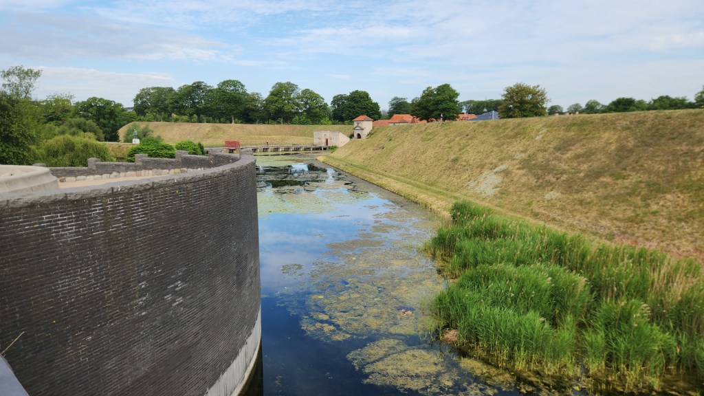
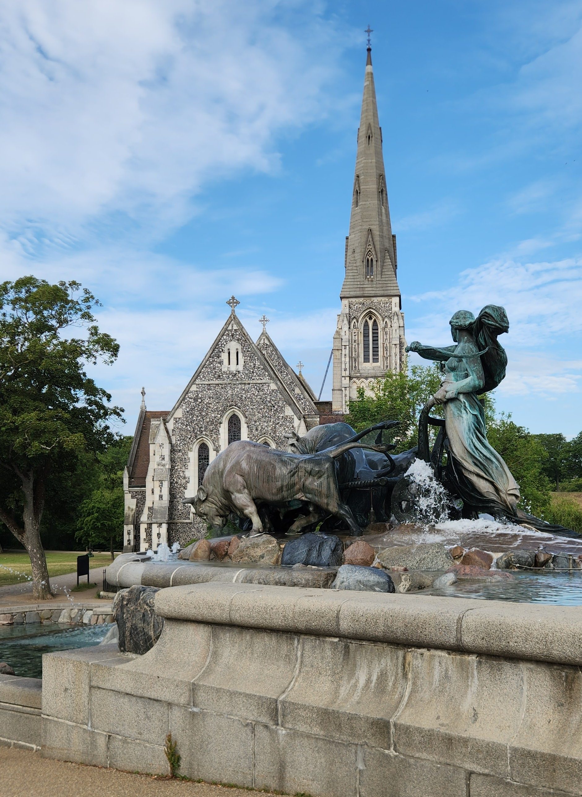
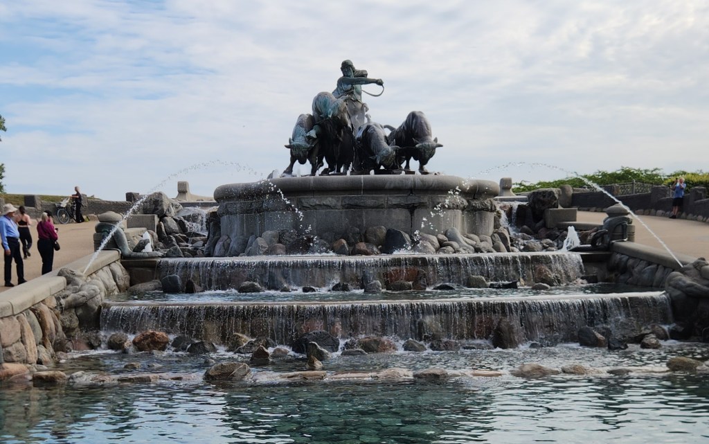
Our tour continued along the pier as we passed through the Amaliehaven, a public garden opened in 1983. We saw the ramparts of the Citadel (Kastellet, a 17th century star-shaped fortress with surrounding moats), Copenhagen’s largest monument (the Gefion Fountain, first inaugurated in 1908, featuring the Norse goddess Gefion driving four oxen), and the St. Albans Anglican Church, built in 1887.

Amaliehaven Gardens
Ramparts and Moat of the Citadel
Gefion Fountain and St. Albans Church
Gefion with her Oxen

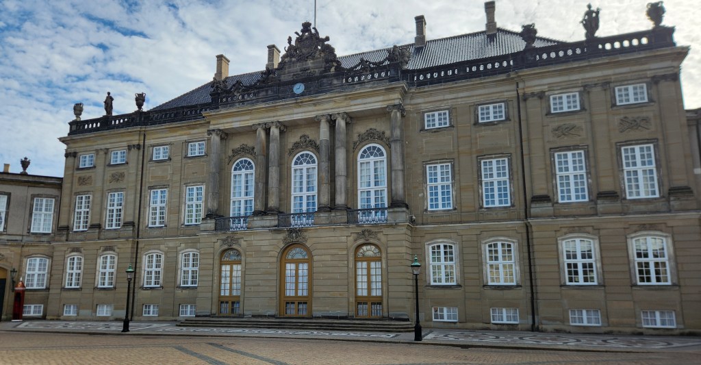
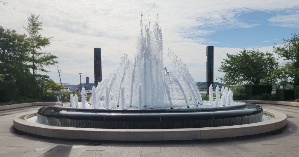
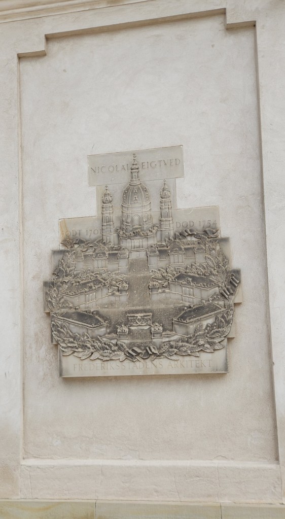
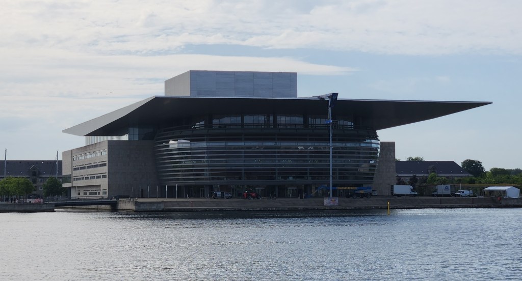
Next came the Amalienborg Palace, the winter residence of the royal family. Four identical Rococo buildings are arranged around a large octagonal courtyard with a central fountain. Amalienborg was originally built for four noble families, but after the Christiansborg Palace (see below) burned in 1794 the royal family bought the Amalienborg palaces and moved in. From the Amalienborg courtyard, we also had a good view of the New Opera House across the harbor, and on our way out of the courtyard we passed by the Marble Church, or Frederik’s Church, an Evangelical Lutheran church built in Rococo style between 1749 and 1894.

Amalienborg Palace
Fountain in Amalienborg Square
Plaque Showing the Original Amalienborg Layout
New Opera House
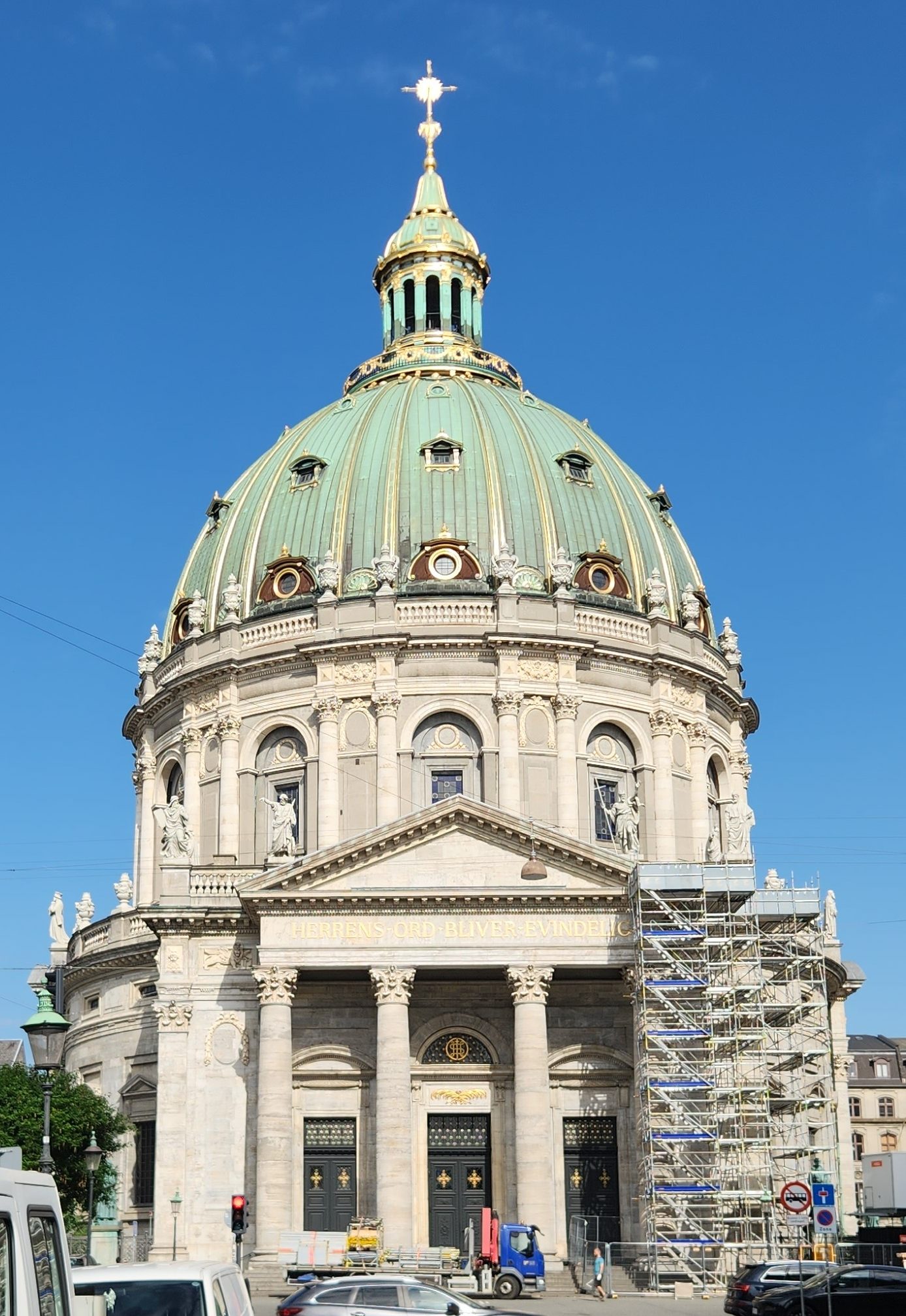
Marble Church

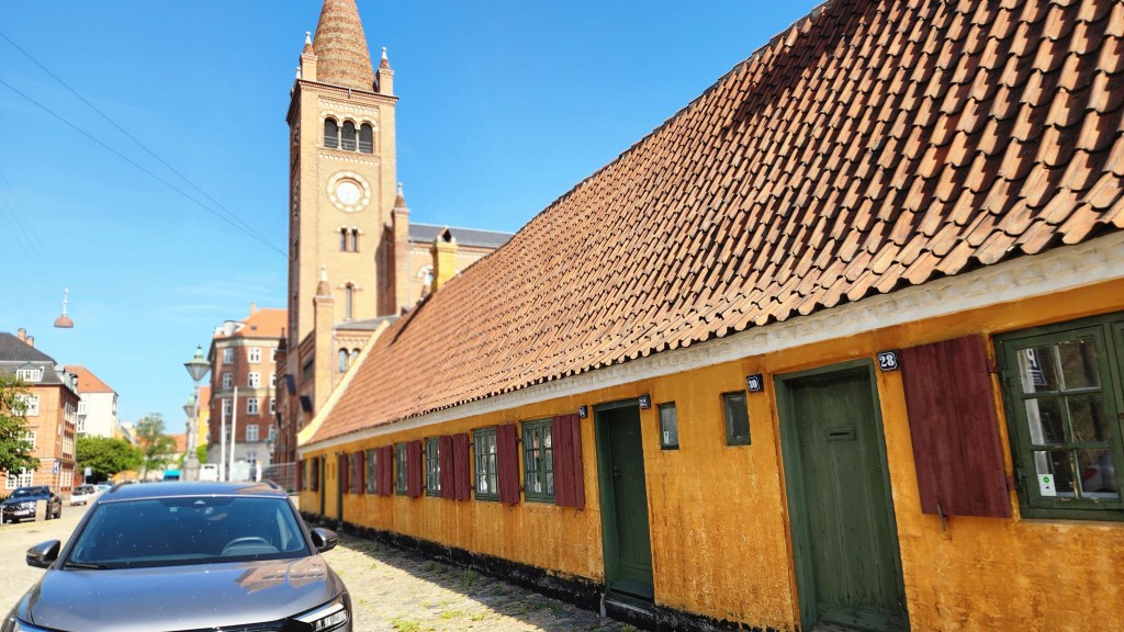
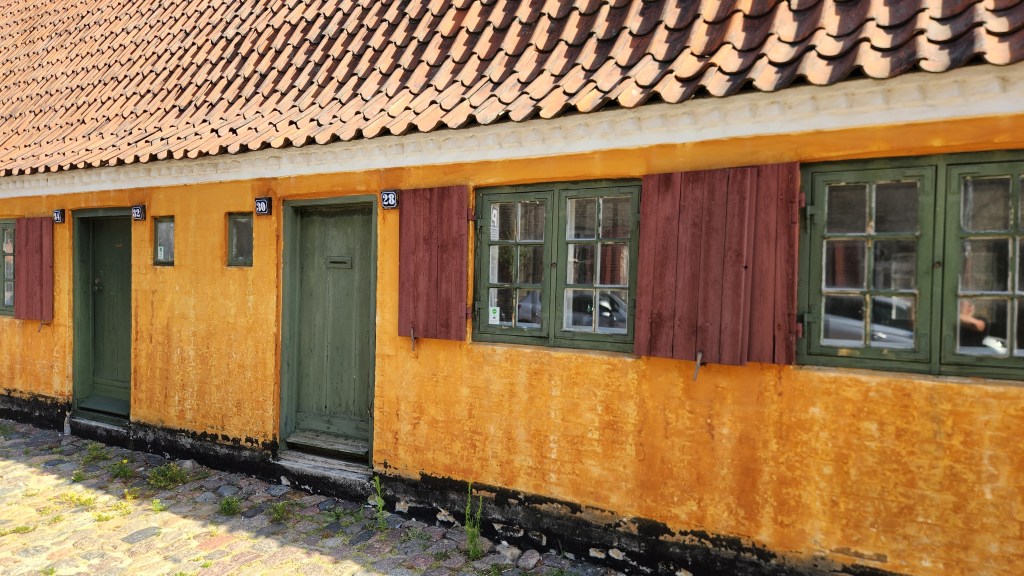
After the palace, we walked through the Nyboder district, which includes historic row houses originally built in the 17th century as naval barracks and still used for military family housing today. The buildings are iconic for their distinct “Nyboder yellow” color.

Nyober District Row Houses
Nyober Yellow Military Housing

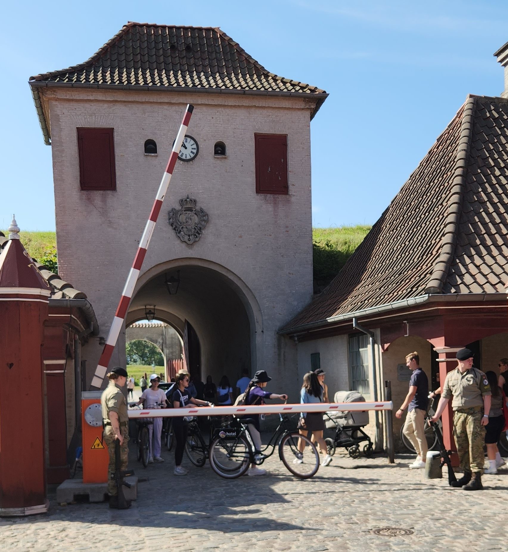
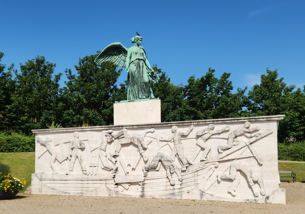
Leaving the Nyboder district, we walked to the public entrance to the Citadel – one of Europe’s best-preserved fortresses surrounded by eight moats, tall ramparts, and cannon bastions – and passed through the fortress to the pier. On the way back to our ship for lunch, we also passed by Maritime Monument (erected in 1928), commemorating civilian Danish sailors killed during World War I.

Moat of the Citadel
Citadel Entrance Gate
Maritime Monument

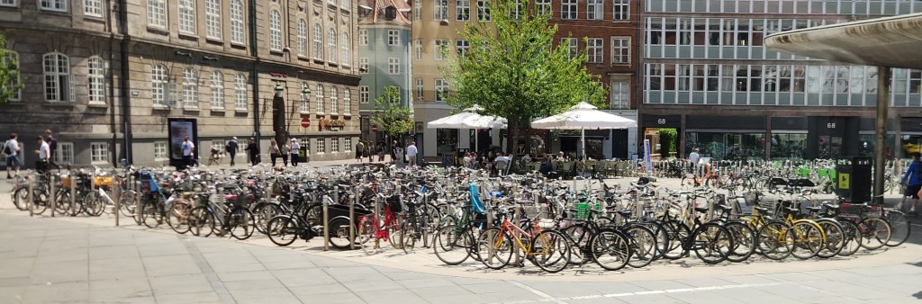
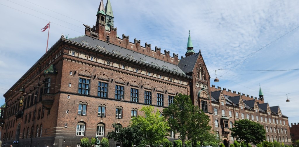
After lunch, we boarded a motorcoach for visits to the iconic Tivoli Gardens and the Christiansborg Palace, the seat of the Danish Parliament and house of the Queen’s Royal Reception Rooms. Along the way, I snapped a picture that says all one needs to know about the popularity of bicycles in Copenhagen, and another of the Copenhagen City Hall.

Bicycles seem to be very popular in Copenhagen
Copenhagen City Hall

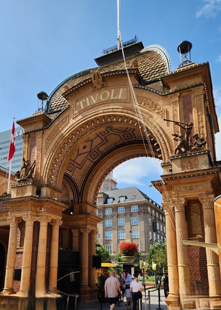
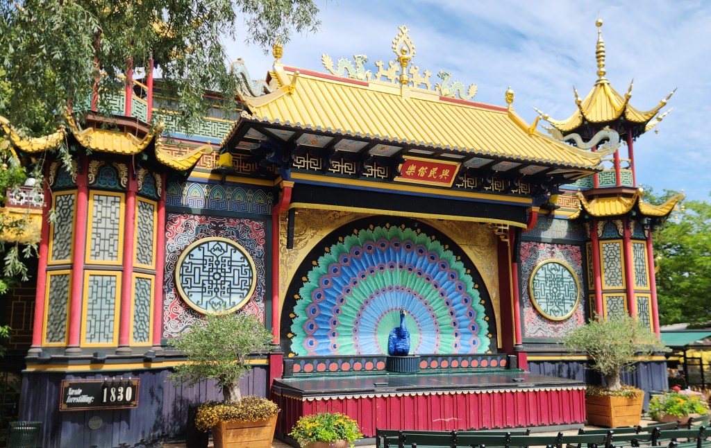
The Tivoli Gardens, the second-oldest operating amusement park in the world, opened in 1843. With 4.25 million visitors in 2024, Tivoli is the most visited amusement park in Scandinavia and second-most popular seasonal amusement park in the world. Our guide gave a brief introduction to the sights, and we were then free to explore the grounds. The buildings and grounds evoke the exotic style of an imaginary East, including the theater, bandstands, and flower gardens.

Entrance to the Tivoli Gardens
The Theater at Tivoli
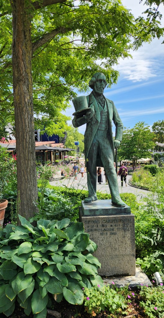
Georg Carstensen, Founder of Tivoli
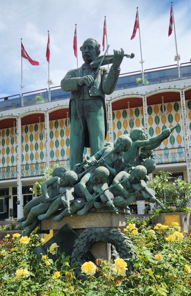
Statue Near Music Hall
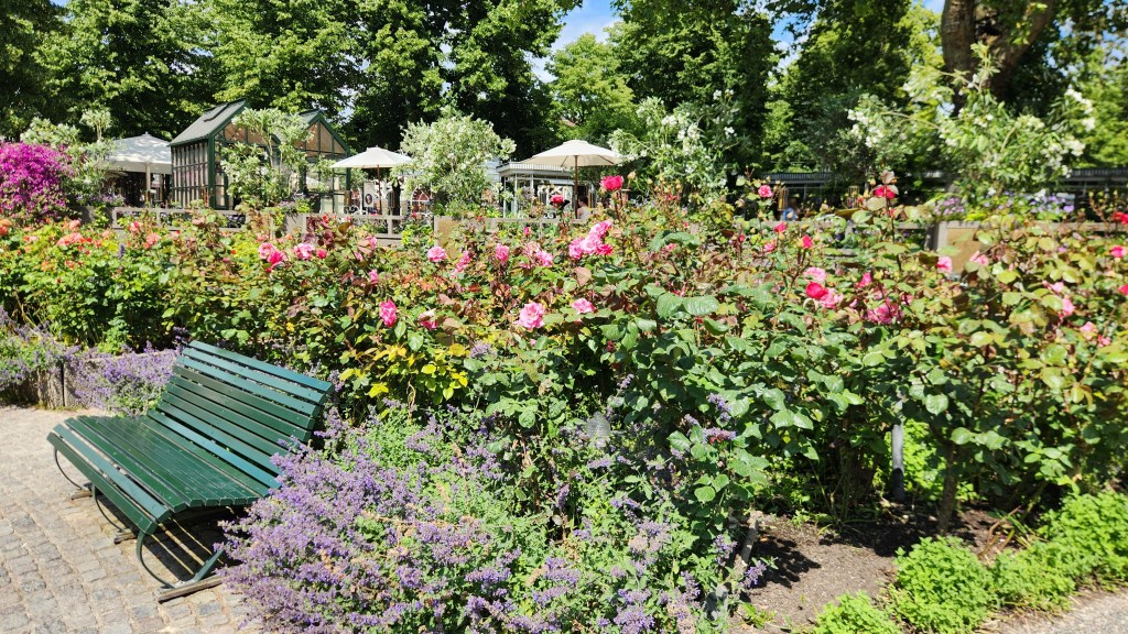
Riotous Gardens Abound at Tivoli
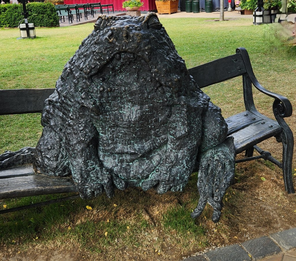
Too much cotton candy, perhaps?

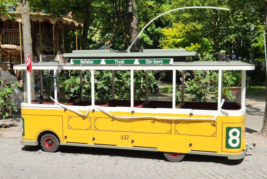
The iconic rides include the Roller Coaster (1914), the Ferris Wheel (1943), the Classic Carousel (1900), and the Vintage Cars (1959). Eschewing those tame attractions, we instead boarded this high-speed trolley for a dramatic race through the park, or at least a senior citizens version of that:

The Ultrafast Tivoli Trolley

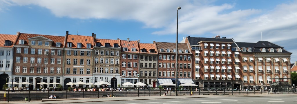
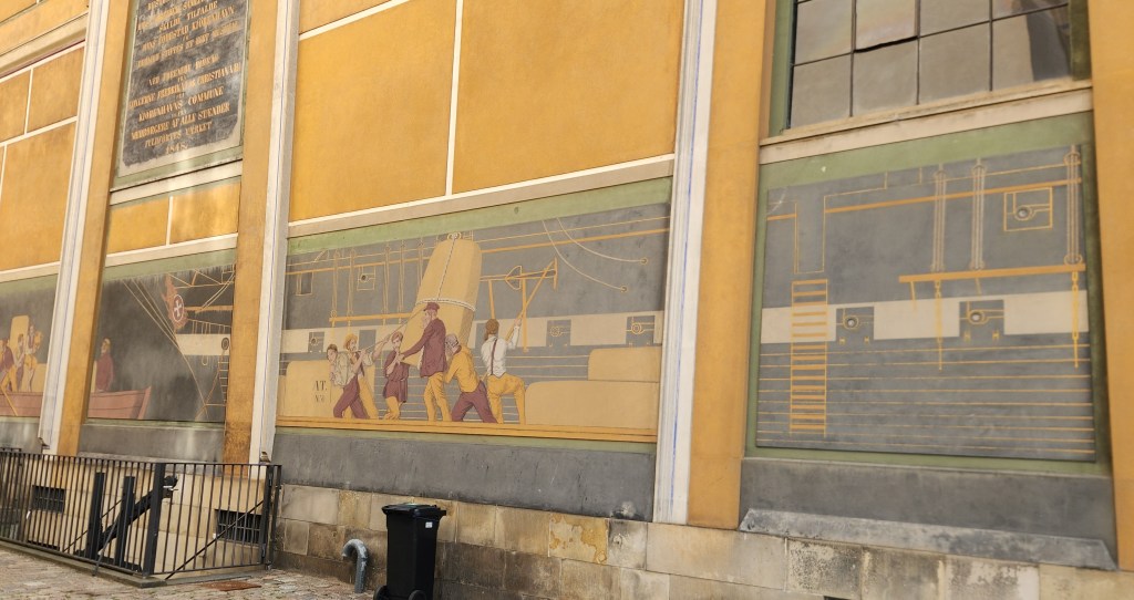
After leaving Tivoli, I snapped pictures of some impressive buildings along the Gammel Strand waterfront and the exterior murals of the Thorvaldsen Museum.

Buildings along Gammel Strand Waterfront
Mural at Thorvaldson Museum

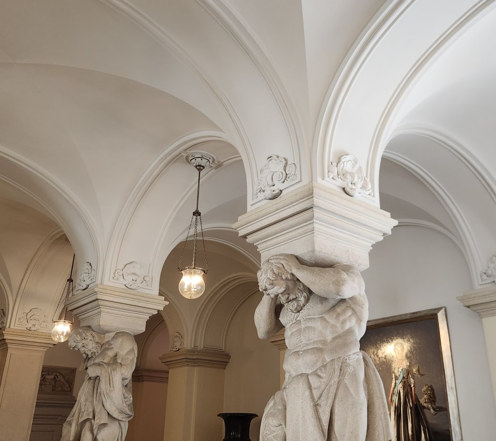
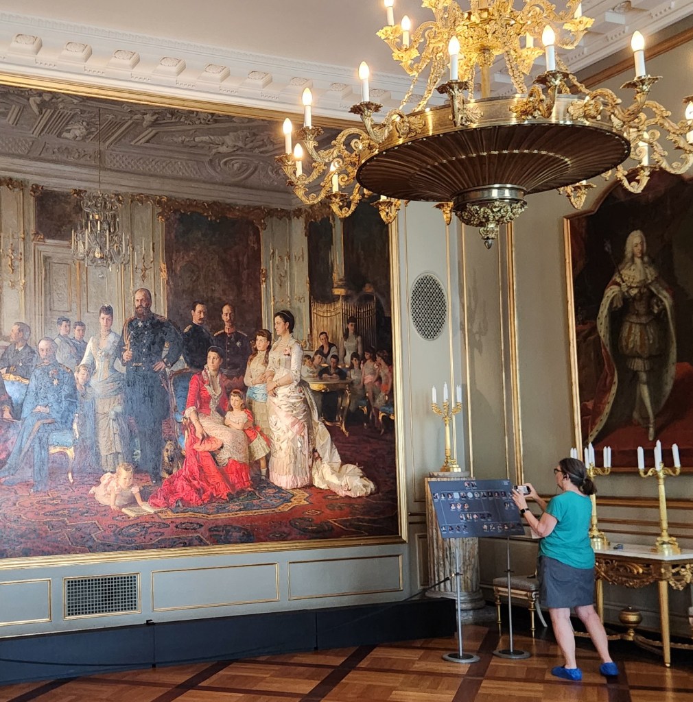
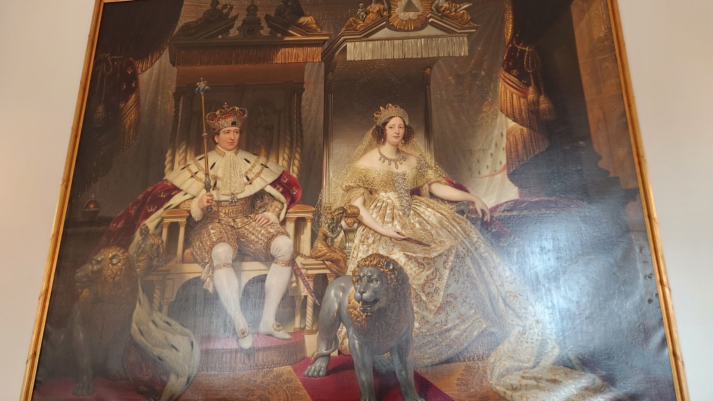
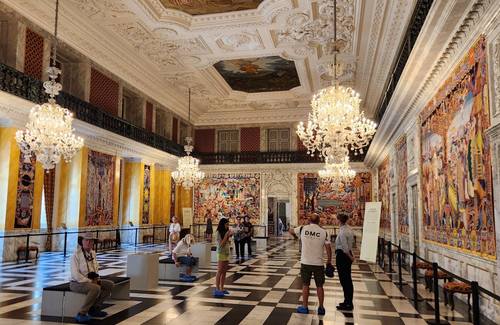
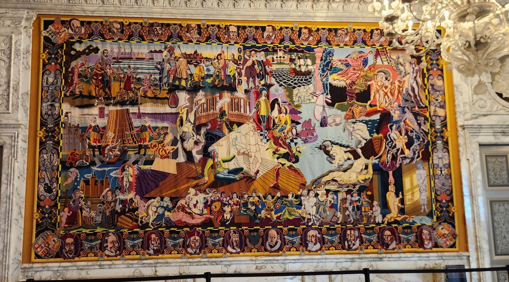
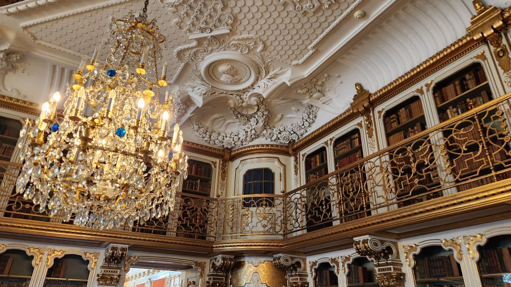
At the Christiansborg palace, we donned special booties to protect the impressive wood flooring before passing through dozens of magnificent rooms used for grand state dinners hosted by the King and Queen, including an entire room filled with tapestries that tell more than 1,000 years of royal history.

The Entry Foyer at Christianborg Palace
Pat in her protective booties, enjoying the artwork
Royal Portrait at the Palace
Tapestry Room at the Palace
One of the Tapestries
One of the many Grand Rooms at the Palace

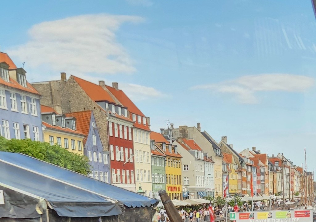
Finally, on our way back to the ship before setting sail for Germany, I took this photo of the colorful 17th and 18th-century townhouses lining the Nyhavn waterfront:

Townhouses Lining the Nyhavn Waterfront

Warnemunde and Berlin, Germany (Thursday, June 25, 2026): The ship docked in the Warnemunde harbor at 6 AM, and after breakfast we left for an all-day visit to Berlin, Germany’s capital city. After a short walk to the nearby railroad station, we boarded a train that took us to the center of Berlin. I didn’t get any pictures of the Warnemunde harbor, and the ones I took from the train on the way to Berlin and back are uselessly blurry, so the description below is focused solely on Berlin.

The first part of the tour was a motorcoach and walking tour during which we saw many reminders of the legacy of the Berlin Wall. I didn’t get many useful pictures due to the heavy traffic and preponderance of construction cranes, but I can tell you that the city was bustling with activity.

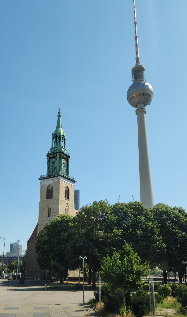
Here’s a picture taken in the Alexanderplatz, a large public square and transport hub in the central Mitte district of Berlin (formerly in East Berlin), showing the 1100-ft tall Berlin TV Tower, built in the 1960s, and St. Mary’s Church (Marienkirche), one of the oldest churches in Berlin.

Berlin TV Tower and St. Mary’s Church

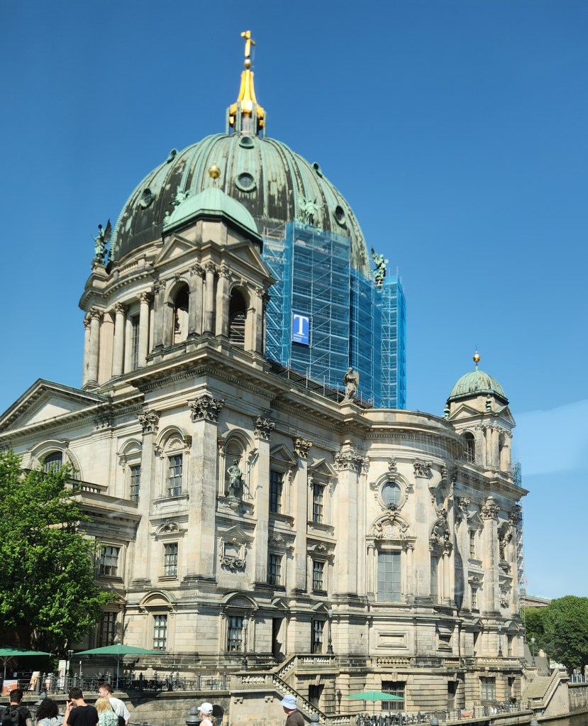
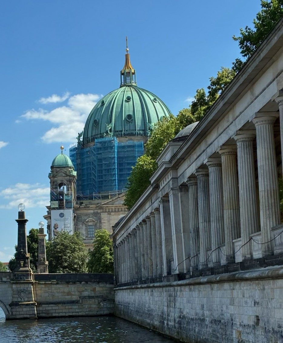
Here is the Berlin Cathedral (Berliner Dom) completed in 1905, the largest Protestant church in the country and known for its massive 320-ft dome. The cathedral is located on Museum Island, a UNESCO World Heritage site.

Berlin Cathedral

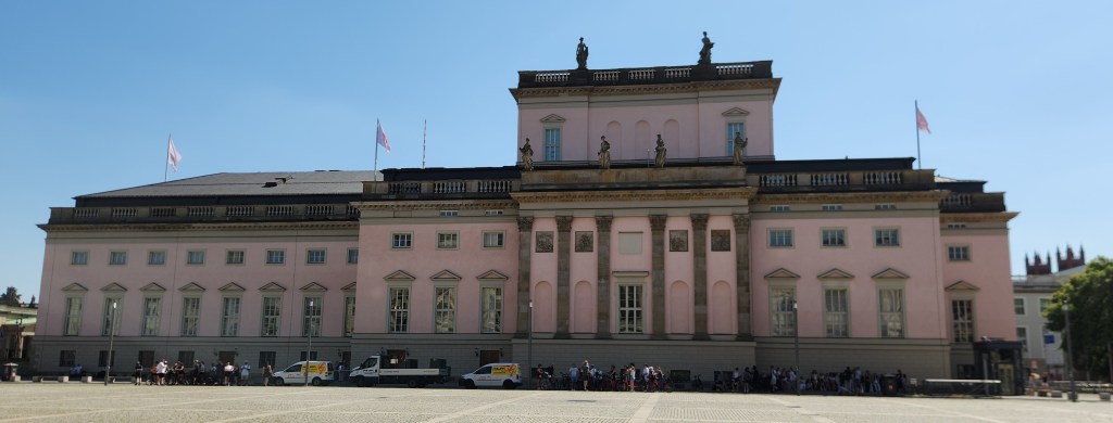
This is the Berlin State Opera (Staatsoper Unter den Linden), a historic opera house located on the Unter den Linden boulevard. Originally built in the 18th century by order of Frederick the Great, it is considered the oldest state opera in the world. The building was reconstructed in 1951 and 1955 after it was heavily damaged during World War II.

Berlin State Opera

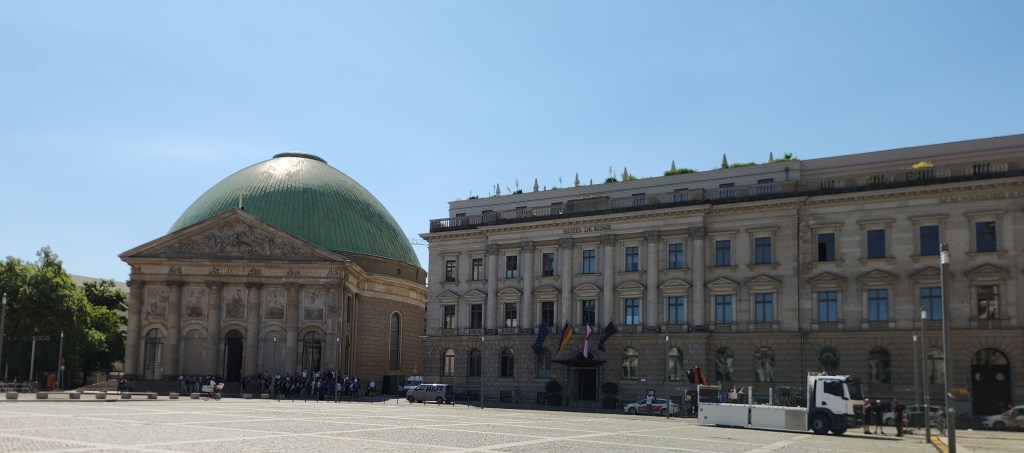
The photo below shows St. Hedwig’s Cathedral with its prominent green dome and the Hotel de Rome, formerly a bank headquarters, located directly on the Bebelplatz square.

St. Hedwig’s Cathedral and Hotel de Rome

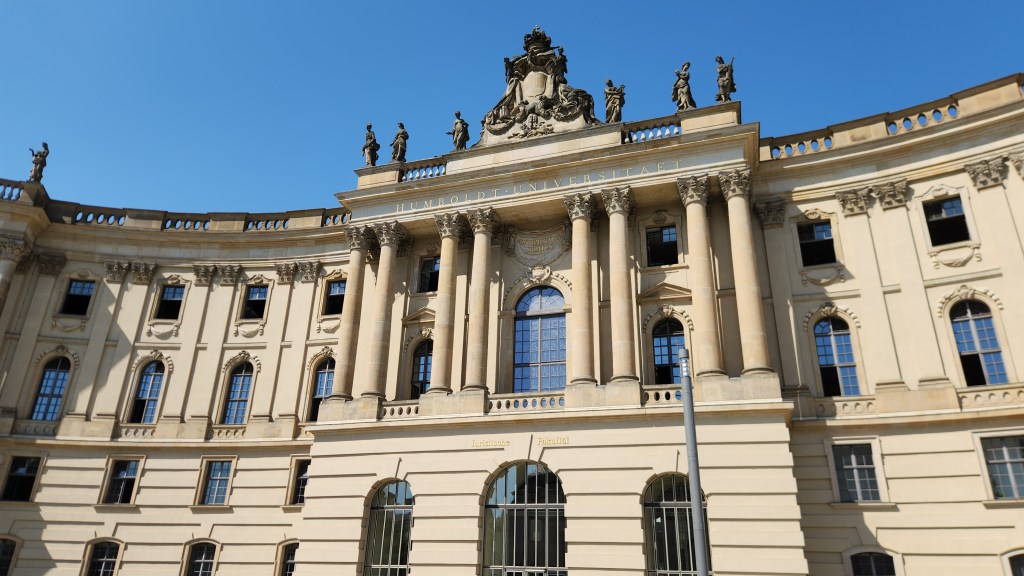
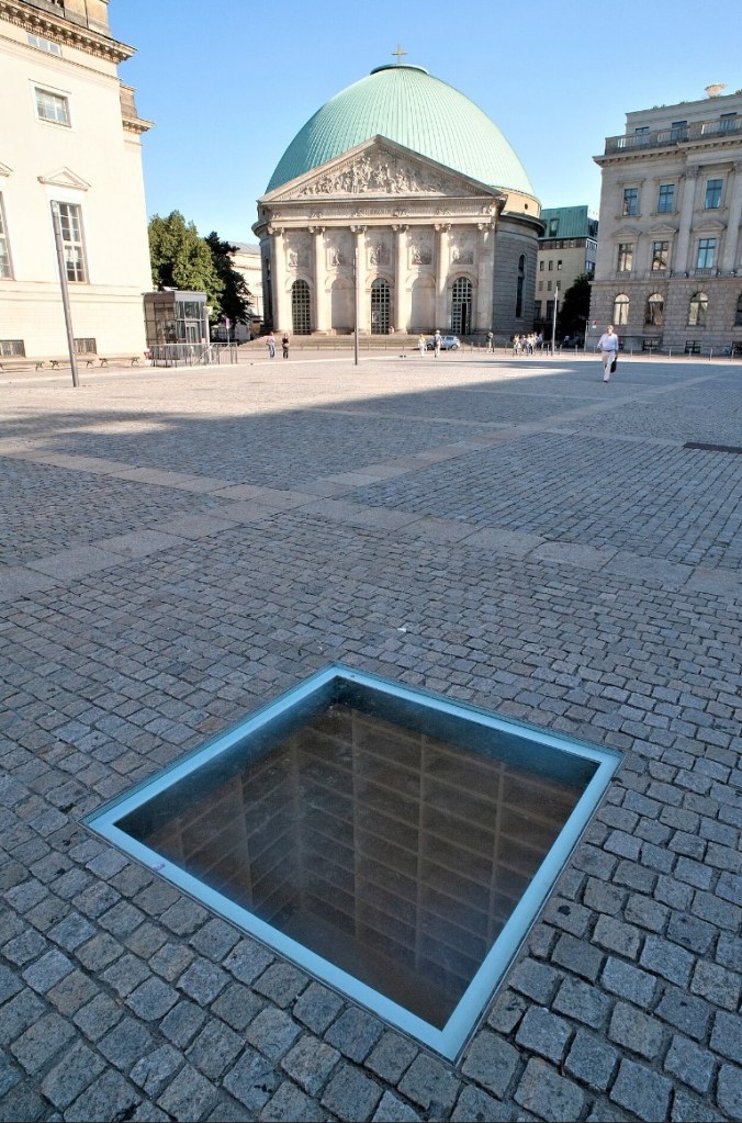
Next is the Old Library building in Berlin, also on the Bebelplatz square, which currently serves as the Faculty of Law for the Humboldt University. Humboldt University was established in 1809 and is recognized as one of Berlin’s oldest universities. It is historically renowned for its contributions to the natural sciences and has been associated with 55 Nobel Prize laureates. The library and the square are notable for being the site of the notorious 1933 Nazi book burning. A memorial now sits beneath the square consisting of empty bookshelves visible through a plexiglass covering to remind visitors of the vile act of the book burning. (My photos of the memorial did not turn out due to the lighting conditions, so I borrowed a photo from Wikipedia.)

Old Library where Nazis confiscated the books to be burned (now part of Humboldt University)
The “Missing Library” Memorial in the Bebelplatz Square (courtesy Wikipedia)

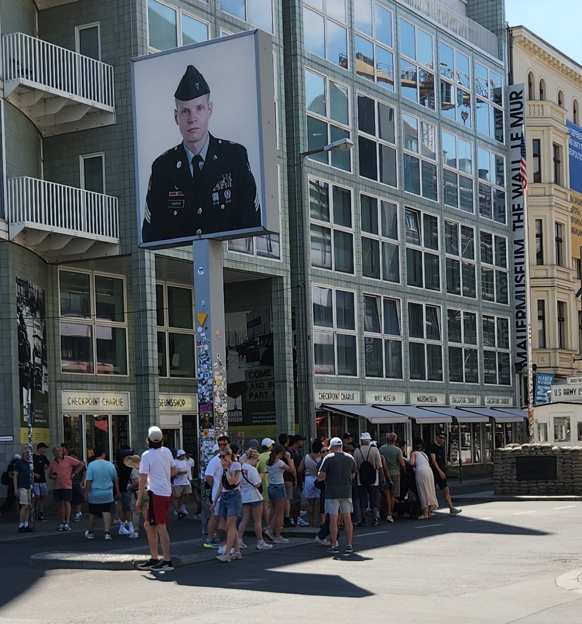
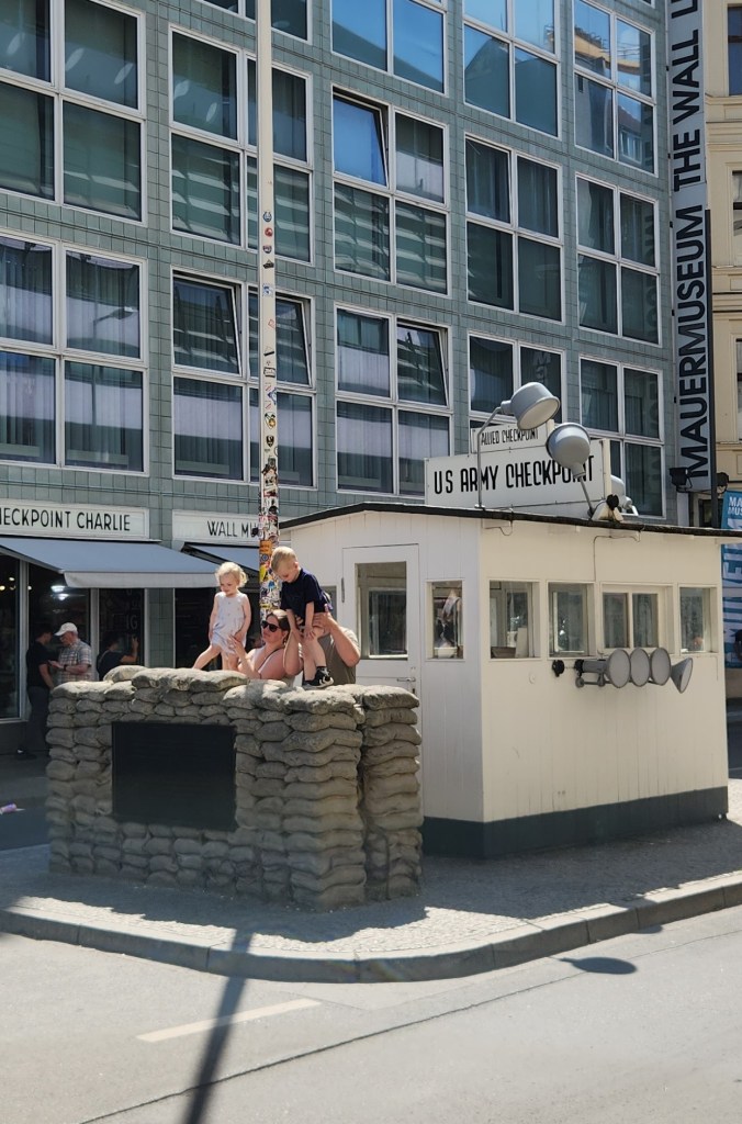
Some of the most interesting sites we saw were directly related to the Berlin Wall, especially Checkpoint Charlie, the only entrance point from the American sector of West Berlin into East Berlin.

Tourists Gathering at Checkpoint Charlie
Checkpoint Charlie

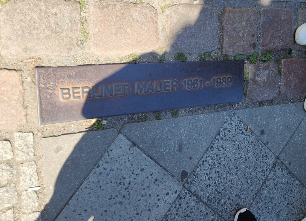
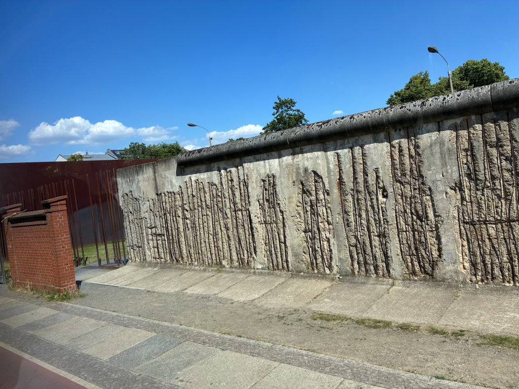
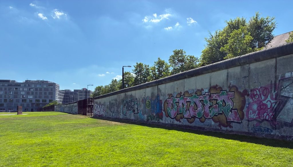
The infamous wall was torn down on November 9, 1989, following a major political blunder by an East German official who announced that citizens were free to travel to the West immediately. This historic mistake caused massive crowds to gather at the checkpoints, ultimately forcing guards to open the borders. The sudden fall of the wall that night marked the collapse of East Germany and paved the way for German reunification, which was officially finalized on October 3, 1990. Since that time, the former East Berlin has been changed by massive public works, infrastructure renewal, and social welfare integration by the German government. However, the former existence of the wall has been commemorated by various markers and lines that mark its entire length. One section of the old wall has also been preserved as part of an open-air museum.

Line Marking Position of the Berlin Wall
Remaining Remnant of Berlin Wall, as viewed from East Berlin …
… and from West Berlin

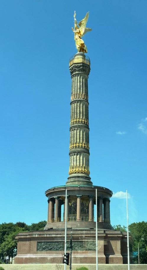
The Berlin Victory Column, featuring the golden statue of Victoria, the Roman goddess of victory, is located in the Tiergarten park. It was designed in 1864 to commemorate the Prussian victory over Denmark. Berliners often call the winged statue Goldelse, which translates to “Golden Lizzy.” The entire structure stands approximately 220 feet tall.

Berlin Victory Column

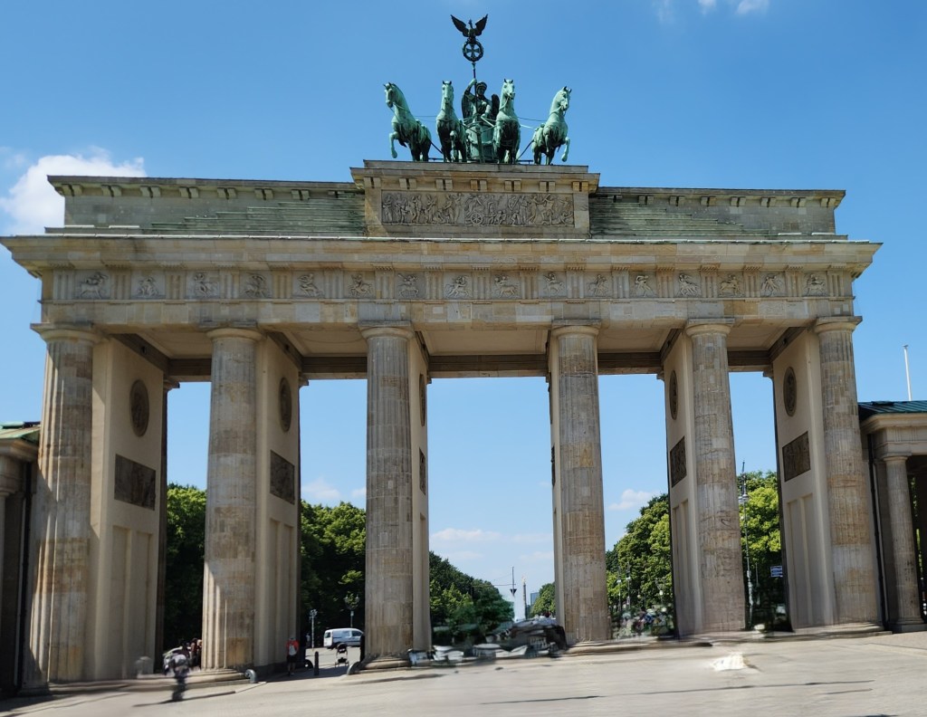
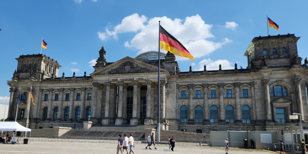
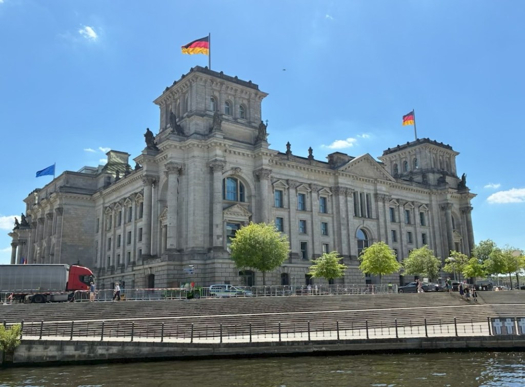
Another iconic site we visited is the Brandenburg Gate, a major site for major historical events. It was built from 1788 to 1791 by orders of King Frederick William II of Prussia. After World War II and during the Cold War, the Berlin Wall obstructed the gateway, and thus was a marker of the city’s division. Since German reunification in 1990, it has been considered not only a symbol of the tumultuous histories of Germany and Europe, but also of European unity and peace. Between the Brandenburg Gate and the Tiergarten stands the Reichstag. The Neo-Renaissance building was completed in 1894 and served as the seat of the German parliament until 1933 when the Nazis set fire to it and blamed the communists as a ruse for Hitler’s rise to power. The unused building was further damaged during World War II and became a museum during East German rule. After reunification, it was restored as the seat of parliament and has since become one of Berlin’s most prominent tourist attractions, drawing hundreds of thousands of visitors each year.

The Brandenburg Gate
The Reichstag

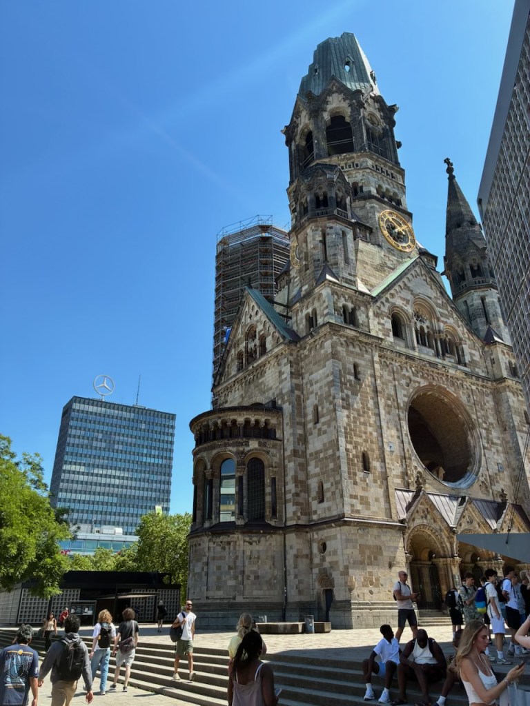
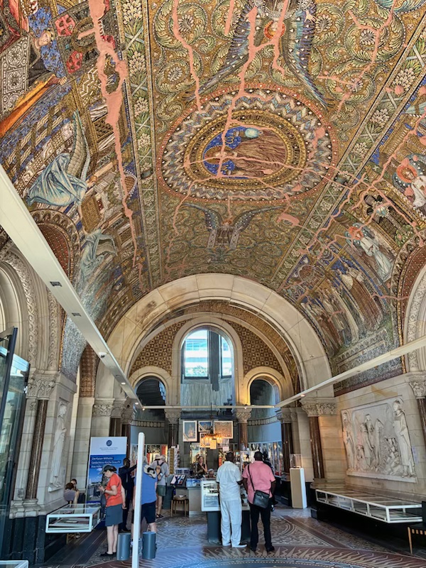
The tour included lunch at a Berlin restaurant followed by some free time, during which we visited the Kaiser Wilhelm Memorial Church, which features a striking ruined spire preserved from a 1943 bombing raid and never repaired so the world would never forget. The original Neo-Romantic style church was constructed between 1891 and 1895. A modern church, completed in 1961, stands beside the historical remains.

Kaiser Wilhelm Memorial Church
Kaiser Wilhelm Memorial Church Interior
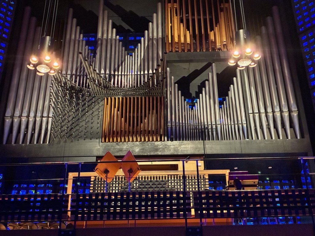
Organ in Modern Church

The last part of the tour was a cruise along the Spree River, drifting past the Berlin Cathedral, Museum Island, the Reichstag and the striking architecture of the new government quarter. It was interesting to observe many of these sights from the different perspective of the river.

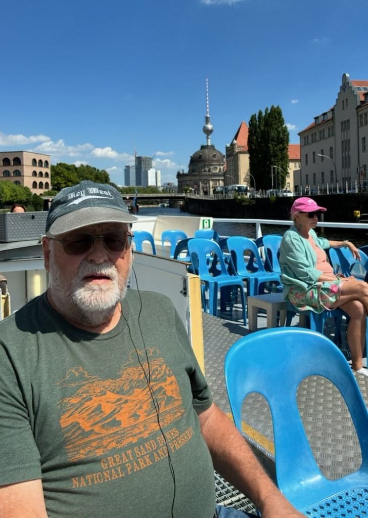
On the Spree River Cruise Boat
The Reichstag viewed from the River Spree
The Berlin Cathedral viewed from the River Spree

After the river cruise, we took the train back to our ship anchored in Warnemunde harbor. I’ll add a couple of final notes from the Berlin tour before moving on to our next destination.

Perhaps the most sobering site we saw in Berlin was the Memorial to the Murdered Jews of Europe, designed by architect Peter Eisenman. It covers 4.7 acres and features 2,711 concrete slabs called stelae arranged in a grid pattern. The memorial was inaugurated in 2005, 60 years after the end of World War II in Europe. An attached underground “Place of Information” holds the names of approximately 3 million Jewish Holocaust victims.

Memorial to the Murdered Jews of Europe

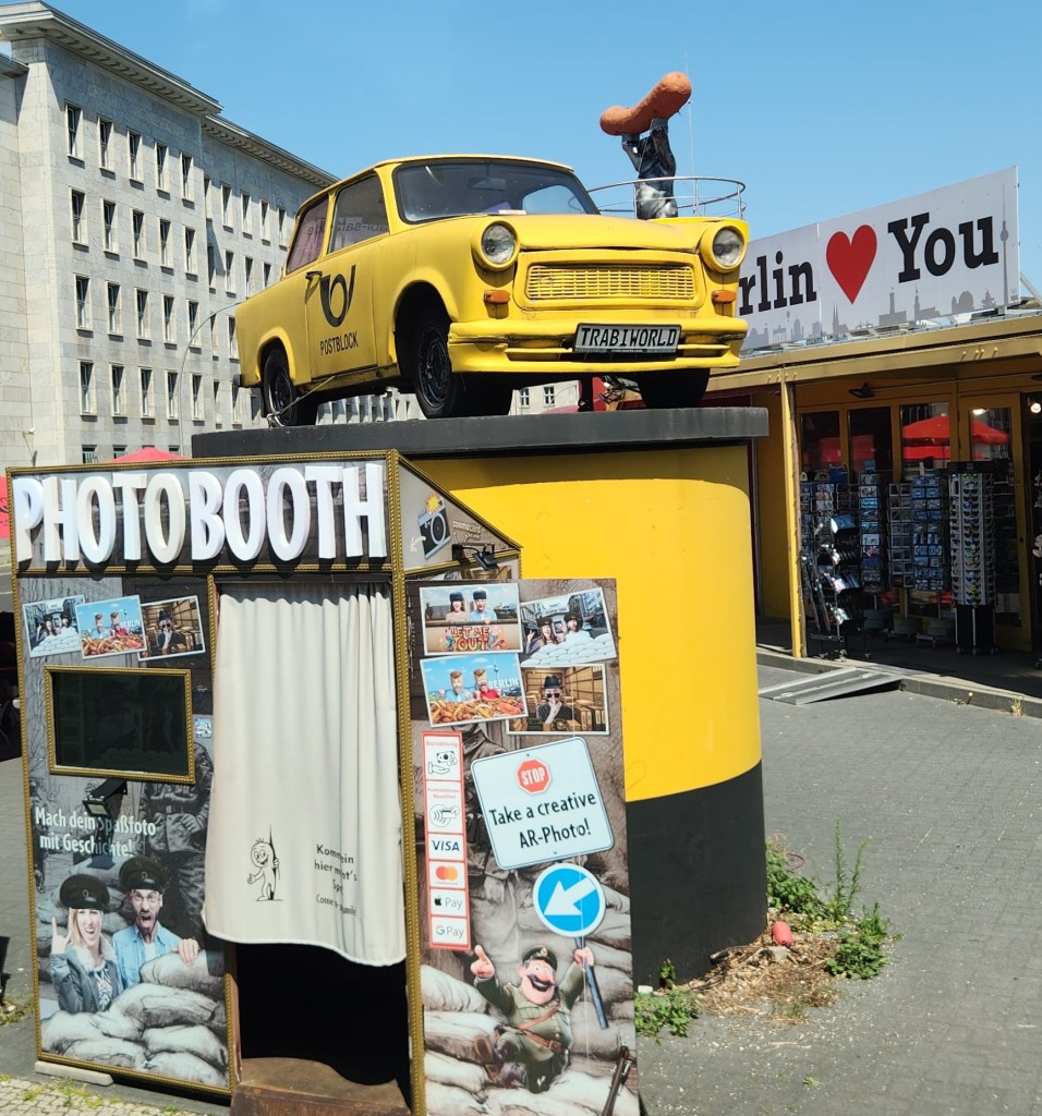
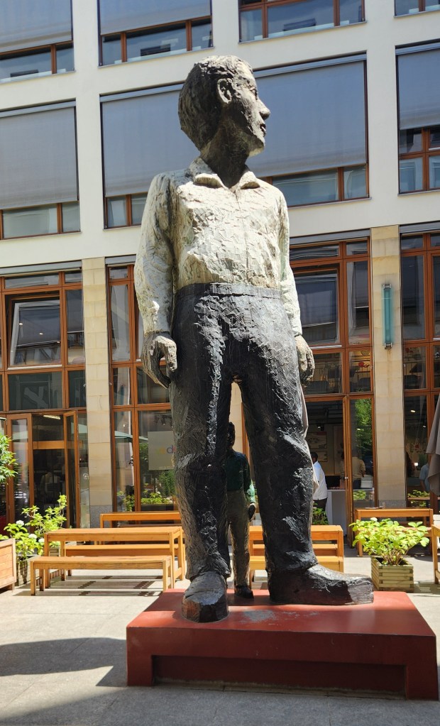
We also saw some more whimsical sites during our visit, including “TrabiWorld,” which commemorates the iconic yellow East German Trabant car and offers tourists the opportunity to drive one, and an interesting statue entitled “Big Man with Little Man.”

TrabiWorld
Big Man with Little Man

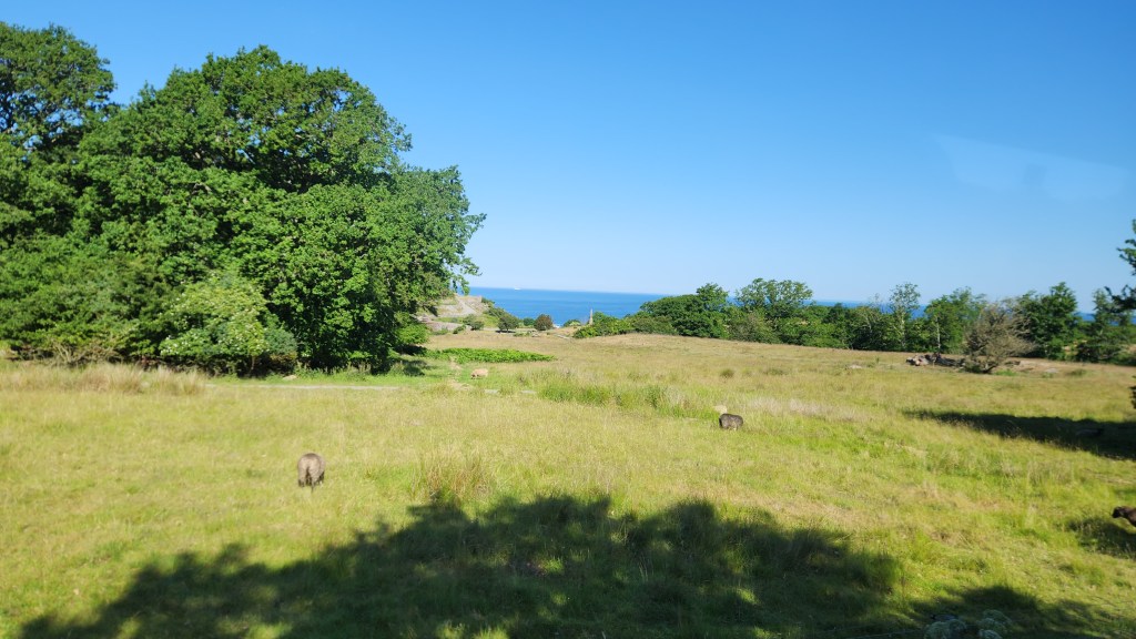
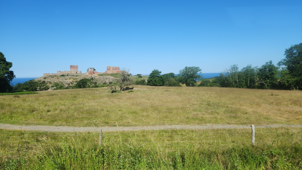
Bornholm, Denmark (Friday, June 26, 2026): Our ship docked in a lovely harbor on this Danish island in the town of Rønne at 8 AM. Our activity for the day was a motorcoach tour of the island where we observed the natural beauty and charming villages of the island. Bornholm is nicknamed Solskinsøen (Sunshine Island) and Klippeøen (Rock Island) for its weather and geology, respectively. The tour began as we passed through the lush green fields of the western coast and passed by Hammershus, the largest castle ruins in Northern Europe.

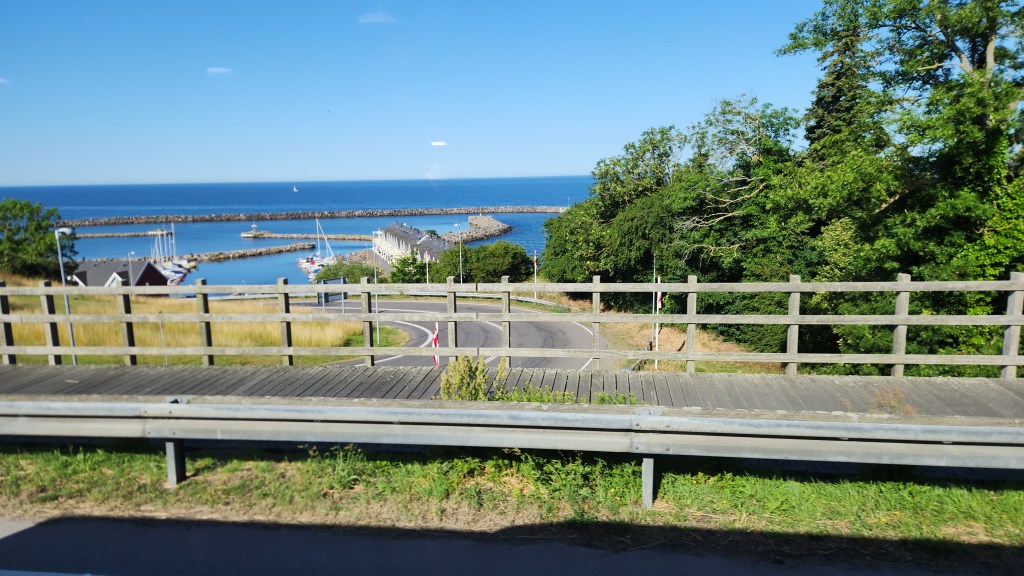
Leaving the Harbor in Rønne
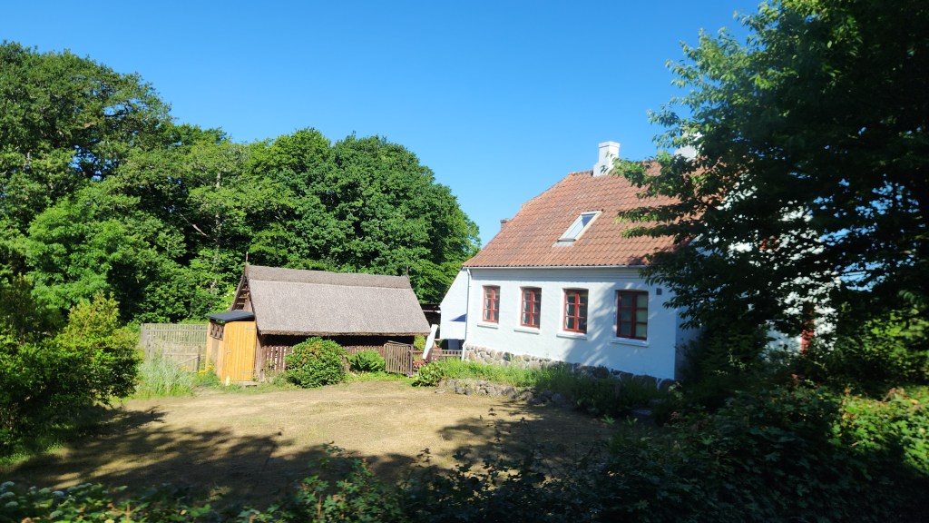
Rural Home on Bornholm
Bornholm Countryside
Hammershus Ruins

Hammershus dates back to the 13th century and is traditionally linked to the Archbishop of Lund, Jakob Erlandsen. The castle became a focal point in power struggles between the church and the Danish crown. After the destruction of Lilleborg in 1259, Hammershus rose in importance and became a key seat of authority on Bornholm. In 1522, the castle and the island were pledged to the Hanseatic city of Lübeck as debt security. During that period the fortress saw its last major expansion. Behind the strong ramparts were living quarters as well as a prison, chapel, kitchen, granaries, stables and even a brewery. One remarkable engineering feature is the system of two freshwater reservoirs built high above sea level. As artillery developed in the 17th century, the fortress gradually lost its military value and began to decay. In 1822, the ruins were declared a national monument, starting a long process of protection and conservation.

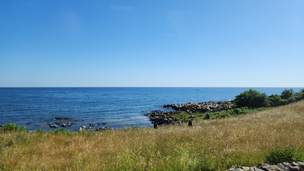
After the fortress, we continued along the island’s rugged northern side and passed through several small villages.

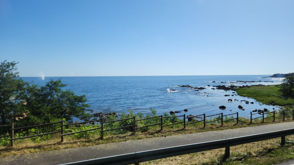
Bornholm Coast
Village on Bornholm
Borholm Coast

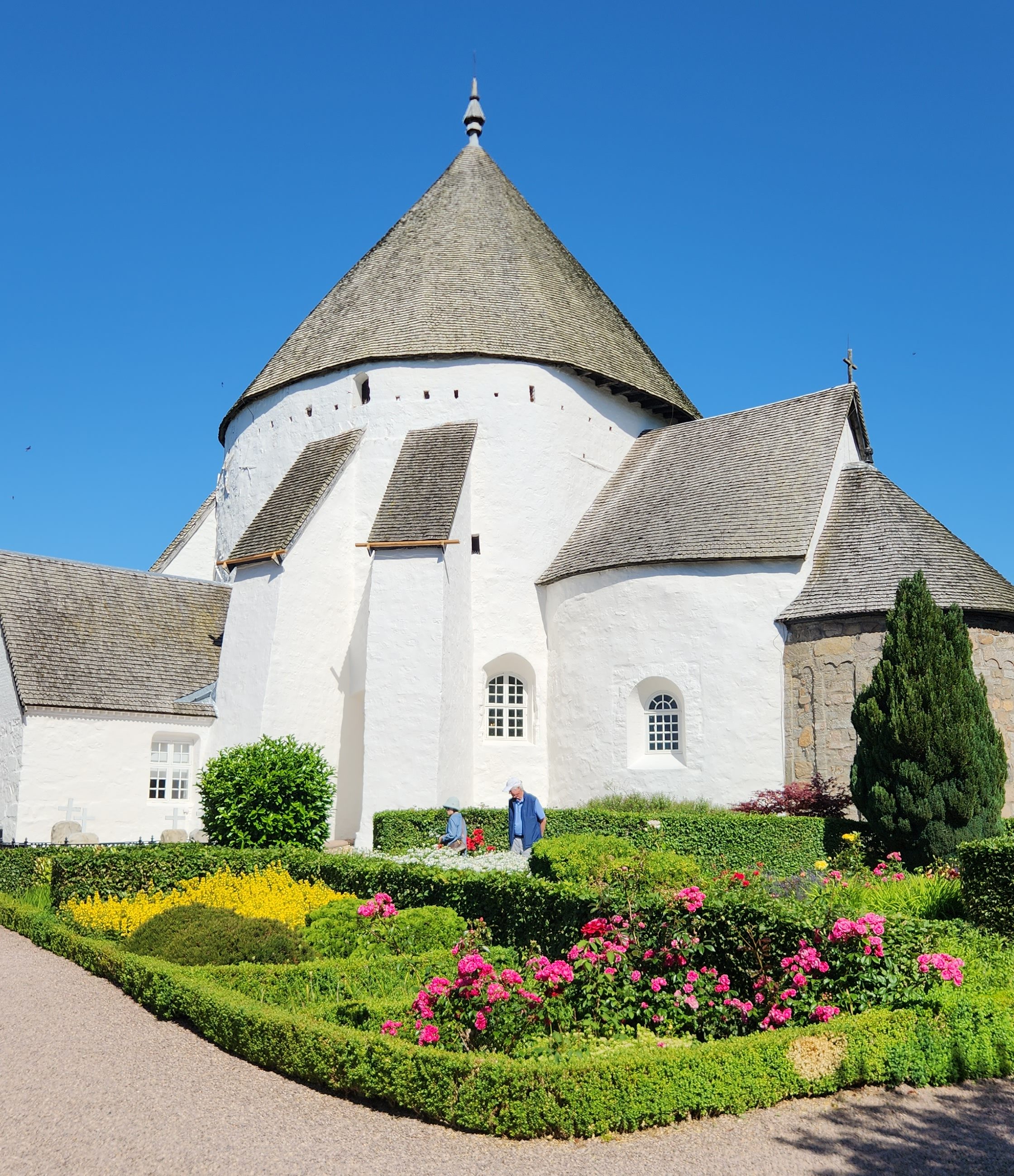
We then left the coastal road and visited one of the four round churches that can be found on Bornholm. These peculiar buildings were not just churches but also served as fortresses during times of conflict. The one we visited is the Østerlars Church, the largest and oldest of the four, constructed around 1160. The unique white, conical-roofed structure was historically designed with defensive features, including a top story used as a shooting gallery.

The Østerlars Church
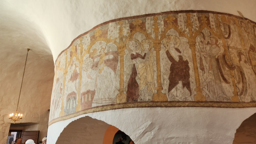
Inside the Østerlars Church

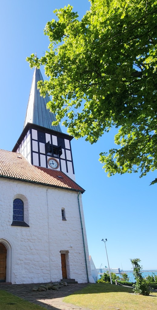
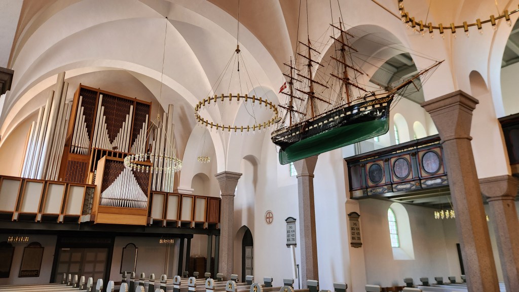
After the church visit, we traveled through the island’s interior back to the ship, then took a stroll through Rønne, where we visited St. Nicolai Church, which was originally built in the 1300s but has subsequently undergone additions and renovations over time.  A distinctive feature is the ship model hanging from the ceiling, reflecting a long-standing maritime tradition in Baltic churches.

St. Nicolai Church in Rønne
Inside the St. Nicolai Church

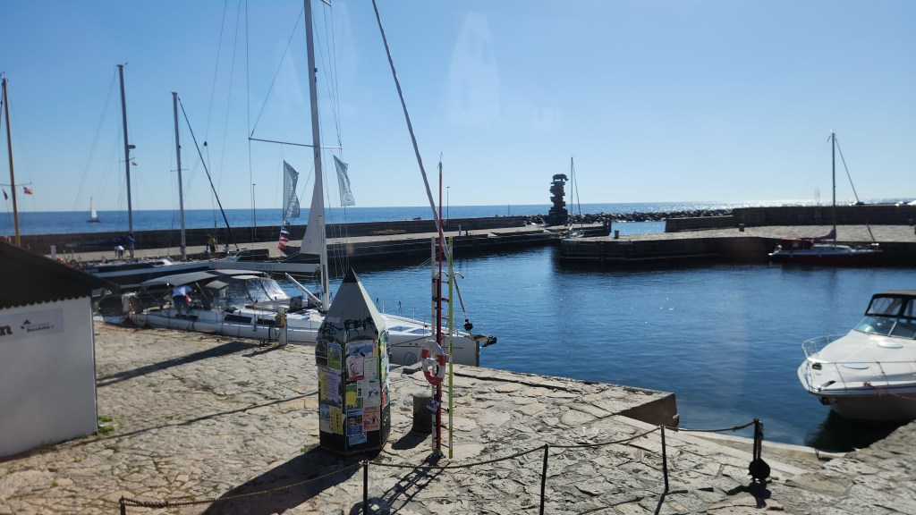
I took the following pictures as we strolled back to the ship in time for our late afternoon departure from Bornholm.

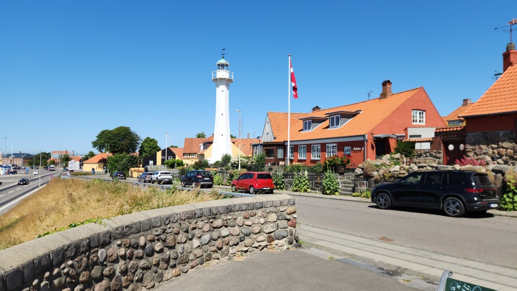
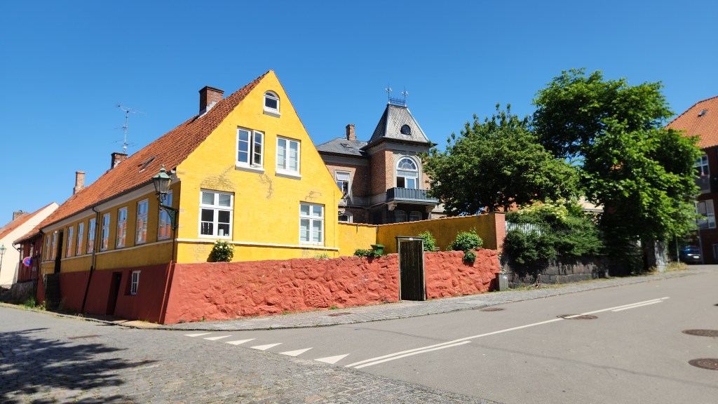
In the town of Rønne

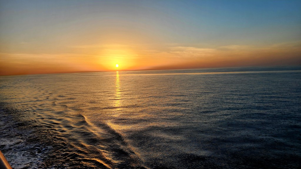
As we sailed eastward on into the evening, I caught this nice shot of the setting sun.

And with that parting shot, let’s end this installment. When Part 4 appears on the website, we’ll find ourselves in Poland.

Stay tuned …

Pat and Dave’s Vibrant Viking Voyage – PART 2: More Norway

Welcome back for Part 2 of my travelogue describing our recent Viking Ocean Cruise entitled “Viking Homelands.” Part 1 described the pre-cruise extension activities in Oslo and Bergen, Norway. This episode will cover the beginning of the actual cruise. Here’s a map of the overall itinerary:

This Part of the travelogue covers our remaining activities in Norway, including locations 1, 2, 3, and 4 on the map.

Bergen, Norway (Wednesday and Thursday, June 17 and 18, 2026): At the conclusion of Part 1, we were still in Bergen on a beautiful sunny Tuesday (rare for Bergen) following our adventures with the goats and trolls on Mount Hoyen. The main activity on Wednesday consisted of a short bus ride from our hotel to our Ocean Cruise ship, the Viking Sky, anchored in the Bergen fjord near the famous Bryggen (wharf), getting the mandatory safety briefing, and getting settled into our cabin, where all our luggage was waiting for us. One of the best things about these Viking cruises is that there is no need for packing and unpacking as is the case with land-based travels. Once settled in, we simply enjoyed the comfort of our cabin and the ship’s amenities for the duration of the trip. As a fellow passenger put it: “they move the hotel to all your destinations.” (The ship is essentially identical to the ones we sailed on in our two previous Ocean Cruises, the Viking Star and the Viking Neptune. I included details about the Star in Pat and Dave’s Tremendous Tropical Trek, which you can take a look at if interested, so I won’t spend any time describing the Sky.)

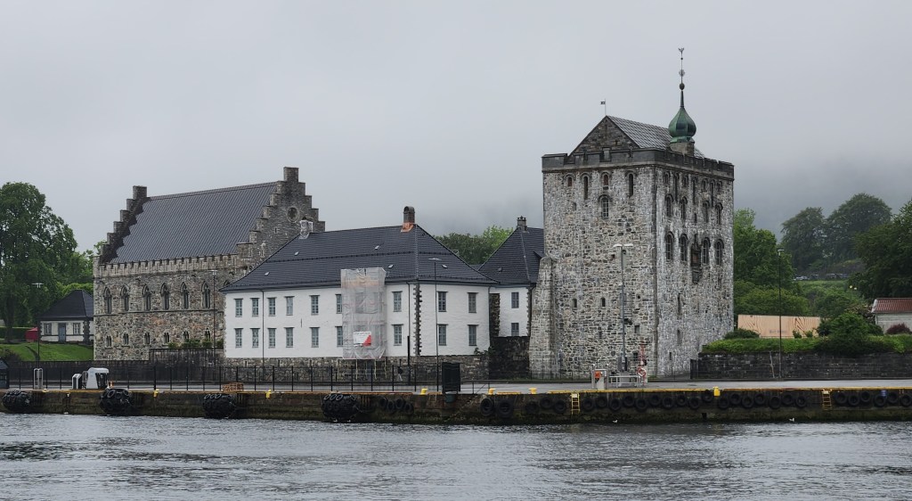
On Thursday morning, we embarked on a scenic coach tour of Bergen, which turned out to be somewhat repetitive after our tour on the previous Tuesday. I did get a better view of the Bergen Fortress that we visited on Tuesday and I discussed in Part 1, from across the harbor:

The Bergen Fortress

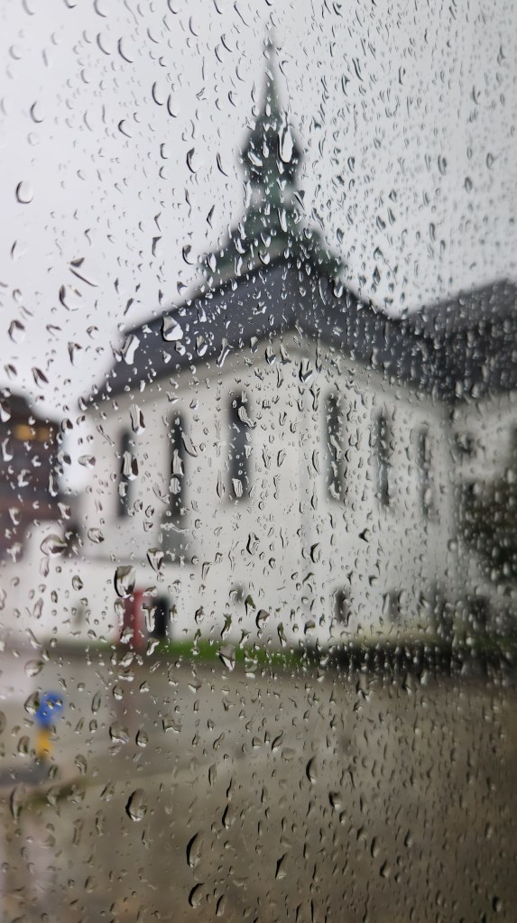
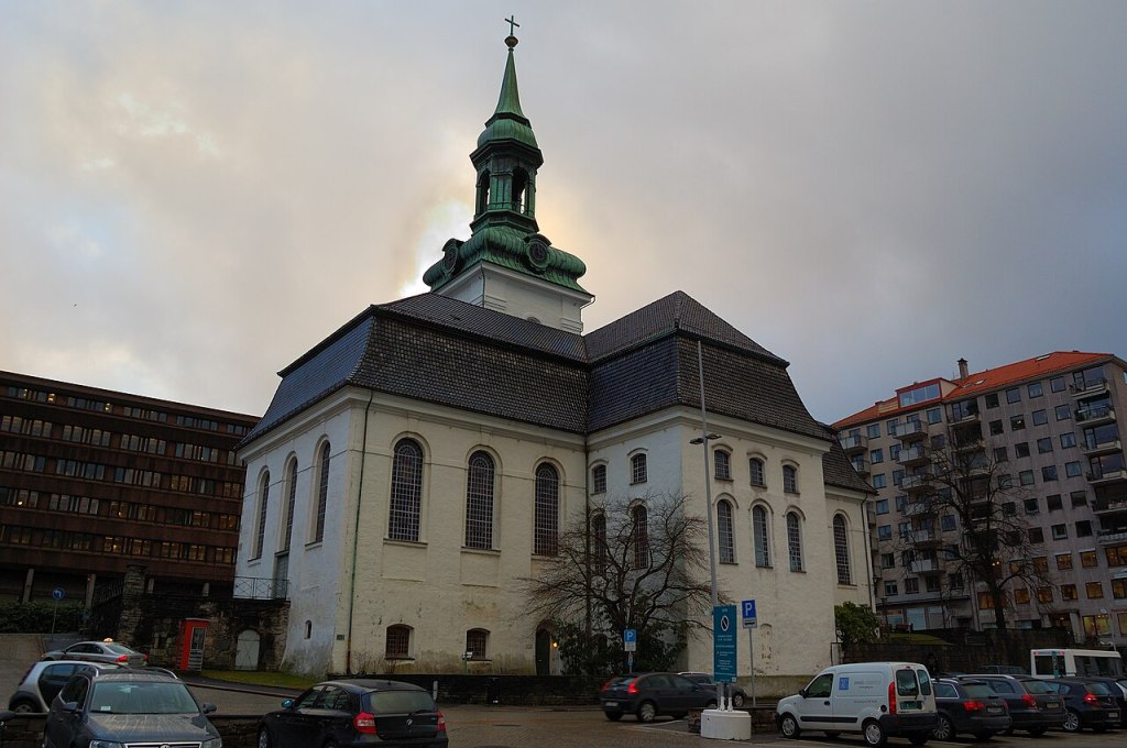
There were some new stops along the way, however. One of these was the New Church (Nykirken). The name comes from the fact that, when originally built in 1621, there were several older churches in Bergen. The church was built on the foundations of the medieval Archbishop’s Residence, originally constructed in the late 1200s but destroyed by fire in 16th century. My only photo of the exterior of the Nykirken illustrates what we understood to be typical Bergen weather, but I’ve added one from the internet to show the building more clearly.

A Soggy View of the New Church
The New Church (courtesy Wikipedia)

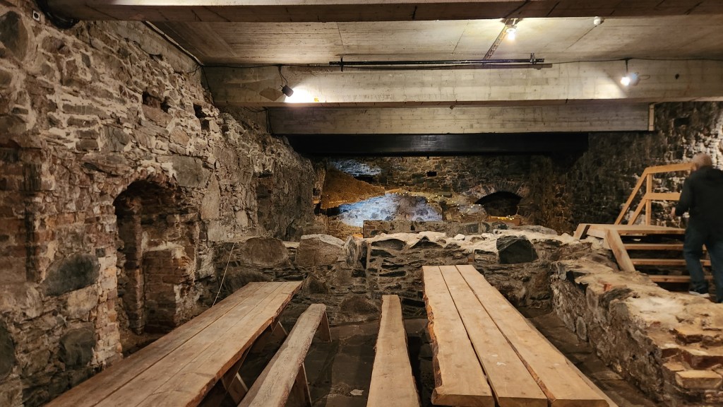
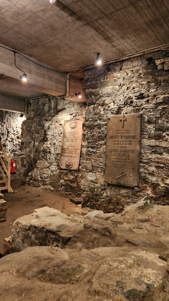
The ruins of the Archbishop’s Residence have been preserved beneath the church, and we were able to go inside to see the interesting artifacts.

Ruins of Archbishop’s Palace

Like much of Bergen, Nykirken has been rebuilt multiple times following devastating fires, most notably after a Nazi ammunition ship exploded in the harbor in 1944, which also destroyed many of the buildings in the harbor area. As an aside, though some claim the explosion was an act of sabotage due to its occurrence on Hitler’s birthday, it was apparently merely a tragic accident.

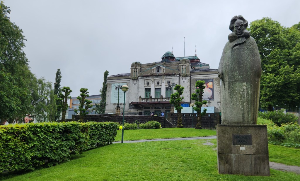
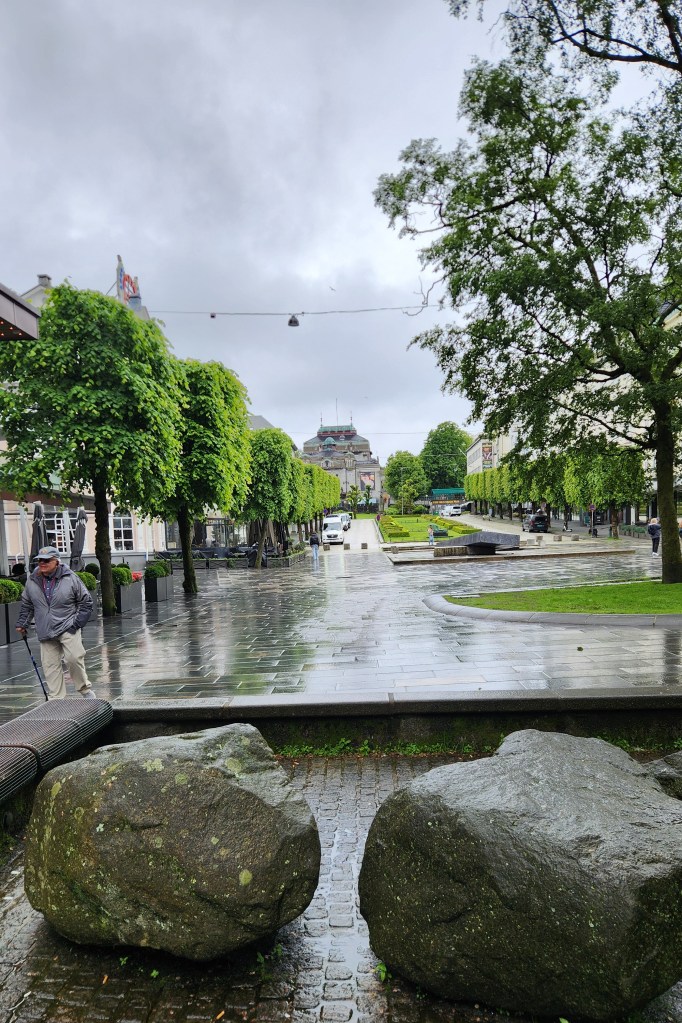
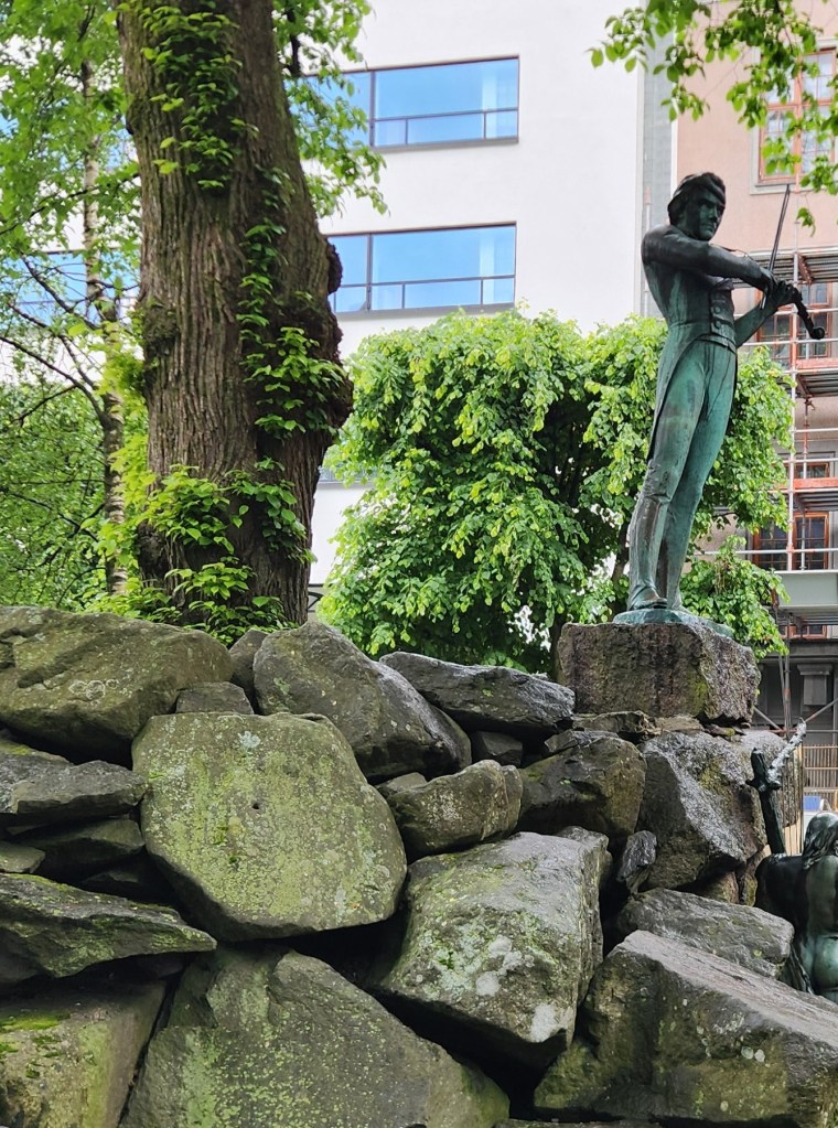
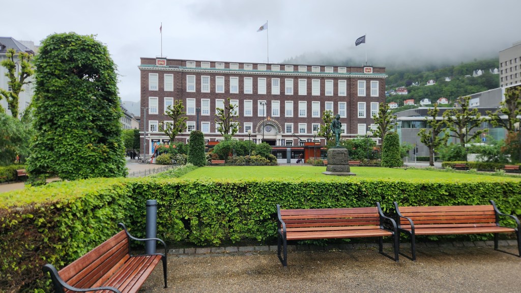
As you can see in the following photos, the rain stopped as we continued the tour. We walked past several Bergen landmarks, including: the National Theater, built with assistance from world famous violinist Ole Bull in 1850; the Telegraph Building, originally built for the telegraph system; and Ole Bull Plaza, a wide pedestrian avenue with a view of the National Theater.

The National Theater, Guarded by Henrik Ibsen
Ole Bull Plaza (National Theater in Background)
Ole Bull Serenading his Fans
Telegraph Building

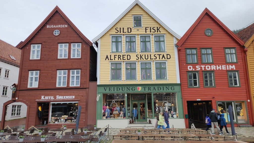
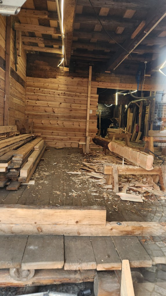
The tour ended at the Bryggen, or wharf, which features the buildings of the Hanseatic League, the powerful medieval confederation of merchant guilds and market towns in Northern and Central Europe. The League dominated maritime trade along the North and Baltic seas from the 13th to 15th centuries through control of major trade routes and secured vast economic privileges. Bergen was one of the four major trading post of the league beginning around 1350. For nearly 400 years, these German merchants dominated the city’s economy, maintaining a strict monopoly over the highly profitable stockfish (dried cod) trade until the 1760s. The iconic Hanseatic League buildings on the Bryggen have been maintained as a major attraction. Restoration of several of the buildings following the harbor explosion continues today, using the original plans and building materials.

Historic Buildings at the Bryggen
Restoration Work on a Bryggen Building (seen through a window)

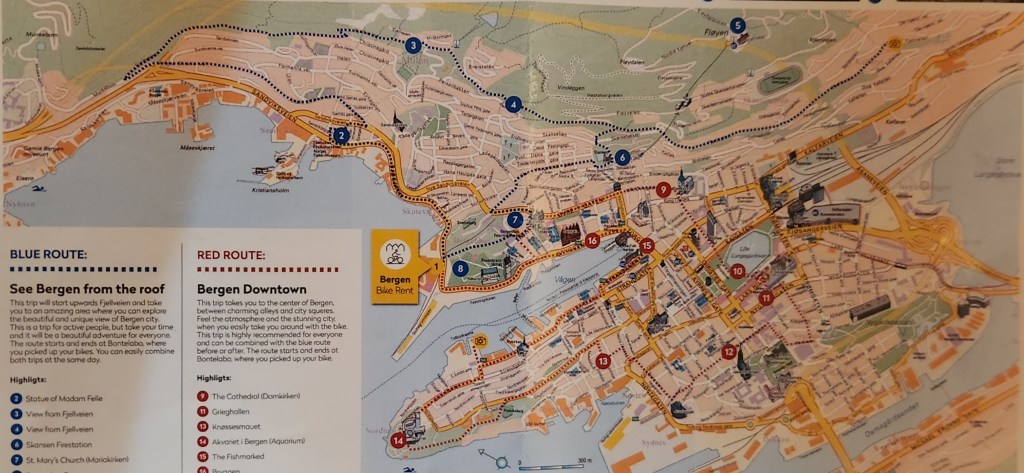
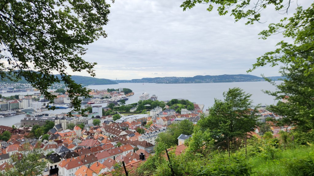
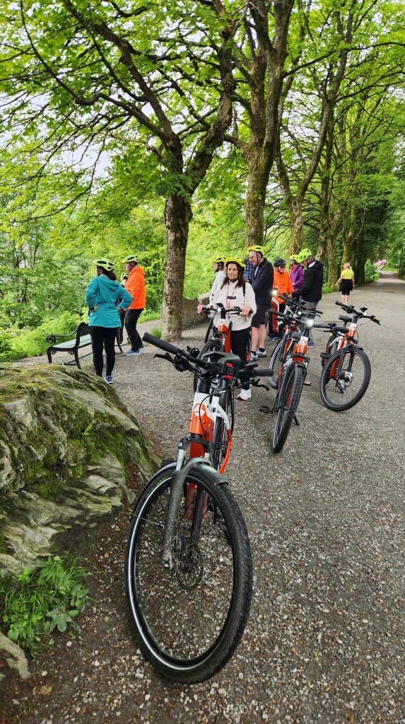
On Thursday afternoon, we went on a particularly enjoyable outing – an E-bike tour of Bergen with about a dozen other Viking passengers. The bikes were excellent and surprisingly easy to maneuver even when we traveled on old cobblestone streets. The tour covered about six miles with a dozen or so stops to gawk at the scenery and listen to our guide, starting from the pier a short distance from our ship, then winding uphill for beautiful panoramic views of the city, then descending back to the city center and returning to the pier.

Map of E-bike Tour — Blue and Red Routes
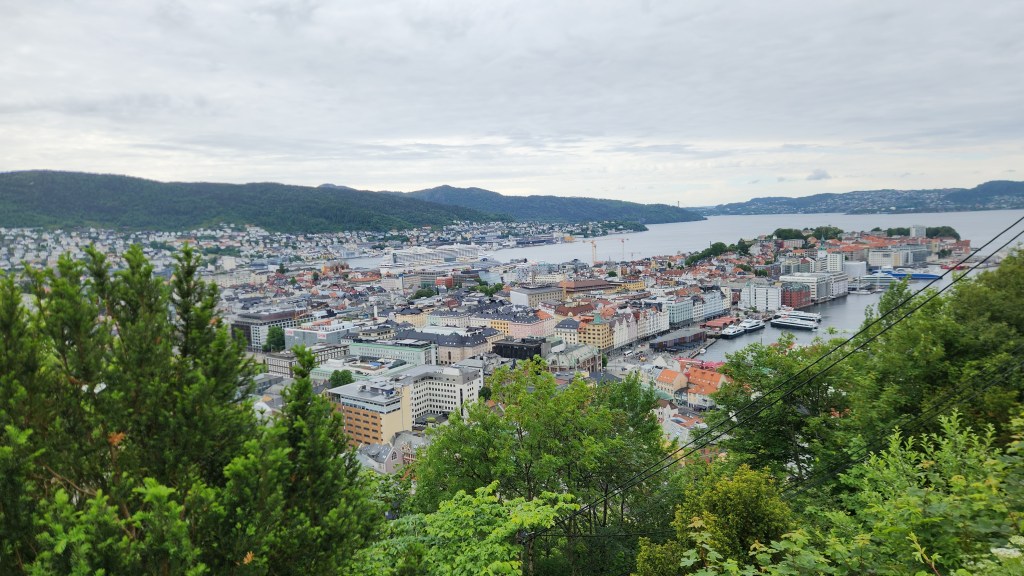
Overlook on E-bike Tour
The E-bikers at an Overlook

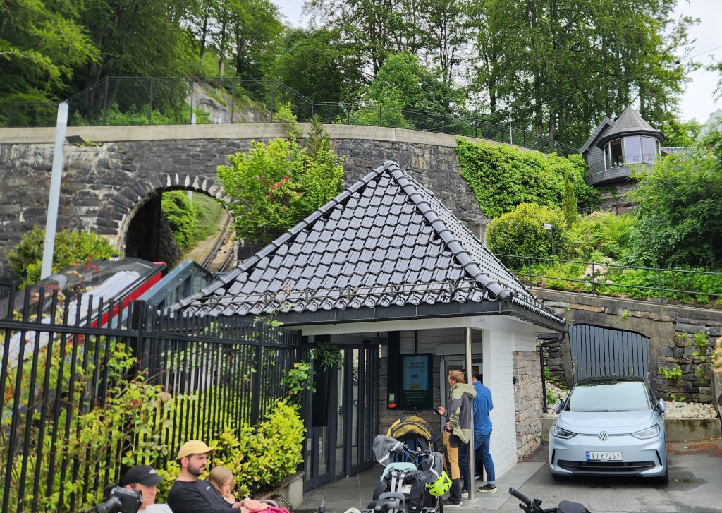
One especially interesting thing for me was when we stopped at a station on the funicular line where several parents were waiting to pick up their kindergarteners who were coming home from their school on the train.

Parents Waiting for their Kindergartners on the Funicular
Overlook on E-bike Tour
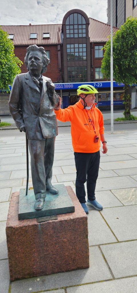
E-bike Tour Guide and Norwegian Composer Edvard Grieg
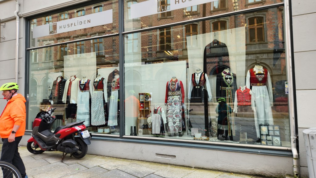
Shop Selling Traditional Dresses — Costing up to $10,000

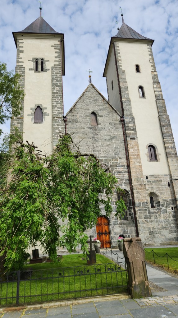
One of the stops was at St. Mary’s church (Mariakirken), a Romanesque style building constructed from about 1130 to 1180, which is considered the oldest remaining building in Bergen. It was historically known as the German church as it served the German merchants of the Hanseatic League.

St. Mary’s Church

Shortly after we were back on board the ship, it set sail for our next destination. I snapped this photo as we passed on into Thursday evening:

Leaving Bergen

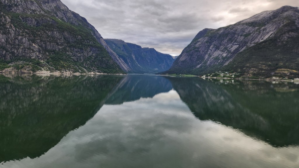
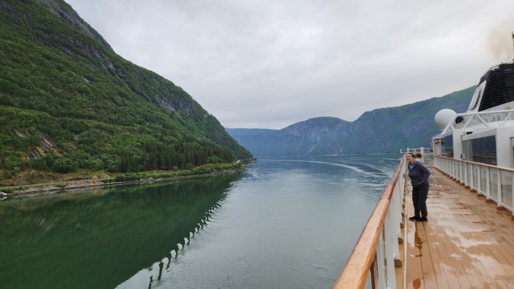
Eidfjord, Norway (Friday, June 19, 2026): Early Friday morning provided another opportunity to gawk and snap photos as we continued sailing along the Hardangerfjord toward our next docking location at Eidfjord.

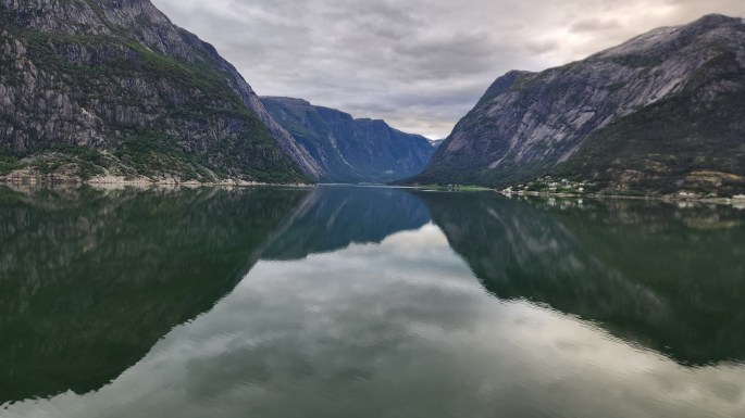
Sailing on the Fjord Toward Eidfjord
Pat Gawks at the Scenery
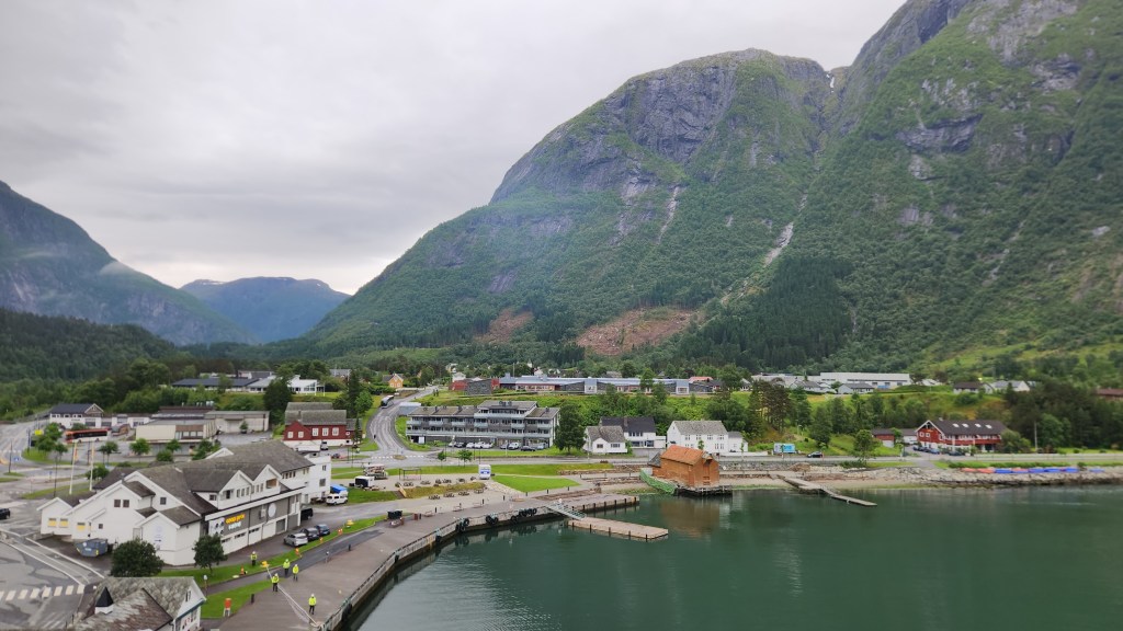
Eidfjord, Norway, viewed from our Balcony on the Viking Sky

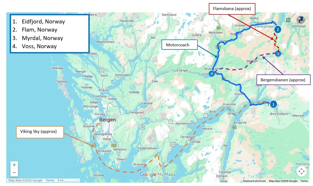
Once the ship had docked, we set off on a full-day excursion to Flåm, one of Norway’s most scenic coastal villages. Here’s a map showing how we got to Eidfjord and how we spent the day:

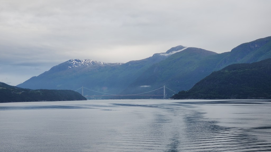
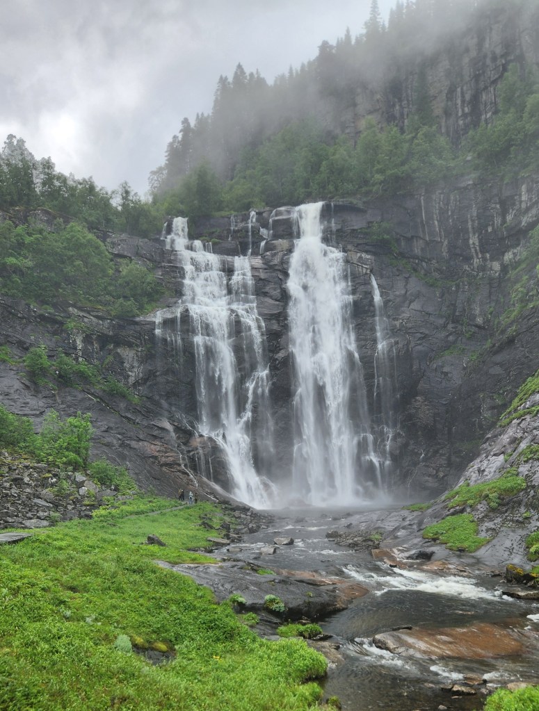
We boarded a motorcoach for a drive from Eidfjord to Flåm, soon finding ourselves crossing the fjord on an impressive suspension bridge and entering into an enormous tunnel – it was so large that it included a roundabout for following tunnels in multiple directions. After what felt like several miles, we emerged again into the countryside, crossing scenic mountain passes and driving through more manmade tunnels. About halfway along, we stopped to admire the Tvinde Waterfall cascading down a steep cliffside.

The Tvinde Waterfall

After the waterfall stop, our coach delivered us to Flåm, where we boarded the Flåm Railway – generally known as the scenic Flåm Railway for a good reason. The track climbs nearly 3,000 feet while passing through 20 tunnels and over numerous bridges on the way to Myrdal.

View from the Flåm Railway
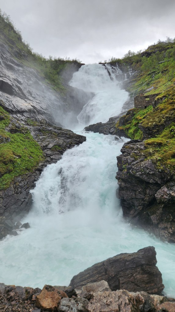
Kjosfossen Waterfall viewed from Tourist Stop on Flåm Railroad

At Myrdal, we boarded the Bergenbanen train, once again passing through the spectacular vistas we saw on our way from Oslo to Bergen during the pre-cruise program. Our train ride this time ended at Voss, where we enjoyed lunch before once again boarding the motorcoach for our return to the ship. Along with the beautiful scenery, including yet another impressive waterfall, we saw a plethora of “marshmallows” dotting the farm fields – the local pet name for bales of hay or straw wrapped in white weather-resistant coverings.

View from Restaurant in Voss
Skervsfossen Waterfall on Route from Voss to Eidfjord
Field of “Marshmallows” Near Eidfjord

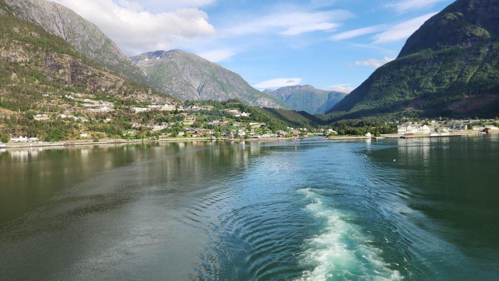
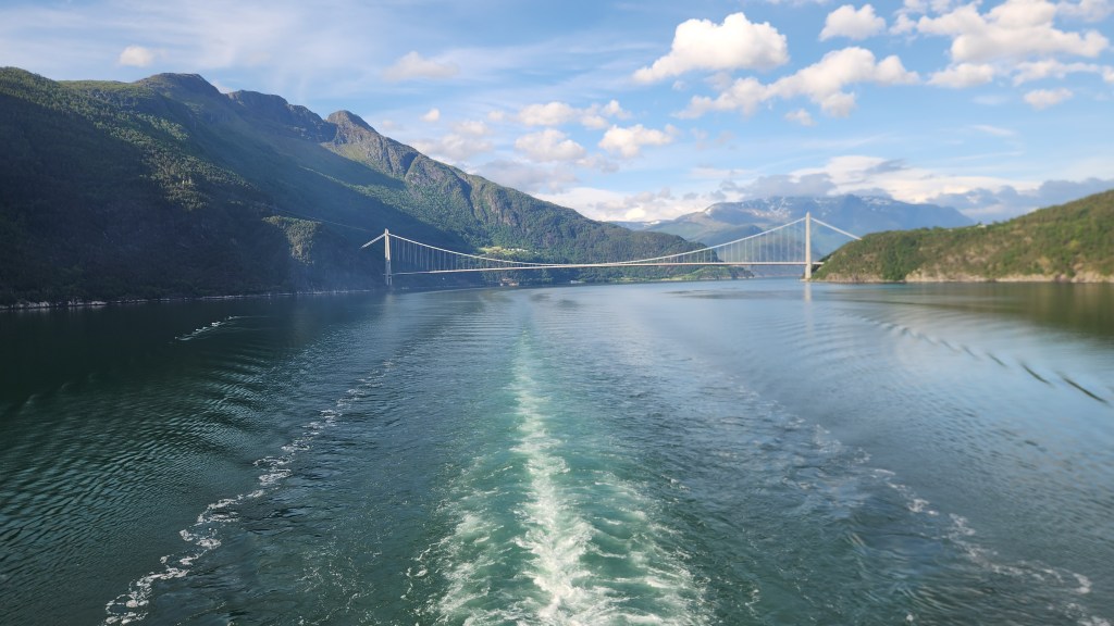
As the ship headed back down the Hardangerfjord toward the North Sea, we contented ourselves with more delightful views of the passing scenery.

Sailing Away from Eidford
Sailing Away from Eidford down the Hardangerfjord

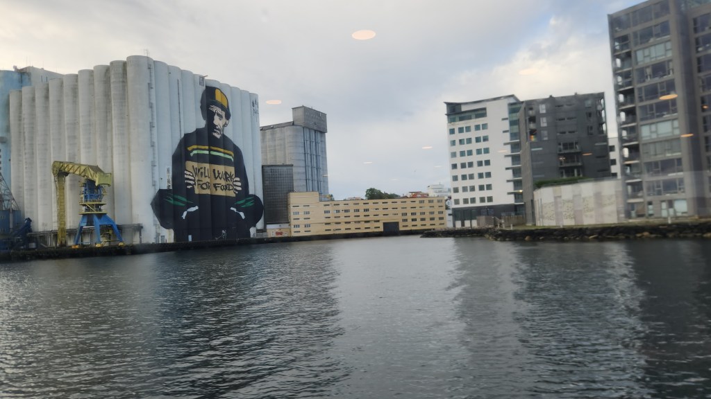
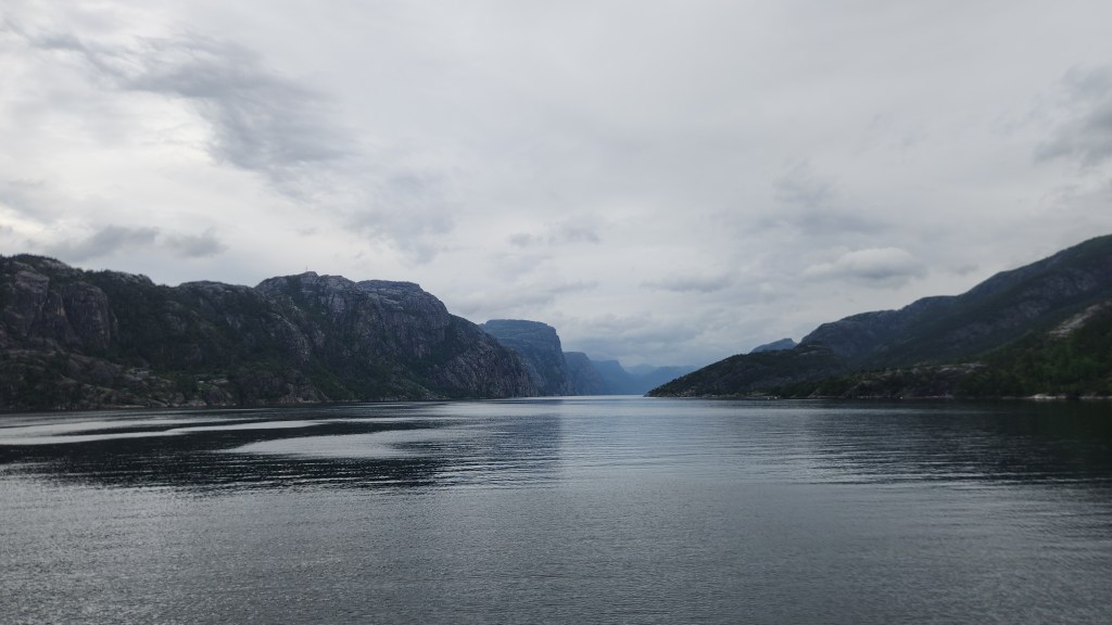
Stavanger, Norway (Saturday, June 20, 2026): After an overnight sail, we arrived in Stavanger at 7 AM for what proved to be a rather quick, half-day stop. While Stavanger appeared to be a lovely city with a world-famous Oil Museum, we opted out of the city tour for an alternate activity – a local sightseeing boat ride up the Lysefjord (“light fjord”, named for the lightly colored granite mountains that rise on each side of the fjord).

On the Tour Boat from Stavanger to the Lysefjord

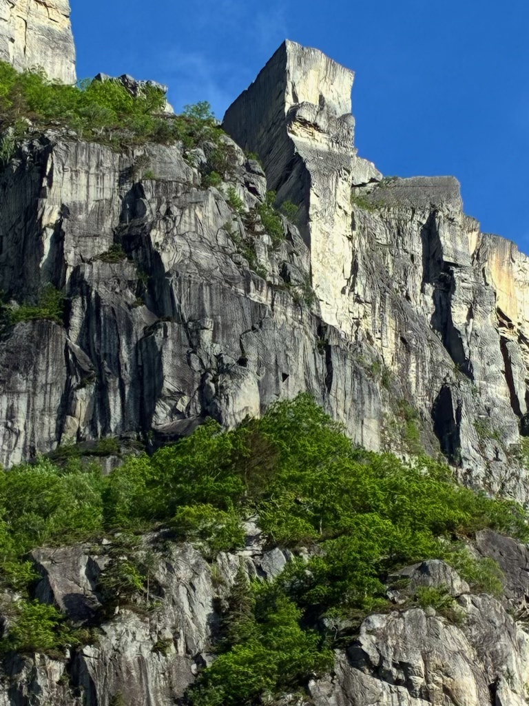
As our tour boat set sail from the Stavanger archipelago, the day was rather dreary, and it seemed as if our visit to the Preikestolen, (Pulpit Rock) might be a bit of a bust. However, as we approached the destination the clouds began to part and we were rewarded with bright sunshine as we passed alongside the famous rock. As you’ll see in the pictures below, the rock takes its name form its resemblance to a church pulpit.

Sailing up the Lysefjord toward Pulpit Rock
Yet another Beautiful Waterfall — this one on the Lysefjord
Pulpit Rock on the Lysefjord

As an interesting side note, we learned that Tom Cruise filmed one of his iconic Mission Impossible: Fallout stunts atop the Pulpit Rock (serving as a stand-in for the mountains of Kashmir), where Cruise’s Ethan Hunt character fights Henry Cavill and dangles from the 2,000-foot-high cliff. The filming required heroic efforts from helicopter pilots to bring in the actors and film equipment in the windy conditions. As sort of a reward for the cooperation of the Norwegian authorities, the world premier of the movie was later shown to an audience on top of the rock.

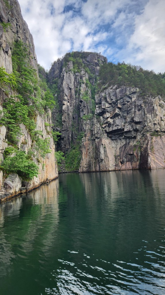
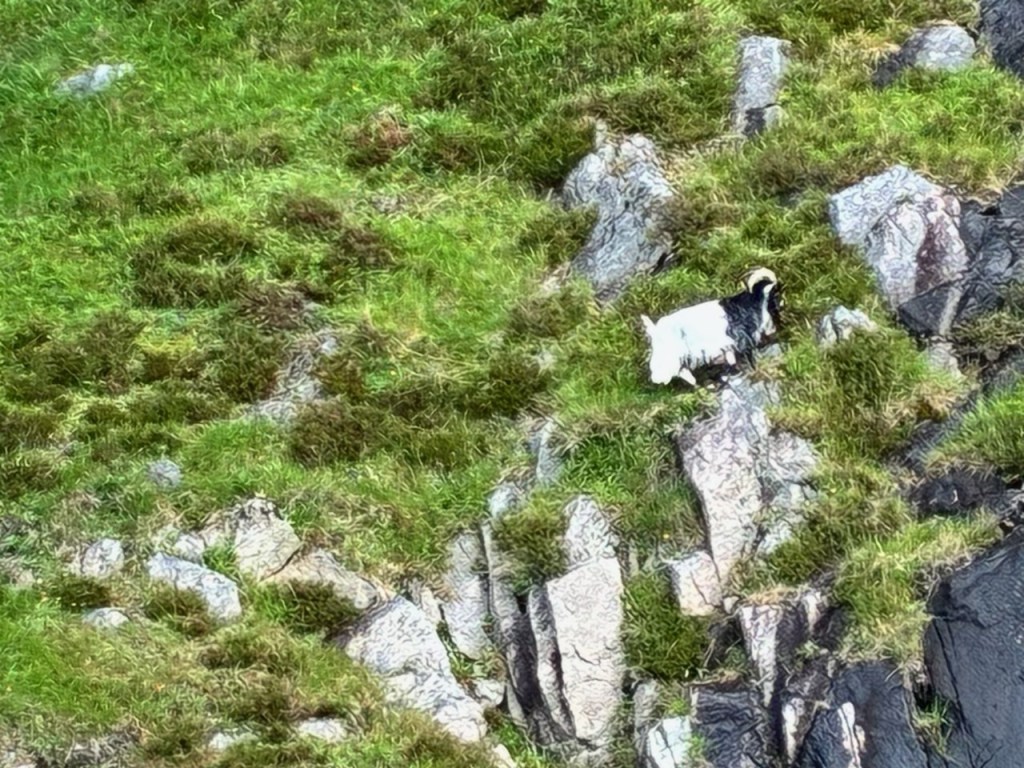
After ogling the Pulpit Rock, we sailed a bit farther up the fjord for a close-up view of an interesting cove as well as the chance to see a pair of goats that generally spend the summer in a cozy spot along the fjord.

Cove in the Lysefjord near Pulpit Rock
A healthy goat has a lush food supply for the summer

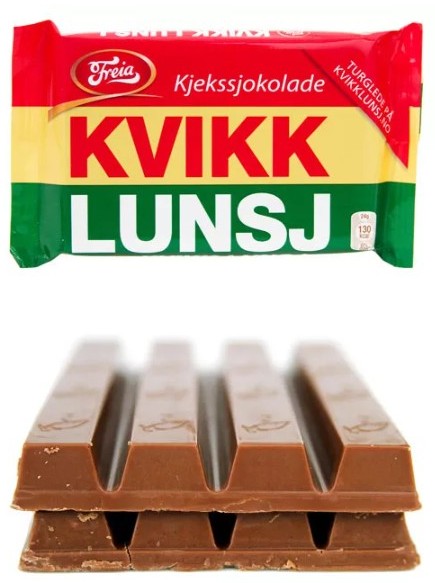
After the sightseeing, as the boat headed back toward Stavanger, we were treated to a lunch of Norwegian waffles with cream and sweet jams. We also purchased a couple of bars of an iconic Norwegian candy called the Kvikk Lunsj, which means just what it sounds like in English and is considered a necessity for hikers in Norway. While some compare it to a Kit Kat bar, any good Norwegian will tell you it is much better. We were told that Kt Kat tried to sue the Freia Candy Company for trademark infringement or some such thing but the court ruled that Kvikk Lunsj was developed and marketed before Kit Kat even existed.

A delicious Kvikk Lunsj atop an Inferior Kit Kat

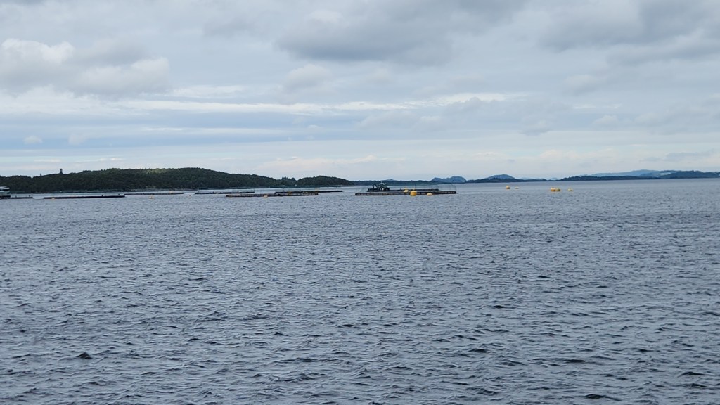
On the way back down the Lysefjord toward Stavanger, we passed by several fish farms, which looked to be quite sophisticated operations.

Fish Farms in the Lysefjord near Stavanger

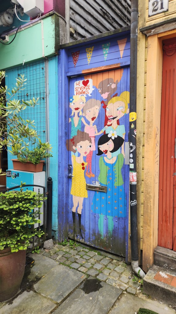
Once back in Stavanger, we wandered about the town for an hour or so before reboarding the ship. Back on our ship, we headed off in the early afternoon for an overnight sail to Oslo. Here are some photos from the town and one more photo as the ship sailed away.

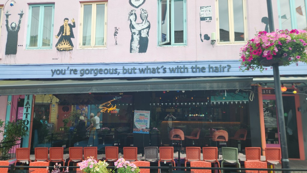
A shop in Stavanger caught my eye …
As did another one …
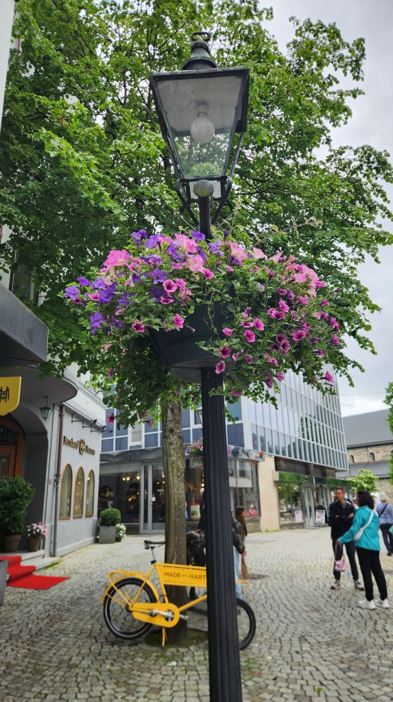
Street scene in Stavanger
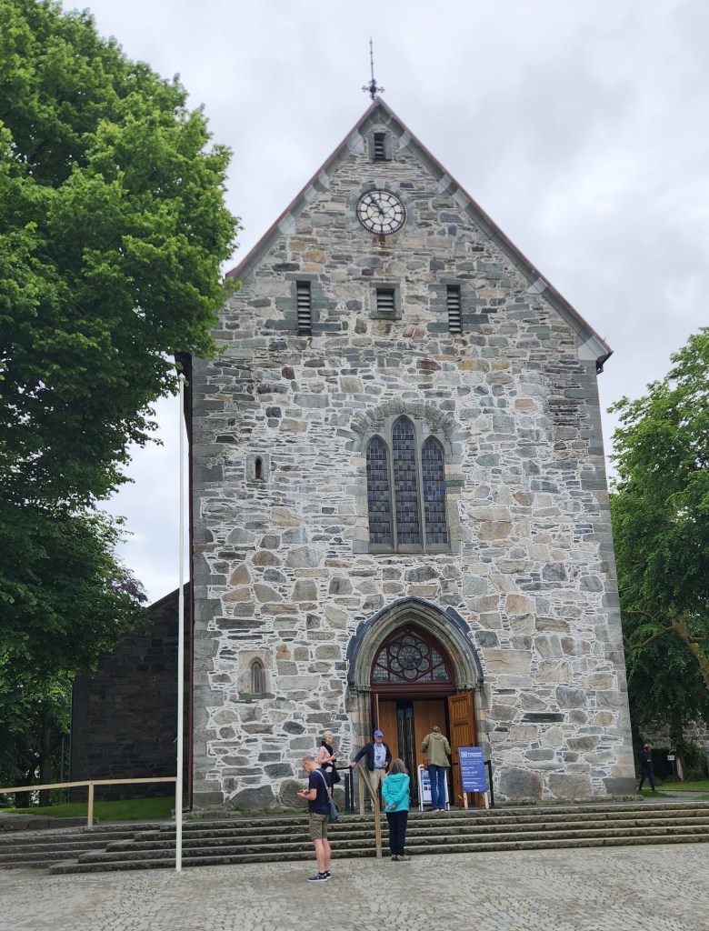
Stavanger Cathedral, established in 1125 and rebuilt after 1272 fire
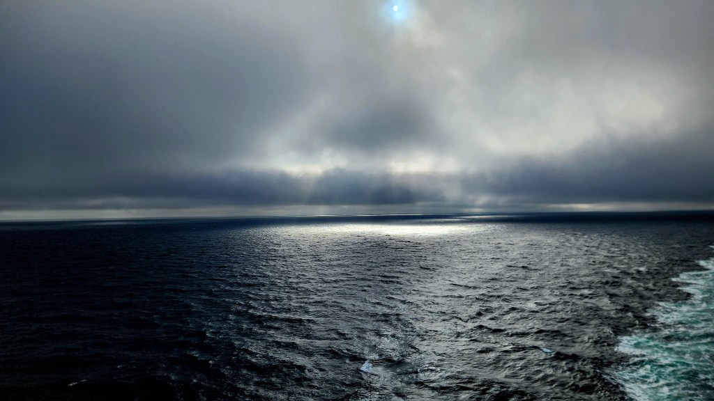
Interesting Sunbeam as we sail away from Stavanger

Oslo, Norway (Sunday and Monday, June 21 and 22, 2026): Our ship arrived in Oslo harbor at noon on Sunday. Our previous arrival, for the pre-tour program described in Part 1, had been at the airport, located far out in the boondocks. It was much more interesting to be able to see the Oslo archipelago as we sailed in.

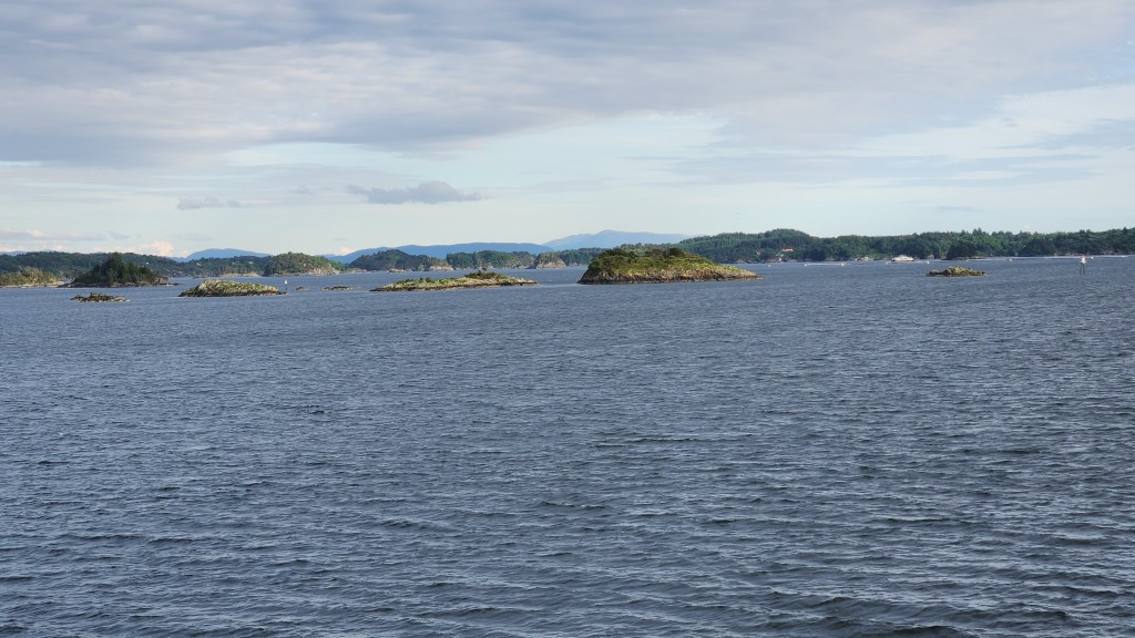
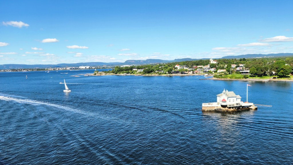
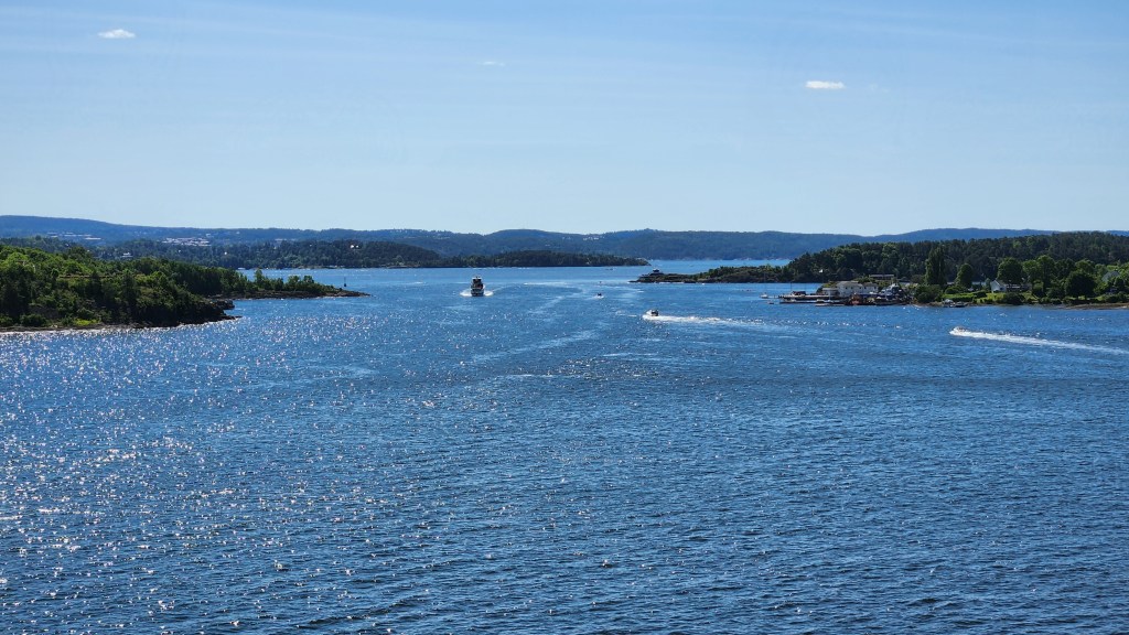
Sailing through the Oslo Archipelago

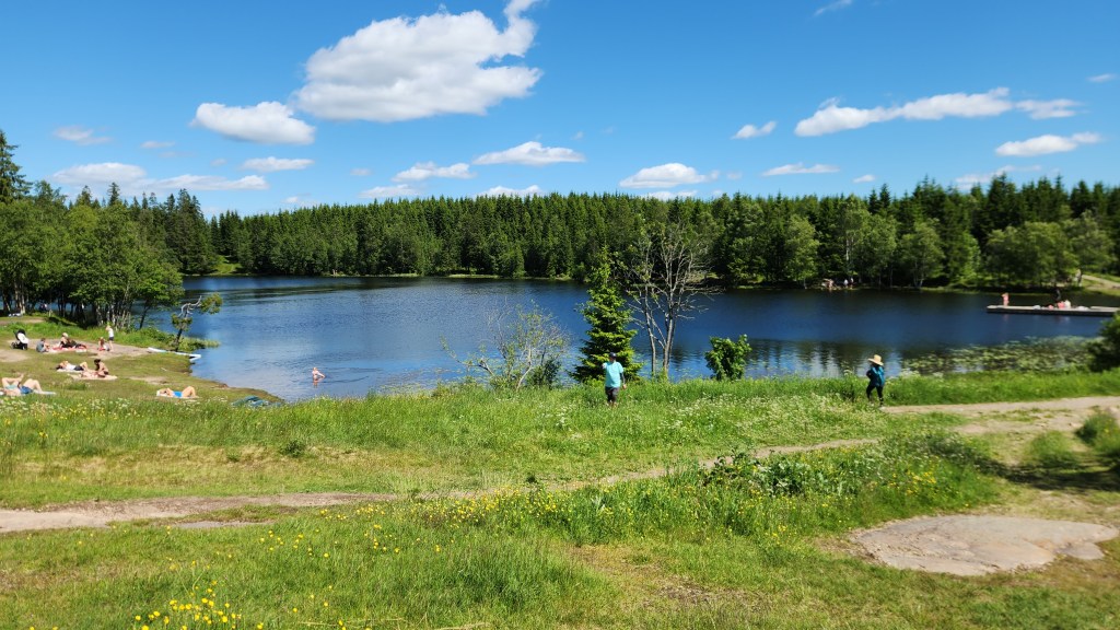
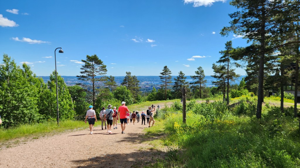
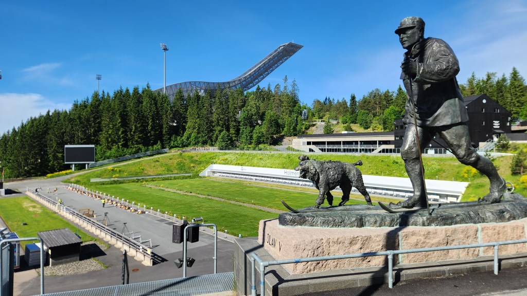
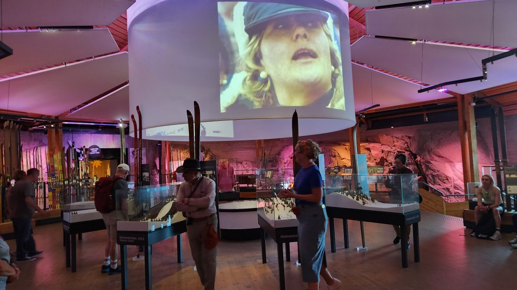
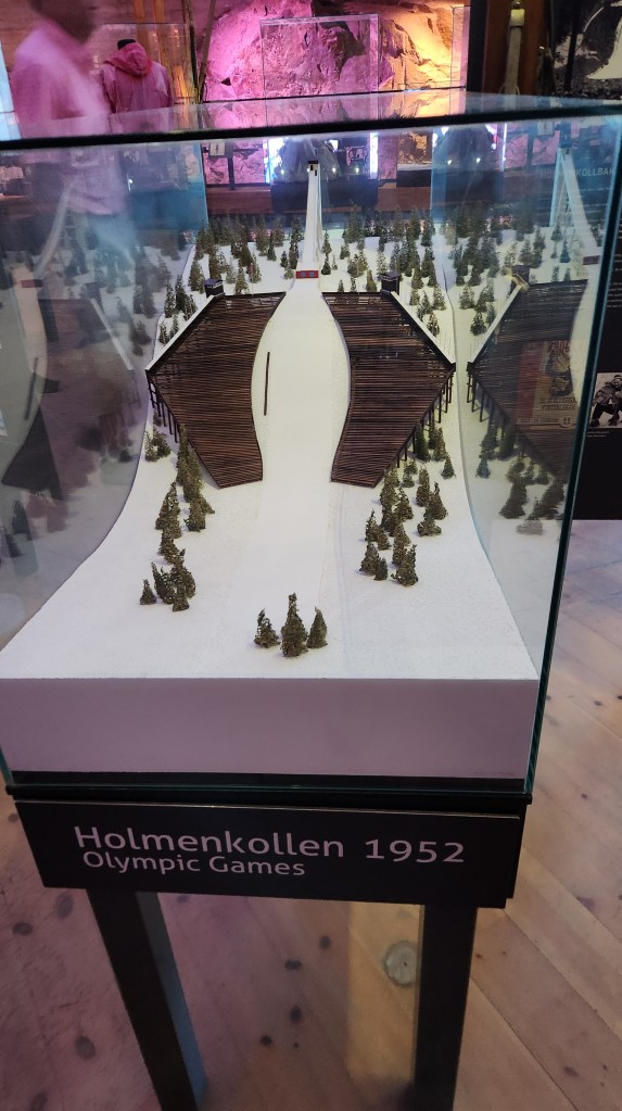
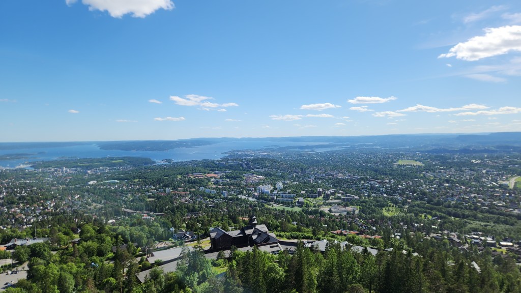
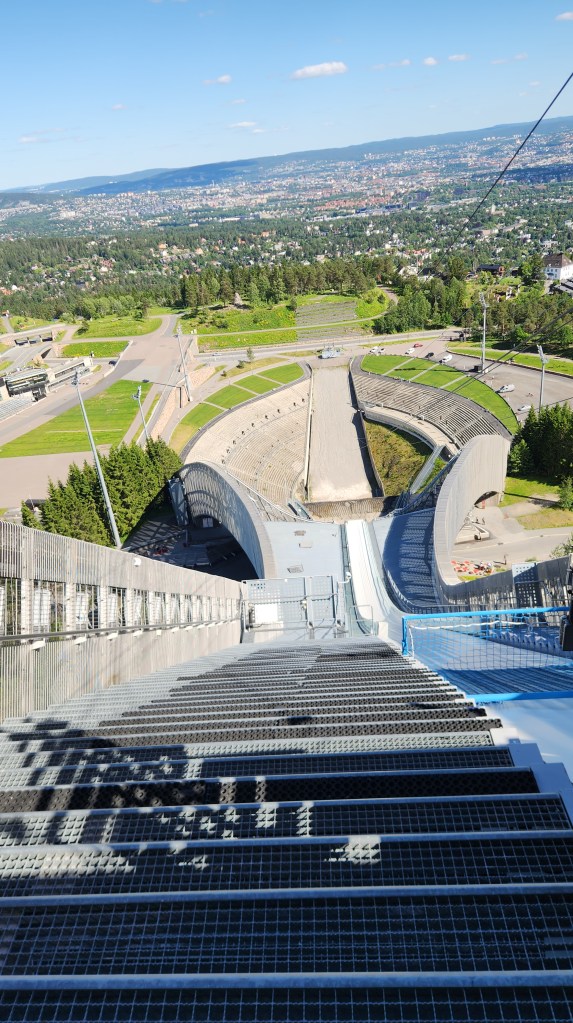
Our activity of choice for Sunday was a trip to the hills above Oslo to the Holmenkollen Park, a popular destination for Oslo residents, especially on a bright sunny day as we had. Our tour group went on a roughly 3-mile, leisurely nature hike through the park, eventually ending up at the world famous Holmenkollen Ski Jump and Biathlon facility. After a tour of the Skiing Museum at the site, we had a nice lunch and a dessert of Kvikk Lunsj bars. (I can confirm that – to my delicate palate – the Kvikk Lunsj was far superior to a Kit Kat bar.) After lunch, we went to the top of the ski jump for a spectacular view of the city, before returning to the ship.

The Holmenkollen Nature Park
The Viking group at the Holmenkollen Nature Park
King Olav V and his faithful dog watch over the Ski Jump and Biathlon Range at Holmenkollen …
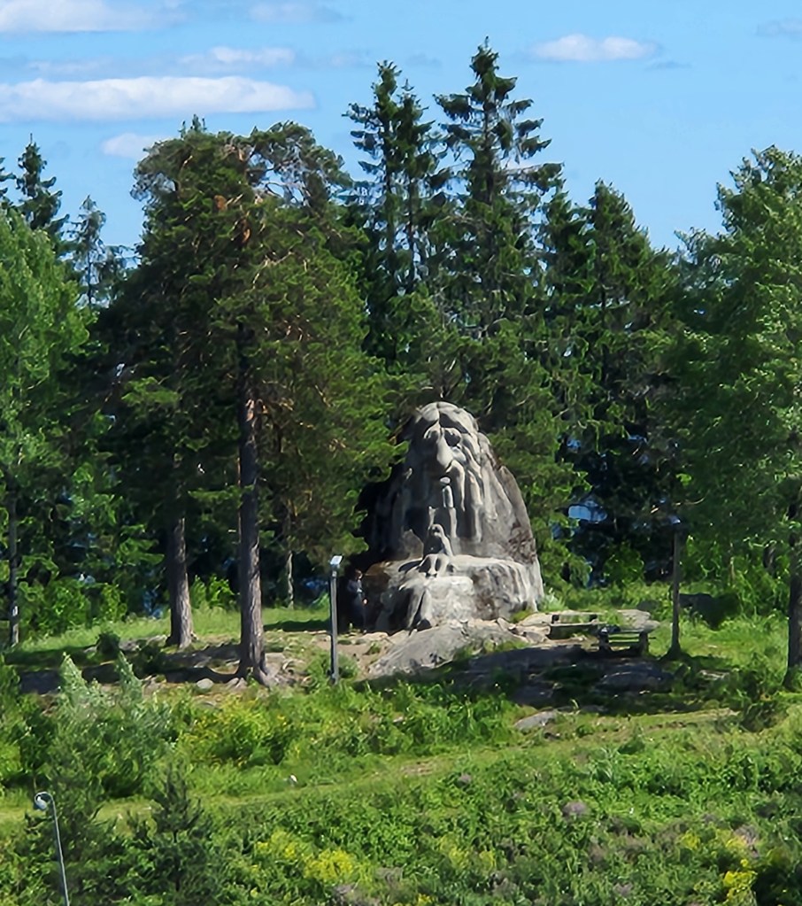
… while a Troll looks on from afar
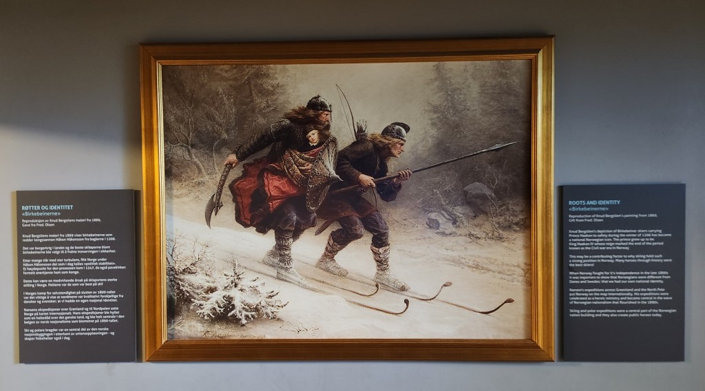
Exhibit at Holmenkollen — Birkebeiners Ski with the Infant Haakon Haakonson to Safety
Exhibits at the Skiing Museum at Holmenkollen
Exhibit at the Skiing Museum
View from the Top of the Ski Jump
A Ski Jumper’s View

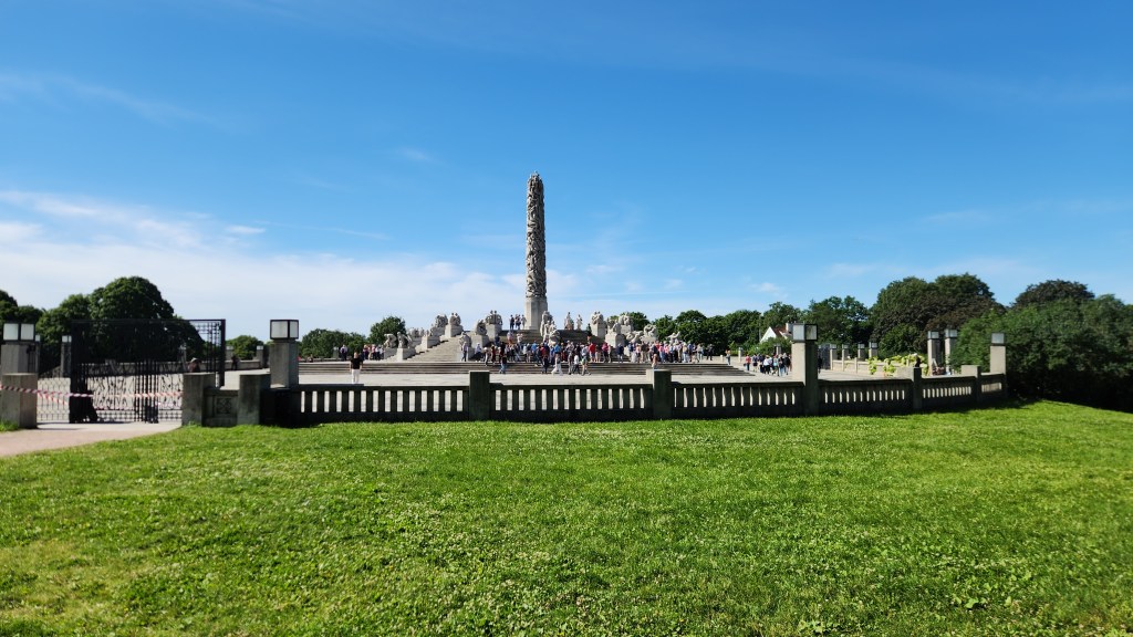
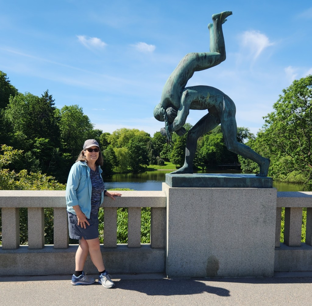
On Monday, our last day in Norway, we began with a motorcoach tour of Oslo including an extensive visit to the Vigeland installation at Frogner Park, which turned out to be an amazing, one-of-a-kind experience. In 1921, Norwegian sculptor Gustav Vigeland struck a deal with the city of Oslo. Vigeland gifted his lifetime’s work to the city in exchange for a combined home, studio, and creative freedom. The result of this extraordinary deal is the Vigeland installation, the world’s largest sculpture park made by a single artist, featuring 212 works by Vigeland. The sculptures are located on 80 acres in the center of Frogner Park and are mostly displayed within several major groupings:

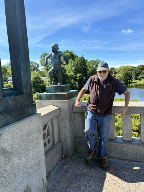
  • The Bridge contains 58 bronze sculptures portraying men, women, and children interacting, including the iconic Sinnataggen (Angry Boy). None of the individual sculpture actually was named by Vigeland, but the Angry Boy has become the popular name, and many visitors touch it for good luck.
  • The Fountain: Originally meant for the grounds of the Norwegian Parliament, it features 20 tree-group figures depicting various stages of life, from birth through old age.
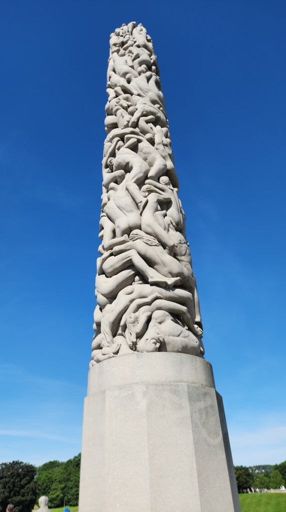
  • The Monolith: The centerpiece of the park, the monolith is carved out of a single massive block of granite. It features 121 entwined human figures reaching toward the sky, representing mankind’s longing for the spiritual and the divine.
  • The Wheel of Life: Found at the far end of the park, this bronze sculpture shows four adults and a child intertwined in a circle, symbolizing eternity.

Vigeland did not live to see the park fully completed before he died in 1943, but what he left behind is simply amazing.

The Monolith and Wheel of Life Groupings at the Vigeland Installation
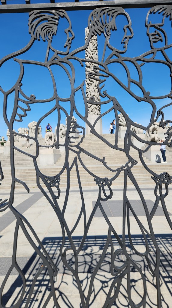
One of the Gates at the Monolith and Wheel of Life
The Monolith
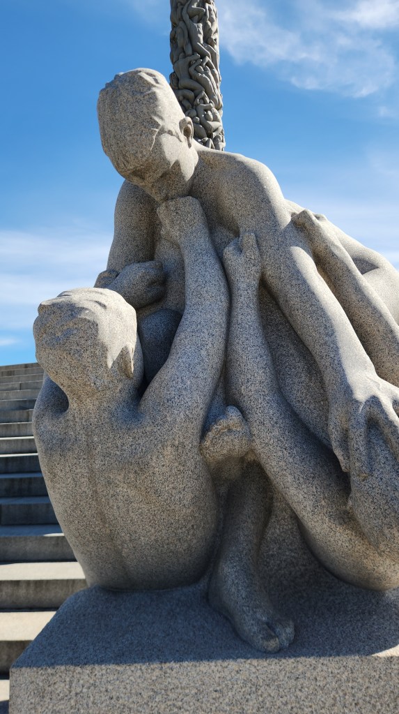
Some of the Figures in the Wheel of Life Grouping
The Fountain Grouping
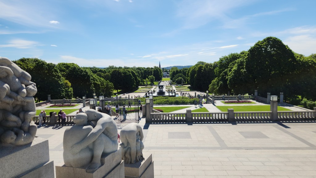
Looking From the Wheel of Life toward the Bridge
Figure(s) in the Bridge Grouping
Has the Angry Boy found an Angry Old Companion?

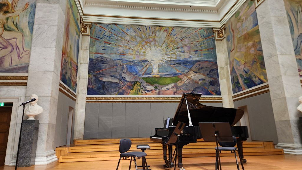
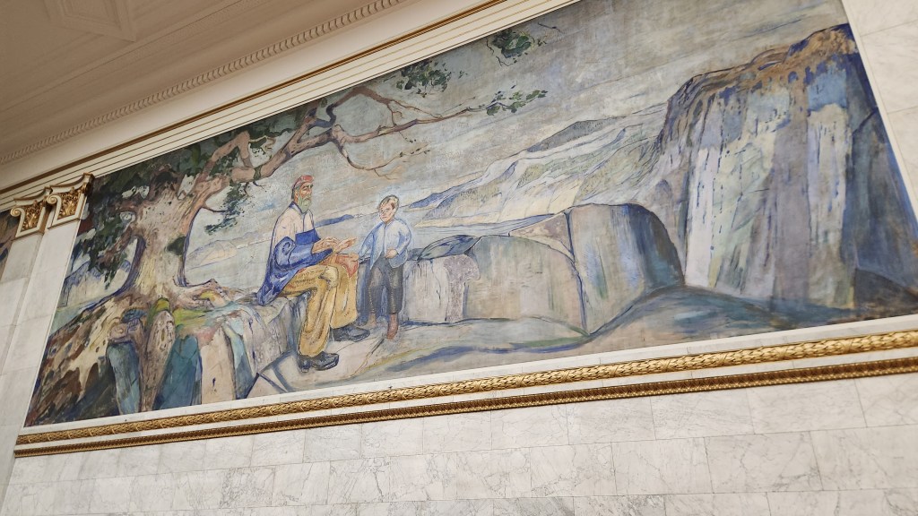
Our final activity in Oslo was a special classical music concert performed for Viking travelers. The University Aula is a prestigious ceremonial and concert hall of the University of Oslo, located on Karl Johans Gate in the center of the city. Built in the mid-19th century, the venue is world-renowned for its interior walls, which feature 11 monumental oil paintings by Edvard Munch, including his masterpiece The Sun. The concert was presented as the story of Peer Gynt, the famous Henrik Ibsen play based loosely on the life of his longtime friend, Ole Bull. The program featured Edvard Grieg’s music written to accompany Ibsen’s play as well as works by Mozart, Puccini, and others.

The Aula Stage and Munch’s The Sun
Another Munch Mural at the Aula
The Concert Musicians
The Concert Musicians and Singers

All in all, we were very impressed by Norway – not only for its stunning beauty and rich culture, but for its environmental leadership. We learned that 100% of new cars sold in Norway are all electric, as are about 80% of all cars on the road. The necessary electric car charging infrastructure is fully in place, providing hope that other countries will eventually be able to do so as well. Norway is powered entirely by green energy, including hydroelectric, wind, and solar. Even though the oil and gas industry is a major part of Norway’s economy, all fossil fuels are exported to other countries. Although only a small country (population 5.6 million), Norway supplies 2% of the world’s crude oil and 3% of its natural gas, and the revenues from these exports are funneled into its sovereign wealth fund for the good of the Norwegian people. The wealth fund exceeds $ 2 trillion and holds stakes in approximately 7,200 companies worldwide, effectively owning about 1.5% of all listed companies on the planet. The fund’s substantial earnings are used to support the national budget including investments in infrastructure, while the large principal value is saved ; the principal is saved to ensure long-term wealth for future generations.

But now it’s time to move on, and when I begin work on Part 3, we’ll find ourselves in Denmark.

Stay tuned …

Pat and Dave’s Vibrant Viking Voyage – PART 1: Introduction and Pre-Cruise Program

Preamble

It’s hard to believe, but it’s already time for another episode in my ongoing series of travelogues documenting our domestic and international travel experiences. As past readers will know, the domestic travelogues have been road trips (either with the RV we formerly owned or with one of our two our electric cars) while the international travels have mostly been with the Viking River Cruise or Viking Ocean Cruise lines. We took our first Viking River Cruise on the Danube River back in 2018 (before I started blogging about our travels), and we enjoyed it so much that we’ve continued to patronize Viking. Just to be clear, I am not a paid influencer and receive no compensation of any type – Pat and I are purely and simply great Viking fans. So here I go again, this time documenting an Ocean Cruise denoted “Viking Homelands.” (Thus the latest in my somewhat goofy series of alliterative titles, using the word “Viking” for both the cruise line and the destinations.)

As sometimes happens, we did not get off to an auspicious start. We were booked on a Delta flight from MSP to Newark at 9:14 AM on Friday, June 12, and a connecting flight from Newark to Oslo. However, at about 7 PM Thursday evening, as we were getting ready to retire before an early morning Lyft to the airport, we received an email notice that the flight to Newark had been canceled. Somewhat anxiously, I called the Viking Travel Emergency number and we were soon rebooked on a 3:55 PM United flight to Frankfurt and a connecting flight from Frankfurt to Oslo. However, when we arrived at the departure gate on Friday afternoon, we learned that the Frankfurt flight had been delayed because the plane could not get to the departure gate – blocked by a Delta plane at the adjacent gate as well as airport construction activities. We finally took off two hours late and – big surprise – missed the connecting flight due to the long line at the passport control checkpoint in Frankfurt. After another call to the Viking Travel Emergency number, we were rebooked again on a later flight. We eventually arrived in Oslo feeling sleep deprived after a very long travel day but ready to start on our Vibrant Viking Voyage.

So, let’s get this travelogue started, shall we?

Pre-Cruise Program

The Ocean Cruise portion of the trip began in Bergen, Norway, on June 17th, but we had also booked a four-day pre-cruise extension program that began with a day in Oslo and included a trip to Bergen on the world-famous Bergensbanen railway and a day of sightseeing in Bergen prior to boarding the cruise ship. This Part 1 of the travelogue describes the highlights of the four-day pre-cruise program.

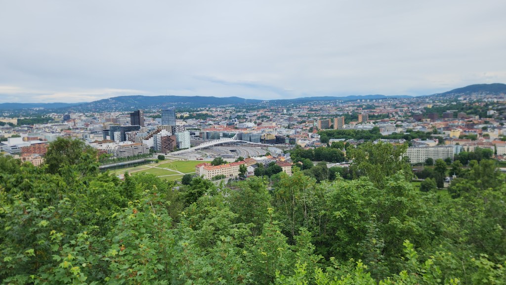
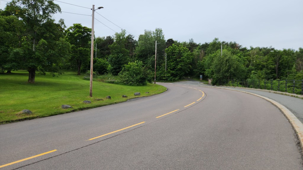
Oslo, Norway (Sunday, June 14, 2026): The first activity was a four-hour scenic motorcoach and walking tour of Oslo. Highlights included a stop at an overlook point with a fantastic view of the city and a visit to the Royal Palace. The overlook is located close to a place in the road referred to as “The Scream curve,” in recognition of the spot where famous Norwegian painter Edvard Munch was walking and came upon an eerie scene of the sunset over Oslo, inspiring his world-famous painting.

Overlook of Oslo
The Scream Curve

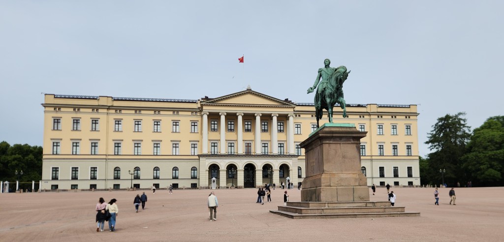
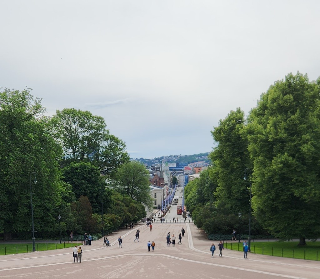
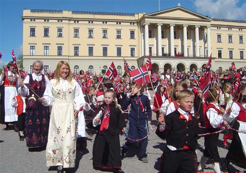
On our way from the overlook to the Royal Palace, home of current monarchs King Harald VI and Queen Sonja, our guide gave us a brief Norwegian history lesson. We learned that Norway had been ruled by Danish and Swedish kings from the fourteenth century until its independence in 1905. However, on May 17, 1814, Norway adopted a constitution establishing the ruling Parliament but retaining the king as a ceremonial leader. After independence, the Norwegian people still wanted a king. Somewhat ironically, Prince Karl of Denmark was asked to fill that role, which he did, but only after a national referendum confirming him as the Norwegian people’s choice. To emphasize continuity with Norway’s medieval kings (prior to Danish rule) he adopted the name Haakon VII. The palace itself was built by Swedish King Karl III Johann, who also became the king of Norway when Sweden was awarded Norway as a prize following the defeat of Denmark in the Napoleonic wars. A huge statue of Karl Johann on his steed stands in front of the palace, facing Oslo’s main street, Karl Johann Gate. On Constitution Day (May 17), a parade runs from downtown Oslo to the palace, with the participants wearing the so-called “bunad,” the traditional costume of Norway. The 54-acre public Palace Garden surrounds the palace, and we enjoyed a leisurely stroll through the garden before resuming the coach tour.

Oslo Royal Palace
Karl Johann Gate viewed from the Royal Palace
Children’s Parade on May 17th 2005 (courtesy Wikipedia)
The Palace Garden

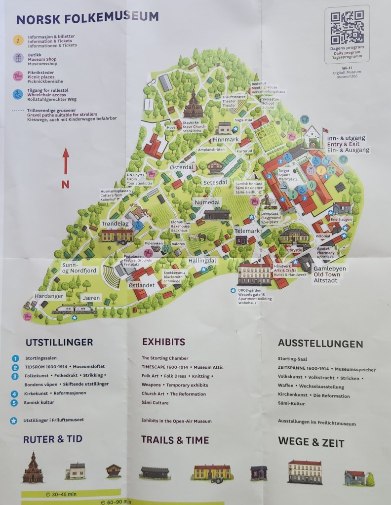
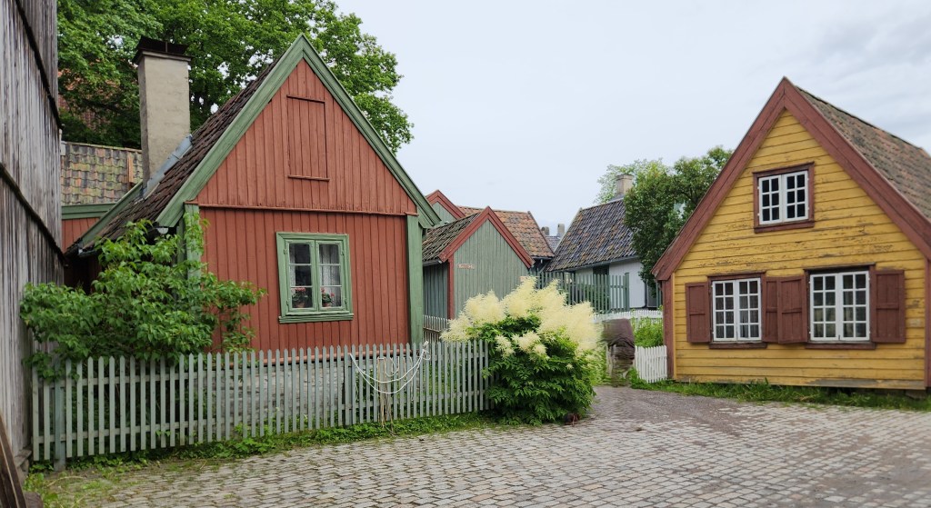
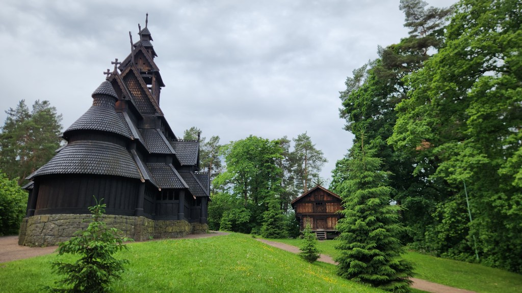
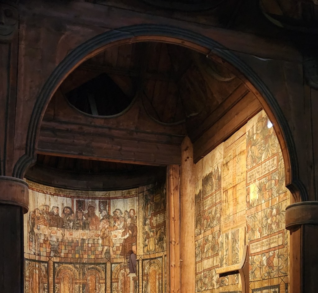
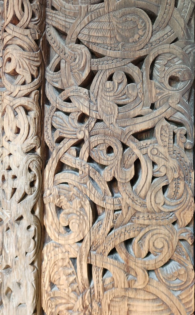
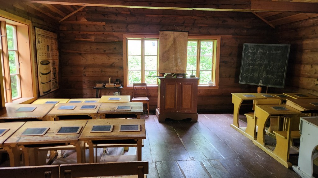
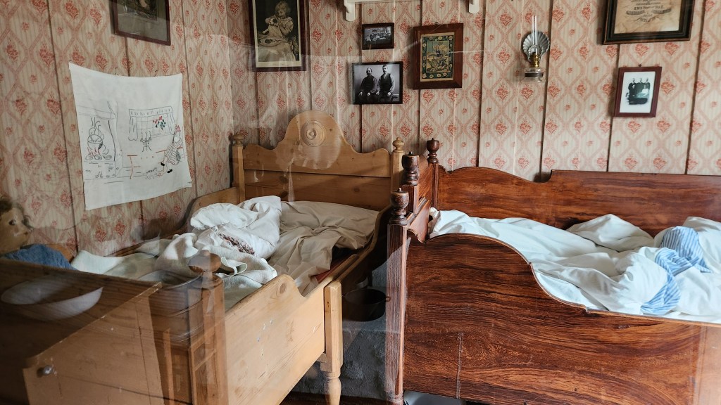
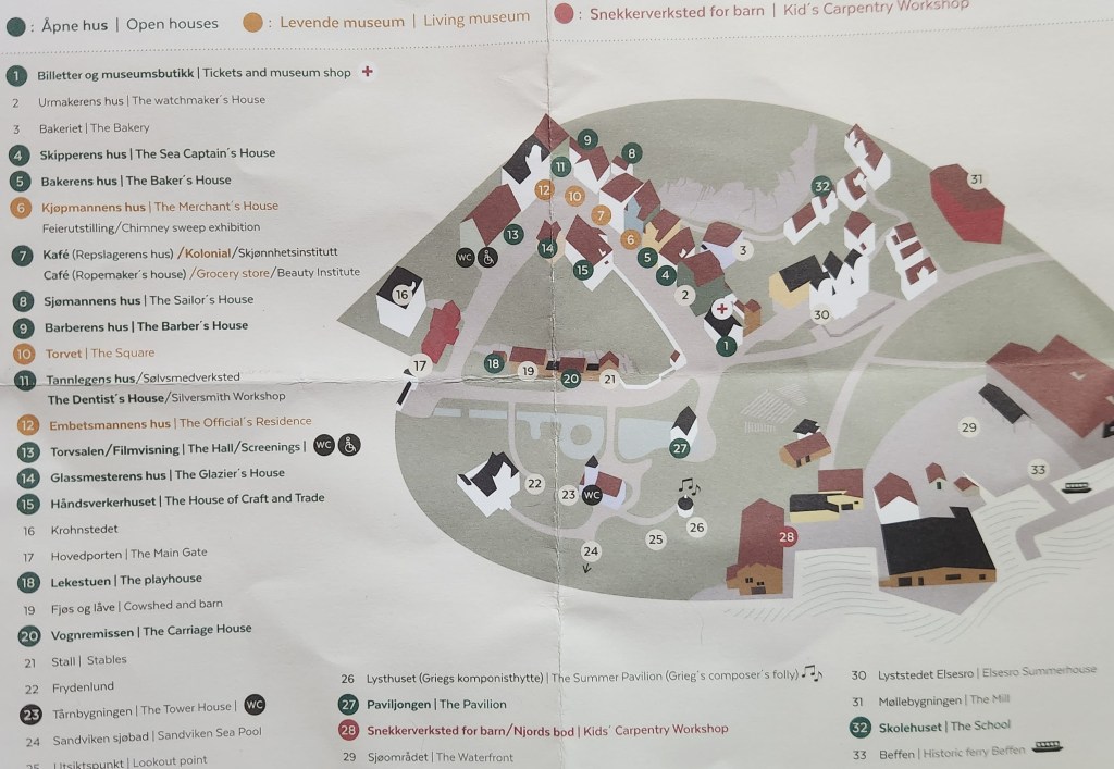
After the Royal Palace, we traveled to the Norwegian Museum of Cultural History (Norsk Folkemuseum), located on the Bygdøy peninsula. This is an open-air museum, featuring over 150 historic buildings relocated from across Norway, including a 13th-century stave church, so named for the “staves” that support the church building.

Norsk Folkemuseum Brochure Map
Museum Buildings
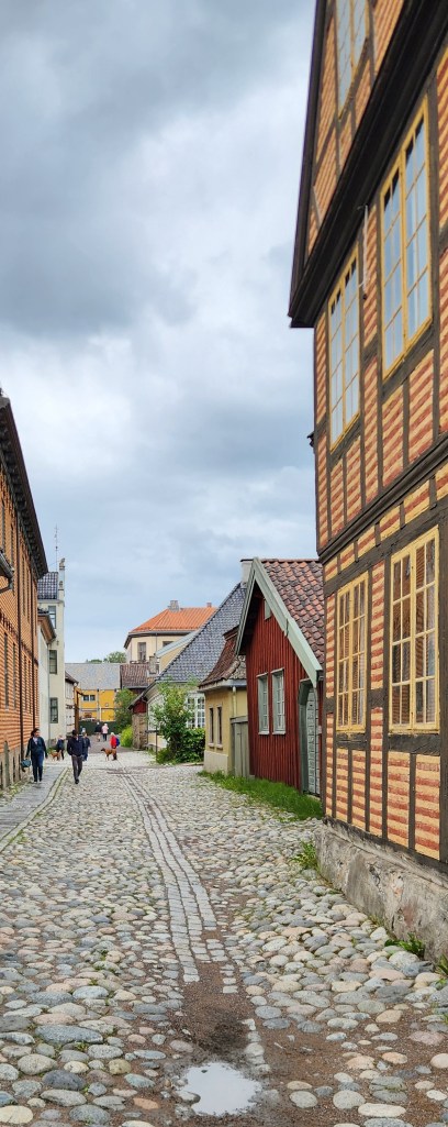
Cobblestone Street
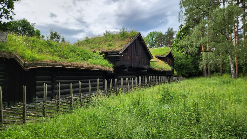
Old-Time Green Roof Technology
The 13th Century Stave Church
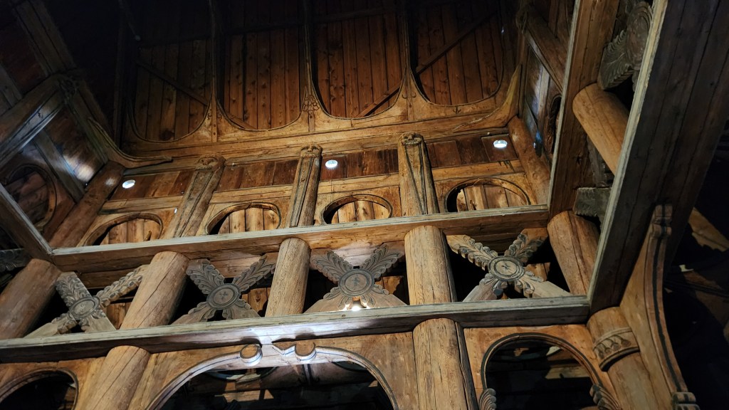
Inside the Stave Church
Wood Carvings in the Stave Church
Old School House
Living Quarters
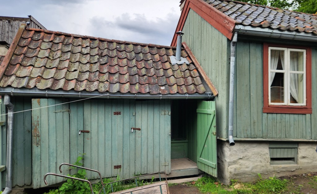
Modern Rest Room Facilities?

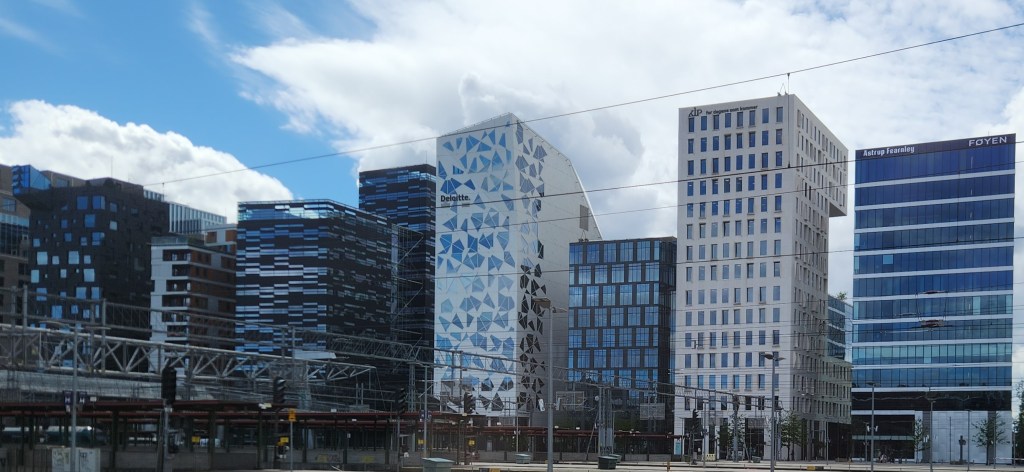
As we drove back to the hotel, we passed by many interesting buildings, including the so-called “bar code” area of Oslo, inspired by the look of the buildings, which include many of Oslo’s financial and technology businesses as well as housing units.

The Bar Code Area

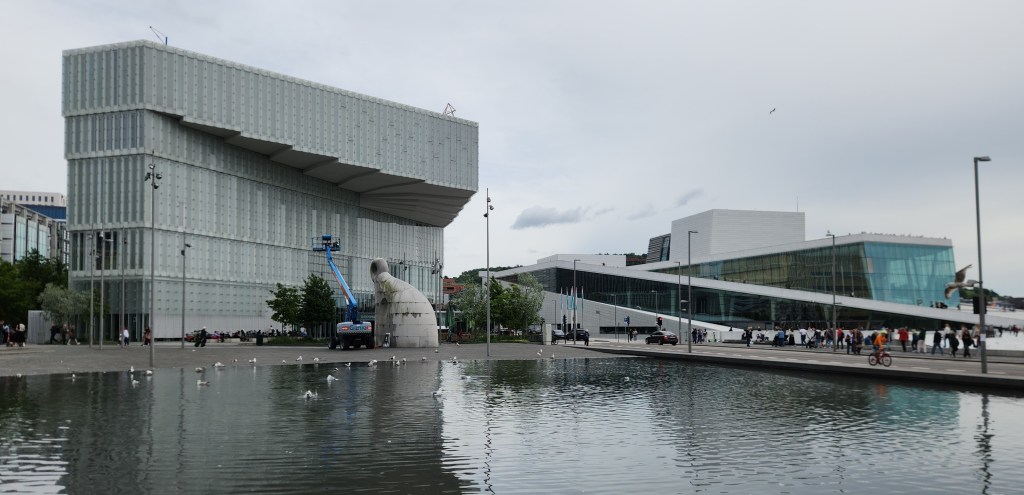
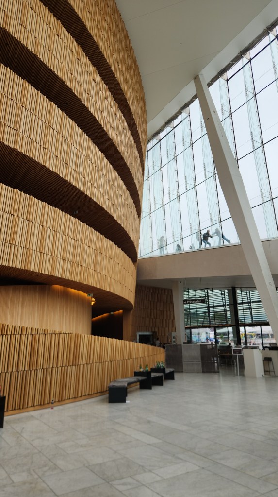
After the coach tour we spent several hours on our own exploring the area around our hotel, including the impressive Opera House and other areas adjacent to the Oslo fjord. (Although we think of a fjord as a deep, narrow, and winding sea inlet flanked by steep cliffs or mountains, which we’ll get to in the next Part of the travelogue, in Oslo’s case it merely refers to the sea inlet – more or less a generic word for “inlet” or “bay.”) The roof of the Opera House is designed for people to walk on, providing beautiful views of the area.

Oslo Library (left) and Opera House (right)
Interior of Opera House
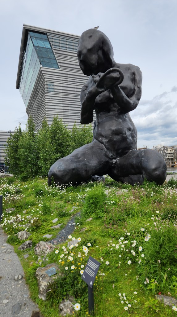
Wildflower Garden and Sculpture (The Mother) by the Fjord
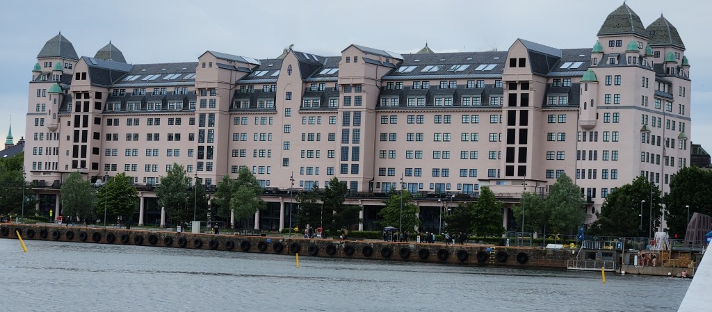
Office Building Across the Fjord from the Opera House

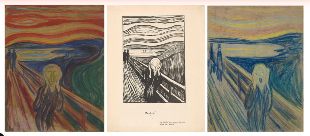
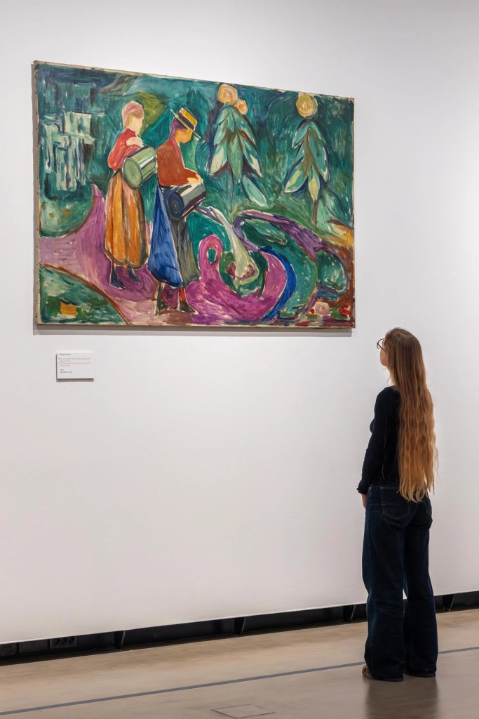
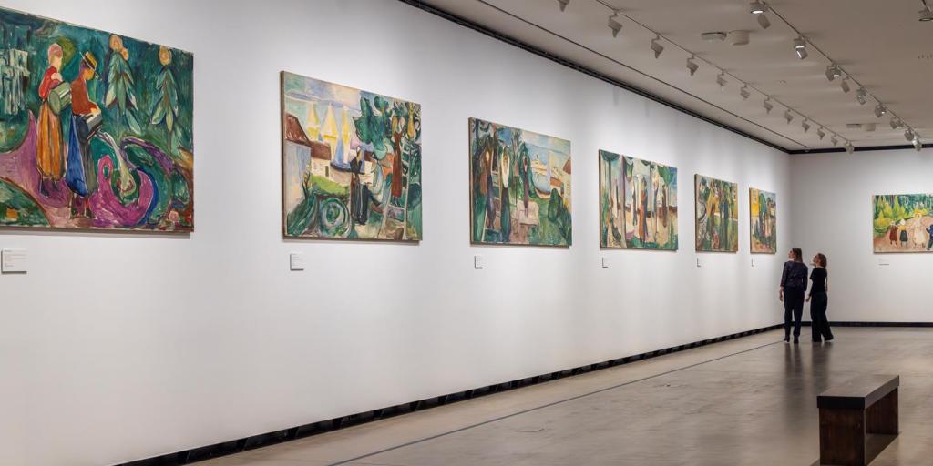
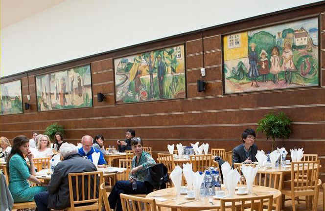
Along the way, we stopped for a couple of hours to tour the Munch Museum. The current museum building opened in 2021 and houses much of the collection bequeathed by Munch to the city of Oslo, including a staggering total of 28,000 artworks and 42,000 unique museum objects. While Munch is best known for The Scream, three versions of which are displayed at the museum, he was a prolific artist who worked in multiple media and formats. Among the most impressive of his works are 12 giant murals commissioned by the Freia Candy Factory to decorate the dining hall for their workers. These were temporarily on display at the museum. For some strange reason, I failed to take any photos at the museum, so I borrowed the following pictures from the museum’s website. (Hopefully they won’t sue me for copyright infringement!)

Three Treatments of The Scream (Courtesy Munch Museum website)
One of the Twelve Freia Murals (Courtesy Munch Museum website)
Temporary Display for the Freia Murals (Courtesy Munch Museum website)
The Murals in the Freia Chocolate Factory Dining Room (Courtesy Munch Museum website)

Although I will bet that most readers are familiar only with The Scream, as was I before touring the museum, the variety and depth of Munch’s works is simply amazing, and I would recommend this museum as a must for visitors to Oslo.

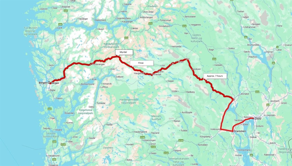
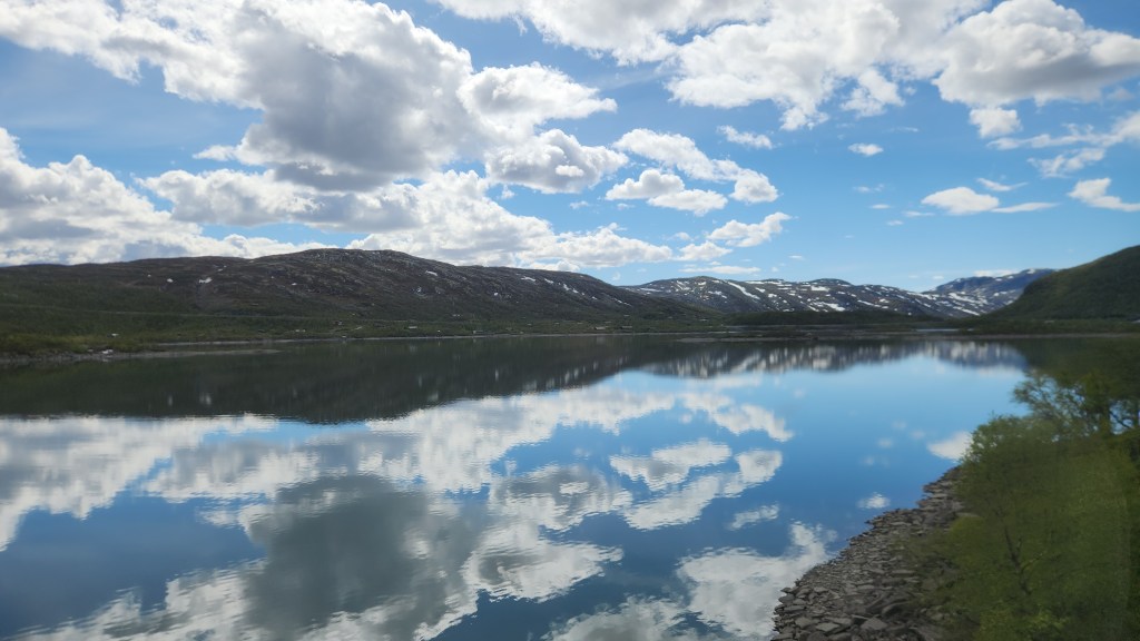
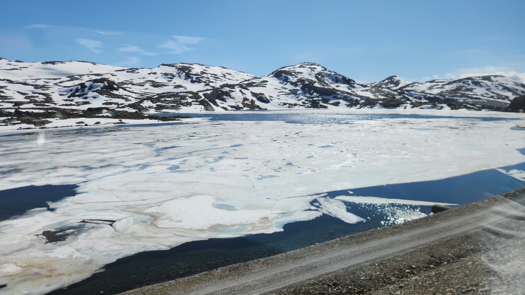
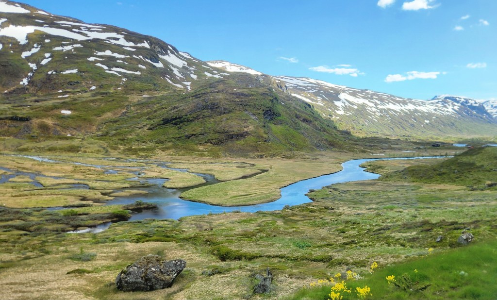
The Bergensbanen Railway (Monday, June 15, 2026): After a lazy Monday morning, we joined our tour group as we walked from the hotel to the railway station and boarded the 12 PM Oslo to Bergen train. The Bergensbanen line is a 308-mile-long railway connecting Oslo and Bergen. It is the highest mainline railway in Northern Europe, crossing the Hardangervidda plateau at 4,058 feet above sea level. The railway took about 15 years to build, officially opening in 1909 as the first year-round transport between Norway’s two largest cities, and was fully electrified by 1964. The route passes through 182 tunnels, the longest of which is the 6.4-mile long Finsetunnelen, which sits at 4009 feet above sea level. The journey took about 7.5 hours and was far and away the most scenic train ride I’ve ever experienced, with breathtaking fjord and mountain vistas. Here are a few photos taken from the train, none of which do justice to the actual views. (There were some spectacular waterfalls along the way, but I didn’t get any decent photos of those as the train raced along, so you’ll just have to go and see them for yourselves.)

Route of the Bergensbanen Railway
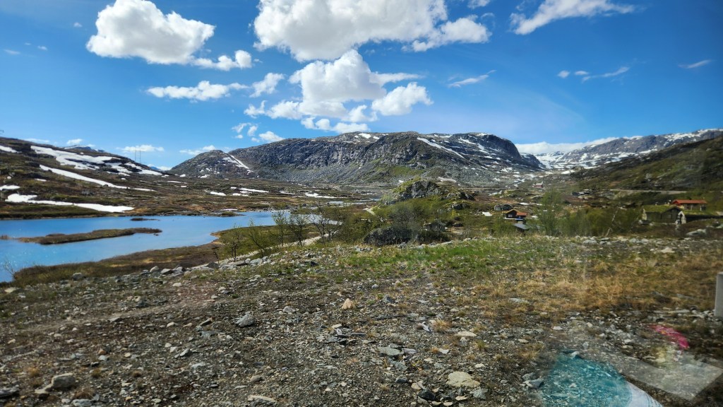
View from the Bergensbanen Train
View from the Bergensbanen Train near Hardangervidda
View from Bergenbanen Train

One interesting bit of trivia we learned along the way is that the scenes of Planet Hoth in Star Wars: Episode V – The Empire Strikes Back were filmed on the Hardangervidda plateau and glacier due to its reliably frigid winter conditions.

Bergen, Norway (Tuesday, June 16, 2026): On Tuesday morning, we headed off for a coach and walking tour of Bergen, passing by the famous Bryggen (wharf) area, where the Hanseatic League established a trading port in the fourteenth century, and various points of interest in the city.

The Bryggen in Bergen

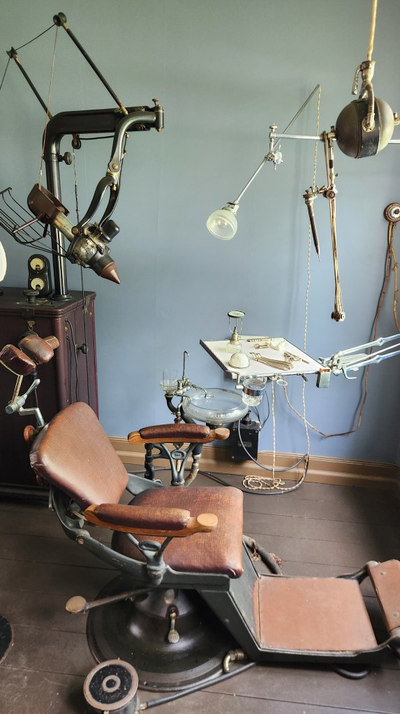
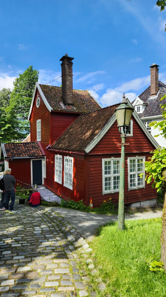
We stopped for a walking tour of the Old Bergen Museum (Gamle Bergen), consisting of some thirty historic buildings (built between 1700 and 1900) relocated from the city center. Costumed volunteers put on a short play in the main square in which a young bride-to-be was forced to have all her teeth extracted by a dentist and replaced with a false set. We learned that this was a common practice in Bergen in the 18th and 19th centuries to avoid problems later in life, and that the patients were generally given cocaine as an early form of anesthetic. After the play, we wandered through the village before reboarding the coach.

Old Bergen Museum Brochure Map
Old Bergen Museum Town Square
The Dentist’s Office
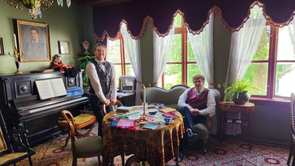
Two Entrepreneurs of the Hanseatic League
At the Old Bergen Museum

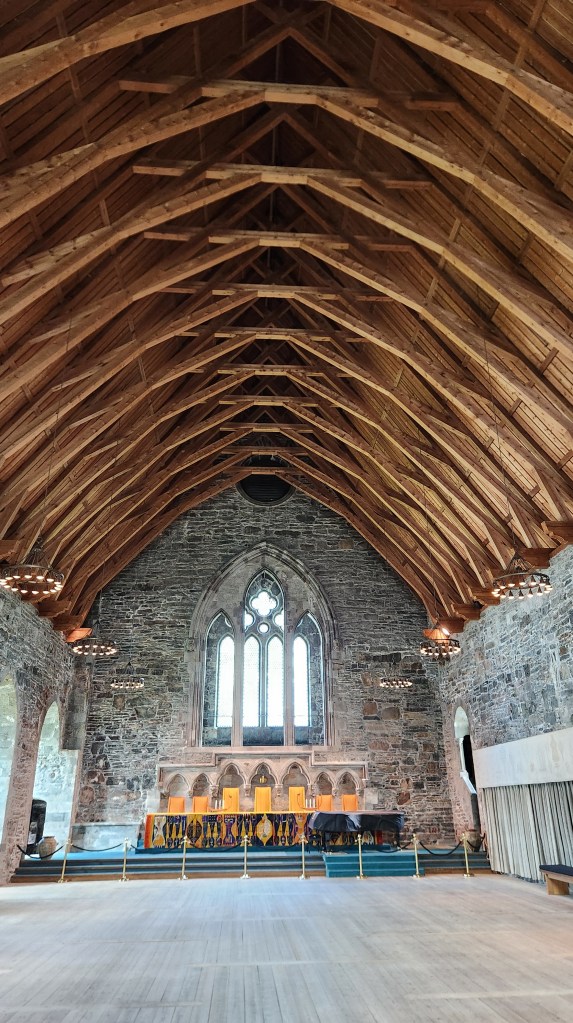
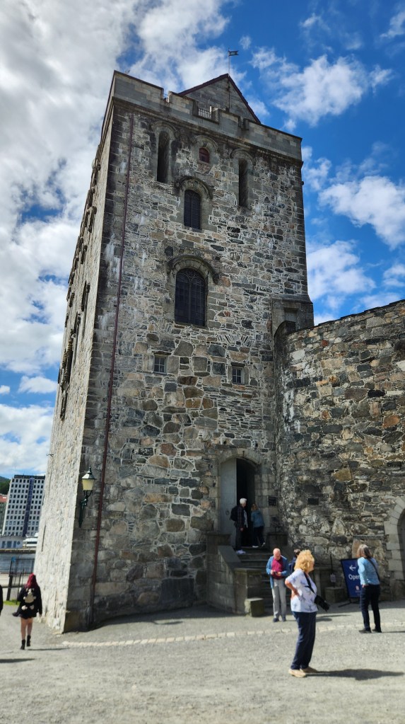
Next, we traveled to the Bergen Fortress, built in the 13th century when Bergen was the capital of Norway. The fortress remains an active military site under the command of the Royal Norwegian Navy, but the grounds are largely open to the public and function as a popular historical landmark and park. The major attraction is Haakon’s Hall, built by King Haakon Haakonsen between 1247 and 1261, a magnificent stone building used as a royal residence and banquet hall. It is the largest and oldest surviving stone building of its kind in Norway. The hall has been beautifully restored and serves as a venue for various Government and private functions.

The Reception Room in Haakon’s Hall

The Rosenkrantz Tower was constructed in the 1560s by Governor Erik Rosenkrantz, incorporating older 13th-century masonry. It served as a heavily fortified residence and a symbol of royal authority.

Rosenkrantz Tower

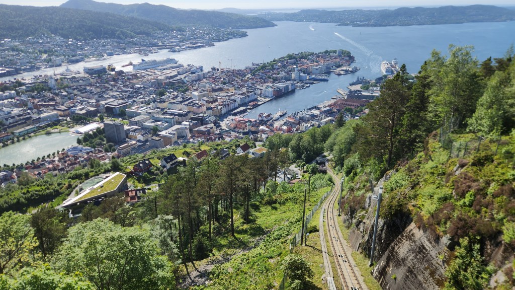
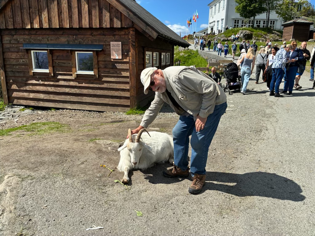
After the tour, we had free time to explore the city. We took the opportunity to ride a Funicular which travels from the city center to the top of Mount Floyen, where we had an excellent lunch (pea soup for me and fish chowder for Pat) before exploring the mountain top area. The scenic views were spectacular – and very lucky, as Bergen has rain for something like 250 days a year – and we also enjoyed petting the local goats, hiking to a lovely lake, and visiting the whimsical Troll Forest. We learned that trolls are very prominent in Norwegian folklore, and the oddly shaped hills and mountains are said to be the remains of trolls caught in the sunlight.

Bergen Funicular Arrives at Mt. Floyen Station
View of Bergen from Mt. Floyen Funicular Station
One of the Floyen Goats (or one old goat pets another?)
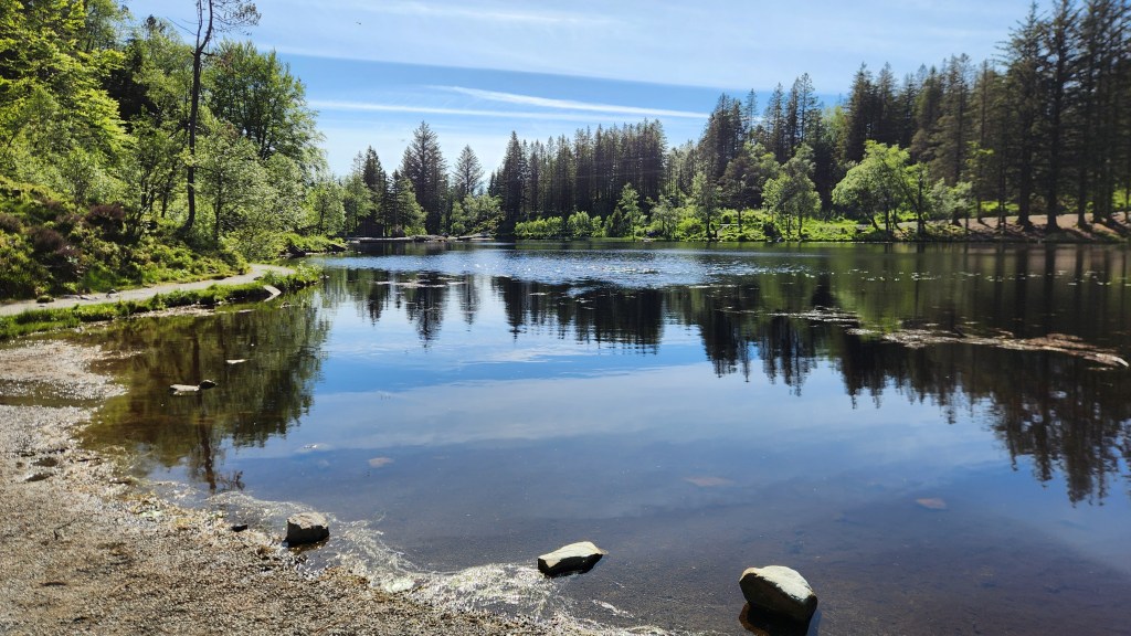
Lake on Mount Floyen
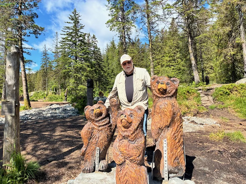
There also were Bears!
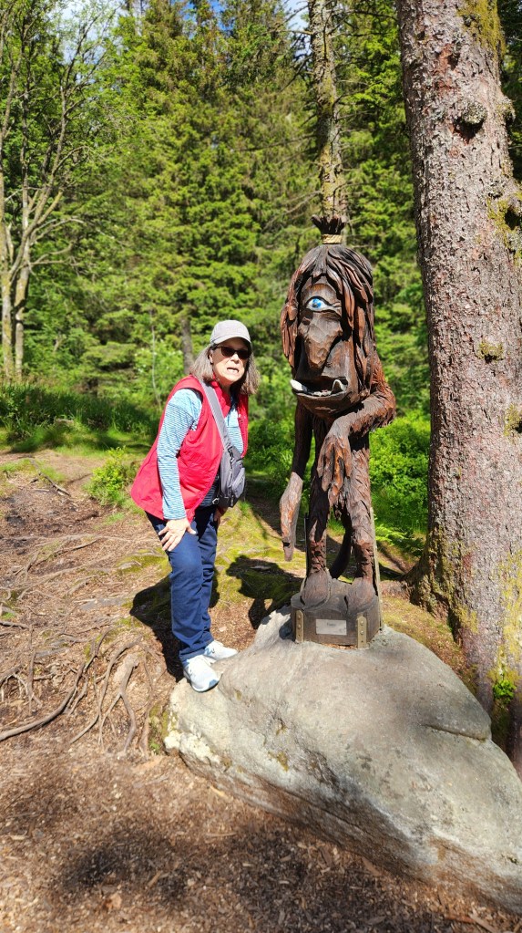
In the Troll Forest
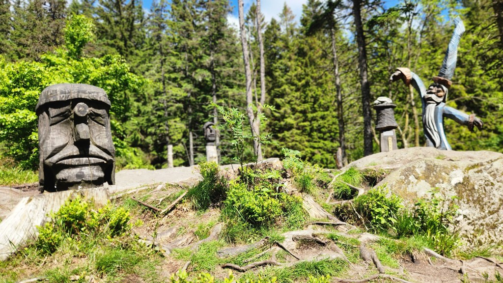
The Trolls Rule!
Trying to get on this guy’s good side …
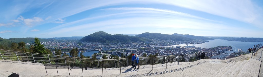
Panoramic View of Bergen from Mount Floyen

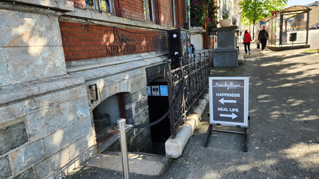
This concluded the pre-cruise portion of the journey, as we prepared to board our ship anchored in the Bergen harbor on Wednesday morning. But I’ll leave you with one final scene of a bar we passed on our way back to the hotel that may capture the spirit of at least some Bergen residents:

Okay, that’s it for Part 1, although there will be more about both Oslo and Bergen in the next Part. I hope you enjoyed the read and will come back for future installments covering the entirety of the Ocean Cruise. Stay tuned …

Pat and Dave’s (Almost) Redundant Road Trip Redo – PART 3: New Visits

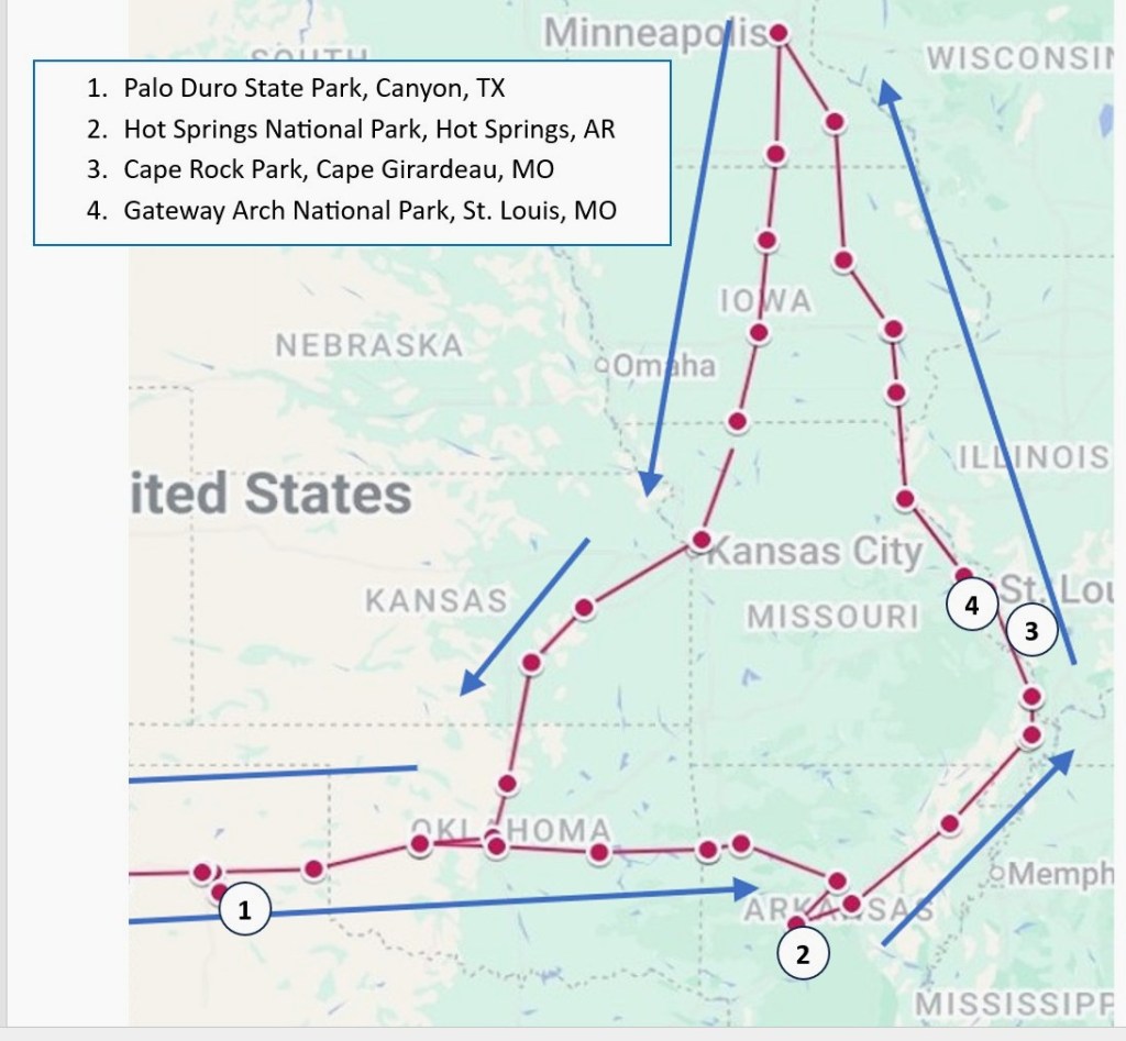
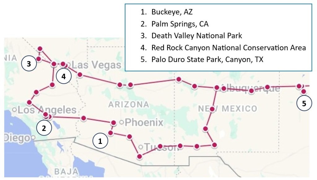
Part 1 of this travelogue covered our 6-week stay in Green Valley, AZ, which was essentially a repeat of last year’s Winter Warmup enlivened with a few new places we discovered this time around. Part 2 covered our travel to several more repeat sites as we began our circuitous trip back home. In this installment, as promised, I’ll finally cover some places we visited on our way back home that were new to us.  Here’s a map showing the places mentioned in this post.

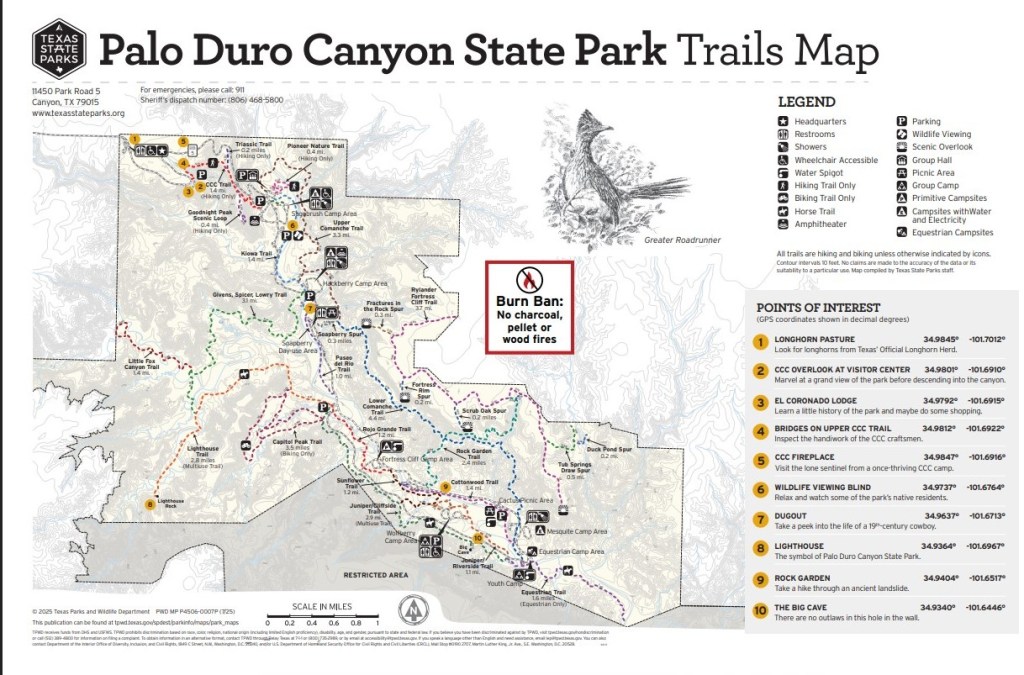
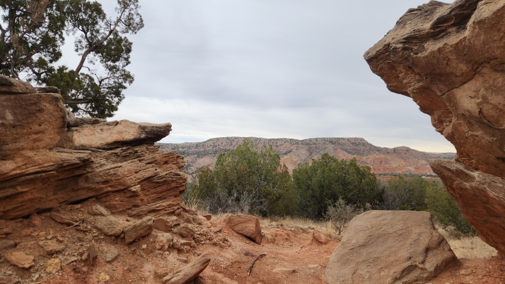
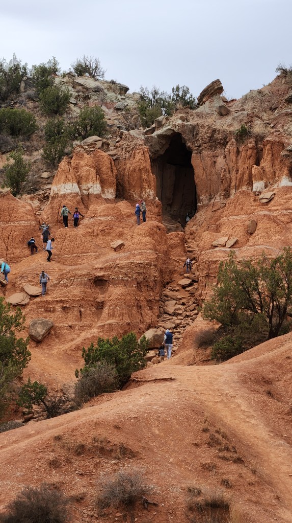
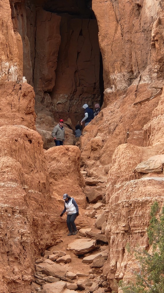
I already covered Palo Duro Canyon, which we visited for the third time on this trip, in Part 2, but I included it on the map simply to indicate how we got to our next destination. We left Amarillo, TX, after visiting Palo Duro, on Tuesday, March 17, and spent two days driving to Hot Springs for our next visit. I’ll pick up the narrative there.

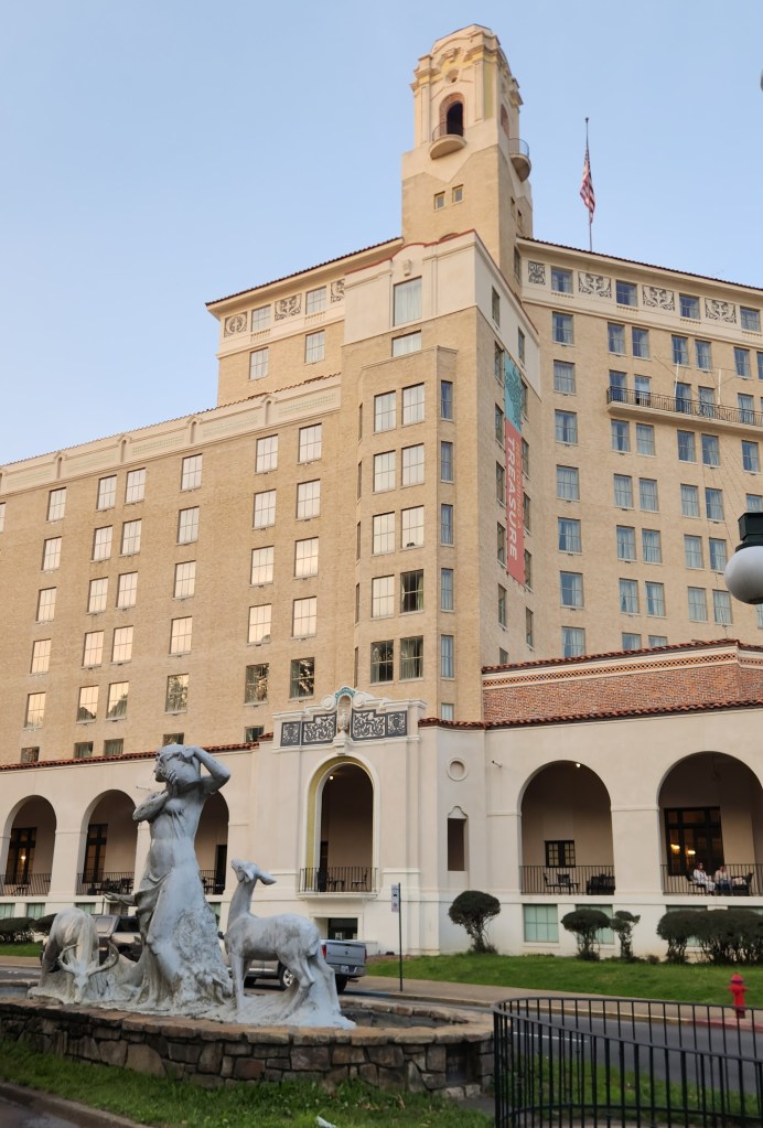
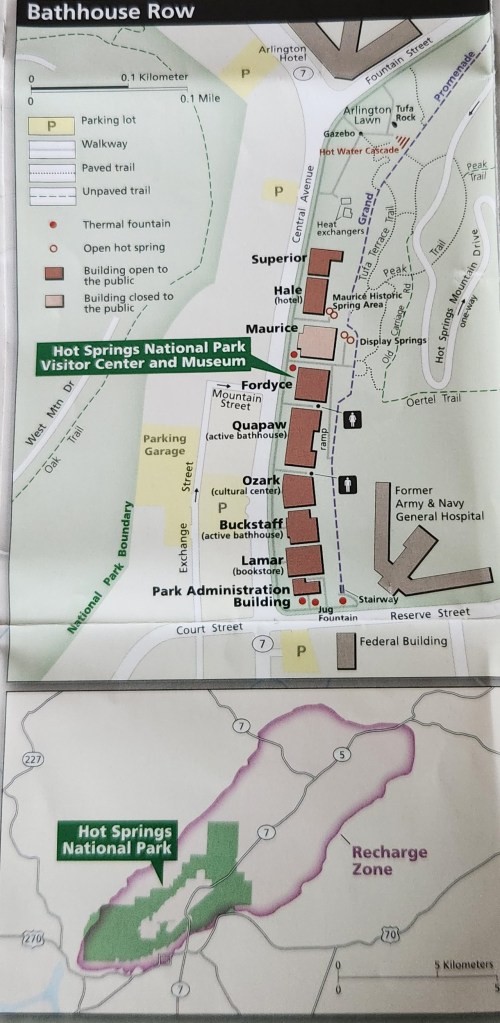
Hot Springs National Park, Hot Springs, AR: We arrived in Hot Springs on Wednesday afternoon and checked into the Arlington Resort Hotel and Spa, a historic landmark opened in its current form in 1924, replacing two previous structures from 1875 and 1893. To quote from the Google AI overview: “Located at the end of Bathhouse Row, it has hosted notable figures like Al Capone, Babe Ruth, and multiple U.S. presidents, offering thermal baths and a storied, luxurious past.” Pat and I decided to describe the hotel as “charming,” though it was very well-worn more than 100 years after its founding. The adjacent parking garage cost $20 a day, but that cost was offset somewhat by free EV chargers – even though three of the six spots were occupied by gasoline vehicles (grrrr!!), we were able to charge our car during our stay. The best thing about the hotel was its ideal location for visiting the National Park.

The Arlington Hotel Resort and Spa
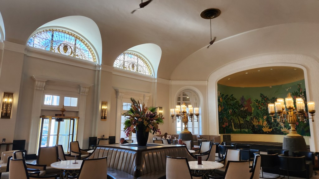
The Arlington Hotel Lobby

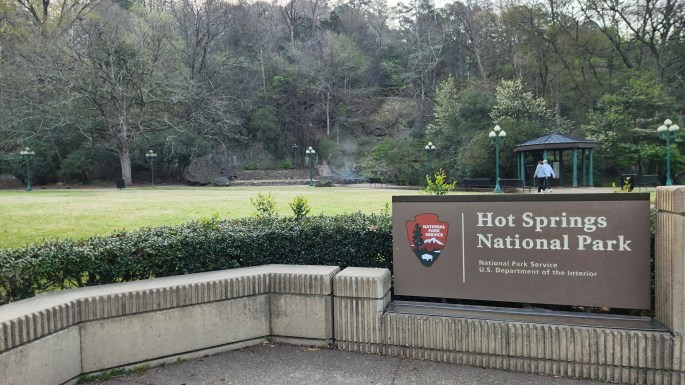
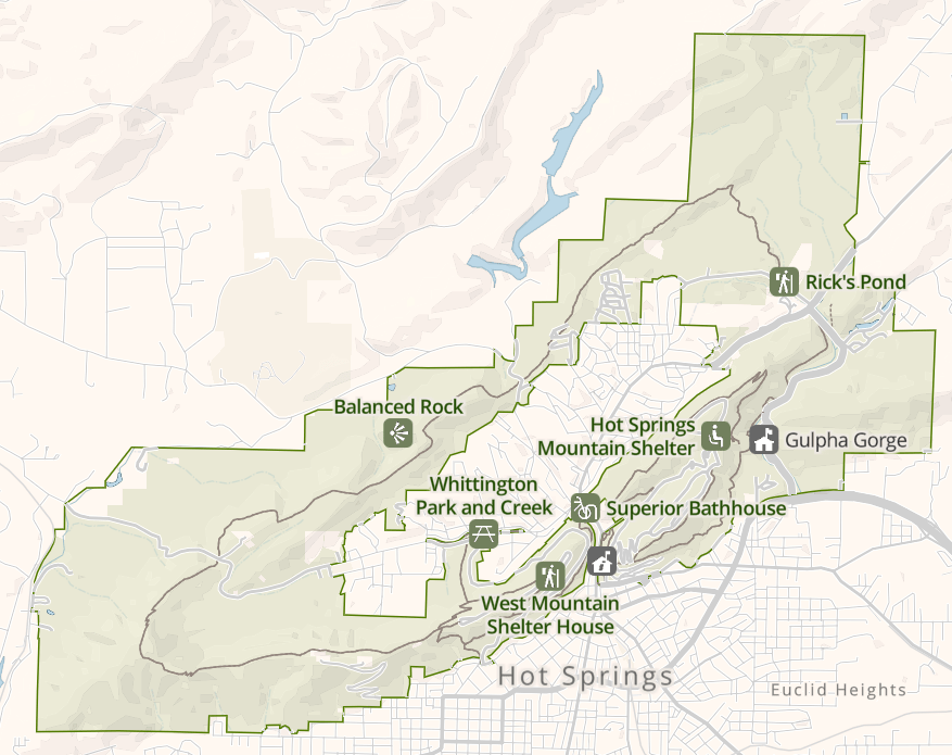
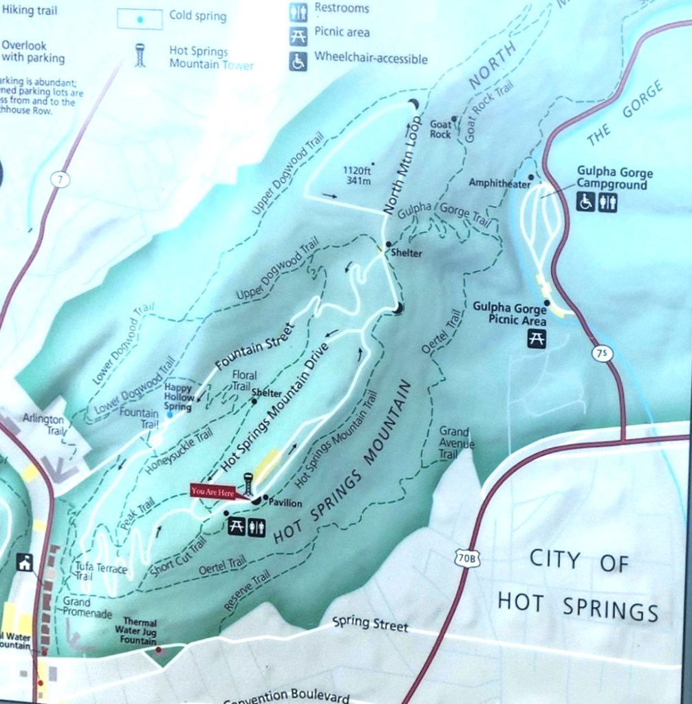
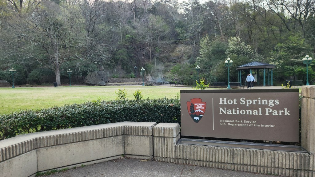
Hot Springs National Park was the 19th National Park, designated as such on March 4, 1921. However, in a way it is the oldest National Park. The Hot Springs Reservation was initially created by an act of Congress on April 20, 1832, to be preserved for future recreation, becoming the first area to be designated for federal government protection forty years before establishment of Yellowstone as the first National Park in 1872. The Hot Springs Reservation came under the management of the US Department of the Interior after that was created by Congress in 1849 and under the National Park Service when that was created in 1916.

There are 37 springs located within the park, in a valley among the Ouachita Mountains. They have been created by a natural, non-volcanic process whereby rainfall on the surrounding mountains infiltrates the ground and seeps deep into the earth (roughly 2,000 to 8,000 feet) through faults and fractures in sandstone and shale for some 4,000 years or more. The water is heated by the Earth’s natural internal heat (geothermal gradient) before rapidly rising back to the surface. The hot water then rises quickly back to the surface along other fault lines, taking only a few years to return, which prevents it from cooling down, resulting in water in the surface wells at an average temperature of 143°F (62°C).

The springs were enjoyed for their healing properties by many native tribes who settled in the valley (the “Valley of the Vapors”) for 8,000 years before their discovery by Spaniard Hernando de Soto in 1541. Around the 18th century the Caddo settled in the area, followed by the Choctaw, Cherokee, and other tribes from the Southeast across the Mississippi River. Ther tribes agreed to put aside their weapons and partake of the healing waters in peace while in the valley. Unfortunately, little detail is known about the native experiences since the remaining Quapaw Indians were forced onto a reservation south of the valley in 1818 and subsequently removed to reservations in Oklahoma in the 1830s, and the oral history has been mostly lost.

The city of Hot Springs grew up around the park area in a somewhat haphazard way with various competing entrepreneurs establishing cabins for visitors to the springs. Ownership disputes were often settled by violence before the city was incorporated in 1851. In the early 20th century, the city was known as the home to Major League Baseball spring training, illegal gambling, speakeasies during the Prohibition era, gangsters such as Al Capone, horse racing at Oaklawn Park, and the Army and Navy Hospital. Horseracing and the National Park seem to be the major draws today.

Hot Springs is the second smallest National Park, comprising only 5,500 acres within and around the city of Hot Springs. It is very accessible, with multiple hiking trails and several roads providing access to the main attractions. The Arlington is located literally across the street from a large lawn area featuring a National Park sign and one of the open hot springs. The others springs are located in the various bathhouses, most of which are no longer active and none of which we visited.

National Park Service On-Line Map
Inset from National Park Service Map
On-site Trail Map Sign

On Wednesday afternoon after checking into the hotel we walked to the park and then uphill along the Peak Trail for a quick look at the Mountain Tower before heading back into town for dinner. On Thursday morning, we took the car out of the garage and drove along two winding park roads, first the West Mountain Loop and then the North Mountain Loop. We made frequent stops for photos on both loops, stopped for a short hike along the Honeysuckle Trail followed by a visit inside the Mountain Tower (I bought a ticket to ride up to the top, but Pat stayed on terra firma while I did so), and finally went for a longer hike along the Goat Rock Trail. I was particularly interested in the diverse types of rock we saw along the way. The dominant rock is something called Arkansas Novaculite, a very hard, dense, fine-grained rock formed from silica, colored white, gray, or black, and there are also significant amounts of shale and sandstone, formed from deep marine deposits. There is also a spongy, soft rock formed at the surface when hot water cools and deposits minerals, called Calcareous Tufa, which is often found around the spring areas.

Arlington Lawn and one of many Hot Springs
Pat by the Hot Spring
Peak Trail
View from South Mountain Loop (Mountain Tower is on the left)
Portion of the Winding North Mountain Loop Road
North Mountain Loop Road
Honeysuckle Trail
View from Mountain Tower looking South (Arlington Hotel is in the center)
View from Mountain Tower looking North
Goat Rock Trail
Goat Rock Overlook
View from Goat Rock Overlook
Interesting Rocks …
… and More Rocks …
… and MORE Rocks …
… and EVEN MORE, this one taken in the city of Hot Springs … (Okay, enough already!)

We drove back to the hotel in the afternoon, plugged in the car again, and then walked back to the park for lunch at the Superior Bathhouse Brewery. After another stroll around the Arlington Lawn, we returned to the hotel in the late afternoon and vegged out for the evening. We thoroughly enjoyed our visit to the (sort of) oldest and second smallest National Park and felt that the two-day stopover was sufficient to get a thorough look at the place. We were also able to tick off one more National Park visited, our 30th of the 63 total in the US.

Cape Girardeau, MO: On Friday, we had a nice breakfast at a pancake house across the street from the hotel before heading north toward our next stopover in Sikeston, MO. We had reservations for Saturday and Sunday in St. Louis, but it was only a two-hour drive. As we continued northward, I couldn’t help but notice the mighty Mississippi showing up on the car’s navigation map, and I was surprised by how many bends it has. Since we had plenty of time, we decided to stop at Cape Girardeau along the way, where we could get a close-up look at the river. We found a fun little place called Cape Rock Park, located on a hill with a nice overlook, where I could easily imagine Huck Finn and Jim floating by on their raft. After that, we stopped in the town for a stroll next to the 16-ft high, 1.2-mile-long flood wall completed in 1964. The wall is designed to protect against a 54-ft high flood stage and demonstrated its value by defending against the 2016 record 48.86 ft crest. The wall also features an 1100-ft-long mural depicting the history of Missouri.

Mississippi River to the East of our Navigation Route
Steps up to Overlook at Cape Rock Park
View from Mississippi River Overlook at Cape Rock Park
Flood Wall at Cape Girardeau
Mississippi River by Cape Girardeau Flood Wall

Gateway Arch National Park, St. Louis, MO: We left Cape Girardeau around 12:30 PM and resumed our drive to St. Louis, where we checked into a hotel called the Hampton Inn St. Louis Downtown at the Gateway Arch (not exactly a pithy name, but quite descriptive) for another two-night stay. This hotel also charged $20 per night to park in their garage, the cost again offset a bit by access to free EV chargers, but the main attraction was its close proximity to the Gateway Arch National Park, which we visited on Saturday afternoon for an hour or so and for several hours on Sunday.

Gateway Arch is the fourth newest National Park, so designated on February 22, 2018. This designation was somewhat controversial, as opponents of the designation believed it was basically just a means for increasing tourism in St. Louis. In fact, the Department of the Interior recommended that it should remain a National Monument. However, Congress was swayed by the pro National Park arguments. It may have been a bold tourism promotion, but I for one was quite impressed with it and do not begrudge the name. Besides, this way we have added National Park number 31 to our growing list of parks visited. Gateway Arch is also by far the smallest of the parks at only 91 acres, less than 2% of the area at Hot Springs, previously the smallest, and minuscule in comparison with Death Valley’s 3.2 million acres and the even bigger parks in Alaska. While the tiny size is perhaps disappointing in a way, it is also great since every single bit of the place can be seen in just a few hours.

As to its history, the site was initially established as a National Monument to 1935 to commemorate: a) the Louisiana Purchase and subsequent westward movement of American explorers and pioneers, due to its location near the start of the Lewis and Clark expedition, b) the first civil government west of the Mississippi River, and c) the debate over slavery, as the park includes the preserved 1839 Old Courthouse where the infamous Dred Scott case originated. The dominant feature is the huge and well-known catenary arch. An international competition was held to select a design for the main monument, which was won by Finnish-American architect Eero Saarinen and German-American structural engineer Hannskarl Bandel in 1947. Construction of the arch took place from 1963 to 1965. It stands 630 feet tall and 630 feet wide at its base. The legs are 54 feet wide at the base, narrowing to 17 feet at the top. A unique tram system was built inside the structure to carry passengers to the observation room at the top of the arch, and a large underground museum was constructed beneath it. The arch sits in the middle of a large, grassy park crisscrossed by tree-lined walking paths and featuring two ponds populated by ducks,.

On Saturday, we strolled along several of the paths taking photos and getting oriented, and we returned Sunday morning to ride the tram and watch a well-made documentary movie about how Saarinen’s fanciful design was actually turned into something buildable by engineers and construction workers. One interesting fact we learned: while the original plans anticipated that up to thirteen construction workers might die due to the risky undertaking, there were no casualties at all.

On-site Map of Gateway Arch National Park
Pat and a few close friends by the Gateway Arch
The Old Courthouse, built in 1839
Mississippi River from Walking Path at Gateway Arch National Park
Pond at Gateway Arch National Park
End View of Gateway Arch
Downtown St. Louis from top of Arch (Busch Stadium at Left, Old Courthouse above Arch Shadow)
Mississippi River from Top of Arch

All in all, our visit to St. Louis and the Gateway Arch was very rewarding. We parked our car and plugged it in on Saturday afternoon and didn’t drive again until we left on Monday due to the easily walkable neighborhood with multiple nearby restaurants. Speaking of which, we had the best barbeque dinner ever on Saturday at a family-owned place called Five Aces Smokestaq Lightning.

I won’t report on the remainder of the trip as we returned uneventfully to our condo in Minneapolis, arriving at 4 PM on Tuesday, March 24th. I was originally intending to add a discussion with some fascinating data regarding road tripping with an EV, but I have since had second thoughts as to whether it might be fascinating to anyone other than me. If I do eventually decide to write that installment, it will come out as PART 4: A Tale of Two Teslas and a Dissertation on Drag. Don’t hold your breath, but either popular demand or my irrepressible nerdiness may yet prevail.

At any rate, thanks for reading, and I hope you enjoyed this travelogue!

Pat and Dave’s (Almost) Redundant Road Trip Redo – PART 2: More Repeat Visits

Part 1 of this travelogue covered our 6-week stay in Green Valley, AZ, which was essentially a repeat of last year’s Winter Warmup enlivened with a few new places we discovered this time around. While we very much enjoyed the warm weather and the relaxation associated with a long-term stay, we were eager to move on as we packed up the car on Friday, March 6, and headed westward. This installment covers several of the stops we made during our circuitous return to Minneapolis, all of which we’d done during previous road trips. (As Steely Dan put it back in the 1970’s, “You go back, Jack, do it again …,” although I’d say our repeat choices were much better than those of the unfortunate subject of that song.)

Here’s a map showing the interesting places we visited during the stretch from March 6 through March 16 followed by brief descriptions of those visits.

Buckeye, AZ: Since we’d allowed for three travel days to make the relatively short drive from Green Valley to our next booked destination in Palm Springs, we decided to stop for a couple of days in Buckeye along the way. This was based primarily on our great memories from Pat and Dave’s Excellent Adventure (Part 4) in 2018 as well as The Saaris’ (Sorta) Safe Sojourn (Part 8) in the Covid times of 2021. During both of those trips, we stayed at an RV park in Buckeye and went hiking at the Skyline Regional Park.

This time around, we stayed in a hotel, but on Saturday, we again hiked the Turnbuckle Trail at Skyline, a 3-mile loop which we also covered in 2018. The views were spectacular and the hike was demanding enough to get our hearts pumping, even though its difficulty was only rated as “Moderate.” While the intervening six years didn’t seem to have slowed me down too much on the uphill portions, I definitely needed my walking sticks to navigate the rocky portions on the final downhill leg.

Map of Hiking Trails at Skyline Regional Park
Panorama Picture on the Turnbuckle Trail
View from Turnbuckle Trail
Going up was fairly smooth …
Coming down, not so much

Loyal readers may recall that on both of our previous visits to Buckeye, we dined at a terrific pizza place called Ciao Grazie, so naturally in the “do-it-again” spirit, we had to go there again after our Skyline hike. We had shown a tiny bit of independent spirit, however, on Friday night, when we dined at a nice Indian restaurant called Punjabi Dhaba that was quirkily located inside a large truck wash.

Palm Springs, CA: On Sunday, we drove to the Omni Rancho Las Palmas Resort and Spa near Palm Springs. I would call it the most upscale place we’ve ever stayed at in our lives – a sprawling place with multiple buildings, swimming pools, tennis courts, and a golf course – although our hotel room did show some signs of wear. The reason we had booked such an un-Saari-like place to stay was simple: Pat wanted to go see some matches at the BNP Paribas Open tennis tournament in Indian Wells, and I wanted to play some golf in the Palm Springs area. So, we decided to splurge on a tennis travel package offered through the official tournament site that included a 3-night stay at a fancy hotel, reserved seats for two all-day sessions at the tournament, and a shuttle service to take her to and from the tournament site.

Pat with her Tournament Pass outside our Room at Omni Rancho Las Palmas Resort
Wildlife at Rancho Las Palmas Resort
Oops … done in by the greenskeeper!

We both thoroughly enjoyed our separate activities. Pat saw a total of eight tennis matches on Monday and Tuesday during the middle rounds of the tournament, with top players including Jannik Sinner and Aryna Sabalenka, the eventual tournament winners, while I played golf at the Cathedral Canyon Golf Club on Monday and at the Rancho Las Palmas course on Tuesday.

The Indian Wells Tennis Stadium
Great View from Pat’s Seat on Tuesday
Aryna Sabalenka at BNP Paribas Open
Jannik Sinner at BNP Paribas Open
18th Hole at Cathedral Canyon Golf Club

I should point out that these activities also were repeats of things we did during previous visits in 2019 and 2021, although the fancy hotel was quite an upgrade from our earlier stays in a nearby RV park. Also, I must add that while I chafed in the non-denim pants I brought along expressly to play at the pretentious Coachella Valley courses, I did try to salve my blue-collar sympathies by booking half-price greens fees through GolfNow and dining at McDonald’s on Tuesday evening.

Death Valley National Park, CA: My original hope when we set off on this trip was that we could visit Yosemite National Park after the stay in Palm Springs, though we hadn’t booked anything as we wanted to see how things developed with weather conditions. That would have been something new for us, a real departure from the redundant aspects of the trip. However, as our stay in Green Valley was ending, the reports we saw online indicated that much of the park was still inaccessible due to snow. As a result, we shifted our sights to Death Valley, another familiar site from our earlier RV trips that we knew would be warm and snowless. As a result, we reserved a 2-night stay in Pahrump, NV, yet another place where we had stayed on our previous trips, and drove there on Wednesday.

We drove from our hotel in Pahrump to the Death Valley National Park on Thursday morning and spent several hours exploring the park. One difference from our previous visits was that we entered the park from the north this time, rather than from the west as we had during our two previous visits, and were rewarded by the beautiful view from that direction.

View of Death Valley from North Entrance Road

Death Valley is famous for being the hottest, driest, and lowest National Park. Here’s a quote from the National Parks website:

“In this below-sea-level basin, steady drought and record summer heat make Death Valley a land of extremes. Yet, each extreme has a striking contrast. Towering peaks are frosted with winter snow. Rare rainstorms bring vast fields of wildflowers. Lush oases harbor tiny fish and refuge for wildlife and humans. Despite its morbid name, a great diversity of life thrives in Death Valley.”

True to these words, we enjoyed the great diversity evident in the park. The yellow and purple wildflowers were blooming to a much greater degree than during our previous visits, and we again enjoyed visiting the Badwater Basin salt flats and driving the stunning Artist Drive loop. We enjoyed lunch and ice cream in two of the eateries in Furnace Creek and strolled on a path that meandered through a portion of the golf course as well as the on-site hotel buildings while we recharged the Tesla at a conveniently located – and free – EV charger before heading back to Pahrump.

Central Plaza in the Oasis at Furnace Creek, Death Valley National Park
Salt Flats at Badwater Basin, Death Valley National Park
No need for walking sticks here …
View from Death Valley Wilderness Road
Artist Drive Loop
View from Artist Drive Loop
View from Death Valley Wilderness Road

As an added highlight to this visit – and something new as well! – we went to a local winery, the Artesian Cellars, and enjoyed a nice meal along with tastings of five different local wines. This was something we had tried to do back in 2021, but the restaurant was closed at that time due to Covid.

Red Rock Canyon National Conservation Area, Clark County, NV: As we sat in our hotel room in Pahrump the night before departing, we realized that our subsequent travels would take us directly past the National Conservation Area that we had visited back in 2021. Naturally, in the “do-it-again” spirit, we decided we should visit there again on this trip. So, I reserved a timed-entry slot on the Recreation.gov site for 9 AM on Friday, March 13. We arrived at the entry gate shortly after nine and spent an hour motoring around the 13-mile Scenic Drive loop, stopping frequently to ogle at the stunning scenery.

Map of Scenic Drive at Red Rock Canyon National Conservation Area
View from Scenic Drive

Palo Duro Canyon State Park, Canyon, TX: After our Red Rock Canyon visit, we spent two days travelling east to Amarillo, TX, where we stopped for a 2-night stay and another “do-it-again” visit, this time to the nearby Palo Duro Canyon State Park. Not to sound like a broken record, but yes, we had visited this place during both of our previous RV adventures and had very fond memories of the place. Palo Duro is known as the “Grand Canyon of Texas” and definitely lives up to the name. The visitor center is located on the rim of the 120-mile-long, 20-mile-wide canyon. After passing the visitor center, we descended on an amazing, scenic road with multiple hairpin turns and switchbacks that winds down some 800 feet to the canyon floor. The well-maintained, 16-mile loop road continues through the portion of the canyon that is open to the public, with access to over 30 miles of hiking trails and multiple campgrounds. On our previous visits, we stayed in the RV at the Hackberry Campground, located about halfway along the loop road, and the Mesquite Campground at the westernmost end. We drove past both of these sites on our trip around the loop, eliciting a raft of fond memories.

As we traversed the loop road, we stopped at a number of turnouts to take photos and took a short hike to a point of interest called the Big Cave (number 10 on the map above). I ventured partway up the steep climb to the cave, but even with my walking sticks I felt too wobbly to go the whole way. Pat was more adventurous, but I decided discretion was the better part of valor and instead documented her exploits from afar. She went inside the cave before returning to the base where I was waiting.

View from Trail at Palo Duro Canyon State Park
The Big Cave at Palo Duro Canyon State Park
Pat Returning from the Big Cave
Pat decided to take a picture of me on her way back …
… while I was photographing her
View from Trail at Palo Duro Canyon
Capitol Peak at Palo Duro Canyon
Unfortunately, we ruffled some of this Road Runner’s feathers

After that, we walked a short way along the Capitol Peak trail before heading to the Trading Post for a lunch of their “world-famous” burgers. We then took another short hike on the Pioneer Nature Trail before heading back up to the rim for a final stop at the visitor center with its spectacular overlooks into the canyon.

Palo Duro Canyon Access Road
View from Visitor Center Overlook

I’ll wrap up this episode here, as we depart from Palo Duro Canyon. Stay tuned for the next installment, in which we actually visit some places we’d never been to before!

Pat and Dave’s (Almost) Redundant Road Trip Redo – PART 1: Overview and Green Valley

Overview: It seems that each year, as we grow older, winter in Minneapolis becomes less attractive. Last year, we went on a road trip during February and March, which I dubbed Pat and Dave’s Winter Warmup and documented in a four-part travelogue post. Since we thoroughly enjoyed it, we decided to do it again this year. Better prepared this year than last, I managed to secure a reservation for a six-week stay at the same place, the Canoa Ranch Golf Resort in Green Valley, AZ, from January 25th through March 6th.

As part of last year’s Winter Warmup, we also took a couple of weeks visiting various National Parks and other attractions on the way back home, so we decided to do a similar thing this year. Given the timing of this year’s trip, Pat suggested we go west to California after our stay at the Canoa Ranch Resort, specifically to Indian Wells so she could attend a few sessions of the BNP Paribas Open tennis tournament. I readily agreed, since I’d be able to play a couple rounds in the golfing paradise known as Palm Springs while she watched tennis. We had done the same thing previously, during Pat and Dave’s Excellent Adventure (Part 10), so this road trip was shaping up to be pretty much a repeat of things we’d already done in the past. However, we didn’t actually book anything other than the six-week stay in Green Valley and a three-day tennis tournament package at the Omni Rancho Las Palmas Resort in Palm Springs, including two all-day tickets and shuttle service for Pat to attend the tournament. We agreed to decide on other places to visit after that, depending on weather conditions and spur-of-the-moment impulses.

As our departure date neared, the cold weather in Minneapolis was wearing us down. To add to the misery, our beautiful city was invaded by a horde of out-of-control ICE agents, resulting in mass protests which only intensified after the murder of Renee Good on January 7th. We had planned to leave on January 20th, and as we began cramming stuff into our trusty 2020 Tesla Model Y and mounting our e-bikes on the bike rack, we were feeling very depressed and in desperate need of a getaway to someplace not only warmer but safer.  On the other hand, we felt somewhat guilty abandoning our fellow citizens during such a time of need, so it was with mixed emotions that we set off on Tuesday morning, January 20, with the temperature hovering near zero Fahrenheit.

We had opted to take our older Tesla because it has a hitch receiver for our bike rack, and we wanted to bring our e-bikes along to enjoy during the six-week stay in Green Valley. We knew from past experience that the extra aerodynamic drag from the bikes would reduce the range of our EV, having used the bike rack during a trip to St. George, UT, back in 2022, but this time it was significantly worse because we had also encased the bikes in a protective cover that flapped away like mad behind the car. I’ll describe the effect on the car in considerable detail in the final episode of this travelogue, but for now suffice it to say that we barely made it to our first planned charging stop, a mere 92 miles away in Albert Lea, MN, and quickly realized that we were going to have to stop nearly twice as often as we’d hoped for car charging, turning the long road trip into a tedious series of short hops. At least we saw some interesting scenes along the way, such as this sunset as we passed into Missouri on Tuesday evening.

Sunset Over Missouri, January 21, 2026
Sunset over Missouri, January 21, 2026

To make matters worse, a huge storm was developing along our planned route, so we needed to travel some 1300 miles – at least into New Mexico in order to beat the weather – in only three days rather than the four we had planned on. Wednesday the 21st was the worst day, as we left our hotel in Kansas City ay 8 AM and arrived at our hotel in Amarillo, TX, at 12:45 AM on Thursday. But as we settled in to a hotel in Las Cruces, NM, at 9:30 PM Thursday evening, we saw on the news that the route behind us had become unpassable due to unprecedented heavy snow, and it felt as though we had dodged a bullet.

As a result of this frantic dash, we arrived at the Canoa Ranch Resort two days earlier than our reserved date, travelling for most of the last day in steady rain that occasionally escalated to torrential downpours. Luckily, the resort was able to accommodate our early arrival, and we settled in to our rented condo on Friday the 23rd at 6:30 PM. By Saturday morning the rain had stopped and we began to look forward to some pleasant weather, although the news from home was terrible as another of our fellow Minneapolitans, Alex Pretti, was murdered by ICE and CBP agents. Our travel travails paled in insignificance compared to this depressing news, but we at least felt that we had escaped an intolerable situation and vowed to make the best of our good fortune.

I won’t try to write a detailed chronological description of the (Almost) Redundant Road Trip Redo, especially since many of the days were quite uneventful, but I’ll try to capture the highlights. First off, here’s a map of the overall journey, which covered 6,600 miles over 65 days:

Here’s a summary of the chronology:

  • January 20 – January 23: Driving from Minneapolis, MN to Green Valley, AZ.
  • January 23 – March 6: Stayed at Canoa Ranch Golf Resort. Visited sites in the vicinity.
  • March 6 – March 8: Stayed in Buckeye, AZ. Visited Skyline Regional Park.
  • March 8 – March 11: Stayed at Omni Rancho Las Palmas Resort. Pat attended the BNP Paribas Open and Dave played golf. While our original thought had been to visit Yosemite National Park following our stay here, news of heavy snowfall in or near the park persuaded us to change course and visit Death Valley National Park instead. We also decided to return to Minneapolis via a southern route rather than through the Colorado mountains (as we did last year) and catch two new (to us) National Parks along the way.
  • March 11 – March 13: Stayed in Pahrump, NV. Visited Death Valley National Park.
  • March 13 – March 14: Visited Red Rock Canyon National Conservation Area, a spur-of-the-moment decision. Overnight stay in Flagstaff, AZ.
  • March 14 – March 15: Overnight stay in Albuquerque, NM.
  • March 15 – March 17: Stayed in Amarillo, TX. Visited Palo Duro Canyon State Park.
  • March 17 – March 18: Overnight stay in Van Buren, AR.
  • March 18 – March 20: Stayed at The Arlington Resort Hotel, Hot Springs, AR. Visit Hot Springs National Park.
  • March 20 – March 21: Overnight stay in Sikeston, MO.
  • March 21 – March 23: Visited Cape Rock Park, Cape Girardeau, MO. Stayed in St. Louis, MO. Visited Gateway Arch National Park.
  • March 23 – March 24: Overnight stay in Coralville, IA.
  • March 24: Returned to Minneapolis.

I’ll expand a bit on the highlights mentioned above in this and the subsequent Parts of the travelogue.

Green Valley, AZ (January 23 – March 6): I documented our time in Green Valley during last year’s visit in Pat and Dave’s Winter Warmup, so I won’t go into much detail about this year’s activities. The following paragraphs touch on some highlights.

  • The Condo: We stayed in the same condo unit as last year and again enjoyed the beautiful views from the balcony. The weather was generally excellent, with only a few days that felt too hot and one or two days with light rainfall. We took many walks and bike rides in the area around the resort, and Dave managed to play golf ten times at the Canoa Ranch Golf Club (a short walk from the resort) and three times at Torres Blancas Golf Club (a ten-minute drive). Our stay at the condo definitely qualified as a Redundant Redo, except for the bikes, which we didn’t have last year.
Sunset View from the Balcony
Lunar Eclipse and Blood Moon view from Balcony (I know it’s blurry — it’s 238,900 miles away!!)
A Friendly Visitor on the Balcony
Elephant Head and MMT Observatory view from Balcony
Our Final Bike Ride in Green Valley
Don Quixote also likes our bike route …
Fourth Hole at Canoa Ranch Golf Course
  • Catalina State Park: This State Park is located 16 miles north of downtown Tucson. We camped here with our RV back in 2021 during The Saaris’ (Sorta) Safe Sojourn, so this again qualifies as a Redundant Redo. Here are some photos from this year’s hike.
Catalina State Park
Catalina State Park
Catalina State Park
  • Saguaro National Park East: We also visited this National Park, located about 20 miles east of downtown Tucson, during The Saaris’ (Sorta) Safe Sojourn, so this also qualifies as a Redundant Redo. We drove around the well-maintained Cactus Forest Loop Road, stopping frequently at various overlooks for photos and short hikes.
Saguaro National Park
Javelina Rocks at Saguaro National Park
  • Madera Canyon: We visited here during last year’s stay in Green Valley, so again – Redundant Redo. We hiked along the same trail we made a futile attempt at last year and, while we got quite a bit farther this time, about a mile, I had to give up well before the desired objective. Even with my walking sticks, the trail just got too rocky and precarious for me – not to mention that it is almost all uphill. Nevertheless, this is a beautiful place and we enjoyed our visit.
Madera Canyon
Old Baldy Trail at Madera Canyon
Trail doesn’t seem so bad …
Still passable …
Getting worse …
Okay, I give up!
The friendly deer was sympathetic to my plight
  • Tubac Presidio State Park: You guessed it – we did this last year also. The trail we took here was much easier than at Madera Canyon, and parts of it follow the historic Juan Bautista de Anza trail followed in 1775-76 by a Spanish delegation travelling to the San Francisco Bay to establish the Presidio and mission there. It would have taken us a bit too long to go all the way to San Francisco, so we turned back after a couple of miles.
Tubac Presidio State Park
Apparently livestock aren’t allowed on the trail …
  • Historic Canoa Ranch: Yup, did it last year. It’s only a mile from the Resort, and it has a lovely 2.5-acre man-made pond inhabited by waterfowl and surrounded by desert plants. A Cienega, or marsh, was also created north of the pond to provide enhanced habitat for wildlife. The de Anza trail also runs alongside the park.
Canoa Pond at Historic Canoa Ranch
Desert Flora at Historic Canoa Ranch
  • Buenos Aires National Wildlife Refuge: OHO! This was something new for us! We drove to the town of Arivaca, about 30 miles southwest of the Canoa Ranch Resort along a scenic, winding road, where we stopped at a General Store. I bought some delicious root beer (WBC, I think it was), and on our way out of town we stopped at this previously undiscovered Wildlife Refuge. The area we walked through was just a small part of the 117,464-acre refuge. The original settlement of the area took place in 1864 when Pedro Aguirre, Jr. built a homestead in the Altar Valley, naming it “Buenos Ayres” (good air) and establishing a ranch, which over time became a significant livestock operation. Decades of overgrazing and fire suppression had turned the grassland into shrubland when the U.S. Fish and Wildlife Service purchased the ranch in 1985 under the Endangered Species Act, specifically to prevent the extinction of the masked bobwhite quail. The refuge uses prescribed burning to restore native grasses, reduce mesquite trees, and enhance the landscape. We spent an hour or so walking the easy trails but didn’t see any wildlife, probably since we were there during the hot afternoon. Maybe we’ll visit again someday in the morning or evening when the animals might be out.
A new site for us!
Buenos Aires National Wildlife Refuge
What a cool bench!
  • Fred Lawrence Whipple Observatory: This one was a half been-there-done-that. We had tickets for a tour during last year’s visit, but Pat got sick and couldn’t make it. However, I enjoyed the tour very much, so we got tickets again this year and both went. The Observatory is the largest satellite facility of the Smithsonian Astrophysical Observatory (SAO), part of the Center for Astrophysics | Harvard & Smithsonian. Located​ on Mt. Hopkins about 12 miles southeast of the Canoa Ranch Resort​, this remote site is home to a number of telescopes, including the 6.5-meter MMT Observatory. The observatory also includes the Very Energetic Radiation Imaging Telescope Array System (VERITAS) gamma-ray observatory, a 4-telescope array designed to find Earth-like exoplanets, and a number of other telescopes used for a wide range of astronomical observations. The tour specifically covered the VERITAS, but the Visitor Center included a number of interesting exhibits on a range of astrophysics topics. (We had a small world encounter when some other visitors enquired about my Grand Marais sweatshirt – they live in the town on Lake Superior where we have our summer home.)
View from Visitor Center at Fred Lawrence Whipple Observatory
Number 1 of 4 in VERITAS Array
Number 2 of 4 in VERITAS Array
  • Steward Observatory and Richard F. Caris Mirror Lab: Another new one! We learned about this place, which is located at the University of Arizona in Tucson, during our tour at the Fred Lawrence Whipple Observatory, as the Mirror Lab manufactured the large mirror used in the MMT telescope. This lab manufactures the largest telescope mirrors in the world, using an advanced process to cast glass over honeycomb structures in a rotating furnace. The curved mirror surfaces are then polished to incredibly tight tolerance levels to provide the sharp focus and clarity needed for today’s advanced optical telescopes. A fun fact from our tour guide: during the fifteen minutes she took to explain the polishing process, our fingernails had grown more than the tolerance of the polished surface! The lab has produced something like 20 mirrors in 40 years, and no other manufacturer in the world can match the lab’s capabilities. We also learned that the Astronomy Department at the University of Arizona has the largest contingent of astronomy professionals in the entire world. This was a very informative and interesting tour lasting about an hour – I highly recommend it for Tucson visitors.
Richard F. Caris Mirror Lab
  • Community Performance and Art Center (CPAC): Finally, I’ll mention one last new thing we did in Green Valley this year – attend a concert at CPAC. This concert featured four musicians playing 17th century instruments, a harpsichord, two violins, and a cello. Their repertoire included works by well-known composers as well as some composed by the players themselves. While they were not quite at the level of excellence that we regularly experience when we listen to the St. Paul Chamber Orchestra, they were very enthusiastic and engaging, and we enjoyed the concert very much.

So, in summary, at least the first part of this adventure was indeed an (Almost) Redundant Road Trip Redo. Okay, that’s enough for Part 1. Stay tuned for more Parts to come …
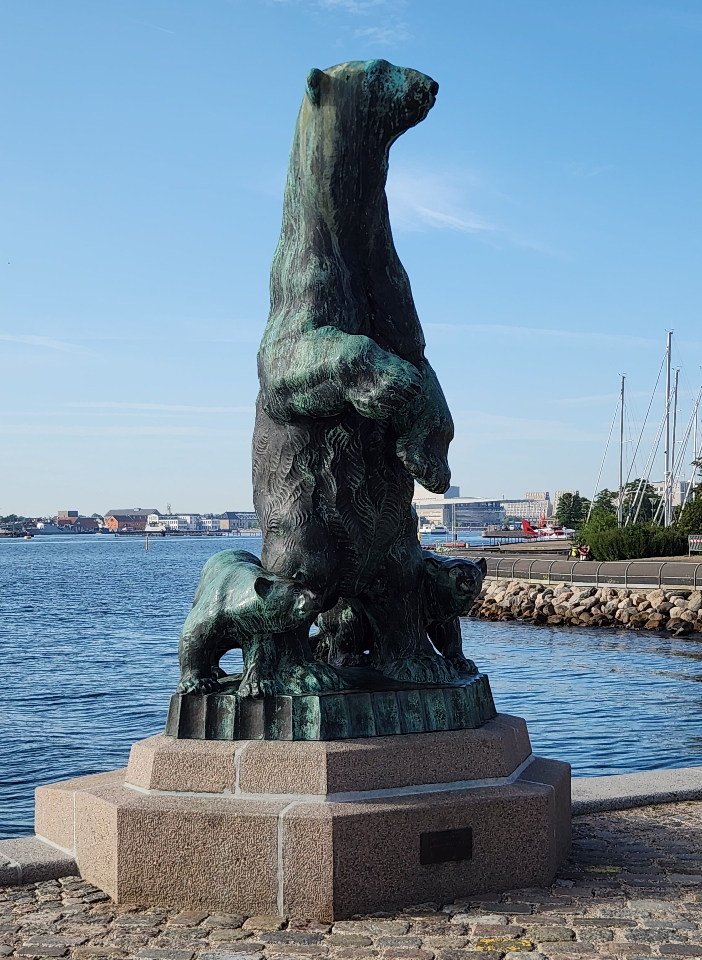
Pat and Dave’s Mediterranean Moments – PART 4: Athens and Classic Greece

Welcome back for the concluding Part 4 of this travelogue series. Part 3 ended as we returned from our first tours of Athens for our final night abord the Viking Neptune, anchored in the Port of Piraeus. Here’s the final map of the journey, showing the places I’ll describe in this narrative.

Now let’s continue the story …

Athens, Greece (Sunday, November 9, 2025): Before we left the ship, I took one last photo of the port.

View from the Port of Piraeus

After breakfast, Pat and I and some 25 or so fellow travelers departed by bus for what the Viking itinerary called “The Full Acropolis Experience.” Before I describe that, here’s some very abbreviated history. Athens is one of the oldest named cities in the world, having been continuously inhabited for some 5,000 years. It became the leading city of ancient Greece in the first millennium BCE. The Acropolis (roughly translated as “high city”) sits on a rocky outcropping overlooking the city. Ancient Greeks built several impressive temples and monuments there, including the Parthenon, the Propylaea, the Erechtheion, and the Temple of Athena Nike, in the fifth century BCE. Over the following centuries, Athens fell under the control of various empires, including the Macedonians, Romans, Byzantines, Latins, Venetians, Florentines, and eventually the Ottomans, in the 15th century.

The Ottomans had little interest in ancient Greek cultural sites and began using the Parthenon as a storage site for gunpowder. During a siege by Venice in 1687, the Temple of Athena Nike was dismantled by the Ottomans and its materials used to fortify the Parthenon. Then, a Venetian mortar shell hit the gunpowder cache in the Parthenon, causing an explosion that severely damaged the structure. The Venetians briefly occupied the city before abandoning it once again to the Ottomans. Significant portions of the remaining structure were looted during the following years, and Athens lost much of its wealth and power. During the 18th century, the city began to regain its stature, but the ruling Ottomans still had no interest in ancient Greek culture.

Enter one Thomas Bruce, 7th Earl of Elgin, a rather shady British nobleman who became ambassador to the Ottoman Empire in 1798. Lord Elgin cut a controversial deal with the Ottomans under which he had about half the surviving Parthenon sculptures, as well as sculptures from the Erechtheion, the Temple of Athena Nike, and the Propylaea, removed and shipped to Britain in order to establish a private museum on his personal estate. However, the ship laden with these treasures sank in a storm off a Greek island shortly after sailing, and much of the cargo was lost. Elgin mounted a costly recovery effort, eventually bringing all of his booty back to England, but he incurred so much debt that he was forced to sell the entire collection to the British Museum in London in 1816, where they are proudly displayed to this day as the “Elgin Marbles.” (As a side note, Pat and I saw the impressive display at the British Museum back in 2016 during a Rick Steves tour of London, where our guide defended Elgin’s acquisition as a noble effort to save them from looting under the Ottomans, with no mention of his less-than-honorable intentions.)

In 1983, the Greek government formally asked the British government to return the collection to Greece and listed the dispute with UNESCO, but the British government and the British Museum declined UNESCO’s offer of mediation. In 2021, UNESCO called upon the British government to resolve the issue at the intergovernmental level, but so far nothing has been resolved. A large part of the British argument for retaining the collection has been that the Greeks had no suitable place to properly display them and did not have the capability to properly maintain them. Which finally brings me to the first stop on our “Full Acropolis Experience” tour – The Acropolis Museum in Athens.

The Acropolis Museum is a beautiful, modern structure located a short walk from the Acropolis hill. It was completed in 2009 to replace an older museum and to house all of the artifacts found on the Acropolis, specifically including the missing pieces of the Parthenon, Erechtheion, Temple of Athena Nike, and Propylaea that now reside in London. Here is a photo of one portion of the Parthenon display, with some of the original pieces alongside plaster models of the pieces that will hopefully be returned by the British Museum someday:

One of the Parthenon Statue Segments — Museum of the Acropolis
More Examples

It was hard not to believe that the original marbles belong here, in Greece, next to the Acropolis, and not in a London museum, no matter how hard the British may try to justify past ethical lapses.

Moving on, the museum is also chock full of other gorgeous artifacts from the Acropolis, such as those below. (Unfortunately, I only managed to get these few photos due to the congestion, but hopefully you can get a feel for the place.)

Column Bases — Museum of the Acropolis
Exhibit at the Acropolis Museum

After the museum tour, our group walked up the hill to the Acropolis itself to marvel at the 3,000-year-old structures as well as stunning views of Athens and its surroundings. Since I’ve already written more words than I had originally intended, I’ll simply show the photos, which as we all know are worth a thousand words each.

The Parthenon
The Erechtheion
Ancient Stones on the Acropolis
View of Athens from Acropolis Hill
View from Acropolis Hill, including Theater of Dionysus and Museum of the Acropolis
View of the Herodion Odeon from the Acropolis

Following the Complete Acropolis Experience, our bus transported us to a hotel called the NJV Athens Plaza, where we would spend the next days while completing our tour of Classic Greece. The hotel is conveniently located in the well-known Plaka District of Athens, next to Syntagma Square, a popular and busy square which is also adjacent to an Athens Metro stop and the Hellenic Parliament Building. There are also multitudes of nearby shops, restaurants, museums, and other interesting sites in the vicinity, some of which I’ll describe below.

After we checked into the hotel, I strolled over to the Hellenic Parliament building to watch the hourly changing of the guard ceremony, a fascinating ritual in which two Evzone (Presidential Guard) sentries stationed outside the building are replaced by fresh troops. The Presidential Guard is an elite ceremonial unit founded in 1868 to guard the Tomb of the Unknown Soldier in front of the Parliament. The elaborate uniforms and the ceremony’s choreography trace back to Greek resistance fighters who battled the Ottoman occupation; their shoes include hobnails designed for traction in the snowy, mountainous regions of Greece, and the “pompoms” on the toes are said to have once concealed knives for defending against their enemies. Here’s an edited video of the ceremony that I took while watching (unfortunately my vantage point was not directly in front since I arrived too late for a prime, central viewing spot) and some photos I took afterward.

Changing of the Guard
The Fresh Guards in Place
Memorials at Tomb of the Unknown Soldier
Hellenic Parliament and Tomb of the Unknown Soldier

Interestingly, when we passed by the Parliament the following Tuesday, the guards were wearing different uniforms as seen below, which I later learned were the cold-weather version rather than the ceremonial version worn on Sundays.

Guards in Cold-Weather Uniforms

I checked out the area around the square before returning to the hotel, telling Pat I’d found a good place for a quick dinner. However, by the time we got back there it had closed, so we wandered around for a half hour before deciding on a nice outdoor dining spot for some tasty Greek pizza.

Corinth, Epidaurus and Mycenae, Greece (Monday, November 10, 2025): At 7:30 Monday morning, we departed for a bus tour of ancient sites on the Peloponnese Peninsula. We stopped along the way near Corinth, where we saw a 4-mile-long canal that connects the Ionian Sea with the Aegean Sea, cutting through the narrow Isthmus of Corinth, which separates the peninsula from the Greek mainland. The first attempt to build a canal there was made by Roman Emperor Nero in 67 AD, but an actual canal was not completed until 1881. Since it is much too small for modern ships, it has little commercial value today, but tourists like me love to see it anyway.

The Corinth Canal

After the canal, we traveled on to Epidaurus, where we visited the Sanctuary of Asclepius, a famed healing center of ancient Greece where early physicians learned much about the human body and how to treat the ailments of the time. Many Greek physicians (possibly including Hippocrates?) learned their trade at the sanctuary, named for Asclepius the Healer, said to be a son of the god Apollo and reportedly born in Epidaurus. The site includes an impressive Odeon, or theater, which is still used for performances today due in large part to its excellent acoustics, as well as a museum displaying many artifacts from the sanctuary.

Theater at Sanctuary of Asclepius
I forgot to mention … it was raining
Display at Epidaurus Museum
Statue of Asclepius the Healer
Artifacts at Epidaurus Museum
At Least Pat Kept her Head …

After Epidaurus, we stopped for lunch at a family-owned restaurant before driving on to Mycenae, which was one of the major centers of Greek civilization in the second millennium BCE. It was a military stronghold, an acropolis, that dominated much of southern Greece, Crete, the Cyclades and parts of southwest Anatolia. Multiple grave sites have been found in the surrounding area as seen in the photo below, and archaeological exploration is ongoing.

Architectural Site at Mycenae

We climbed up the hill and passed through the Lion Gate to view the foundations of Agamemnon’s Palace, the Tomb of Agamemnon, and the Treasury of Atreus. I was especially impressed by the precise masonry work in which enormous stones were fitted together precisely to create the impregnable walls of the fortress. The fact that such works could be built 3,000 years ago is a tribute to ancient Greek technology. Once again, I’ll try to let the photos do the talking …

The Lion Gate — Entrance to the Fortress at Mycenae
Interior of Lion Gate
Massive Stones Placed by Ancient Masons
Ruins of Agamemnon’s Palace
View from Fortress at Mycenae
This Feline was Enjoying the View

Our final point of interest was a huge underground chamber nearby, perhaps a tomb built for one of the noble inhabitants of the palace. Once again, what impressed me was the massive scale of the construction.

Underground Chamber
Interior of Chamber

The return trip was slowed by brutal traffic as we neared Athens, and we didn’t make it back to the hotel until 5:30 PM. Pat wasn’t interested in any dinner, so after a brief rest, I ventured out into the square to take in the ambience as well as some very non-Greek food (the details of which I will only mention in private to anyone who presses me for details).

Delphi, Greece (Tuesday, November 11, 2025): We departed the hotel at 7:15 for another bus trip, this time to the site of the ancient Oracle at Delphi. Fans of the Greek classics know that the Oracle was responsible for all sorts of tragedies, as various protagonists went to learn their fates and then spent years trying in vain to prevent them from occurring. Luckily, no such tragedy has befallen us, as the Oracle was not in during our visit. Her place of business was beautiful, however – yet another example of the amazing architectural achievements of the ancient Greeks.

The site, in the shadow of Mt. Parnassus, was originally sacred to Gaia, the Earth goddess, but later became a temple to Apollo, who, in some myths, killed Gaia’s serpent child, Python, to claim the site from her. Our first point of interest was a replica placed at the location of the Omphalos, or “navel of the world,” believed by the ancient Greeks to be the center of the world, discovered by two eagles dispatched by Zeus.

Replica of the “Navel of the World” at Delphi

From there, we climbed up the hill to see the entrance to the Temple where the Oracle received visitors, the magnificent theater, and the site of an ancient race track where chariot races were held, not to mention spectacular views of the surrounding countryside.

Entrance to The Oracle’s Temple
Walls and Remnants at Delphi Site
Remnants at Delphi Site
Theater at Delphi Site
Overlook of Theater and Scenic Surroundings
Massive Blocks with Ancient Inscriptions
Closeup of Inscriptions
Impressive Masonry Work

After touring the site, we proceeded to the adjacent Delphi Archaeological Museum, where we saw the original Omphalos along with many other ancient artifacts.

Model of Delphi Site in Ancient Times
Original Omphalos at Delphi Archaeological Museum
Statue at Delphi Archaeological Museum
Display of Artifacts at Delphi Archaeological Museum
Column Base at Delphi Archaeological Museum

After a very filling lunch at another family-owned restaurant, the Omphalos Tavern, we headed back toward Athens. The return trip took even longer than Monday’s trip as traffic approaching from the northwest was even more brutal, and we didn’t make it back to the hotel until after 8 PM, making for quite a long day. We again dined at a restaurant near the hotel, enjoying actual Greek fare this time.

Athens, Greece (Wednesday, November 11, 2025): All of the organized Viking activities were over at this point, leaving us a day to wander about Athens at our leisure. We began the day by wandering around the Plaka District; the sites we saw included some ruins uncovered during excavation for the Metro system, Hadrian’s Arch, the ruins of the Temple of Olympian Zeus, the Panathenaic Stadium (site of the first modern Olympics in 1896), the Zappion Exhibition and Congress Hall, and the National Gardens.

Ruins Uncovered During Metro Excavation
Hadrian’s Arch and View of Acropolis Hill
Hadrian’s Arch — Opposite View
Ruins of Temple of Olympian Zeus
Panathenaic Stadium
Panathenaic Stadium Vital Statistics
Pathway in National Gardens
Foliage in National Gardens
1848 Century Hermitage for Gardener, now a Children’s Library
Exhibition and Congress Hall Near National Gardens
Acropolis Hill Viewed from Exhibition and Congress Hall Grounds
Acropolis Hill Viewed from Walkway Near National Gardens

After that, we visited the nearby Museum of Ancient Greek Technology, which we were inspired to do by our earlier visit to the Archimedes Museum in Olympus as well as general awe at the technological achievements we’d seen over the past days. The museum had many impressive exhibits about ancient Greek inventions – such as an early computer, a hydraulic pump, an endless screw, a machine for creating enlarged or reduced copies of objects, even wine-serving robots! – as well as an extensive collection of ancient musical instruments.

Ancient Computer for Calculating Dates
Ancient Hydraulic Fire Pump
Ancient Hydraulic Endless Screw
Replicas of Ancient Wine-Serving Robots — 3rd Century BCE
Ancient Instrument

We then had a lunch of pita sandwiches at a small bistro before continuing to wander through the Plaka District, encountering various interesting buildings and other sites along the way.

Interesting Building in Plaka District
Orthodox Church in Plaka District
Statue in Plaka District

We capped off the day with our final Greek meal at the nearby Ella Restaurant before returning to the hotel at 8 PM for an early night’s sleep.

Final Thoughts: We got up Thursday morning at 3 AM, had our final included breakfast, and sleepily boarded a shuttle van which delivered us to the Athens International Airport. After a 29-hour trip (from wake-up in Greece to crash in our condo, including layovers in London and Chicago along the way), we returned safely back to our Minneapolis home. Since our return, I’ve been reflecting on the outstanding experience we had on the trip and appreciating how fortunate we are to be able to enjoy so many such experiences during our Golden Years of retirement. At the same time, having returned from the birthplace of democracy to a nation whose founders took their inspiration from the ancient Greeks, I feel somewhat depressed by the efforts underway by the current US administration to rewrite history, to retreat from the ideals set forth by those founders, and to undo the progress we as an immigrant nation have made over nearly 250 years to better define and more fully achieve those ideals. But the trip also helped me put the current situation in perspective. The first, though imperfect, democracy was established in ancient Athens starting in 507 BCE, 2532 years ago. Over the subsequent millennia, there have been many setbacks and steps forward throughout the world, yet the dream of democracy still persists. Now is not the time to give up hope. I urge all my readers to stay strong and help turn the tide in the right direction again.

Okay, that’s it for our monumental Mediterranean Empires tour. I hope you enjoyed the read and will come back in the future for more of my travelogue series.

Pat and Dave’s Mediterranean Moments – PART 3: Corfu, Olympia, Santorini, Athens

Welcome back for Part 3 of this travelogue series. Part 2 concluded as we sailed away from Kotor, Montenegro, down the Adriatic Sea toward Greece. Here’s a map showing the places I’ll describe in this part of the travelogue: Corfu, Olympia, Santorini, and Athens, all in Greece.

Now let’s continue the story …

Corfu, Greece (Wednesday, November 5, 2025): After sailing overnight from Kotor, we docked in the Corfu Cruise Port Terminal on the island of Corfu (known as Kérkira in the Greek Language) at about 8 AM on Wednesday. Here’s a map showing the Island and our docking port:

Our shore excursion began with a bus trip through the countryside to the Kanoni viewpoint, a popular lookout spot high above the harbor of Corfu Town named for the old cannon facing the sea. From there, we had beautiful views of the Straits of Corfu and the Greek mainland in the distance. The most famous island near Corfu town is called Mouse Island, supposedly for its mouse-like shape; the island is famous for its Byzantine church and connection to the Odyssey legend. Closer to shore sits the 17th century Vlacherna Monastery, situated nearby on a separate islet connected to the mainland by a causeway.

View from Kanoni Viewpoint
The Kanoni

The bus then delivered us to the Corfu Town marina. Across the water we could see the Old Fortress, built by the Venetians in the 15th century on a site originally fortified by the Byzantines in the 12th century. The fortress was isolated from the mainland by a large moat and was used for successful defense of the city during multiple sieges by the Ottomans in the 16th century. The fortress has two towers, or peaks, which gave rise to the name of the Island – the Byzantine Greek word “Koryfó,” meaning “city of the peaks,” refers to the two peaks of the old fortress.

Corfu Town Marina
The Old Fortress

We then had a brief walking tour before setting off on our own to explore the city. Here are some of the sights we saw.

Greek Orthodox Church in Corfu Town
Interior of the Church
Government Buildings in Corfu Town
Main Square in Corfu Town
“,,, a Church I Passed Along the Way …” (with apologies to The Mamas and Papas)
And Another One …
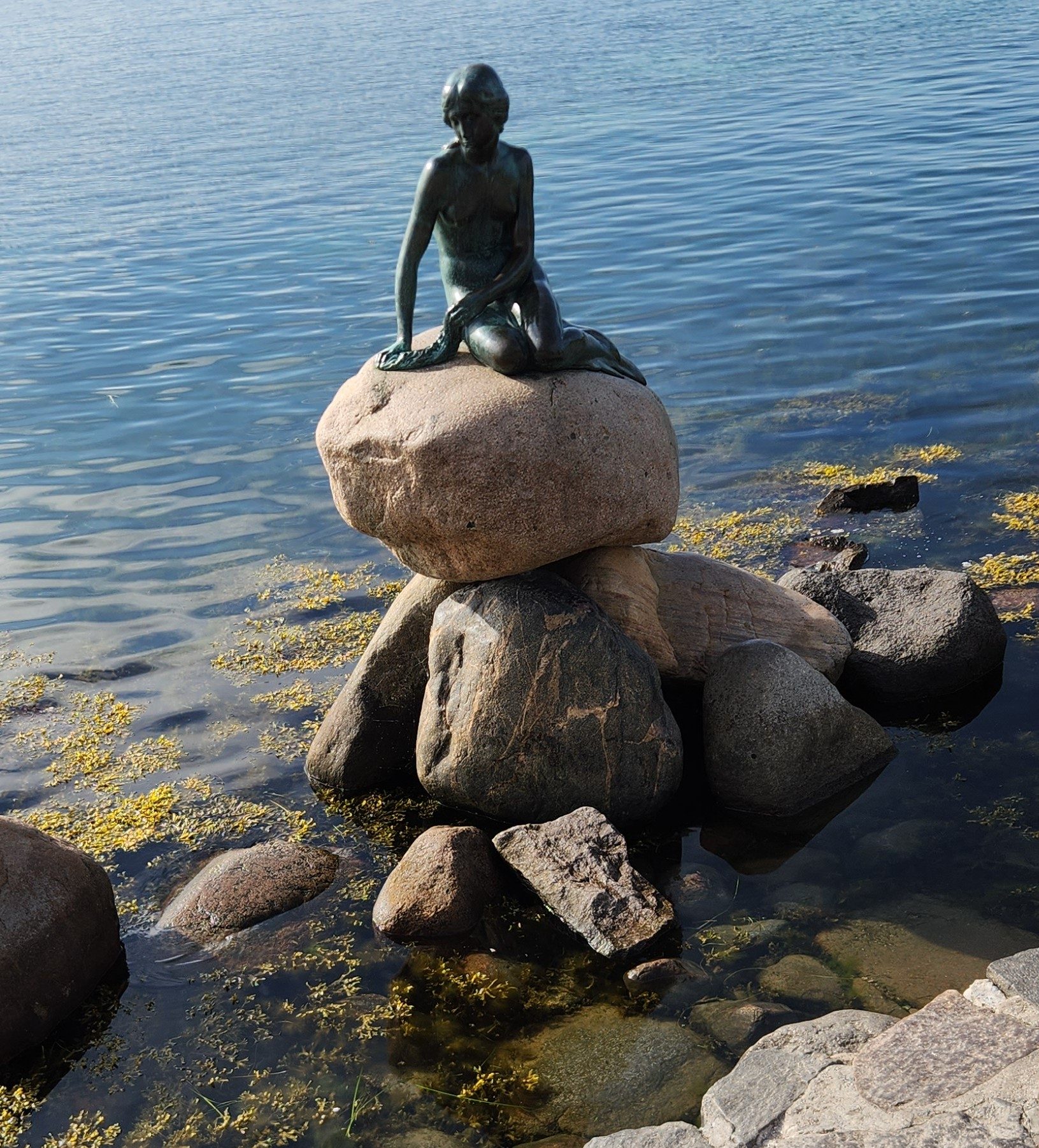
Of particular interest to me was the so-called New Fortress. It was built after the first major Ottoman siege of 1537 to provide additional fortification for the city, beginning in the mid-1570s. We were told that it was open to the public for tours, so we spent about an hour wandering around its periphery trying to find the entrance, but when we finally found the ticket booth, it turned out to be closed for renovations.

Rear Walls of the New Fortress
Symbol of the Venetian Republic
Main Gate to New Fortress
Sculpture at the Old Fortress
New Fortress Walls Near Public Entrance

We still enjoyed the outing, however, which carried us through a good portion of the city before we returned to the marina to catch a Viking shuttle bus back to our ship. Here’s a final look at the Straits of Corfu as the ship sailed off for our next destination.

Leaving Corfu

Olympia, Greece (Thursday, November 6, 2025): On Thursday morning the ship docked at the port in Kotakolon, on the northwestern edge of the Peloponnese Peninsula. Kotakolon serves as the main port for access to the ancient site of Olympia. Here’s a map showing Corfu, Kotakolon, and the ancient site:

From the port, we departed for a 20-mile, 40-minute bus ride to the ancient site of Olympia, where the original Olympic Games were held every four years from 776 BCE until they were abolished in 393 AD by the Roman Emperor Theodosius I, who banned pagan festivals like the Olympics as part of his efforts to suppress paganism and promote Christianity.

We spent a couple of hours on an extensive tour of the site, which was definitely among the highlights of the trip. I’ve included photos to try and portray the vast extent of the site and the amazing degree to which the ancient ruins have survived for up to 2,800 years. ’ll also pass along some of the interesting tidbits we learned from our local guide:

  • The Olympic athletes were all male and competed in the nude, slathered with oil and covered in dust, with the aim of paying tribute to the god Zeus. Women were banned under penalty of death, except for the priestess of Demeter, goddess of fertility, who had a reviewing stand next to the stadium altar. One exception to the death rule was Kallipateira of Rhodes — she disguised herself as a male trainer to watch her son compete but, when caught, was pardoned because her father, brothers, and son were all Olympic champions.
  • There were, however, separate competitions for unmarried women known as the Heraia Games, in honor of the goddess Hera, in which the participants raced a shorter course at the Olympic stadium while clad in costumes with short skirts.
  • During the celebration of the games, the Olympic truce (ekecheiría) was announced so that athletes and religious pilgrims could travel from their cities to the games in safety.
  • The prizes for the victors were olive leaf wreaths or crowns.
Ancient Olympics Site
The Prytaneion — Seat of Dignitaries and Site of Celebratory Feasts
Mosaic Illustrating Chariot Raceing
Site of the Running Stadium with Viewing Stand

The path to the stadium is lined with bronze statues known as Zanes, which were paid for by athletes who cheated during the games. Known as the walk of shame, the walls feature inscriptions by the miscreants including their names and the misdeeds for which they were being punished, such as bribery, lying about their city-state, or other acts against the integrity of the games. The display was a reminder to all athletes entering the stadium of the importance of honesty and integrity.

Walk of Shame
Description of the Zanes

After our tour of the Olympics site, we strolled into the nearby town of Olympia for lunch and a brief stop at a small museum dedicated to Archimedes. Photos were prohibited, so I can’t show any of the exhibits, but they were quite impressive, detailing many of the Greek genius’s inventions and relating the sad story of his death at the hands of a Roman soldier during the siege of Syracuse in 212 BCE, despite Roman orders to spare his life. (NOTE: We later went to a much larger ancient technology museum in Athens that also featured Archimedes; I’ll describe that in Part 4.)

After the shore excursion, we were driven back to the ship for departure shortly after 3 PM. I took this photo of the Port as the ship was preparing to depart:

Kotakolon Port

Santorini, Greece (Friday, November 7, 2025): On Friday morning around 9 AM, the Neptune dropped anchor in the waters off the island of Santorini, or Thi̕ra in Greek. Santorini in its present form was created by an enormous volcanic eruption circa 1600 BCE. The eruption destroyed the Minoan settlement at Akrotiri, as well as communities and agricultural areas on nearby islands and the coast of Crete with subsequent earthquakes and tsunamis. What remained behind is a partial caldera, the hollow that remains after a volcano disgorges its contents. Here’s a map of the island showing its configuration and the Neptune’s anchor point.

For our shore excursion, we boarded a tender boat operated by the local Greek authorities, which deposited us on shore. We then boarded a bus for a zig-zagging trip up the steep slope to the rim of the caldera and the capital city of Fira and then on to the village of Oia (pronounced “ee-ya”). In Oia, we had a brief walking tour before heading off for exploration on our own and lunch at a nice café, where we had lamb and Moussaka accompanied by an excellent Santorini wine. The village is known for its beautiful vistas, cliffside whitewashed buildings, blue-domed churches, and stunning sunsets over the caldera. (Unfortunately, the overcast skies hampered the views and we had to leave before dark so did not see the sunset. Such is life …)

View of Oia and the Caldera
View from Oia — Caldera Basin and Viking Neptune at Anchor
A Couple of Gentlemen Enjoying the Vibe in Oia
Oia Church and Clock Tower
Church in Oia
Park Area in Oia

Earthquakes caused by a nearby underwater volcano have damaged some buildings over the years, such as this house we saw as we wandered around.

“Captain’s House” Damaged by Earthquake

As in many Greek towns, cats are to be seen all over the place. Donkeys are also still used to transport goods from the harbor below, and we were lucky enough to encounter some during our stroll along the main pedestrian street.

Cat Roaming the Main Pedestrian Street of Oia
A Tribute to the Donkeys
Donkeys Delivering Goods in Oia

I was particularly taken by the remains of a castle on the edge of the village and naturally had to clamber around taking photos.

Remains of the Old Castle
View of the Sea from the Old Castle

Once it was time to return to the ship, we took a very steep cable car ride down to the harbor below Oia. Two other tourists who rode in the same cable car with us seemed scared nearly witless, but to me it was a suitable thrill to cap off a thrilling day.

The Cable Car Ride — Going Down
Looking Up from the Harbor

In the harbor, we caught another tender boat that returned us to the Viking Neptune. Here are a photo I took from the tender and one final look back at the harbor and Oia as the Neptune began to sail away shortly after 5 PM.

Buildings Near the Harbor
Looking Back at Oia from the Ship

Athens, Greece (Saturday, November 8, 2025): Our ship arrived in the port of Piraeus, the largest of three ports serving the capital city of Athens, at 8 AM Saturday morning. Shortly after, we left for a half-day shore excursion to the city of Athens during which we saw the major sights out the bus windows before stopping for a thorough tour of the National Archaeological Museum. I’ve included some photos from the museum below. (I didn’t get any good photos from the bus, but don’t worry – you’ll see plenty more of Athens coming up in Part 4.)

National Archaeological Museum in Athens
Archaeological Museum Exhibit

After returning to the ship, we set off again by bus back into Athens for a very enjoyable tour of the city on E-bikes, along with some 18 fellow Viking passengers (all senior citizens like us). For the most part, our ride followed spacious pedestrian boulevards, though we did need to intermingle with cars in a few areas. While a couple of the wobblier riders had spills and suffered minor scrapes along the way, nobody was seriously injured. The main difficulty was starting to ride again after our various stopping points because we had to ride so slowly, often dodging among hordes of pedestrians and motorbikes. Pat and I were unscathed, although her bike died about halfway through. Luckily, our guide, a fit young man some thirty or forty years younger, traded bikes with her and pedaled manually up some of the steepest hills. Here are some photos of the spectacular scenery we encountered during the ride.

E-Bike Tour Near Odeon of Herodes Atticus
Site of Ancient Agora Viewed During E-Bike Tour
Site of Ancient Cemetery Viewed During E-Bike Tour
The E-Bikers with Acropolis Hill in Background

Then it was back to the ship again via the Viking shuttle bus.

Okay, that’s it for Part 3. I hope you enjoyed the read and will come back for Part 4, which will cover the post-cruise extension in Athens including the most famous sites of Classic Greek culture.

Stay tuned …