
In Part 1 of this series, I described our travels from Minneapolis, MN to Pigeon Forge, TN, where we stayed at a VRBO rental called Golf Vista, on Dollywood Lane. (Alas, we did not visit Dollywood, though we were close enough to hear the choo-choo train that presumably ferried visitors around the park.) This episode focuses on the five days we spent in the Great Smoky Mountains area.
Friday, April 19, 2024: For our first day’s foray, we drove to the Great Smoky Mountains National Park (the 20th National Park we have visited so far).
Getting there was surprisingly slow as we crawled our way through Pigeon Forge. It turned out that we were in town during the weekend that Pigeon Forge was hosting an annual event called the Rod Run – a hugely popular auto show with multiple venues and events – and the roads through town were absolutely packed with visitors. Once past Pigeon Forge, however, traffic was moderate and we moved along quickly.
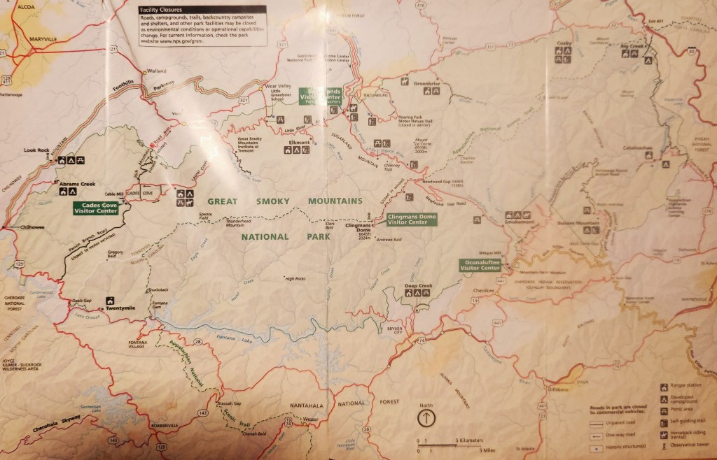
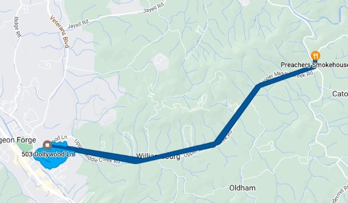
We learned that this National Park also does not charge for admittance, like the New River Gorge in West Virgina, once again rendering my lifetime Senior Pass moot. However, visitors are required to display parking passes if they plan to stop for 15 minutes or more to visit the various visitor centers, points of interest, or hiking trails. We bought a one-week pass for $15, which seemed very reasonable. Our driving route on Friday is shown on the image below (from my Google Timeline).
The Timeline approximates the route as a series of straight lines, but the roads in the National Park wind their way through the woods and are often quite narrow.
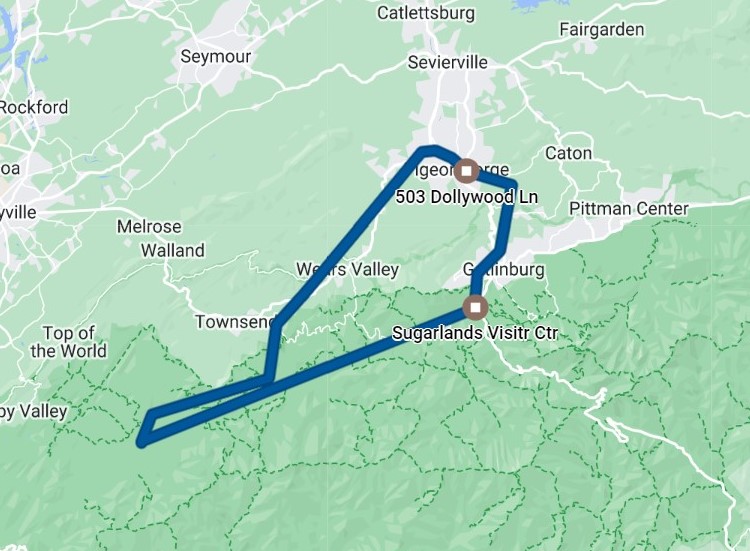
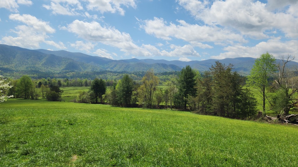
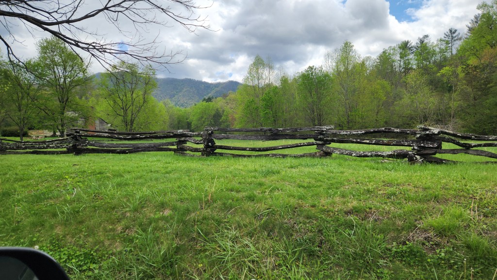
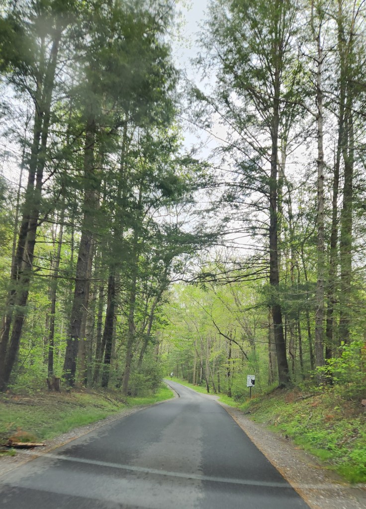
Virtually every road we drove on in the park was very smooth and well maintained, however, making for a very scenic and enjoyable drive. Our first destination was the so-called Cades Cove Loop, an 11-mile road at the southwest corner of the route shown in the Timeline above. The loop is a narrow, one-way road in the area where the earliest residents had their farms and homesteads, with designated parking spots on either side at various overlooks and points of interest. Many historical buildings have been restored and maintained, including an old mill originally powered by water from a creek that flows nearby – the water still flows from the creek through a long, wooden flume to the water wheel.
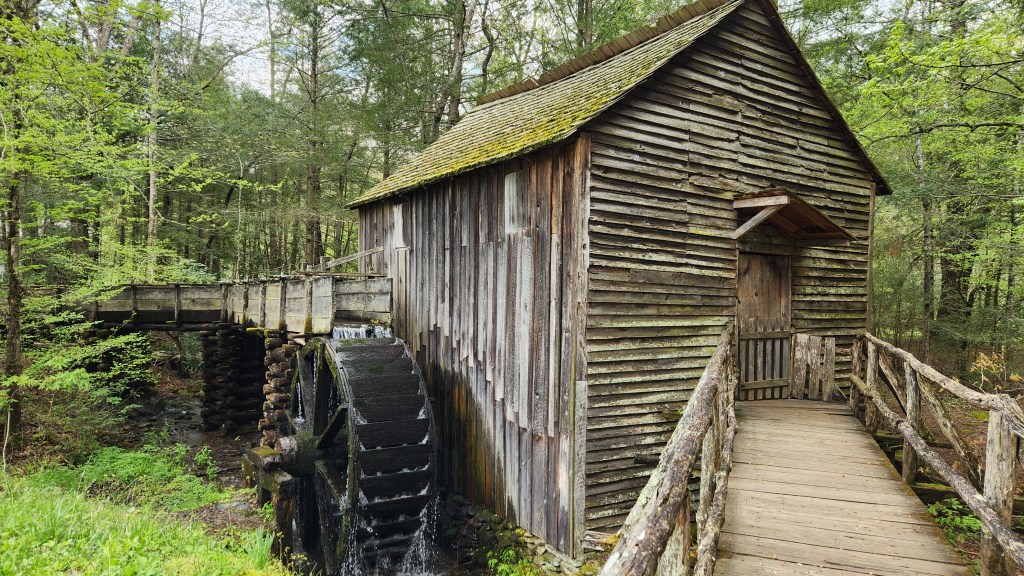
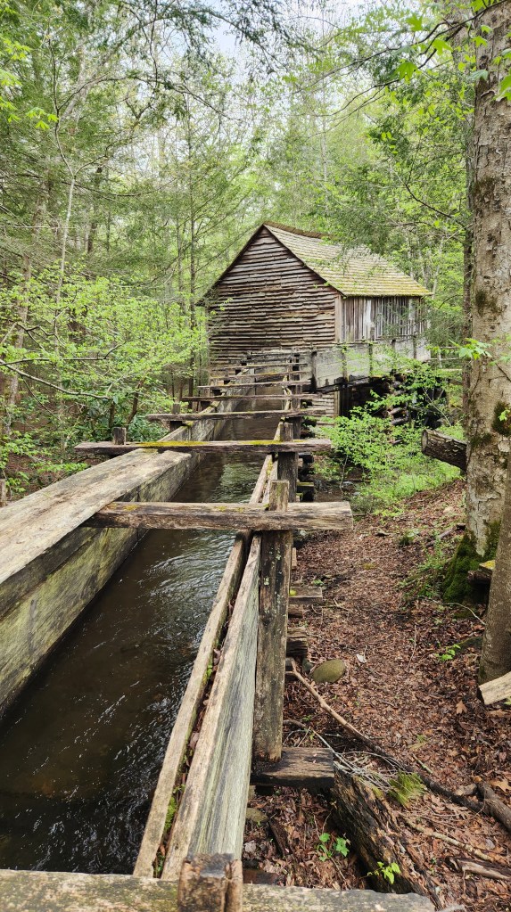
It took us a couple of hours to make the circuit, including several photo stops and a walking visit in the vicinity of the Cades Cove Visitor Center. The loop road was pretty busy, with frequent slowdowns or stoppages as cars pulled into and out of the parking areas. We understand that during the summer peak season the loop road is more like a parking lot, so we were happy to be visiting during a quieter time. After Cades Cove, we drove to the Sugarlands Visitor Center for a brief stop and then back to home base on Dollywood Lane. Here are some photos from the Cade’s Cove loop and the road to the Sugarland Visitor Center.
For the return trip, our navigation system sent us along something called Gnatty Branch Road, which was just as narrow and winding as the National Park Roads, but in terrible condition and flanked by a wide range of structures – from new and modern to sad and ramshackle. Thankfully, the road eventually teed into a much better track (unfortunately named Boogertown Road), which was jam-packed with traffic heading into town for the Rod Run. (There were moments during this part of the trip I could swear I heard dueling banjos being played, but I think that was just a trick of the mind.) Once back at the Golf Vista, we settled in for a quiet evening watching action TV shows on a newly discovered (to us) network called ION.
Saturday, April 20, 2024: Here is my Timeline map for our second day in the Smokies area.
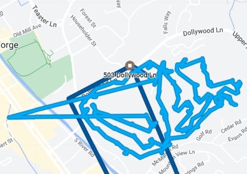
I know it doesn’t look like much – it merely shows us driving eastward (away from the Rod Run mayhem) to a fantastic barbecue place called Preacher’s Smokehouse, where we enjoyed an excellent dinner. We got a sampler plate for two, resulting in enough leftovers for a couple more meals later on back at the Golf Vista. So, what did we do all day before dinnertime? Let’s focus in on that blue blob on the left part of the Timeline for a clue.
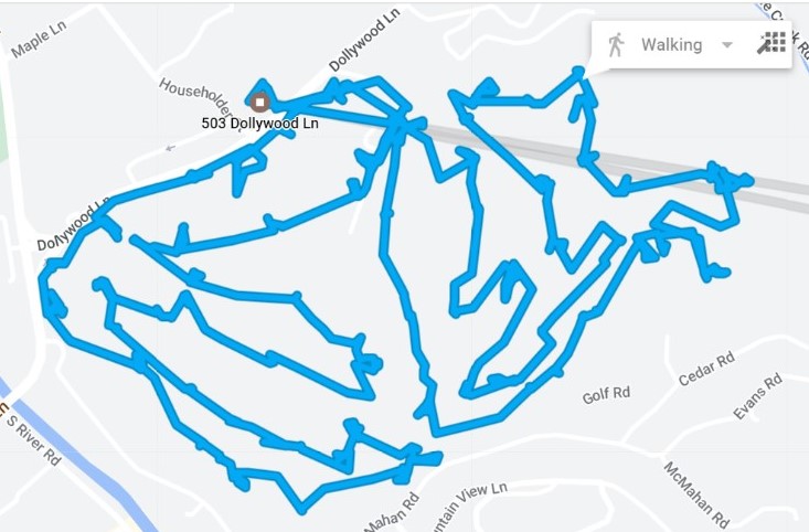
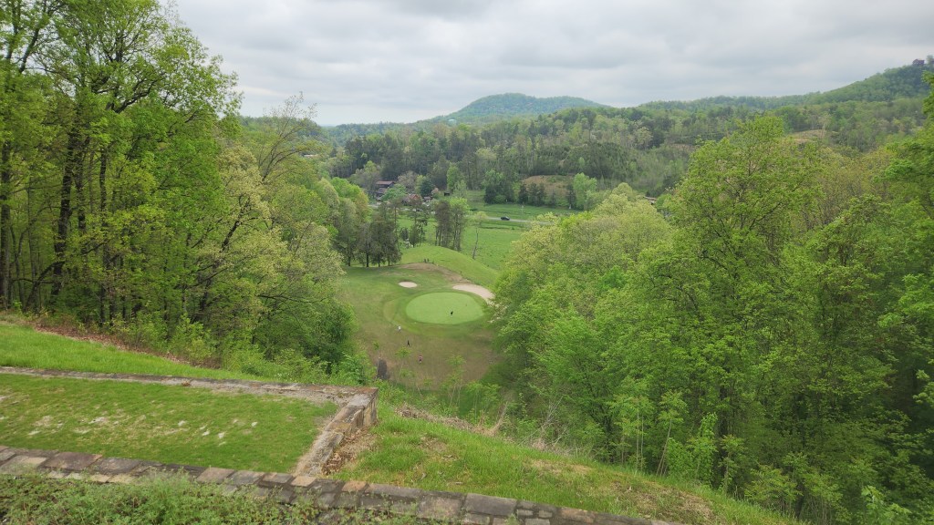
Yes, that shows me playing 18 holes at the Gatlinburg Golf Course, where Pat dropped me off at 9:45 AM before heading off to do a bit of exploring and shopping in Pigeon Forge. Per the Timeline image above, Google seemed to think I was walking the course, but I actually took a cart since it would be my first time golfing with my new knees, and I didn’t wat to overdo it. I’m happy to report that the knees held up just fine. The golf swing didn’t hold up as well – I had a wide range of shots, from the pretty good to the absolutely pathetic, but all in all it was good for the first time out.
Pat reported that it was too busy for comfort in town, which prompted her to find the barbecue spot for dinner, in the opposite direction from the inrushing Rod Run fans.
Sunday, April 21, 2024: The highlight of the day was going to a fancy place in Gatlinburg for Pat’s 67th birthday, as shown on the Timeline map below.
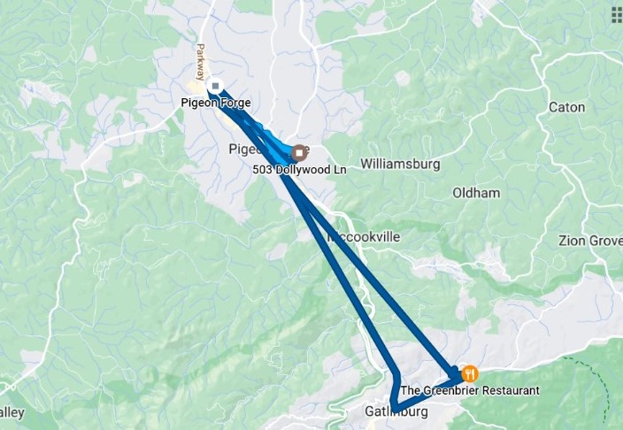
The Greenbrier Restaurant is located in the woods above the main part of Gatlinburg, and the road became very winding and fairly narrow as we approached it, providing for some pre-dinner excitement. The atmosphere, the food, and the service were all quite nice – I’d recommend it for any readers looking for a nice restaurant in the area.
Before going to dinner, we spent some time exploring Pigeon Forge as shown on the expanded image below.
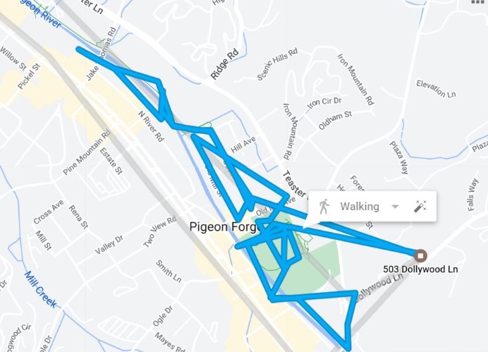
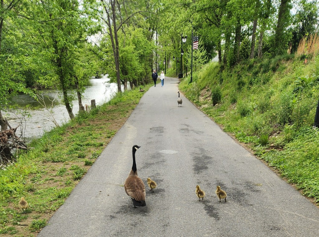
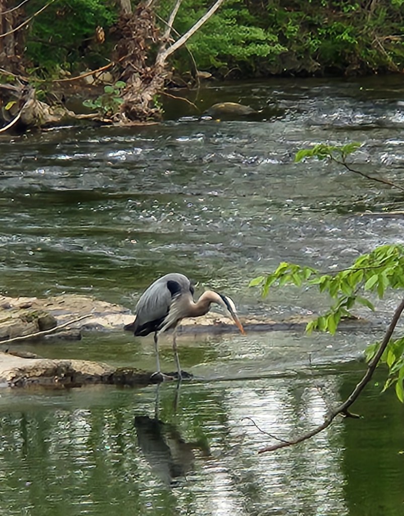
Although the Timeline implies that we walked all the way to town, we actually drove a short distance and parked near the transit center before walking along a nice path around town called the Riverwalk. During this walk, we saw some interesting wildlife. I found it interesting that the Great Smoky National Park boasts of a huge number of wildlife species, yet almost the only non-human species we encountered during the entire trip were found on this walk through the town of Pigeon Forge.

Monday, April 22, 2024: We again set out by car to visit the National Park on our fourth full day in the Smokies.

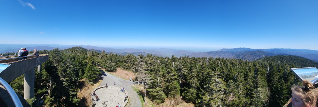
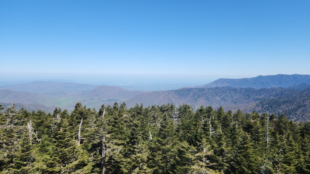
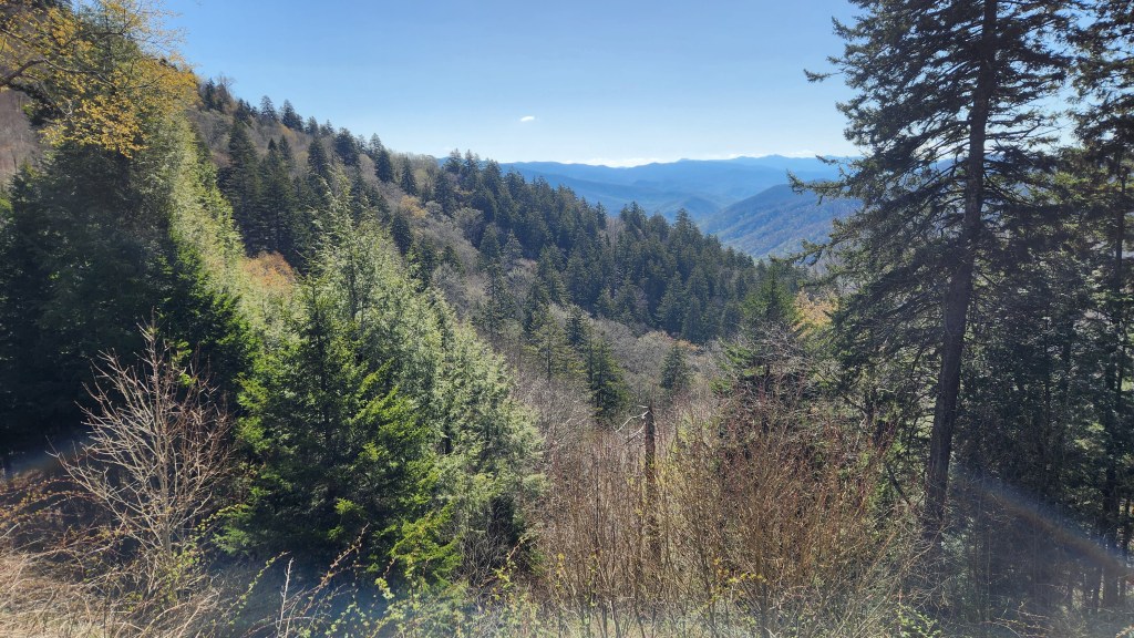
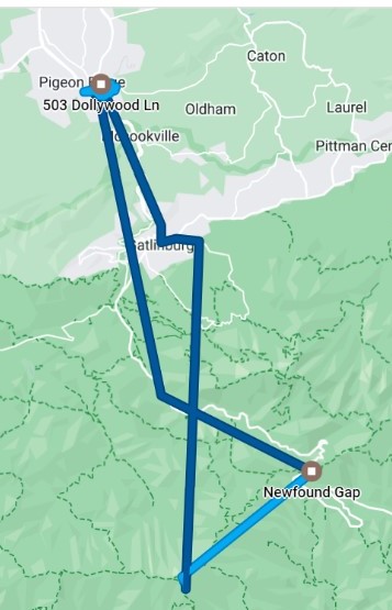
We left the Golf Vista at a little before 10 AM, driving to the Clingmans Dome Visitor Center and then hiking to Clingmans Dome. At an elevation of 6,643 feet, Clingmans dome is the highest point in Great Smoky Mountains National Park. It is the highest point in Tennessee, and the third highest mountain east of the Mississippi. The half-mile walk from the visitor center to the observation tower on top of Clingmans Dome is quite steep, and I found myself huffing and puffing and requiring a couple of sit-downs along the way. The views from the top are stunning, however, making it well worth the effort. Some of the pictures show the characteristic blue haze that gives rise to the name of the mountains. (It’s caused by vapor molecules released by the mountains’ vegetation, which scatter blue light from the sky.)
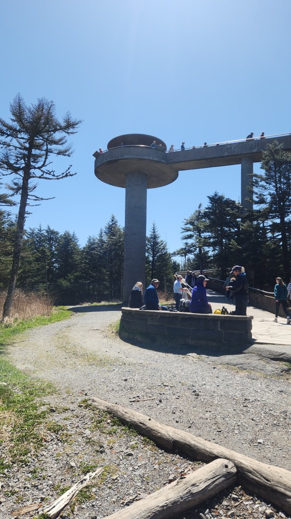
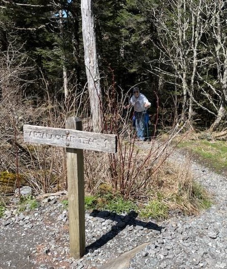
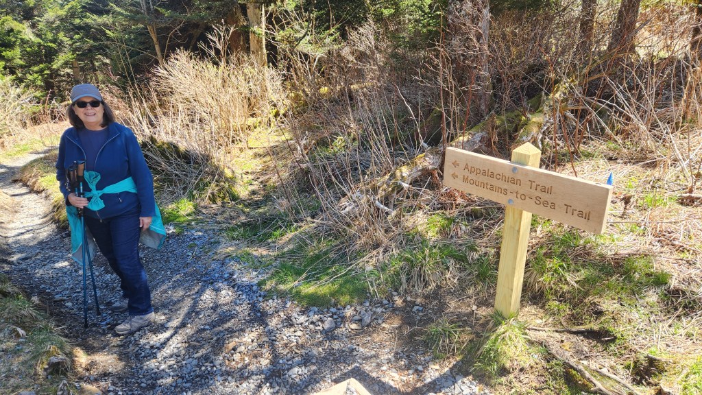
Interestingly, the Appalachian Trail crosses the path to the Dome more than once, so we each had to take a quick side trip on it so we can boast of hiking the Appalachian Trail – at least thirty feet worth.
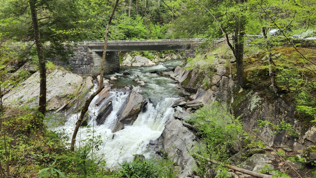
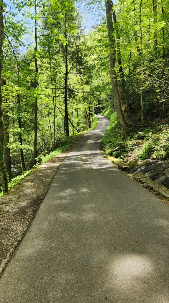
The drive up to and back from Clingmans Dome was gorgeous, as the steep road wound back and forth alongside and across various creeks and streams. We made numerous stops to ogle, ooh, and aah, including an extended look around at the so-called Newfound Gap. I’ll let the pictures do the talking …
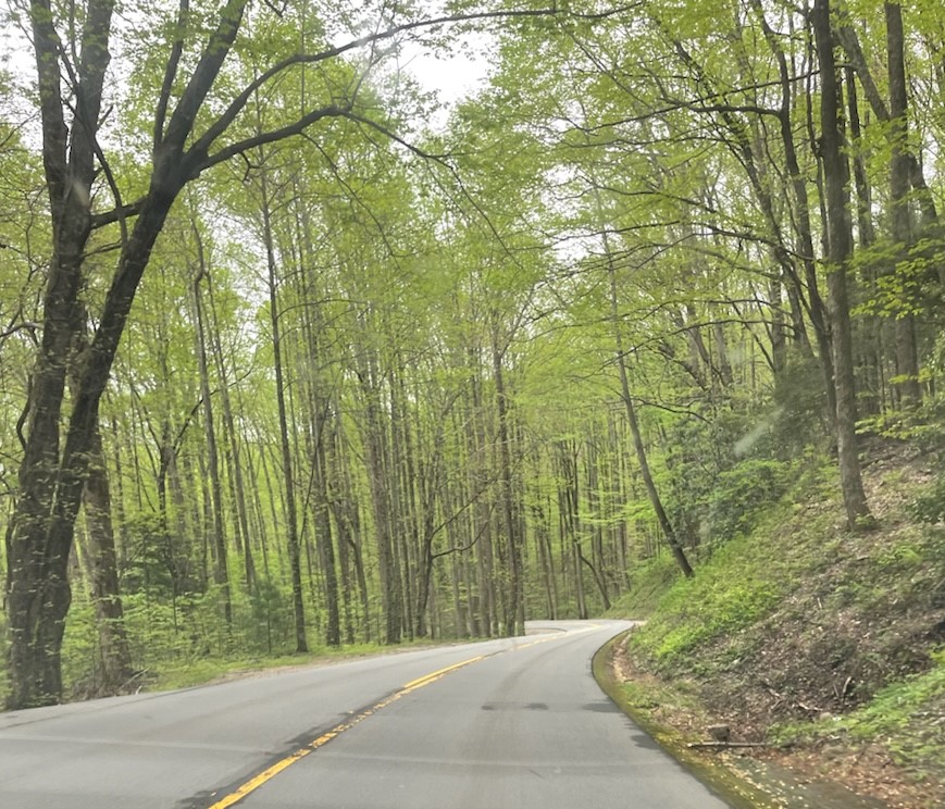
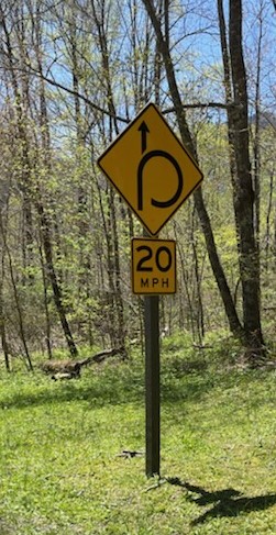
We also explored a section of the National Park that is accessible from Gatlinburg called the Roaring Fork Motor Nature Trail. We drove along a narrow, one-way road that loops through the forest, up into and down out of the mountains and back to Gatlinburg. We saw that there were multiple points of interest and hiking trails. We didn’t stop to explore any of them, but vowed to come back on Tuesday to have a longer visit and a good hike.
We got back to Golf Vista at about 2:30 PM, and I was feeling frisky enough for another foray at the Gatlinburg Golf Course, so I abandoned Pat to her own devices, drove across the street, and began my second attempt at golfing at just about 3:00.
This looks pretty much like the first try, except for that 1,000+ yard driver shot into Pigeon Forge on the left. That’s actually some sort of Google glitch, though – I can’t hit a ball that far anymore. This time, my performance ranged from the sublime to the ridiculous, though overall a bit better than the first try. The main takeaway was again that my knees held up well, and I returned to Golf Vista with a smile on my face.
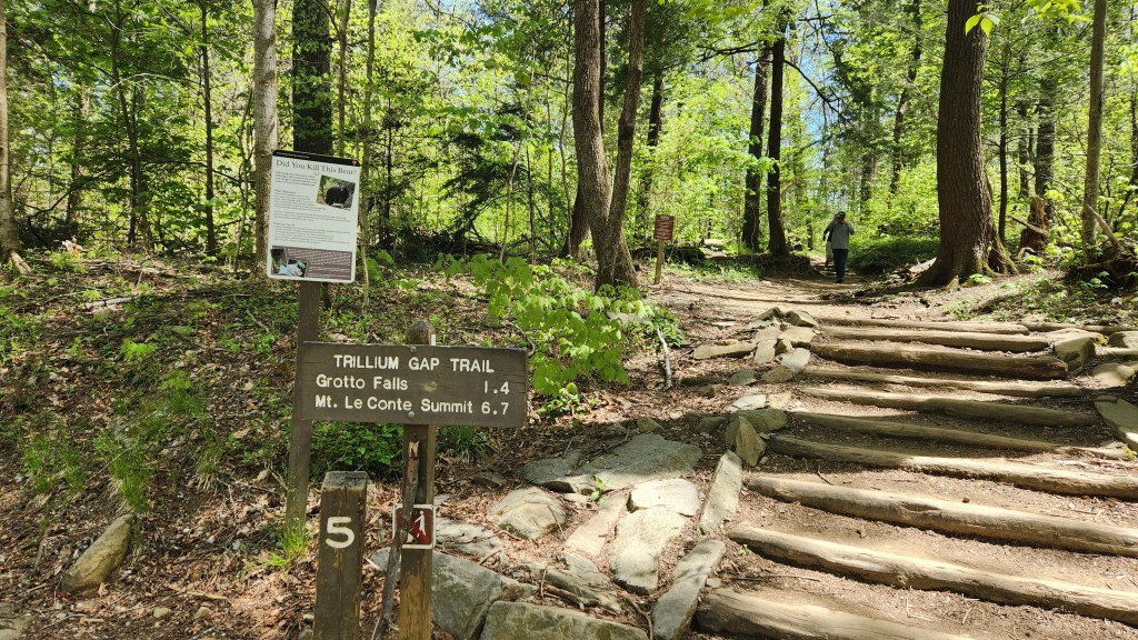
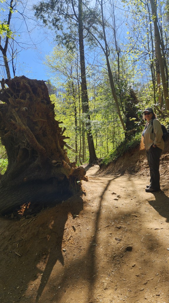
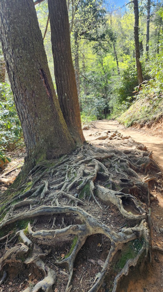
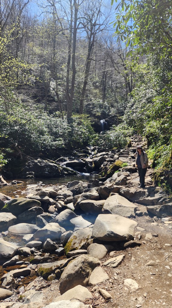
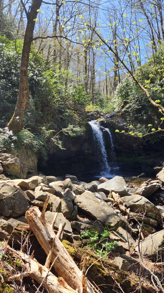
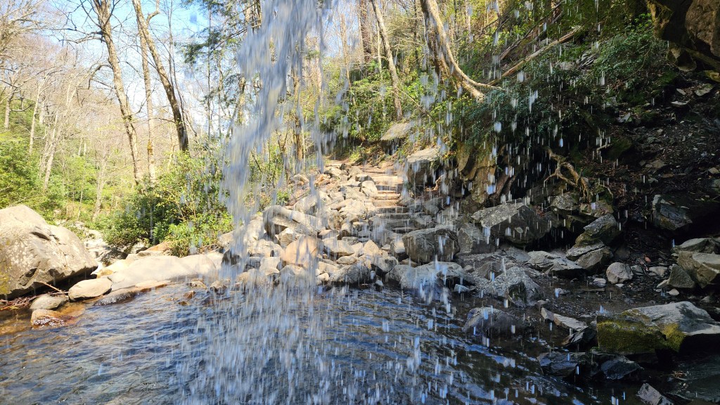
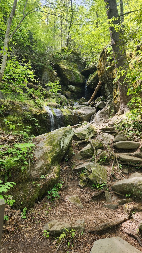
Tuesday, April 23, 2024: True to our word, we returned to the Roaring Fork Motor Nature Trail. This time, we found a parking spot near the Trillium Gap Trailhead and hiked along the trail for 1.4 miles to the Grotto Falls.
On this walk, we finally encountered some wildlife, including a few deer grazing near the trail and a large black bear with three little cubs. The deer were very cooperative models, but the bears were up in a tree across the river near the falls and my attempt at a picture was a dud. For safety’s sake, we didn’t try to get close enough for a picture, but it was fun to see them from afar.
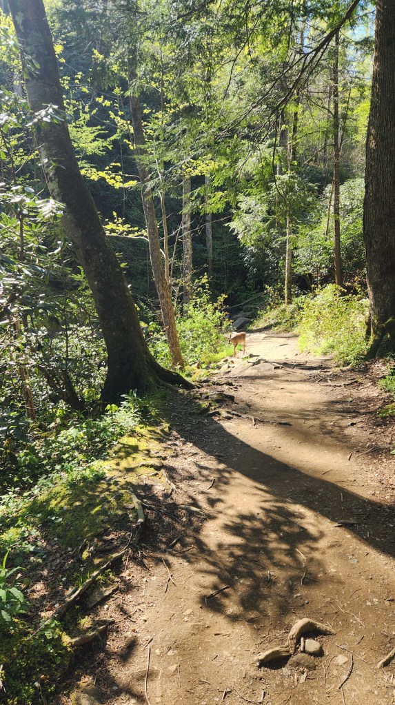
The trail was moderately challenging for my knees but very scenic, and the Grotto Falls were beautiful. Again, I’ll let the pictures speak for themselves.
After our hike, we made our way back to Gatlinburg along the Roaring Fork Motor Nature Trail, stopping several times along the way for more photo ops.
Finally, we headed back to Golf Vista and then to the Tesla Supercharger to “fuel up” for the beginning of our drive home on Wednesday. The most impressive thing about that short jaunt was the absolute lack of traffic, as the infamous Rod Run had ended on Sunday.
That’s it for this episode. In Part 3, I’ll give a quick summary of our return to Minneapolis. Also, for those who may be interested in learning more about taking an EV on a road trip, I’ll provide some details on how the new Tesla performed and what extra planning we needed to do compared with a trip using an ICE car. Stay tuned!

One thought on “Pat and Dave’s Easy EV Road Trip – PART 2: The Great Smokies”