Pat and Dave’s Winter Warmup – PART 3: Road Trip Home

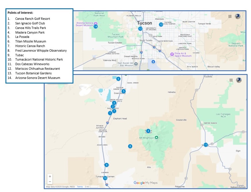
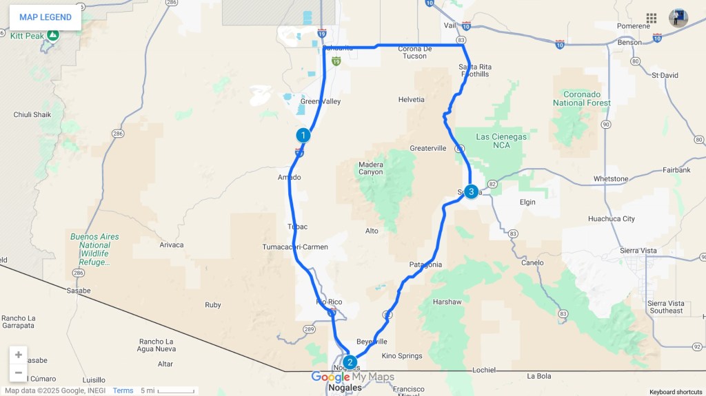
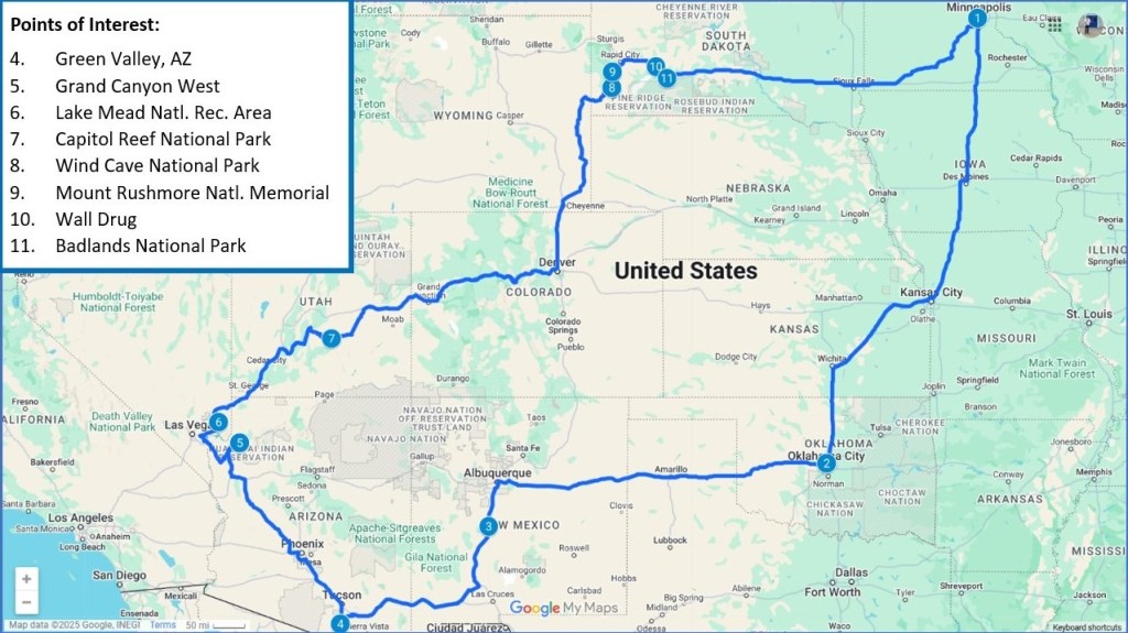
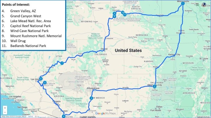
Part 2 of this travel blog series described the places of interest we saw in and around Green Valley, AZ. This final installment describes the fun stuff we did as we drove back home to Minneapolis. As a reminder, here is a map of the overall journey, including the main points of interest covered in this installment:

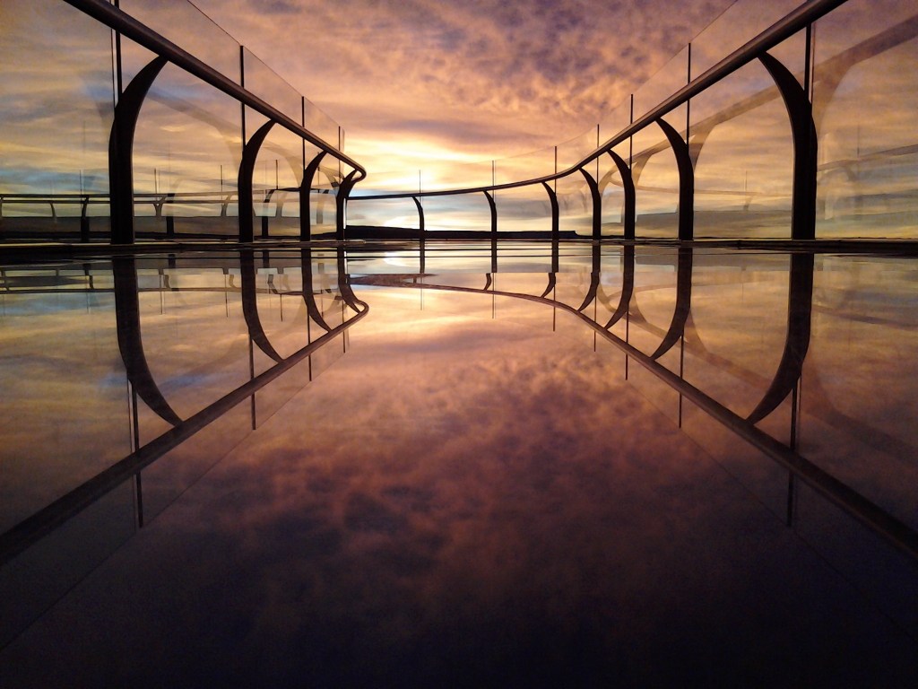
Grand Canyon West: We departed from the Canoa Ranch Golf Resort at 8:30 AM on Friday, March 28, heading northwest toward Kingman, AZ, where we stayed the night. On Saturday morning, we drove north toward Grand Canyon West, the recreation area owned and operated by the Hualapai native American tribe and best known for the Skywalk, which is billed as “a horseshoe-shaped bridge made of glass allowing visitors to walk 4,000 ft above the canyon floor.” (More about that language later.)

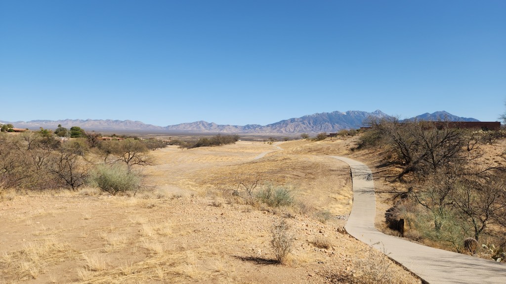
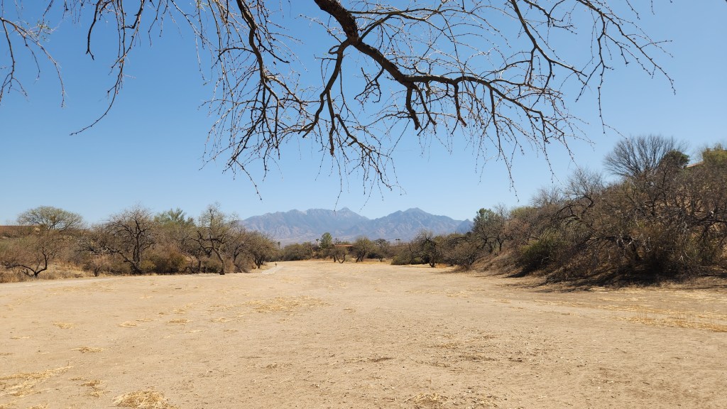
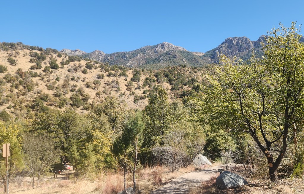
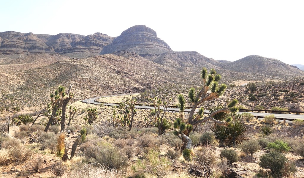
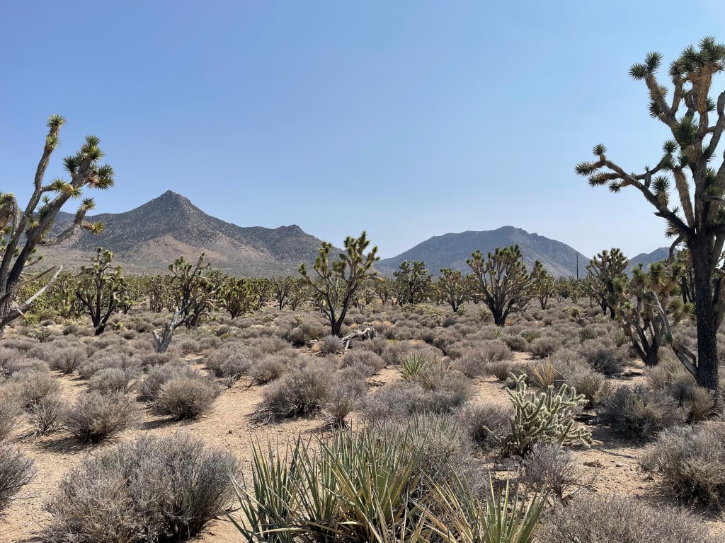
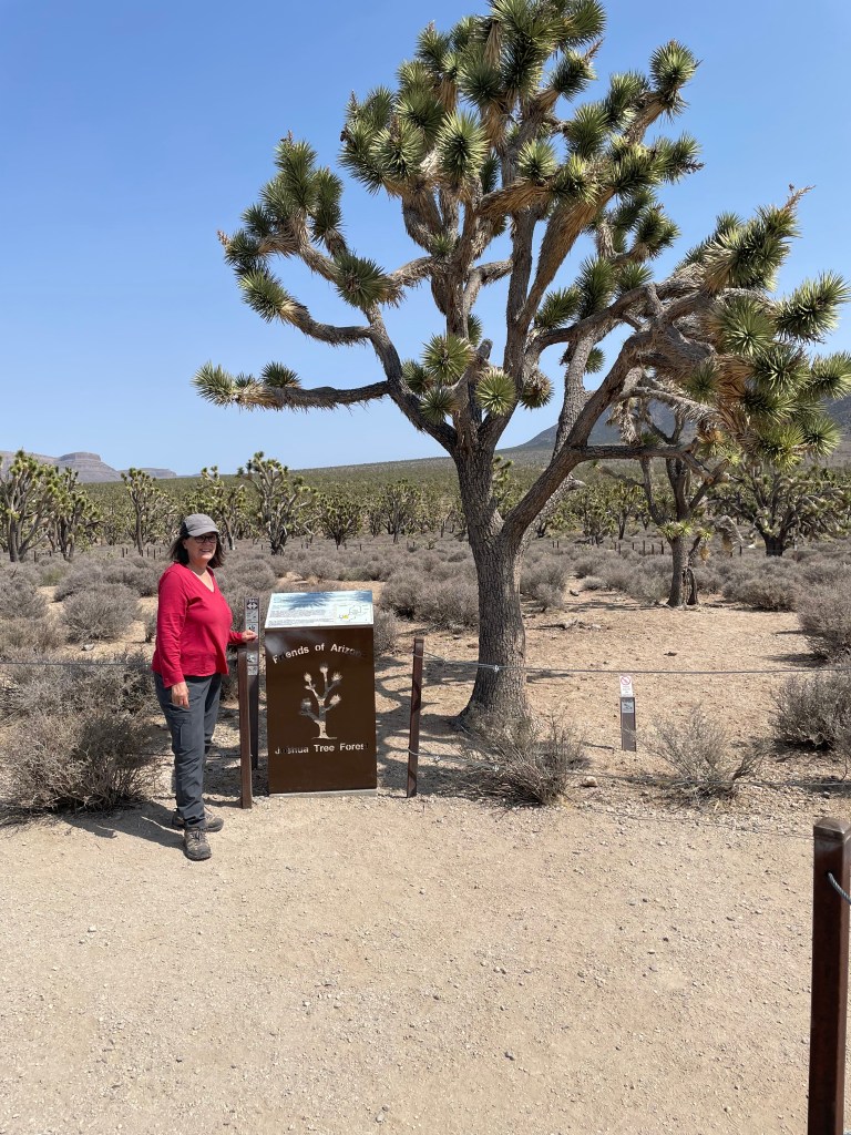
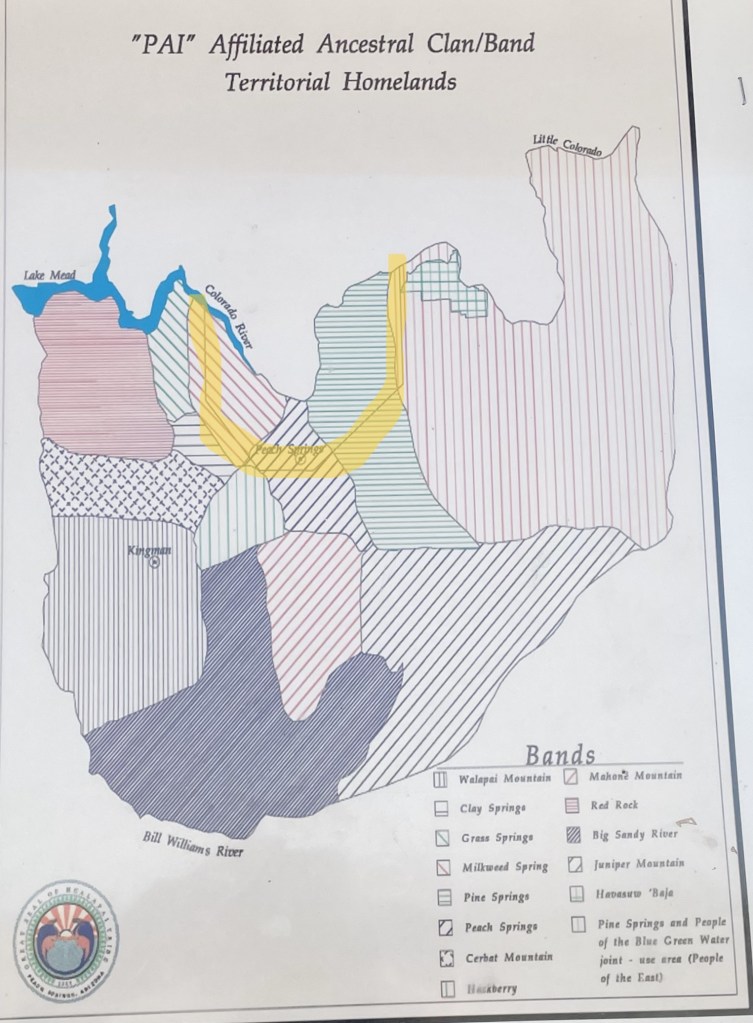
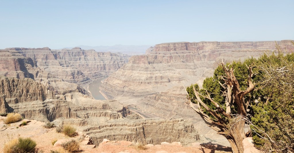
After driving for some 40 or 50 miles through dry scrubland which seemed to be used almost exclusively for cattle grazing, we were quite surprised to find ourselves driving past Joshua trees, then what appeared to be thriving orchards growing nut trees of some sort, perhaps walnuts. As we continued in a northeasterly direction toward Grand Canyon West, the Joshua trees became more and more abundant, until they completely dominated the landscape. Road signage informed us that we were in the Arizona Joshua Tree Forest, which seemed to me to have many more Joshua trees than the more well-known Joshua Tree National Park located 230 miles to the southwest in California. We stopped at a nice little nature preserve where we admired the trees and other desert flora and also learned something about the Hualapai tribe.

View from an Overlook in the Arizona Joshua Tree Forest
Nature Preserve in the Arizona Joshua Tree Forest
The Joshua Trees are Healthy and Robust
Map of Former Hualapai Territorial Homelands (Current Hualapai reservation approximate outline is shown in yellow)

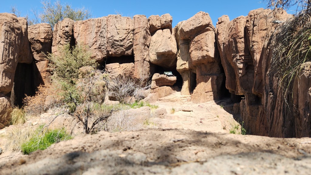
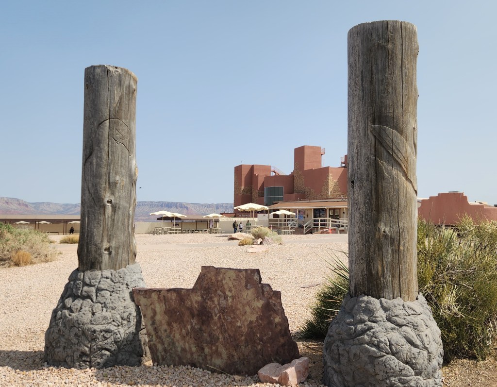
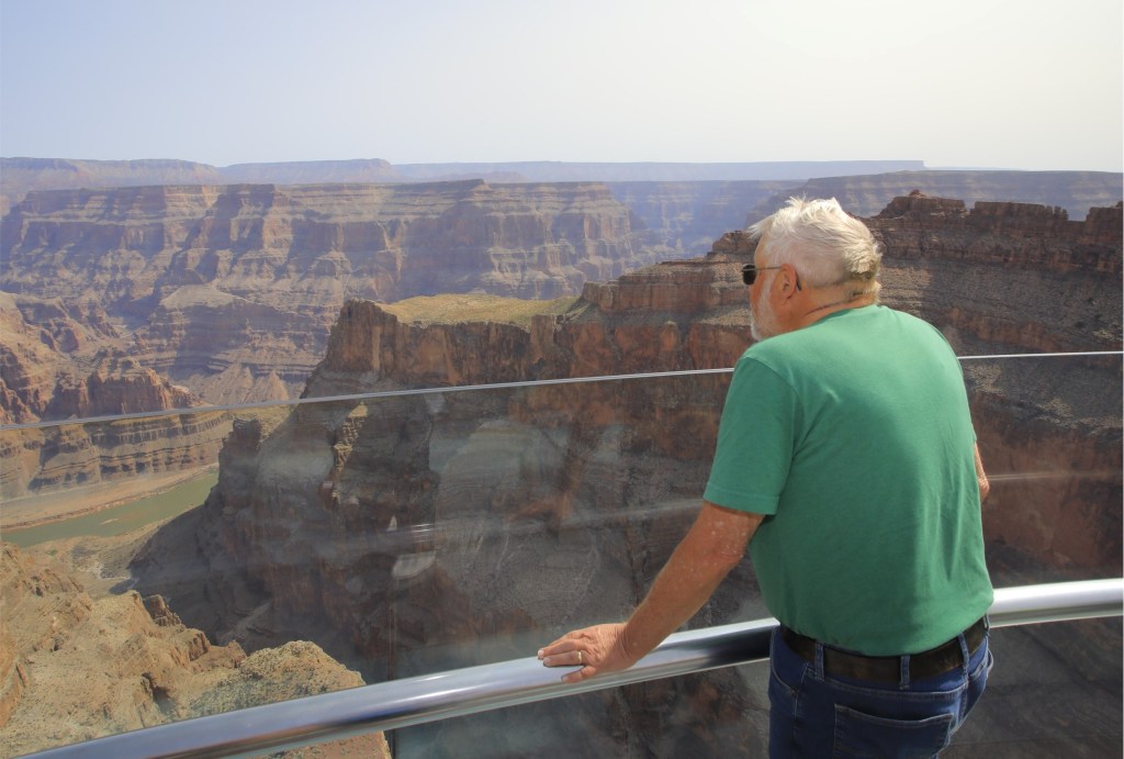
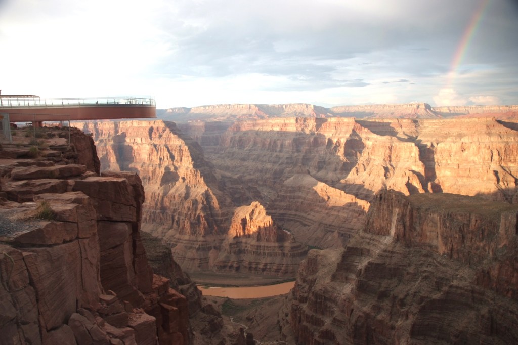
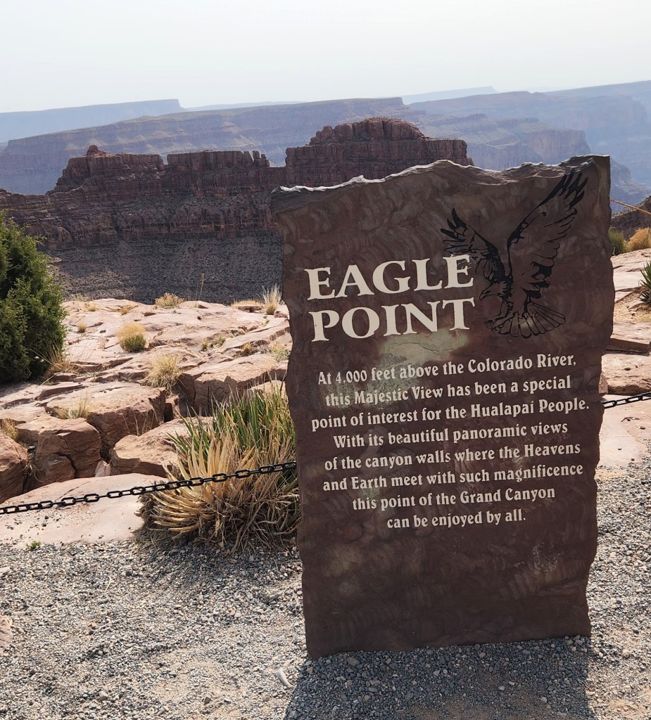
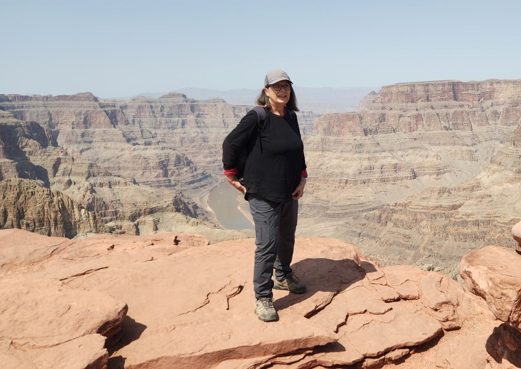
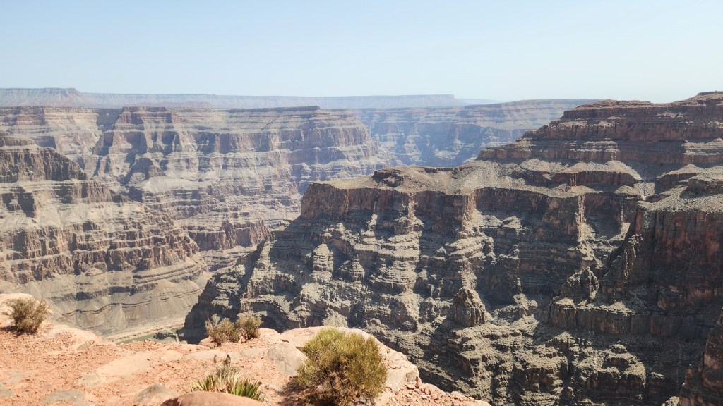
We arrived at Grand Canyon West at about 12:30 to find the huge parking lot something like 10% occupied by vehicles. We strolled over to the Visitor Center, where the electronic tickets I’d purchased the day before were scanned and we boarded a bus to take us a few miles north to Eagle Point, the first of two stops near the canyon rim. Its name derives from the huge natural rock formation resembling an eagle with outspread wings. Once there, I scanned my ticket to enter the famous Skywalk, while Pat wandered around nearby – she was too much of a chicken to go on the Skywalk.

Eagle Point Visitor Center
Admiring the View from the Skywalk
It’s actually not scary at all
Marketing Photo of Skywalk by Hualapai Tribe
Another Marketing Photo

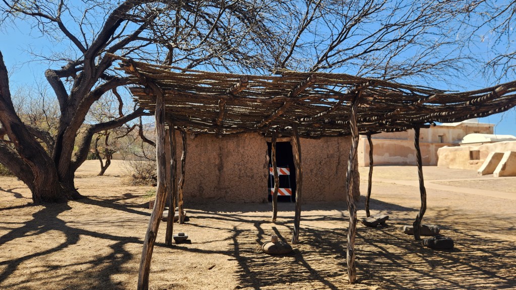
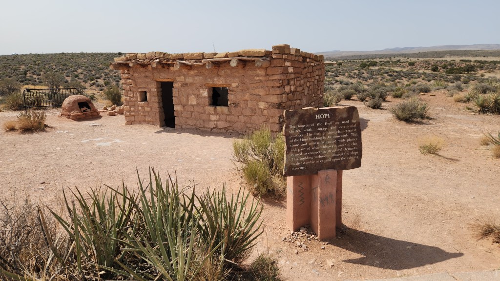
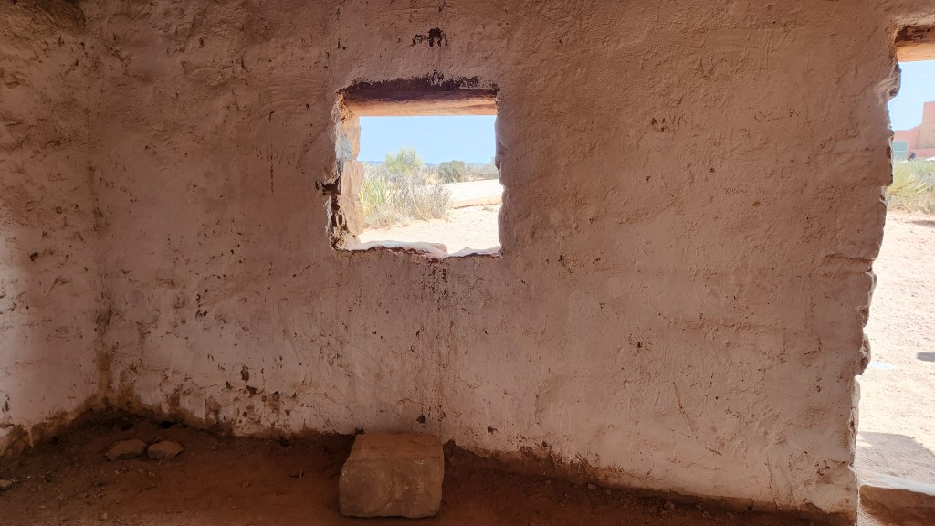
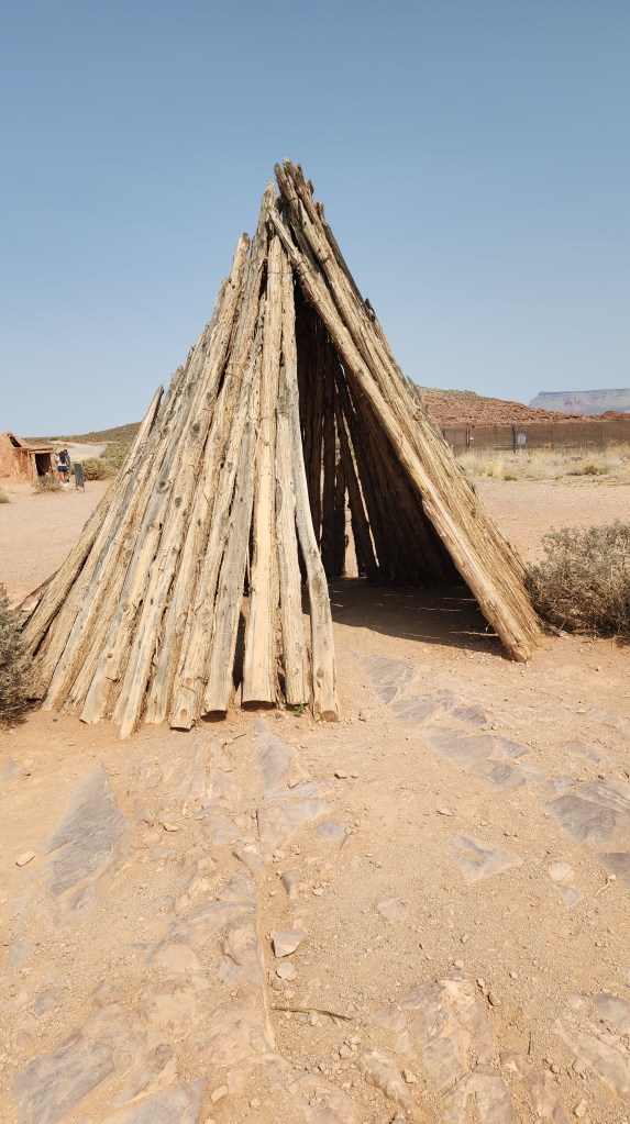
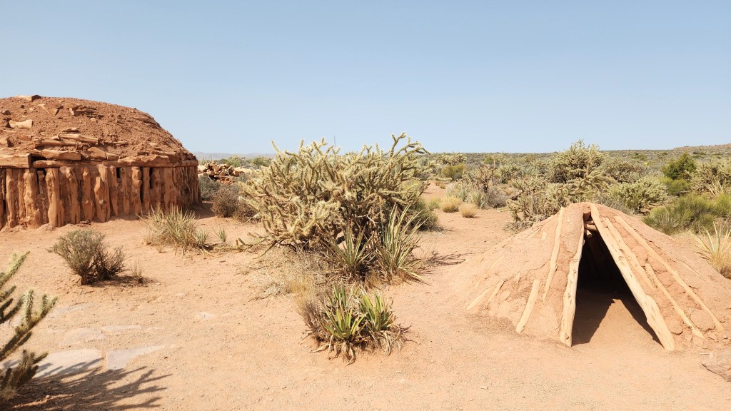
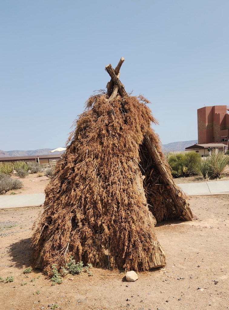
After the Skywalk, we walked along the canyon rim and then along a loop trail that passed by several types of traditional native American dwellings and structures. Pat and I both felt that the Hualapai tribe has done a very nice job of providing educational materials honoring the cultures of their own and other neighboring tribes.

Eagle Point Marker in front of Eagle Rock Formation
The Eagle’s Head is in the Middle, the Wings Outspread to Either Side
View from Eagle Point Canyon Rim
Navajo Hogan on Eagle Point Loop Trail
Hopi Dwelling on Eagle Point Loop Trail
Interior of Adobe Dwelling
Dwelling Structure on Eagle Point Loop Trail
Interior View of Dwelling
Along the Eagle Point Loop Trail
Dwellings on Eagle Point Loop Trail
Dwelling On Eagle Point Loop Trail

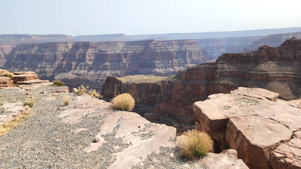
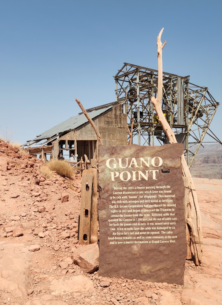
We then boarded the bus again for a short drive to the second stop, Guano Point. This name came about as a result of a bat cave discovered by boaters on the Colorado River in the 1930s. They successfully sold their dream of riches from guano mining to the U.S. Guano Corporation, who constructed a tramway system to extract guano from the cave to the canyon rim at what became known as Guano Point, as well as roads to transport the valuable shit to market. The cave’s guano supply, having been vastly exaggerated by the original discoverers, ran out in 1959. To add insult to injury, a U.S Air Force Top Gun wannabe wiped out the tram cable while hot dogging in the canyon some years later. Presently, the tramway structures have been left intact as a monument to man’s attempt to mine the Canyon, and the roads built by the mine operators are now used for Grand Canyon West tourism buses. At any rate, we disembarked at Guano Point, had a nice lunch of pulled pork and coleslaw, and walked around the site with our mouths agape as we took in the stunning views.

Guano Point Tramway Structure
Guano Point Canyon Rim
View from Guano Point Canyon Rim

As we were leaving the recreation area, the Visitor Center had become jam-packed with people and the number of cars in the parking lot had probably quadrupled or more. This bore out the advice we had heard that the busiest times were between about 1 and 4 PM.

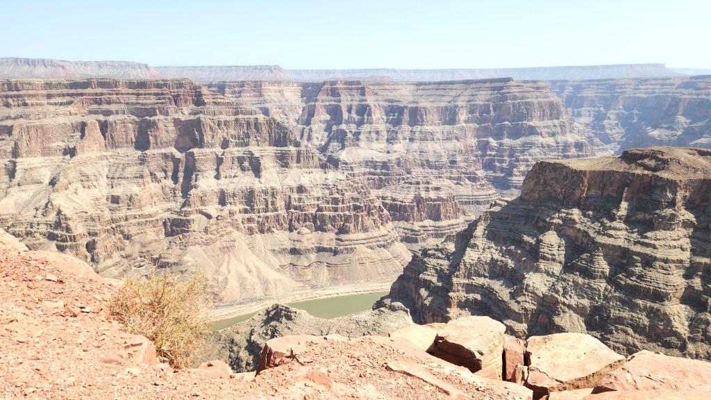
Before I move on to our subsequent points of interest, let me say a few words about the Skywalk and the recreation area in general. Perhaps you will have noticed from the words I quoted above that the Hualapai do not actually state that the Skywalk overhangs the Grand Canyon, although I suspect most people think it does – until they actually visit the place. You’ll notice from the pictures above that the Skywalk, while in fact some 4,000 feet higher than the Colorado River, does not actually extend beyond the canyon rim. Once I thought realistically about it, I realized that it would probably be impossible to construct such a structure – it would need to be extremely long, would probably cost billions, and would probably cause irreparable damage to the natural beauty of the canyon. The Skywalk does provide beautiful views of the canyon from an entirely safe vantage point, actually much safer than walking near the canyon rim, and does provide a feeling of being suspended in the air. It’s a great marketing “hook” and probably is the primary reason that many people go to the recreation area. In fact, it’s what hooked me.

At first, I was a bit annoyed by this discovery, but the sheer beauty of the rugged overlooks at Eagle Point and Guano Point were well worth the price of admission. Our experience at Grand Canyon West was much more intimate than our visits to the Grand Canyon National Park. The crowds were smaller, there were no CCC-built walls along the rim, leaving a much more natural view, and the vistas were as spectacular as anything at the National Park. If anyone asks me which of the two places to visit, I’d say go see both. They each offer something a bit different and very rewarding. Oh, and I failed to mention that the Hualapai recreation area also has a zipline for the adventurous, which both Pat and I were too chicken to try.

I’ll add one final note regarding the Hualapai tribe and their great success in drawing tourist dollars to their reservation. I learned that Guano Point is sacred to the Hualapai for a very poignant reason. In 1874, the U.S. military forced the Hualapai people to march from their traditional lands in western Arizona to a relocation camp at La Paz, on the Colorado River Indian Reservation. This journey was physically demanding and resulted in many deaths due to disease and lack of resources. Many Hualapai weren’t able to escape the “Long Walk to La Paz.” These tribespeople, called the lost souls, jumped off the canyon edge to their deaths at what is now called Guano Point rather than be captured by the military. The tribe was eventually given their own reservation, a small portion of their ancestral homeland, and allowed to return. I find it very hard to begrudge a people so resilient as to have reestablished themselves once again and discovered a way to thrive in the modern world. Far from feeling “fleeced” by the slight deception regarding the Skywalk, I’m thrilled that Pat and I got to experience this special place.

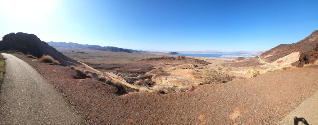
Lake Mead National Recreation Area and St. George, UT: After leaving Grand Canyon West, we drove to the Hoover Dam Lodge, overlooking Lake Mead, to spend the night. On Sunday, March 30, we drove to Richfield, UT, via St. George. Rather than take the faster freeway route through the Las Vegas area, we drove through the Lake Mead National Recreation Area, using my priceless Senior National Parks Pass for free entry. We didn’t actually stop anywhere except at St. George to charge the car, but we thoroughly enjoyed our leisurely drive (pulling over frequently to let impatient drivers speed past) and the beautiful scenery around Lake Mead, which we have visited several times during previous travel adventures. The mountain passes following the Virgin River into St. George are also absolutely gorgeous, so that Sunday’s travels were among our most enjoyable of the entire trip.

Lake Mead View from Hoover Dam Lodge Trail

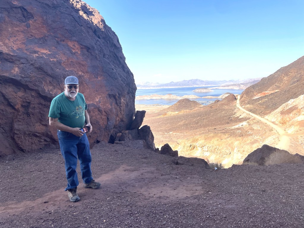
So, why aren’t there more pictures? Since I did most of the driving, I couldn’t be taking pictures, and Pat doesn’t like to take pictures out the car windows because they usually turn out to be disappointing. Sorry.

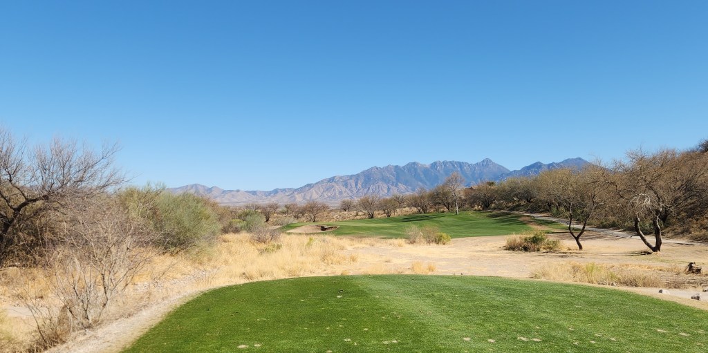
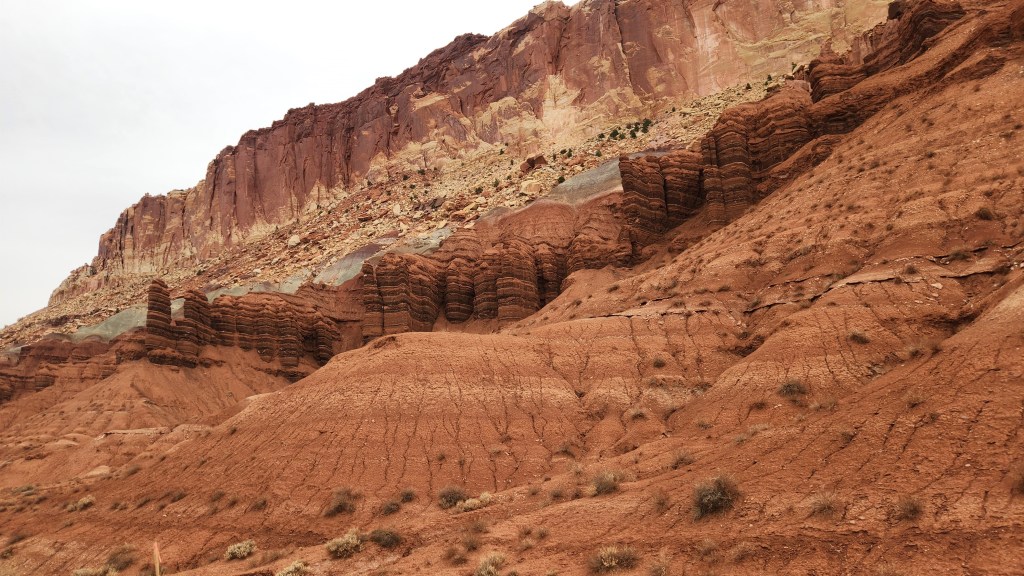
Capitol Reef National Park: After spending Sunday night at a hotel in Richfield, we drove to Capitol Reef National Park, the 29th National Park we’ve visited so far and the only one in Utah that we hadn’t visited previously. The park takes its name from white domes of Navajo Sandstone that resemble the dome of the U.S. Capitol building, and a formidable ridge of rocky cliffs that early Mormon settlers, who settled in a town they named Fruita due to the fruit orchards they established there, likened to a “reef.” Per the National Park Service brochure:

“Capitol Reef’s defining geologic feature is a wrinkle in Earth’s crust, extending nearly 100 miles from Thousand Lake Mountain to Lake Powell. It was created over time by three gradual yet powerful processes: deposition, uplift, and erosion. The result is a classic example of a monocline, or one-sided fold, in the otherwise horizontal rock layers.”

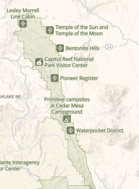
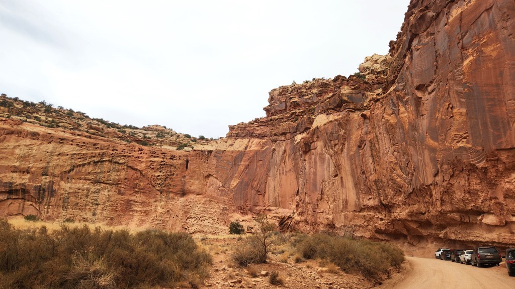
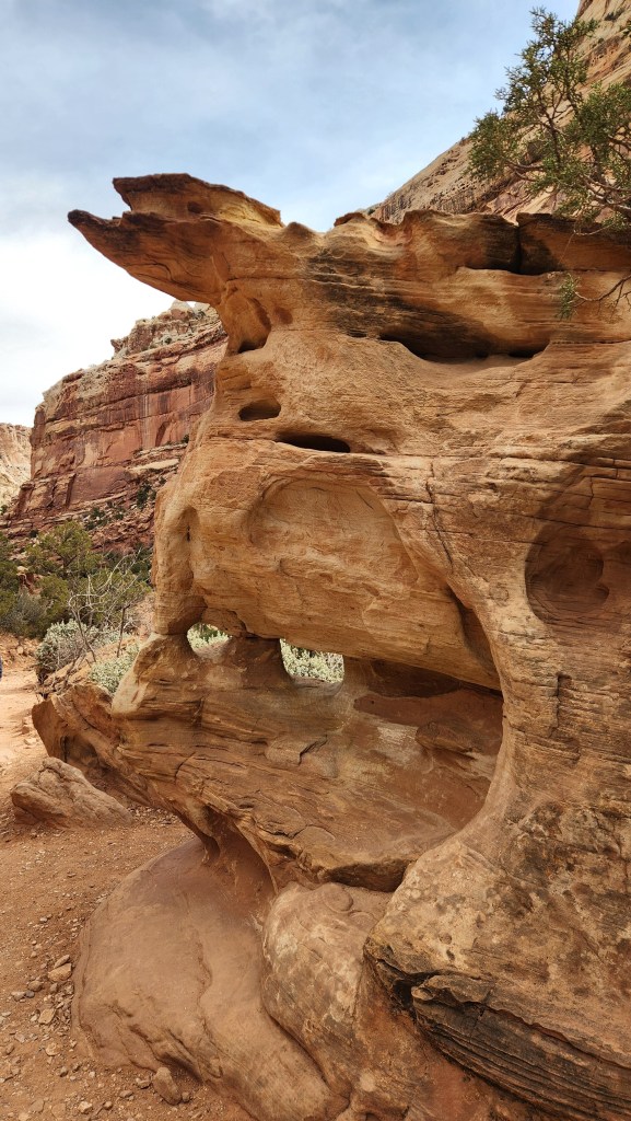
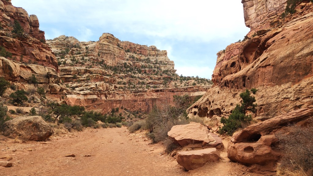
This “wrinkle” is known as the Waterpocket Fold, and it created a land of fascinating and spectacular scenery. The National Park is very large, comprising nearly a quarter million acres. The maps below show the entire extent of the park and the portion that we explored over several hours.

Capitol Reef National Park
The Portion we Explored

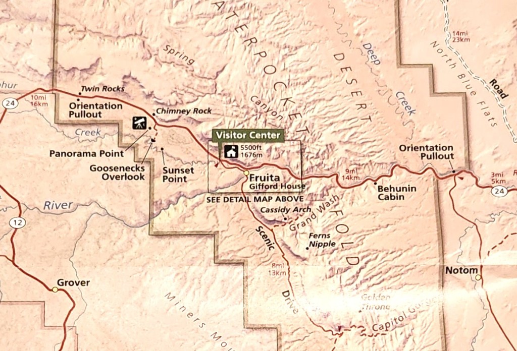
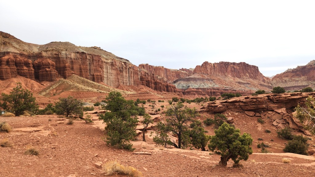
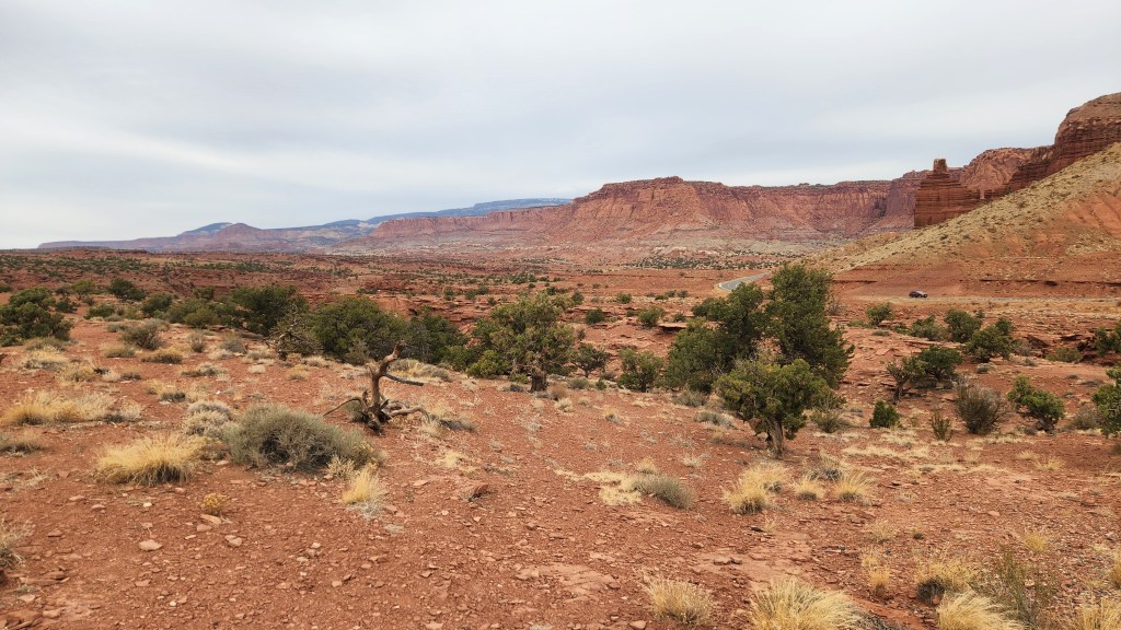
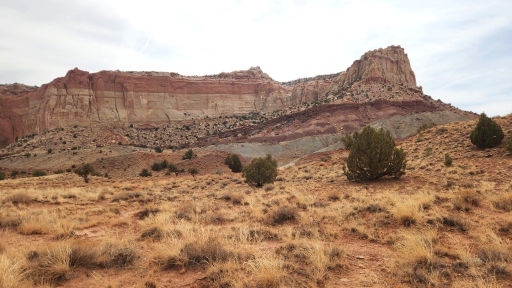
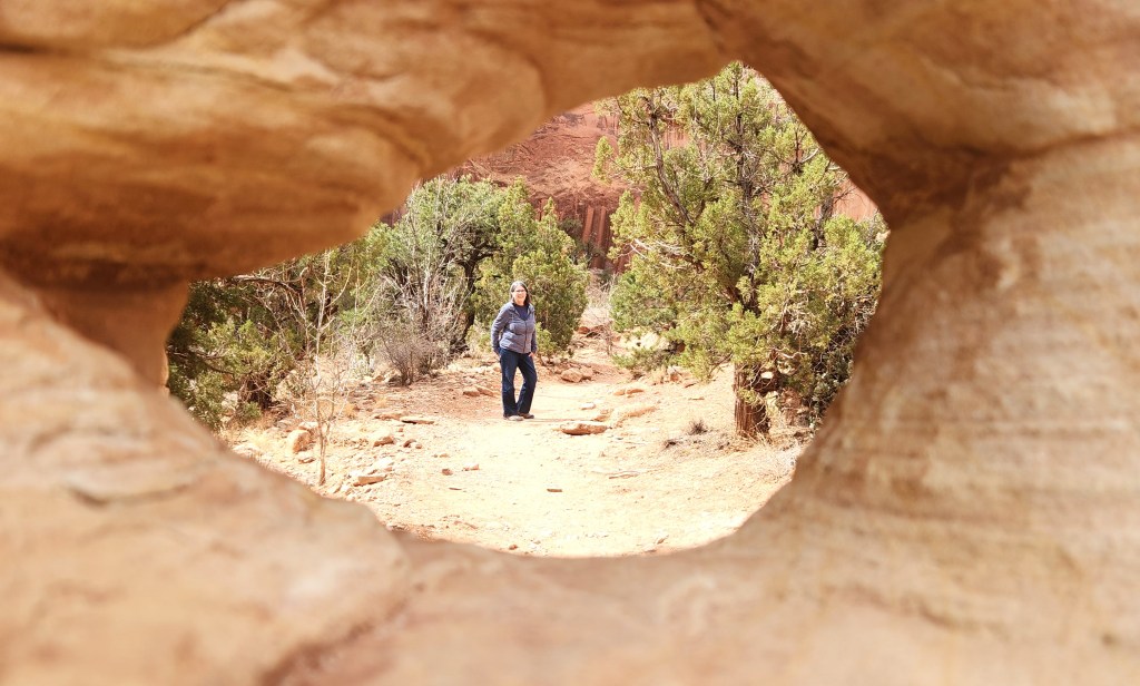
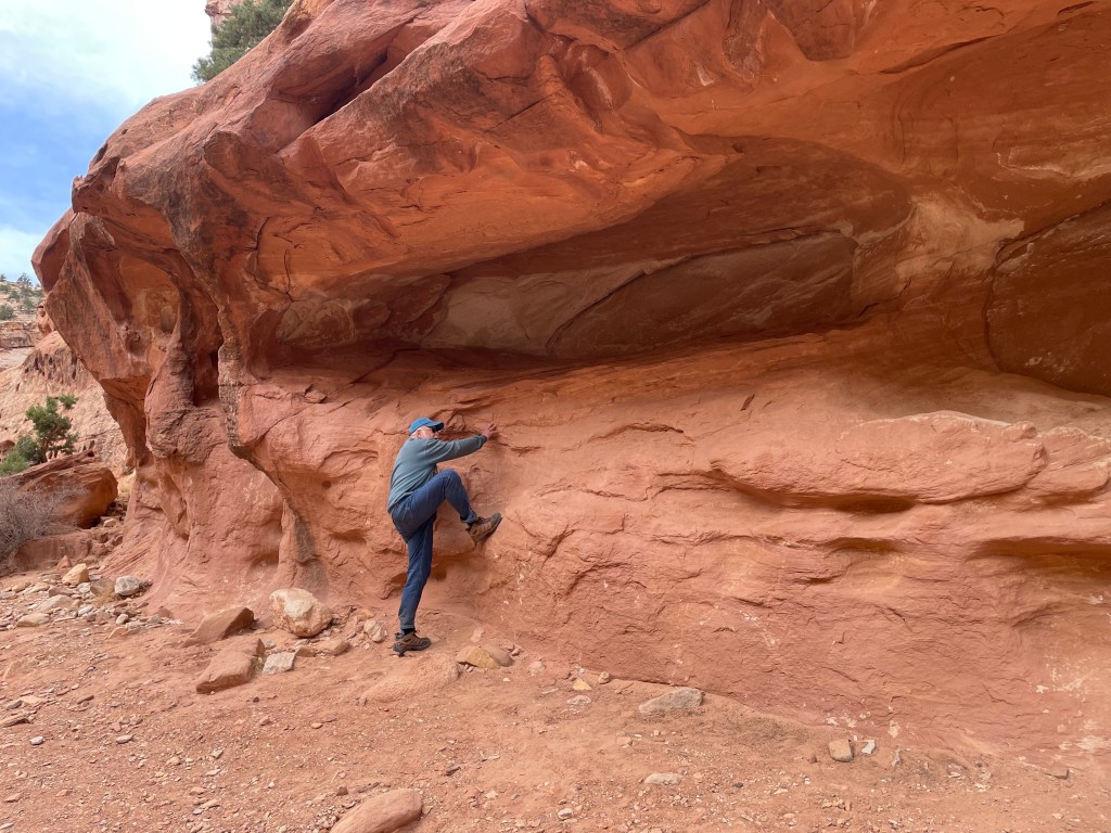
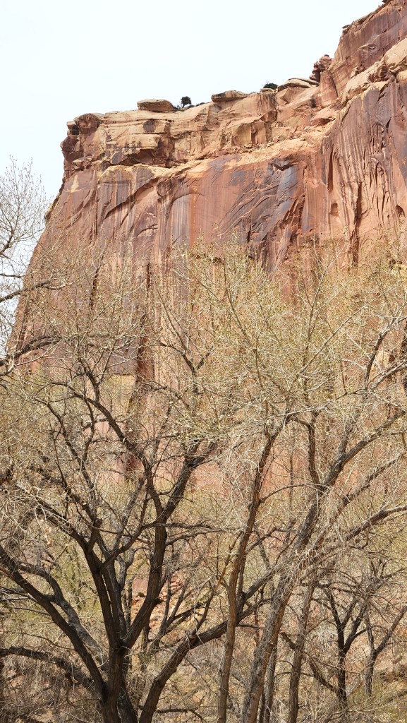
We drove into the park on Highway 24 from the west and stopped at the Visitor Center to watch the National Park Service video overview, then drove 8 miles south along the Scenic Drive until the pavement ended. Along the way, we stopped to hike along the Grand Wash trail and then stopped at multiple overlooks along the rest of the Scenic Drive. I was jumping in and out of the car like a jackrabbit and snapping pictures like a crazed documentarian, and Pat was doing her best to put up with my antics. After the tenth or twelfth stop, she suggested that maybe she could drive and I could just gawk out the windows.

View of Capitol Reef from Scenic Drive Overlook
The Road to the Grand Wash Trail
Rock Formation Along Grand Wash Trail
The Grand Wash
Peek-a-boo, I see Pat …
The new knees are great, but … I couldn’t make it up to the cozy resting spot
View from Scenic Drive Overlook

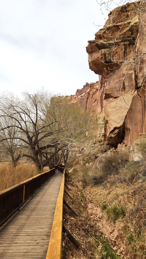
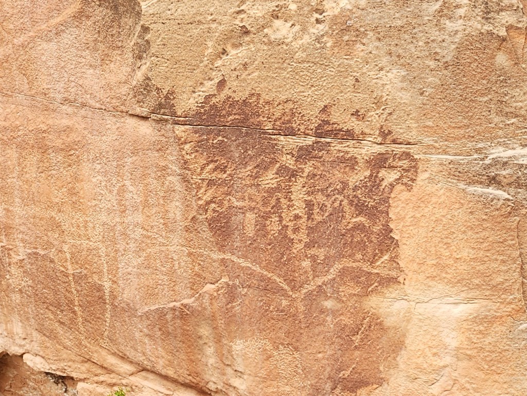
With Pat at the wheel, we returned to the Visitor Center area and stopped to explore a walkway with views of a cliff containing ancient petroglyphs.

Cliff face North of Fruita
Walkway for Petroglyph Viewing
Ancient Petroglyphs
More Petroglyphs

We then headed east again on Highway 24, and I contented myself with window gawking until we made one last stop at the eastern entrance to the park before heading on toward our next hotel in Green Valley, UT. Incidentally, we passed by those Capitol dome-like mounds along the way, but I failed to get a decent photo from the car, so you’ll just have to use your imagination.

The East Entrance on Highway 24

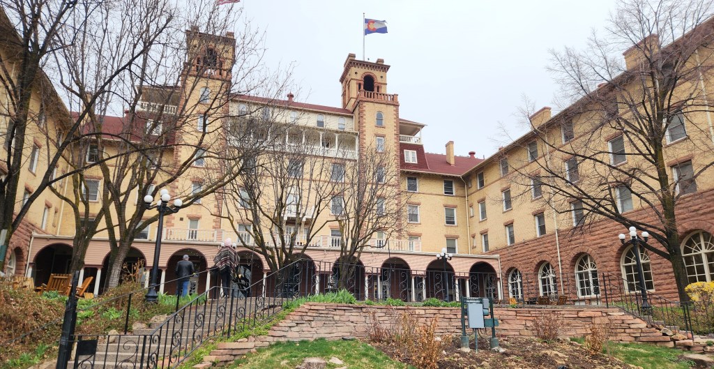
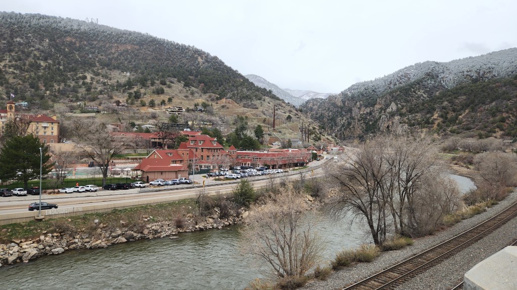
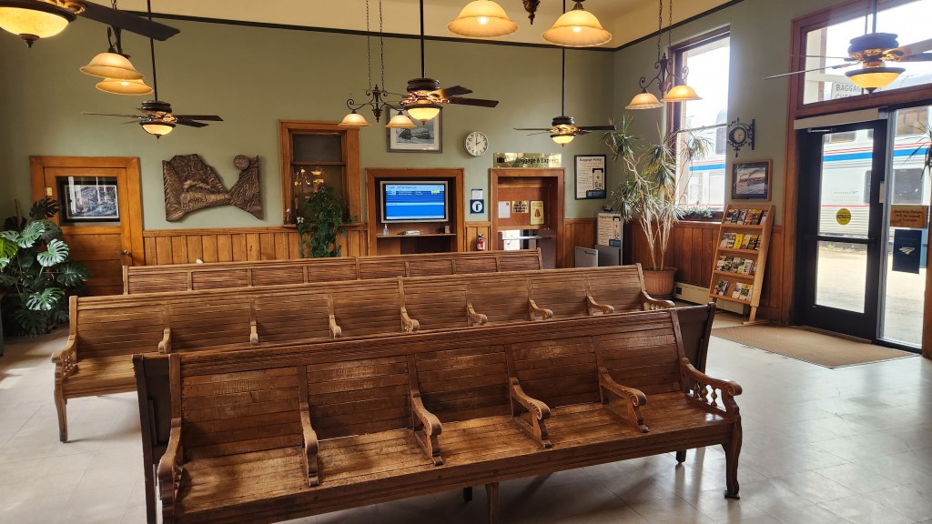
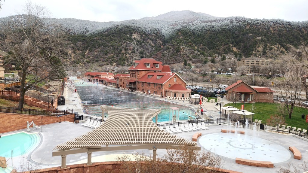
Glenwood Springs, CO: Our original plan for Tuesday was to drive from Green Valley to Golden, CO, for our next night’s stay. However, weather reports indicated that a heavy snow storm was developing in the Vail Pass, complete with avalanche warnings. The prospect of battling the elements as we navigated the high altitude crossing through Colorado ski country was a bit unsettling, so we changed plans and booked a hotel in a cute little town called Glenwood Springs instead. We got there around lunchtime and spent a couple of hours walking around before checking into our Holiday Inn. We had lunch at the Colorado Hotel, a grand old place founded in 1893 and now included on the National Trust’s list of Historic Hotels of America, before wandering off to the nearby railroad station and passing by an impressive Hot Spring and Spa.

Hotel Colorado, Glenwood Springs, CO
The Colorado River flows through Glenwood Springs
Interior of Glenwood Springs Railroad Station
Spa and Hot Springs at Glenwood Springs

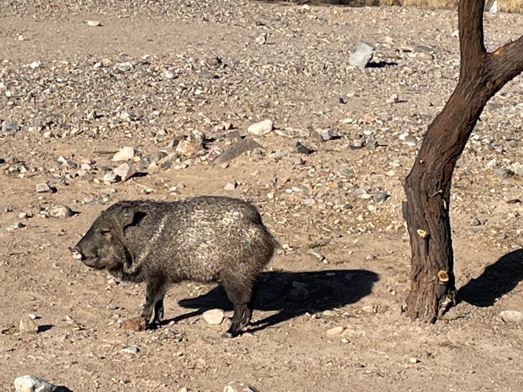
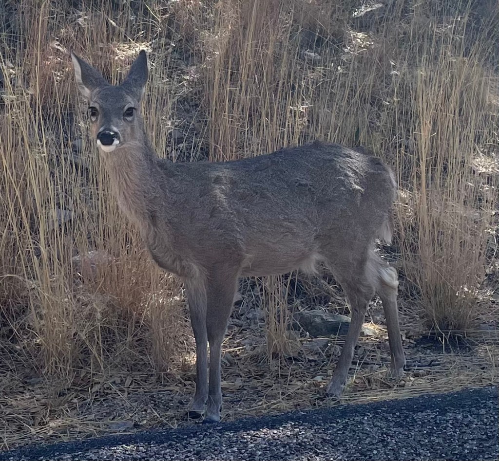
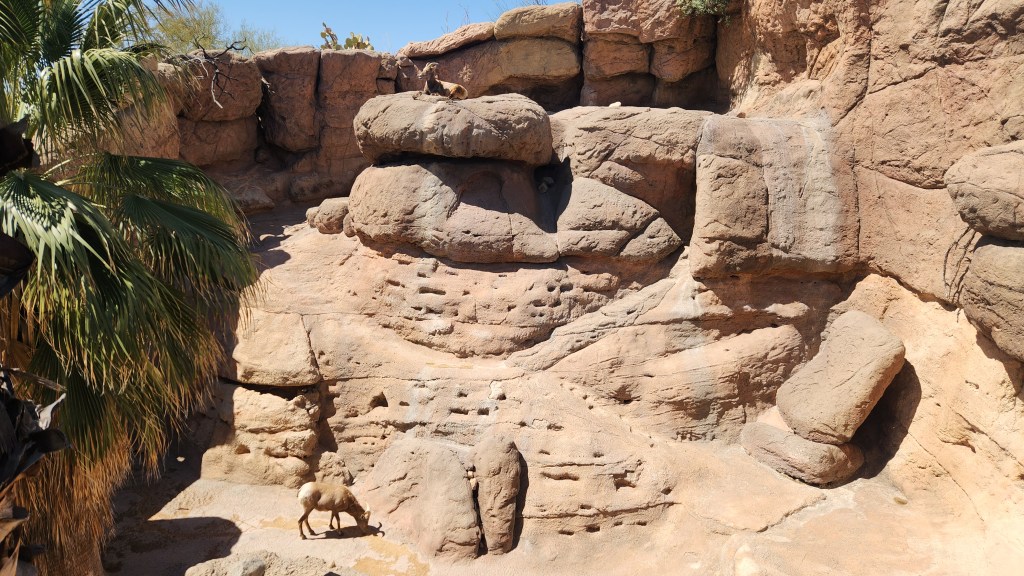
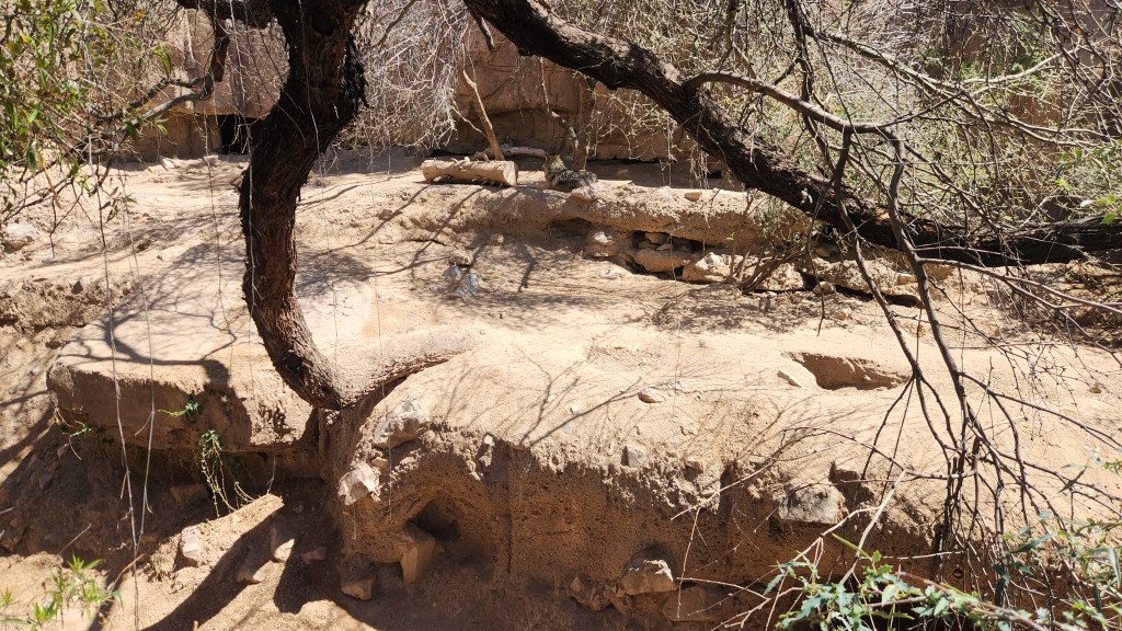
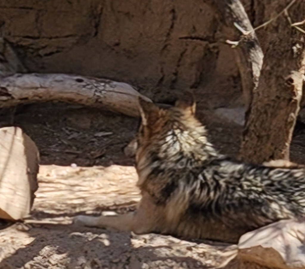
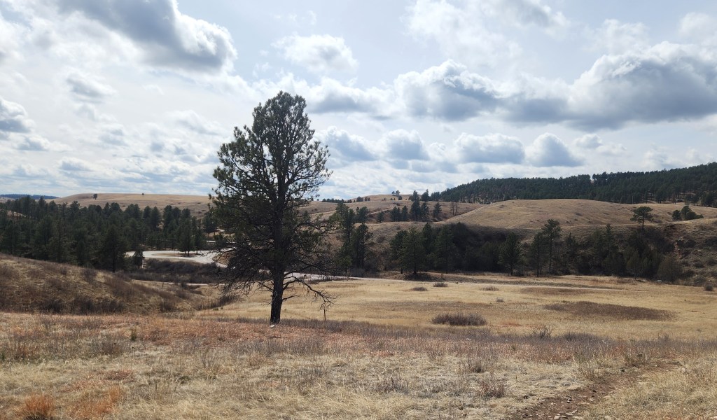
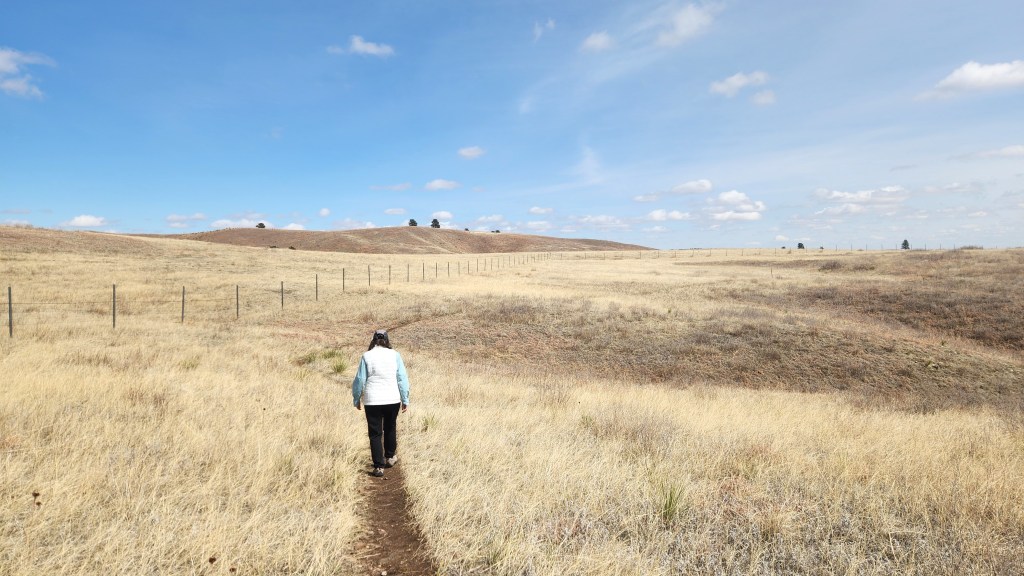
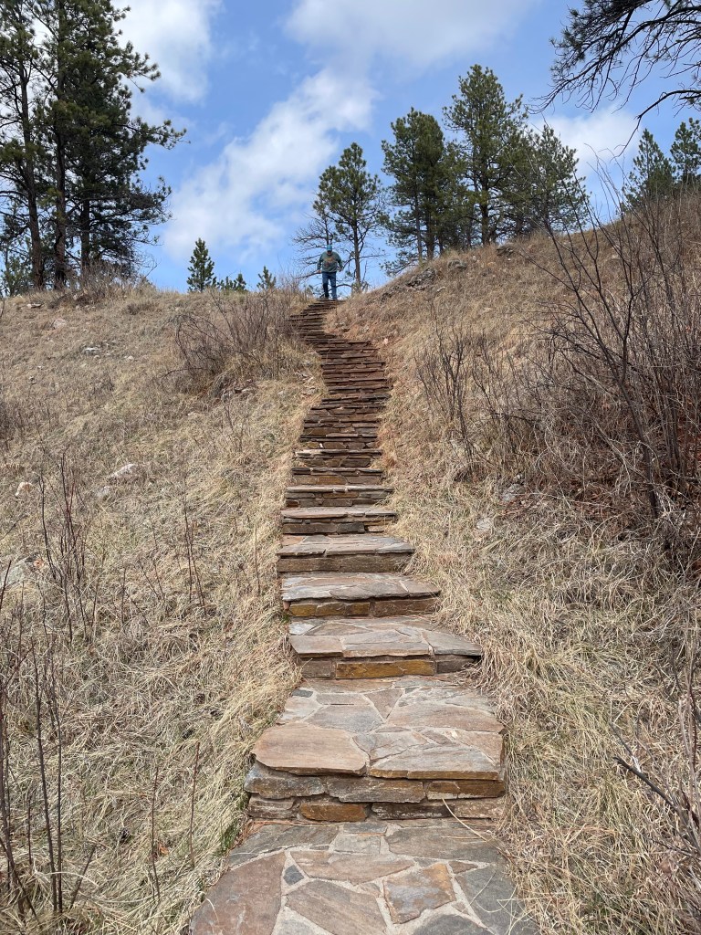
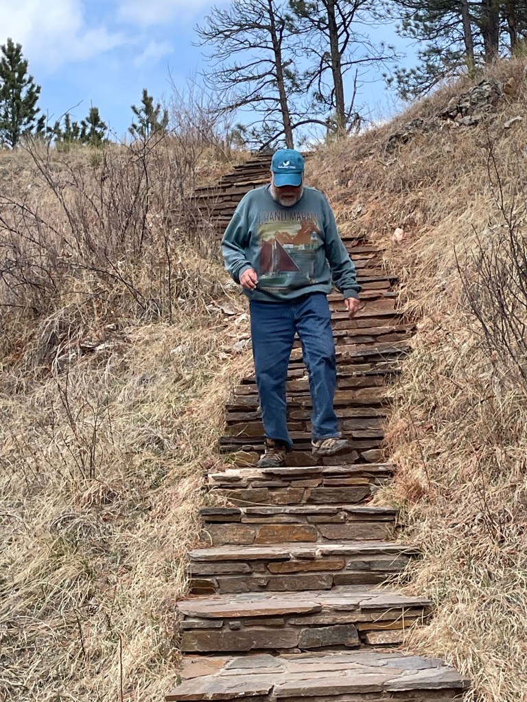
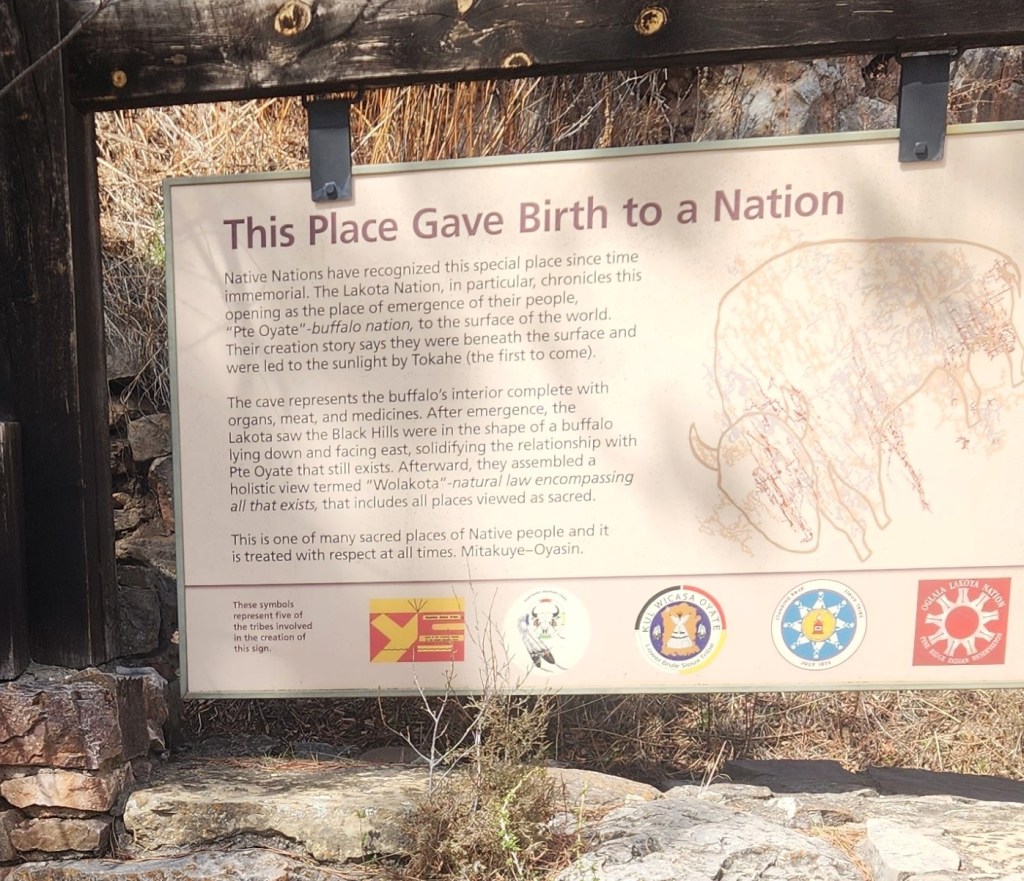
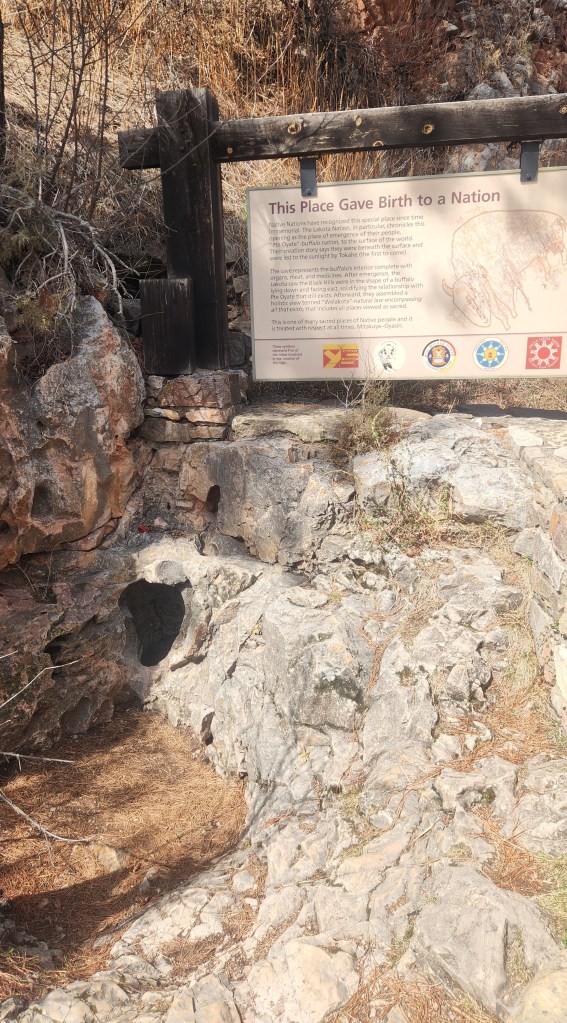
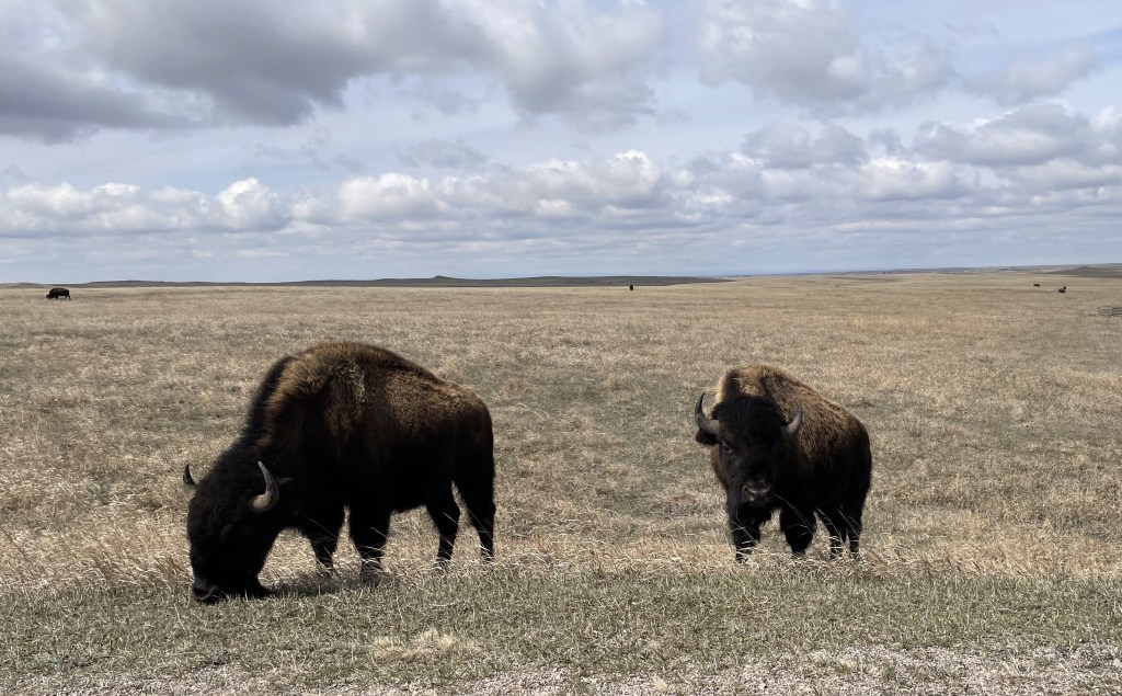
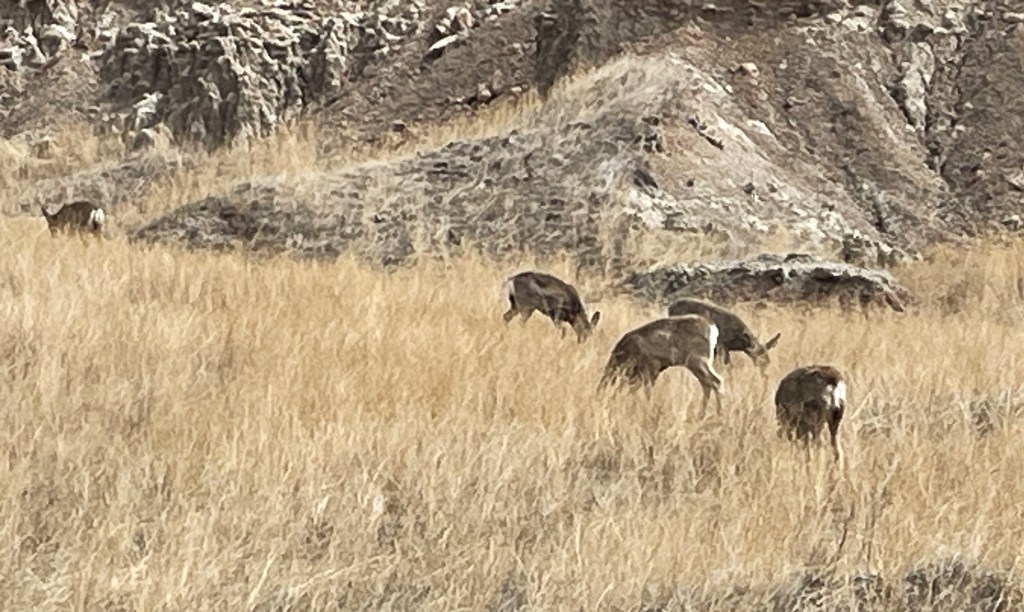
Wind Cave National Park:  On Wednesday, we resumed our eastward journey along I70, passing through the remnants of the storm in the Vail Pass and beyond. We passed a number of snowplows clearing the shoulders and experienced a few spots where the road was still icy, but by the time we reached the Eisenhower-Johnson Memorial Tunnel through the Continental Divide (11,132 feet elevation) all was clear. We drove on to a hotel with a destination charger that we had stayed at last October in Wheatland, WY, then drove on into South Dakota on Thursday morning and visited Wind Cave National Park. Unfortunately, all the cave tours were sold out for weeks in advance – we should have made on-line reservations before leaving Green Valley, but didn’t have enough foresight for that. As a result, our visit to the National Park (number 30 on our list) was limited to the Visitor Center, a short hike along a trail near the center, and a brief jaunt along a portion of the scenic drive. At least we saw some interesting rocks and some friendly animals. We’ll have to go back there some time to see the cave, which is said to be the seventh longest cave in the world with 154.2 miles of explored cave passageways (as of 2021) and the third longest cave in the United States. The cave was discovered in 1881 by a pair of brothers due to the sound of a strong wind blowing out of the hole (it blows in or out depending on the atmospheric pressure) and subsequently developed for tourism.

Nature Trail at Wind Cave National Park
Count those stairs, old man!
Sign Near Original Cave Entrance
The Original Wind Cave Entrance

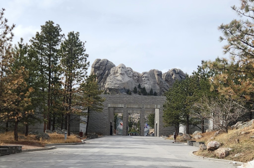
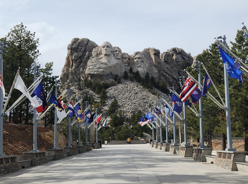
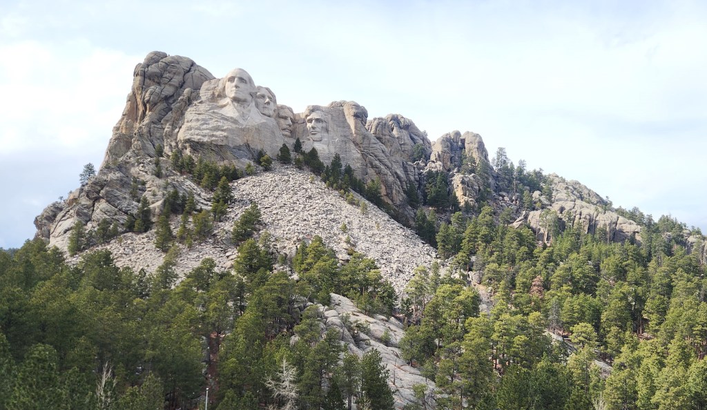
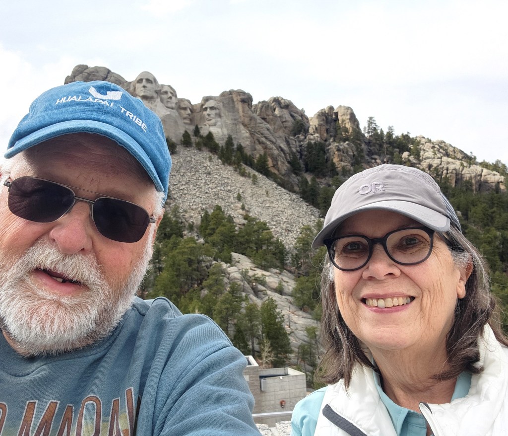
Mount Rushmore National Memorial: Since we were so close to this iconic piece of Americana, we had to stop and check it out. Unfortunately, the temperature was falling precipitously and the wind was rising, so, lacking appropriate cold weather wear, we didn’t spend a whole lot of time checking it out. There are some nice trails there, but they were closed due to the weather and we were too cold to go on them anyway. We did sit by a fireplace to watch a nice video and have some refreshments before leaving, though. One neat thing: it cost us only $5 to enter and park the car (half-price for seniors), and our ticket is valid for an entire year, so if we make it back out that way during better weather, we’ll stop in again.

Entrance to the Mount Rushmore National Memorial
An array of U.S. State and Territorial Flags leads to the viewing area
In better weather, we could have walked up a trail for a closer view
Just so you know we were really there …

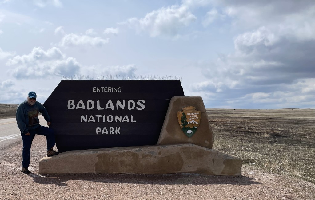
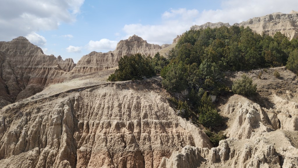
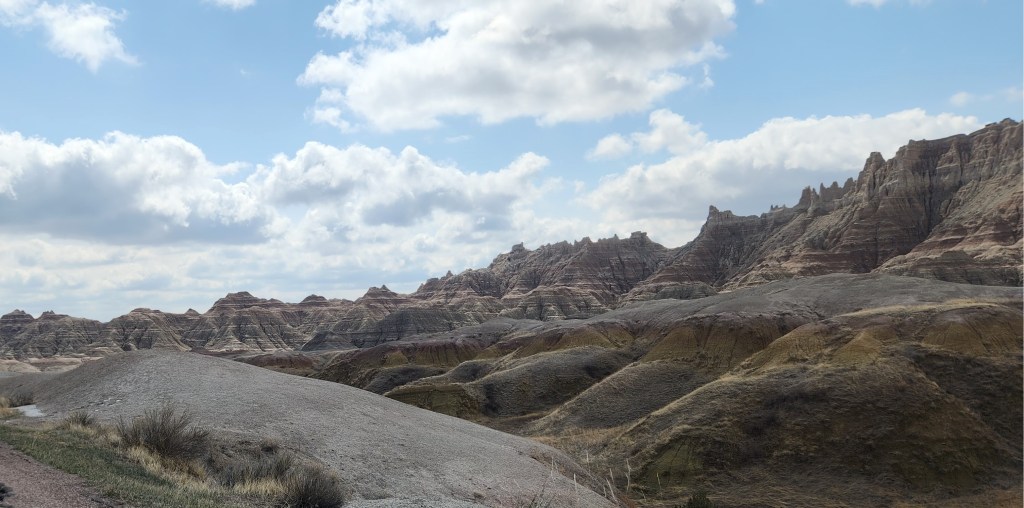
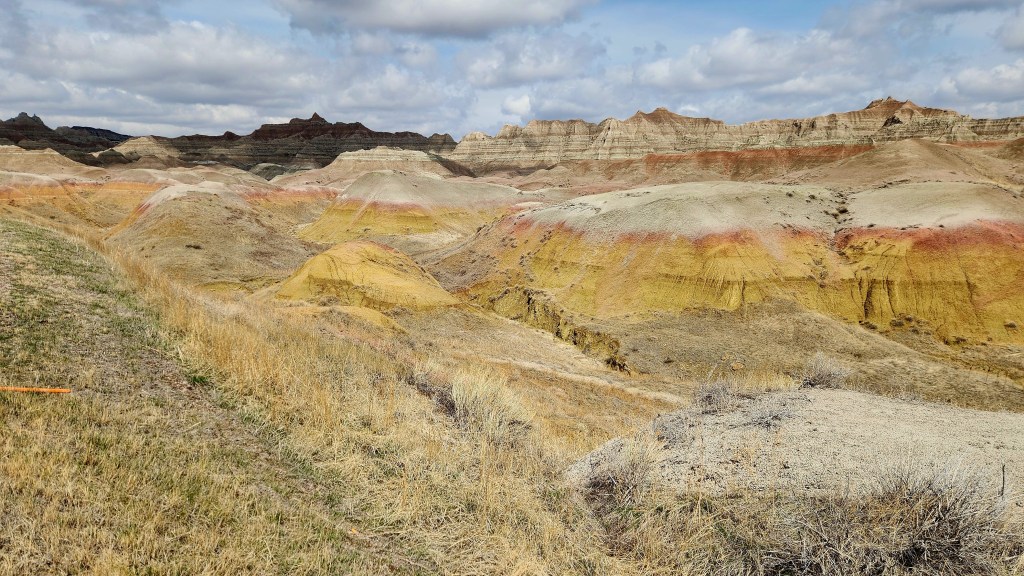
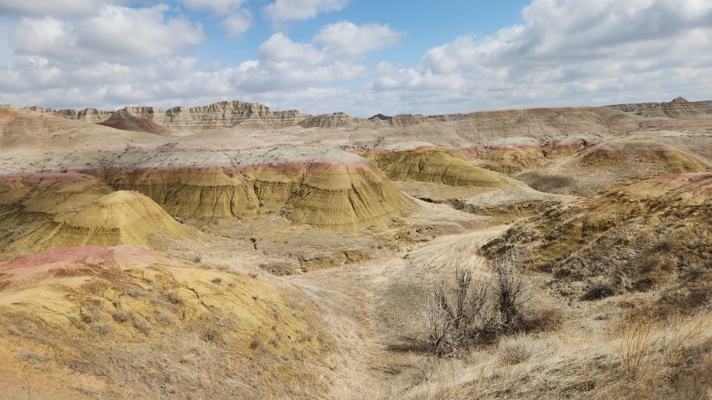
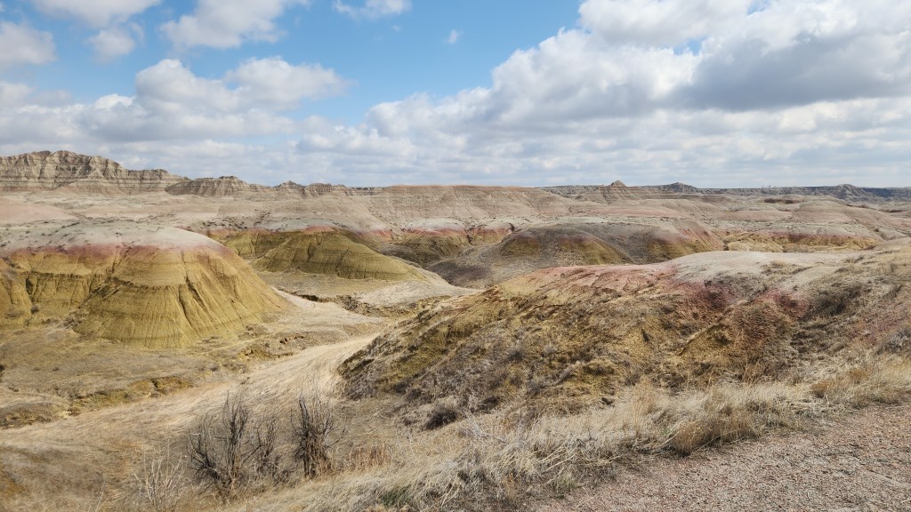
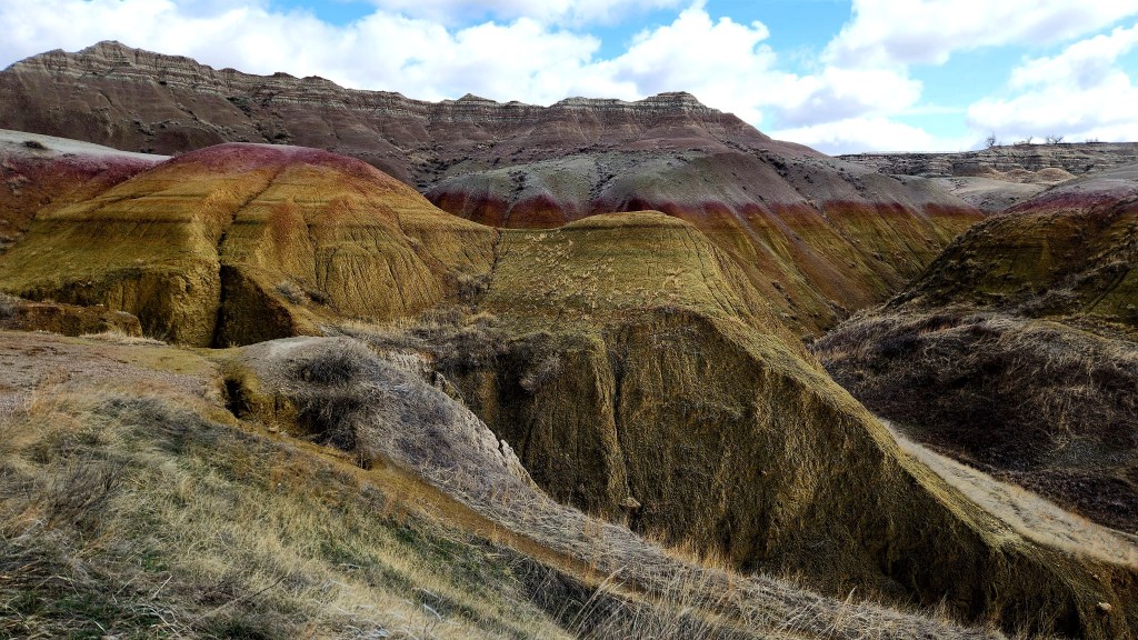
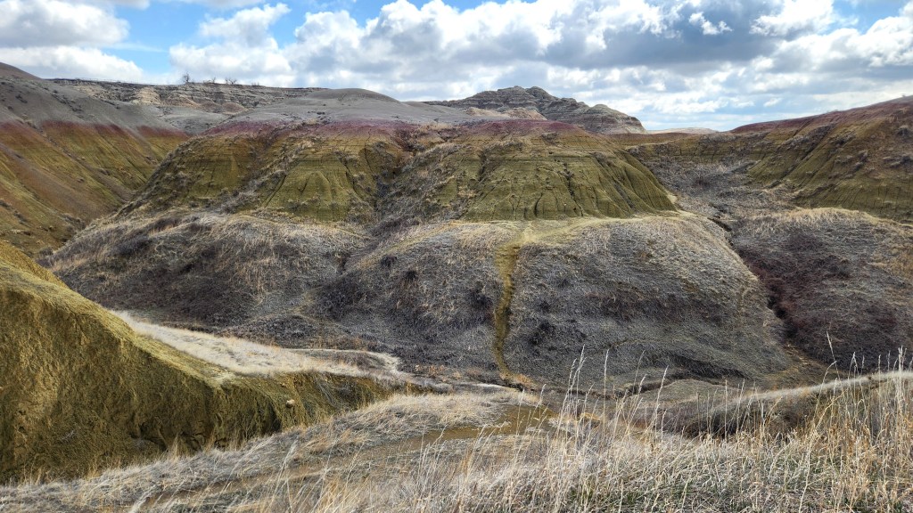
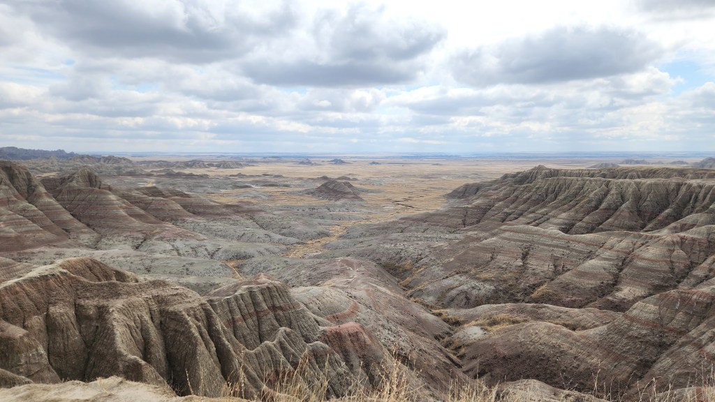
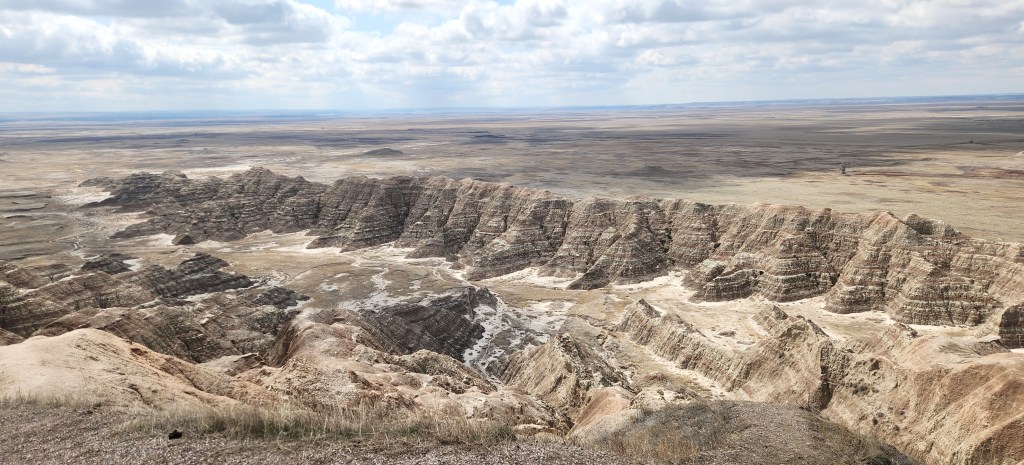
Badlands National Park: Afterspending Thursday night in Rapid City, SD, we drove to Badlands National Park, which brought our total number of National Parks to 31 so far. As you see on the map above, we failed to avoid Wall Drug as I had planned, but the only reasons we went there were: 1) to charge the car, and 2) to get on the road that enters Badlands from the north. I’ll admit that we did go inside – to use the rest rooms, not to bathe in the kitsch. At any rate, after surviving Wall Drug, we drove south to the park entrance.

Map of Badlands National Park

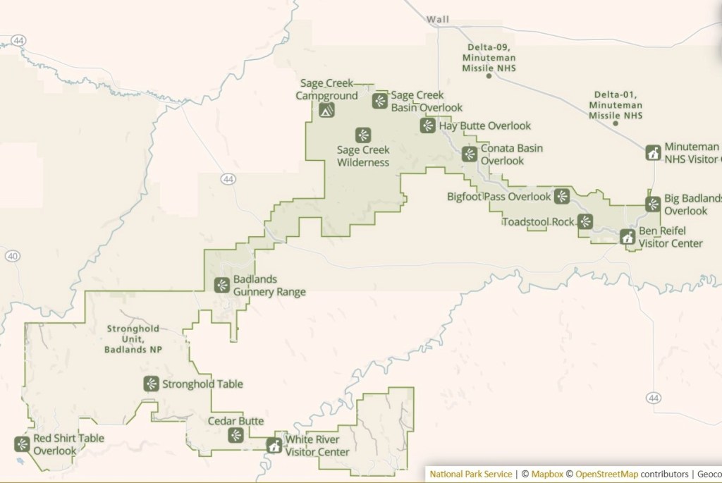
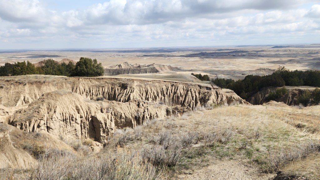
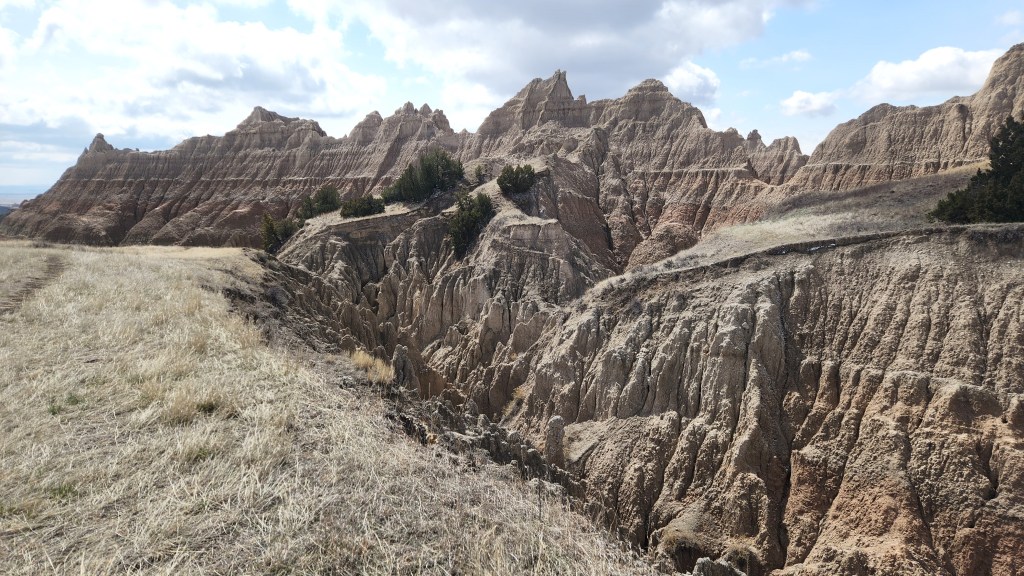
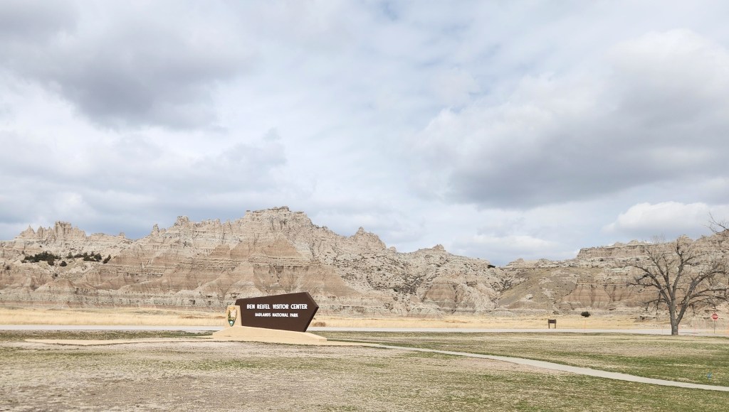
After stopping at the entry gate and showing my Senior Parks Pass, we headed southeastward through the park to the Ben Reifel Visitor Center. We had somewhat of a repeat of the Capitol Reef experience – jackrabbit Dave, Pat growing impatient until she took over driving, and Dave gawking and taking crummy pictures through the car windows. At the Visitor Center, we watched a video (of course) and perused the exhibits before heading off to the east toward Sioux Falls. If I can sum up the park in one simple statement, I’ll use a quote from the video, which was something like: “Badlands is a geologist’s wonderland.” As is sort of becoming a pattern with these travel blogs, I’m running out of gas, and you probably are, too, so I’ll just finish off with pictures.

The North Park Entrance
View of Badlands National Park from Scenic Drive Overlook
View from the Ben Reifel Visitor Center
Bison have a beautiful Home on the Range
Pronghorn are also abundant

Okay, that’s a wrap for Pat and Dave’s Winter Warmup. After a night in Sioux Falls, we arrived safe and sound back home in Minneapolis on Saturday, April 5. We once again enjoyed traveling to the beautiful southwestern United States, visiting some familiar locales and some new ones, each and every one interesting and enjoyable. I hope readers enjoyed sharing the adventure with me!

Our next planned travel adventure (no doubt to be documented in yet another travel blog series) will be in October and November of 2025, when we go on a Viking Ocean Cruise with pre- and post-cruise extensions. This time, Viking will be escorting us from Baveno, Italy to Athens, Greece.

Thanks for reading! Bon voyage, until next time …

Pat and Dave’s Winter Warmup – PART 2: Green Valley and Surroundings

Part 1 of this travel blog series told of our decision to head south to escape the Minnesota winter and described our travels to Green Valley, AZ. We arrived at the Canoa Ranch Golf Resort at 7:30 PM on February 17. We spent a total of five weeks at the resort, and except for about ten days during which first I and then Pat came down with rather severe upper respiratory ailments (the first real illnesses we’ve experienced in about five years), we thoroughly enjoyed our stay. During that time, at least during the times that I wasn’t out golfing at one or another of the many courses in the area, Pat and I visited a number of interesting places in the surrounding area. Here’s a map of the main places we visited:

This installment describes these places, in no particular order. So, without further ado, here goes.

Canoa Ranch Golf Resort: The resort has a total of 98 rooms located in about eight buildings distributed around the site. Our accommodations, which we had reserved five months in advance, consisted of a nicely furnished suite complete with a kitchen, living area, bedroom, shower and bath, multiple storage closets, and a laundry closet with washer and dryer. A balcony accessible via sliding doors from both the living room and bedroom overlooked the ninth hole of the golf course and provided impressive views of the mountains to the south and east. A full-time housekeeping staff provided daily refresh service if desired (we rarely used that) and once-weekly thorough cleaning (on Thursday afternoons in our case). Free breakfast was provided daily in the main resort building, only a short walk from our building. Outdoor parking was available in front of our building, and the staff even marked off a parking spot for us with access to an electric outlet for charging our EV.

View from our Balcony
View from Neighbor’s Balcony (Photo by Jared Sour)
A Javelina checked me out one evening as I was plugging in the EV
And maybe the same guy visited our neighbor in the back yard? (Photo by Jared Sour)

Golf Courses: I spent a fair amount of my time playing golf, primarily at the course owned by the resort. I played a total of seven 18-hole rounds at the Canoa Ranch Golf Course, one round at the San Ignacio Golf Course, one 18- and one 9-hole round at the Haven Golf Course, and one 9-hole round at the Torres Blancas Golf Course. The Torres Blancas outing was intended to be 18 holes, but I abandoned ship after 9 because the wind was blowing so fiercely on the particular day I tried it. With that one exception, the weather was quite nice, with temperatures ranging from the upper 70s to mid-90s with little or no wind on the days I played. (My Gunflint Hills Senior League partner Steve, who joined me for a couple of rounds as he was visiting relatives in the area, found the 90+ degree afternoon temperature at Canoa Ranch excessively debilitating after escaping the frigid Grand Marais winter, but managed the mid-70s morning temperatures at Haven much better.)

Canoa Ranch was my favorite of the lot, with beautiful mountain views and interesting hole layouts. San Ignacio was in slightly better condition, especially the sand traps (which were almost unplayable at Canoa Ranch), but had a much more noticeable housing-development vibe. It also cost more and I was only reluctantly allowed on the course in my blue jeans (and was told not to wear denim if I ever came back). Although I had procured some non-denim pants in anticipation of this classist and outdated policy, I instead opted not to show up there again and instead played happily in blue jeans at the other courses. Torres Blancas was also a nice course, where I would have played again except for time lost due to my bout of illness. Haven was rather uninteresting compared to the others and suffered from many wet spots due to a leaky watering system, but was the easiest in terms of scoring.

Here are some photos to provide a flavor for the two nicest courses:

Canoa Ranch Golf Course — 15th hole
Canoa Ranch Golf Course — 4th hole
Canoa Ranch Golf Course — 3rd hole
Canoa Ranch Golf Course — 2nd hole
Canoa Ranch Golf Course — 11th hole
San Ignacio Golf Course — 17th hole
A Fan at San Ignacio Golf Course

Canoa Hills Trails Park: This site is essentially a golf course that has gone on to its version of Valhalla. Once the site of the Canoa Hills Golf Course, it was purchased by Pima County and turned into a very nice walking park when the course developers went belly up. Pat and I went there a couple of times and walked around on the former cart paths, thoroughly enjoying the beautiful scenery.

Canoa Hills Trails Park

Madera Canyon Park: Madera Canyon is a recreation area within the Coronado National Forest, owned and operated by the National Forest Service, which includes several picnic areas and hiking trails. Pat and I spent an afternoon hiking and driving around there, although we only managed a mile and a half or so on one of the trails before turning back, as it became steeper and rockier as we went along. We enjoyed seeing some large bluebirds and some friendly deer during our meanderings.

Hiking Trail at Madera Canyon
Campground Area at Madera Canyon
Friendly Deer at Madera Canyon

La Posada Central Park:  This park is a part of La Posada, a retirement community on the eastern side of Green Valley, located next to some large pecan orchards. It contained an interesting collection of art works scattered throughout the well-groomed grounds, and even had a fun little mini-golf course along with a supply of putters and balls. (I had a much better score there than at Canoa Ranch or San Ignacio.) As a bonus, there was a very nice coffee shop in the mall next to the park called Posada Java — I had a hot chocolate on our first visit and a milk shake the second time while Pat had lattes.

La Posada Park
La Posada Park Artwork

Titan Missile Museum: Located just off of I19 about halfway between Green Valley and Sahuarita, this place turned out to be an impressive surprise. It was established as a museum after the Titan II ICBMs (which stood in continuous, ready-to-launch condition from 1963 to 1987) were deactivated as part of the US missile modernization effort leading up to the SALT II treaty negotiations. The museum was chock full of interesting exhibits explaining the history of the Titan II missile program, and the missile in its silo and the adjacent underground launch control room have been maintained in a non-functional condition for educational purposes. We took an exceptionally informative tour of the underground facilities, including a simulated launch of the missile. I was lucky enough to sit at the command control station and act out the process of coordinating with a second volunteer at a nearby station to send the missile screaming toward its target, presumably somewhere in the USSR. “My God, we just destroyed the world,” I said to him safter the demonstration was over. I felt a sense of awe as I realized in a visceral sense how close the world was to the so-called mutually assured destruction (MAD) that loomed constantly during the cold war.

Deactivated Titan II Missile in its Silo
Exhibit at Titan Missile Museum
Titan II Launch Control Panel

Historic Canoa Ranch: Located just to the east across I19 from our resort, this 4,800-acre site is owned and maintained by Pima County and is listed on the National Register of Historic Places. It is a portion of a site originally known as the San Ignacio de la Canoa Grant, given to Tomas and Ignacio Ortiz in 1821, shortly after Mexican independence from Spain. The Canoa Ranch functioned as a working cattle ranch from 1820 until 1970, and is still well-maintained and a popular site for public tours. The Juan Bautista de Anza National Historic Trail also runs through the site – in 1775 de Anza led an expedition of settlers and soldiers from the nearby Presidio of Tubac to San Francisco Bay and established the famous Presidio of San Francisco. The site also includes a lovely lake that supports a myriad of waterfowl and plants. One interesting factoid is that the site was used for filming several scenes in the 1970s TV series Petrocelli, the discovery of which prompted me to begin watching the old series. (So far, I’ve watched 13 episodes of Season 1 on YouTube – a nice respite from my other lawyer-show obsession, Perry Mason.)

Lake at Historic Canoa Ranch
Waterfowl at Historic Canoa Ranch
Ranch House at Historic Canoa Ranch
The de Anza Trail
Close-up of “Elephant Head”
Petrocelli Exhibit at Historic Canoa Ranch

Fred Lawrence Whipple Observatory (FLWO): This facility, operated by the University of Arizona and the Smithsonian Institution, is located near and on top of Mount Hopkins in the Santa Rita Mountains. The observatory on top of the mountain, visible from our balcony at the resort, is the site of the 6.5-meter MMT telescope, while the facility near the base of the mountain is the site of the Very Energetic Radiation Imaging Telescope Array System (VERITAS) gamma-ray observatory.

Pat and I attended a lecture by the FLWO director, given at the Green Valley West Social Center, at which we learned many fascinating details about the observatory. For example, the original telescope was built in 1979 using six 1.8-meter mirrors, the largest that could be made at that time, to create an effective telescope diameter of 4.5 meters. This unique construction was the source of the telescope’s name – the Multiple Mirror Telescope or MMT. Innovative mirror construction technology developed at the University of Arizona allowed the six mirrors to be replaced by a single, 6.5-m mirror in 1998, and a novel deformable secondary mirror was added in 2002, providing the ability to make corrections for atmospheric interference. The combination of the large mirror, the high altitude, the dark skies in the area, and the adaptable mirror make the MMT one of the premier ground-based telescopes in the entire world, providing image quality comparable to space-based telescopes such as the James Webb.

Enthused by the lecture, we signed up for a tour of the VERITAS observatory. Tours of the MMT on top of the mountain are currently unavailable due to the logistics of transporting visitors along the narrow mountain road, but the VERITAS tour seemed like the next best thing. Unfortunately, our tickets were for a day when Pat was suffering from the above-mentioned malaise, so I went on my own. The tour was fascinating and absolutely perfect, except for one small detail – I found the other tourists to be very annoying, what with talking while the guide was explaining things and then asking questions which he had already answered in detail. I suppose that’s why people call me a curmudgeon.

Anyway, how about some pictures?

Exhibit at FLWO VERITAS Site
One of the Four VERITAS Telescopes
View of the MMT Atop Mount Hopkins

Tubac: This town, about 15 miles down I19 from the resort, is a popular tourist destination with lots of restaurants, galleries, and shops. We ate at a well-known Mexican place called Elvira’s, which lived up to its reputation, before strolling through the town and to the Tubac Presidio Historic Park, the home of the first fort (established in 1752), the first European settlement, the first American mining community, and the first printing of a newspaper in Arizona. Returning north on I19, we passed through a border checkpoint staffed by dozens of border agents and boasting about thirty or forty fancy looking Government vehicles. Agents stationed on each side of the three traffic lanes prominently displayed their holstered weapons while casting surly looks into the vehicles crawling along the freeway. Ferocious looking dogs were also in evidence, but we didn’t see anyone actually being stopped. Pat and I were flabbergasted by the scale of the thing, just about thirty miles north of the border crossing at Nogales. Did they think they were preventing people from sneaking past the Mexican border and then hitchhiking rides on the freeway? It struck us as a massive waste of resources, all for show.

OK, I’ll stop grousing now and offer more pictures.

Tubac, Arizona — One of Many Galleries
Tubac Artwork
Tubac Artwork
Dinosaurs at Tubac
Tubac Presidio Historic Park

Tumacácori National Historic Park: This place, located about four miles south of Tubac on I19, is at a cultural crossroads in the Santa Cruz River valley, where O’odham, Yaqui, and Apache people met and mingled with European Jesuit and Franciscan missionaries, settlers, and soldiers, sometimes in conflict and sometimes in cooperation. We watched an excellent video describing the history, and one of the most poignant moments was when an O’odham speaker said something like “Of course we welcomed the Europeans when they came, but eventually visitors can overstay their welcome.”

A Jesuit mission was established on the site in 1691 by Father Eusibio Kino, who worked tirelessly to gain the trust of the native peoples, many of whom adapted his Christian teachings to their own religious beliefs to create a sort of hybrid religion that is still practiced today. A Franciscan mission was built on the site in the late 18th century after the Jesuits fell out of favor with the Spanish, and its ruins are what sit on the site today.

The ruins and the museum on site contain many excellent artifacts and interesting information about the various native and European cultures. I was especially impressed by the beautiful basketry work by the O’odham people.

Franciscan Mission Ruins at Tumacacori National Historic Park
Mission Ruins at Tumacacori
Native Structure at Tumacacori

Dos Cabezas Wineworks: This place is located in Sonoita and can be reached by means of lovely drives in either of two manners: 1) heading south on I19 toward Nogales, then northeast on Highway 82 to Sonoita, or 2) heading north on I19 to Sahuarita, then east to Highway 83 and south to Sonoita. In order to maximize the scenic experience, we made the trip into a loop, going there on the southerly route and returning on the northerly one.

The wine works is also known as Pronghorn Pizza, as they serve a menu of delicious pizzas as well as Arizona wines from the Dos Cabezas wineries, a defunct one near Sonoita and an active one in Willcox, AZ. To go with the pizza, I opted for the wine tasting menu, which included a souvenir glass and five selections of the local wines, while Pat stuck with water, still feeling the effects of her illness. We enjoyed the experience so much that we bought two bottles of wine, which we eventually shared with our condo neighbors on their balcony at the resort.

Canoa Ranch Resort to Sonoita Loop
Scenery Along the Sonoita Loop
Poster at Dos Cabezas Wineworks
My Souvenir Wine Glass

Mariscos Chihuahua Restaurant: I have to include a mention of this place because I’ve been enamored with it ever since we first discovered it on an RV trip back in 2018. We visited again several times while staying at a Tucson RV park in 2020, and naturally I had to go back again on this trip when we visited some places in Tucson. Faithful readers will guess what I ordered: Camarones Rellenos – shrimp stuffed with cheese and wrapped in bacon. I talked it up so much with our condo neighbors that they also tried it and gave their thumbs up as well.

Tucson Botanical Gardens: While in Tucson, we also visited the Botanical Gardens, which offer a marvelous display of desert flora native to Arizona and other places with similar climates, such as various South American countries. Since I’ve been blathering on for quite a bit, I’ll refrain from further commentary and just go with pictures.

Tucson Botanical Gardens Artwork — Hear no Evil, Speak no Evil
Tucson Botanical Gardens Artwork
Tucson Botanical Gardens
Moths at Tucson Botanical Garden
Moth at Tucson Botanical Gardens
Giant South American Moth at Tucson Botanical Gardens
Tucson Botanical Gardens

Arizona-Sonora Desert Museum: This is the last place I want to talk about, located adjacent to Saguaro National Park West. According to the museum map, the 21-acre museum includes two miles of walking paths through various habitats, 230 animal species, 1200 types of plants and 56,000 individual specimens, comprehensive regional mineral collections, and world-class art exhibitions. We spent several hours strolling along the winding paths through the exhibits, which include:

  • Warden aquarium
  • Reptile, invertebrate, and amphibian hall
  • Earth sciences center and cave
  • Ancient Arizona and Sonorosaurus
  • Mountain Woodland
  • Desert Grassland
  • Desert Loop Trail
  • Cat Canyon
  • Riparian Corridor
  • Birds of the Sonoran desert
  • Life underground
  • Hummingbird aviary

We visited a majority, but not all, of the exhibits and were delighted by the variety of flora and fauna we were able to see, including real live (animatronic) dinosaurs! Not only that, but we had a great lunch, including the most amazing hot dog I’ve ever eaten.

Cacti at Sonoran Desert Museum
Mountain Lion Exhibit at Sonoran Desert Museum (he’s sleeping)
Deer Chilling at Sonoran Desert Museum
Pronghorns at Sonoran Desert Museum
Grey Wolf Exhibit at Sonoran Desert Museum
Zoom-in on the Wolf
These Guys are Pretty Feisty
That could have been me …

Okay, that’s it for Part 2. Stay tuned for Part 3, in which I’ll describe the interesting places we visited during our road trip back to Minneapolis.

Pat and Dave’s Winter Warmup – PART 1: Overview and Starting Out

While we truly love our homes in the great state of Minnesota, a condominium in Minneapolis and a cabin in Grand Marais, we love them a lot less during the winter than the other three seasons. By the time February rolls around, we’re usually tired of the snow and ice and cold weather, so we start looking for a getaway to someplace a bit more hospitable to human habitation. This year, we hit on the idea of trying an extended stay in one place as well as a bit of a road trip. In fact, the extended stay idea was implanted in our brains by some friendly upstairs condo neighbors who have taken to spending time every February and March at a resort in Green Valley, AZ. This implantation occurred in April of last year as they regaled us with tales of the lovely accommodations and the many fun things to do in the area. They explained that a long-term stay (more than 30 days) qualifies a guest for a reduced rate, as the short-term hospitality taxes and fees are waived. Pat was sold on the idea rather quickly, and suggested that I take charge of getting us a reservation for February and March of 2025.

“So, what’s this place called?” I asked. “The Canoa Ranch Golf Resort,” our neighbors replied, and provided me with the contact information I’d need to make said reservation. Upon hearing the word “Golf,” I immediately agreed to take charge. “I’ll get right on it, dear,” I told Pat.

Fast forward to September 20. I was at the cabin in Grand Marais while Pat was back at the condo, and I suddenly realized that I had not yet “gotten right on it,” having forgotten to call for the promised reservation. After a bit of telephone tag, I finally managed to complete my assigned task, although due to my procrastination no rooms were available until February 21. Better late than never, I told myself, while trying to craft the proper words to gently break the news to Pat.

Luckily, we had a great fall travel season, as documented in my earlier blog posts, Pat and Dave’s Nifty National Park Lark and Pat and Dave’s Intrepid Iberian Interlude, which helped us to forgive my less-than-stellar performance in securing the Canoa Ranch Resort reservation.

First off, here’s a map of our overall journey, to set the stage for this narrative:

We had planned to depart on February 18 and spend four days driving to Green Valley, but a big snowstorm hit the Midwest, causing us to delay our departure and shorten our travel time to three days. Fittingly, as we rolled out of the condo parking garage in our EV on Wednesday, February 19, it was a bone-chilling negative 4 degrees Fahrenheit.

It felt good to be heading to warmer climes, as the high temperature hadn’t reached positive figures for two solid days. However, as we drove south to our first overnight in Olathe, KS, in suburban Kansas City, it didn’t warm up at all. When we resumed our journey on Thursday morning, we had to scrape snow and ice off the car and the thermometer read negative nine. We passed a herd of about 100 cows standing in groups on both sides of the highway as we departed Olathe. “Are those cows even moving?” I asked Pat. “I don’t think so,” she said, studying the miserable-looking, immobile beasts. “Maybe they’re all frozen solid.”

It didn’t get much warmer until we passed through the Texas panhandle, and when we reached our second night’s hotel in Tucumcari, NM, it was still only about 20 degrees. During the second day of driving, it finally began to warm up, reaching into the 50’s by the time we reached Willcox, AZ, and finally into the 70’s as we rolled into the Canoa Ranch Golf Resort at 7:30 PM. I won’t say much about the drive to Green Valley, since all we did was drive, charge the EV, eat, and sleep, but I will offer this photo of the lovely sunset we encountered near Amarillo, TX, on Thursday evening.

Sunset Near Amarillo, TX

I’ll be writing two more installments for this adventure. Part 2 will cover the five weeks we spent in the Green Valley area, and Part 3 will describe the beautiful places we visited on our way back to Minneapolis. But first, I want to say a few words about our EV. (Those readers who are tired of my EV proselytizing can just skip the rest of this installment and come back for Part 2 in a few days.)

Some of my prior posts have provided detailed information about traveling with an electric car, because I want to help readers to understand the real-world aspects of joining what I like to call the EV Universe. In those posts, I have been effusive in my praise of the specific brand of car that we drive, but for now I’m merely calling it an EV. Why? The overriding reason that we have purchased two EVs and no longer drive a gasoline powered car at all is our desire to do something to help stem the tide of global climate change. Electric cars are the future, and I have tried to provide useful information to readers based on our real-world experience. Unfortunately, one individual (whose name I shall not mention), after becoming the world’s richest man by successfully developing the US electric car industry, has now revealed himself to be an unspeakably disgusting, corrupt man who doesn’t even believe in the mission of the EV Universe – he merely exploited a market opportunity to amass enormous wealth and power which he is now using in an attempt to destroy the very soul of our great nation. Many people now say we should get rid of our EVs as a protest against this man. But as a fervent believer in the goal of the EV Universe, I urge readers not to abandon your EVs. Fellow owners of American-made EVs, please keep driving your zero-emission vehicles. Join the mass protests against the man, put a protest sign on your car, urge your members of Congress to send him packing, but don’t let him destroy both the EV dream and the US Government.

Love the Car, but not the Man

Okay, I’ll calm down now and provide some information about our EV that will hopefully be of interest. It was quite obvious during our drive from Minneapolis to Green Valley and back again that the performance of the car was noticeably reduced when the temperature was low and was very good when the temperature was high. So, I decided to compare the car’s efficiency during the drives between our charging stops (based on my records of actual miles driven and energy added during each charging session) with the air temperatures at the various charging locations as documented by the Weather Underground website. Here’s what I came up with:

Although there is significant scatter in the data due to other variables that affect performance (terrain, wind, driving speed, heating or air conditioning usage, etc.), it is clear that the actual efficiency was lower than the EPA rating at low temperatures and higher than the EPA rating at high temperatures. This bears out the general wisdom I have heard that EVs are good warm-weather cars and not-so-good cold weather cars. To put this data in perspective, I also spent a little time trying to find a comparable analysis for a gasoline-powered car. For the most part, I could only find general statements about the temperature impact, but I did find this interesting chart posted on the Fuelly.com website by the owner of a 2009 Honda Fit 1.5 RS CVT:

The Honda owner is clearly one who takes measures to maximize fuel economy, since his calculated 55 MPG vastly exceeds the 31 MPG EPA rating for that car, but the interesting aspect of the above chart is that is shows a decrease in efficiency for the gas-powered car at lower temperatures that is comparable to what I found for our EV. It also shows a decrease in efficiency at elevated temperatures, which the EV data does not show. While a comparison of calculations by two individuals for two cars is not in any way a sound scientific analysis, this interesting anecdotal data shows that the temperature impact for the EV efficiency is no greater than that for the gas-powered car.

Okay, that’s enough for Part 1. Stay tuned for Parts 2 and 3, which will feature more pictures and less pontificating.