

Readers of this travel blog series may recall that it was born back in 2018 when, at the urging of family members, I began documenting a 10,200-mile RV trip. Since then, I’ve documented a total of thirteen domestic and international trips. Next up will be our fourth trip with Viking Cruise Lines, this time starting at Lake Como, Italy, and ending in Athens, Greece. As I was looking over the list recently, it dawned on me that I have neglected a major aspect of our travel experiences. We are most fortunate to be able to spend most of our summers at our cabin on Minnesota’s beautiful North Shore of Lake Superior, and we regularly visit various points of interest along and near the magnificent lake. So, purely in the interest of furthering readers’ knowledge of excellent travel destinations, I decided to write a travel blog installment describing some of the places we visited during the summer and early fall of 2025. Which I will now proceed to do …
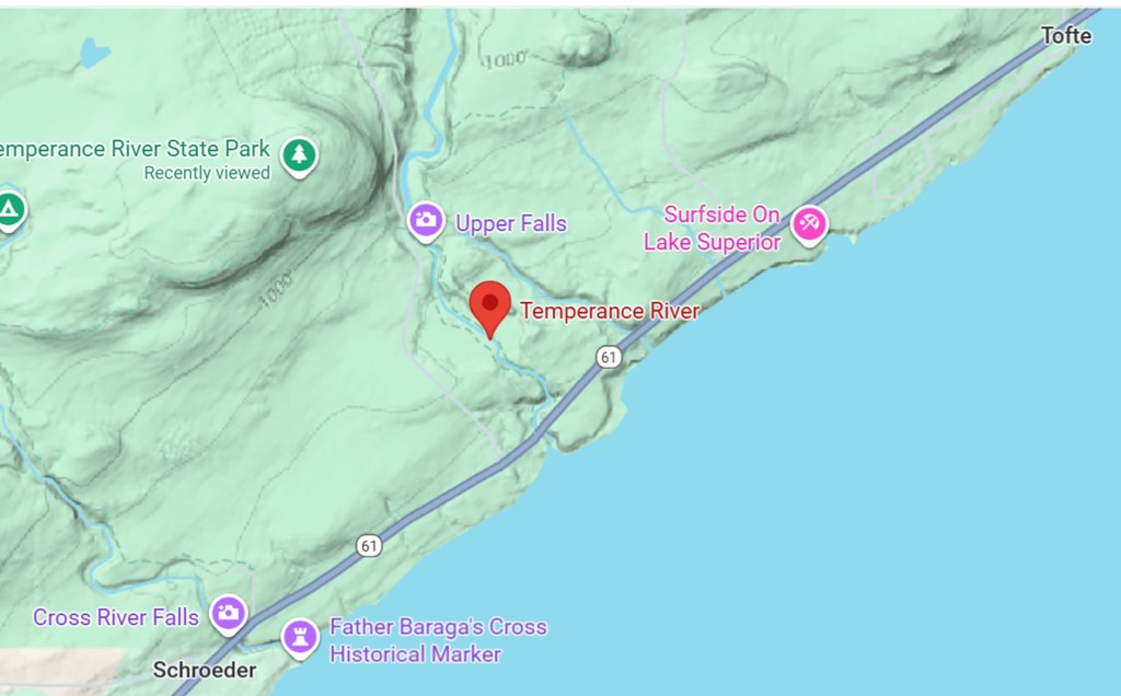
Sites Near the Cabin: Our peaceful cabin (which I’ve now dubbed The Saaris’ Summer Sanctuary) is located on Minnesota Highway 61, also known as the Voyageur Highway, some 5.6 miles east of the harbor in Grand Marais, MN. I’ll describe three nearby features that we frequently visit by strolling down a path from the cabin and crossing the highway. Readers interested in checking out these features can travel by car or kayak to a public access point denoted on the satellite image below as the Durfee Creek Watercraft Campsite. (I may seem friendly on these blog posts, but I will not be charitable to anyone dropping in at the cabin for an unannounced look-see.)
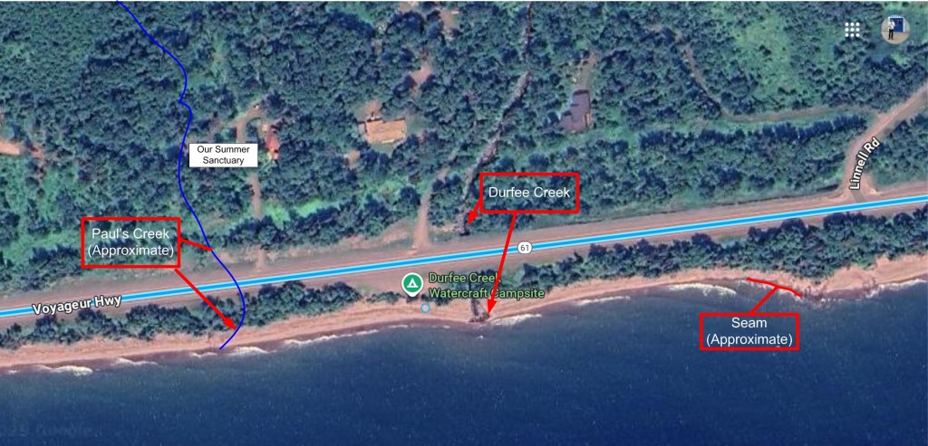
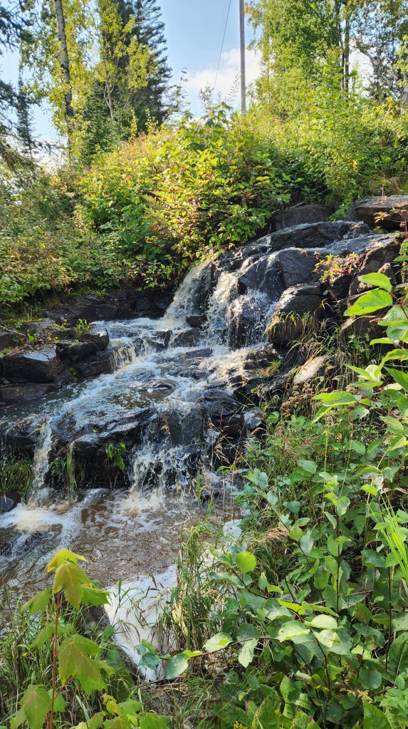
On the satellite image, I’ve hand sketched a line labeled Paul’s Creek. You won’t find such a creek on any map, although Google Maps indicates a nonexistent, unnamed creek that supposedly flows into Lake Superior somewhat to the east of the actual, unnamed creek. I gave it the unofficial name of Paul’s Creek in honor of my late father, who enjoyed constructing makeshift footbridges across the creek bed. For most of the year, this little stream is barely a trickle, but after a significant rainfall it can look quite impressive. Here are some photos of the waterfall on the north side of Highway 61 and its subsequent discharge point into Lake Superior.
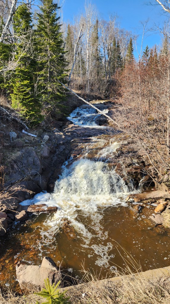
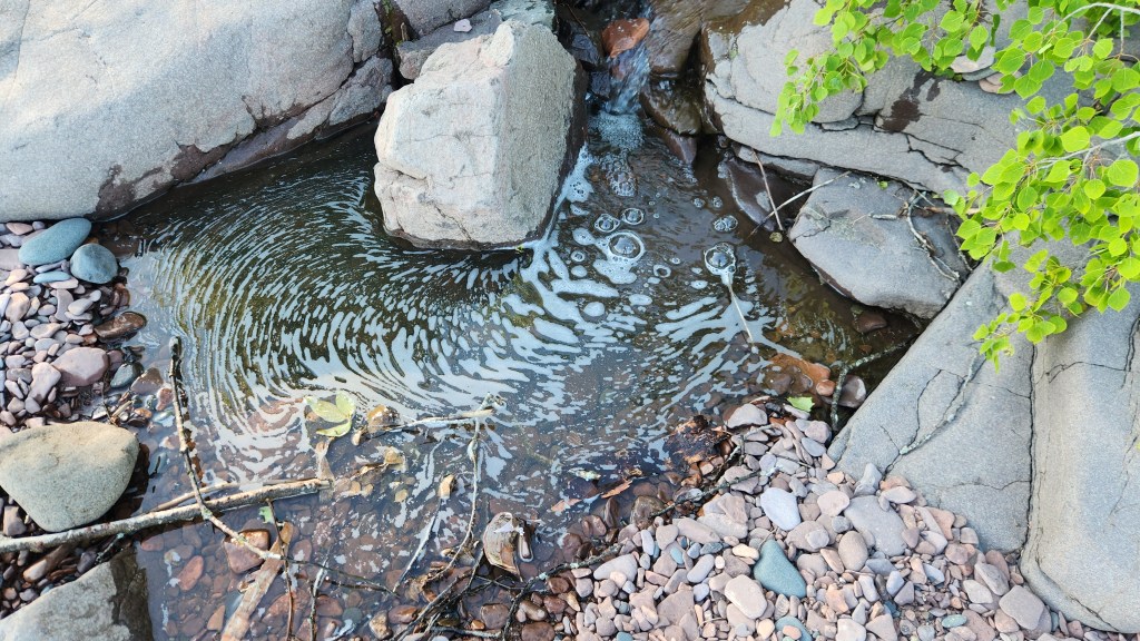
A few hundred yards to the east there is a much larger stream known as Durfee Creek, which flows steadily year-round but also becomes engorged after a rainfall. The most interesting aspect of Durfee Creek is its discharge into Lake Superior, which can change dramatically from day to day depending on the volume of water flow in the creek as well as a particular day’s wave action on the Lake.
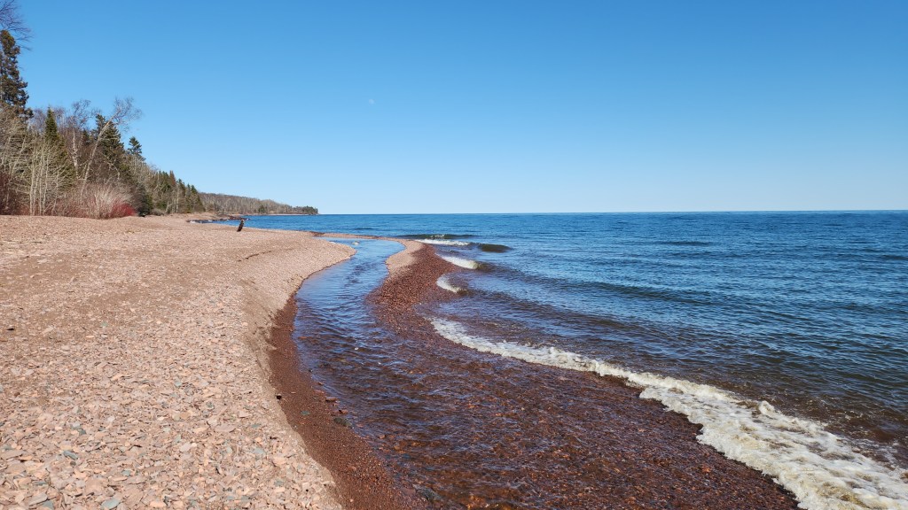
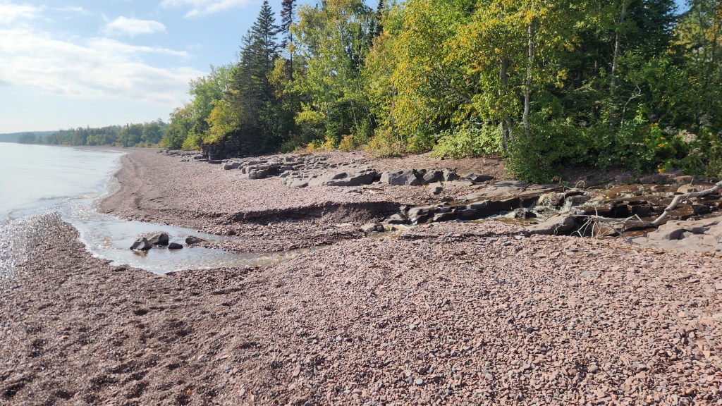
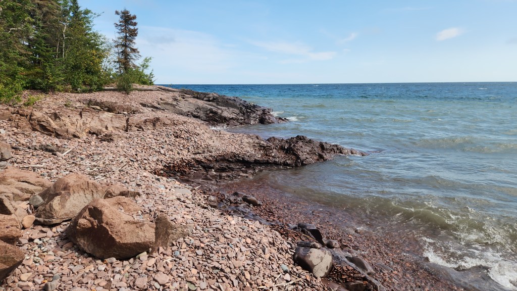
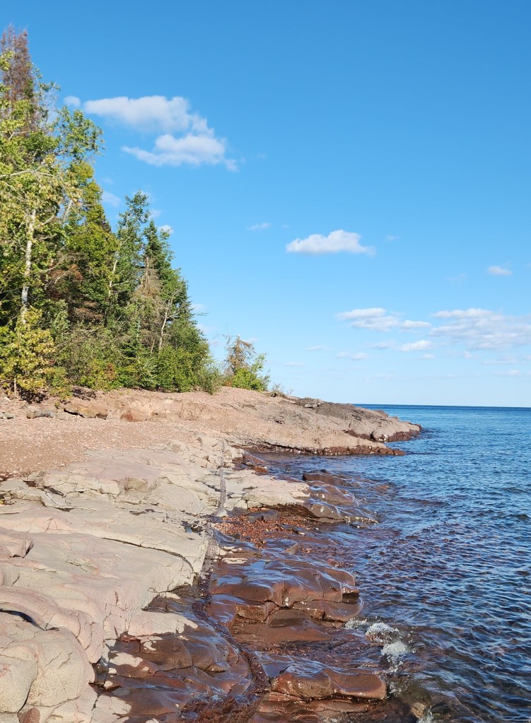
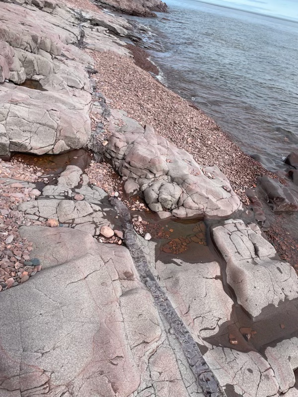
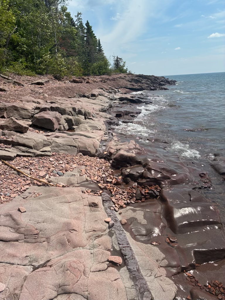
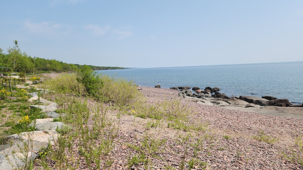
I’ve sketched in another interesting feature to the east of Durfee Creek, which I call “The Seam.” Along this stretch of Lake Superior, the billion-year-old bedrock which forms the shoreline is generally covered over with stones, most of which are flat and really fun to skip along the surface of the Lake on calm days. Here’s a photo looking eastward showing a typical configuration of these stones. However, the wave action routinely spreads the rocks around in many different ways, so that the shoreline can look completely different from one day to the next.
Sometimes, the waves remove most or all of the covering stones to reveal the bedrock. When that happens, you can see The Seam. I’m not a geologist, but to me it looks like a place where the rock cracked open in ancient times, and lava flowed from below to fill in the gap. I absolutely love the days when The Seam reveals itself for my enjoyment.

These three features of the ever-changing Lake Superior shoreline near our Summer Sanctuary have thrilled me for nearly fifty years and never fail to make the summer months especially rewarding.
A Lapse in Attentiveness: Unfortunately, there was one aspect of the summer that was not a positive. For the first time in nearly sixty years of driving back and forth on Highway 61, I hit a deer. It was all my own fault. It was a sunny afternoon in May and I was returning from a trip to Duluth with son Brian. As we neared Two Harbors, he began yelling “Whoa! Whoa!” Not expecting to see deer at that time of day, I had failed to notice four of the critters ambling across the highway. I slammed on the brakes and almost managed to stop in time, but I caught the lead deer’s hindquarters with the right front bumper of the car. I imagined him laughing at me as he loped off into the woods.
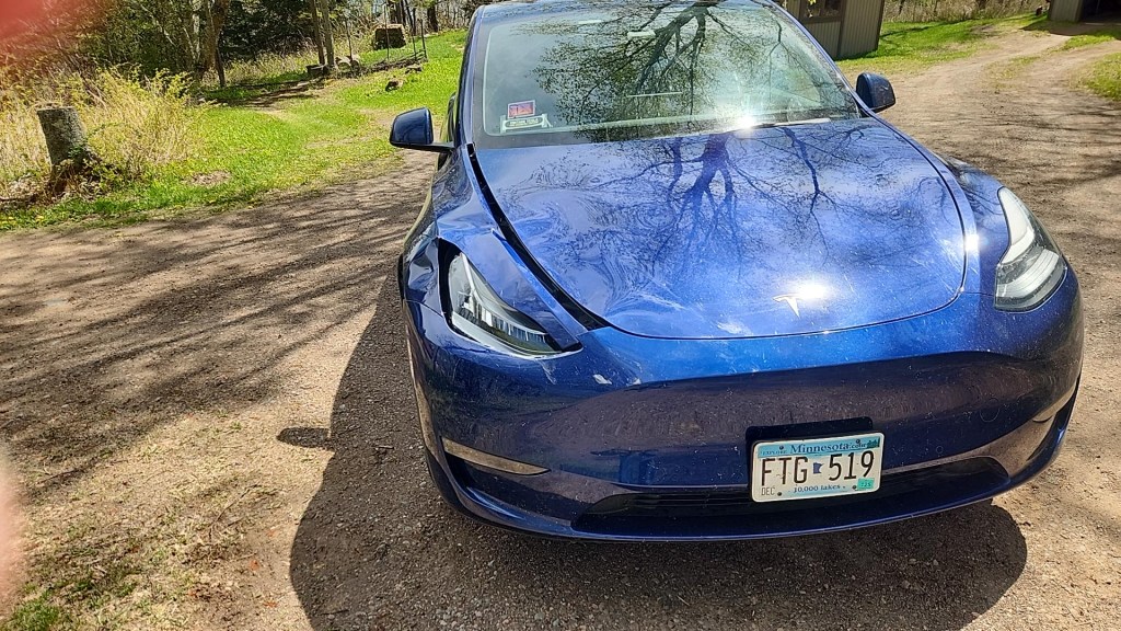
While the damage appeared minimal, it still required a trip to the Tesla Repair Center in Eden Prairie. I dropped it off there on May 29 and had to leave it there until June 12, leaving us with only one car for a couple of weeks. As a big promoter of electric vehicles, I have to admit that the paucity of repair facilities is one downside of Tesla ownership. (I guess that’s an example of what Brian calls a first world problem.)
Kitchi Gammi Park: Pat and I stopped at this nice park on the east end of Duluth on our way back to the Summer Sanctuary on June 2, after dropping the damaged car at the repair shop. The park was recently renovated, improving the access drive and adding rest rooms, picnic tables, and children’s play areas. Here are a few photos.


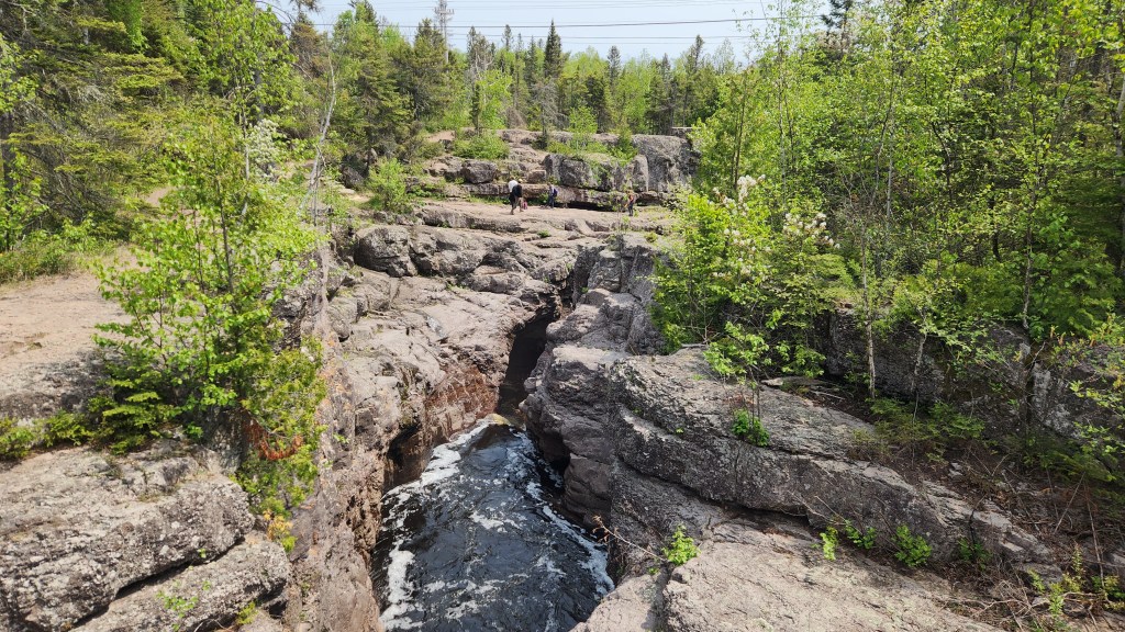
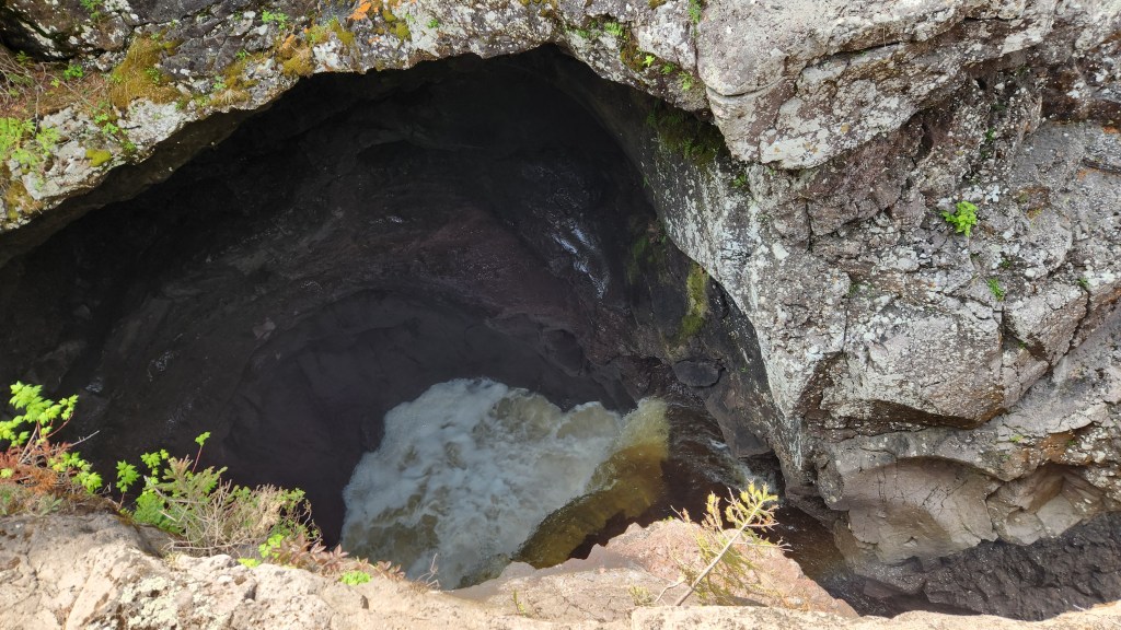
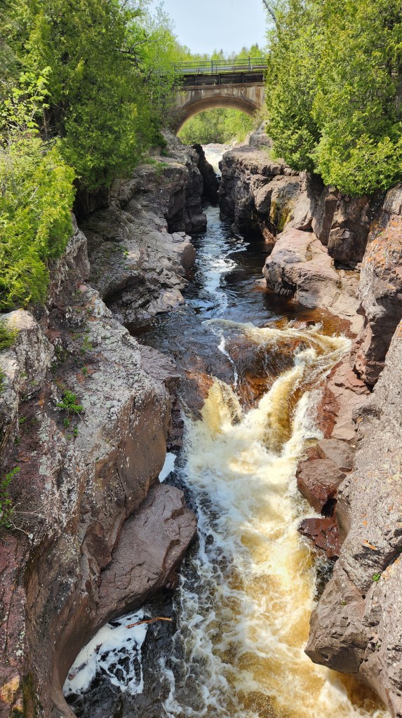
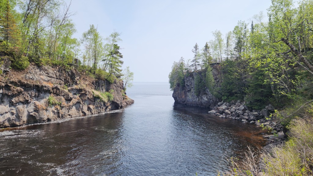
Temperance River: Temperance River State Park, located along Highway 61 between Schroeder and Tofte, is one of eight state parks along the North Shore.
The river owes its name to the fact that it is the only river on Minnesota’s North Shore that has no bar at its mouth. We stopped there on June 2 and spent an hour or so on the hiking trails both upstream and downstream of the highway. The upstream part of the river canyon is extremely rugged, with multiple potholes initially gouged out of the bedrock some 10,000 years ago by powerful torrents of glacial meltwater.
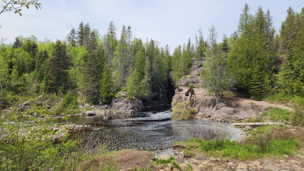
The downstream portion becomes more serene as rapids give way to the gentle river mouth, with no bar as promised by the river’s name.

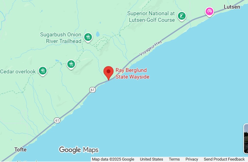
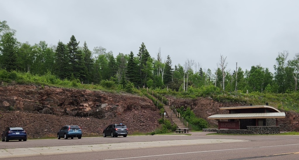
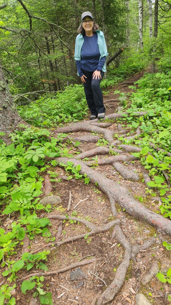
Onion River: The Onion River Trailhead starts at the Ray Berglund State Wayside, located along Highway 61 between Tofte and Lutsen. We drove there from the Summer Sanctuary on June 22 and walked alongside the Onion River for about three quarters of a mile to a bridge where the Gitchi-Gami State Snowmobile Trail crosses the river. The walk through the forest is peaceful and scenic, with limited views of river, until reaching the Onion River Falls, which were flowing very nicely on the day of our visit.
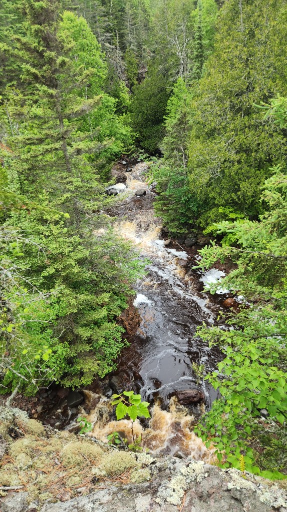
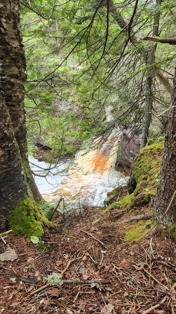
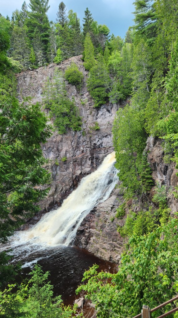
Caribou Falls: This is another nice place to stop when driving to or from the Summer Sanctuary, located between Little Marais and Taconite Harbor along Highway 61. The State Wayside has a nicely paved parking lot and a rest room (handy for those days when too much Dr. Pepper is causing a bloated bladder). A trail heads north from the parking lot to the Caribou Falls. Here are some photos from June 30, when Pat and I stopped for the 1.3-mile hike and were rewarded with a spectacular view of the falls from an excellent access stairway.

OK, that’s it for Part 1. Thanks for reading, and stay tuned for Part 2, in which I’ll cover several more highlights from the summer season.
