Our last episode ended at Doheny State Beach in Dana Point, CA, our next-to-last stay along the Pacific coast. This post describes we’ve done during the subsequent month.
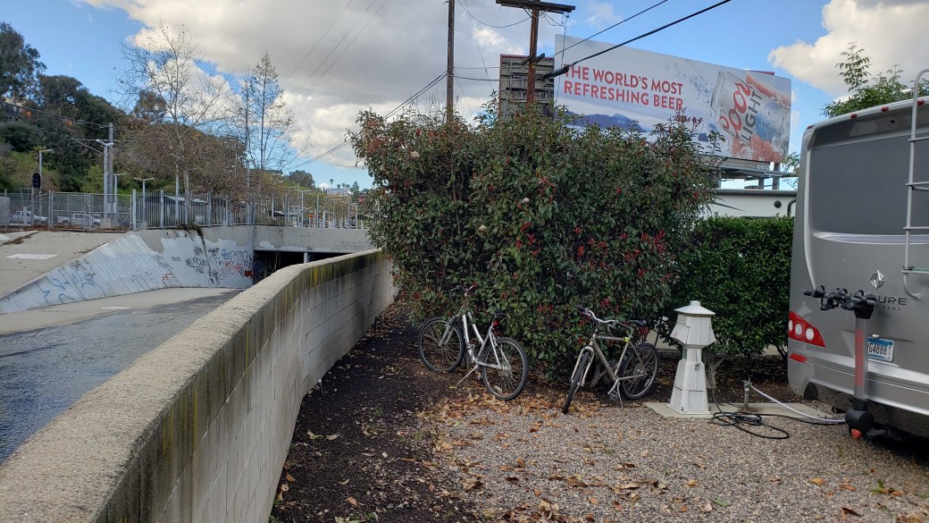
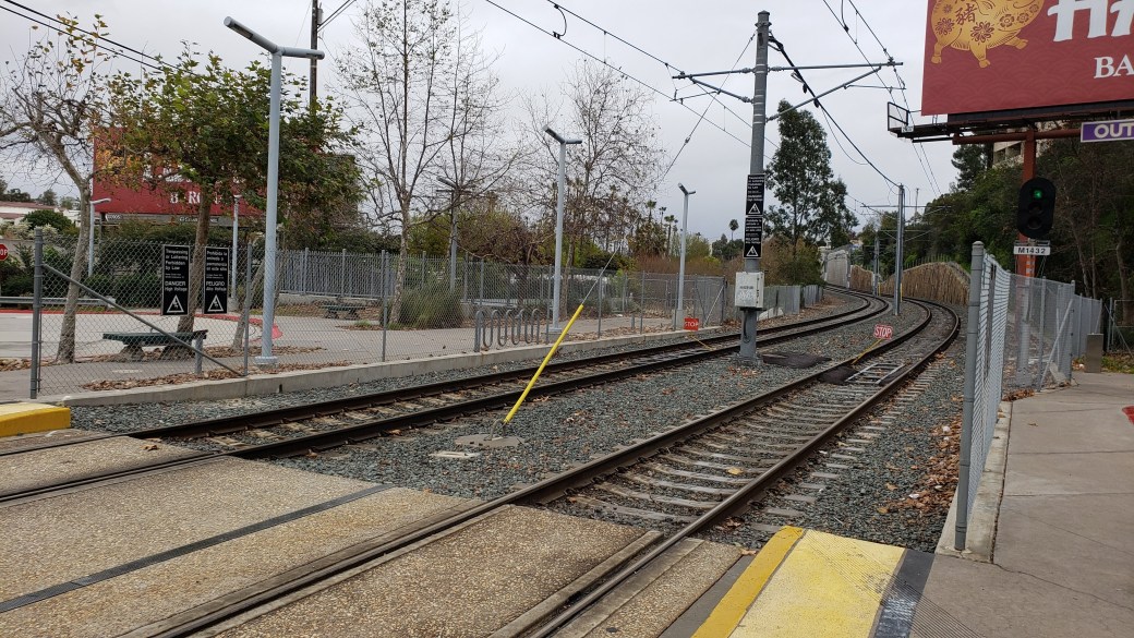
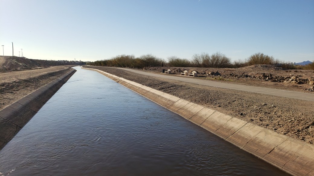
February 13-21 (Wednesday-Wednesday-Thursday): On Wednesday, we left Doheny State Beach and drove to the Sunland RV Park in San Mateo, CA, a suburb on the east side of San Diego. We had booked a week’s stay to allow time for receiving some mail from our forwarding service. As it turned out, a week was not enough time for the good old US Postal Service, so we ended up staying an extra day waiting for the mail and then one more day because, when the mail finally arrived, it was raining cats and dogs all across the southern part of California. In fact, of the nine days total we spent in the San Diego area, it rained for at least a portion of five of them. On those rainy days, we basically just hunkered down in the RV and hoped we didn’t wash away in a flash flood. Luckily, the other four days were quite nice, so we were able to do some fun things. The RV Park was unique in its proximity to one of the three main lines of the San Diego Trolley system. In fact, our RV site was literally a pitching wedge distance (about a hundred yards) away from the 70th Avenue station on the Sycuan (Green) line. (The first photo below is taken from behind the RV looking toward the trolley station. The other photo is taken from the trolley station, and you can sort of make out our RV in the background.)
We bought two four-day passes on Thursday ($15 each) that allowed unlimited rides on the trolley lines as well as all the area bus lines. It rained too heavily for traveling on one of the subsequent days, so we also bought one-day passes ($5 each) on Tuesday. Even though the rain ended up costing us the extra $10, we made the most of the four days we spent riding the rails. We literally travelled every single foot of track on each of the three lines, Sycuan (Green), UC San Diego (Blue), and Orange. (Apparently the Orange line couldn’t find a title sponsor.) Here are the things we did during our trolley riding days:
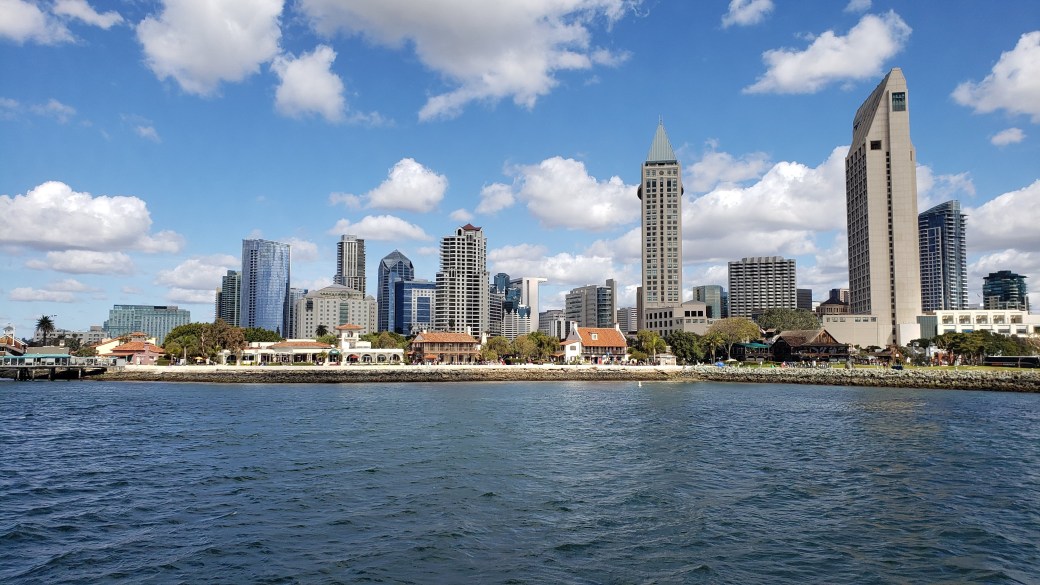
- We started off with a trolley to the Gaslamp Quarter station where we had a nice BBQ lunch, then walked around the downtown area to get oriented, passing by Petco Park, the Convention Center, and along the oceanfront before returning to the Santa Fe Depot station. We observed many, many people zipping around town on rental scooters and bikes. These are parked all around town on the sidewalks – a rider just grabs one, swipes or taps a card, rides to his or her destination, and leaves it there for someone else. It looked very convenient and quite fun, but we relied solely on our own feet, unwilling to risk a life-threatening injury of some sort. On the way back to the RV Park, we got off at the SDSU station and walked two blocks to Trader Joes for groceries before returning to the RV park. We were very impressed with the trains – they were clean, comfortable, and ran frequently, never requiring more than a five- or ten-minute wait.
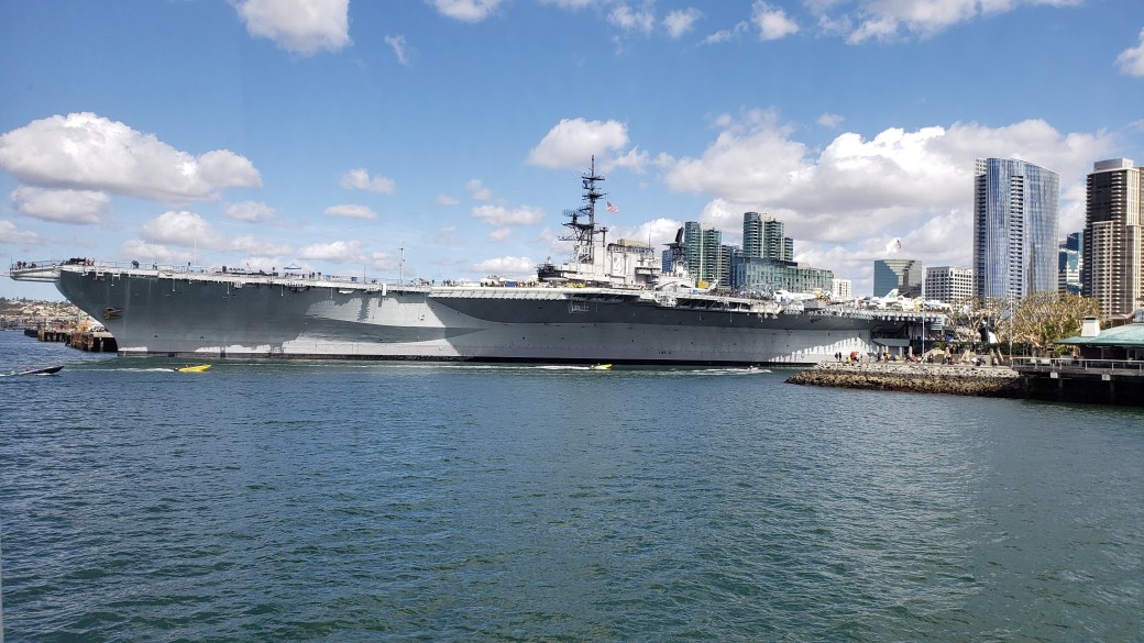
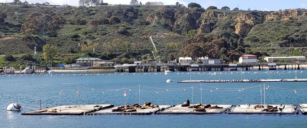
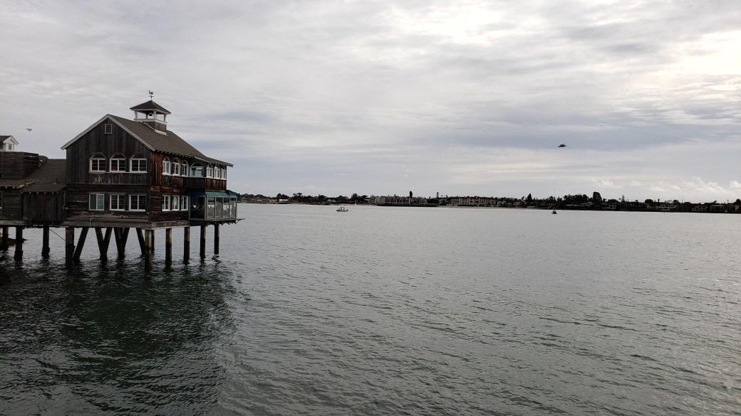
- For our next trip, we rode to the Santa Fe Depot station again before walking to a nearby terminal, where we boarded a boat and took a two-hour harbor cruise. It was abundantly clear from the tour that the US Navy is the lifeblood of the San Diego harbor. We saw seemingly hundreds of active Navy ships of all sizes and capabilities and several drydock facilities that primarily service the Navy ships. The USS Midway, a gigantic, retired aircraft carrier, is also docked in the harbor as a floating museum. We also saw some commercial vessels, including a cargo ship capable of carrying 2400 automobiles – it was anchored just outside the harbor waiting for final clearance to deliver its cargo. (Maybe DJT needed to collect his tariffs first?) We learned that 24% of all cars imported from the Far East for the US market enter through the San Diego port. The California sea lions pictured below didn’t seem overly impressed with either the Navy ships or the commercial vessels, however. We topped off the day with dinner at the San Diego Pier Café, situated on pilings above the harbor water. I had an excellent cioppino, Pat had fish tacos, and we even splurged on Margaritas.
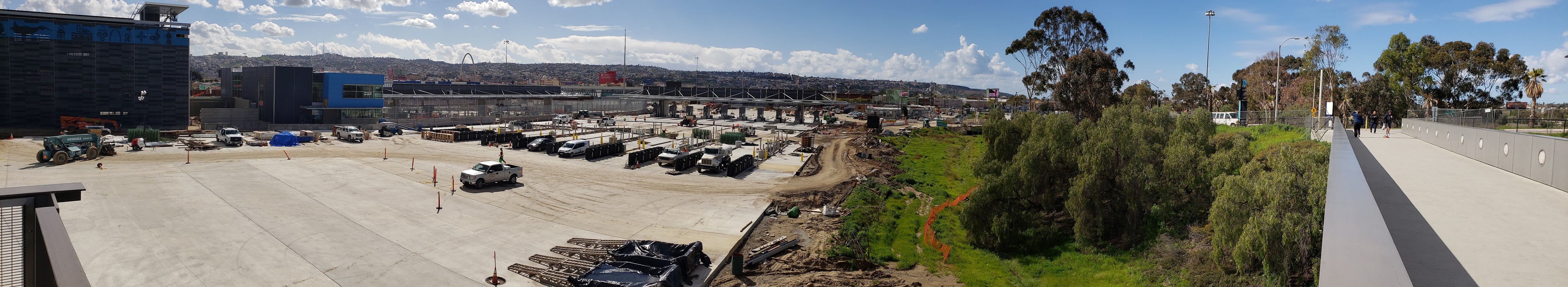
- For our next foray, I thought it might be useful to travel down to the US-Mexico border and make my own personal assessment of the so-called national emergency going on there. We rode the Green line to its terminus, walked a hundred yards or so to board the Blue line, and rode that all the way to the San Ysidro border crossing. This is the very place where tear gas was fired at asylum-seeking families supposedly attempting to storm the border just a few weeks previously. We saw no signs of any sort of panic; instead we observed: people shopping at a large outlet mall located literally a stone’s throw from the border fence; people calmly walking to and from the border crossing locations; construction crews busily working on a massive upgrade project that will significantly increase capacity, both vehicle lanes and pedestrian crossings in both directions; and US Border Patrol agents leaving at the end of their shifts, talking, smiling, and laughing among themselves as they passed us, presumably on their way to their parked cars. We learned that 70,000 vehicles and 20,000 pedestrians cross the border from Mexico at San Ysidro every day, but that the vast majority are Mexican citizens commuting to work in the US before returning in the evenings, as well as tourists (returning Americans and foreign visitors). In short, we saw no evidence of a national emergency – apparently you can only see it if your politics lean in a certain direction – we merely saw the usual hustle and bustle of a typical, vibrant American city. The most significant thing to me was the difference in the view – to the north I saw mostly vast, open spaces, to the south, multi-story dwellings crammed together on every hill I could see over the fence.
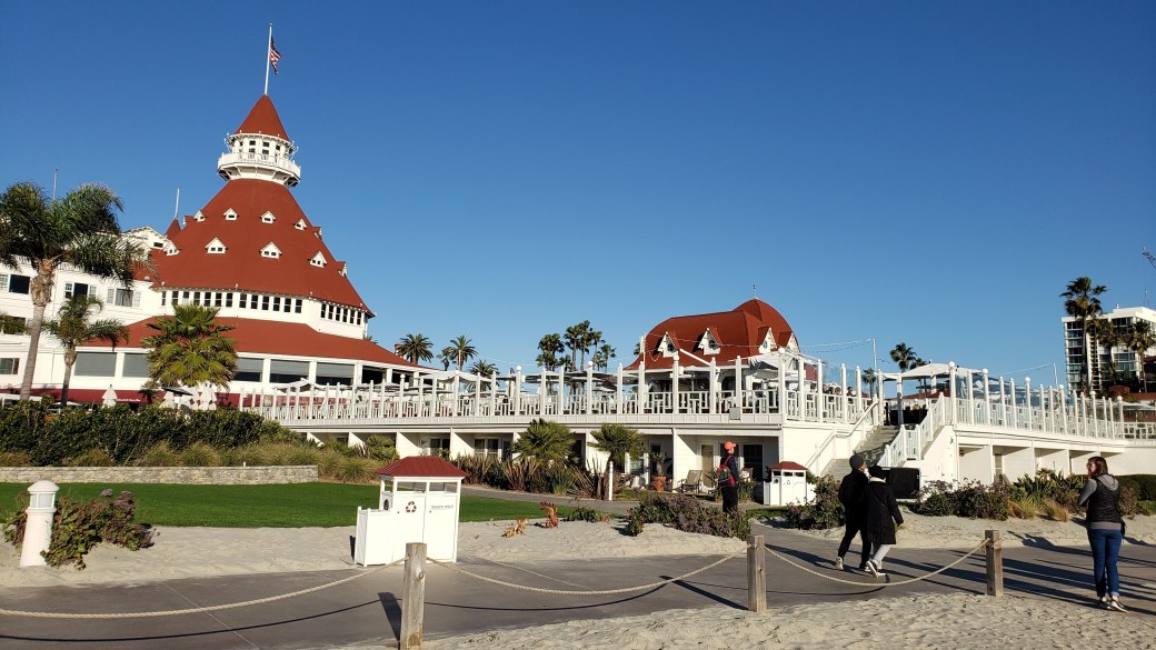
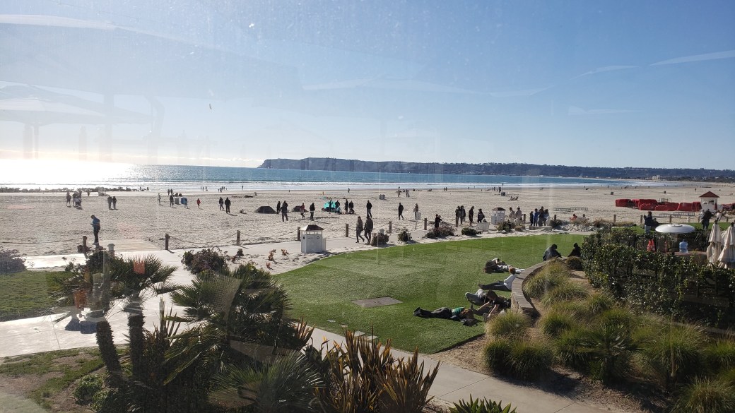
- For our last San Diego outing, we again took the Green line to the Santa Fe Depot, then walked to a ferry terminal (right next to the harbor cruise terminal). The ferry took us to the east side of Coronado Island. We walked about a mile and a half across the island to the historic Hotel del Coronado, where we walked around admiring the iconic building before stopping for a late lunch at an outdoor patio restaurant. It was a bit breezy and cool sitting outside, but we enjoyed both the food and the view. After walking across the island again, we boarded a smaller ferry boat and rode back to a terminal near the Convention Center before catching the trolley. This time, we took the Orange line to its terminus, transferred to the Green line and rode to its terminus, and then rode back to our RV park. Great fun for a couple of train enthusiasts.
As I noted above, we had intended to move on to our next destination on Wednesday, not actually knowing where that might be, but the mail hadn’t yet arrived, so we extended our stay until Thursday. The mail finally came on Thursday morning, but as we were trying to decide where to go next, we saw that the forecast was for rain over the entire region, and even snow in some areas. So, we decided to extend our stay another day, and were immediately rewarded with a downpour that lasted well into the night. Having grown weary of the rain, we decided to head back to Arizona on Friday in hopes of finding the sun again.
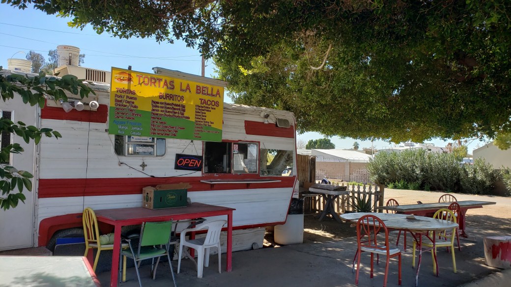
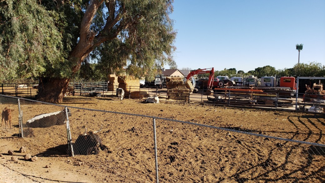
February 22-24 (Friday-Sunday): We headed east on Friday morning, driving through the remnants of snowfall in the mountains as we left the San Diego area. As we descended from the mountains into the desert, it got sunnier and warmer with virtually every mile until we rolled into a place we had visited before, Rolle’s Lynda Vista RV Park in Yuma, AZ. Here we were at last rejuvenated by glorious sunshine for three straight days. There was, of course, no trolley as we had enjoyed in San Diego, but we were familiar with the area and were able to ride our bikes every day – to the nearby grocery store, to the local taqueria, around the neighborhood to visit the cattle I’d grown fond of during the last visit, and along a nice bike trail that ran three or four miles along the Colorado River and an irrigation canal. Over the course of our stay, as I listened to the clucking of chickens wandering about the park and the daily afternoon jingle of the neighborhood ice cream truck, a feeling of déjà vu surfaced. I could swear we had been here before, and we had – back in December!
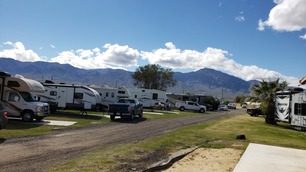
February 25-March 2 (Monday-Sunday): Fully refreshed by the Yuma sunshine, we resumed our quest, heading north and west again toward the Coachella Valley. (I’ll explain why a little later.) This time we went up the west side of the Salton Sea until we came to the Oasis Palms RV Park near the not-quite thriving metropolises of Mecca and Thermal, CA. We had thought we would be close to the Salton Sea at this park, but actually could not see it at all. It was a sleepy place just to the west of Highway 86, with a nice little pond, pickle ball court, laundry, showers, and about 200 RV sites with full hookups. The surrounding area had several date palm groves, greenhouses, and agricultural fields of many varieties, but very little in the way of hiking or other tourist-type activities. I used my bike to ride around the park and to a nearby store (where I was able to buy some incredibly cheap wine as well as my daily Dr. Pepper fix), and I did a little chipping and putting in a small area set aside for that purpose, but otherwise we spent our time here vegging out and falling into a near stupor. Also, the Wi-Fi service was pretty … darned … s … l … o … w.
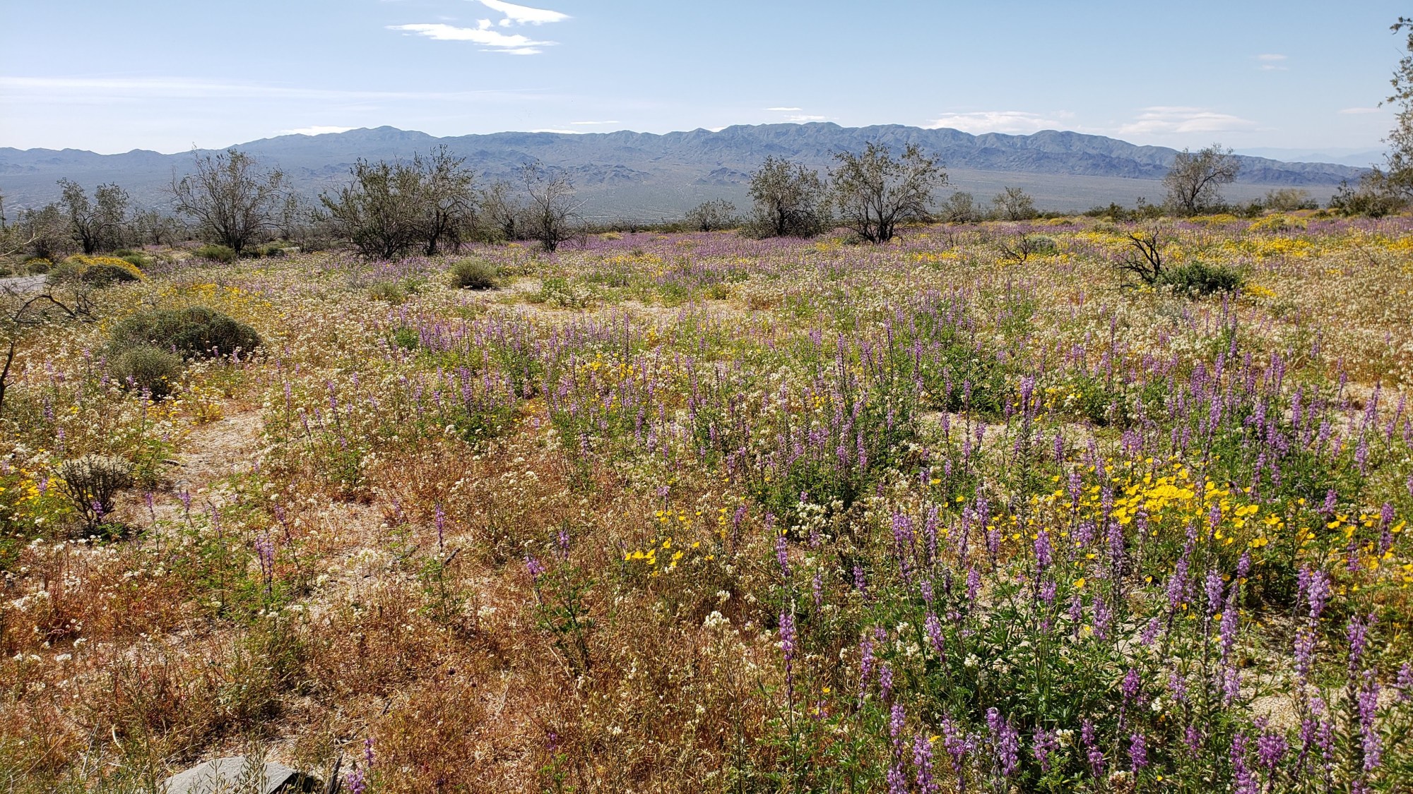
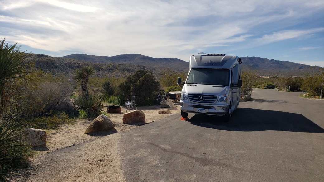
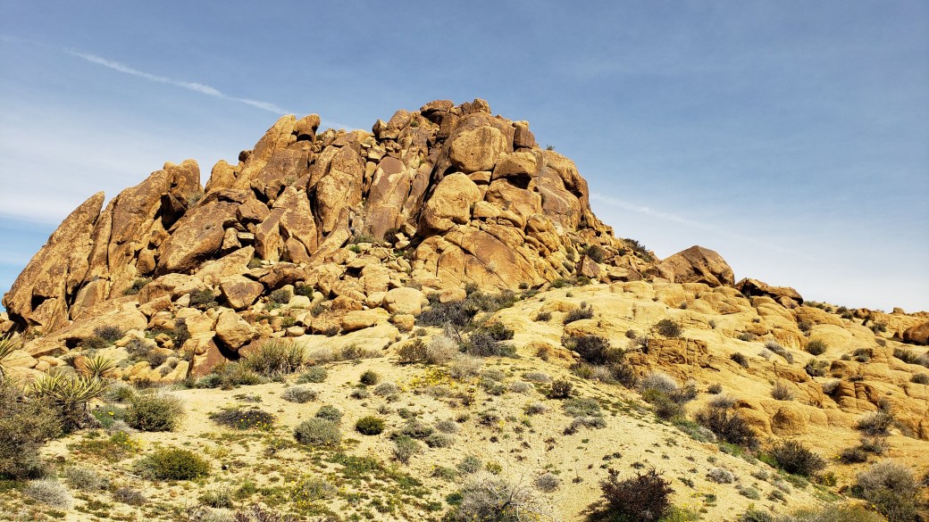
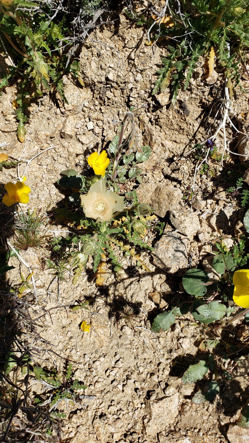
March 3-5 (Sunday-Tuesday): On Sunday we drove to Joshua Tree National Park. We had previously stayed at the Black Rock campground on the north side of the Park back in December; this time we entered from the south and stayed at the Cottonwood campground. As we drove into the Park, we were greeted by a stunning display of spring wildflowers in vibrant colors, primarily green, yellow, and purple.

As we drove further north to the campground, the flowers thinned out and esentially disappeared, leaving a sandy landscape very similar to what we saw in December. We stayed in a lovely RV site with no hookups for three nights.
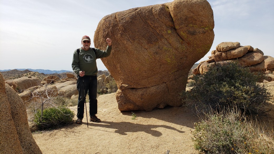
On Sunday, we followed a trail from the campground to a place where it intersects the primary area loop trails (only about a half-mile round trip). On Monday, we hiked along the Mastodon Loop in a clockwise direction. The first half of the trail was very similar to those we hiked at the north campground, with sandy soil and sparse vegetation (though there were only a very few Joshua trees, not the multitude we saw in the north). The trail climbed about a thousand feet to the summit of Mastodon Peak, offering spectacular views of the surrounding mountains and desert areas. We also passed by the remnants of an old mine. The trail then descended from the peak toward the Cottonwood Springs oasis, and as we neared that area, we again saw many beautiful spring flowers. Unfortunately, my phone had died by then and Pat had left hers in the RV, so we got no pictures along the final third of the loop. All in all, this hike covered about 3.5 miles. When I recharged the phone, I was surprised to see that several emails and a phone call had come through, even though we had no cell service at the campground. It dawned on me that we must have picked up a signal somewhere in the higher elevations near the peak during our hike.
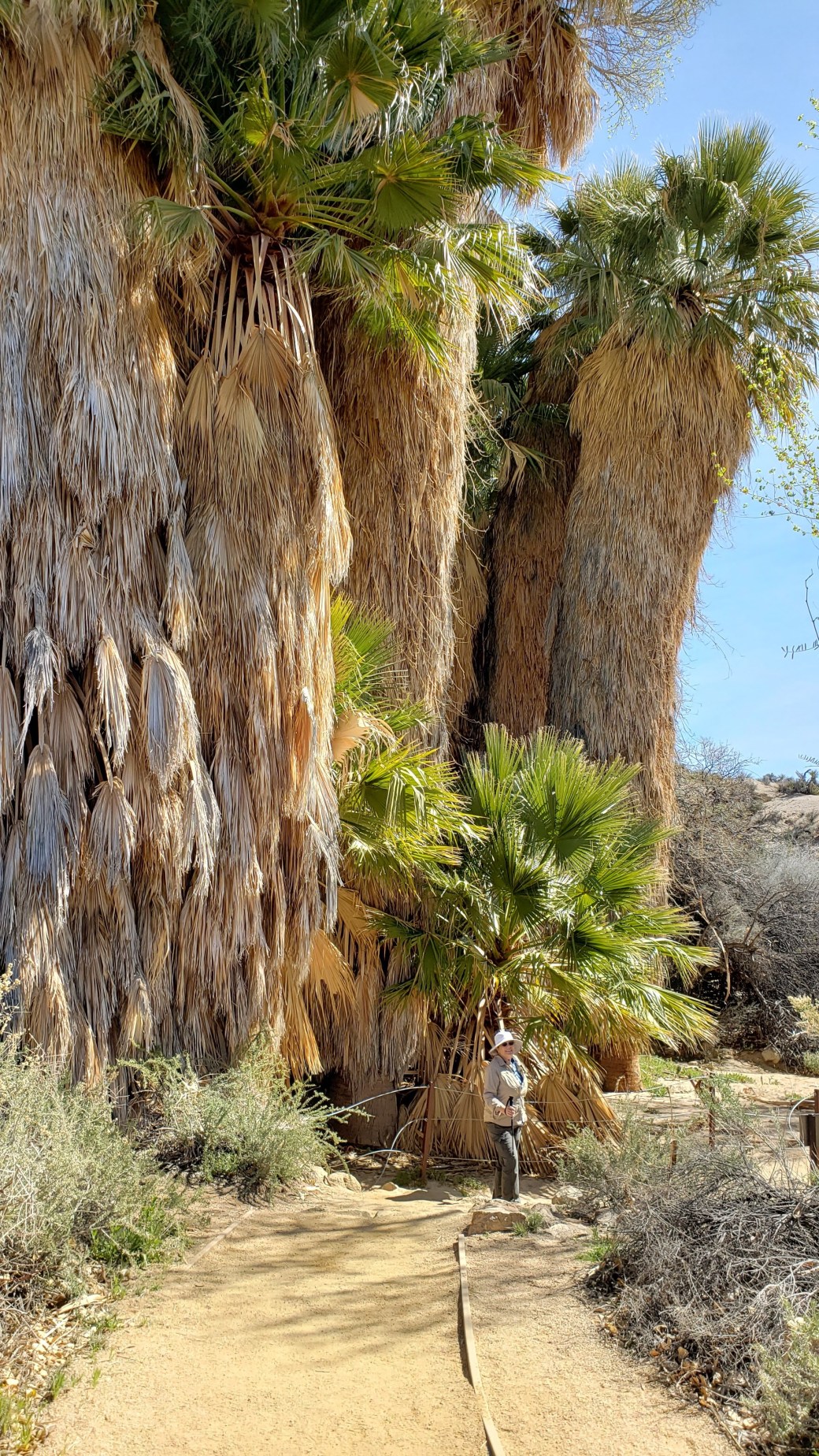
On Tuesday we hiked the 3.5-mile trail again, but in the counterclockwise direction so we could be sure to get photos of the oasis and the flowers. The oasis was very surprising, with a dozen or more gigantic date palm trees that thrive on the water from the eponymous spring. (We couldn’t see any water flowing, but the ground around the trees did appear to have some wet spots. The area was posted with signs stating that the ground water had been contaminated by mining activity. The native Coahuilla tribe lived here for hundreds of years without damaging the environment, but it only took the civilized folks a half-century to do it in.)
We tried to get some closeups of the flowers, but they don’t do the place justice. Many of the blooming flowers had surprisingly delicate and intricate features, yet the stems and roots were hardy enough to withstand the harsh desert climate. I was also impressed by the sheer number of different plant species on display – there were dozens of them when I had expected to see only a few.
As we neared the peak again, our phones found cell signals, so we stopped for a brief rest at the top, where we couldn’t resist checking our emails (and playing a few games of Words with Friends) before we lost the signals again on the way down.
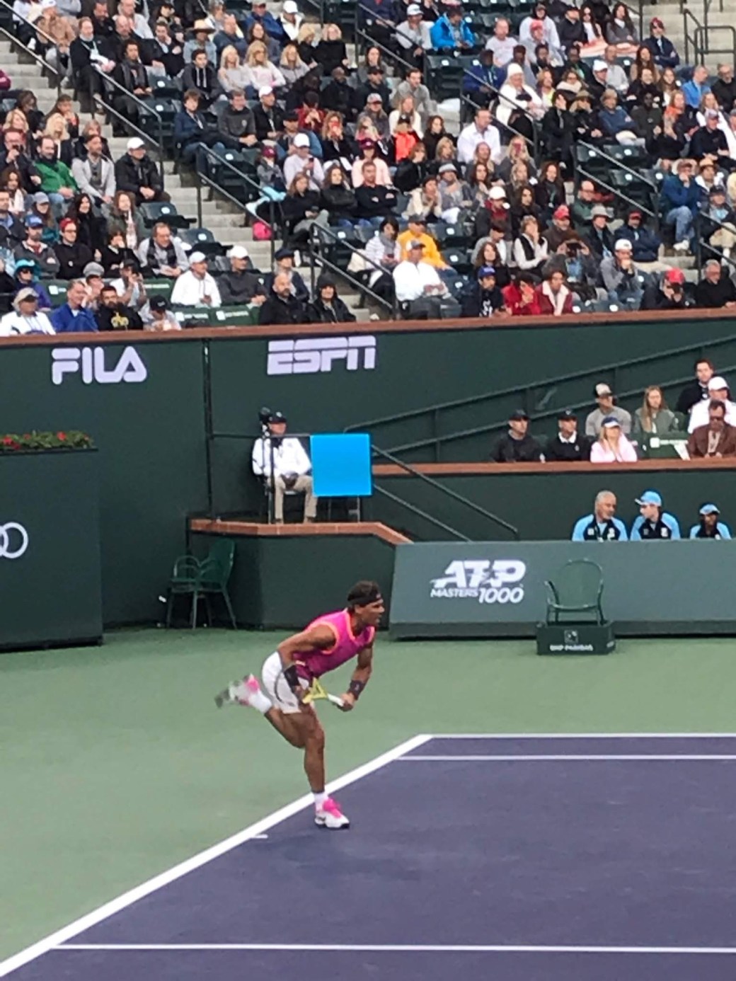
March 6-14 (Wednesday-Wednesday-Thursday): On Wednesday, we drove back down into the Coachella Valley and once again checked into the Catalina Spa RV Resort in Desert Hot Springs. Why were we revisiting so many places? A good question, with a complicated answer. Back when we were staying in Morgan Hill in January, Pat decided she would like to go see some action at the PNB Paribas Open tennis tournament in Indian Wells, one of the many cities in the Palm Springs area. This is quite a famous tournament which attracts most of the top players in the world. She was easily able to obtain tickets for the tournament, for Sunday and Monday, March 10 and 11. Since she planned t attend the tournament from morning till night, we thought it would be a good idea to stay in a hotel near the tennis venue for a couple of nights. This is where the plan got tricky – every hotel she called was booked solid due to the popularity of the tennis tournament. She kept trying to find a hotel as we drove south along the Pacific coast, hampered severely by lack of cell service in most places. Finally, she was able to get a connection and book two nights at the Hotel Paseo, a new establishment in Palm Desert, about 4 miles from the Indian Wells Tennis Garden. She prepaid the reservation and we happily continued our journey for several days. But then we started to wonder if the hotel would be able to provide parking for the RV while we stayed there. Pat called them while we were staying in San Diego and, you guessed it – the answer was no, they could only accommodate passenger cars due to very limited parking on site. Our solution to this conundrum was to stay at an RV resort, rent a car for a while, and leave the RV at the resort while we stayed in town for the tennis. And what better place to visit than the Catalina Spa, where I had stayed for three weeks while golfing my brains out in December and January? (We later learned we weren’t supposed to leave the RV unoccupied for more than 24 hours without prior permission, but that’ll be our little secret.) We were able to rent a car for a week using credit card points, and we made good use of the car for the tennis outing as well as gadding about the Palm Springs area for other things.
Since this post is getting inordinately long, I’ll just briefly summarize some of the things we did during our stay. Pat had a fabulous time at the tournament, where she saw many of the game’s greats, including her favorite, Rafael Nadal, as well as Roger Federer, the Williams sisters, and many more.
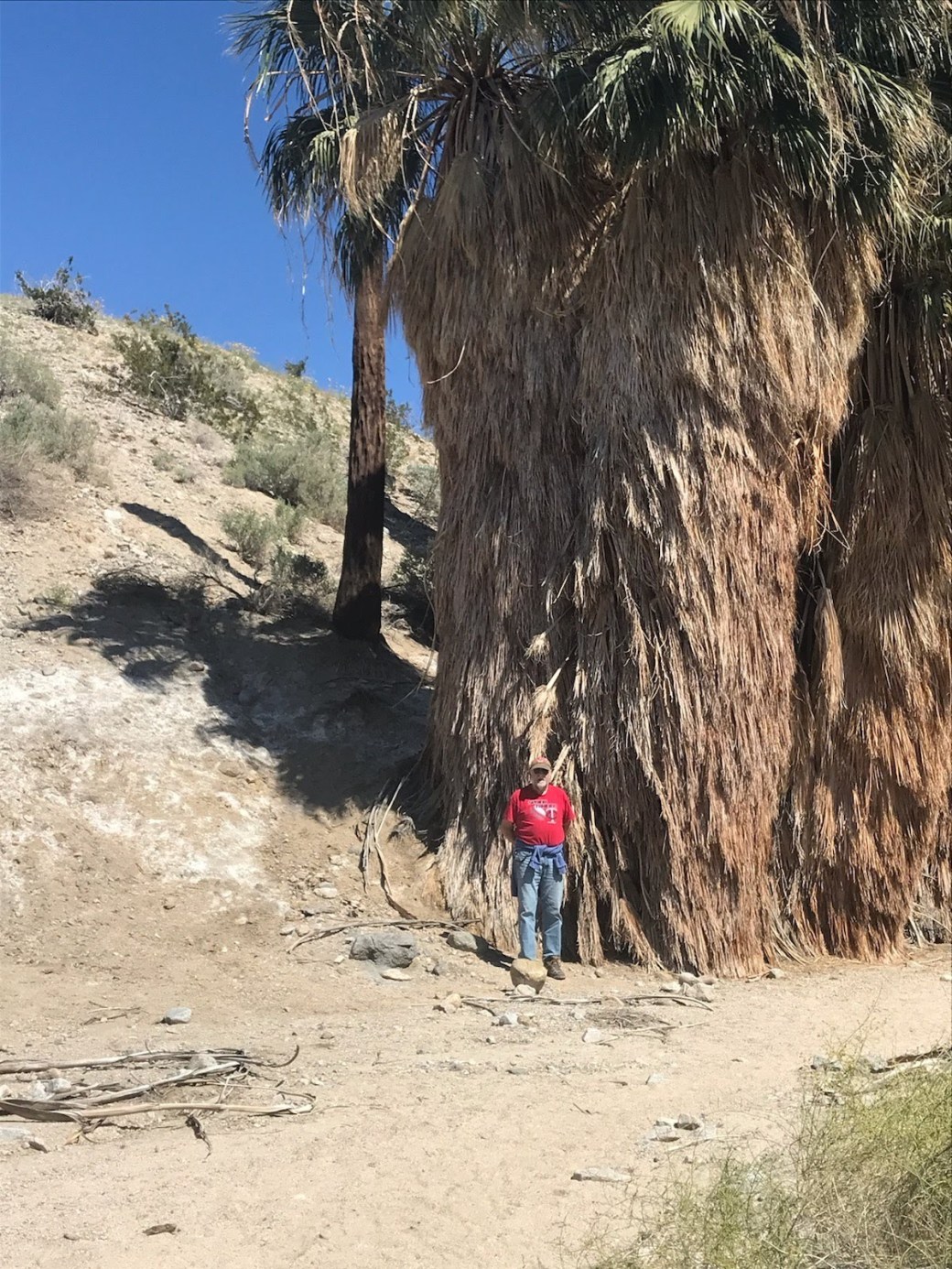
I played golf twice at the Shadow Mountain golf course, the first course ever built in the Coachella Valley back in the 1950s. It’s a short track that places a premium on accuracy rather than length and has incredibly difficult greens. I also saw one of the game’s greats who was my cart-mate the second time, a young man from Long Island named Ryan, who shot even par with three birdies and an eagle during his round. I did not quite achieve that level, playing poorly the first time and abominably the second time. (At that point, I recalled that I had given up the game back in Morgan Hill and should have just skipped golf altogether.) We also did several errands during the stay, including laundry, getting the RV washed, getting Pat’s bicycle tire repaired (it had gone flat), and getting our tax returns printed at a local FedEx (we couldn’t e-file this year due to technical issues). More hiking was also in the cards, as we visited the Coachella Valley Preserve, located about 5 miles away in Thousand Palms. There, we saw many more of the large date palms that grow in oases fed by spring water. (I say, that must be why they call this area Palm Springs!) I learned that the tree trunks are much smaller than they look, as they reside within large “skirts” formed by the old palm fronds. You can see that in the photo below, where I am standing between a tree with a large skirt and another on which the skirt had been burned away.
OK, enough for now! We’re off again, heading east toward Arizona. Check back in a couple of weeks or so to learn what we get up to next. Below is a map of our travels since leaving Palm Springs for the first time in early January. (Click here for maps of the entire trip so far.)


Great fun reading about your trip!
LikeLike