Once upon a time, not all that long ago, most people in the United States – even a few Republicans – still respected science and engineering and the earnest, hard-working people who studied and practiced in those fields. A seemingly brilliant and altruistic engineer named Elon Musk was well along in his admirable quest to build a world-class electric car company. With its high-tech American-built cars and extensive nationwide charging network, Tesla was the absolute best choice for anyone interested in abandoning an eco-unfriendly gasoline-powered car in favor of an EV capable of long-distance travel. When we purchased a 2020 Tesla Model Y in January of 2021, the shining, stylized “T” on the front of the car felt like a badge of honor. At that time, we still had an ICE (internal combustion engine) car for backup, but we primarily used the Tesla for the next several years.
Three years and 45,000 zero-emission miles later, we were still in love with our Tesla. Our youngest son’s fourteen-year-old Toyota Corolla was on its last legs and had to be replaced, so we transferred our backup ICE car to him, having decided to replace it with a second EV. Reviewing our needs at that time, it was clear that Tesla was still the best EV choice for us, with its advanced features, long range, and charging network needed for travel between Minneapolis and Grand Marais as well as for long distance travel around the US. In addition, the 2023 Inflation Reduction Act (IRA) had expanded the number of EVs eligible for Federal tax credits, and we believed that a 2024 Tesla Model 3 would meet the tax credit criteria. With enthusiasm, we purchased our second Tesla and began driving it all over the US – to the Great Smokey Mountains, back and forth to Grand Marais, to National Parks and Monuments in Utah, Colorado, Montana, and South Dakota.
However, even before buying the second car, black clouds had begun to gather. First, the formerly brilliant Musk had seemingly lost his mind with the purchase and wreckage of Twitter. Second, while the Model 3 was eventually added to the list of eligible IRA vehicles, since we hadn’t waited until the pronouncement was official, we got no tax credit. Finally, Musk has devolved even further into a completely despicable being, buying the presidency for Donald Trump and eagerly seizing upon his so-called mandate to destroy the US Government. His Gulf of Mexico sized ego seems to have driven him to abandon all pretense of what I had misinterpreted as altruism in favor of enriching himself to a level never seen before in human history. Instead of the man who created an eco-friendly American EV industry, he’ll now be forever known as the man who seized the opportunity to loot government coffers while pretending to champion “efficiency.” (Sometimes as I toss and turn at night, I dream that co-President Trump will become annoyed with playing second fiddle to Musk. After all, he has his own foray into Corruptocurrency to worry about. Perhaps he’ll send Pam Bondi and Kash Patel to arrest his former ally on some sort of presumably Trumped-up charges …)
But I digress. Given these tragic turns of events, that shining, stylized “T” has now become a scarlet letter of shame. So, what’s a once-proud Tesla owner to do? I hear many competing voices in my head. “Sell the cars? Donate them to Trump sycophants? Torch them in a grand, public display? Drive them off the rim of the Grand Canyon, ala Thelma and Louise? Replace them with VWs, Hyundais, Porsches, Volvos, or some other alternative?” Pat seems ready for one of those options, but none of them seems right to me.
I remind myself that there are many good, hard-working people still employed by the evil Muskrat, still working to produce high-quality, eco-friendly EVs. Surely many, if not most, of those people actually believe in the EV mission, even though Musk clearly doesn’t. Shouldn’t I still try to support them rather than abandoning ship and letting Musk have the last laugh?
So, I’ve at long last come up with a plan. I still love both cars and am proud to be driving zero emission vehicles (by now up to a total of more than 65,000 miles). I have purchased two bumper stickers which I will prominently display on both cars:
If people stop to engage me in conversation about these signs, I’ll text them a link to this diatribe. Although, if they seem to be Trumpites or Muskmen, I’ll probably rickroll them instead.
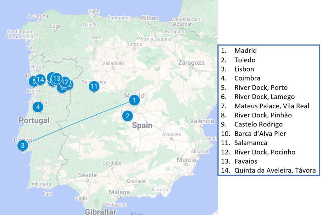
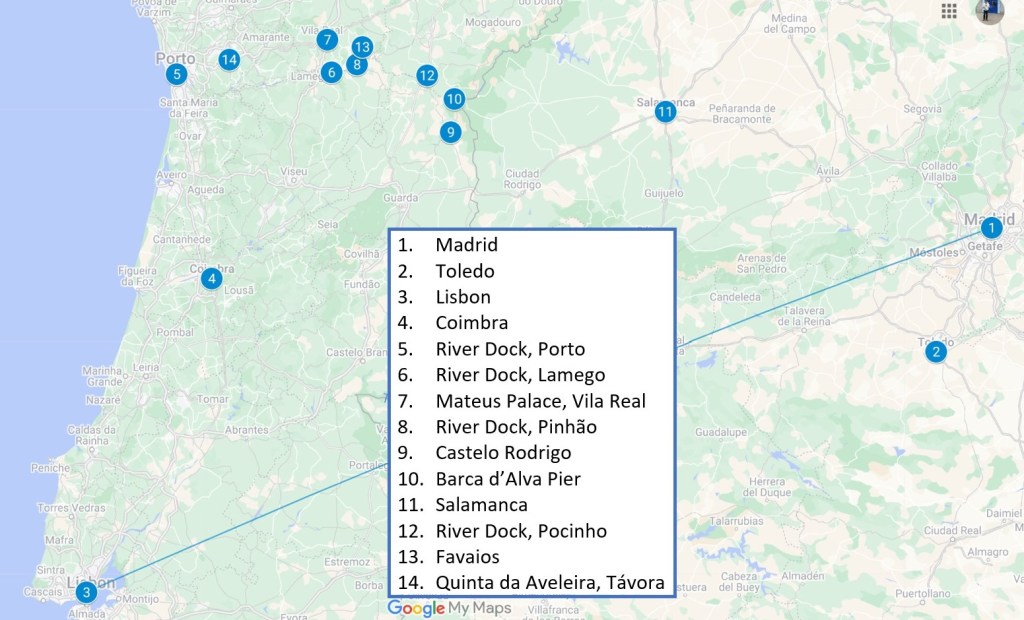
Welcome back for the final episode of this narrative of our recent trip to the Iberian Peninsula. Part 3 described three of the shore excursions we took during the river cruise, leaving off in Pocinho on November 15th. This episode describes the last four shore excursions and our trip back home.
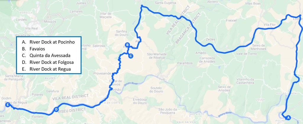
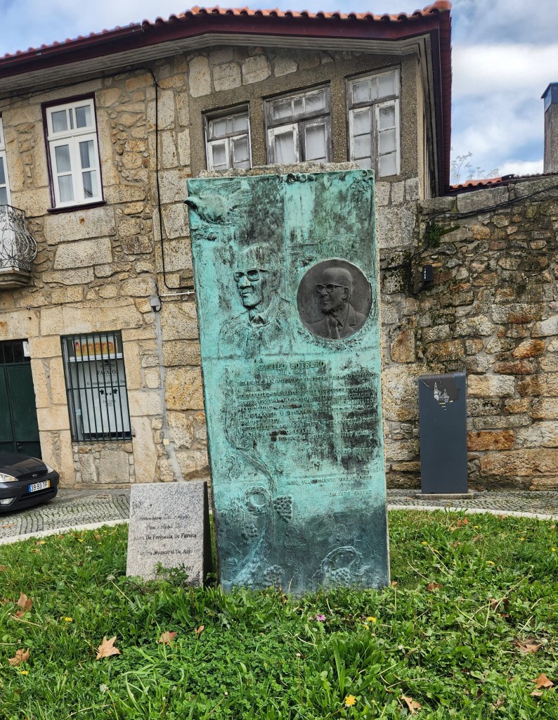
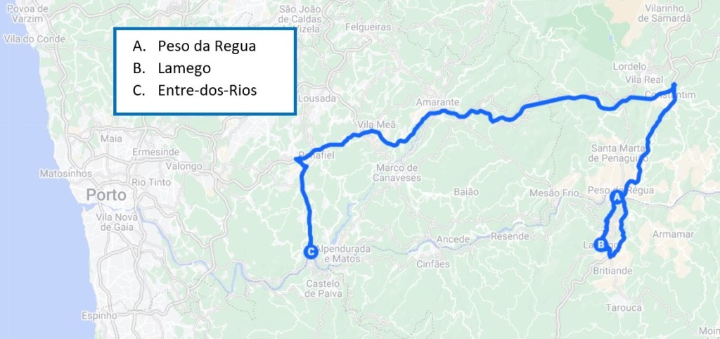
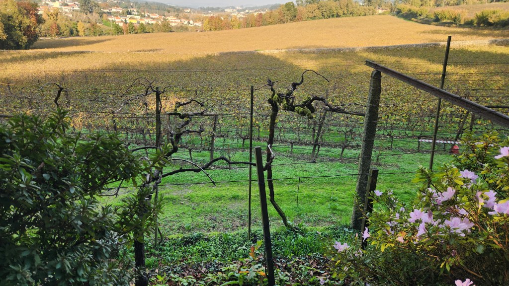
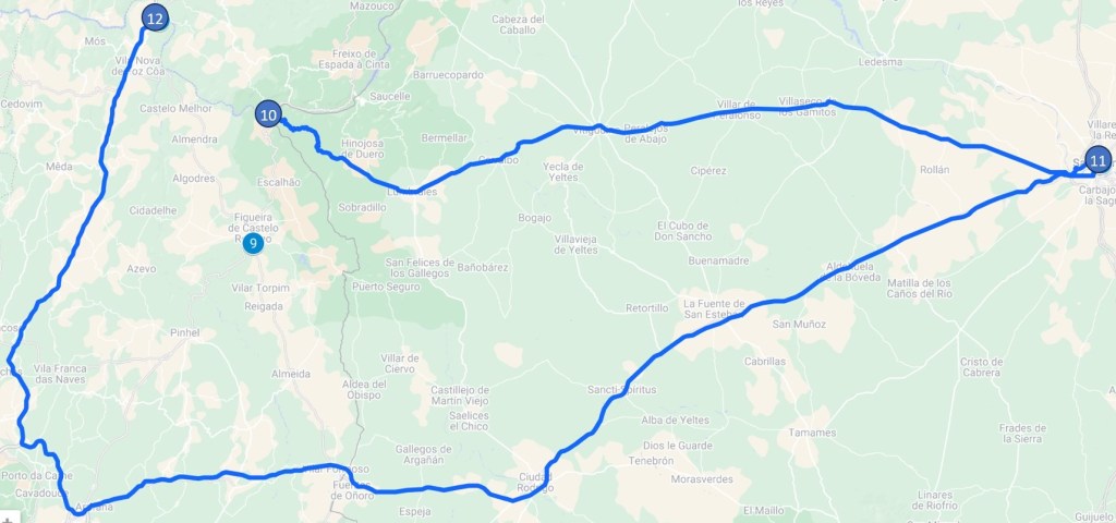
Favaios and Quinta da Avesado (November 16): On Saturday the 16th, we disembarked from the Helgrim at 8:30 AM for a 50-mile bus drive through the beautiful Douro valley to the town of Favaios. In Favaios, we visited a wine producing cooperative, a bakery, and a museum, before traveling to the Quinta da Avessada, an impressive vineyard where we were served an excellent lunch. After lunch, we returned to the ship, which had sailed downstream from Pocinho to Folgosa while we were on the shore excursion. After reboarding, the ship sailed on to Peso da Regua where we docked for the night. Here’s a map of the day’s travels:
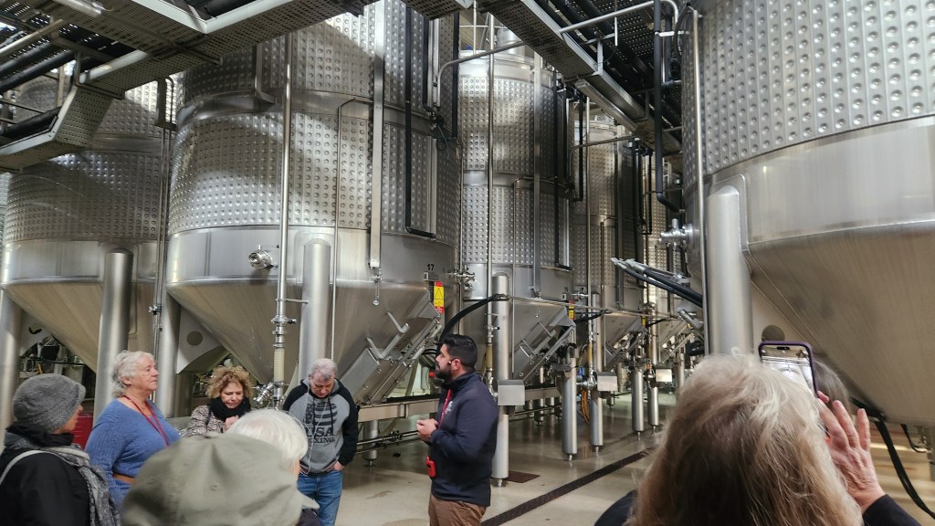
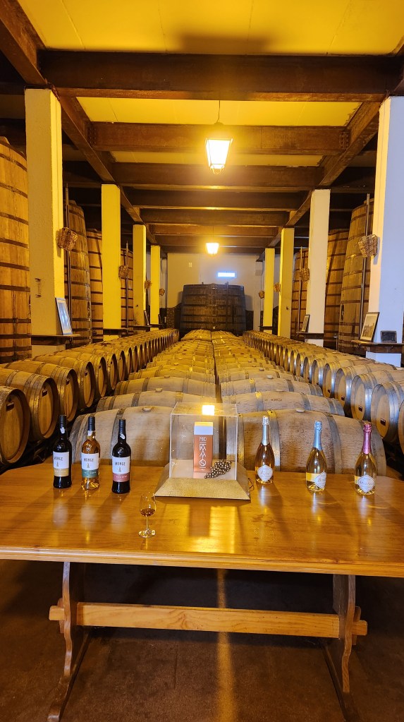
Favaios is the home of the Adega Cooperativa de Favaios, which was our first stop on the excursion. Adega is a cooperative that produces a popular fortified wine known as Moscatel, produced from the Muscat grapes that thrive in the plateau more than 1,000 feet above the Douro River (Favaios lies at an altitude of 1,800 feet). The cooperative includes some 100 member vineyards that supply the grapes during a short harvest season, typically from late September to mid-October. The cooperative has developed an ultramodern, computer-controlled processing facility that produces well over a million bottles of Moscatel each year, although the majority are the very popular 55 ml “shot” sized bottles that the Portuguese love to mix with beer. The cooperative has an aggressive expansion planned to add another hundred member vineyards and double the processing capacity to account for the ever-shorter harvest season due to the undeniable impact of climate change. The process is similar to that for Port wine, which I described in Part 2 of this series – the highly-sugared grapes are fermented in large stainless-steel vats before fortification with aguardente and then aged in wooden barrels for several years. Our tour of the facility concluded with a tasting of several glasses of Moscatel; we were sufficiently impressed to buy a couple of the little “Favaita” bottles to take home.
The Adega Cooperative in Favaios
Fermenting Vats
Aging Barrels and Sample Wine Bottles
The Delectable Favaito Muscatel
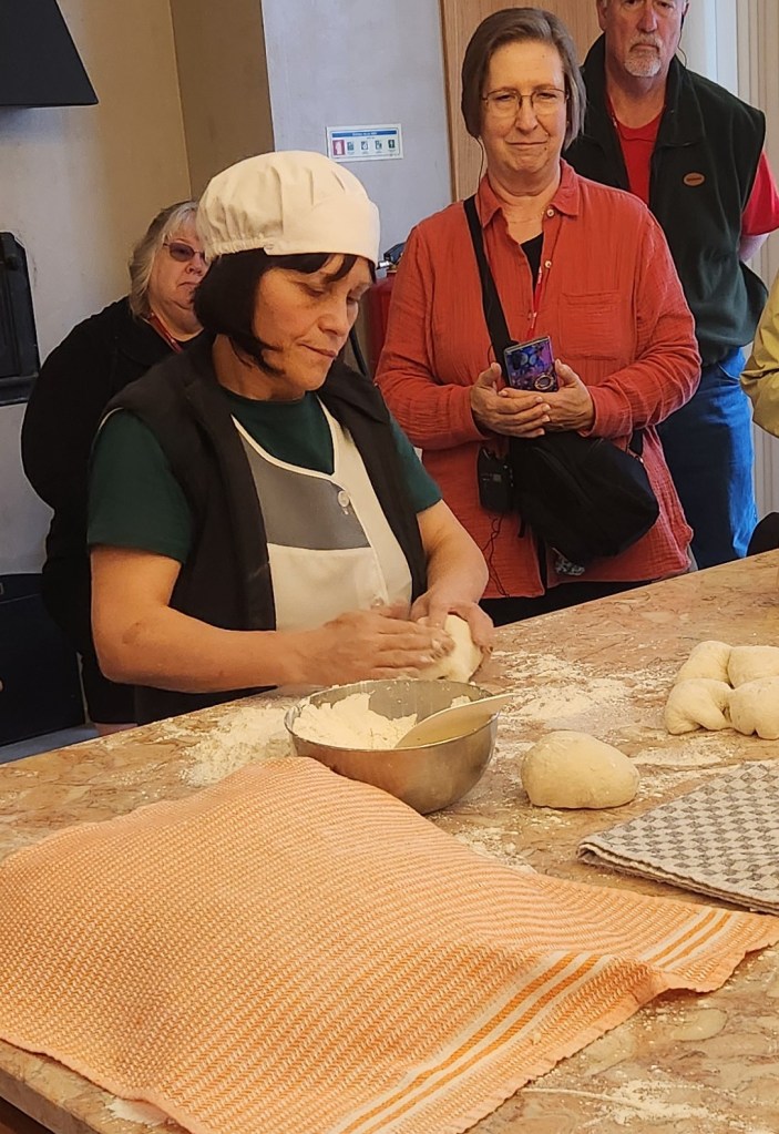
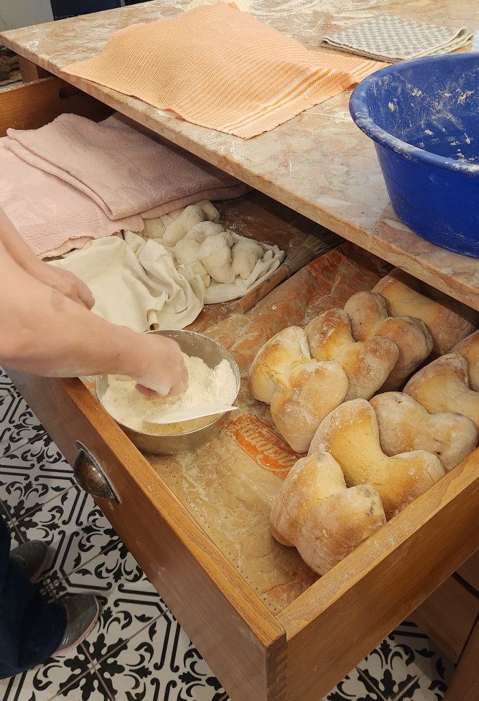
After the wine cooperative, we strolled down the street with a local guide to a bakery where bread is baked fresh daily. Eight bakeries in Favaios create 8000 loaves of the famous Four Corner Bread daily, by hand, using only four ingredients, and bake them in ovens fueled by pine branches. The loaves are distributed by the bakeries to bread shops throughout the region, and they sell out the entire lot every day. We watched as a skilled baker demonstrated the time-honored technique for kneading the dough into a time-honored shape. After witnessing the demonstration, I was delighted to sample the freshly baked bread and satisfy my watering mouth.
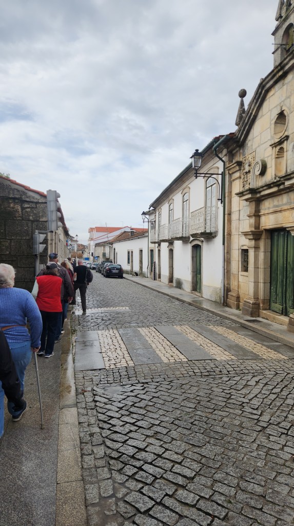
a Favios Street
The Favaios Bakery
Four Corners Bread Dough
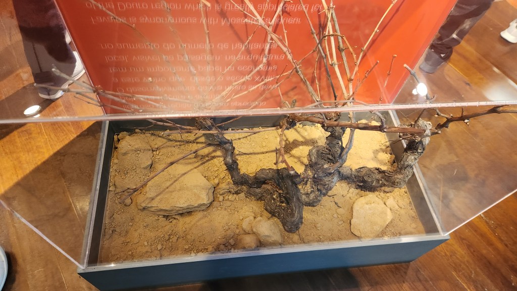
The final stop in Favaios was at the nearby Core Museológico Favaios, the Bread and Wine Museum. Among the exhibits there was a display of the thick grape root stock from America, to which the native wine plants were grafted in the 1800s to combat the deadly infestation of the phylloxera worm that nearly killed the wine industry.
Near the Wine and Bread Museum in Favaios
Museum Display — American Roots for Grafting Native Grapes
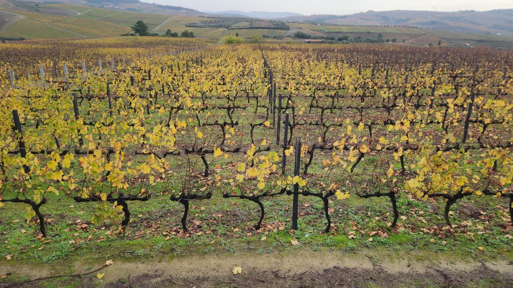
We then rode the tour bus for about 18 miles south to a beautiful vineyard called Quinta da Avessado. This winery is located at the highest point in the demarcated Douro region (1970 feet altitude) on a large, flat plain. Over 90% of the grapes grown on its 60-plus acres of vineyards are supplied to the Adega Cooperative for production of Moscatel. The vineyard and its facilities (including a 100-year-old building) were very beautiful, and we were treated to an excellent lunch, naturally including some of the wines produced from the grapes grown there. As a bonus, we were serenaded by an accordion player as we ate (luckily he had a better technique than my father).
Symbol of the Quinta da Avassado Winery
Quinta da Avassado Vineyards
Wineglass-shaped Fountain at Quinta da Avasseda
Homage to the Olden Days
Wine Tasting in the Aging Room
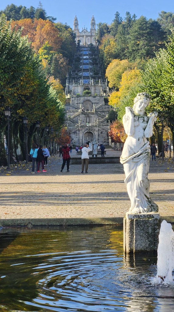
Lamego (November 17): After a night at the Regua pier, we set off at 8:30 AM for a tour of the town of Lamego. While we were enjoying the excursion, the Helgrim set sail again, moving downstream to Entre-os-Rios, where it waited for the excursion participants to return at 12:45. Here’s a map of our shore excursion journey:
Lamego was first settled before the Roman occupation of the Iberian Peninsula and is known for its historic city center. Legend holds that the first Portuguese Cortes (an assembly of nobility, clergy, and bourgeoise) was held in Lamego in 1143, proclaiming Alfonso Henriques as Portugal’s first King. Subsequent Cortes were called and dismissed by the King at will at places of his choosing.
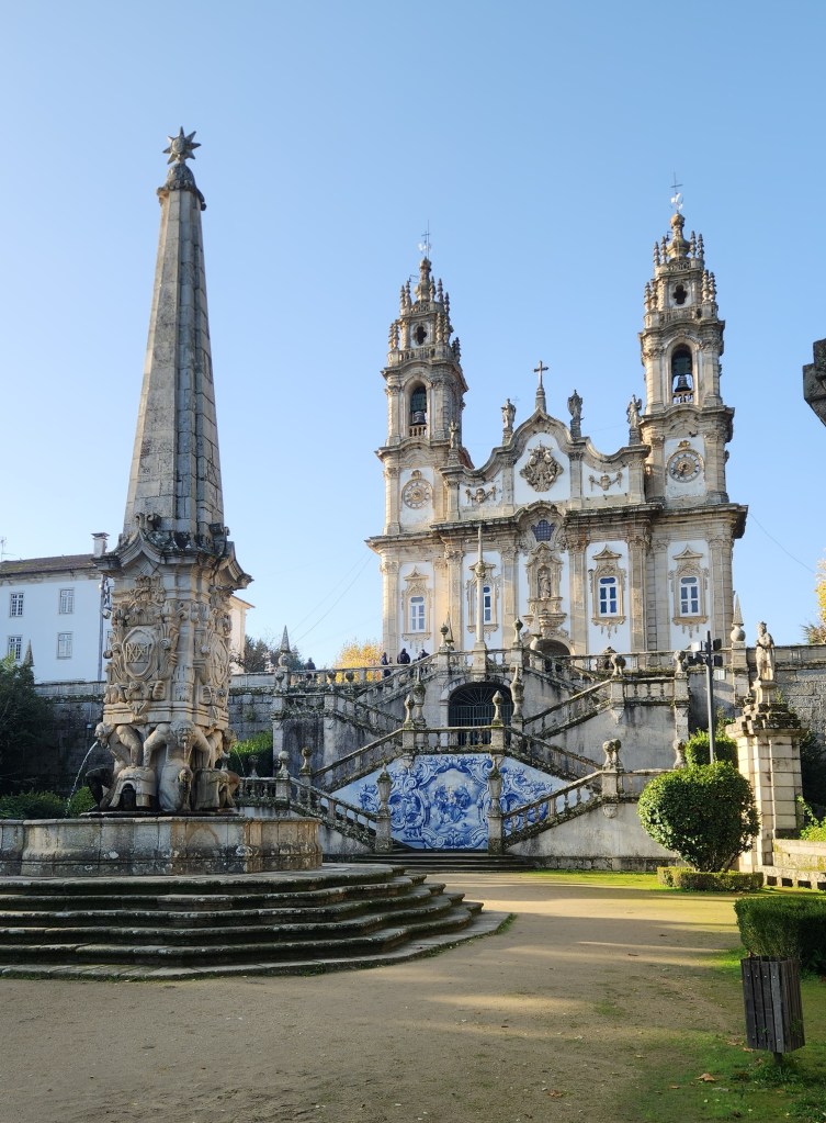
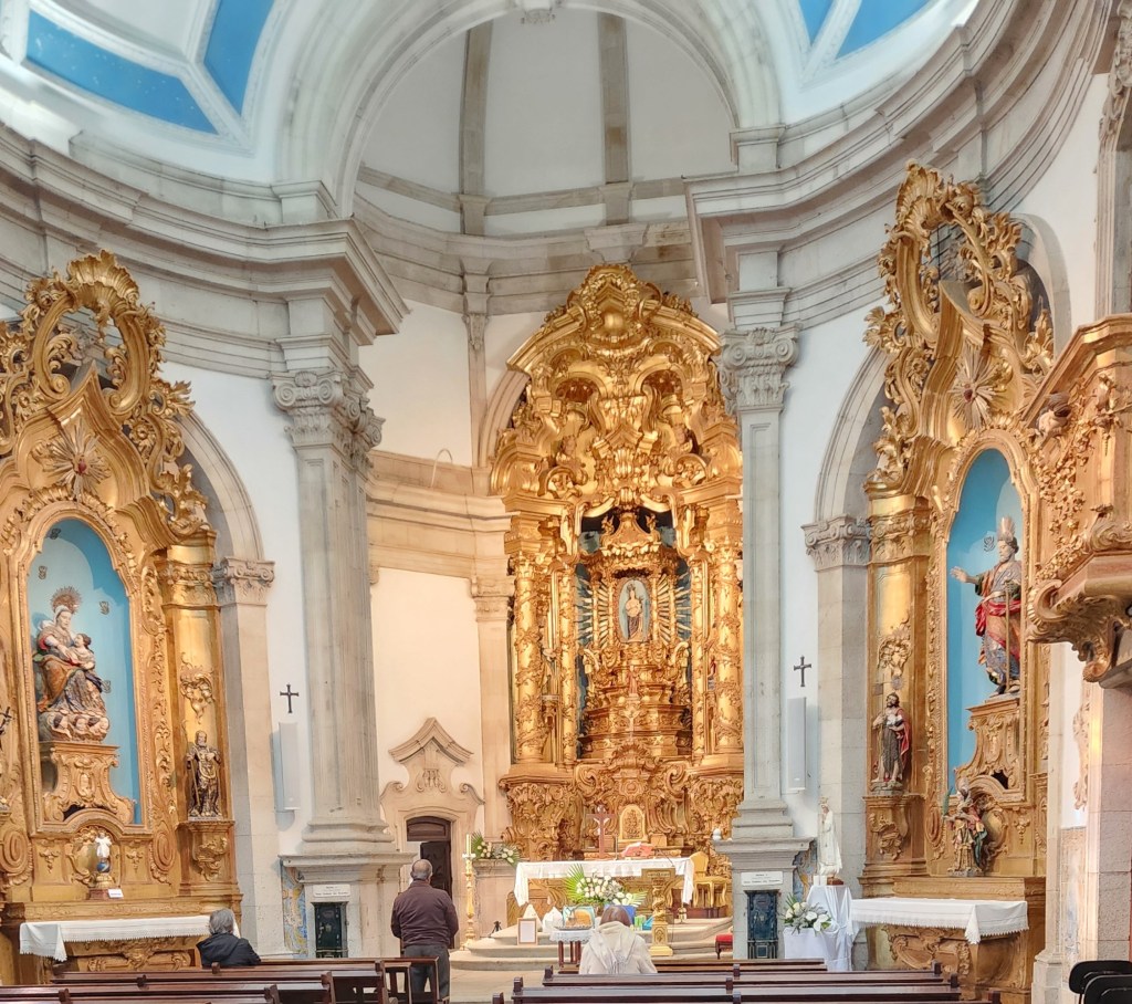
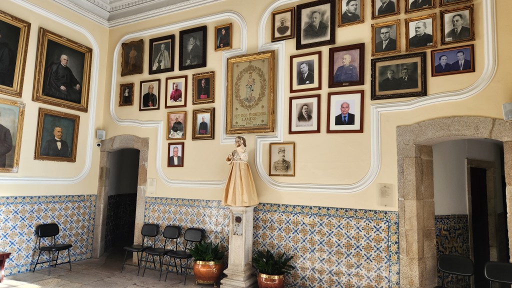
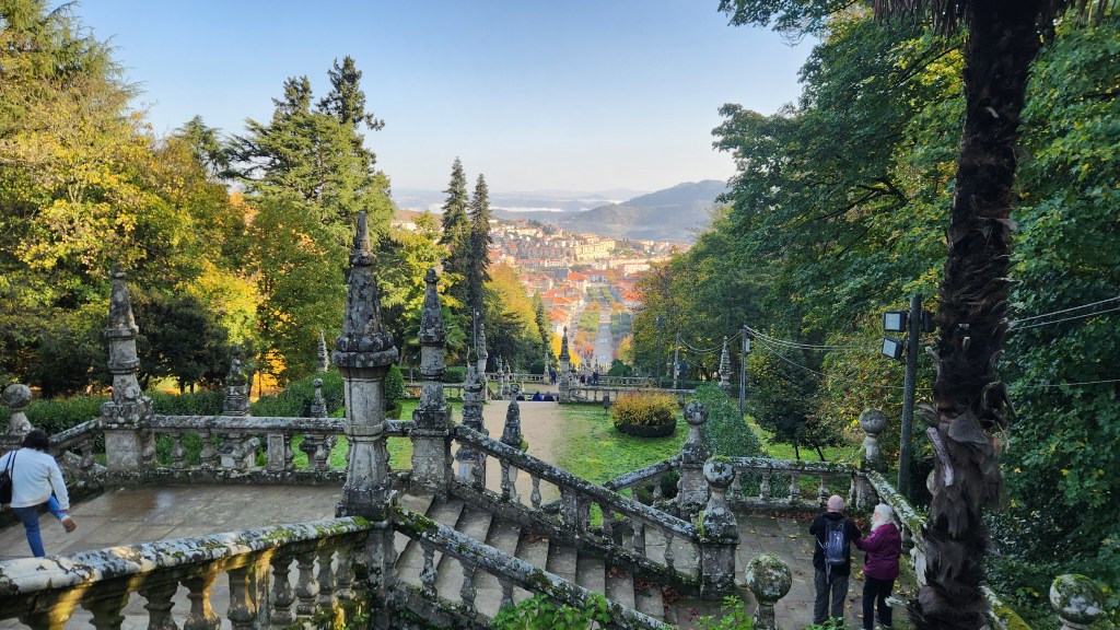
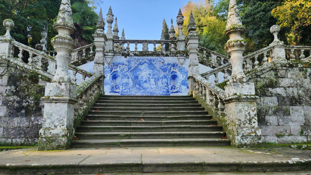
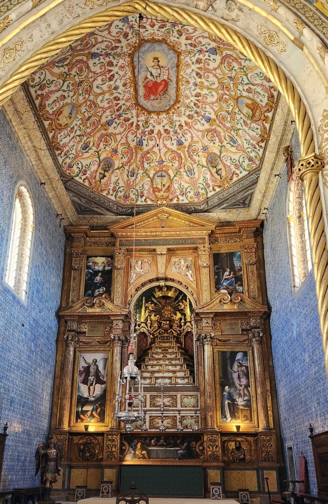
Our first stop was the Sanctuary of Our Lady of Remedies, built in 1750. The church houses an unusual and somewhat controversial statue of a breast-feeding Madonna commissioned at the request of the Bishop of Lamego in the 16th century, initially intended as a shrine to ensure fertility and later seen as a cure for various diseases. The Sanctuary sits at the top of a hill overlooking the city center, accessed by an imposing staircase with 686 steps and beautiful porcelain artworks depicting various historical or religious scenes. Pilgrims hoping to be blessed or cured would climb these steps on their knees to show their devotion before reaching the Sanctuary and kissing the Madonna statue. The church includes many other artworks as well, including a statue of baby Jesus that the nuns carefully dress from head to toe, including stockings.
Sanctuary of Our Lady of Remedies
Inside the Sanctuary
Artworks in the Sanctuary, including Baby Jesus Statue
After touring the Sanctuary, we descended the steps to the city center, which provided the stunning views pictured below. Nerd that I am, I tried counting the steps on the way down and came up two off from the official 686, though I’m sure the guidebooks have the correct number.
View from the Sactuary Plaza
One of the Ceramic Tile Murals
View of the Sanctuary from Below
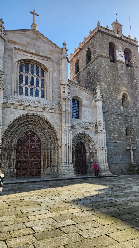
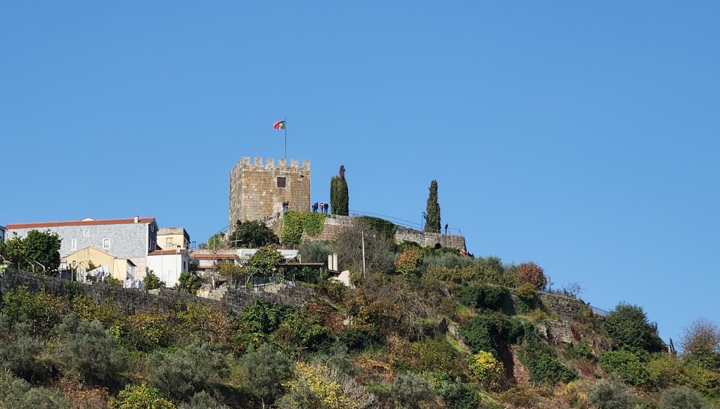
Once in the city center, we visited the Cathedral, which was founded in 1129 and still serves as the seat of the diocese of Lamego that was originally established in about 570. From the city, we had a good view of the medieval castle built in the 12th century by Ferdinand of Leon.
Cathedral of Lamego
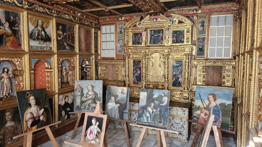
Artworks in the Cathedral
Hilltop Castle in Lamego
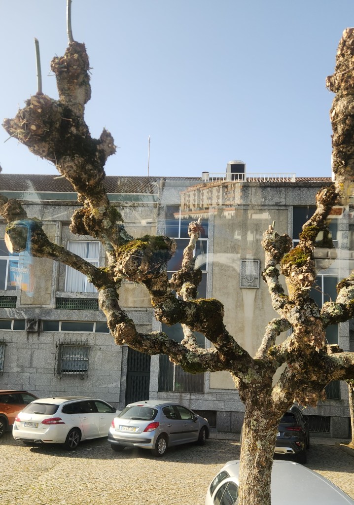
In the city, we bought a purse and a wallet made from cork — Portugal is the world’s leading cork producer, accounting for over 60% of world supply, and Lamego had a lovely shop that specialized in cork products. As we were leaving town, I noticed some odd-looking trees, which are a type of oak with no leaves. Cork-producing oaks are the most valuable type in Portugal, but there are also many evergreen oaks and quite a few of these Dr. Seuss-like ones.
Unusual Oak Tree in Lamego
After a long drive through the impressive Portuguese countryside, we reboarded the ship at Entre-os-Rios. Once all the excursion passengers were aboard, the Helgrim resumed sailing downstream to its starting point at the pier in Vila Nova de Gaia where it docked for the night.
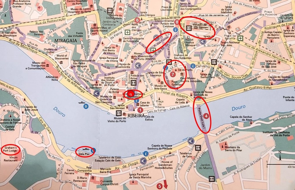
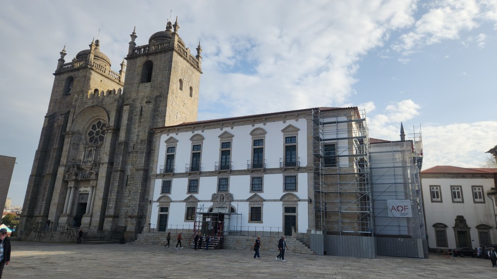
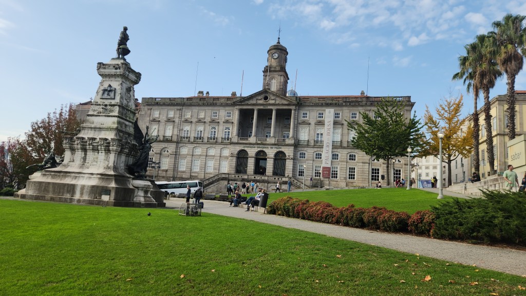
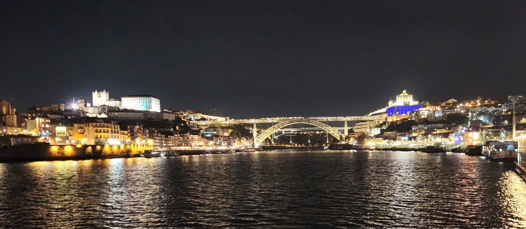
Porto (November 18): On Monday the 18th at 8:30 AM we left the Helgrim at its dock in Porto for a short bus ride to a bridge across the Douro River linking Vila Nova de Gaia, or just Gaia as the locals call it, and Porto. There we met up with a local guide who led us on a walking tour of the city. The map below shows some of the interesting places we saw on the excursion.
Our tour stops and points of interest included the following.
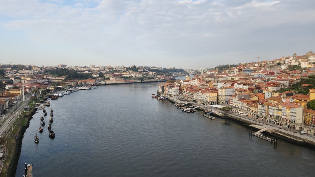
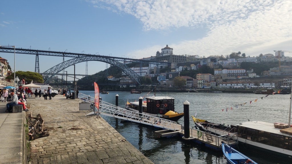
We began by crossing the Luis I bridge (location 4 on the map above) from Gaia into Porto. Here are some photos looking downriver and upriver from the bridge.
The Luis I Bridge connecting Porto and Gaia
Looking Downriver from Luis I Bridge
Looking Upriver from Luis I Bridge
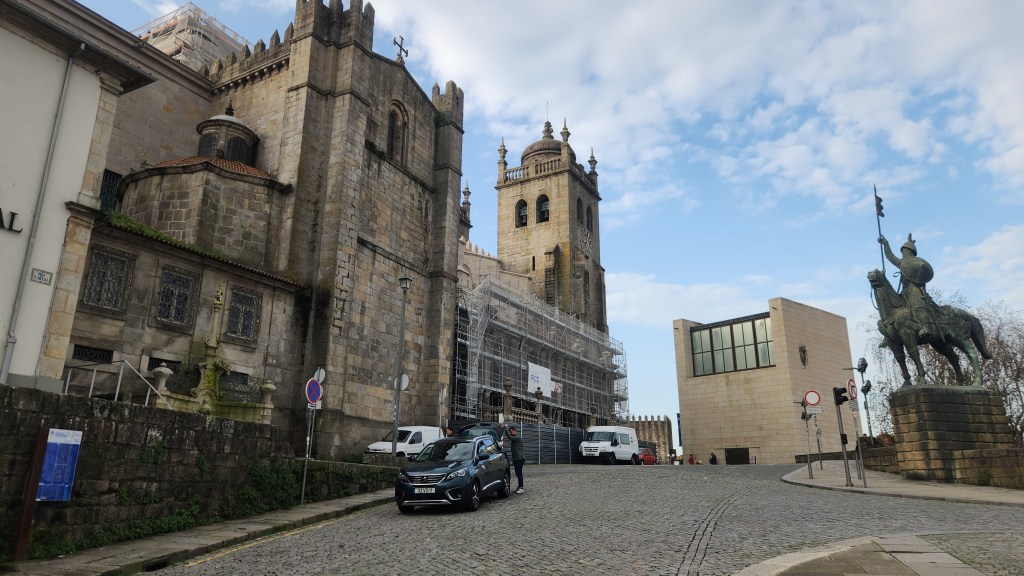
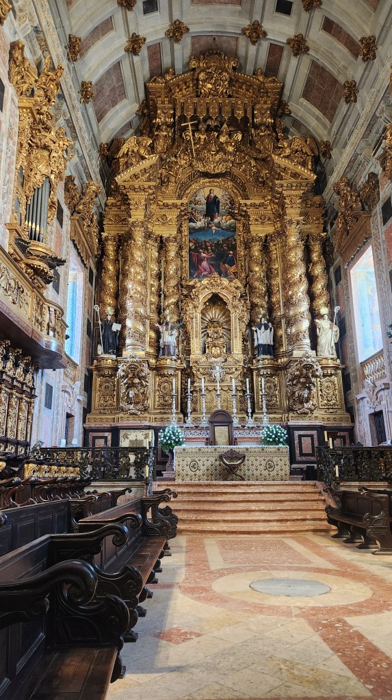
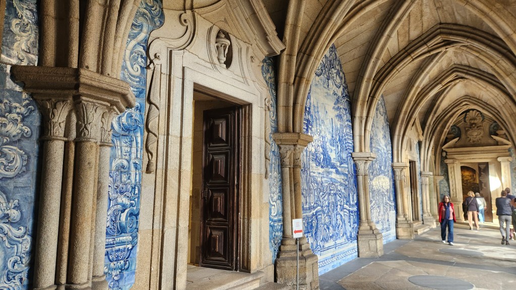
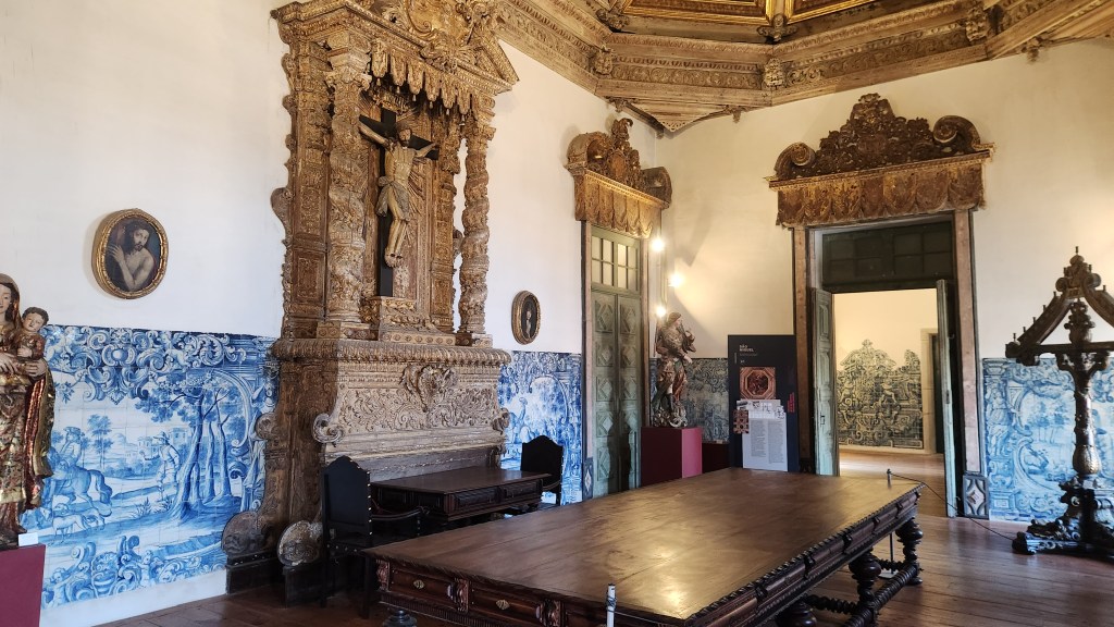
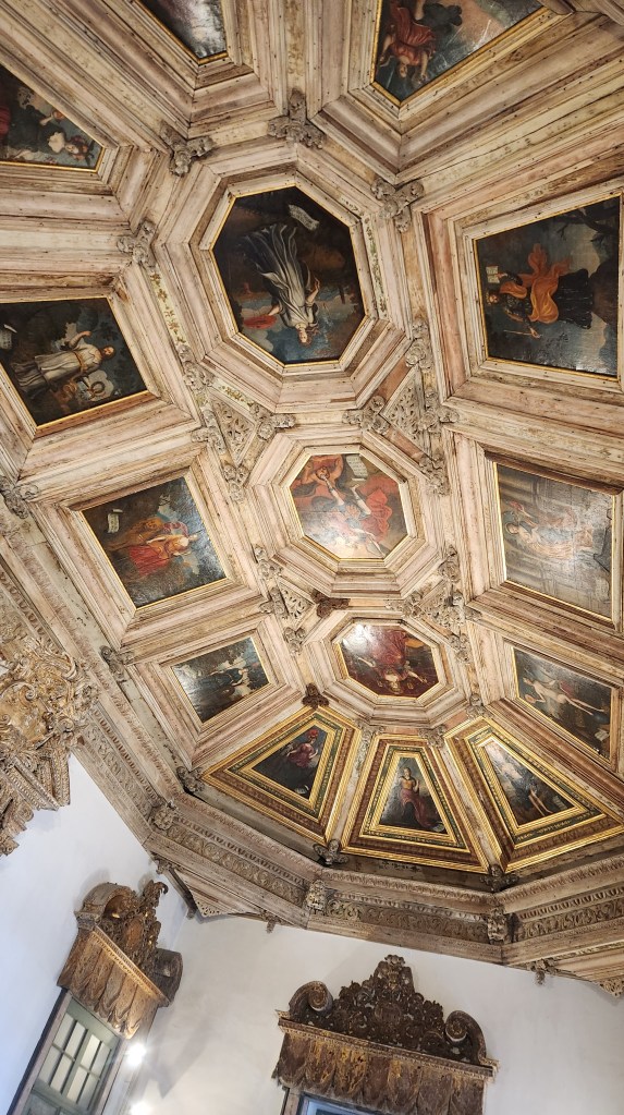
The Cathedral of Porto (location 7). Construction of the Cathedral began in the second half of the 12th century and work continued until the 16th century. There were major Baroque additions in the 18th century, and further changes were made in the 20th century.
Porto Cathedral Viewed from the Northeast
Porto cathedral and Monastery Viewed from the West
Cathedral Interior
Cathedral Altar
Monastery Cloister with Ceramic Tile Murals
Monastery Room with Ceramic Tile Murals
Ceiling in the Monastery
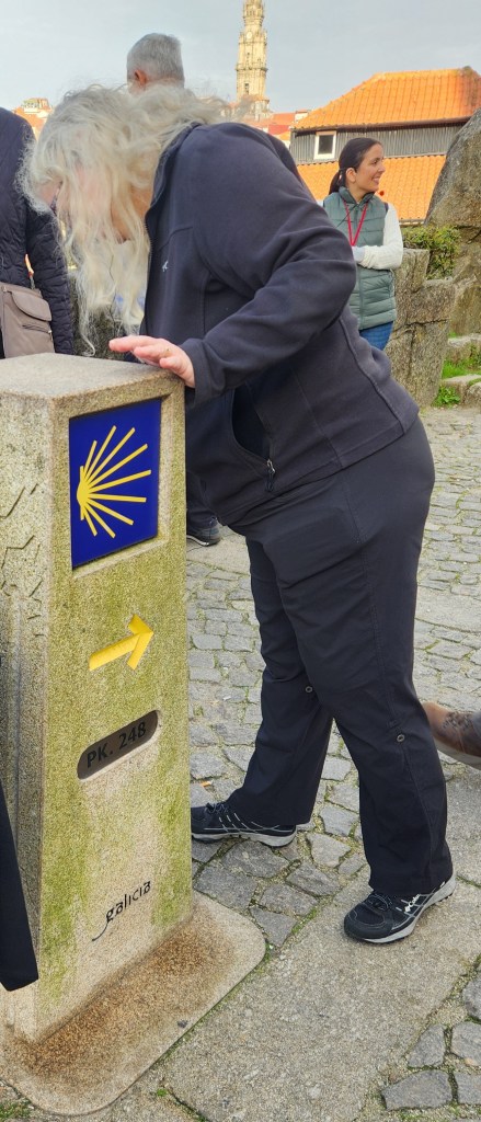
Is she looking for the way to Santiago de Compostela? The shell symbol marks the route.
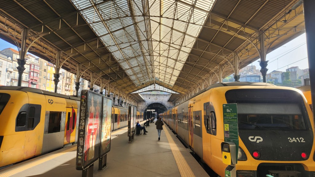
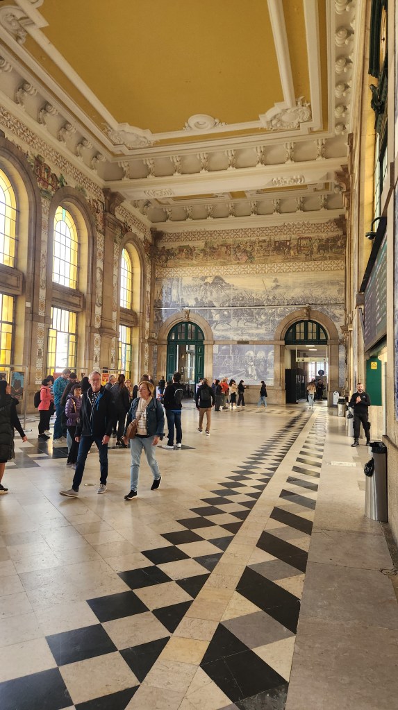
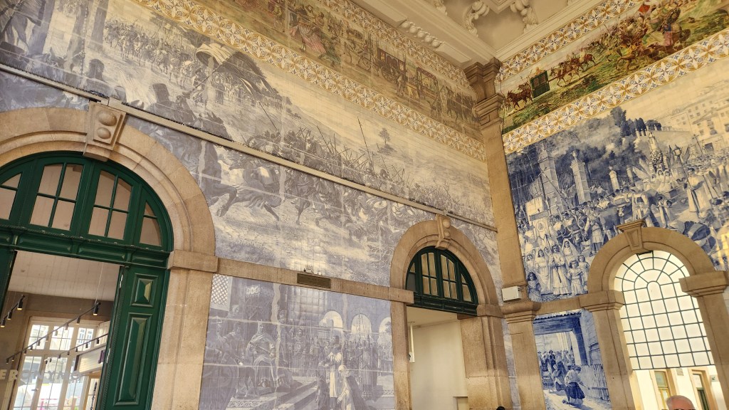
Sao Bento Railway Station (location 8). This is a major rail hub serving all of Portugal. Construction of this building began in 1904, and the entry hall includes beautiful ceramic panels illustrating the history of Portugal.
The Railway Station
Railway Station Entry Hall with Ceramic Tile Murals
The Murals Illustrate the Story of Portugal’s History
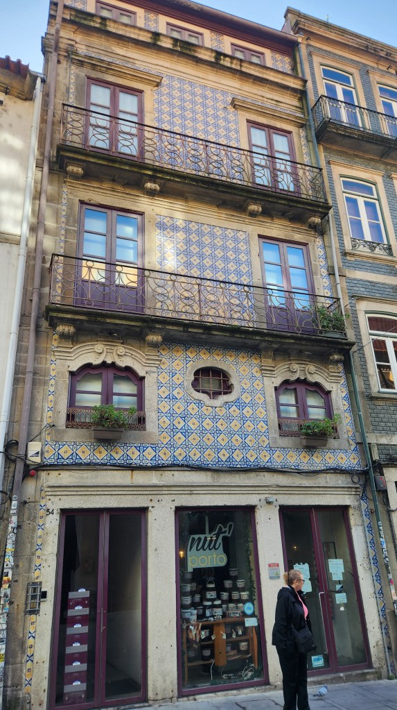
Various streets of the city, including Rua des Flores (Flower Street), a major shopping boulevard. Here are some photos illustrating the architecture, especially the lovely balconies and ceramic tiles.
On the way from the Cathedral to the Railway Station
Shop and Apartments near Flower Street
Restaurant and Apartments near Flower Street
Well-kept or renovated apartments sell for six figures in Porto
A plaza (location 9) dedicated to Prince Henry the Navigator (1394-1460), regarded as the main initiator of the Age of Discovery during which Portugal explored much of the world.
Prince Henry the Navigator
After the walking tour, we took a water taxi across the Douro River and walked back to our ship moored at the Gaia Pier, arriving about 12:15 PM.
The Water Taxi Dock
Note that the map above also shows the location of Graham’s Port Lodge, which we visited back on November 12 as described in Part 2 of this series.
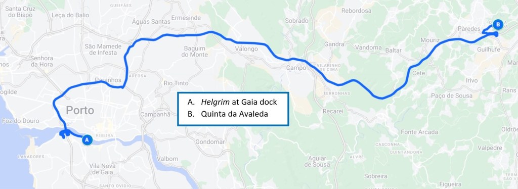
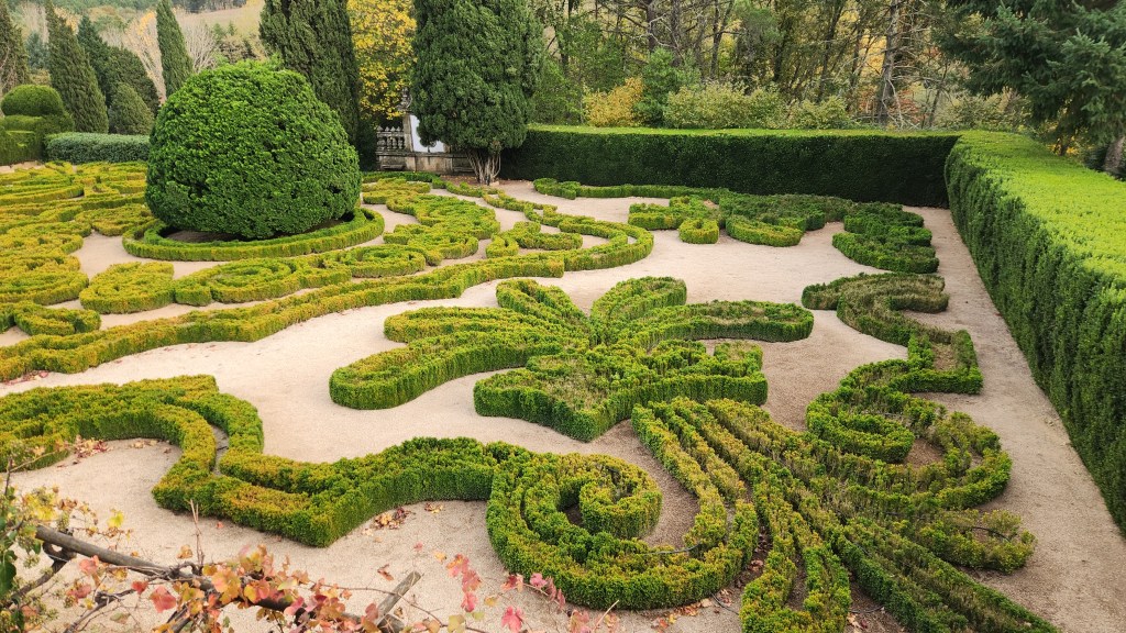
Quinta da Avaleda (November 18): After lunch aboard the Helgrim, we disembarked for our final shore excursion at 1:45 PM. We rode a tour bus with a small group of passengers to visit the beautiful winery of Quinta da Aveleda and its amazing garden.
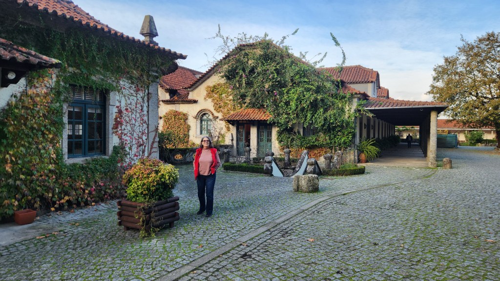
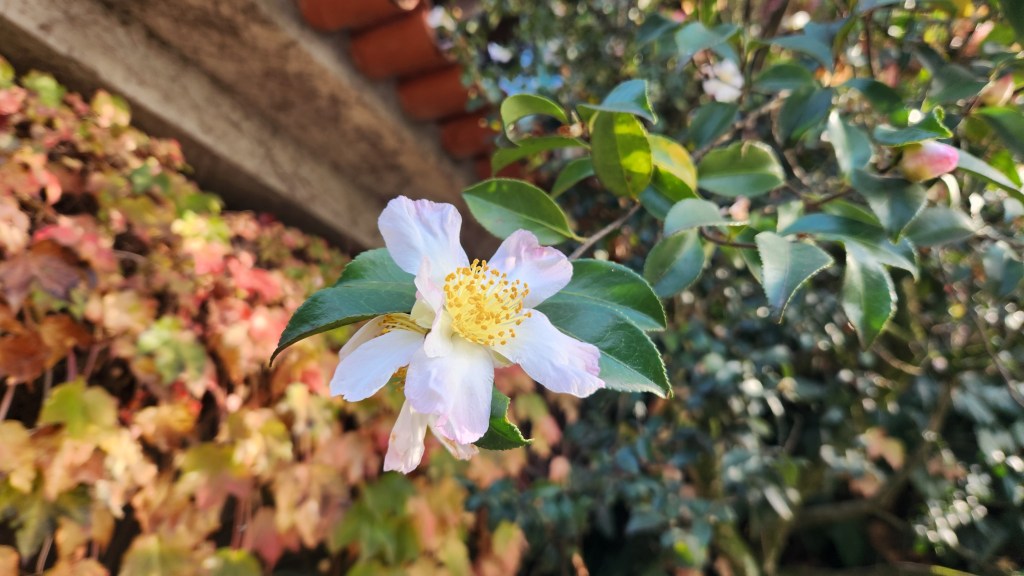
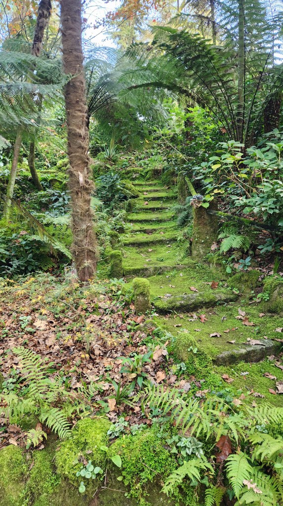
The main building was built in 1671 by a wealthy Portuguese family. Manoel Pedro de Guedes, an important Porto politician, inherited the property and established the estate in 1870, including the vineyards and the incredible garden. The Guedes family still owns the estate and uses the main house for family gatherings, but the estate is open for public tours and has become a highly popular tourist destination. After touring the garden, we sampled several wines produced under the Casal Garcia brand from grapes grown throughout Portugal, but the garden was the truly amazing aspect of the estate, including granite buildings, vineyards, a lake, a teahouse, fountains, gothic ruins, streams, oak trees, camelias, azaleas, eucalyptus, and sequoias. I’m sure readers are getting tired of my verbose descriptions, so I’ll just leave off with some of the photos I took.
The Commercial Winery Building with Gift Shop
Beautiful Rhododendron (I think)
The Camellias were Blooming Early due to Warm Weather
Stairway to Heaven?
An Old Oak Tree (but no yellow ribbons …)
Strolling Down the Garden Path …
Hunting Lodge and Fountain
Hunting Lodge Ceiling
Vineyards seen form the Garden
Vineyards by the Garden
The Family Home, originally dating from 1671
A Lovely and Appropriate Mascot
The trip home (November 19-20): Why did it take two days to get from Porto to Minneapolis? Well, we had a glitch, the one and only disappointment of the entire trip. We left the Helgrim at 3:30 AM on Tuesday the 19th, boarding our Viking bus and heading for the Porto airport to catch a 6 AM flight to Frankfurt, Germany, from where we were booked on an 11:15 AM Lufthansa flight to MSP. All went smoothly through boarding at Porto, but once all the passengers were on board and the doors closed, the pilot announced that our flight would be delayed due to a problem with one of the runways in Frankfurt. So, there we sat, for well over an hour, and by the time we finally took flight and arrived in Frankfurt, our MSP flight was long gone. After attempting to navigate some incredibly long lines at several Lufthansa service counters, we received emails explaining that we were now booked on the 11:15 flight the next day and that we were receiving vouchers for an overnight stay in a nearby Frankfurt hotel. Off we trudged to find the hotel shuttle bus, which deposited us at the Intercity Hotel at 12:22 PM. Unfortunately, our luggage was still in the baggage queue at Lufthansa, including our clothes and toiletries as well as my medications, so we had to go without. Luckily, Pat had a travel toothbrush, so at least Pat didn’t have to abide my schnitzel-tinged breath all night. Thankfully, the voucher did cover dinner and breakfast, but we had to pop for our own lunch.
The only upside to this glitch was that our Wednesday flight to MSP was only about two-thirds full, so we were able to spread out comfortably. I watched a couple of movies while Pat dozed across the aisle, and the flight was uneventful. Once at MSP, we had our first test of the Global Entry system that we enrolled in last spring. After landing, we each submitted a request using the Global Entry apps on our phones, receiving electronic receipts that allowed us to whisk through a special customs line in a matter of minutes – definitely worth the $100 fee, which is good for five years and also includes the TSA PreCheck system for boarding flights.
After another Lyft ride from MSP, we made it back to our condo at 5:01 PM on Wednesday, a mere 31 hours after leaving the Helgrim, rather tired but exceedingly pleased with our Intrepid Iberian Interlude. I hope readers have enjoyed the journey as well.
OK, that’s a wrap. Thanks for reading, and stay tuned for more adventures in the future!
Welcome back for Part 3 of this narrative of our recent trip to the Iberian Peninsula. Part 2 described our travel from Lisbon to Porto, via Coimbra, and our journey up and down the Douro River. In this episode, I’ll describe three of the shore excursions we took during the river cruise.
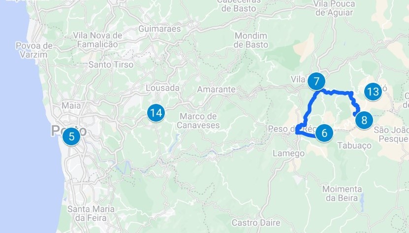
Mateus Palace and Gardens (November 13): On Wednesday the 13th, after sailing from Vila Nova de Gaio to a pier near Lamego, we disembarked at 2:30 PM for a 20-mile bus drive to the Mateus Palace located in the Mateus parish of the city of Vila Real. After touring the palace and its magnificent garden, we drove back to the ship, which by then had sailed further upriver to Pinhão and docked for the night.
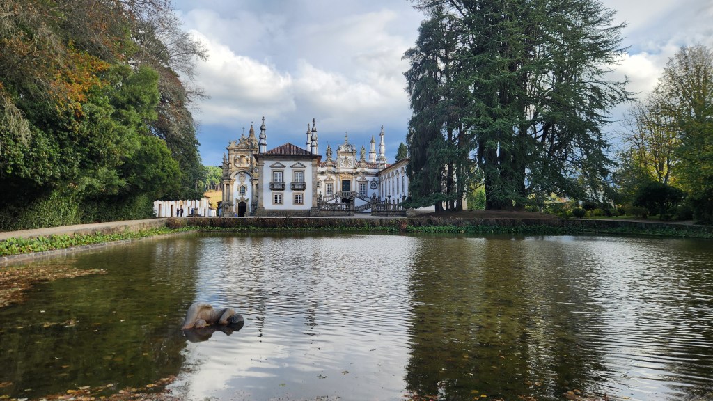
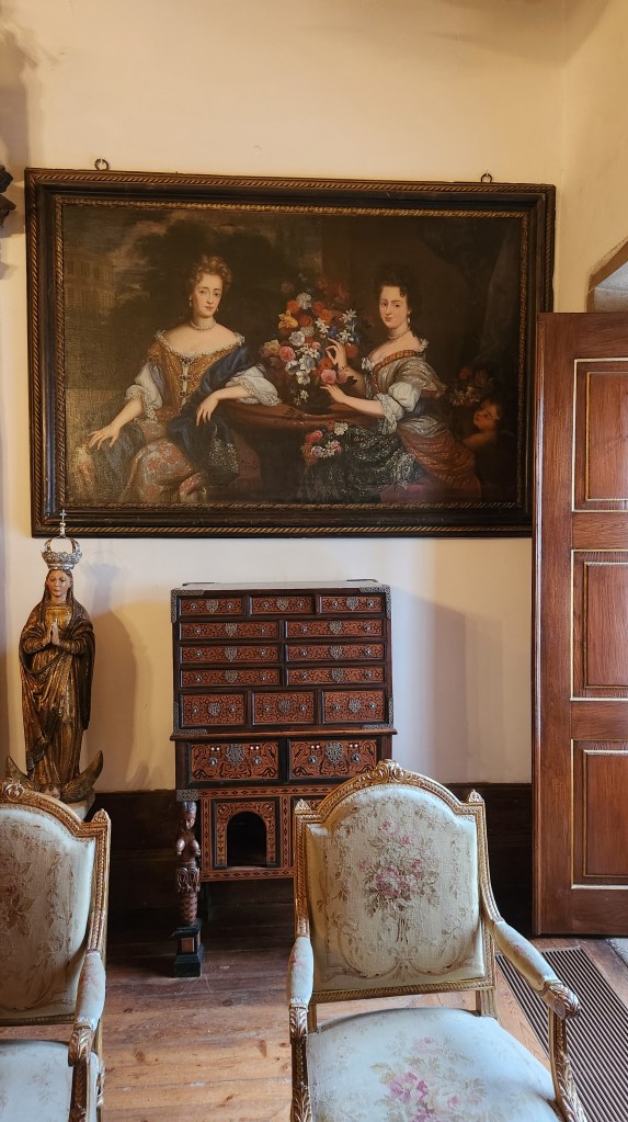
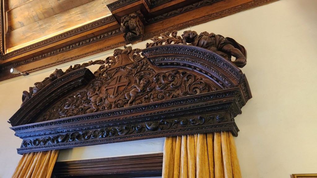
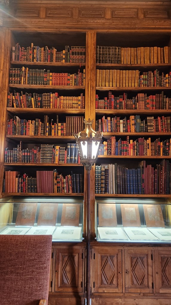
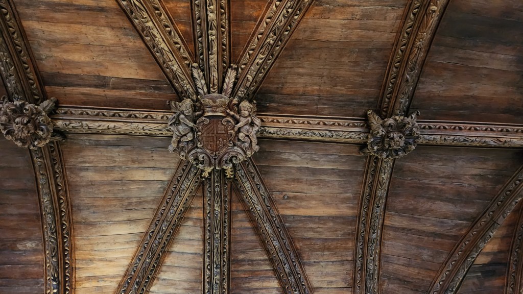
The Mateus Palace was built around 1740 on the site of an estate originally built in the early 1600s by a family of wealthy vineyard owners. The third-generation owner, António José Botelho Mourão, had it designed and constructed by Nicolai Nasoni, an Italian architect widely-known for his work throughout Portugal. It was designated as a National Monument in 1910 and is now a major tourist attraction. The interior decoration includes intricately carved chestnut wood ceilings, furniture from several periods, 17th and 18th century paintings, and an impressive library with hundreds of books.
The Mateus Palace and its Reflecting Lake
Wing of the Mateus Palace
Decor, Including Painting, Cabinet of Drawers (with secret codes for opening each drawer), and Chairs
Oak Carving above Window
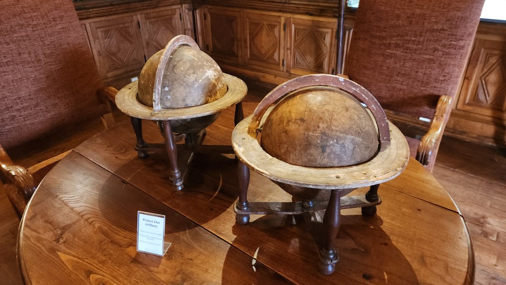
The Library
Library Artifacts
Oak Ceiling
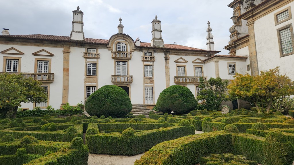
The palace is surrounded by an immense garden originally planted in the 1700s, then modified in 1870 and expanded in 1930. In the 1950s and 1960s, the garden area was extensively modified and a lake was added to act as a mirror reflecting the manor house. A dense planting of chestnut and oak trees was added in the 1970s. Amazingly, the garden is overseen by a single, full-time gardener, though our guide told us that he has help from multiple volunteers.
One Small Segment of the Enormous Garden
We arrived back at the Helgrim at 7 PM, just in time for the usual sumptuous Viking dinner.
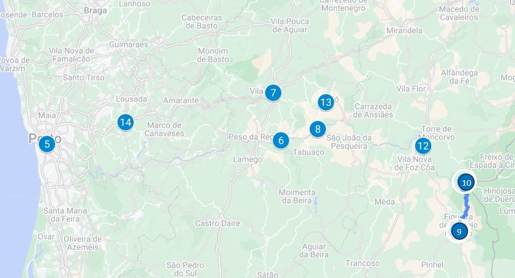
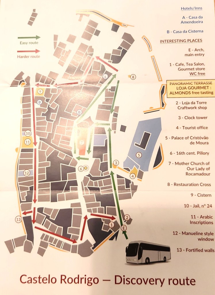
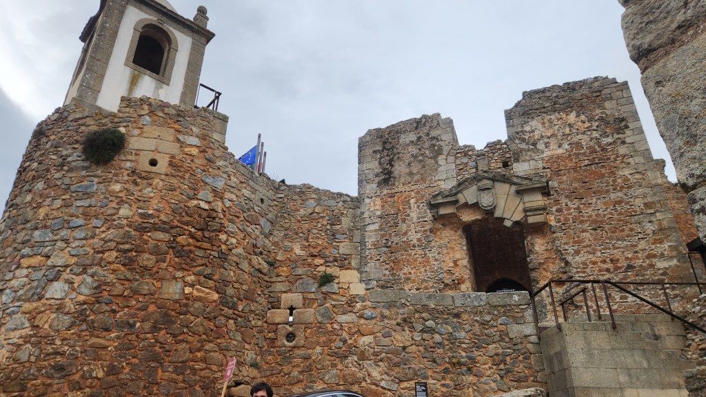
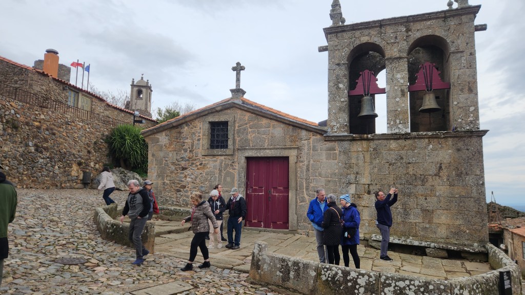
Castelo Rodrigo (November 14): We spent the morning and early afternoon of Thursday the 14th sailing upstream to Barca d’Alva, then disembarked for a tour of an ancient town called Castelo Rodrigo.
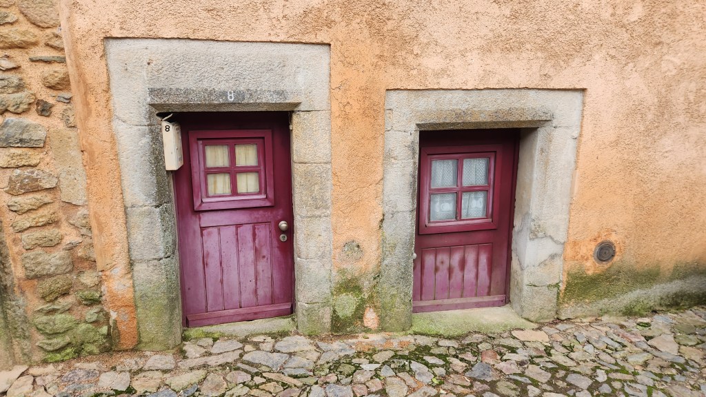
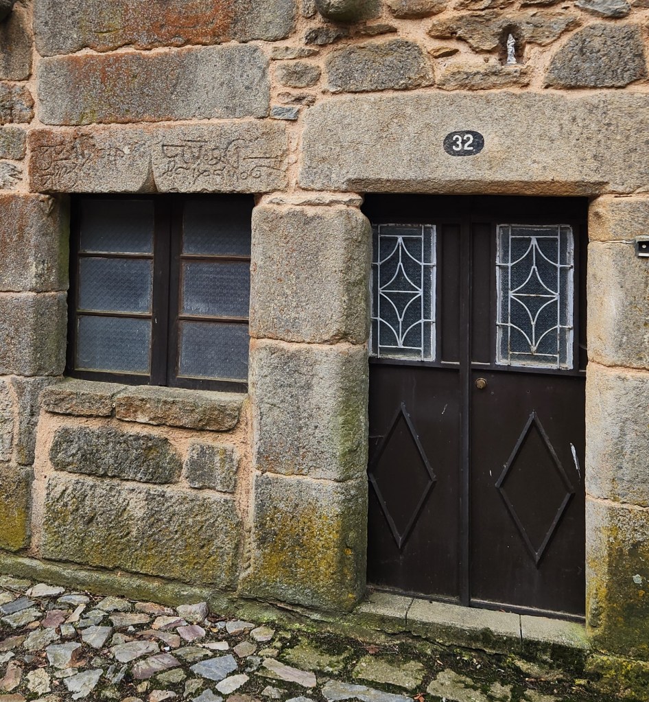
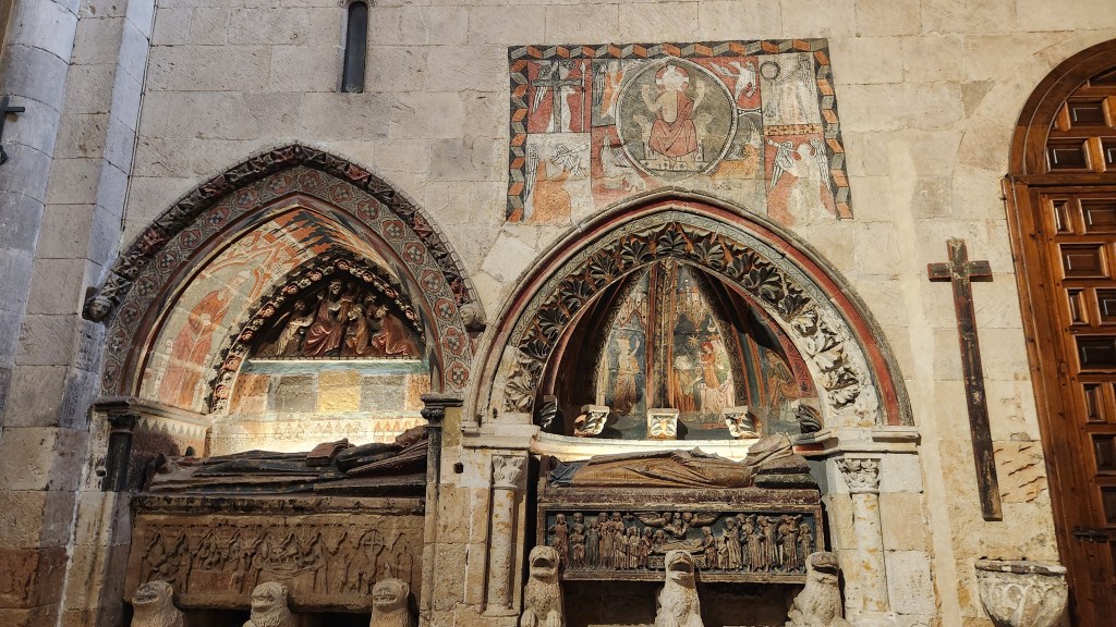
It is believed a castle and village were founded on the site in the 6th century and subsequently inhabited by Romans and Moors before being conquered by King Alfonso IX of Leon in the 1200s. Alfonso had the city fortified and the walls reinforced, placing Count Rodrigo Gonzalez de Girón in charge of its defense, and he became its namesake. It was incorporated into the Kingdom of Portugal in 1297, ceded by Leon to King Denis after extensive battles. The fortress and walled fence were rebuilt, and 13 turrets, a keep, a fortified entrance gate, and moats were constructed by Denis in the 14th century. It has been listed as a National Monument since 1922. Our tour group strolled through the town on the cobblestone streets, visiting among other places a medieval church, the ruins of an ancient synagogue, and a lovely shop where we bought some delicious roasted almonds.
Castel Rodrigo Keep
Mothyer Church of Our Lady of Rocamadour
Doors — made as small as possible to conserve heat
Building with Ancient Hebrew Inscription
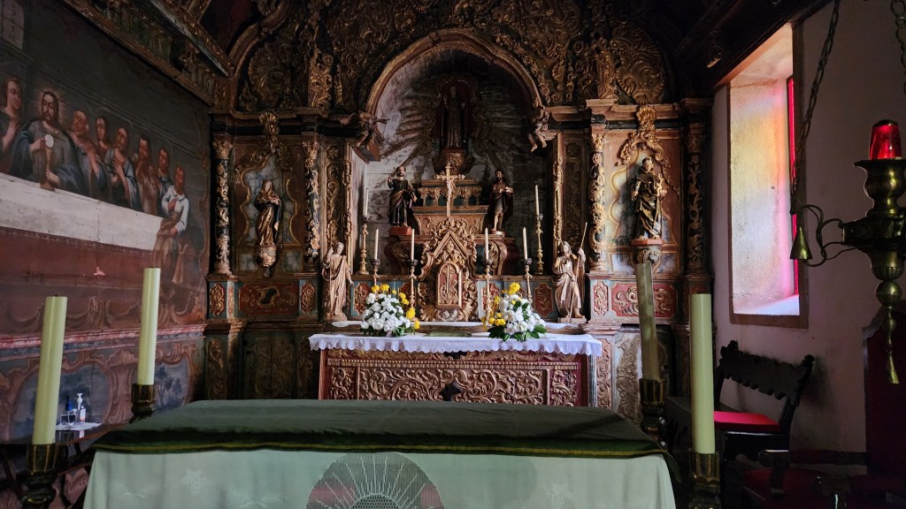
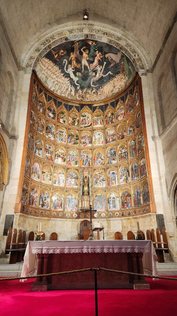
The church, Mother Church of Our Lady of Rocamadour, located on the path to the famous shrine, Santiago de Compostela, and marked by images of seashells, was established in the 12th century by the Brothers Hospitallers. It contains some interesting artwork as shown in the photos.
Church Altar
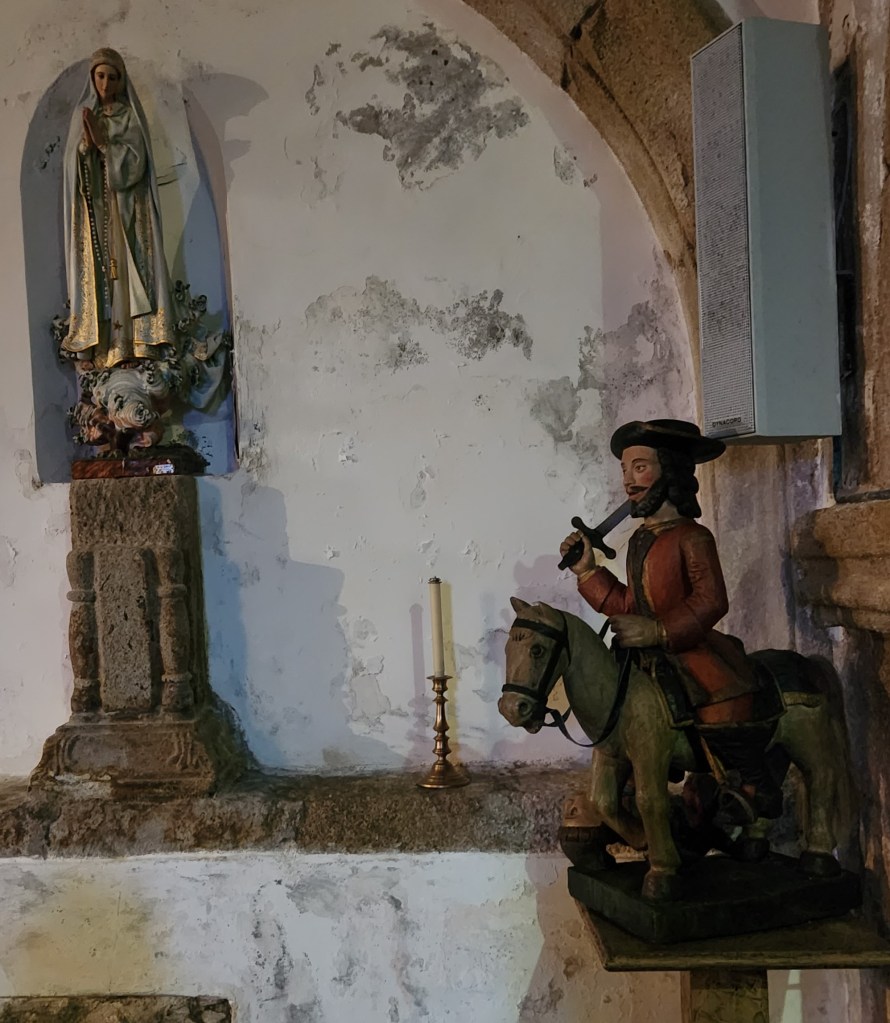
Was the Conqueror a Giant, or was he Riding a Pony?
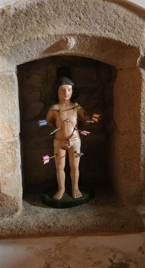
St. Sebastian is honored in the Church
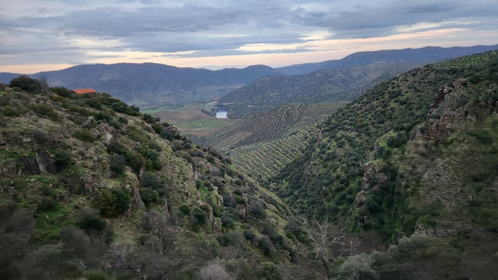
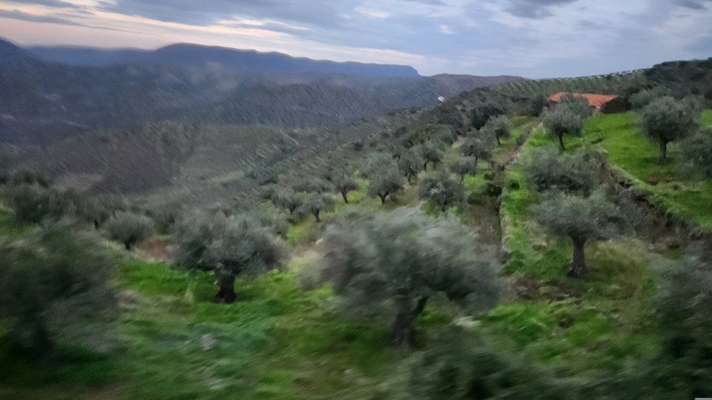
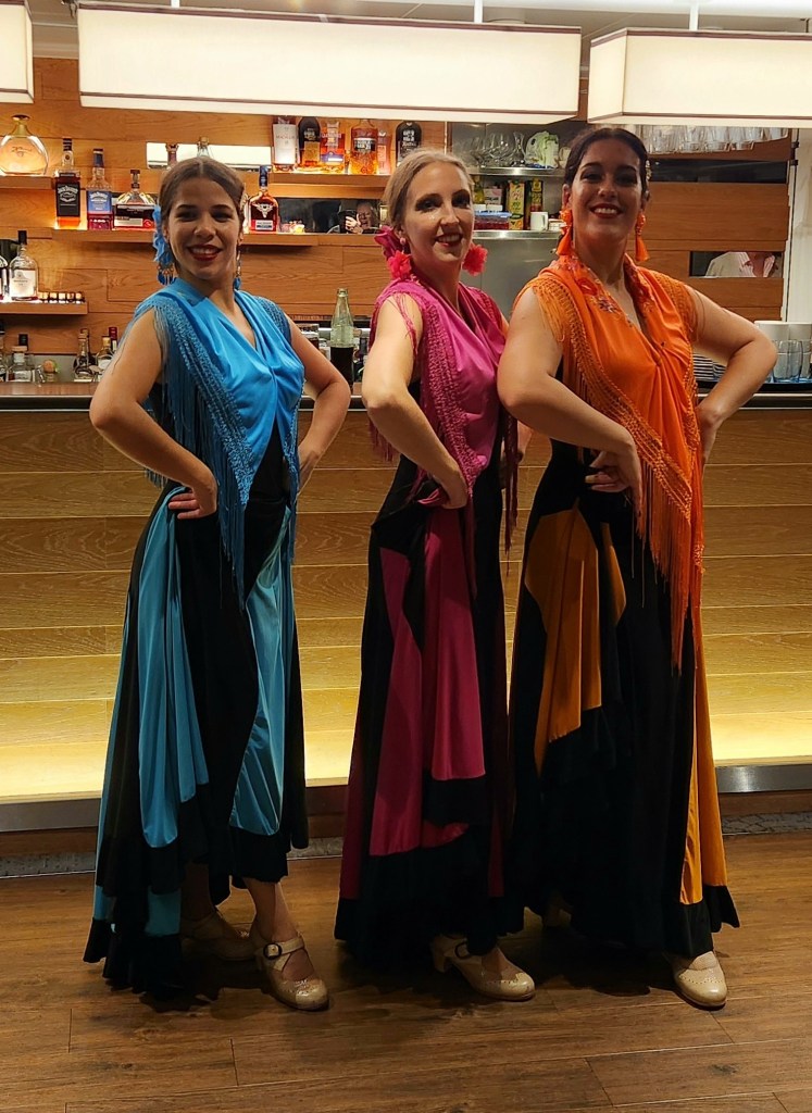
On the way back to the ship, we passed by acres and acres of almond and olive trees, both of which are major products in the areas outside the Douro Valley. Back on the ship, we were treated to a Flamenco Dance exhibition by a trio of professional dancers to cap off a lovely day.
Orchards near the Agueda River (Portugal/Spain Border)
Closeup of Orchard (sorry for the blur — the bus was moving fast)
Flamenco Troupe Visits the Helgrim
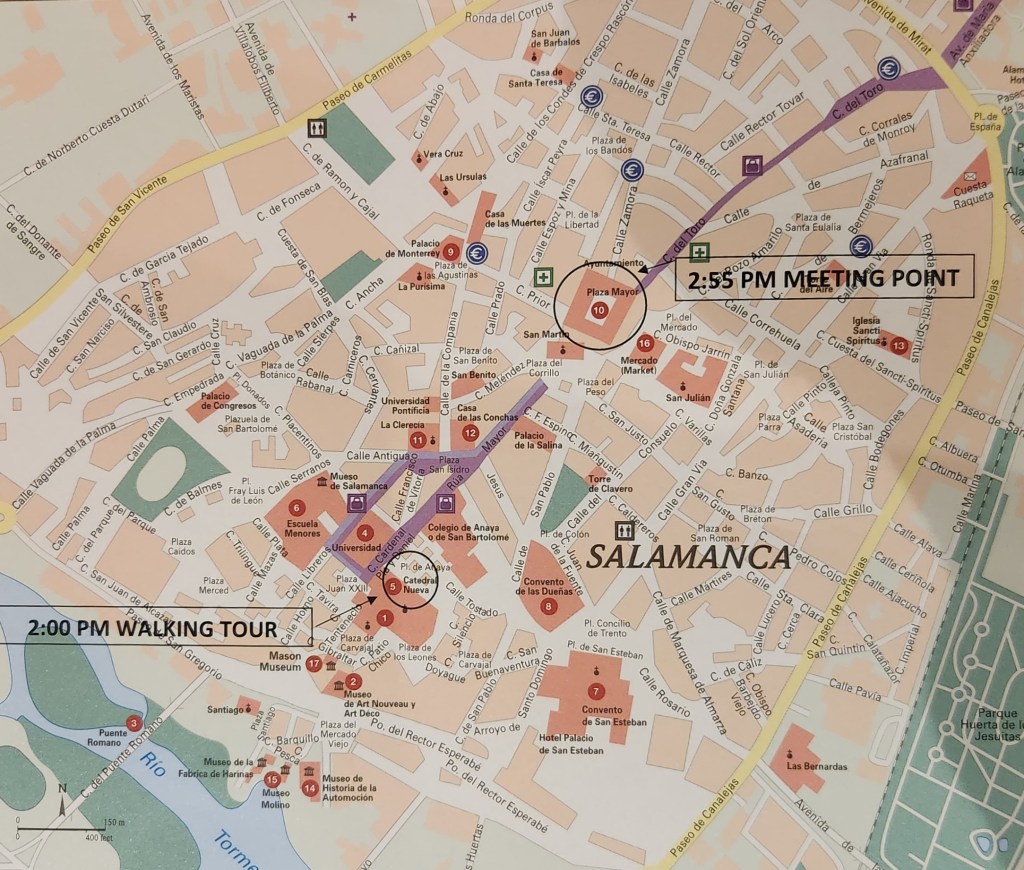
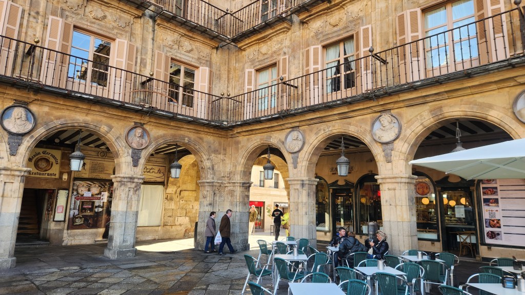
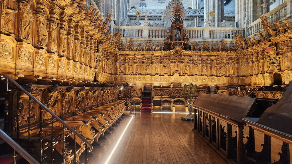
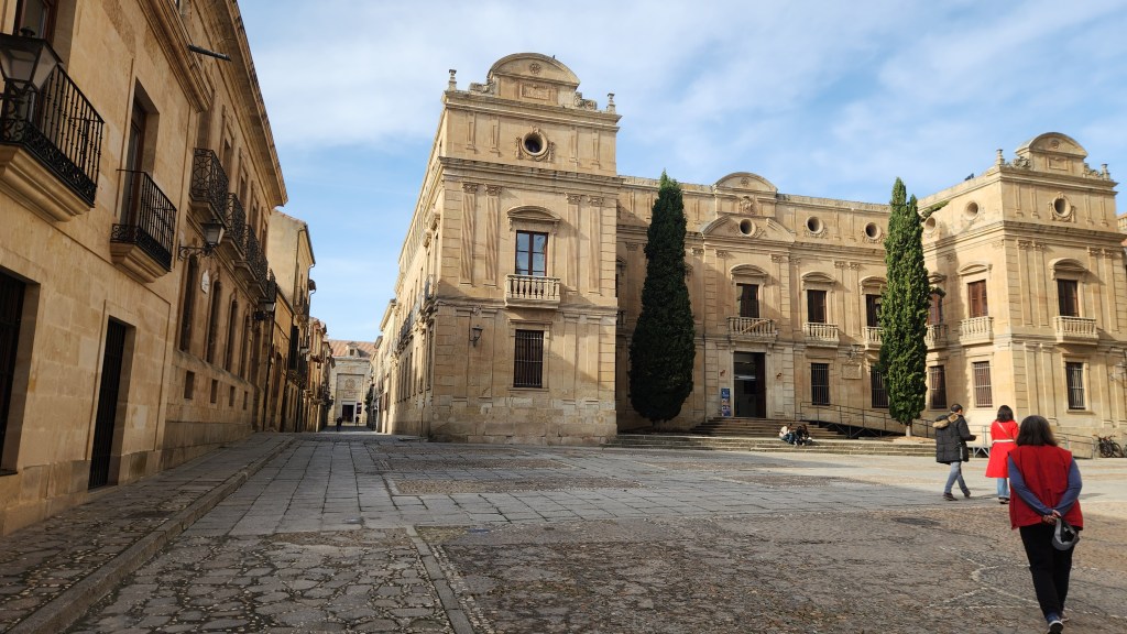
Salamanca, Spain (November 15): On Friday the 15th, we left the Helgrim at its dock in Barca d’Alva at 8:30 AM for a bus ride to Salamanca, Spain. While we and a majority of the 102 passengers traveled to Salamanca, the Helgrim began the return journey down the Douro, and we eventually returned to the ship at its overnight position in Pocinho at 9:20 PM.
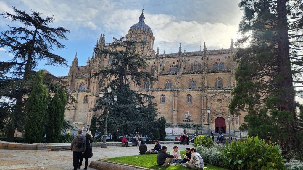
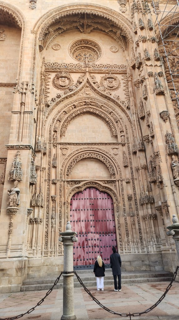
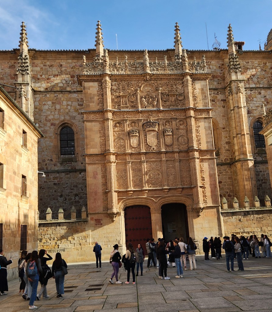
The earliest human habitation of Salamanca occurred in the first millennium BCE, and the earliest stable settlement in the 7th century BCE. As throughout Spain, the city was subsequently occupied by Romans, Alans, Visigoths, and Moors before being recaptured by Alfonso VI of Leon in 1085. It is known for its two Cathedrals and for the University of Salamanca, and these were the primary focus of our tour. The Old Cathedral of Salamanca was built between 1120 and 1236. The adjacent New Cathedral was built between 1513 and 1733. The first school buildings were established nearby to the Old Cathedral in 1134, and it was officially founded as a university in 1218, and many of its current buildings were constructed from 1401 through 1611. Here’s a map of the Old City:
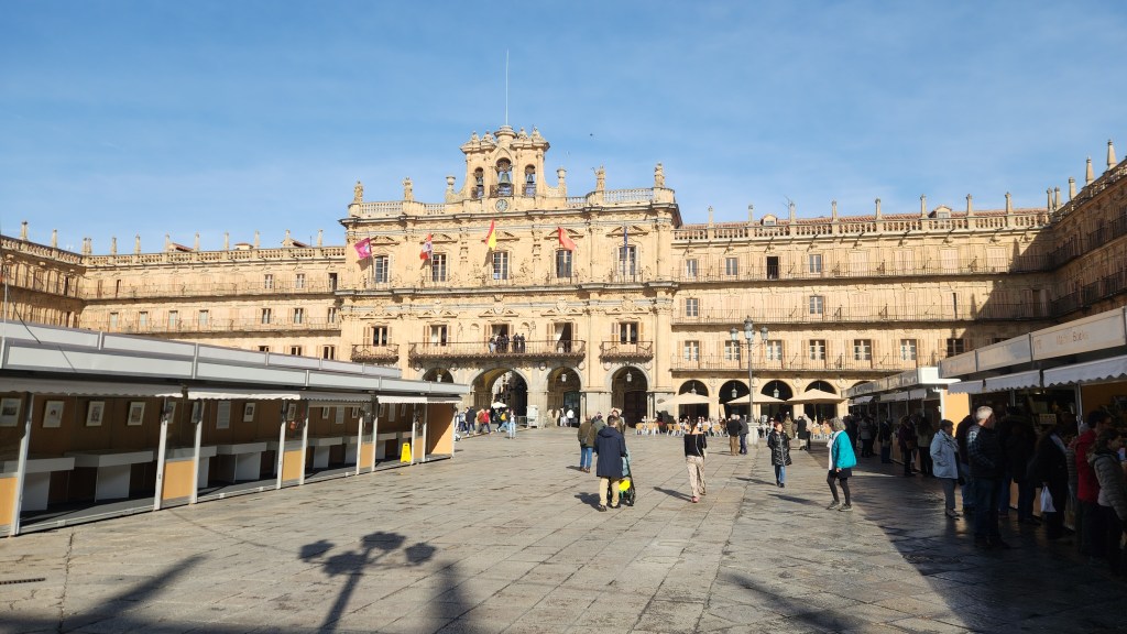
After strolling to the Plaza Mayor with our Viking guide, we had some free time to explore the area before joining a local guide at the entrance to the New Cathedral. This was far and away the biggest and most magnificent church we saw on the entire trip, rivaling anything I’ve seen anywhere in Europe. Maybe the photos below will give you a feel for it, but the scale was so grand that I couldn’t really capture the essence of it with my puny little cell phone.
Plaza Mayor in Salamanca
Plaza Mayor in Salamanca
Statue Commemorating Salamanca Artisans
And One for Salamanca laborers
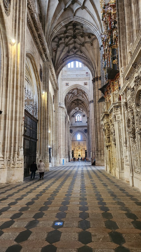
New Cathedral of Salamanca
New Cathedral Door
New Cathedral of Salamanca
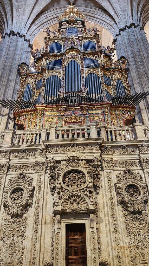
New Cathedral Organ
One of Many Shrines in the New Cathedral
The Cardinals’ Seats in the New Cathedral
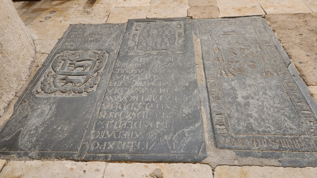
Crypts in New Cathedral Floor
Altar in the Old Cathedral
The Old Cathedral of Salamanca
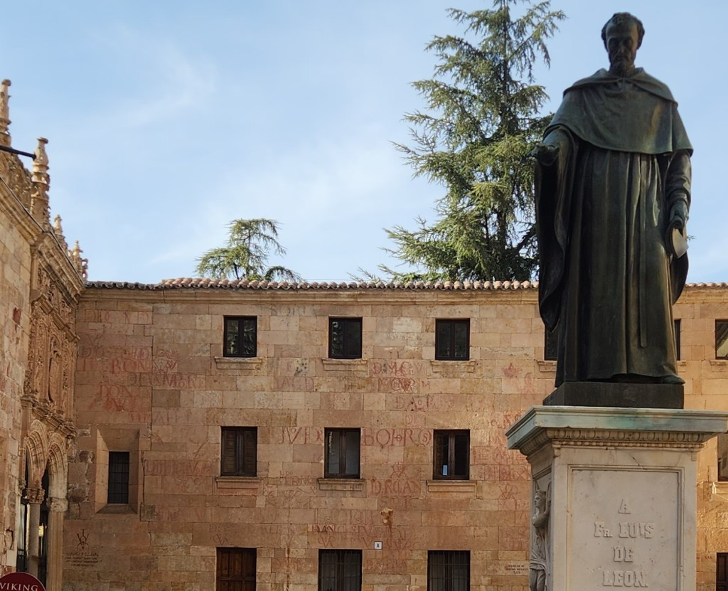
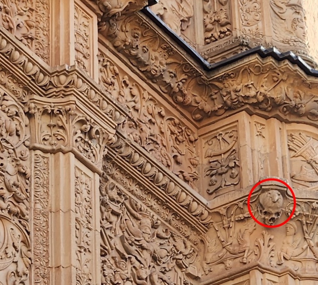
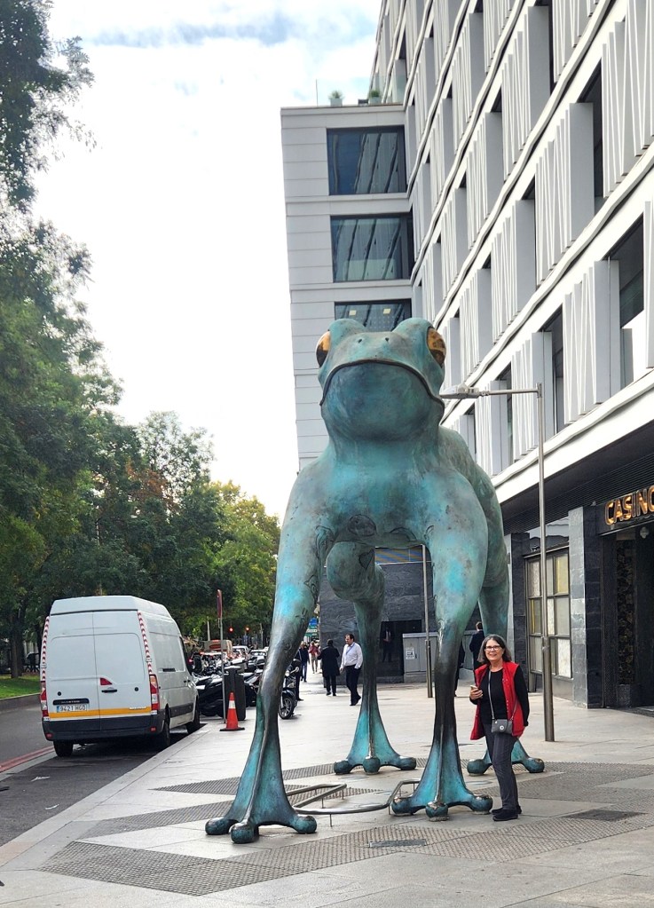
After the Cathedral, we strolled with our guide among the University buildings where our guide told us some interesting stories about the history of the place. Many of the building walls sported names and dates inscribed with bull blood; these were written by doctoral students to celebrate and commemorate the day when they survived a days-long period of isolation and intense study followed by severe questioning by the professors to earn a degree. (And I thought my Ph.D. orals were tough!) The University Chapel has exceedingly ornate carvings around the entry door, including a skull on top of which a frog is perched. Many of the carved images, including the frog, were intended as a warning to the students that misbehavior of any sort while attending the University was forbidden (I didn’t quite “get” the frog connection myself). This frog became world famous, and souvenir frogs of all sizes and colors are sold at gift shops throughout the city and in the wider region around Salamanca.
One Building of University of Salamanca
Inscriptions on the Walls in Bull Blood
The University of Salamanca Chapel
Detail of University Chapel Facade (with famous frog highlighted)
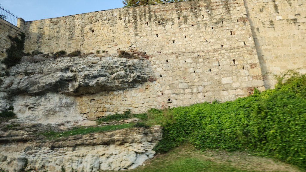
We then followed our guide along Rua Mayor back to the Plaza Mayor before boarding the bus back to the ship, catching a glimpse of the crumbling old walls as we drove past.
The Old Walls of Salamanca
OK, that’s it for Part 3. In the final episode, I’ll describe the last four shore excursions we took during the river cruise and our travels (and travails) getting back home to Minneapolis.
Welcome back for Part 2 of this narrative of our recent trip to the Iberian Peninsula. Part 1 left off as we completed a walking food tour of Lisbon on November 11th. In this episode, we’ll head north to Porto, with a stop at Coimbra along the way, and begin sailing along the Douro River.
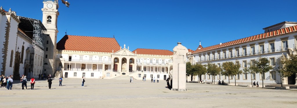
Coimbra (November 12): On Tuesday the 12th, we set our luggage outside our Lisbon hotel room for collection by the Viking team at 6:45 AM before heading down for our final excellent breakfast at the Corinthia. We boarded our Viking bus at 8:15 AM. During the two-hour, 130-mile drive north to Coimbra (with a rest stop for snacks and the all-important restrooms along the way), our Viking guide gave us some background on the history of Coimbra and the places we were going to visit. The city, located on a hill by the Mondego River, was originally founded by the Romans during the reign of Augustus (63 BCE – AD 14). It was later conquered and ruled by Germanic tribes including the Visigoths beginning in the 400s and then by the Moors beginning in the 700s. It was recaptured in 1064 by the king of León. The subsequent king, Alfonso VI of León, gave Henry of Burgundy stewardship of Coimbra and the surrounding territories when he married Alfonso’s illegitimate daughter. Henry’s son, Alfonso Henriques, later rebelled from of León, consolidated power in the territories and had himself declared the first King of the newly independent Kingdom of Portugal in 1131, establishing Coimbra as its capital and continuing to expand Portuguese territory by driving the Moors out of the south. Coimbra remained the capital until 1255, when it was relocated to Lisbon.
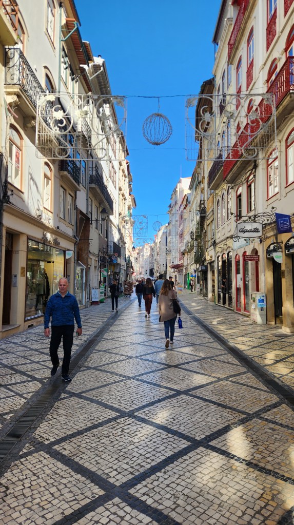
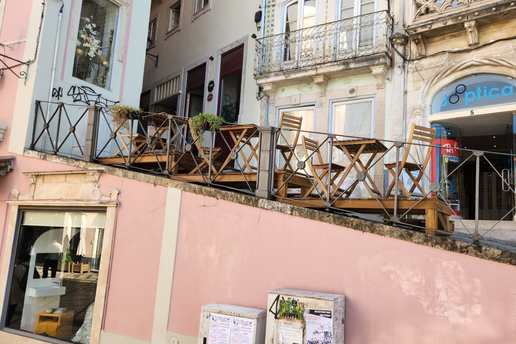
When we arrived in the city, we first had a short break as we strolled down a long, commercial street. Our guide suggested we stop at a pastry shop to try Coimbra’s famous custard tart, the Pasteis de Santa Clara, or St. Claire pastry, originally invented at the Santa Clara convent and popularized when the nuns began selling them to University students. However, when I asked for a “Saint Claire pastry,” the clerk sold me an éclair instead, so I unfortunately didn’t get to taste the proper thing.
Commercial Street in Coimbra
How one Coimbra Restaurant Adapts to the Hilly Terrain
Christmas is Big in Coimbra, as in all of Portugal
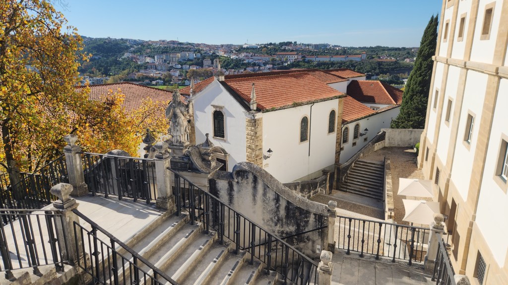
The University of Coimbra was founded in Lisbon in 1290 but relocated to Coimbra in 1308 and transferred to the premises of the Coimbra Royal Palace in 1537. Since then, city life has revolved around the state-run university, which we toured during our visit. Of special interest was the Biblioteca Joanina, or the Joanine Library, founded in 1717 by King Joan V. It is home to more than 70,000 volumes, including many priceless historical documents and first editions. It is registered as a National Monument. The library is carefully climate controlled and taking of pictures was forbidden, so you’ll just have to believe me when I say it was a beautiful and impressive place. A resident colony of bats protects the books from termites, but this aspect of preservation does dictate covering the tables at night and daily cleanup before tours are admitted. Some say that the library was used as the Harry Potter film set for the Hogwarts library; it was not, but its appearance is quite reminiscent of the movies. Also, the University students’ traditional uniforms are said to have inspired the Hogwarts uniforms in the Potter books, as author J. K. Rowling resided for a time in Porto.
Here are some photos of other parts of the University.
Main Plaza of the University of Coimbra
Overlook of Coimbra from the University Plaza
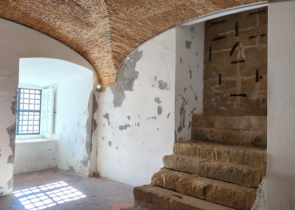
Entrance to the University Jail formerly used for Recalcitrant Students
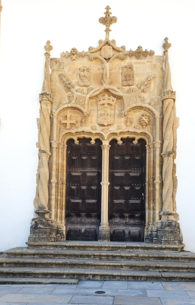
Entrance Door to University Chapel
University Chapel
University Student Wear — Said to be the Inspiration for Hogwarts Students
After visiting the University, we stopped for an excellent lunch at a restaurant called Republica da Saudade. As we ate, we were entertained by a trio of musicians performing what is known as Coimbra Fado – a genre of music born of the late-night love serenades made famous by university students over the centuries. Here’s a sample:
Fado Singer and Musicians: a nice extra touch for our lunch
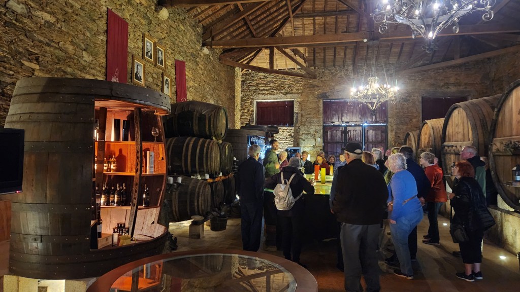
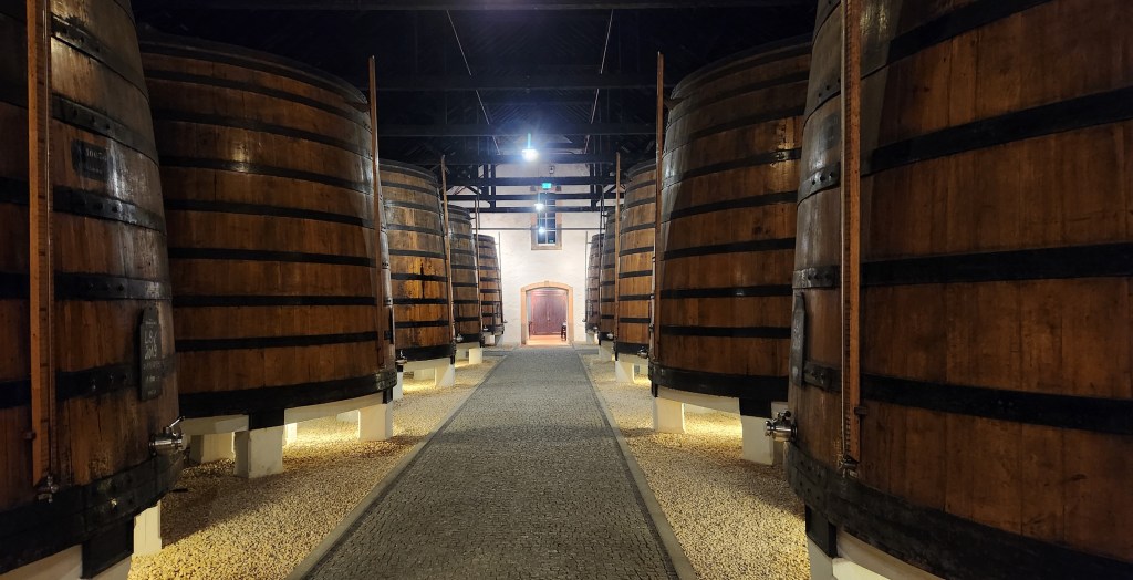
Porto (November 12): After lunch, we boarded the bus again and headed north for some 80 miles . We arrived at the river dock in Vila Nova de Gaia (a suburban city across the river from Porto) and boarded our ship, the Viking Helgrim, at about 4:30 PM. After we settled into our stateroom and walked around the ship a bit, we were called for a mandatory safety drill during which all 102 passengers reported to the lounge area with our safety vests for instructions should an emergency occur. Once properly trained, Pat and I and a dozen or so other passengers departed for an optional tour of Graham’s Port Lodge, a major wine production house built in 1890 by a Scottish wine importer and located high on the nearby bank of the river.
At Graham’s we learned about the history and production of Port wine. First and foremost, a wine can only be called Port if it is produced in the Douro Valley. The Douro valley was defined and established as an official appellation in 1756, making it the third oldest wine in the world (after Chianti, 1716, and Tokaj, 1730). It is named for the city of Porto, where much of the wine is produced and from where much of it was initially exported to England. Port wine is produced from grapes with a high sugar content, which are fermented in large wooden barrels. After several days of fermentation, the wine is fortified by the addition of a tasteless and odorless grape spirit known as aguardente (78% alcohol content) which stops the fermentation, leaving residual sugar in the wine and boosting its alcohol content. The wine is then stored in barrels. This technique for producing so-called fortified wine was developed in the late 17th century to prevent spoilage during transportation by ship from Portugal to England. These two kingdoms first signed one of the oldest existing trade agreements in the world, the Treaty of Windsor, in 1386, establishing terms for the trade of English cod for Portuguese wine. English and Scottish merchants subsequently set about perfecting the methods for producing wine – and eventually Port wine – in the Douro Valley.
There are three major types of Port wine:
Ruby Port is filtered after fermentation and stored in steel or concrete barrels to prevent oxidation and preserve its bright red color and full-bodied fruitiness. Once bottled, it does not age further. Once opened, a bottle of Ruby Port should be consumed within three to four months.
Tawny Port is aged in wooden barrels after fermentation, allowing it to mellow to a golden-brown color and pick up nutty flavors. These wines are typically blended to produce a desired style and character, then filtered and bottled. As with Rubies, Tawny Ports do not age further after bottling. Once opened, a bottle of Tawny Port should be consumed within three to four weeks.
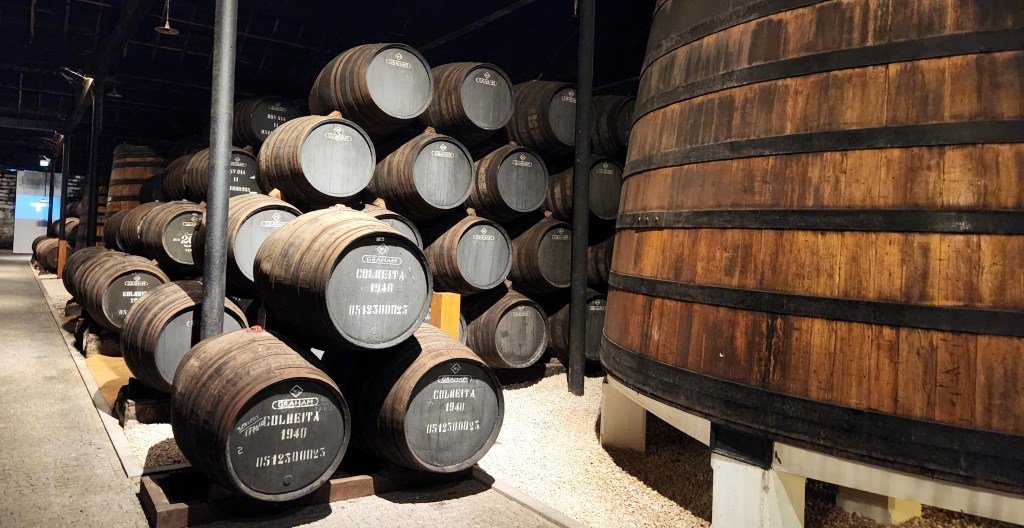
Vintage Port is made only in certain years when the growing conditions are deemed to be of the highest quality by the Instituto dos Vinhos do Douro e do Porto (IVDP), a government organization overseen by the Minister of Agriculture. A wine producer may decide to declare a Vintage Port if they believe the wine from a specific harvest year meets specified criteria. The producer then submits samples of the wine to the IVDP for analysis. The IVDP assesses the samples, and if the wine receives a rating of 9 out of 10, it is certified as a Vintage Port. The wine must then be bottled by the end of the year of certification, but it is not completely filtered so that it continues to age in the bottle. A Vintage Port may be aged in its bottle for decades, but then should be consumed within three or four days after opening.
Here are some photos of the Graham’s climate-controlled production and storage facilities:
Port Fermentation Vats at Graham’s
Aging Barrels at Graham’s
After our tour of the facilities, we were treated to a tasting of five Graham’s wines: a Ruby, two Tawnies, and two Vintages (2000 and 2014). Various member of our group preferred one or another of them, but Pat and I were in agreement that the 2000 Vintage was the best, so we bought a bottle to bring home. (Now all we need to do is decide what special occasion to choose for opening it.) To close out the evening, we were served a fantastic three-course dinner in the restaurant on the top floor of the building, which provided a spectacular view of the Douro and the cities of Porto and Vila Nova de Gaia.
Douro River with Porto on the Left and Vila Nova de Gaia on the Right
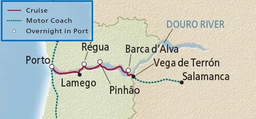
Douro River (November 13-18): On Wednesday the 13th, the Helgrim cast off and headed upriver. Here’s a map showing details of the river portion of the trip:
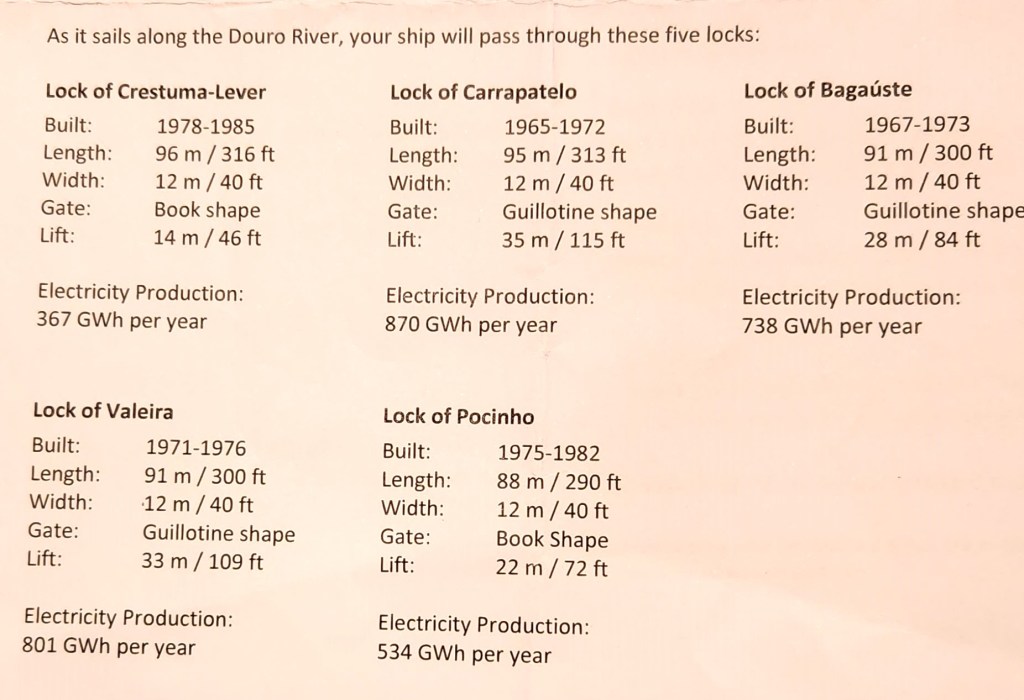
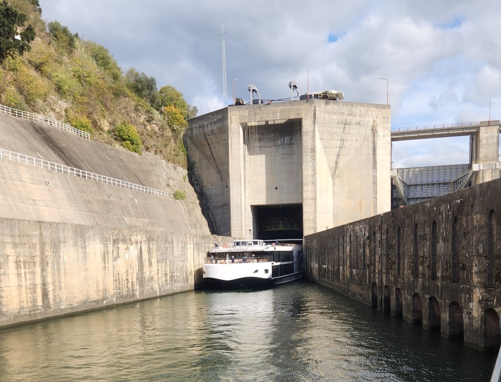
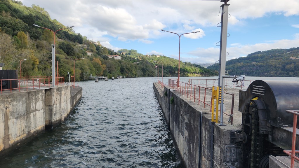
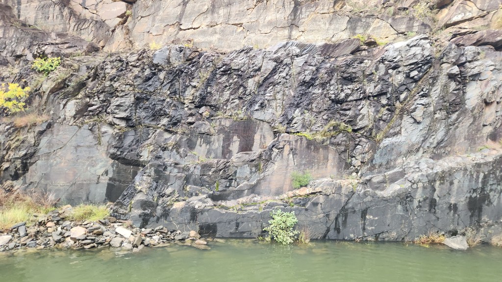
Over the course of the river journey, the ship sailed upstream from Porto to Vega de Terron and then back downriver to Porto again. It passed through five locks in each direction. Here are the technical specs for my fellow geek readers some photos of our passage through the lock of Carrapatelo, and a video of the upstream lock gate being retracted (more geeky stuff).
An Eastbound Ship Emerging from the Lock
Interior of Lock of Carrapatelo
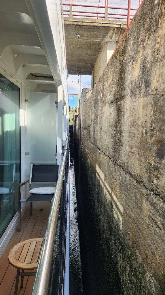
Not Much Sideways Clearance in the Lock
Lock Gate Retracting After the Lock is Filled with Water from Upstream
Leaving the Lock of Carrapato
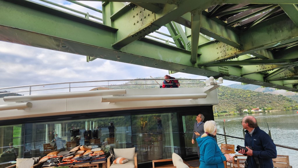
As you can see from the photos, the maximum width of the river ships is restricted by the width of the locks. I determined from walking around the ship as we passed through at least one of the locks that the ship could also not have been any longer. Here’s another one that shows that the height is also limited by various bridges spanning the river, even with the superstructure lowered – the lucky crew member holding a stick is there to alert the captain if the ship is riding too high to fit beneath the bridge — more evidence that the Viking Helgrim was custom built specifically for travel on the Douro.
The Helgrim Passes Beneath a Low Bridge
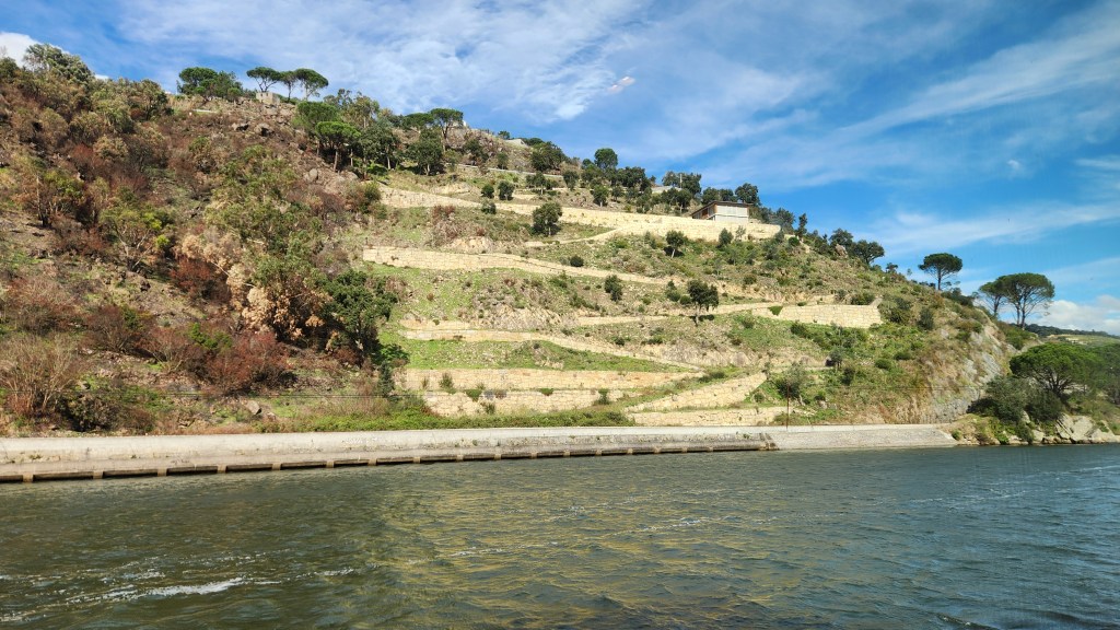
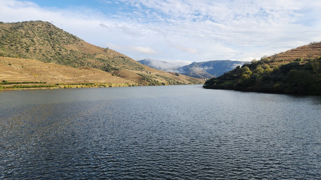
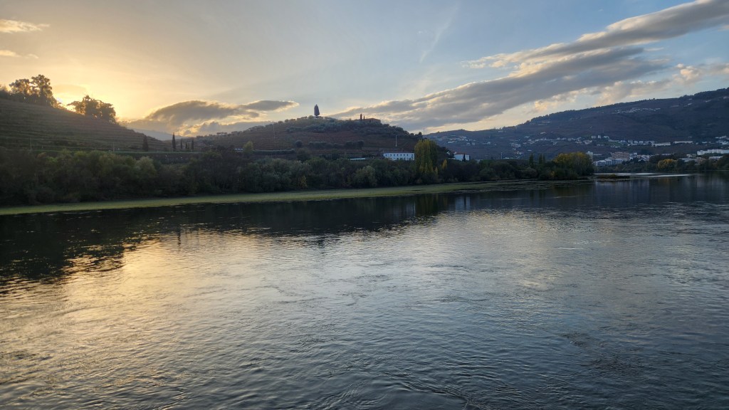
I’ll close out this episode with some pictures of the scenery along the river as we sailed upstream to Vega de Terrón and back downstream again to Porto.
View from the Helgrim between Porto and Lamego (Nov 13th)
View from the Helgrim between Porto and Lamego (Nov 13th)
View from the Helgrim between Porto and Lamego (Nov 13th)
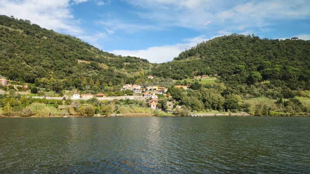
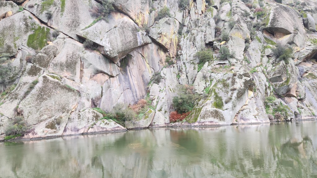
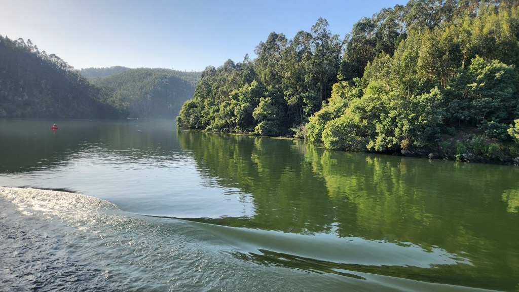
The Riverbank between Pinhao and Pocinho (Nov 14th)
The Riverbank between Pinhao and Pocinho (Nov 14th)
View from the Helgrim between Pinhao and Pocinho (Nov 14th)
View from the Helgrim between Pinhao and Pocinho (Nov 14th)
View from the Helgrim between Pinhao and Pocinho (Nov 14th)
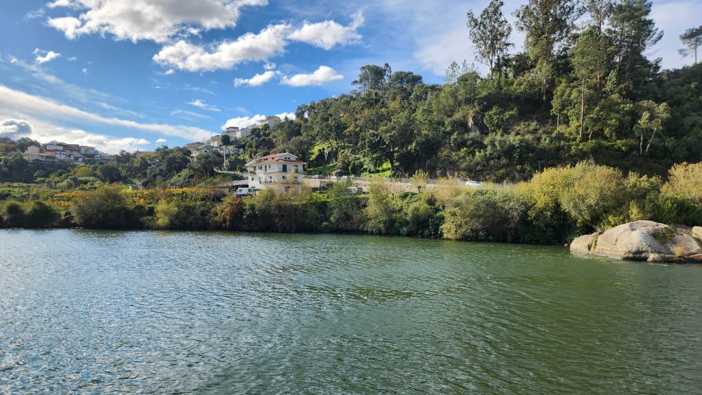
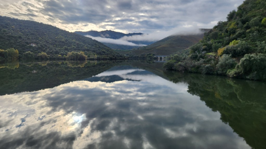
View from the Helgrim near Peso da Regua (Nov 16th)
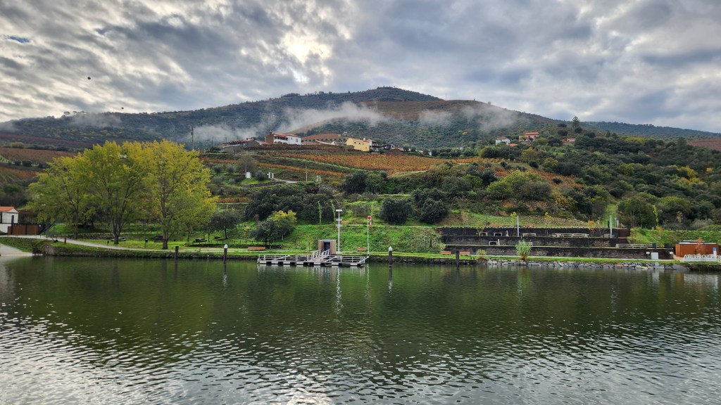
View from the Helgrim between Entre os Rios and Vila Nova de Gaia (Nov 17th)
OK, that’s it for Part 2. In the remaining episodes, I’ll describe seven shore excursions we took during the river cruise and our travels (and travails) getting back home to Minneapolis.
Winter temperatures have arrived in Minneapolis with highs in the low teens, though we only have a light layer of snow so far. Fortunately, I can conjure up some warmth by fondly reflecting on our most recent travel experience and writing this latest installment of my travel blog series. Perhaps your first question might be “why are you calling it your ‘Intrepid Iberian Interlude?’ ” So, let’s start there.
The travel blog series was born back in 2018 when, at the urging of family members, I began documenting a 10,200-mile RV trip during which Pat and I visited 11 states, 9 National Parks, 2 National Monuments, 1 National Recreation Area, and 12 or more State Parks in Iowa, Missouri, Kansas, Oklahoma, Texas, New Mexico, Arizona, and California. Since then, I’ve documented a total of fourteen trips. Here’s a list of the travel blog series so far:
(For the convenience of readers who may be real gluttons for punishment, the list provides hyperlinks to the final part of each installment.)
You’ll notice that, beginning with the third one, I took to naming the narratives using clever alliterative titles that provide hints about each trip. So, in keeping with this approach, the current narrative’s title includes: 1) “intrepid” because traveling abroad at our advanced ages seems rather bold and daring, 2) “Iberian” because we visited the Iberian Peninsula (Spain and Portugal), and 3) “Interlude” because the last four trips have been in North America as will be our next one (to Arizona), so going to Europe was a sort of interlude. (And because I couldn’t think of a better word that started with I, OK?) Now that that’s out of the way, let’s get on with the story.
The trip was booked with Viking River Cruises, and included pre-cruise stays in Madrid and Lisbon before boarding a ship in Porto and sailing up and down the Douro River, described poetically as Portugal’s River of Gold.
ASIDE: We’ve become huge fans of Viking, this being out fourth journey with them. Previous trips included numbers 6 and 7 in the above list and a 2014 cruise down the Danube before I began blogging about our trips. The beauty of Viking is that all we need to do is arrange one booking, and all the details are planned and executed for us, efficiently and luxuriously. We truly can “travel the world – in comfort,” as their tagline says. (Sort of diminishes that “intrepid” business a bit, but hey.) Just to be clear, I do not receive any compensation from Viking for writing this blog even though I may deserve it; I’m sure they don’t even know the blog exists.
Here are maps showing the main places we visited along the way. I’ll provide more detailed maps of specific areas when appropriate as the story unfolds.
We left our condo in Minneapolis on Wednesday, November 6 at 7:28 AM CST, catching a Lyft ride to MSP airport, then flew to Chicago O’Hare and then on to Madrid on Iberia Airlines, arriving at 7:45 AM CET (Central European Time) on November 7.
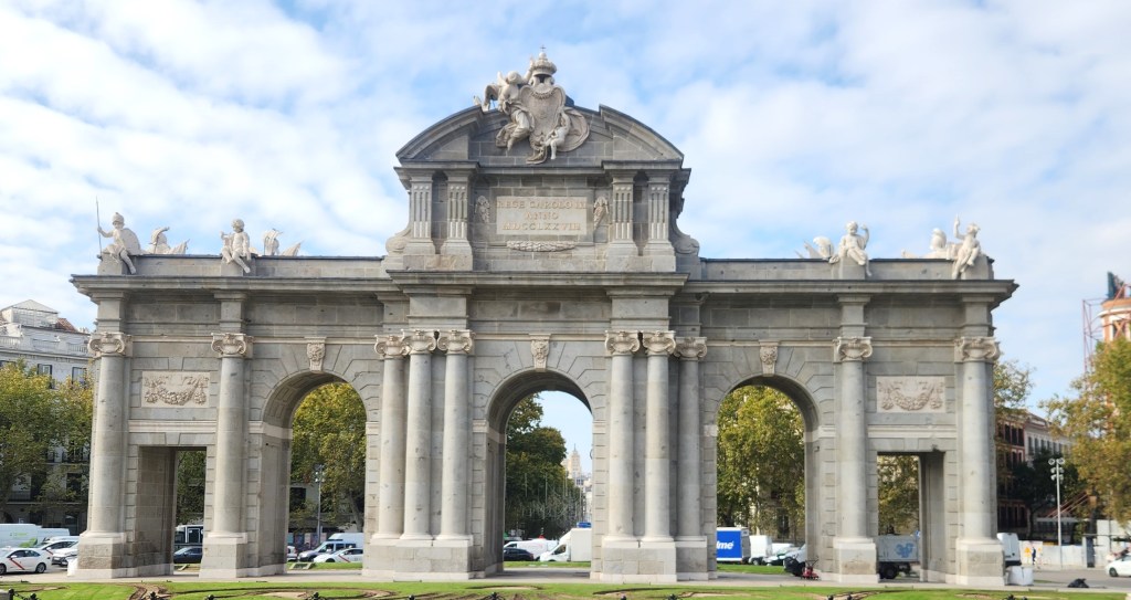
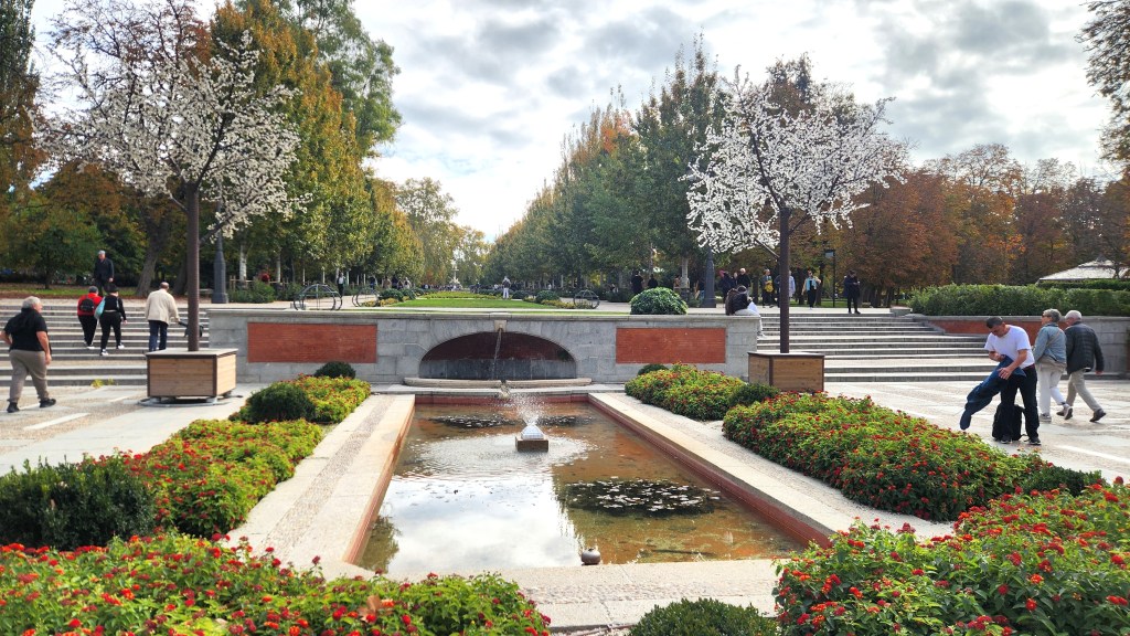
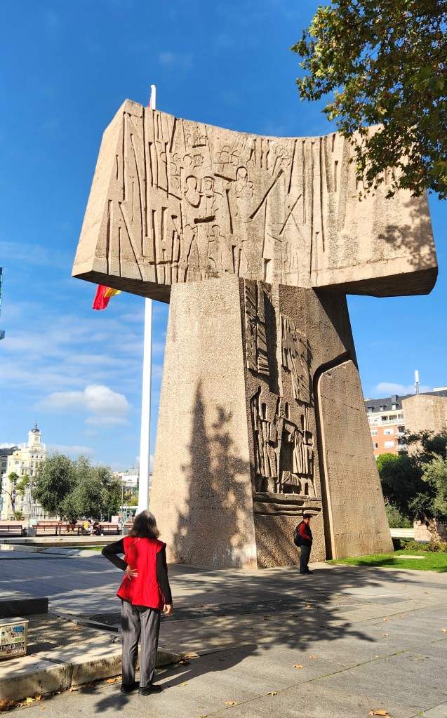
Madrid and Toledo (November 7-9): On Thursday the 7th, Pat and I were met at the Madrid Airport by a Viking driver, who drove us and our luggage to the Hyatt Regency Hesperia Hotel in the Paseo de la Castellana neighborhood of Madrid. There we met our Madrid Viking Host, Susana, who explained that we were the first of a dozen Viking tourists to arrive for this pre-cruise extension and provided us with a map of the area and suggestions for exploring on our own before meeting with the entire group later that evening. Thus armed, we trundled off to wander the streets of Madrid, observing many interesting buildings and sculptures. I confidently led us off in the wrong direction, but after Pat activated the Google maps app, we made our way to the Retiro Park, established in the mid-17th century for the enjoyment of King Philip IV. The nearby Puerta de Alcala, erected in 1778 by Italian architect Francesco Sabatini, is a triumphal gate that was once the main entrance to the city. It was commissioned by King Charles III (later nicknamed the Best Mayor of Madrid), who was unimpressed by the gate that welcomed him when he first arrived in 1759.
One of the Eclectic Statues in Madrid
The Puerta de Alcala
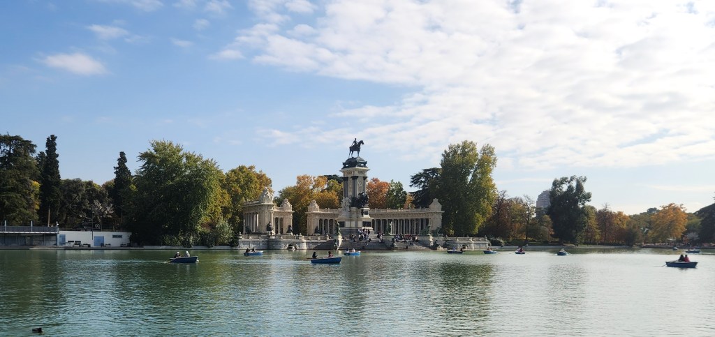
Retiro Park
Retiro Park
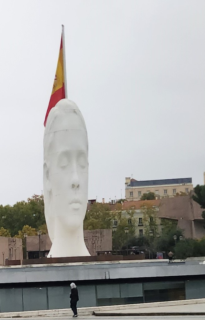
On our way back to the hotel, we passed by a large plaza including a sprawling monument to Christopher Columbus, including inscriptions of the crew members’ names from the famous 1492 voyage.
Christopher Columbus Monument
The Giant Head, near Columbus Monument
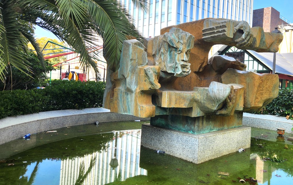
Madrid Sculpture
After returning to the hotel and taking a brief nap in our room, the Viking group was briefed by Susana on the plans for the next days before she led us on a brief walk around the neighborhood. Later, we went to a local café that Susana had recommended. The two young men manning the place spoke no English and were convinced we wanted beer, but with the aid of Google translate to decipher the menu and much gesticulating, we managed to order some delicious jamon de bellota sandwiches. The meat was carefully carved in thin layers off a huge pork leg, from a free-range pig fed only on acorns to produce the best Iberian ham.
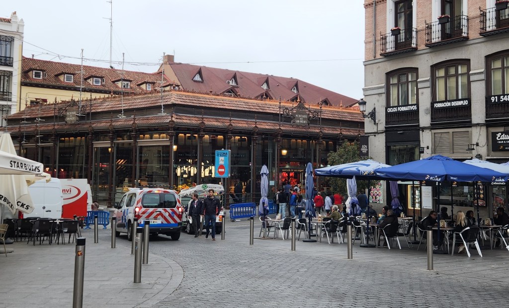
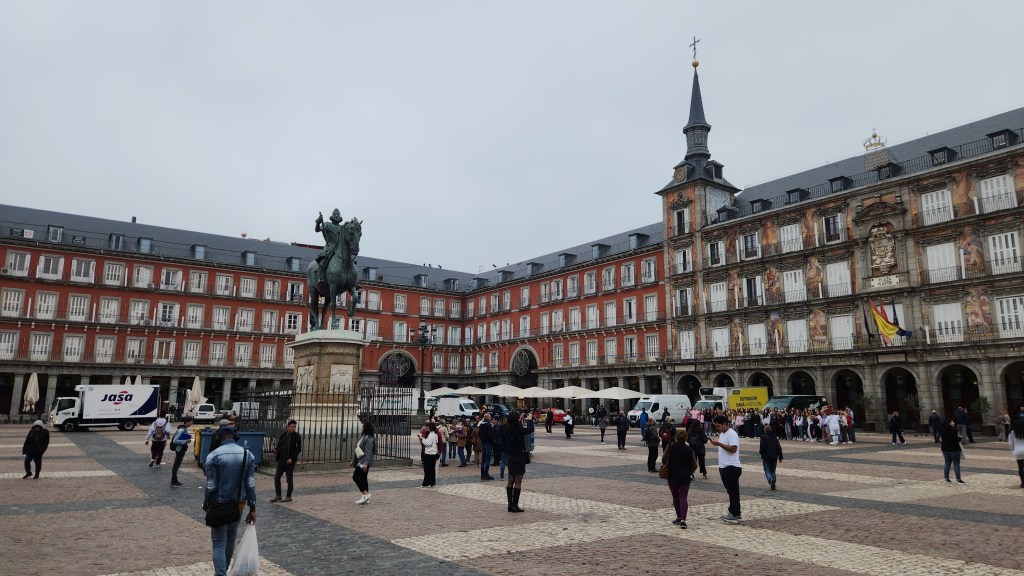
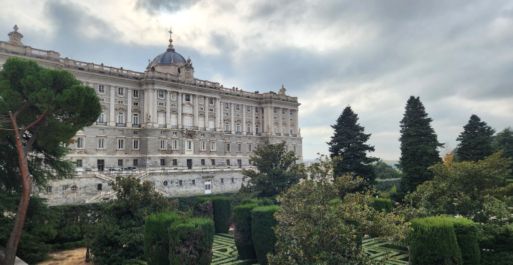
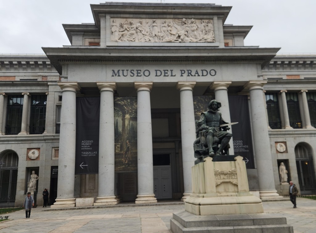
On Friday the 8th, we had a bus and walking tour of Madrid, during which we visited the Mercado de San Miguel (a bustling marketplace) and the Plaza Mayor, a huge square established in the 17th century by King Philip III, whose bronze equestrian statue stands in the square. We then passed by the Royal Palace and other landmarks before heading to the famous Prado art museum.
Mercado de San Miguel
Plaza Mayor
The Royal Palace
The Prado Museum
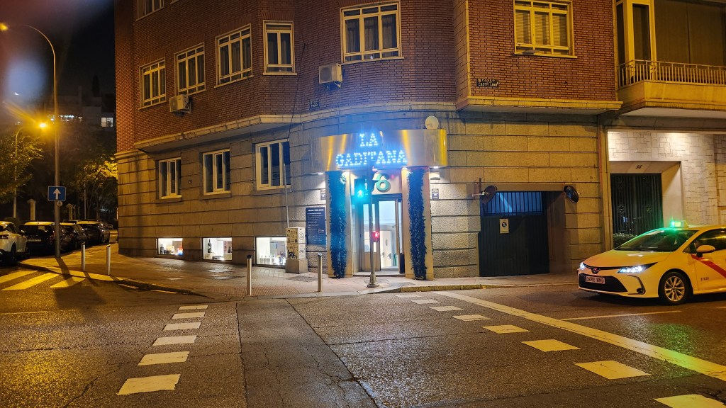
We spent a couple of hours in the Prado, including lunch in the cafeteria. Photos were not allowed except in a few rooms, so I can’t show any, but some favorite things we saw were “The Washing of the Feet” by Tintoretto and “Las Meninas” by Velazquez (amazing perspective works), “Garden of Earthly Delights” by Bosch (intricate details, some bizarre and unsettling), and a series of paintings by Goya throughout his career, including the disturbing “black paintings” from his early 70s and his later return to using vibrant colors after moving to France. After the Prado, we elected to return to the hotel on our own by city bus rather than with the Viking tour bus. Unfortunately, we missed getting off at the bus stop nearest the hotel and ended up walking an extra eight or ten blocks. All in all, we found Madrid to be a clean, bustling, pleasant city. That evening, we had an excellent dinner of seafood paella at a restaurant near the hotel called La Gaditana.
Restaurant where we ate Seafood Paella
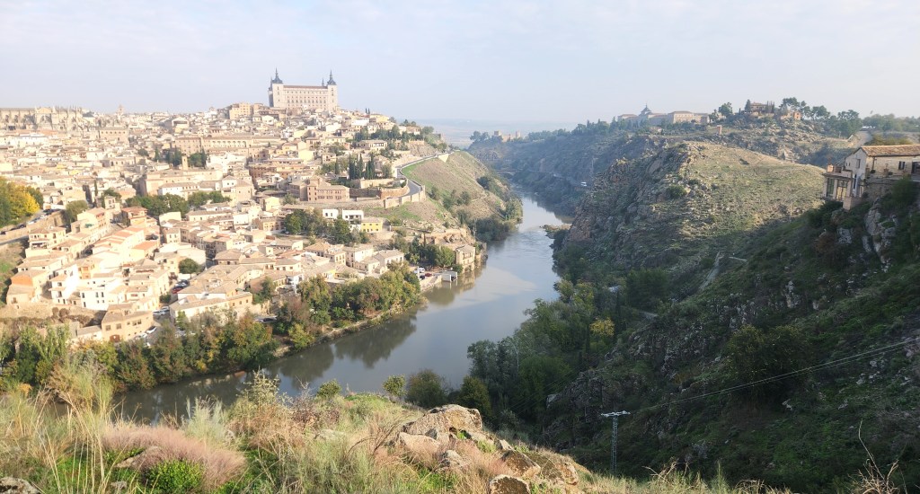
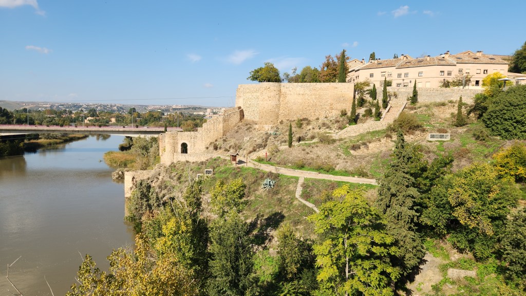
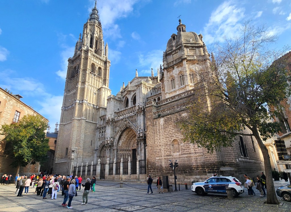
On Saturday the 9th, we rode a bus some 45 miles south to Toledo, the original capital of Spain before Philp III made Madrid the capital in 1603. Toledo is strategically located on a high hill on the north bank of a bend the Tagus River.
Overlook of Toledo
Toledo Old City
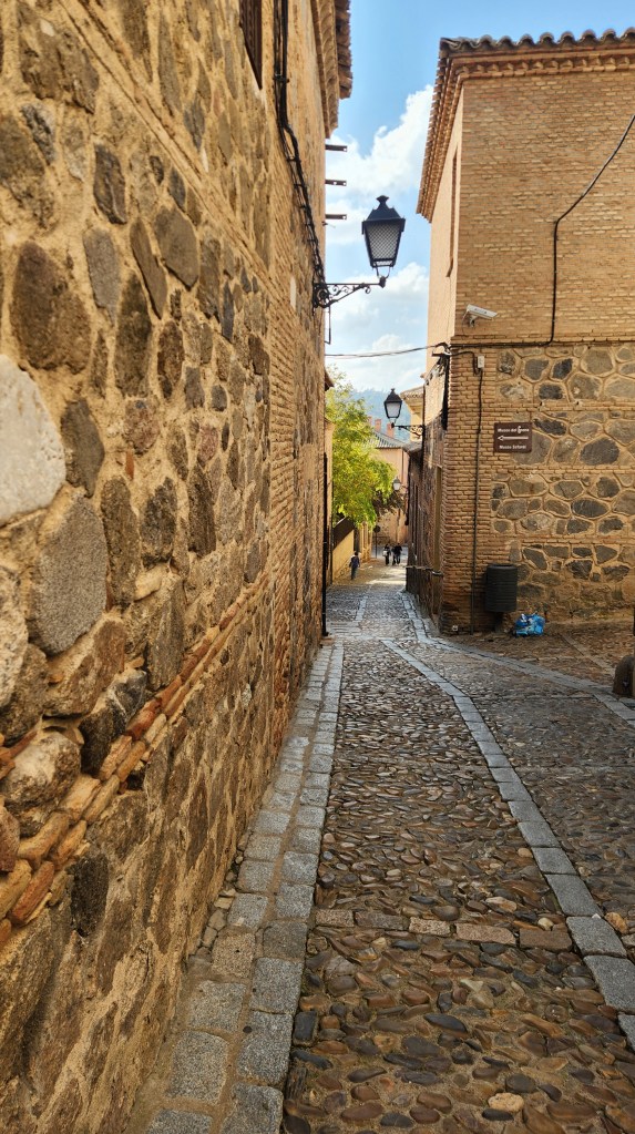
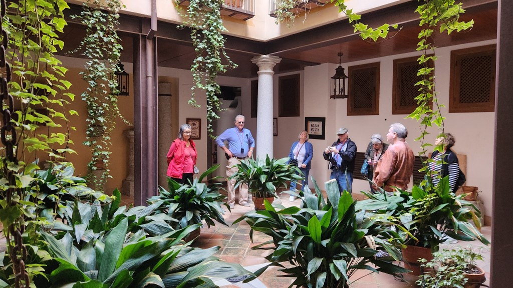
Toledo is known as the “City of the Three Cultures” for the cultural influences of Moors, Christians, and Jews throughout its history. Toledo has long been known for its production of fine steel for weapons and jewelry, so we first visited a touristy factory/retail outlet just outside the town and saw how some of the products are made today. We then traveled into the city and rode to the top of the hill on a series of conveniently located escalators before beginning our walking tour. While the streets of the old city are very narrow, many houses have beautiful courtyards just inside their doors.
Old City Toledo Street
Courtyard of Toledo Home
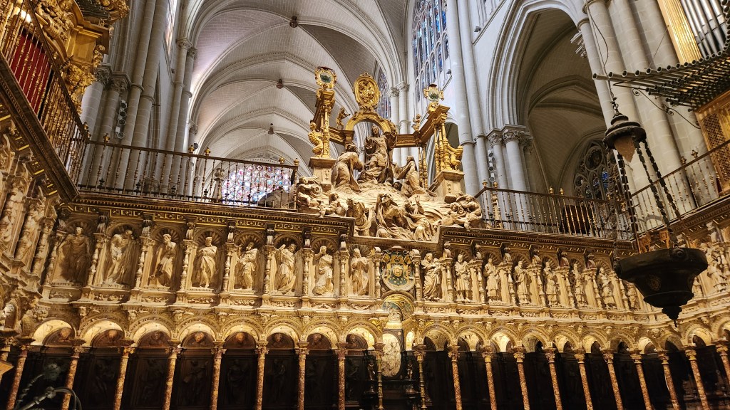
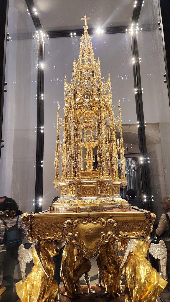
Our first visit was to the gothic style cathedral, which was begun in 1226 and completed in 1493. Among its treasures is a magnificent gold artwork called the monstrance, made for Queen Isabella in 1515-1523, that is carried through the city during annual festivals.
Cathedral of Toledo
Cathedral of Toledo
Monstrance in Cathedral of Toledo
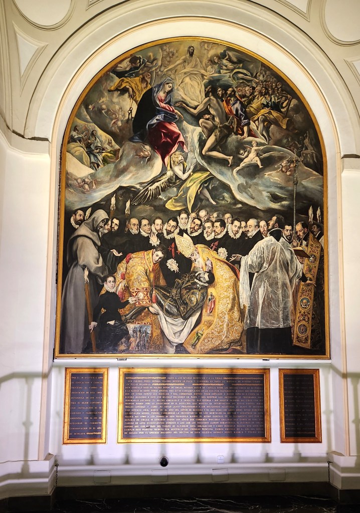
Another highlight was the Church of Santo Tome, the lobby of which displays the El Greco masterpiece “The Burial of the Count of Orgaz” which commemorates a local legend and is known for its use of multiple schools of art and for inclusion of a self-portrait of the artist as one of the funeral attendees.
“The Burial of the Count of Orsaz” by El Greco
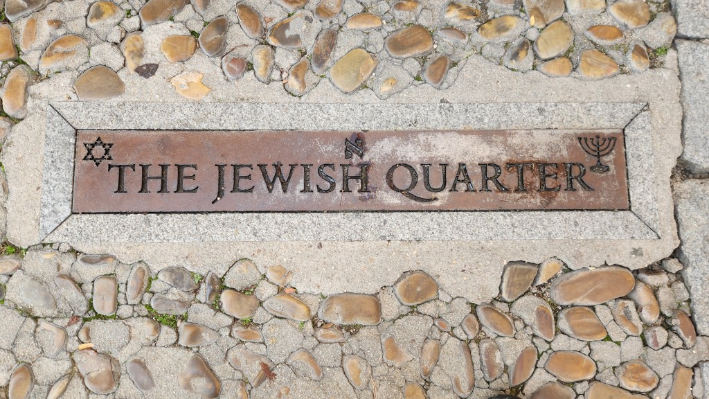
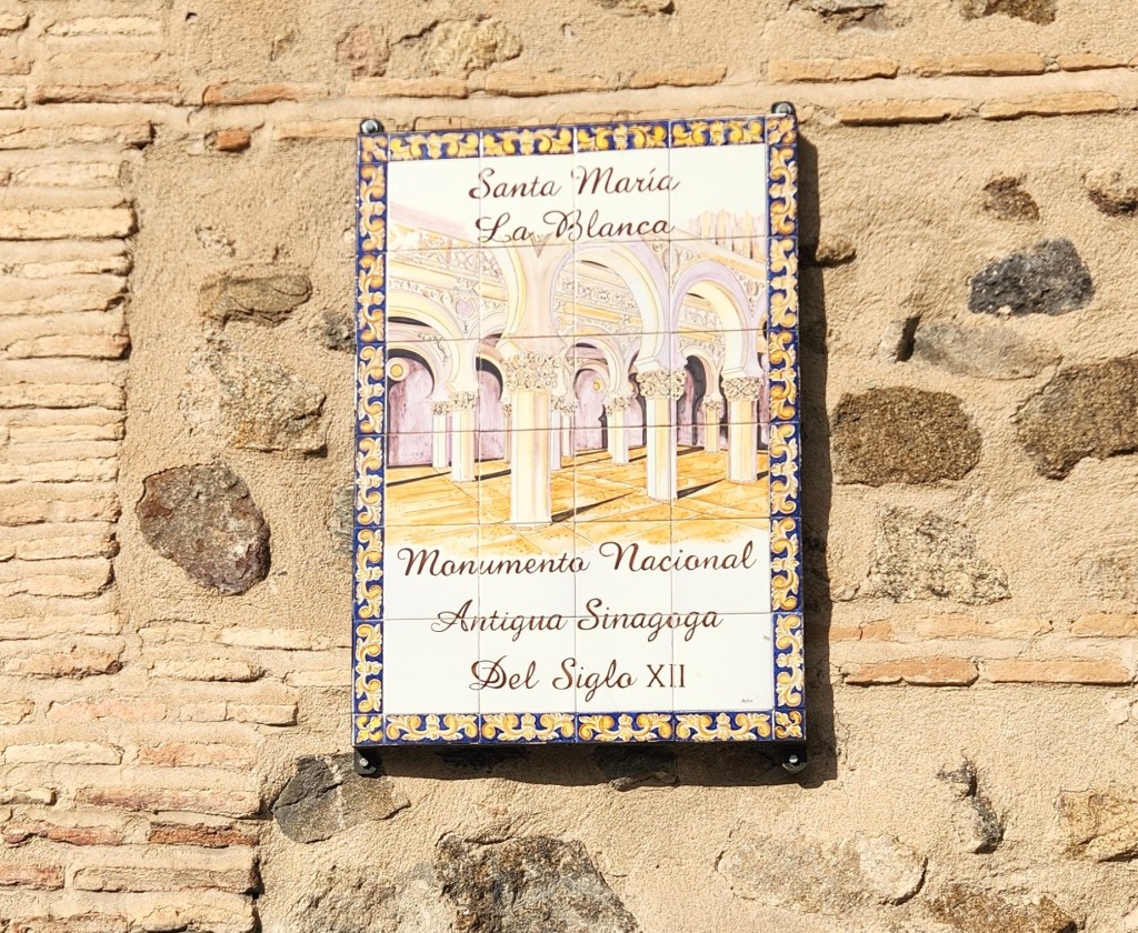
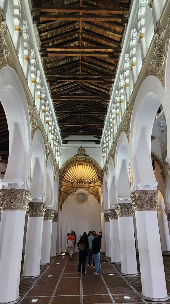
We also visited the Jewish quarter, including a former Jewish synagogue that has been established as a national monument although given the unfortunate name of Santa Maria La Blanca (St. Mary of the White Virgin).
Entrance to the Jewish Quarter
What a name for a Jewish Synagogue
But at Least the Synagogue is a National Monument
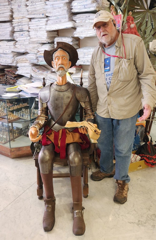
We then strolled through the old town area and emerged into a street with modern shops, even one in which Pat and I encountered some friendly inhabitants.
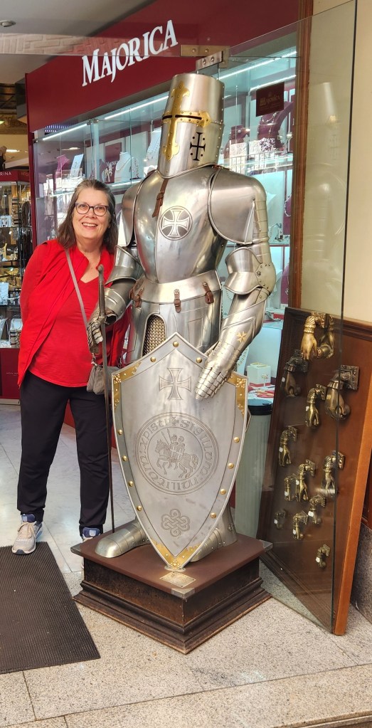
Dave Meets Don Quixote …
… and Pat Meets a Knight in Shining Armor
Lisbon (November 10-11): On Sunday the 10th, we were transferred by a Viking bus from our hotel back to the Madrid airport, where we boarded a flight to Lisbon operated by a regional carrier for Iberia Airlines. We were again met by Viking representatives and were driven to the Corinthia Lisbon Hotel, where we met our Viking Cruise Director Tamara and the local Viking Host. We spent some time wandering around the neighborhood and ate a light lunch in one of the hotel restaurants, then joined the Host at 3:30 PM for an introductory walk-and-talk, then attended a welcome session by Tamara at 6:00 PM for an overview of Lisbon and plans for our time there. After a short walk to a nearby restaurant for a delicious meal, we retired to our hotel room. My only complaint about the elegant five-star hotel is that the electronic safe in our room did not operate properly so we could not store away our passports.
Courtyard of the Hotel Corinthia
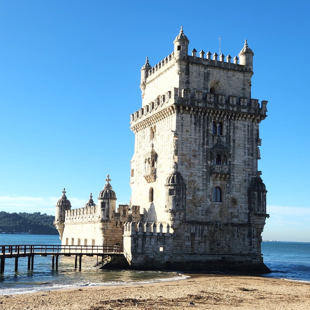
On Monday the 11th, we headed off on a bus and walking tour of Lisbon, during which we took in the sights and learned quite a bit of Portuguese history. (Now known as a well-functioning democracy, Portugal was actually ruled by a dictator, António de Oliveira Salazar, from 1932 until he died in 1970. His successor was deposed in the bloodless Carnation Revolution in 1974, and Portugal transitioned to a constitutional democracy by 1976). We drove through the hilly city to the tourist area called Belém near the Tagus River – the very same river we saw in Toledo, by this point grown very wide before discharging into the Atlantic – where we saw the Belém Tower, a 16th-century fortification that served as a point of embarkation and disembarkation for Portuguese explorers and as a ceremonial gateway to Lisbon. It was built during the height of the Portuguese Renaissance, and is a prominent example of the Portuguese Manueline style, but it also incorporates other architectural styles, such as the minarets inspired by Moorish architecture.
The Belém Tower
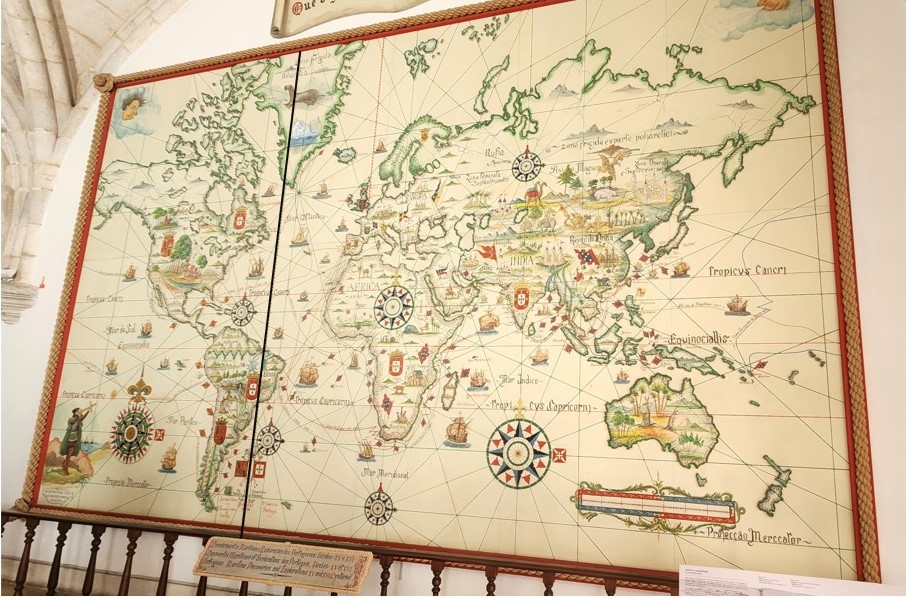
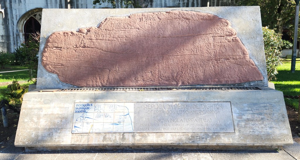
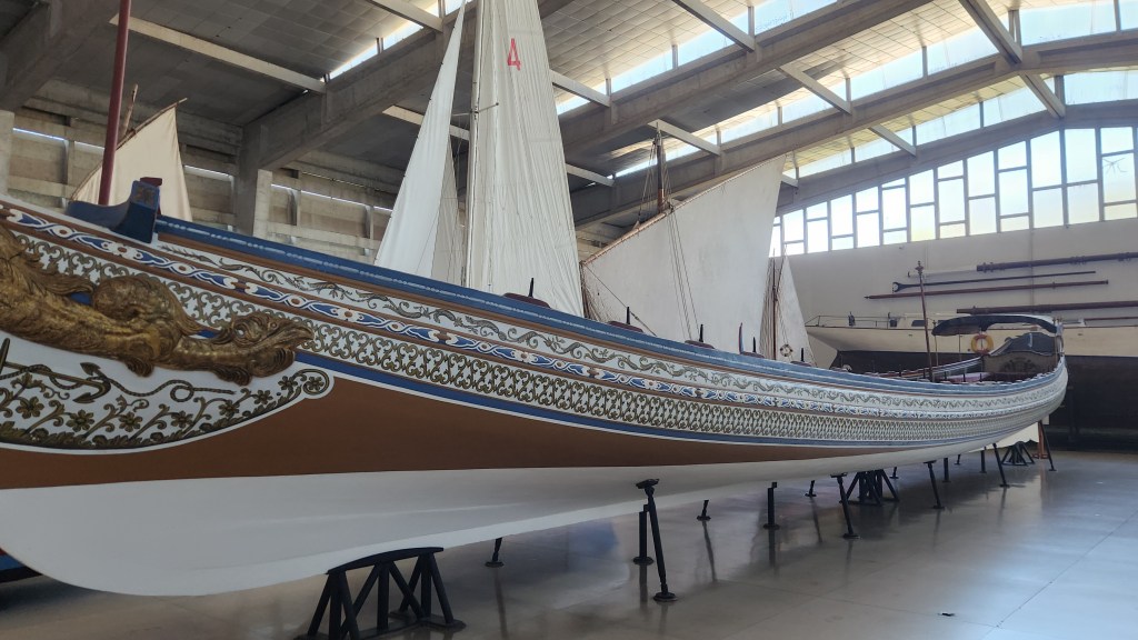
After visiting the tower and a surrounding park, we moved on to the Maritime Museum, dedicated to all aspects of the history of navigation in Portugal. Our guide pointed out many of the interesting features and explained how Spain (Castile at the time) and Portugal signed the Treaty of Tordesillas in 1494 to divide the world in half – Portugal was given the lands to the east and Spain those to the west of a line of demarcation. The two countries explored and claimed much of the world, with Portugal establishing colonies in Africa and India and conducting trade as far east as Japan beginning in 1543. Portuguese explorers continued to sail the east coast of North America – an inscription carved on Dighton Rock in 1511 supposedly commemorates Miguel Corte-Real – but did not settle there in accordance with the treaty. Portugal was allowed to establish their colony in Brazil since it lay to the east of the treaty’s demarcation line, although the western part of what became Brazil is actually to the west of that line.
World Map in Maritime Museum (Line of Demarcation Highlighted)
Replica of Dighton Rock Inscription
Ceremonial Boat in Maritime Museum
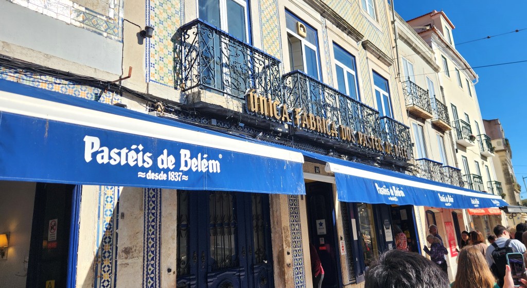
Following the museum visit, we had free time to visit the Jeronimos Monastery, erected in the early 1500s near the launch point of Vasco da Gama’s first journey, and nearby shops, including the Pastéis de Belem bakery, established in 1837 to make the original, world famous Pastéisde Belém from an ancient recipe developed by the monks of St. Jerome at the monastery. The recipe remains secret, and these delicious custard pastries are made every day “by hand,” supposedly using traditional methods. Amazingly, they produce and sell 20-40,000 of them per day. Pat and I each had one, and they more than lived up to their reputation. We explored the nearby Vasco da Gama Garden while savoring them, before returning to the tour bus.
World Famous Famous Bakery
Vasco da Gama Garden
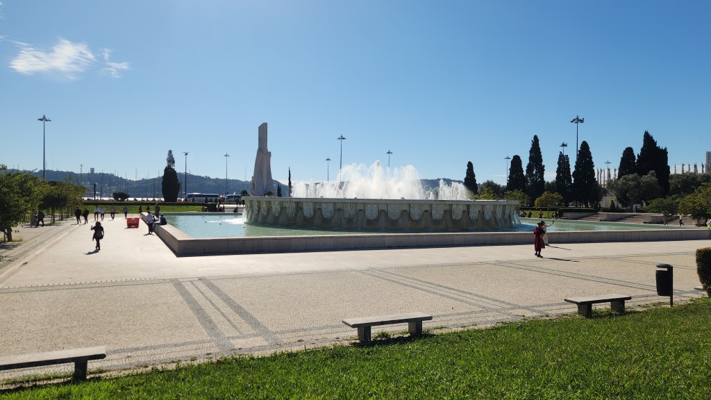
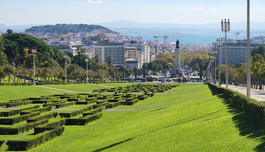
Another stop on the tour was the Parque Eduardo VII, the largest park in central Lisbon, covering 62 acres. The park was named after King Edward VII of England, who visited Lisbon in 1903, and provides a gorgeous view of Lisbon and the Tagus River.
View of Lisbon Overlooking Parque Eduardo VII
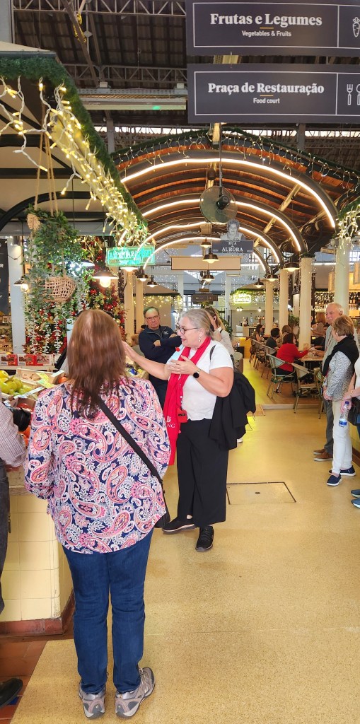
Once back at the hotel, we spent some time exploring a nearby park before heading off on a 3 ½-hour walking tour of Lisbon restaurants, where we sampled a variety of Portuguese delicacies and libations. One of the spots was called the Pastéis de Nata bakery, where they make a custard tart very similar to the Pastéis de Belém, using a non-secret recipe well known to millions of Portuguese. We were told by our Viking host that the Portuguese people are divided on which of these delicacies is better. For my part, I thought they were equally delicious.
Our “Taste of Lisbon” Tour Guide
The Other Custard Tart Bakery Logo
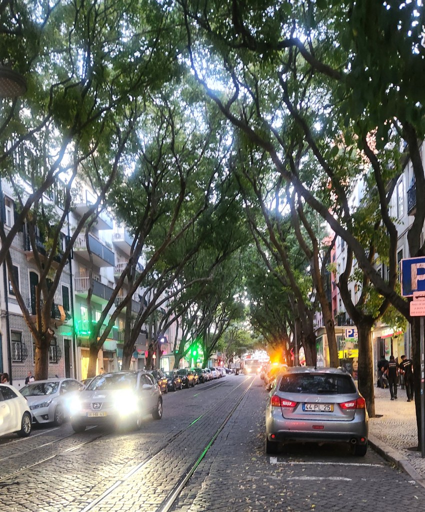
Lisbon Street View During our Tasting Tour
OK, that’s it for Part 1. Thanks for reading, and stay tuned as we head north toward the Douro River and our ship, the Viking Helgrim, coming in Part 2.
In Part 1 of this travel blog, I began the description of our recent 4,128-mile road trip, during which we visited six National Parks and one National Battlefield. As a reminder, here’s a map of the journey:
I’ll pick up the narrative again after our visits to the three National Parks located in Utah.
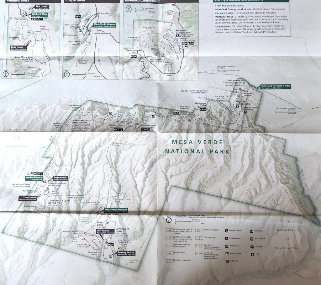
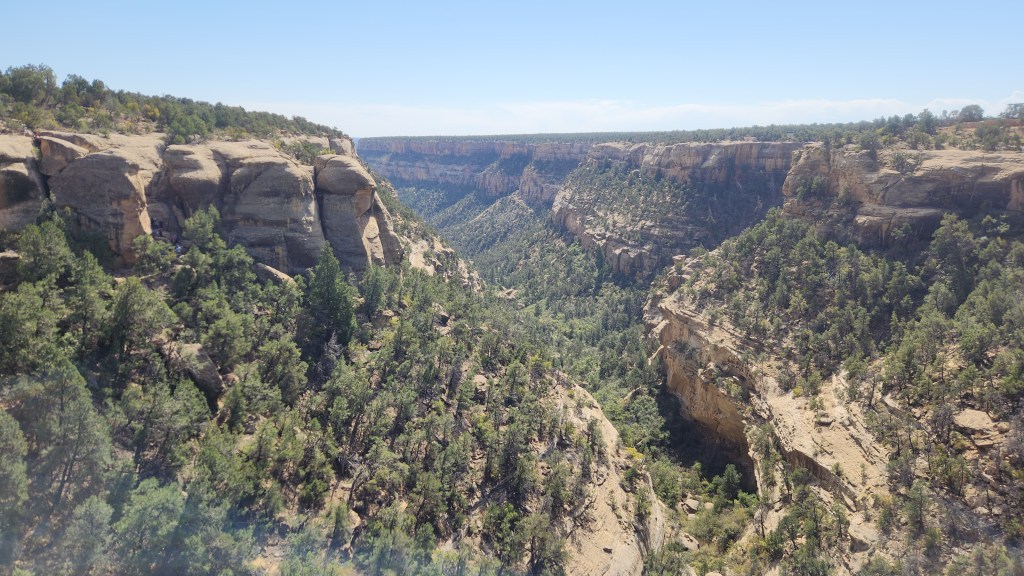
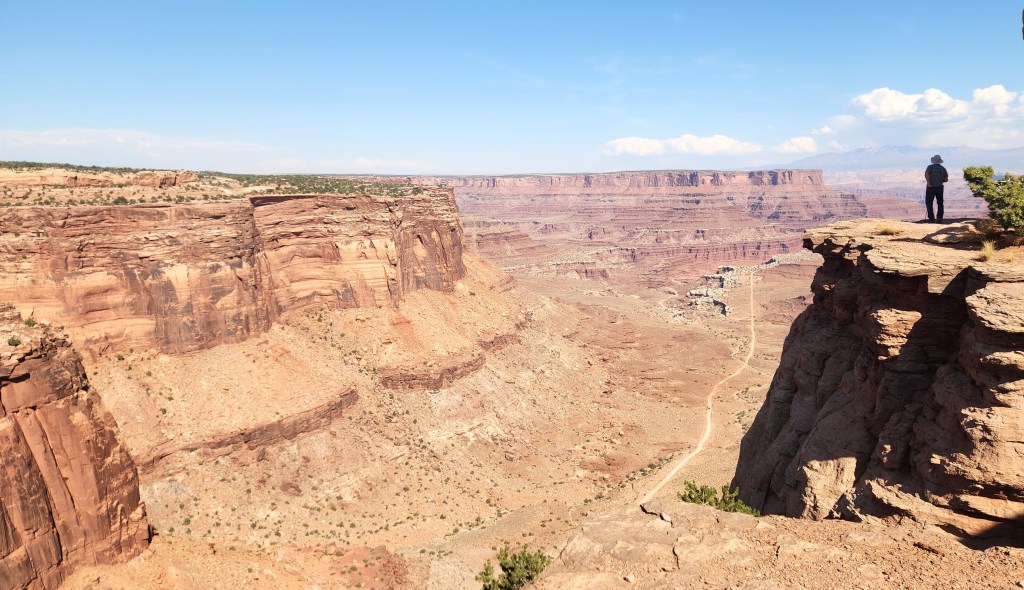
Mesa Verde National Park (October 9): I’d never heard of this park before the trip, but Pat suggested we check it out. The name for the area, which translates as “Green Table Mountain,” was coined by early Spanish explorers who noted the unusually lush greenery on flattened mountain tops separated by canyons. This was a misnomer, however, since the top of a mesa is almost perfectly horizontal, whereas the flatlands in the park actually are inclined at an angle of 7 degrees toward the south. Such an inclined, flat surface is known geologically as a cuesta, so that the “proper” name for the park perhaps should have been “Cuesta Verde.” At any rate, the park is very picturesque, with a well-maintained road that winds among the canyons to provide access to the various points of interest. Here’s a map:
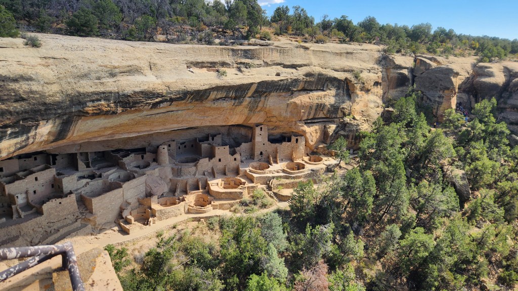
The cuesta top land is covered by soil, providing a much more fertile climate then the surrounding desert land. As such, it became an attractive home for the Pueblo people who began growing corn in the area as early as 1000 BCE and lived in villages on the surface near the crop fields. The people flourished as corn production increased and a thriving trade economy developed, with the population of Mesa Verde reaching about 40,000 at its peak in the 1200s. Around that time, the inhabitants began constructing and moving into cliff dwellings adjacent to the flatlands, which provided access to potable water via seep springs, protection from heat and rain, and places for storage of grain, clothing, and manufactured items such as baskets. One of the largest of these dwellings, known as the Cliff Palace, is a main feature of the National Park.
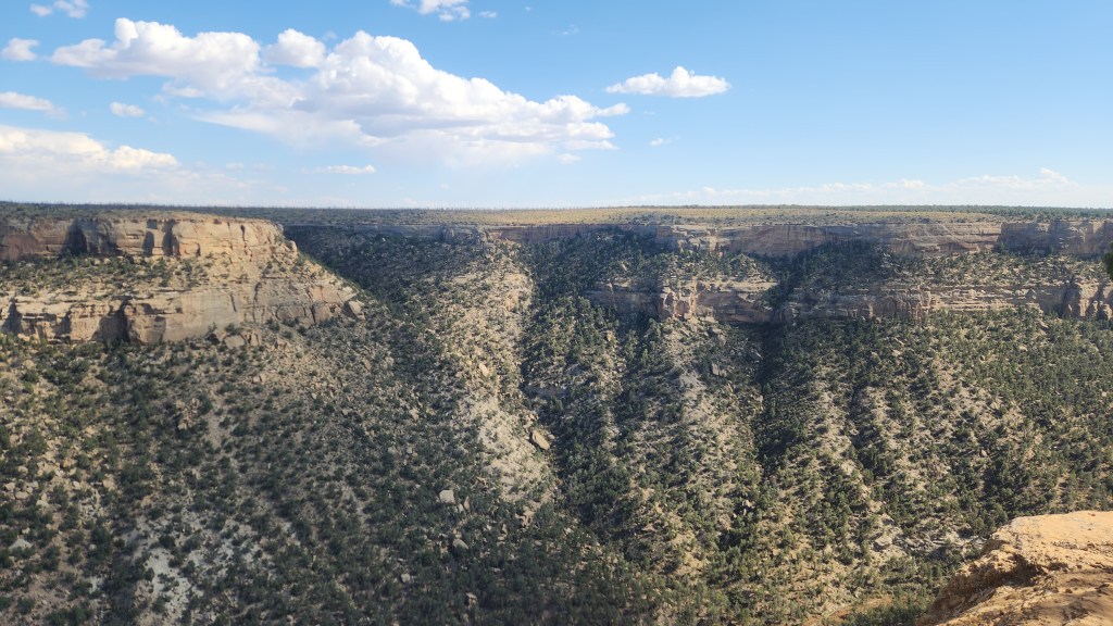
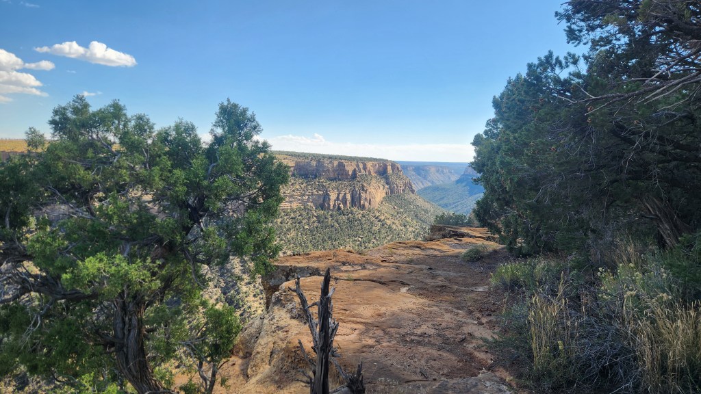
The highlight of our visit to Mesa Verde was a ranger-guided tour of the Cliff Palace. On the evening before our visit, we obtained tickets for a 1:30 PM tour on October 9 ($8.00 apiece) using my Recreation.gov app. We arrived at the Visitor Center around 10:30, watched a nice movie about the park (of course!), and then ogled the spectacular scenery while driving to the Chapin Mesa area.
View from Roadside Overlook
View from Roadside Overlook
View from Roadside Overlook
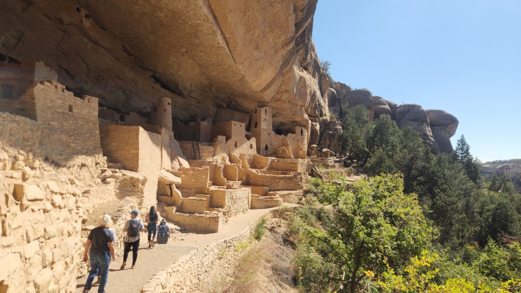
Once at the Chapin Mesa area, I bought a souvenir T-shirt at the Mesa Verde Museum and we ate lunch at a nice cafeteria before our tour. Access to and exit from the Cliff Palace was a bit challenging, including stone steps, some narrow passages, a path that was precariously close to the cliff edge in places, and even a series of wooden ladders –the ranger was very careful to stress the hazards before we started – but the tour was well-worth it. I highly recommend it for anyone traveling to Mesa Verde, as long as they are fit enough for the climb down and out again. There were a couple of people on our tour (out of about forty total) who seemed a bit wobbly to me, but everyone managed to navigate it safely.
The Cliff Palace
Canyon Adjacent to the Cliff Palace
Touring the Cliff Palace
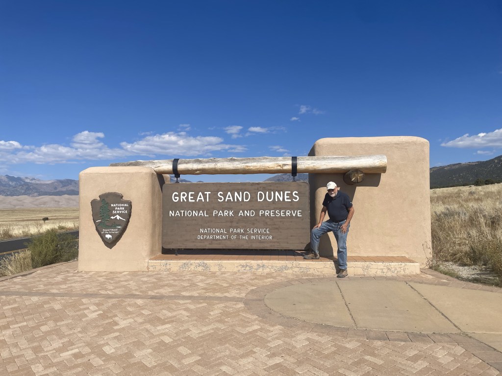
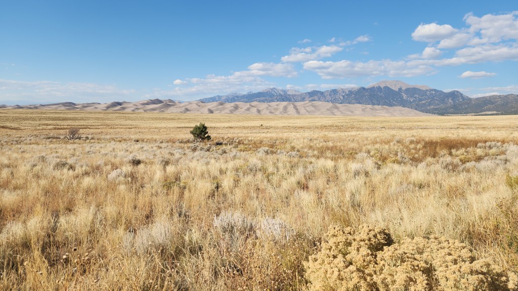
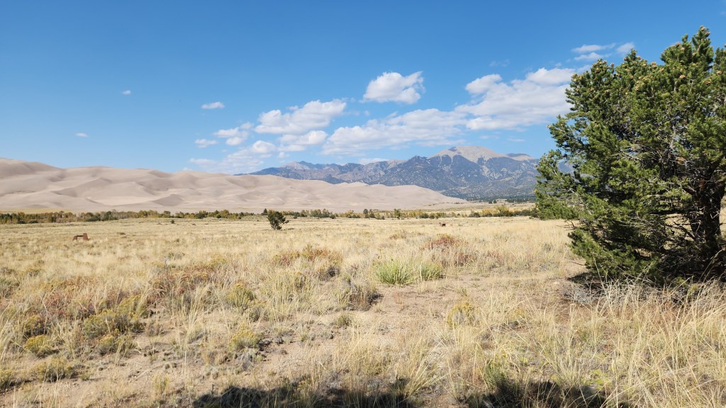
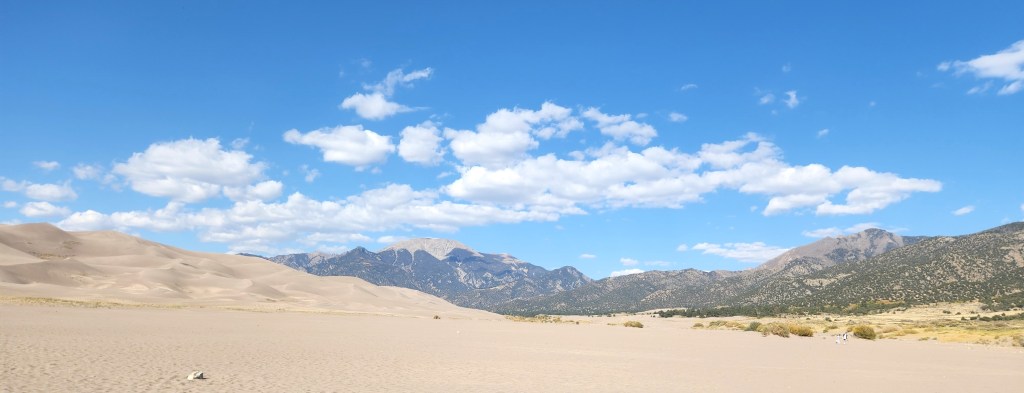
Great Sand Dunes National Park (October 10): This is another one I had not heard of before this trip, and once again I give credit to Pat for steering us there. After driving for about four hours from the Casa Blanca Inn, we were approaching the National Park from the south over a flat plain that extended for many miles with a view of some mountains in the distance, and I began to wonder if we had taken a wrong turn since there appeared to be nothing of real interest on the horizon. However, a huge pile of sand gradually began to take shape and we eventually came to the park entrance sign.
No, we hadn’t made a wrong turn …
Introductory View: Great Sand Dunes and Sangre de Christo Mountains
We proceeded to the Visitor Center and, naturally, watched a movie about the park and bought a souvenir T-shirt. (Perhaps you’re beginning to realize that we are creatures of habit.) The film was absolutely mesmerizing to a fluid dynamicist such as myself. What does a huge sand dune have to do with fluid dynamics, you might ask? Plenty, it turns out. I learned that the Great Sand Dunes developed over thousands of years, beginning as sediment deposited in ancient lakes. As the climate warmed, the lakes disappeared, leaving a vast layer of sand behind. Predominant winds from the southwest blew much of the sand into a low curve of the Sangre de Christo Mountains, and periodic storm winds from the mountains pushed sand back in the other direction, causing it to build up into the immense dunes. The dune structure now maintains itself through an annual cycle as follows: the desert winds blow sand into the mountains during the fall and winter seasons, and then spring and summer floods wash sand back down via Medano Creek, which borders the sand dunes to the east and south. Another fascinating aspect of the system is that the water flow in Medano Creek exhibits a pattern of waves that is unique in the world due to the ebb and flow due to the large quantity of sand carried by the water. The only disappointment in all this was that, while the film included beautiful footage showing the water flow, the actual creek was completely dry at the time of our visit, as it always is in late fall and winter. In other words, a return visit during the spring or summer will be an absolute must.
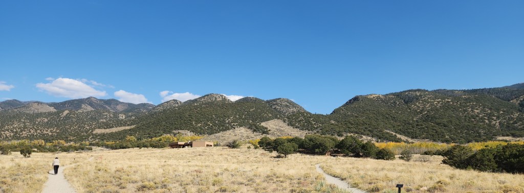
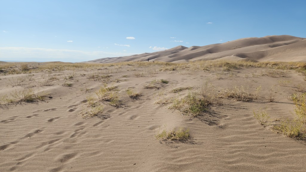
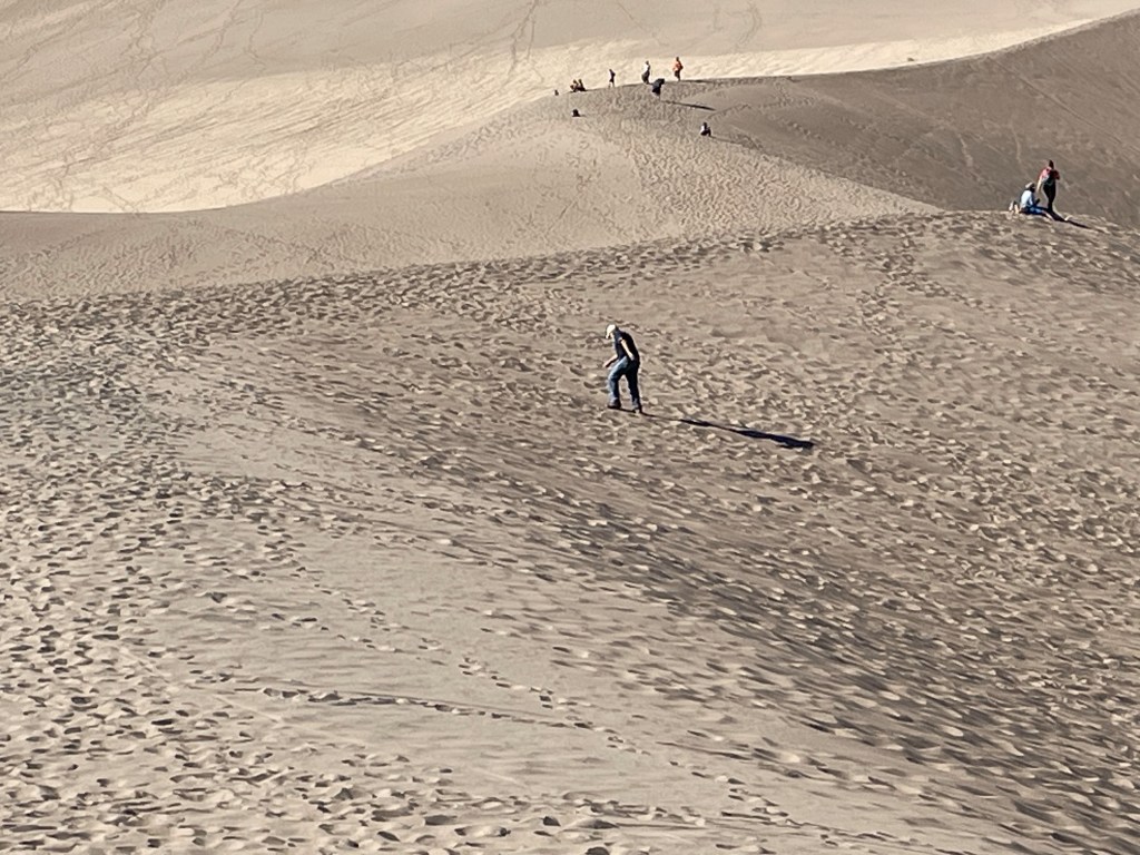
We did spend a couple of hours exploring the park, first walking around a nice loop trail near the Visitors Center, which offered great views of the dunes and the mountains and also had signs identifying the various species of local foliage, and then driving to a parking lot with access to the dunes. We walked for some distance on the coarse, khaki-colored sand, which made for very tough slogging. I found the immensity of the dunes very impressive, but in fact they were neither as accessible nor as interesting as the dunes at White Sands National Park, which we visited back in 2020, where the dunes of fine, white sand are easily accessible and more changeable in the wind. All of which again points to the need to visit Great Sand Dunes at the proper time of year, when the water is flowing.
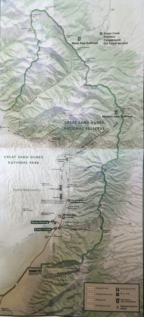
Map of Great Sand Dunes National Park
View from Nature Trail
View from Nature Trail
The Great Sand Dunes
The Great Sand Dunes
Slogging in the Dunes
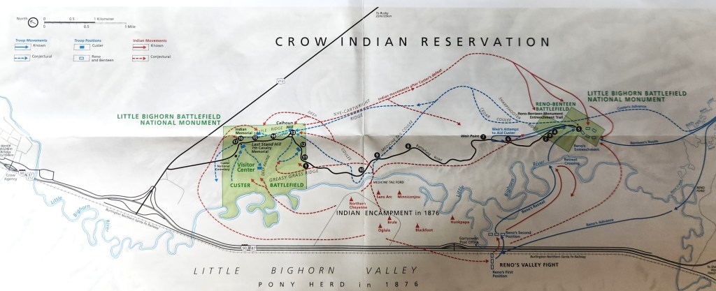
Little Bighorn National Battlefield Monument (October 12): I first learned about the battle of the Little Bighorn some 65 years ago, when I was a young boy. At that time, it was universally referred to as Custer’s Last Stand and portrayed as a tragic loss in the righteous war to subjugate the Native people. One of the first things I saw that presented somewhat of an alternate view of the battle was the 1958 movie, “Tonka,” starring Sal Mineo in a non-PC role as a young Lakota who captures and tames a wild stallion (the titular Tonka) before eventually joining Custer’s 7th Cavalry and surviving the battle. I suspect the film was actually quite biased, but somehow it sparked an interest in me and planted a seed of doubt about just how “righteous” the white man’s war actually was. I have since read many things about the conquest of the Native peoples, George Armstrong Custer, Sitting Bull, Crazy Horse, and the battle at Little Bighorn which have confirmed those early doubts. I also remember seeing an episode of “The Twilight Zone,” in which three US Army soldiers on a tank training exercise find themselves retracing Custer’s movements – after some rather mysterious goings on, the final scene shows the three men’s names on grave markers at the Little Bighorn Battlefield site. All of this background left me with a curiosity to see the actual battle site. Since we were traveling not too far from it, I suggested that we add it to our itinerary.
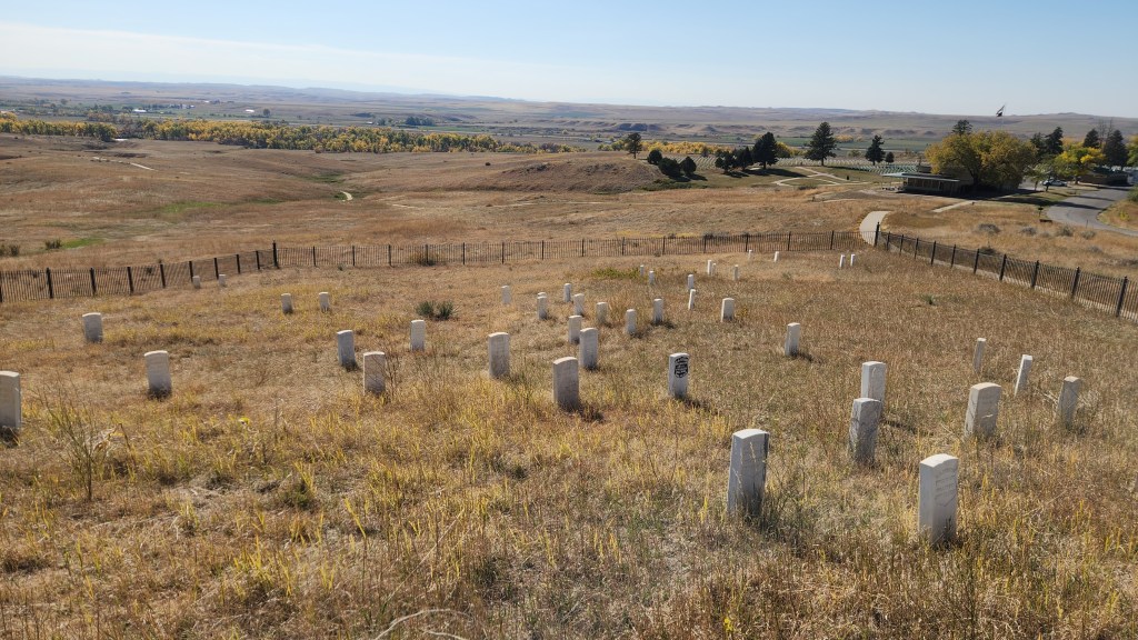
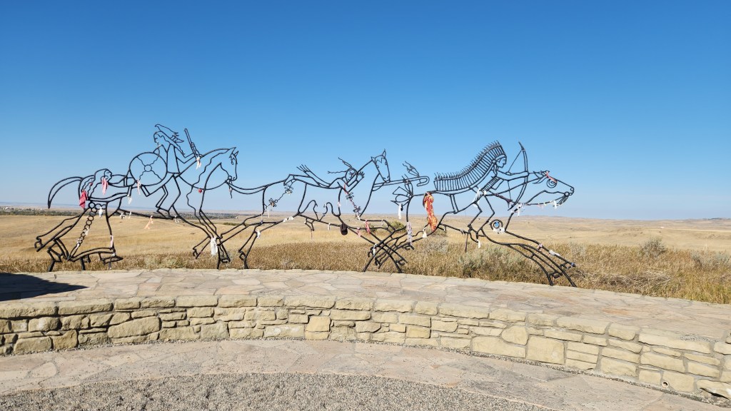
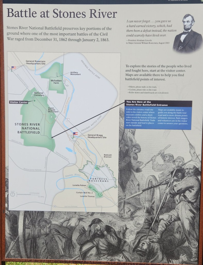
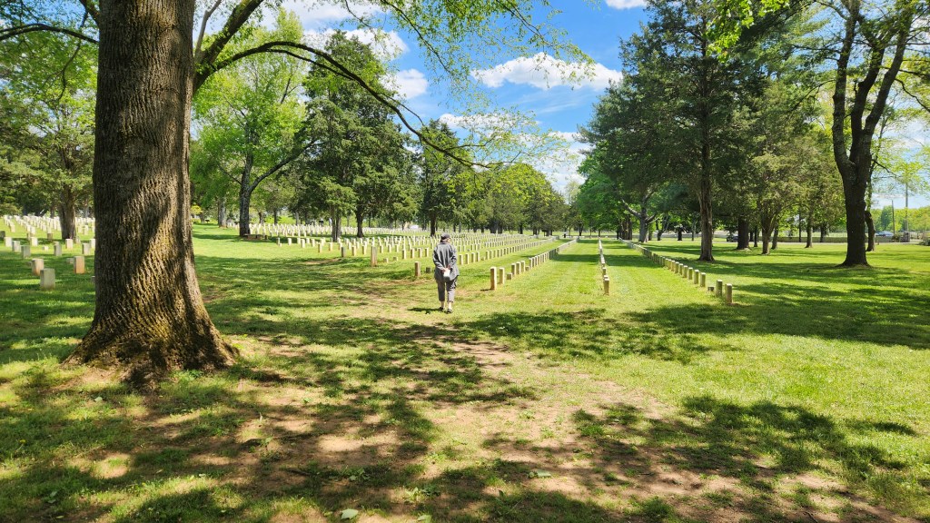
The Little Bighorn Battlefield National Monument was originally established by the Secretary of War in 1879 as a National Cemetery to commemorate the battle and preserve the graves of the soldiers and their allies who died there. In addition to those who died in the 1876 battle, the site includes graves of many hundreds of soldiers who subsequently served in the military in an area called Custer National Cemetery. The site was transferred to the National Park Service in 1940 and eventually given its present name in 1991 by an Act of Congress, which also decreed that an “Indian Memorial” be added to the site near Last Stand Hill. Here’s a map of the site:
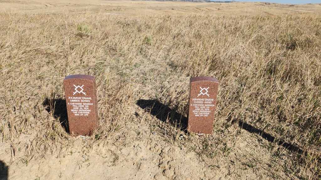
We spent about an hour walking around the area near Last Stand Hill and the newer Native People’s memorial and then driving along Battlefield Road to see the various points of interest. In addition to white gravestones marking places where 7th Cavalry soldiers fell, newer, granite markers have been added to mark places where some of the opposing Native warriors died. The site was interesting, and I was pleased to see that the NPS is trying to present a more balanced view of history than I remember from the 1950s. I would hope that all Americans can agree that this is a good thing (though I have my doubts given ongoing efforts by many to recreate the 1950s version of history).
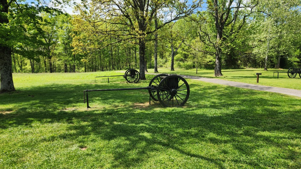
7th Cavalry Gravestone Markers
Fallen Warrior Native Markers
Native People’s Memorial
Native People’s Memorial
View from Battlefield Drive
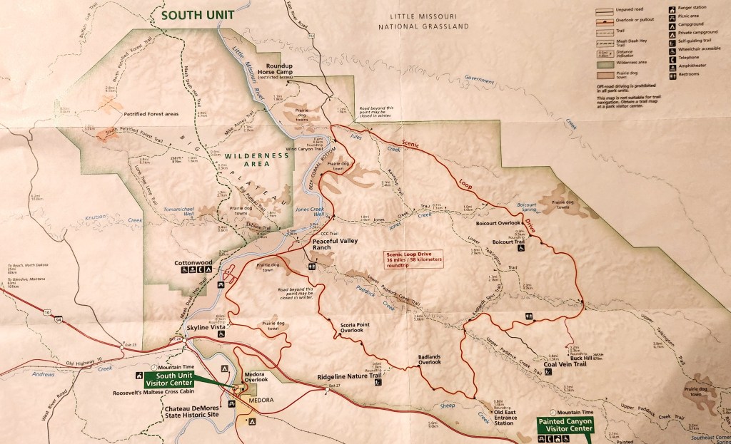
Theodore Roosevelt National Park (October 13): This was the final stop on our road trip, easily accomplished since we were driving right past it on I94 as we headed back toward Minnesota. The park was designated to honor the man known as the Father of the National Parks, which have become Theodore Roosevelt’s most lasting legacy. What is now called the North Unit of the park was originally designated as the Roosevelt Recreation Demonstration Area in 1935, before being transferred to the US Fish and Wildlife Service and renamed the Theodore Roosevelt National Wildlife Refuge in 1946. What is now called the South Unit was established as Theodore Roosevelt National Memorial Park in 1947. The North and South Units, along with the Elkhorn Ranch Unit, were finally designated as Theodore Roosevelt National Park in 1978.
We arrived at the South Unit Visitor Center at about 10:30 AM. This time, after viewing the park movie, I bought a souvenir sweatshirt, rather than a T-shirt (a near-radical departure from past practice). We spent about three and a half hours driving along the Scenic Loop and stopping frequently at various points of interest and to take a couple of short hikes. Since I’m running out of steam, I’ll just share some photos and call that good enough.
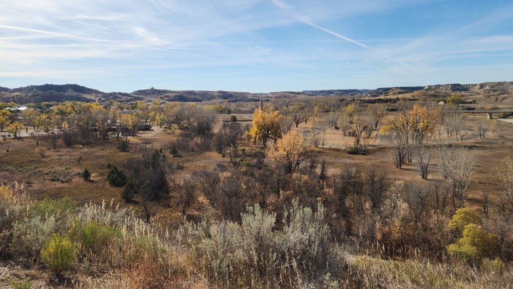
View of Medora, ND, from Theodore Roosevelt National Park
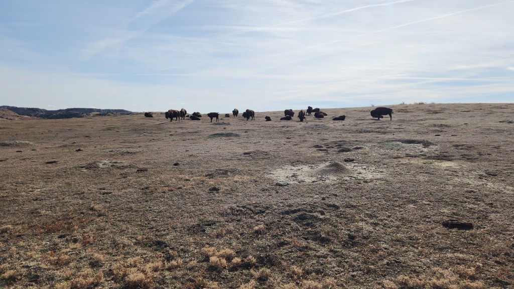
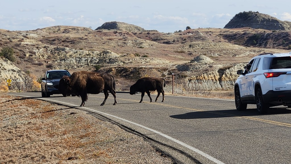
Bison at Theodore Roosevelt National Park
Kings of the Road …
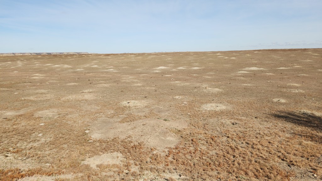
Prairie Dog Metropolis at Theodore Roosevelt National Park
Prince of the Prairie …
Another Prairie Dog Town
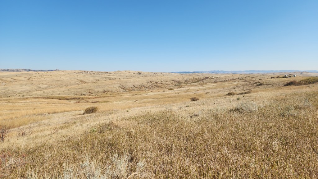
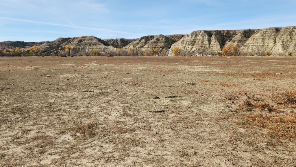
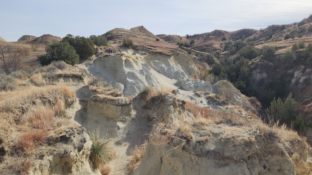
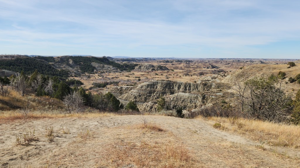
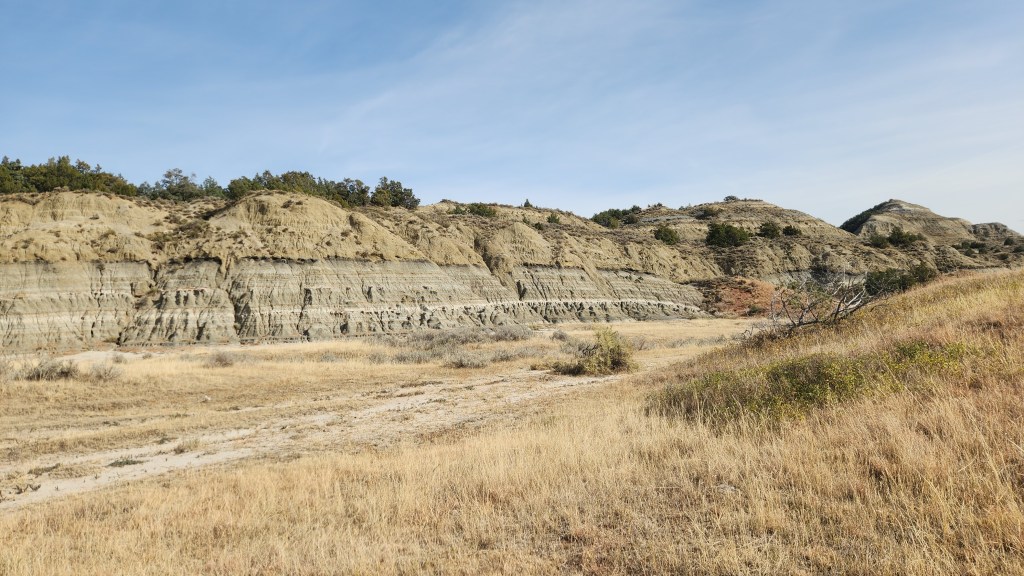
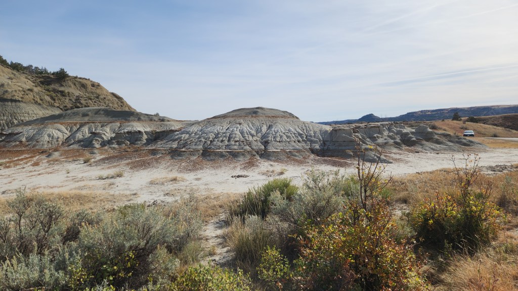
View from Scenic Loop at Theodore Roosevelt National Park
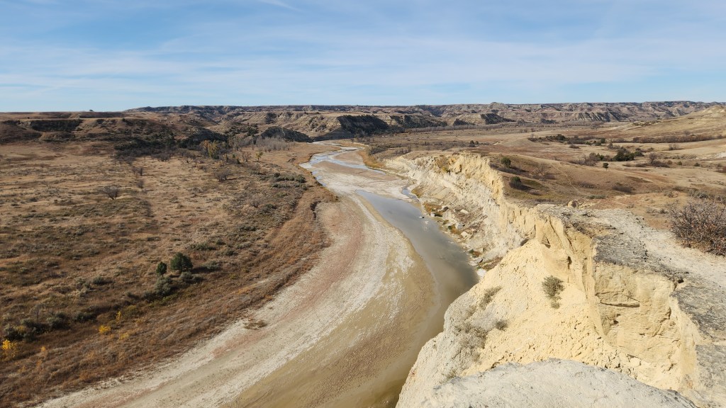
View of Little Missouri River from Nature Trail at Theodore Roosevelt National Park
View from Scenic Loop at Theodore Roosevelt National Park
View from Scenic Loop at Theodore Roosevelt National Park
View from Scenic Loop at Theodore Roosevelt National Park
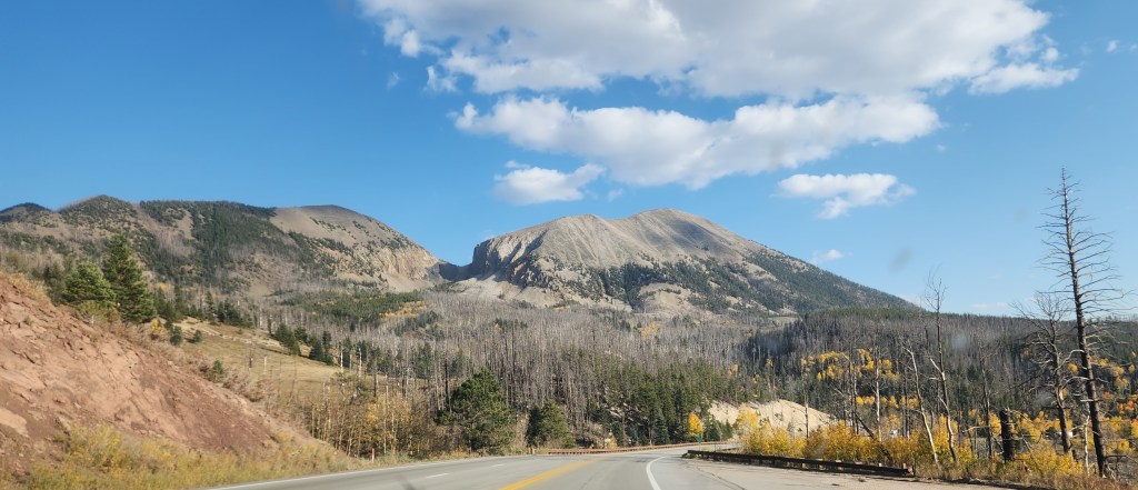
Scenery Along the Way: In addition to the main attractions described above, we also enjoyed beautiful scenery we encountered during many of the major stretches of driving. These sights only added to our enjoyment, so I thought I’d leave you with a few miscellaneous photos we took, some through the car windows and some from roadside stops.
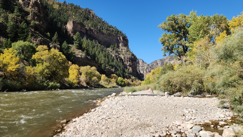
Colorado River, near Glenwood Springs, CO
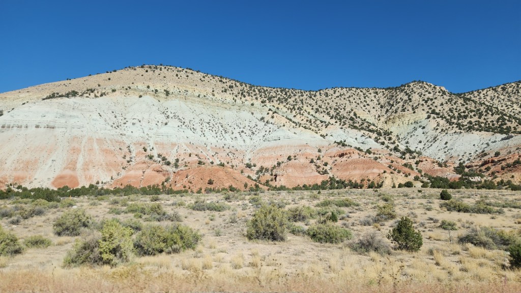
On I70 in Utah, on the way to Bryce Canyon
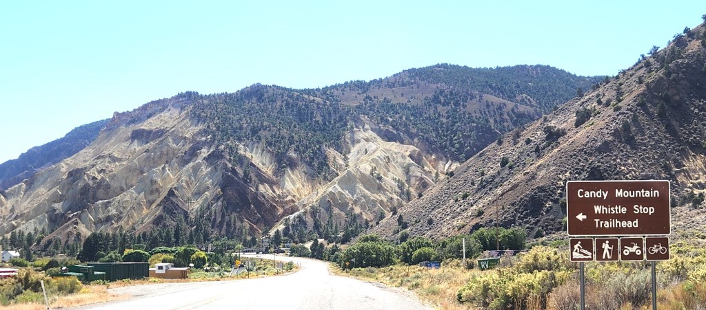
The “Candy Mountain” Along US Highway 89 in Utah
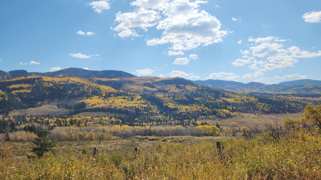
Fall Colors at Cumbres Pass in Colorado
On US Highway 160 in Colorado
That wraps up my documentation of this fabulous trip. I won’t include a lengthy discussion of our Tesla Model 3 EV this time, as I did in relating our April trip to the Great Smokey Mountains. Let it suffice to say that this trip again showed that taking a road trip in an EV is easily done, requiring only a little more planning and patience than driving an ICE car. The Tesla performed very well throughout, and we had no problems finding available chargers. One difference on this trip was that we encountered other EV brands using some of the Tesla Superchargers, specifically including several Rivians and one Mustang Mach E.
Just to let readers know, you won’t have to wait too long for my next travel blog installment. Next up will be another Viking River Cruise, this time to Spain and Portugal in November. Bye for now!
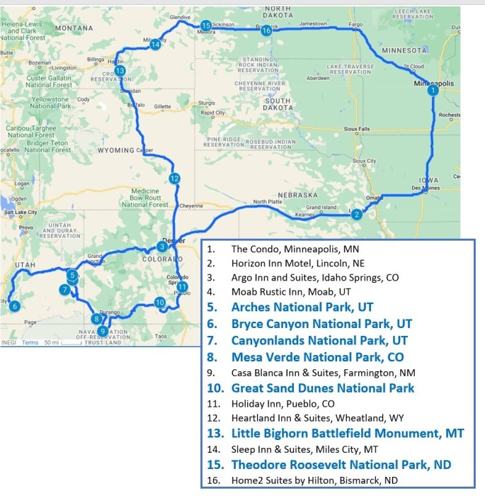
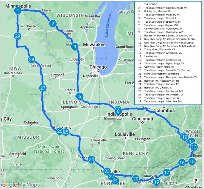
Fall has arrived and the golf courses are closed in northeastern Minnesota, which can only mean one thing. It must be time for another road trip travel blog! Sure enough, Pat and I have just recently returned from a road trip outing, which I will now attempt to memorialize. The trip was a classic example of our rather spontaneous, some might say haphazard, approach to car travel. In contrast to certain unnamed relatives, we do not go in for detailed planning of such things, though at least some aspects, such as lodging in high-demand locations, do need to be arranged in advance to ensure availability when desired. So, here’s how this latest trip began and then developed as time went by.
The central idea for the trip was actually born some two-and-a-half years ago, in May of 2022, when we spent one day visiting Bryce Canyon National Park as part of a previously documented road trip. In that earlier blog post, I made a vague reference to my aching knees. In fact, it was at Bryce Canyon that I finally decided I needed to have my severely arthritic knees replaced, since walking on the trails was extremely difficult for me. Add to that the fact that we did not actually drive our car into the park and were thus unable to visit places where the convenient shuttle bus route does not reach. Further add that we very much admired the look of the in-park lodge cabins as we strolled past them. As we were leaving, we decided that we would come back for a longer visit once I had my new knees, that we would stay in one of those nice cabins, and that we would drive all the way to the end of the park road to take in the full park experience. Fast forward to February of this year: I made a reservation for three nights in one of those little cabins, from October 5 through October 8, by which time I assumed the golf season in Grand Marais would be winding down. (Incidentally, the process for making the reservation was really convoluted, requiring multiple phone messages and callbacks rather than the expected few clicks on a web site. Government contractor inefficiency at its finest.) We put the dates on the calendar, leaving all further details of the trip to be determined later, and went on with our spring and summer activities.
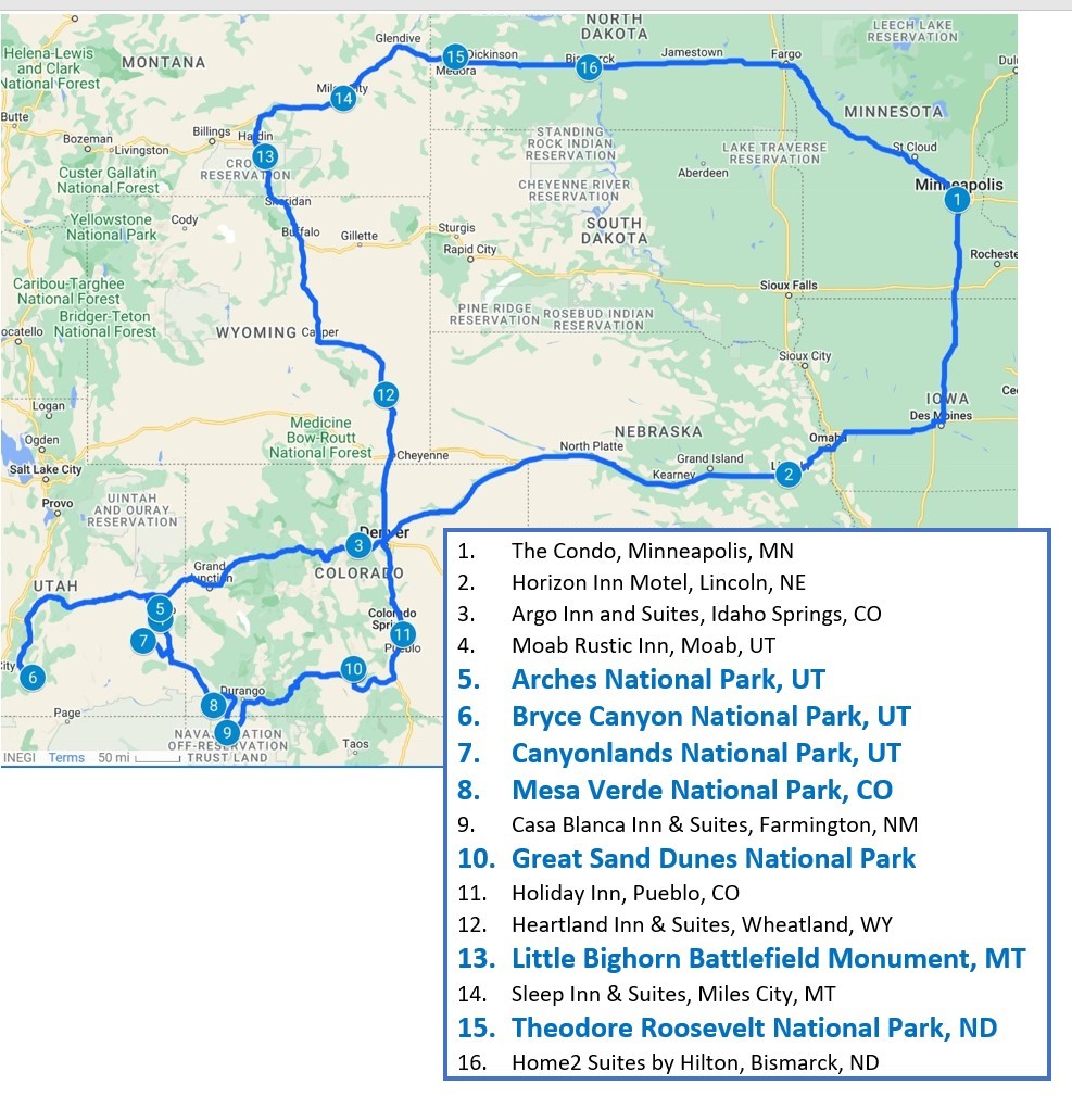
Sometime around the end of September, Pat began to suggest that we maybe ought to start thinking about what else we might do as part of the road trip. After all, it seemed like a long way to drive for only a three-day visit to one National Park. “Let’s just book some hotels near EV chargers for the trip out there, and we can add some other stuff for the way back,” I suggested. So that’s what we did, after deciding that we would leave on October 1st. Once we took off, the trip developed organically, eventually turning out to cover 4,128 miles in our Tesla Model 3 with visits to six National Parks and one National Battlefield. Here’s a map of the journey:
NOTE: This brings our total of National Parks visited to 27, or 43% of all the National Parks in the US. Maybe we’ll get to them all someday, or at least a majority of them. We’ve now also visited 20 other paces operated by the National Park Service, including National Monuments, Conservation Areas, Wildlife Refuges and Sanctuaries, and Battlefields. All of these national treasures represent socialism at its finest, if you ask me.
Although I’ve included the various hotels on the map to illustrate our actual route (I left off the Moab Valley Inn for visual clarity), I won’t spend any time describing them, since we only spent one night at each of them except for two nights at the Moab Rustic Inn. Suffice it to say that reserving all of these places was very easy using various travel and lodging apps on Pat’s iPhone and that all of the accommodations were convenient and comfortable. (A side note for EV drivers: both the Casa Blanca Inn and Suites in Farmington, NM, and the Heartland Inn and Suites in Wheatland, WY, had free Tesla Destination Chargers. The Heartland one was unusual in that there was also a Tesla Supercharger at a different location in the hotel parking lot.)
OK, now let’s move on with some descriptions of the main attractions, in chronological order.
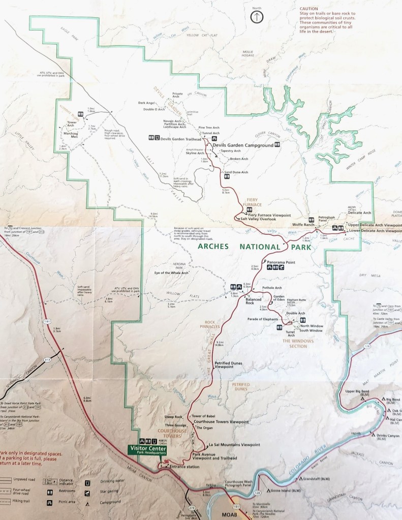
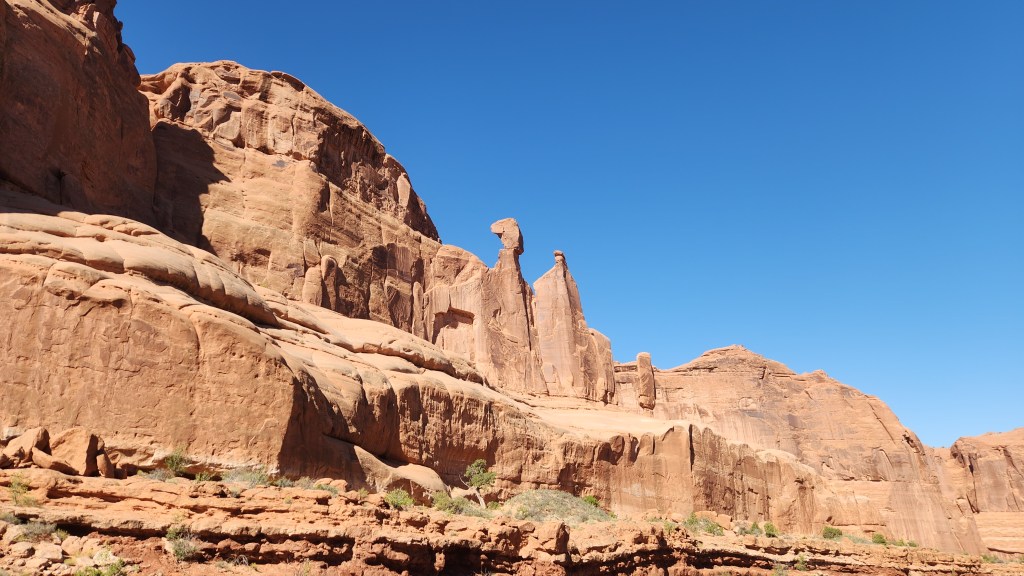
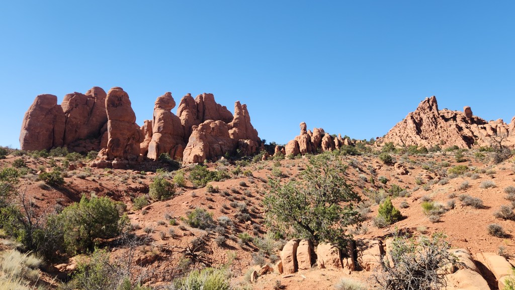
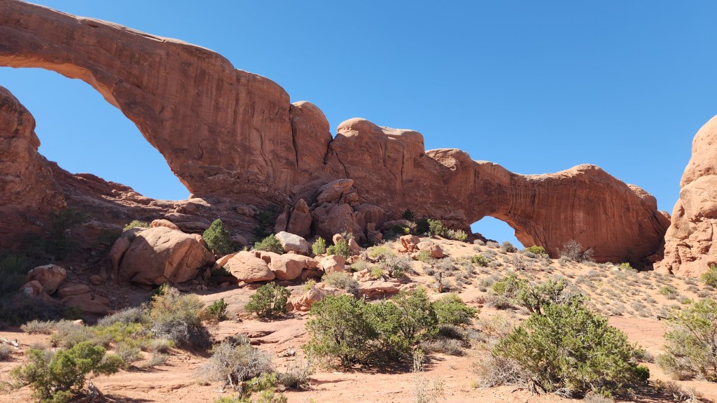
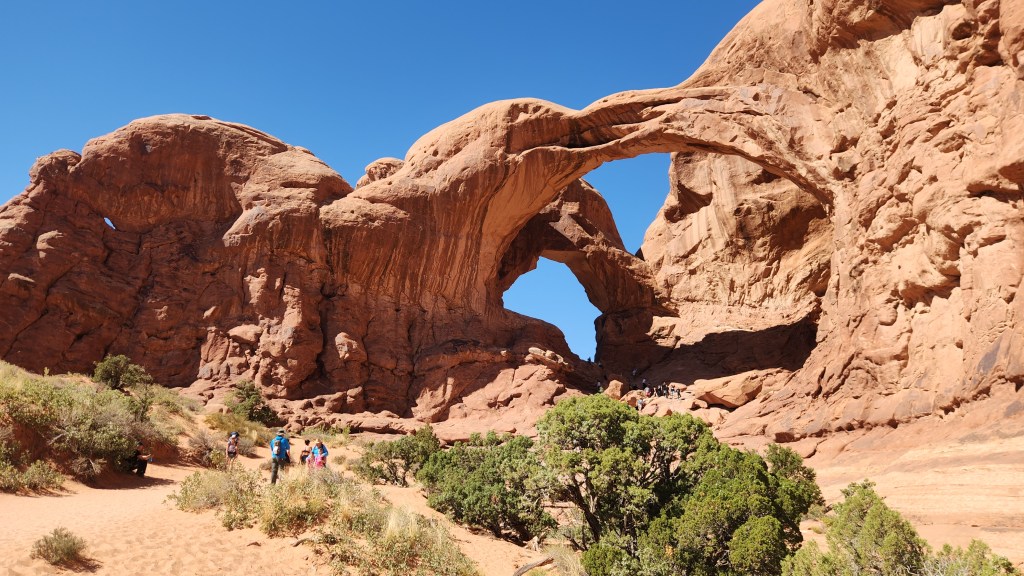
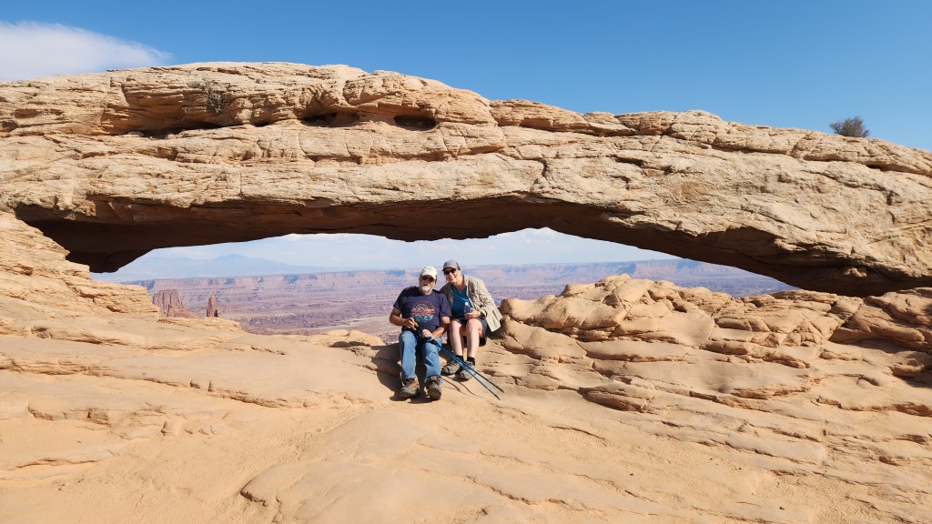
Arches National Park (October 4): We arrived at the Moab Rustic Inn shortly before 4 PM on October 3. At 7 PM, I used the Recreation.gov app on my phone to obtain a timed visitor’s pass for access to the National Park between 10 and 11 AM the following morning. The National Park requires these passes, which cost $2 per car, during prime visiting hours in order to manage traffic in the park. (As I understand it, a pass is not needed for access before 7 AM or after 5 PM.) We obtained free entry to the park using my Lifetime Senior Pass, as we did at all of the other NPS sites during the trip. Here’s a map of the park, which covers 76,680 acres (120 square miles):
After stopping at the Visitor Center to watch an excellent movie about the park and buy a souvenir T-shirt, we spent about 6 hours driving along the excellent road through the park and stopping at multiple points of interest. The park includes over 2,000 natural sandstone arches, of which we saw about 20, a multitude of fascinating rock formations, and a limitless number of stunning vistas. We walked along the one-mile Windows Trail for some excellent views of the Windows Arches, then returned by the 1.2-mile primitive trail, which provided a good test for my new knees. I did use walking sticks due to the rough terrain on the primitive trail, but I was quite pleased with how it went. I couldn’t quite keep up with my younger and spryer wife, but I didn’t feel like a near invalid as I did back in 2022.
Enough words – here are some pictures:
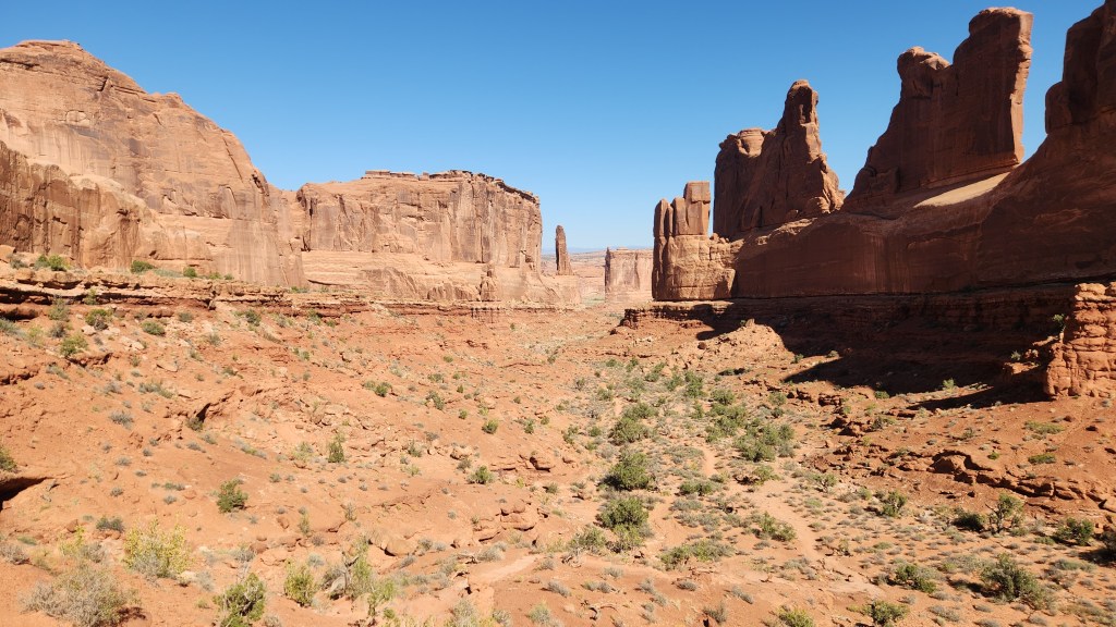
Courthouse Towers Viewpoint
Courthouse Tower Viewpoint
Rock Formations at Arches National Park
The Windows Arches
View from Windows Arch Primitive Trail
The Double Arch
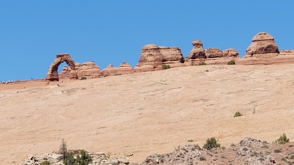
The Delicate Arch
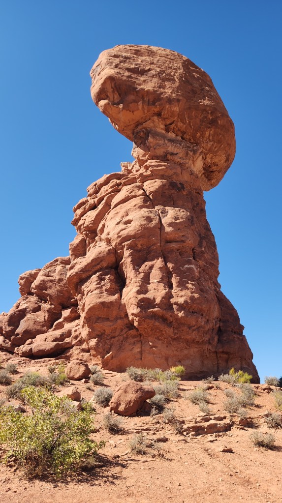
Balanced Rock
Interesting Terrain at Arches National Park
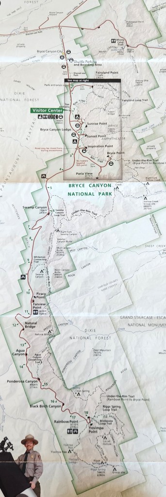
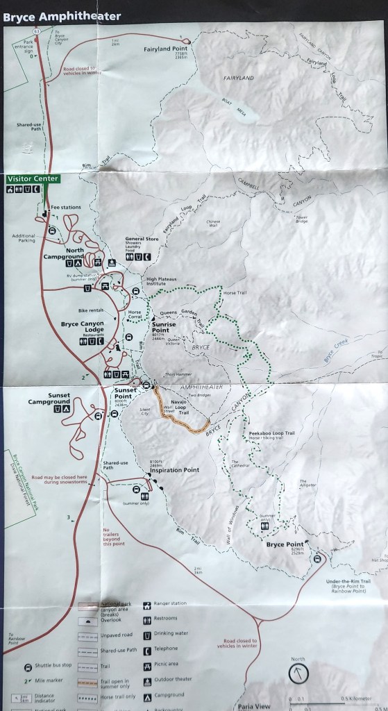
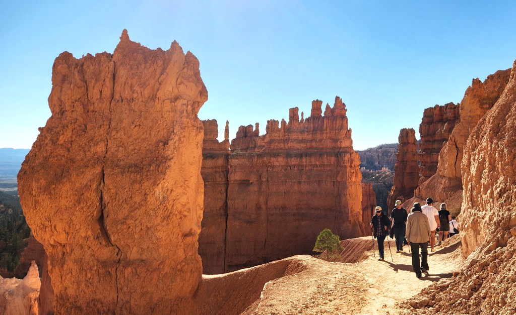
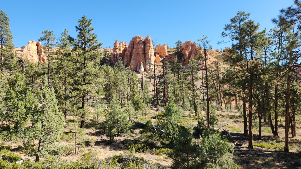
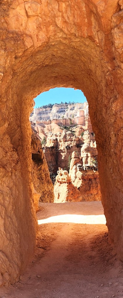
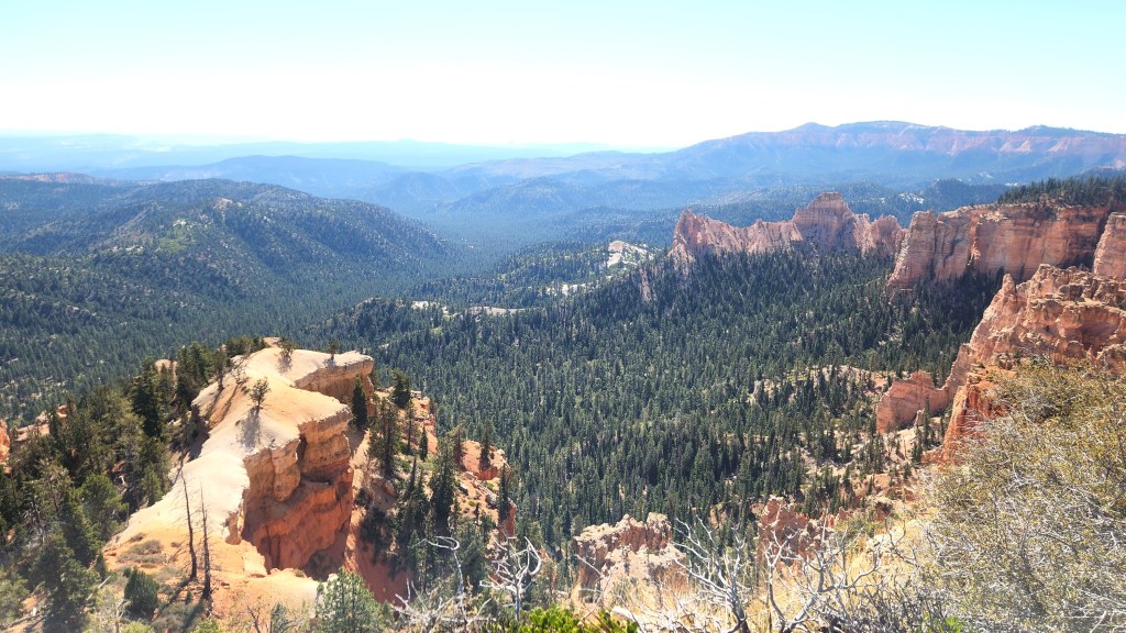
Bryce Canyon National Park (October 5 – 7): After our second night at the Moab Rustic Inn, we drove to Bryce Canyon National Park, which, as noted above, was the central idea for the road trip. Bryce manages traffic in the park by means of their free shuttle service and thus does not require timed entry passes. The shuttle picks up passengers who stay in the nearby town of Bryce Canyon City (as we did for our 2022 visit) or at the Visitor Center and ferries them around a loop to various points of interest in the Bryce Amphitheater as shown in the following maps:
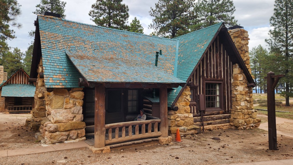
This time, we drove directly into the park (using my Senior Pass for entry) and to the Bryce Canyon area Lodge, where we checked in to Room 526, one-half of a lovely duplex cottage. The accommodations were very comfortable, with a gas fireplace, two queen beds, a bathroom, and a dressing area – the only drawback was the lack of Wi-Fi (heaven forbid!) in our room. Wi-Fi was available in and around the main lodge, however, and I occasionally got a cell signal in our room, so we weren’t exactly roughing it. The lodge has an excellent dining room, where we had breakfast and dinner each day, and there are a couple of nearby places where we could get lunch. Here’s a photo of the cottage – note the interesting roof tile construction which gives an optical illusion of a wavy surface.
Our Cottage at Bryce Canyon National Park
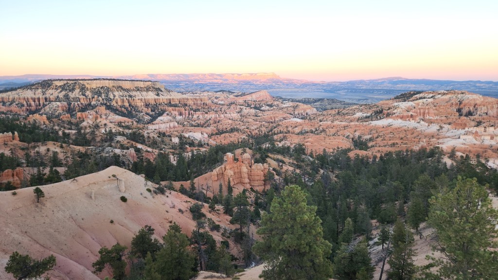
We spent the afternoon and evening of the 5th walking along the paths near the lodge, oohing and aahing at the spectacular views from the canyon rim, and I easily traversed the very same paths I was nearly unable to manage in 2022.
View from the Bryce Canyon Rim
View from Bryce Canyon Rim at Sunrise Point
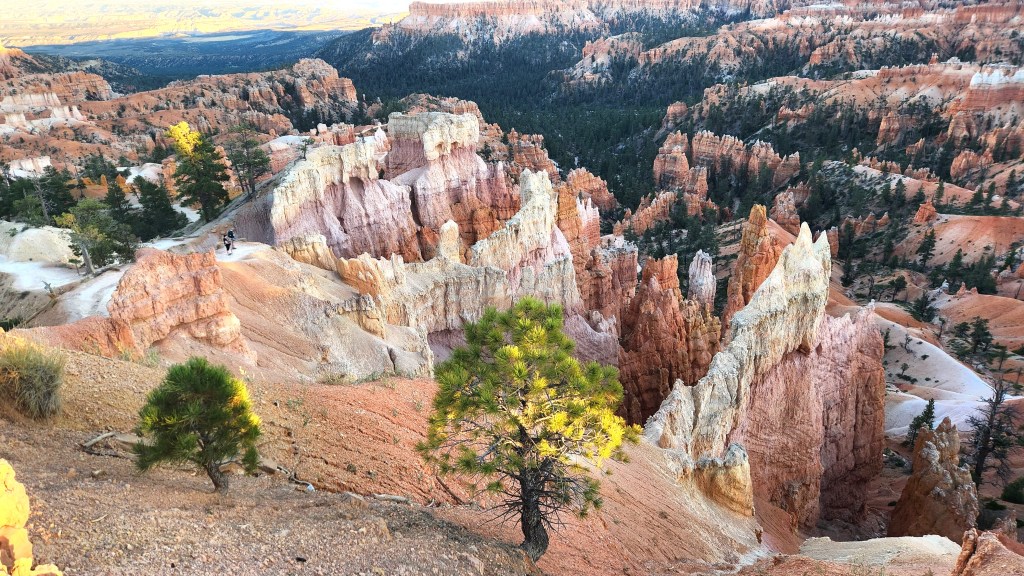
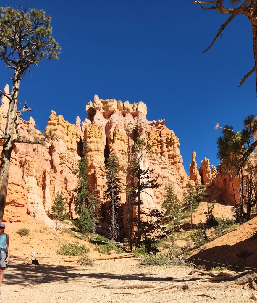
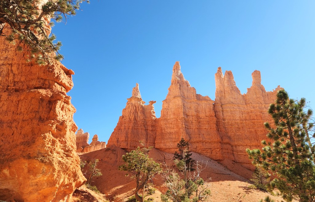
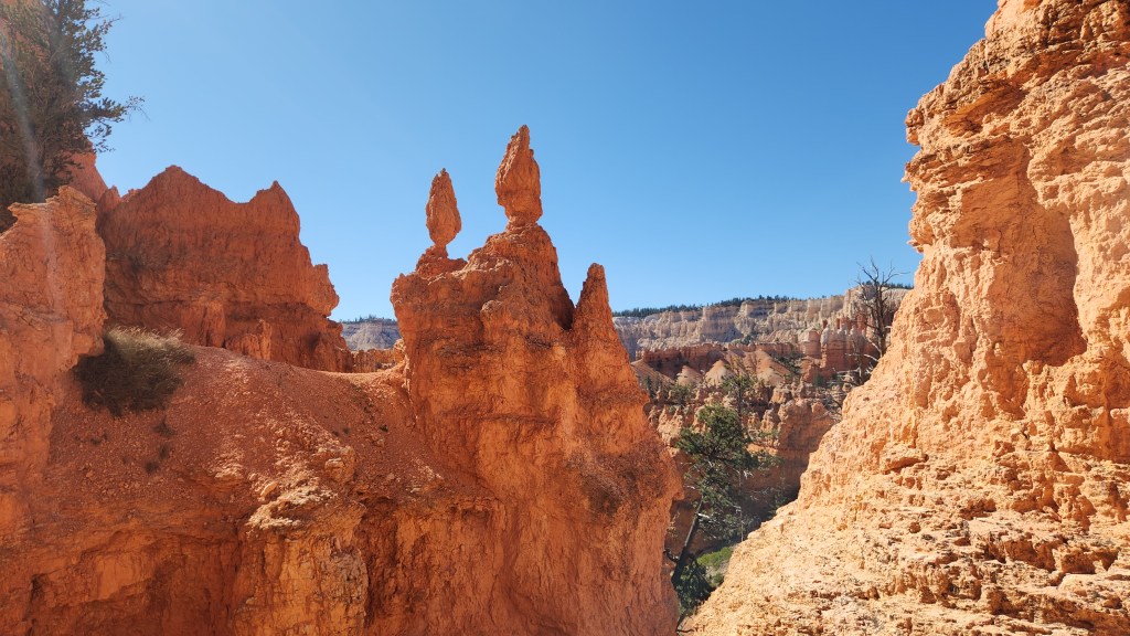
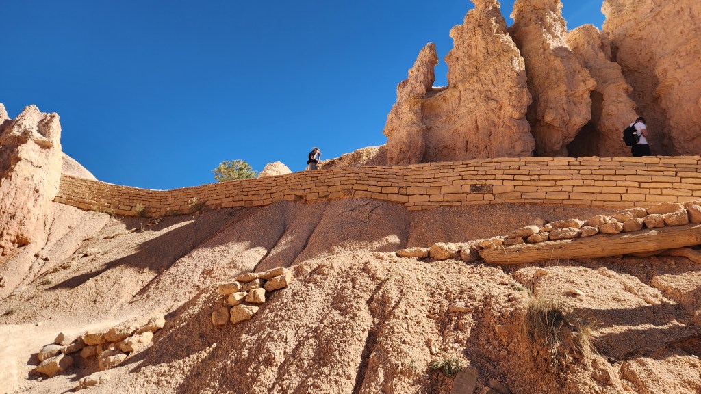
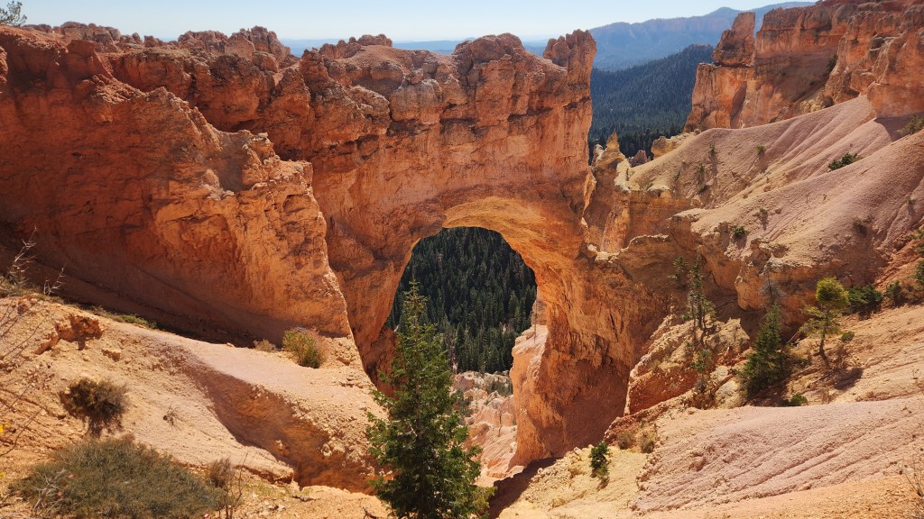
The next day, we took a hike on the Navajo Loop Trail, which meanders 450 feet down into the canyon, then returned to the rim on the Queen’s Garden Trail, some 2.9 miles in total. It was especially fascinating to see the rock formations and the foliage from the canyon floor, which provided a very different perspective than the view from the rim.
Navajo Loop Trail
Navajo Loop Trail
Navajo Loop Trail
Queen’s Garden Trail
View from Queen’s Garden Trail
Queen’s Garden Trail
View from Queen’s Garden Trail
View from Queen’s Garden Trail
Queen’s Garden Trail
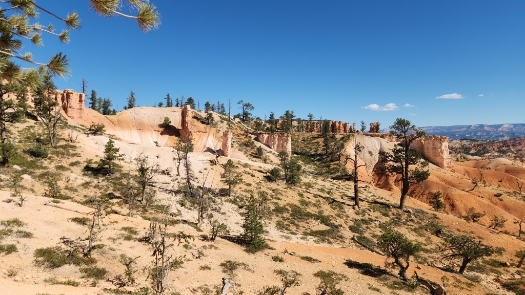
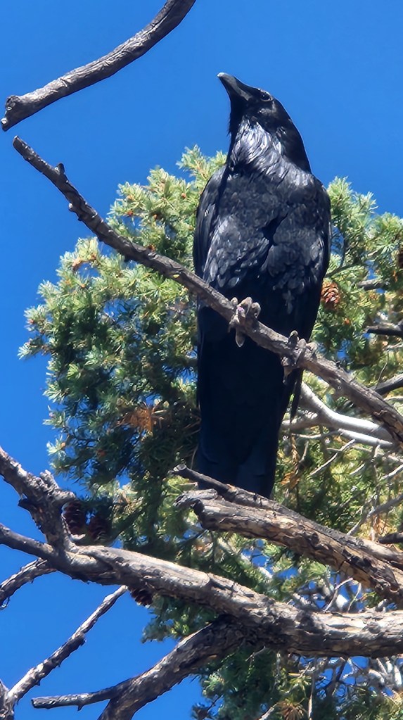
After our hike, we took the shuttle bus to the Visitor Center for, what else, a movie about the park and a souvenir T-shirt, then rode the shuttle back to the Lodge. On the third day, we drove along the excellent park road to Rainbow Point, the highest elevation in the park at 9,115 ft, and walked along the easy, 1-mile Bristlecone Trail. On the way back to our cottage, we stopped at all the points of interest and took another short walk from Fairview Point to Piracy Point.
View from Farview Point
Natural Bridge
Quoth the Raven … near Piracy Point
Another feature of the park is its certification as a dark skies location. I stepped outside a couple of times during the night to take in the stars, which looked especially bright in comparison to the views from the various hotels we had been staying in, or for that matter from our Minneapolis condo, but not too dissimilar to that from our Grand Marais summer home. All in all, the Bryce Canyon visit was an excellent cornerstone for our road trip.
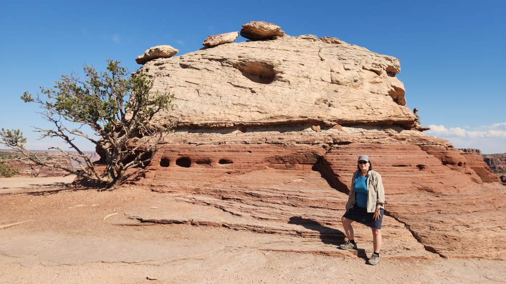
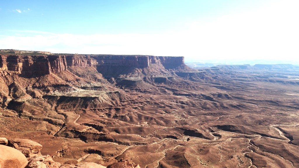
Canyonlands National Park (October 8): After leaving Bryce Canyon, we retraced our steps toward Moab and then drove to the Canyonlands Island in the Sky Visitor Center from the north. The visitor center was smaller than those at Arches and Bryce, and there were fewer visitors. This may be due to the presence of the Needles Visitor Center which is accessed from the south and which we did not visit. We arrived at the Visitor Center at around 3 PM and, after watching another excellent movie (no T-shirt this time), spent about two hours driving to the Grand View Overlook and back again, with several stops including a short walk to see the Mesa Arch.
Canyonlands National Park
Overlook at Canyonlands
Mesa Arch at Canyonlands
Green River Overlook at Canyonlands
Canyonlands National Park
OK, that’s it for Part 1. Thanks for reading, and stay tuned for the three remaining National Parks and the National Battlefield, as well as some pictures of the scenery we encountered at various points during the journey, all coming in Part 2.
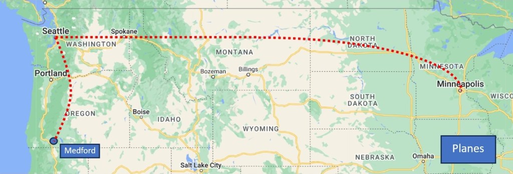
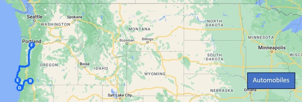
My most recent blog post described our multi-modal travel to Oregon and back – by airplane, automobile, and train – during June of 2024. That post focused primarily on the modes of travel involved, but I pledged to add another post describing the beautiful places we visited during the automobile portion of the trip. True to my word, here it is.
The map below shows the main places we visited in Oregon and northernmost California. Brief descriptions of these points of interest are provided below.
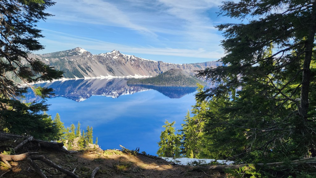
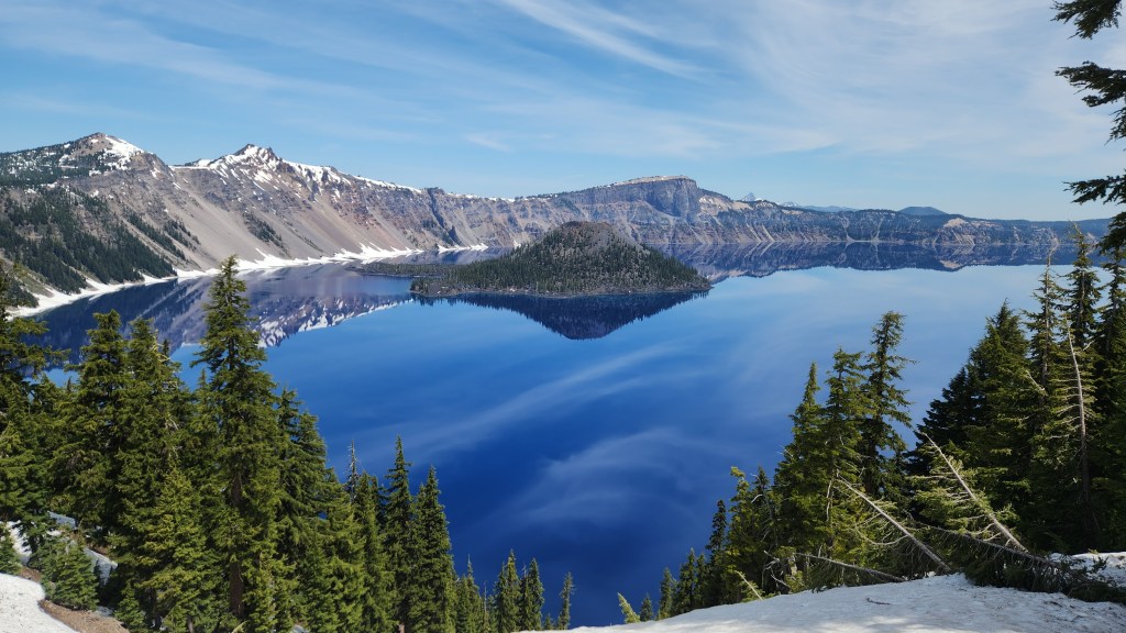
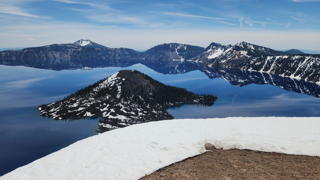
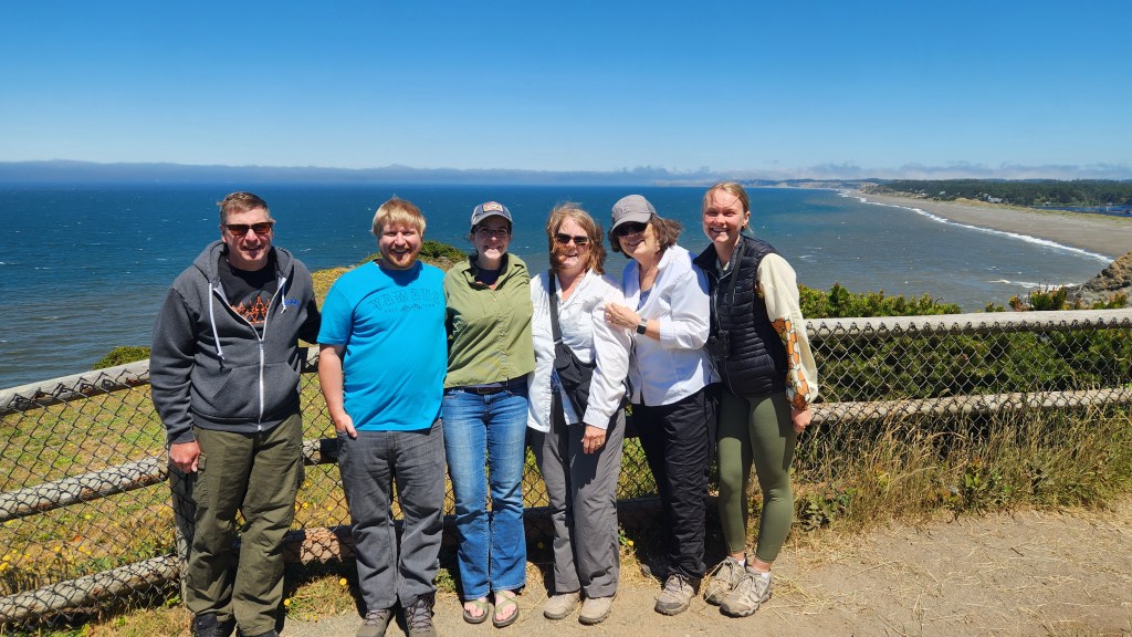
Crater Lake National Park, OR: On our second day in Oregon, in-laws Andy and Barb drove us to visit Crater Lake and served as our tour guides, since they had been there several times before. It was my first visit and Pat’s second, becoming the 39th National Park that we have visited together. I had seen pictures of the lake, but that had not prepared me for the beauty of the place. I’ve included some photos I took myself, but they also fail to do justice to this magnificent national treasure.
Crater Lake was formed when a massive eruption 7,700 years ago decimated a mountain peak and created in its place a deep basin. Centuries of rain and snow filled the basin, creating the deepest lake in the United States (1,943 feet at its deepest point) with water of stunning color and clarity. The lake is 6 miles across at its widest point and 4.5 miles across at its narrowest and contains 4.9 trillion gallons of water. The lake level is maintained by precipitation, with rain and melted snow averaging 5.5 ft annually. The National Park is open year-round, but the rim road is typically closed from mid-October to late June, with annual snowfall accumulations ranging from 25 to 50 feet over the past five years. The road was still closed during our visit, so we were unable to drive all the way around it, but we did walk along the rim trail near the Visitor Center to experience a multitude of amazing views. Since a picture is said to be worth 10,000 words, here are 60,000 eliminated words for your viewing enjoyment.
View from the Rim Trail, Crater Lake National Park
View from the Rim Trail, Crater Lake National Park
View from the Rim Road at the last open overlook, Crater Lake National Park
Relaxing along the Rim Trail, Crater Lake National Park
Visitor’s Lodge, Crater Lake National Park
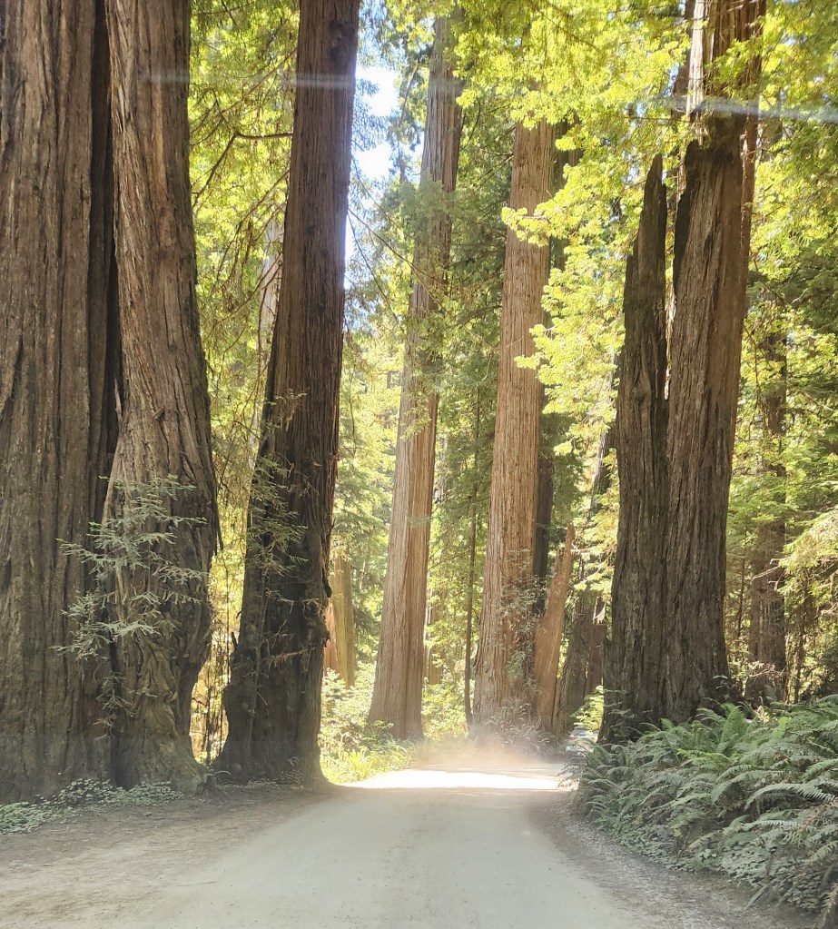
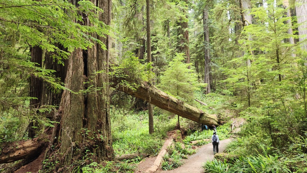
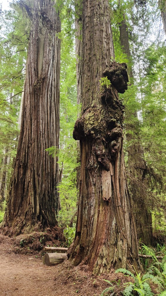
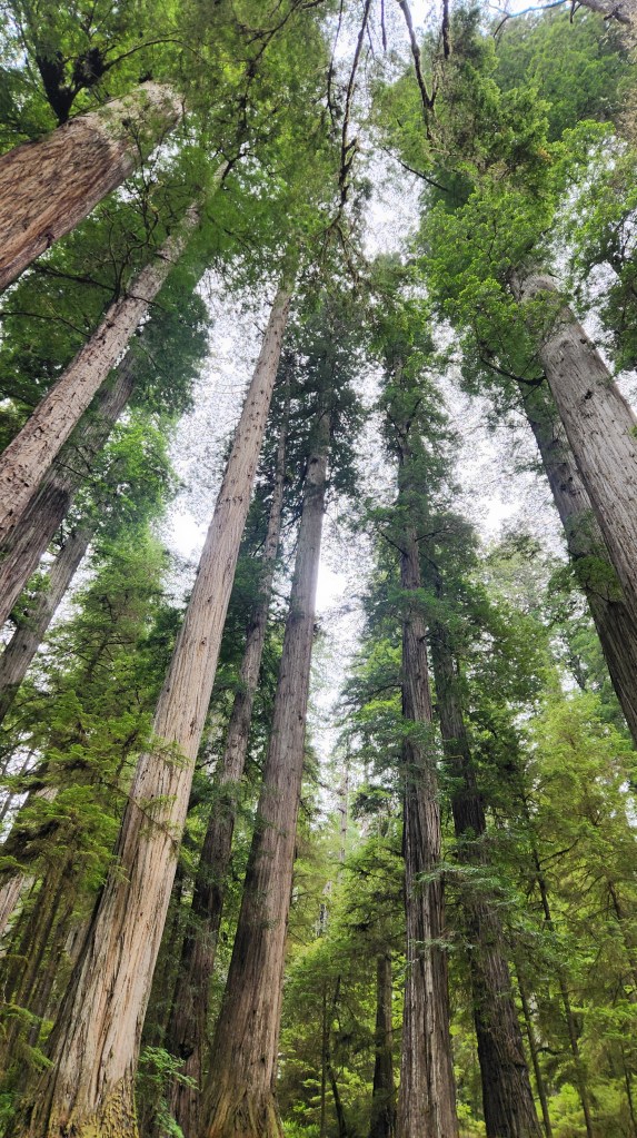
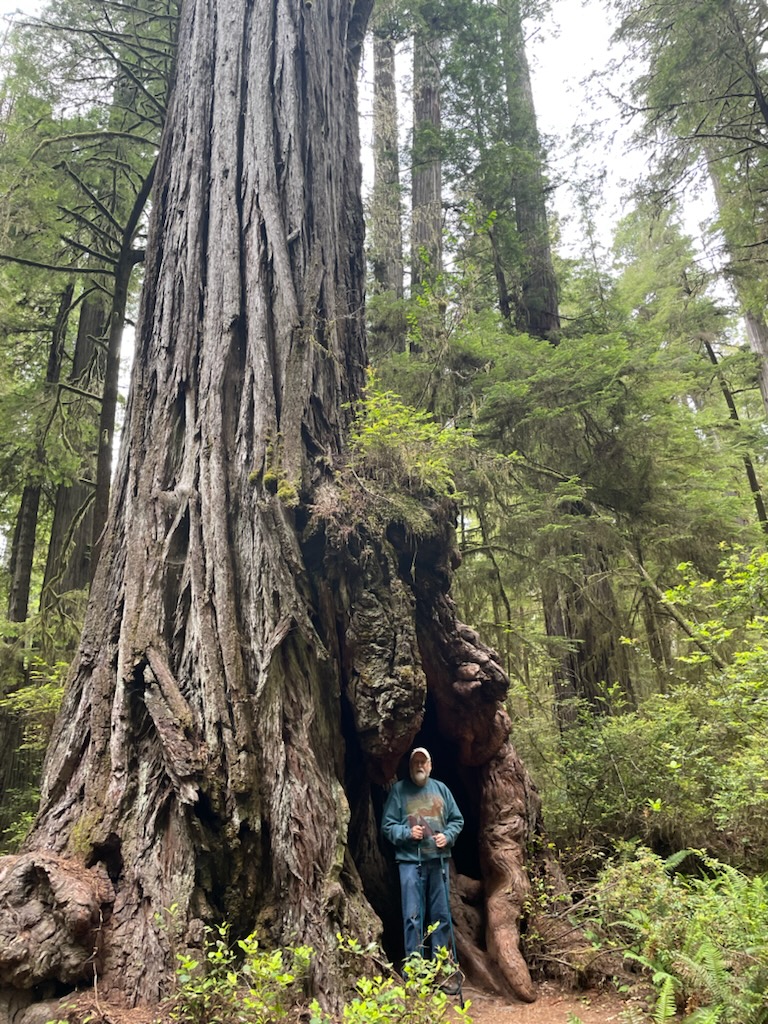
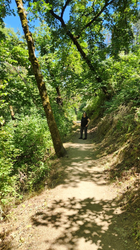
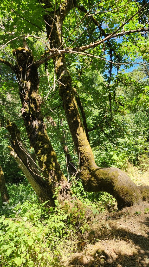
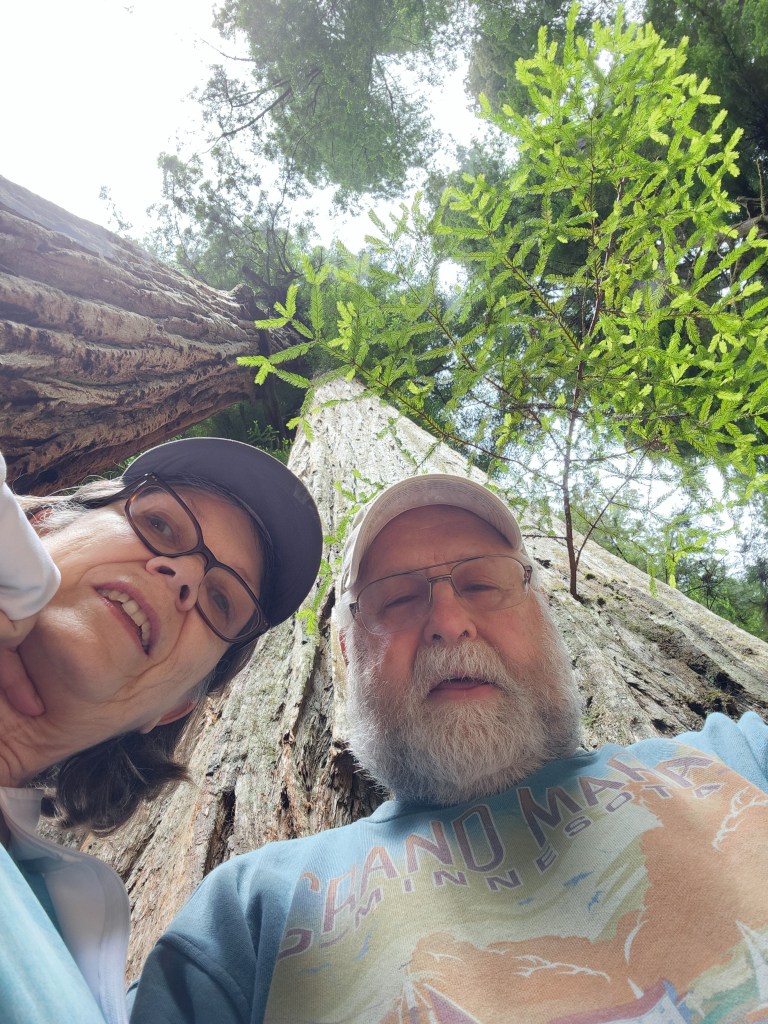
Boy Scout Tree Trail, Crescent City, CA: After two days staying in Medford, OR, including our visit to Crater Lake, we drove along an amazing road, US Highway 199, that wound its way steeply up and down and around a multitude of sharp curves as it traversed the mountains toward Crescent City, CA. As we neared Crescent City, we got off the main highway to take small, forest roads into the Jedediah Smith Redwoods State Park. The most amazing of these was called Howland Hill Road, a mere dirt path that wound its way through giant redwood trees. We stopped at the Boy Scout Tree Trailhead and walked about a mile and a half into the forest to admire magnificent trees and beautiful wildflowers. Again, the pictures can not truly capture the immensity of these ancient trees, but I’ll once again dispense with 60,000 words.
Howland Hill Road, near Crescent City, CA
The Boy Scout Tree Trail, Jedediah Smith State Forest, CA
Interesting Redwoods with Burls along the Boy Scout Tree Trail
Tree Blossom along the Boy Scout Tree Trail
My Attempt to Illustrate the Immensity of the Redwoods
Feeling Puny along the Boy Scout Tree Trail
Crescent City Breakwater: After our walk in the woods, feeling quite puny and insignificant compared to the massive trees, we again drove along Howland Hill Road until it emerged from the forest and morphed into a city street. Once in Crescent City itself, we had a nice lunch at SeaQuake Brewing (I had clam chowder and a hearty stout) before taking a short walk to the nearby breakwater. This structure is known for its unusual design, employing concrete structures called tetrapods, designed by the US Army Corps of Engineers in the 1950s to serve as protection against the heavy ocean waves that frequently impinge on the pier. I found these tetrapods fascinating, given my nerdy engineer curiosity, so I’m calling this a point of interest even though others may not be overly impressed.
Crescent City Breakwater with Tetrapods
Crescent City Lighthouse viewed from Breakwater
Port Orford Heads State Park, Port Orford, OR: As I explained in Part 1, visiting this location was the underlying purpose of the whole Oregon excursion – to visit the site where our nephew, Steve, and his wife, Kelci, were married in a quiet ceremony last year, so we could celebrate the event with them post facto. The assembled relatives all trooped along a lovely walking path to the overlook where the nuptials took place and gave the newlyweds our collective congratulations. As we stood looking out at the surroundings, I couldn’t resist the urge to say a few words of purported wisdom to the happy couple. Here’s what I came up with:
“I’m very happy that you chose such a beautiful place to say your wedding vows, because it can serve as a symbol of your future life together. I say this because there is nothing in the world more beautiful than the love shared between life partners.”
Okay, maybe a bit sappy, but there you have it. Now for some more word-saving photos.
The Happy Couple at Their Wedding Site
Port Orford Head State Park, Port Orford, OR
Port Orford Head State Park, Port Orford, OR
Foliage Along Walking Path at Port Orford Head State Park
Wildflower Along Walking Path at Port Orford Head State Park
Battle Rock Wayside, Port Orford, OR: After our visit to the State Park, we drove to the nearby town of Port Orford for a great lunch at a place called The Crazy Norwegian’s Fish and Chips and then walked to a nice little beachside park called the Battle Rock Wayside. While the name comes from one of the many unfortunate moments in American history (a battle between white settlers and indigenous people who were being unceremoniously expelled from their supposed treaty lands), it was actually a very beautiful place, and we spent some time roaming the beach and enjoying the scenic overlooks.
Overlook at Battle Rock Wayside, Port Orford, OR
Beach at Battle Rock Wayside
A new Driver? On the Beach at Battle Rock Wayside
Prehistoric Gardens, Gold Beach, OR: Calling this one a point of interest is a bit of a stretch. It’s a tourist attraction featuring 23 life-sized sculptures of dinosaurs set among the lush foliage of the area’s temperate rainforest. The gardens are the work of an amateur paleontologist in the 1950s, but I presume it’s mainly the sort of place people stop to entertain their kids. Unfortunately for our little tour group, it did include one big kid – me. So, we had to make a quick stop on the way back from Port Orford so I could pose with the big T-Rex that’s visible from the highway. We didn’t actually go into the gardens, though, so I can’t really give an opinion on whether or not it’s a worthwhile stop.
Some People Never Grow Up
Ophir Beach Wayside, Gold Beach, OR: On our last day before heading off to catch the train in Portland, we visited one of the many nice waysides along US Highway 101. Ophir Beach is a long, sandy beach divided by a small creek that emerges from the hillside area east of the highway. We enjoyed beautiful views of the ocean and the sandy hills as well as interesting driftwood and other objects strewn along the sand.
View from Ophir Beach Wayside, near Gold Beach, OR
Driftwood at Ophir Beach
Ophir Beach
Ophir Beach
Object found at Ophir Beach
Detritus on Ophir Beach
Miscellaneous: Finally, to round out this narrative, I have a couple more photos I want to share from other places we passed by during the trip.
Rogue River seen from Jot’s Resort, Gold Beach, OR
Sunset along Oregon Coast near Gold Beach, OR
OK, that’s it for this installment of my travel blog. Thanks for reading, and stay tuned for our next adventure, coming in October of 2024.
I recently reported on a trip we took with our new Tesla to the Great Smoky Mountains in April of 2024. The electronic ink is barely dry on that one, and here I am writing another post about our most recent travels. This time, we were inspired to head to the west coast to visit our nephew, Steve, and his new bride, Kelsi, in Medford, OR. The happy couple married last year in a small, intimate ceremony by the sea, depriving the lad’s mother of the opportunity to attend another wedding. To rectify this situation, the newlyweds agreed to a visit from a few family members, during which we would go to the site of their wedding vows and wish them well in their new life together.
The simplest way to make this trip would have been to fly to their Oregon hometown and impose on them to pick us up, put us up at their house, ferry us around for a day or two, and then drop us back at the airport. However, this did not seem like a good way to celebrate the big event, much less to be seen as thoughtful aunt- and uncle-in-law, so we thought better of suggesting that. Instead, we came up with a more adventurous plan – I have to credit Pat for thinking of it – involving the abovementioned planes, trains, and automobiles.
NOTE: Those readers who aren’t as advanced in years may not catch the reference: it comes from the classic 1987 comedy starring John Candy and Steve Martin. To be more chronologically and syntactically precise, I should call it planes, automobiles, and train, but that doesn’t quite have the same ring to it.
At any rate, in this first episode, I’ll mostly focus on the multimodal travel involved, saving more details about the beautiful places we visited during the automobiles portion for a future Part 2. So, here we go.
Wednesday, June 19, 2024: We rolled out of bed in our Minneapolis condo at 4:15 AM, performing the necessary toiletries before sleepily rolling our luggage down to the lobby and exiting the building precisely as Mustaf, our friendly Lyft driver, pulled to the curb at 5:00. We were at MSP airport by 5:23, well in advance of our flight departure. (We were thankful that Lyft is still serving Minneapolis despite the threat of abandoning the city over a proposed ordinance mandating driver pay increases, which was subsequently made moot by a state law negotiated between Lyft, Uber, and Governor Tim Walz, among others. I have been very pleased with the service provided by Lyft in the past, and I hope they continue to be successful under the new law.)
The first leg of the flight did not get off to the best start, as high, shifting winds led to a change in runways and a long line of planes waiting to take off, but we eventually did get airborne some 45 minutes late and arrived in Seattle with enough time to catch the next hop to Medford. Along the way, I enjoyed gazing out the airplane window, as the sky was very clear, and soon realized that I could use the Google Maps app on my phone to track along the terrain we were flying above and identify the various rivers, mountains, highways, and towns as we passed by. (Just the sort of nerdy thing you might expect from me, eh?) I tried to get some photos, but most didn’t turn out. Here’s one that wasn’t too bad, followed by a map of the Planes portion of the journey.
View from the Airplane with Mount Adams, WA, (I think) in the distance
We arrived at the somewhat ostentatiously named Rogue Valley International Airport in Medford shortly after noon Pacific time. We had reserved a rental car from Enterprise, so I proceeded to the minuscule rental desk, staffed by two young women, while Pat collected our luggage. Despite the fact that I was the only customer, it took about a half-hour before I had actually succeeded in renting the car. The first young woman’s iPad crashed after I had checked all the appropriate boxes and signed with my fingertip, and the second young woman spent an inordinate amount of time answering questions from someone who wasn’t even renting a car before finally starting over with me on her iPad. Meanwhile, the status of the Rogue Valley International Airport continued to diminish in my mind as I waited impatiently.
Ay any rate, we finally managed to get a car, a nice Toyota Corolla – at least nice enough for an ICE car. It took me a while to get used to driving it, especially the part about having to step on the brakes to make it stop. I’ve become so used to the regenerative braking in our EVs that it seemed odd – I must have used the brakes more during our six days in Oregon than I have in the past three years with our Teslas. The car handled and performed very well, though, and got an impressive 44.36 mpg. Gasoline cost us an average of $4.28, so it still cost about $0.10 per mile for fuel. I hope to go back to Oregon sometime with our newer Tesla so I can find out what it would cost to drive an EV there.
After renting the car, we headed off to a nice place called Noho’s Hawaiian Café where I had a delicious but huge lunch of barbecued pulled pork (which I finally finished two days later). The rest of the day was taken up by a brief hike at a nearby park called the Jacksonville Forest Trails, checking into our hotel (Medford Hampton Inn), and dinner at a lovely restaurant called The Point Pub and Grill in neighboring Central Point, OR, with the newlyweds and our nephew’s parents (who traveled separately by car to meet us out there).
Pat on our Hike at Jackson Forest Trails
Interesting Tree at Jackson Hiking Trails
Thursday, June 20 – Monday, June 24, 2024: During this period, we rode in a total of three automobiles: our rental Toyota, brother-in-law Andy and sister-in-law Barb’s Honda CR-V, and nephew Steve’s Honda Pilot. On Thursday, Andy drove Pat, Barb, and me to visit Crater Lake. On Friday, Pat and I drove the rental car out to the Pacific Coast, where we stayed for three nights at Jot’s Resort in Gold Beach, OR, and visited with the assembled rellies (Steve, Kelsi, Andy, Barb, and Steve’s cousin Grace Ann) at an Airbnb they had rented, located about eight miles north along the coast. On Saturday, Steve drove us all from the Airbnb to the Port Orford Heads State Park, the site of last year’s wedding, and to the town of Port Orford. On Sunday, Steve again drove us from the Airbnb to a lovely spot called Ophir Beach. On Monday, Pat and I drove to Portland to catch the train. I’ll report in detail on all this in Part 2, but here are a map of the Automobiles portion of the trip and a few teaser photos:
Crater Lake National Park, Oregon
Dwarfed by Redwoods along Boy Scout Tree Trail near Crescent City, CA
Andy, Steve, Kelsi, Barb, Pat, and Grace Ann at Port Orford, OR
Monday, June 24 – Wednesday, June 26, 2024: As mentioned above, we drove to Portland on Monday, with a brief stop to visit longtime friend Lynn in her assisted living facility before returning the rental car, thus completing the Automobiles segment of the trip. After a brief walk to Portland’s Union Station, we relaxed in the customer lounge before boarding the Amtrak Empire Builder train for our trip to St. Paul, MN.
Customer Lounge at Portland Union Station
The train trip took a total of 36 hours, roughly twelve times as long as a non-stop flight, but we wanted to experience a long train trip just for the fun of it. Here’s a map of the route:
We had booked what Amtrak calls a bedroom suite, which turned out to be a whopping 7 ft x 6.5 ft space with a lounge chair and a couch that turned into a lower bunk. The upper bunk folded down from above and was accessible by a portable ladder. The room had a restroom with a shower, but neither of us dared to try the shower as it was nothing more than a spray handle within the tiny restroom, with no separate enclosure. I would not call the accommodations deluxe, but they were certainly better than the ordinary seats in which we had travelled from St. Paul to Chicago a couple of times in years past. Pat used the upper bunk, being a bit nimbler than I, and I had a terrible time sleeping with the constant jostling of the train.
Bedroom Suite on the Amtrak Empire Builder
Despite the somewhat uncomfortable accommodations, we enjoyed the trip. We lurched through the constantly swaying train cars toward the back of the train many times, for meals in the dining car (which were quite nice) and to visit the observation car which provided beautiful views of the passing scenery, especially on Tuesday morning as we passed south of Glacier National Park.
Observation Car on the Amtrak Empire Builder
Columbia River from Amtrak Empire Builder
Middle Fork of Flathead River from Amtrak Empire Builder
View near Glacier Park
View Near Glacier Park
We arrived in St. Paul at 9:13 AM, feeling slightly disheveled but overall, no worse for the wear. We exited St. Paul’s Union Station, summoned a Lyft, and were driven home by Marco, another friendly and efficient driver, arriving at the condo at 9:48 AM.
All in all, I would describe the Train portion of the trip as a worthwhile and enjoyable experience, although one we probably won’t be too eager to do again.
OK, that’s it for Part 1. Thanks for reading, and stay tuned for some lovely photos of giant redwoods and the Pacific Coast, coming in Part 2.
In Part 1 and Part 2 of this series, I described our travels from Minneapolis, MN to Pigeon Forge, TN, and our visits to two National Parks, New River Gorge NP in West Virginia and Great Smoky Mountains NP in Tennessee. This final episode provides a brief summary of our trip back home and some details of how our new EV performed on the road trip.
Wednesday, April 24, 2024: We left the Golf Vista on Dollywood Lane shortly after 9 AM and headed eastward, stopping to charge the car at a place called Buccees in Crossville, TN. We’d never heard of Buccees before, but it’s apparently a very popular fuel and convenience store chain in the southeastern US. We were absolutely amazed by the place. There had to be sixty or more gas pumps in addition to two charging stations – a Tesla Supercharger bank with 16 chargers and a ChargePoint station with four chargers (interestingly bearing Mercedes Benz logos). The convenience store was huge – easily as big as large truck stops such as Loves or Pilot – and was filled with an amazing array of ready-to-eat foods, groceries, gift items, and such. One especially unique feature was an array of about twenty or thirty different types of custom-made beef jerky. We bought a bag and it was delicious. I’d recommend Buccees as a welcome stop for travelers of all stripes.
The Amazing Buccees in Crosville, TN
Tesla Superchargers at Buccees — hardly anyone using it, as usual
ChargePoint Charger at Buccees
After charging the car, we drove to the Stones River National Battlefield in Murfreesboro, TN, for our final point of interest before sprinting for home. This site, operated by the National Park Service, memorializes the Battle of Stones River, which took place from December 31, 1862 through January 2, 1863. Union forces squeaked out a victory in a bloody conflict there, boosting morale in the North and gaining control of central Tennessee. Of the major battles in the Civil War, Stones River had the highest percentage of casualties on both sides.
We first stopped in at an impressive Visitors Center with interesting displays about the battle and its aftermath and then strolled around the 600-acre site to see several key battleground areas and the large National Cemetery in which more than 6,100 Union soldiers are buried, including more than 2,500 who were never identified. We left with a somber feeling, with a new appreciation for the immense toll that the Civil War took on the soldiers who fought in it and their surviving families and loved ones.
Stones River Battleground Sign
Stones River Battleground
Stones River National Cemetery
Then we headed off to another charging stop just southeast of Nashville and then on to the Hampton Inn in Pleasant View, TN. We enjoyed a meal at a little place called Firecracker Pizza near the hotel before turning in for the evening.
Thursday, April 25, and Friday, April 26, 2024: Our last two days were uneventful, including a drive to the Hampton Inn O’Fallon near St. Louis for our final night’s stay and then a long (for us) eleven-hour drive home as the weather turned cold and rainy. As we trundled our luggage up to our fifth-floor condo, we felt very satisfied with our Easy EV Road Trip. Here’s a recap:
EV Performance: Now for some information (hopefully not too nerdy) about how our new EV performed on the Road Trip. Hopefully this will be of interest to readers who may be considering purchasing an EV or who may feel hesitant about it due to perceived EV problems.
Many questions are related to charging an EV. How much does it cost? How long does it take? How hard is it to find chargers? I’ll answer these questions based on actual data from our Easy EV Road Trip. Details of our charging sessions during the trip are provided in this table:
One thing I’ve heard from a number of people is that, with electric costs rising due to inflation, operating an EV is too expensive. So, what did we actually spend on electricity during this Road Trip? $238.94, including the pre-trip charging at home in the condo garage. How would that compare to the identical trip with an internal combustion engine (ICE) car? If we assume an average gas price of $2.60, based on what we observed on various gas station signs along the way, fueling an ICE car would cost the same as what we spent on charging the EV if it got 37.2 mpg. (If gasoline prices miraculously fell to $2.50, an ICE car would only need to get 29.1 mpg to break even with the EV, but if it spiked to $4.00, it would need to get 46.5 mpg for an equivalent fuel cost.) Put it this way – the plethora of large pickup trucks and SUVs we observed along the way are costing a lot more to take on a road trip, while a Toyota or Honda hybrid would cost a bit less.
It’s important to understand that using high-speed (Level 3) chargers (such as the Tesla Superchargers we used) is the absolute most expensive way to charge an EV. By comparison, slow (Level 1) charging at our condo with a simple 110V circuit costs less than half as much, or intermediate (Level 2) charging at our Lake Superior cabin, with a reduced off-peak rate, costs less than a fifth as much. Equivalent-cost ICE cars would need to get 77.2 mpg or 193.7 mpg to compete with these Level 1 and Level 2 chargers, and I can guarantee there are no such ICE cars in existence anywhere. So, if you consider that road trips probably represent a very small percentage of the total driving that any of us do, an EV with a Level 1 or Level 2 home charger is far less costly to operate than an ICE car.
Another issue for EV hesitance is the time required for charging stops on a road trip. So, just how long did we spend charging the car on our Easy EV Road Trip. As the table above shows, the total charging time for the 17 stops was 468 minutes (7.8 hours) with an average of 27.5 minutes per stop. We generally used that time for something more or less productive, such as eating lunch, buying groceries, using the rest room, watching a Netflix movie on the Tesla screen, etc., so it didn’t really feel like wasted time. However, if getting to your destination as fast as possible is a high priority, the time spent charging is a significant detriment.
To put it in perspective, the comparable time for fueling an ICE car depends on the size of its gas tank and the car’s mileage. Calculations I did based on a Honda Accord hybrid, a light-duty pickup, and a heavy-duty pickup showed minimum total time for fueling over a 2,777 mile Road Trip would be 49.7 minutes, 55.1 minutes, and 59.3 minutes, respectively (assuming ten minutes per fill up), for a saving of nearly 7 hours compared to our EV, although some of that time would be eaten up by the aforementioned eating, shopping, etc. This would easily allow the trip to be completed in a day less, although Pat and I – retirees both – don’t like to drive for more than 4 hours a day anyway, so the savings would be meaningless to us. A good deal of this aversion to long driving times comes from the stress induced by other drivers — huge pickups that tailgate menacingly, freeway mergers who insist on reaching their final merge point at exactly the same position as our car — or driving conditions such as endless stretches of road construction or heavy wind or rain, to name but a few.
Probably the biggest factor in EV hesitance is range anxiety – will an EV driver be able to get to the next charging station before running out of power? The new Tesla Model 3 proved to be excellent in this regard. The quoted range is 324 miles under ideal conditions, and we found that the actual distance traveled averaged 93.4% of the range estimated by the car during the Road Trip. We generally recharged the car when it dropped below 20% of battery capacity and charged it to 80-90% of full at each stop. A major reason we bought the Tesla is the large number of Superchargers that have been deployed all across the country, and we never had any anxiety about reaching one in time. Planning the stops was very easy; we used two methods. The simplest way was to give a voice command, e.g. “Navigate to Pigeon Forge, Tennessee,” and let the car map out recommended charging stops. Sometimes we used an app called ABRP (for ABetter Route Planner) to check out alternate routes – this app can be customized to use actual performance data from a specific car and/or to specify such things as minimum charging time, avoiding tolls, and the like.) Thus, the trip truly lived up to my claim as Pat and Daves Easy EV Road Trip. I can’t offer any insight regarding road trips in non-Tesla EVs, however.
One final note about the Tesla. Coincidentally, just before we left on the trip, Tesla decided to give all or most Teslas on the road a free month of what they call “Supervised Full Self Driving” capability, so we decided to try it out during the trip. The video below shows how it worked – quite well and rather fun.
Tesla “Supervised Full Self Driving” demonstration
It also included automatic parking in parking lots and automatic parallel parking on streets. However, neither of us was comfortable letting the car drive itself, and we also felt that the price for this feature — $ 99 per month or $4,000 dollars for the life of the car – was too steep, so we did not pick it up after the free trial. The car still has what Tesla calls “Autopilot,” which is adaptive cruise control, and “Autosteer,” which maintains the car within the driving lane and automatically steers around curves.
While the above considerations are all related to practical matters – cost, time, level of anxiety – they do not speak to the major reason to buy an EV, which is to help slow the inexorable advance of climate change. While I’m afraid that the drivers of those menacing, tailgating pickup trucks will merely scoff at that idea, I hope it can influence some readers; after all, doesn’t helping to save the planet seem more important than saving a little time on a road trip?
OK, that’s it! Thanks for reading, and please consider joining the EV universe!