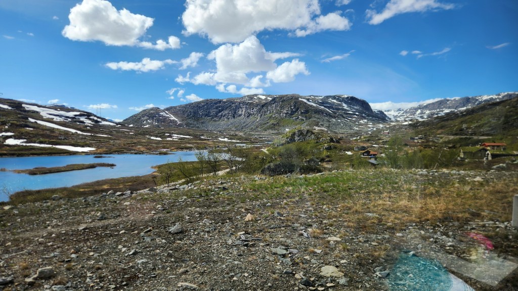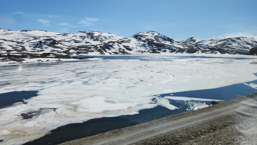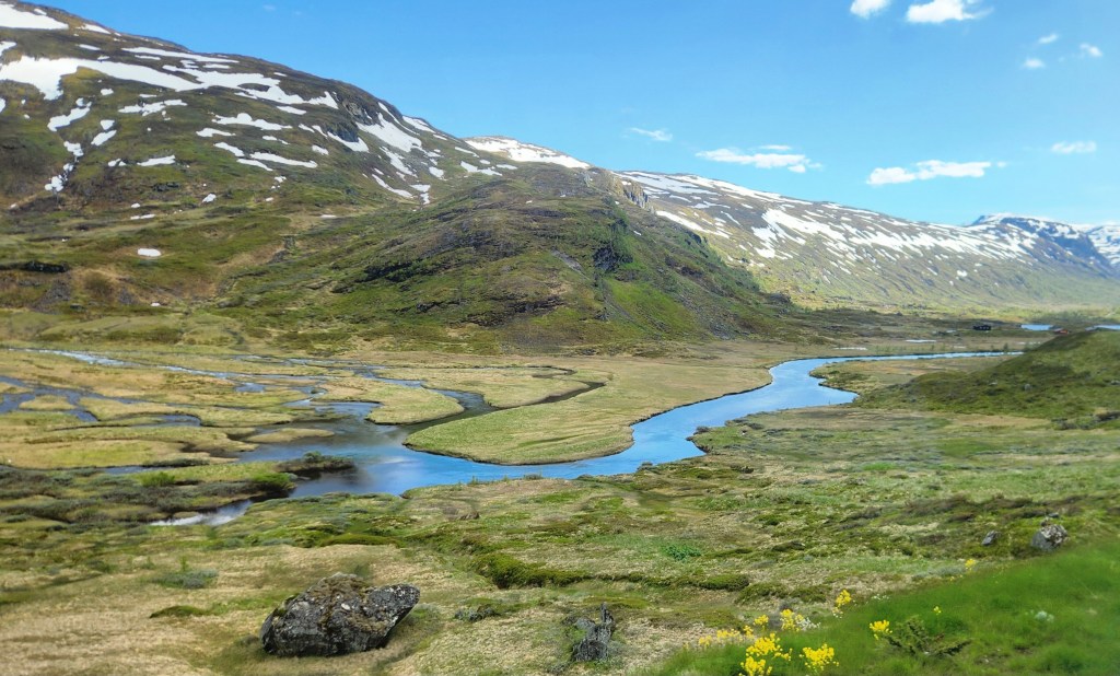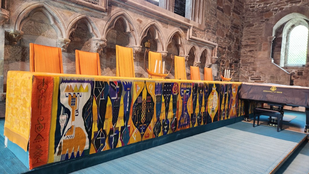
Pat and Dave’s Vibrant Viking Voyage – PART 4: Poland, Estonia, and Sweden

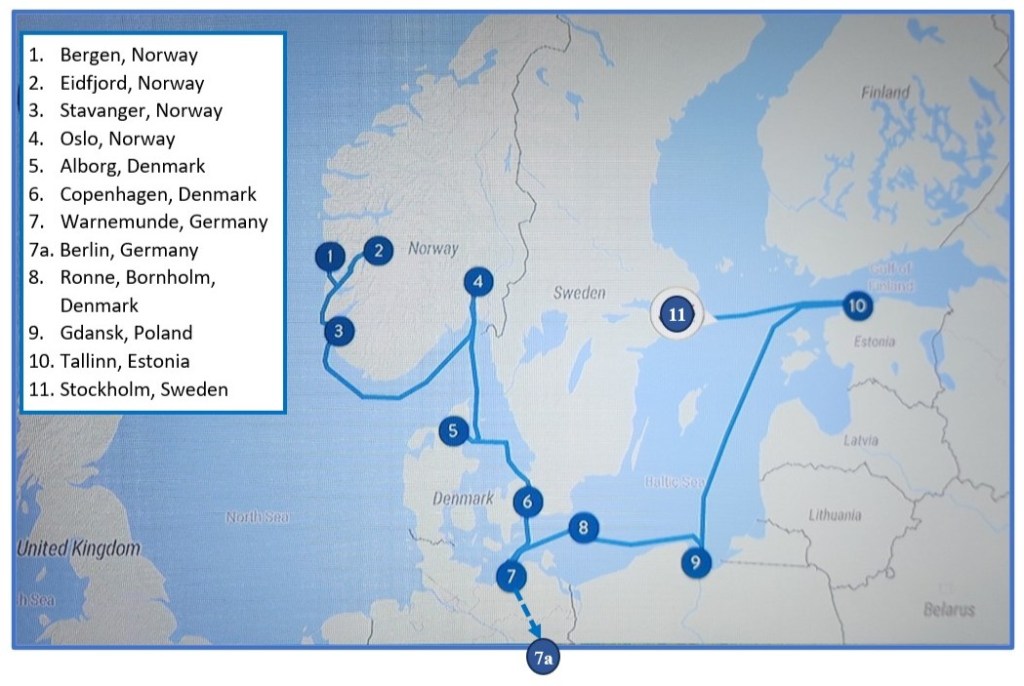
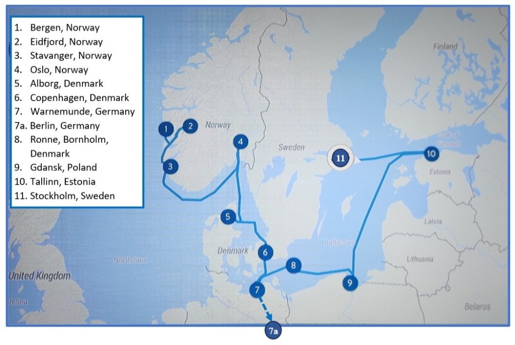
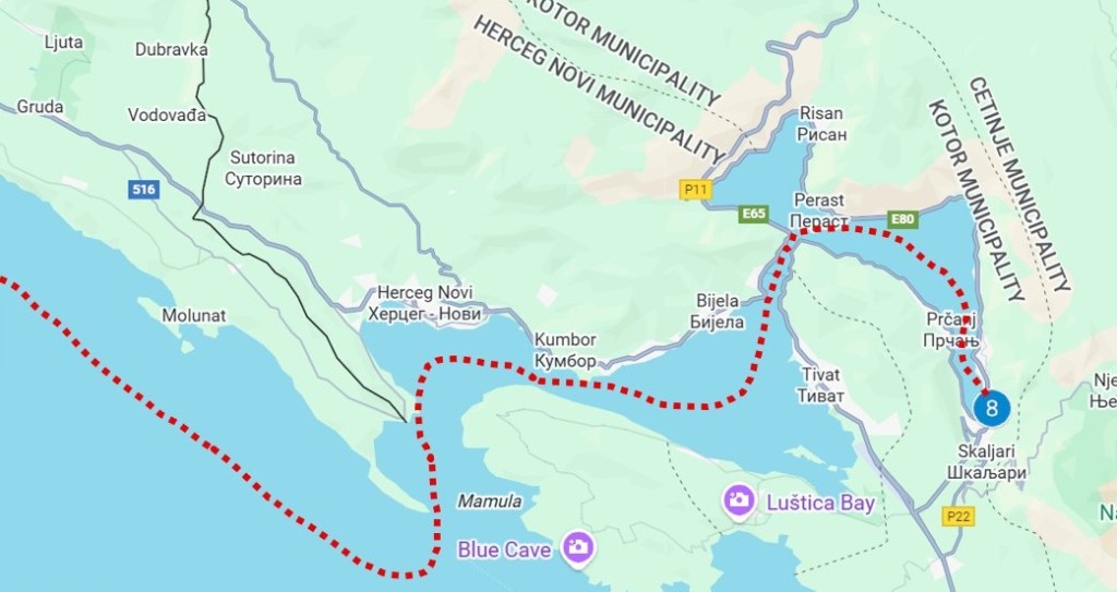
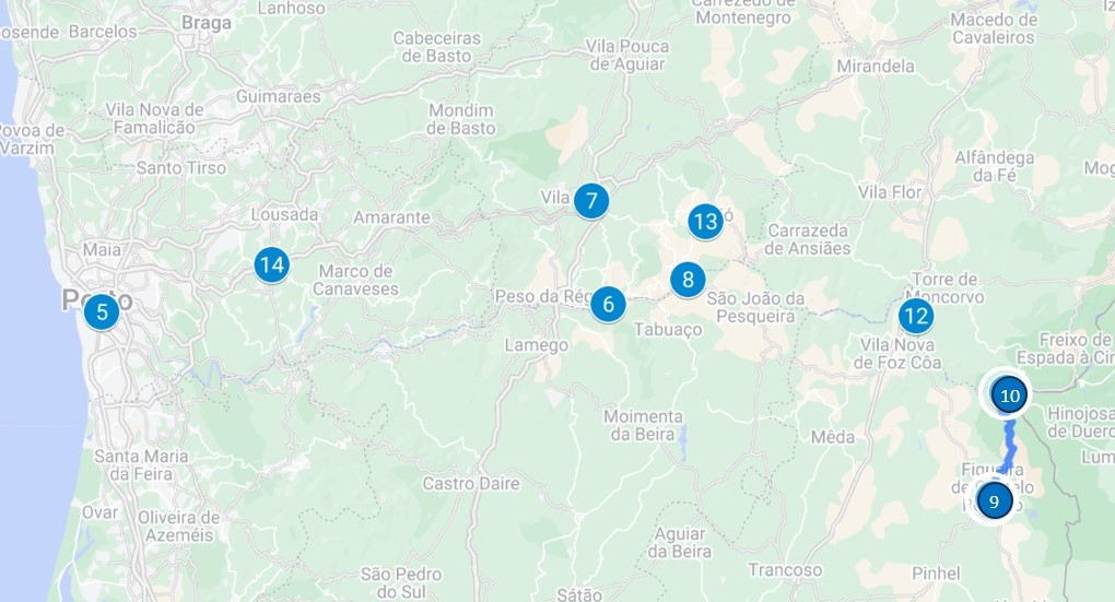
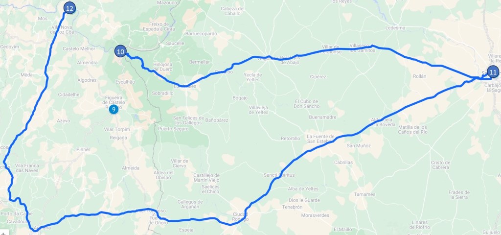
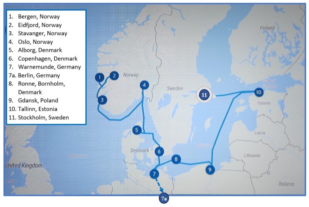
Welcome back for Part 4 of my travelogue describing our recent Viking Ocean Cruise entitled “Viking Homelands.” Part 3 left off as we were departing from Bornholm, Denmark. This episode will cover our stops in Poland, Estonia, and Sweden, including locations 9, 10, and 11 on the map of our itinerary.
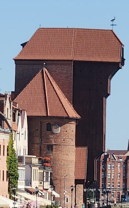
Gdansk, Poland (Saturday, June 27, 2026): Our ship docked at the port in Gdansk at 8 AM, and we were soon off on a motorcoach for a tour of the city’s old town. I didn’t know what to expect in Gdansk, since I knew that the city suffered extensive damage during World War II – 95% of the old town, then known as Danzig, was reduced to rubble. I was surprised and delighted to see how well the old town has been restored. Our guide explained that the immediate, post-war restoration work was primarily done by volunteer city dwellers, since Poland was unable to fund a major restoration project. (She described the situation as “grandmothers hauling bricks.”) Up until the war, the city was populated largely by German descendants of the 19th century Prussians, but most of the Germans either left or were expelled after the war and were replaced by Polish settlers eager to rebuild the city. The restoration recreated the pre-Prussian Gothic, Renaissance, and Baroque styles of architecture to bring back the old town as it existed in medieval times, when it was one of the most prosperous cities in the Hanseatic League. Here was my first view of the old town waterfront on the Motlawa River as we left the bus and headed toward the city. The large block-like structure in the distance (on the left side of the river) is a fascinating treadwheel crane, a 14th-century human-powered device that helped the medieval port load and unload cargo.
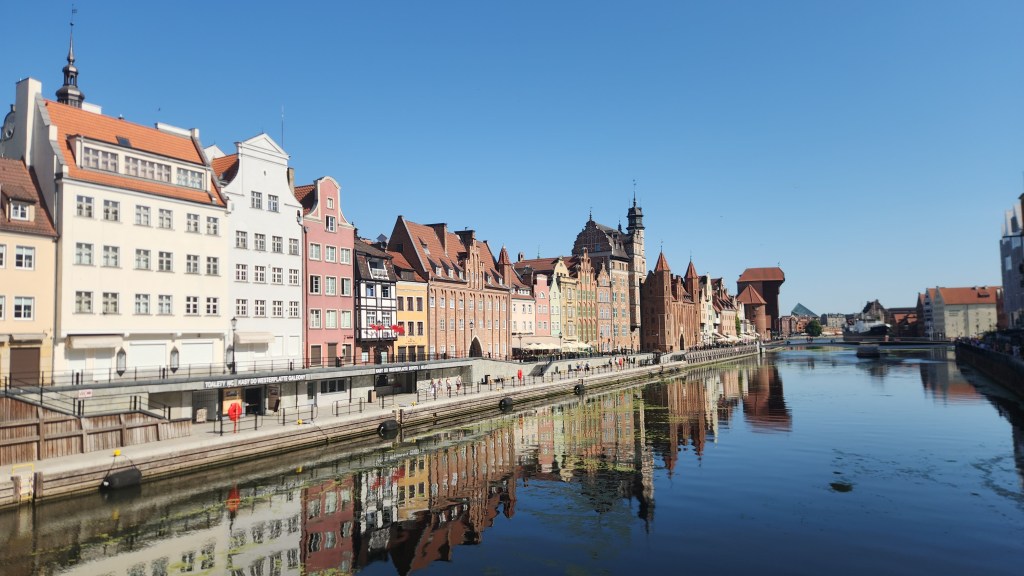
Gdansk Old Town Riverfront
Treadwheel Crane

We entered the old town through the Green Gate, which was built in 1571 to be the formal residence of Poland’s monarchs – although no Polish king ever actually lived there – and now houses the National Museum.
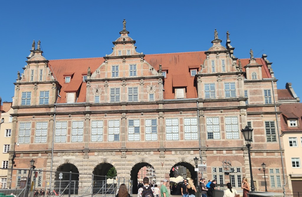
The Green Gate

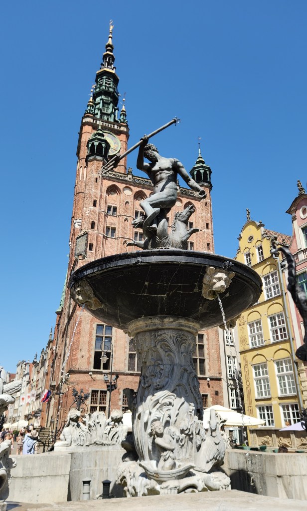
Passing through the Green Gate, we entered Long Market Street, a pedestrian plaza full of beautiful structures including the 15th-century Artus Court (a merchant’s palace), Neptune’s Fountain from the 17th century, and the Gothic-Renaissance Town Hall, which has a tall brick tower featuring a distinct spire and clock face.
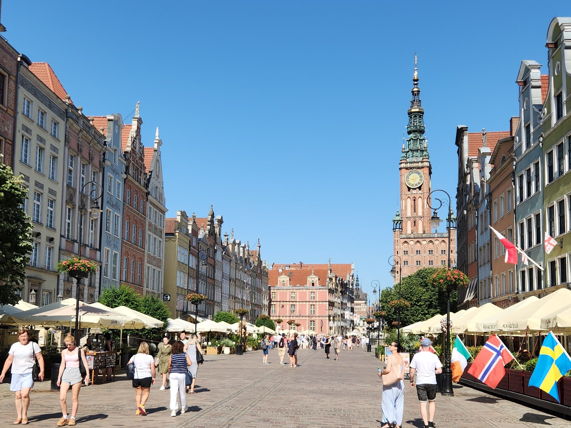
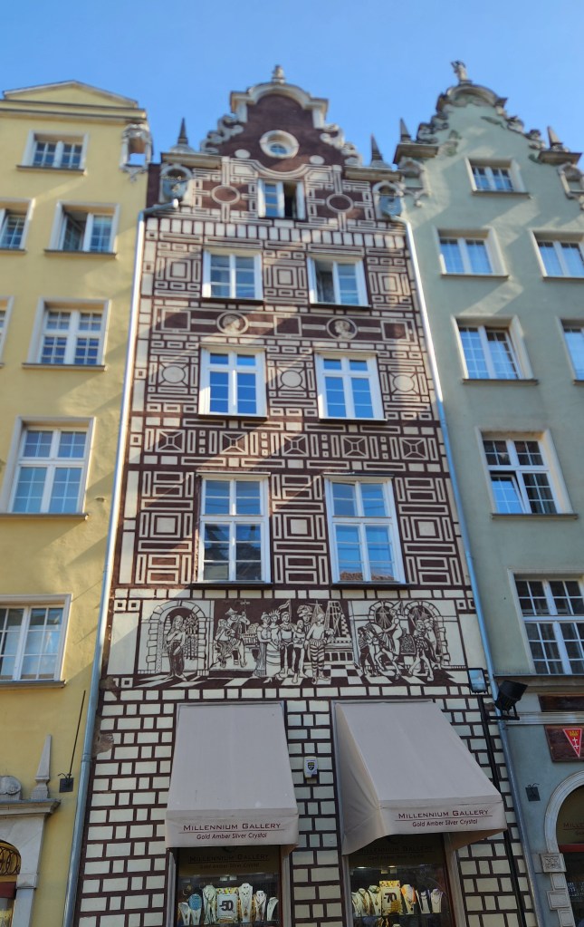
Long Market Street
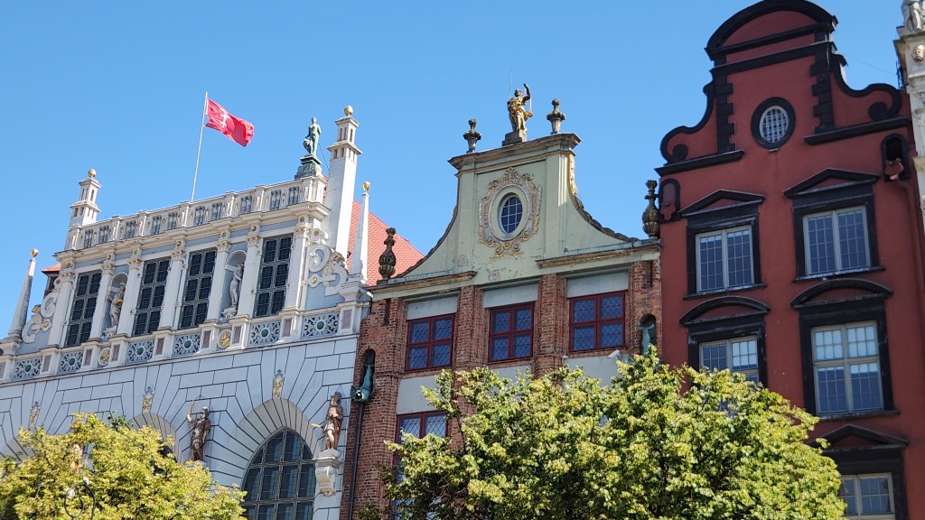
Artus Court
Neptune’s Fountain and Town Hall
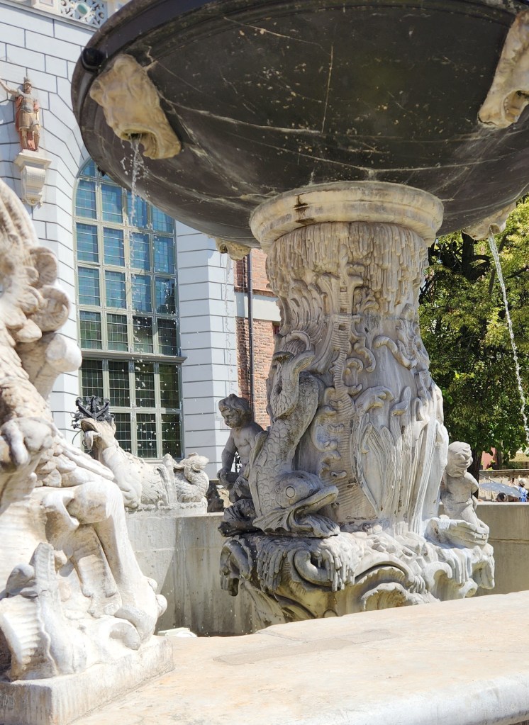
Example of Incredible Detail on Neptune’s Fountain
Buildings on Long Market Street
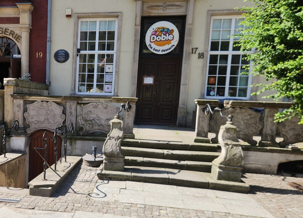
Interesting Handrails
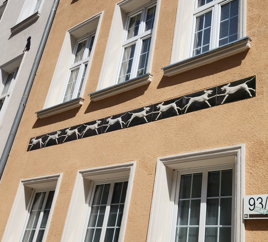
Home of a Dog Lover?

As we strolled along the street, we heard the delightful chimes of the clock tower.

Clock Tower Chimes

We also stopped to see a display case dedicated to Daniel Fahrenheit, the city resident who invented the Fahrenheit temperature scale and whose house has been preserved on a street one block away from the Long Street.
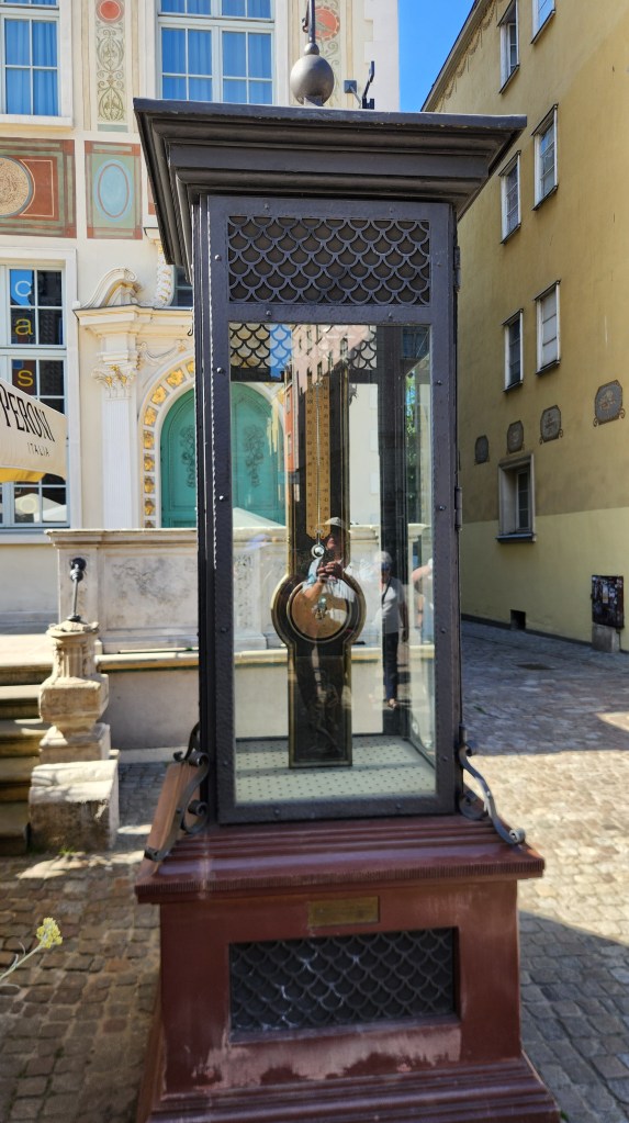
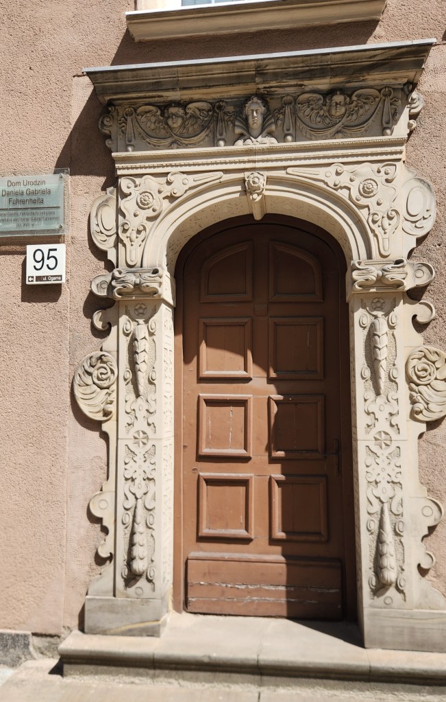
Daniel Fahrenheit Display
Fahrenheit’s Home

Next, we saw the Great Armory, built between 1600 and 1605, the finest example of Flemish Mannerist architecture in Gdansk.
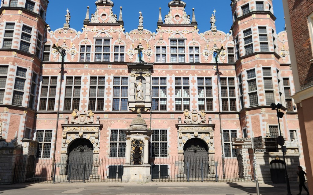
The Great Armory

After the armory, we walked back toward the river on a parallel street, where we came to the Chlebnicka Gate, a well-preserved medieval Gothic gate dating back to the 15th century. The gate is commonly called either the Bread Gate, named for the medieval bread stalls and benches that used to line the nearby street, or the Lily Gate, named for the carved lily symbol of the Dukes of Pomerania displayed on the river-facing side.
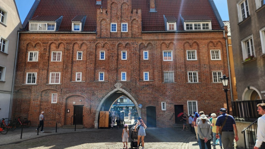
The Bread Gate, or The Lily Gate

Another famous structure near the entrance to the Long Street is the Prison Tower and Torture House, built in the 14th century as part of the Main Town’s medieval defensive walls and gate complex. It still looked foreboding to me, though no tortured prisoners are housed there anymore.
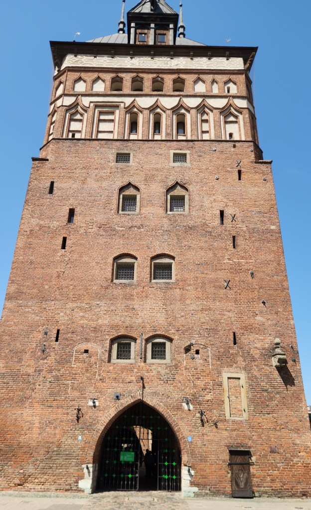
Prison Tower and Torture House

The tower once held a branch of the Gdansk Amber Museum, as the city is well-known as a supplier of amber jewelry. Rather than the museum, we stopped in a jewelry shop specializing in amber, and Pat picked up some very nice earrings. While there, we learned that the way to determine whether a purported amber item is real is to toss it in water. If it doesn’t burn or float, it’s not real.
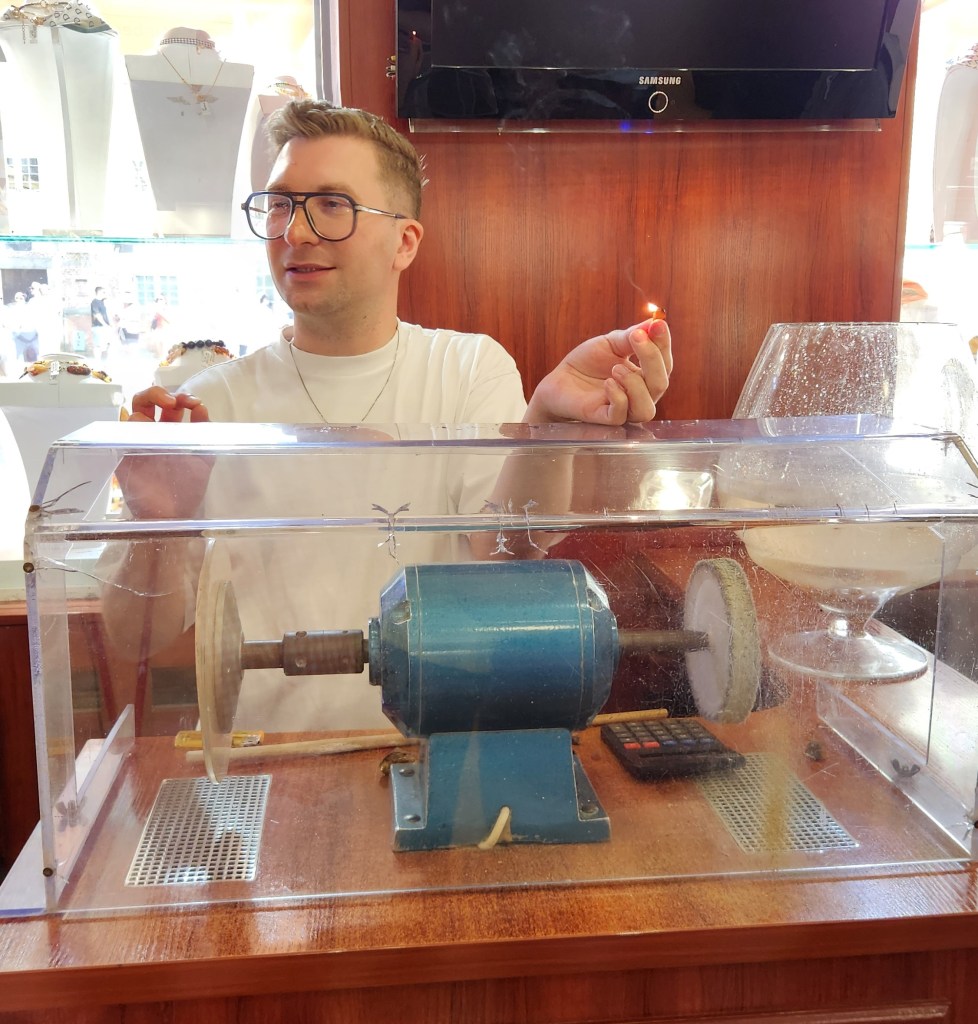
Shop Proprietor about to test for authentic amber

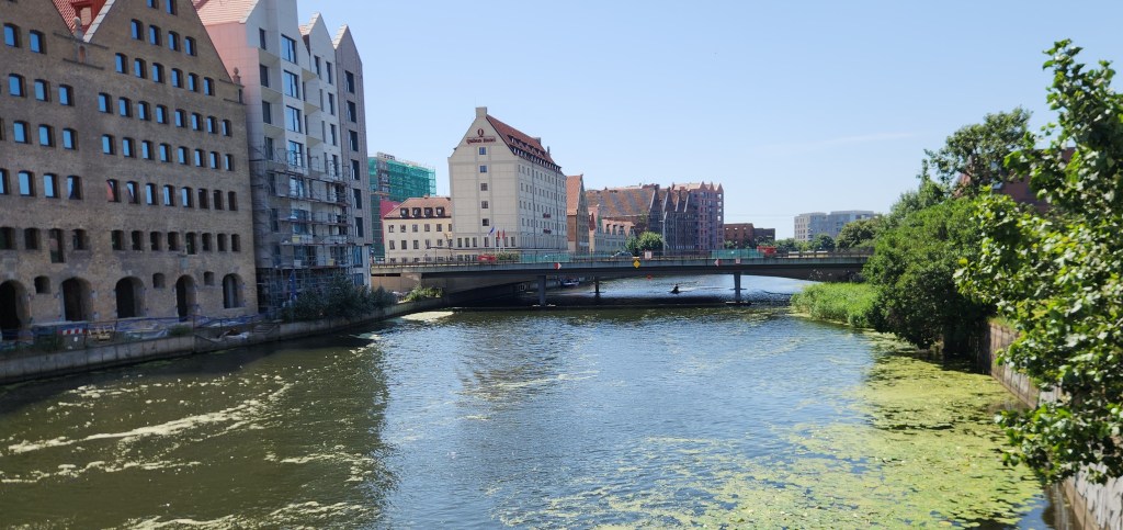
As we left the old town to get back on our bus, we passed by an impressive bank building, which now operates as a branch of BNP Paribas Bank Polska. I also got another photo of the river as we crossed a bridge departing the Old Town.
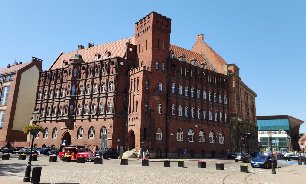
BNP Paribas Bank Polska
Last Look at the Old Town Riverfront

On the bus again, we headed for our final destination, and although we passed by several other Gdansk landmarks, the only one I managed to get a decent photo of was the railway station, built in a Renaissance Revival and baroque style with red brick and a prominent 160-foot clock tower.
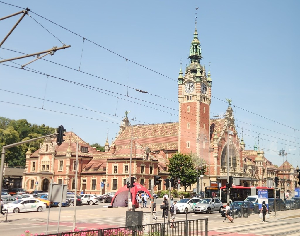
Railway Station

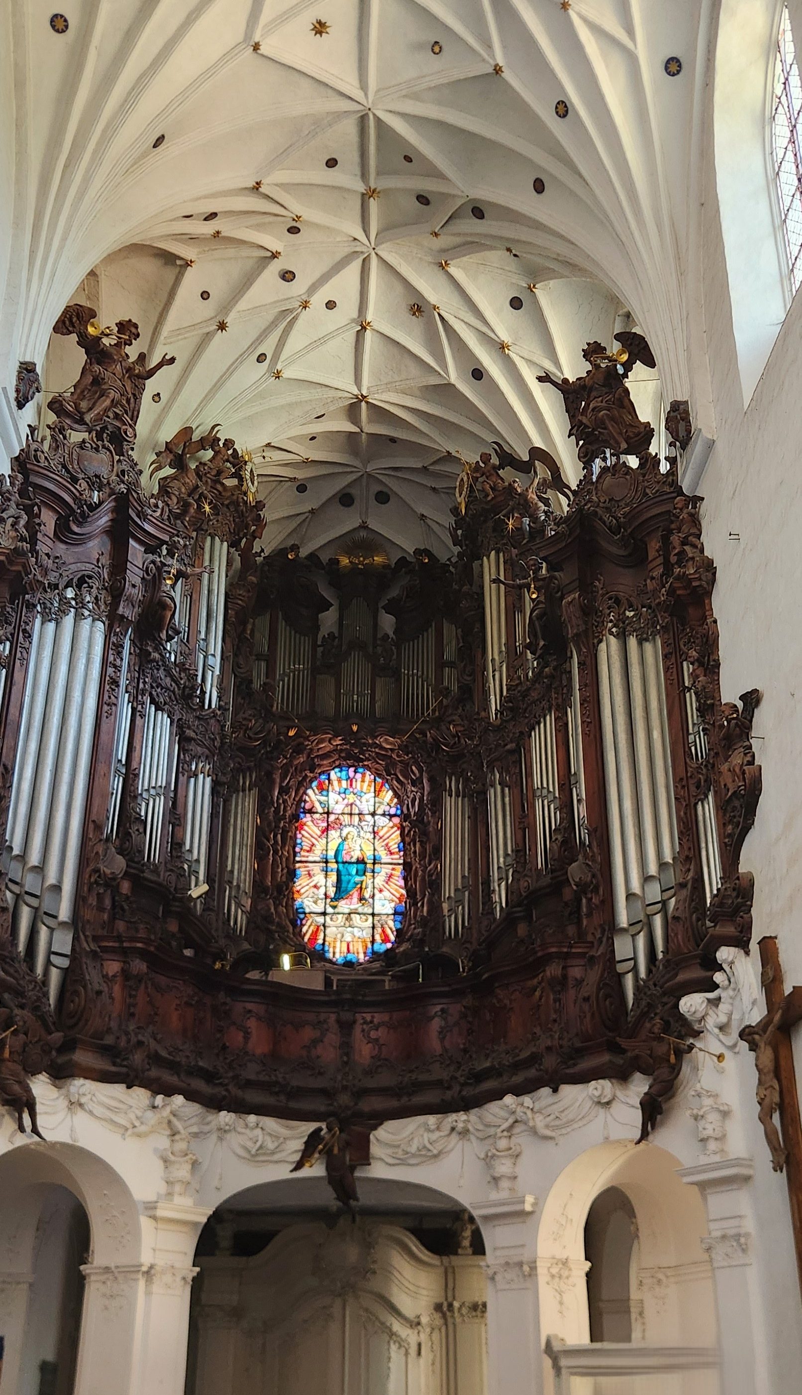
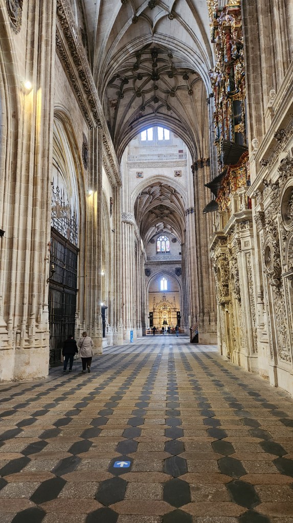
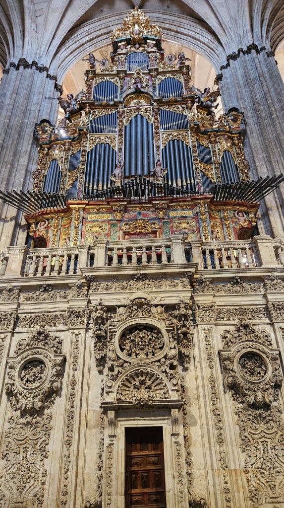
Our final visit of the day was to the Oliwa Cathedral, Poland’s longest church, completed in 1594. The church features brick Gothic architecture with Baroque and Rococo interior elements and is famous for its massive 18th-century pipe organ that features moving wooden figures and angels. After touring the church, we sat in the pews and listened to a 20-minute organ concert. Unfortunately, I was unable to capture any of the moving figures, but I’ve included a snippet from the concert anyway.
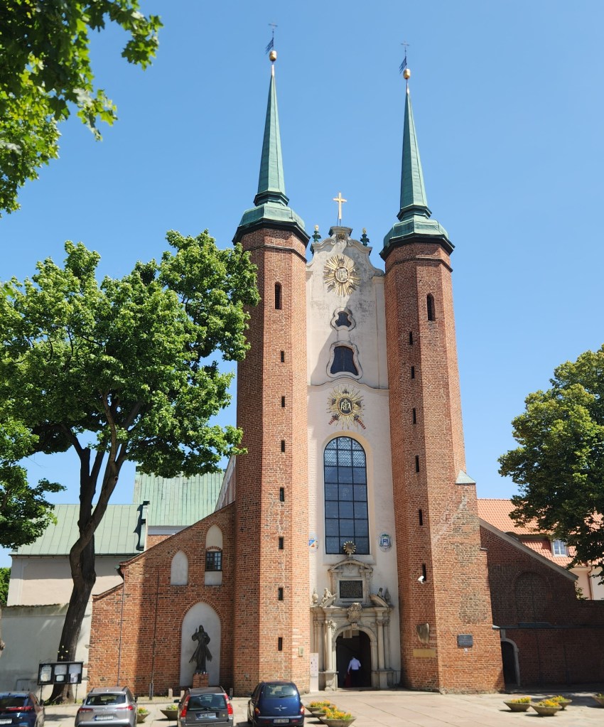
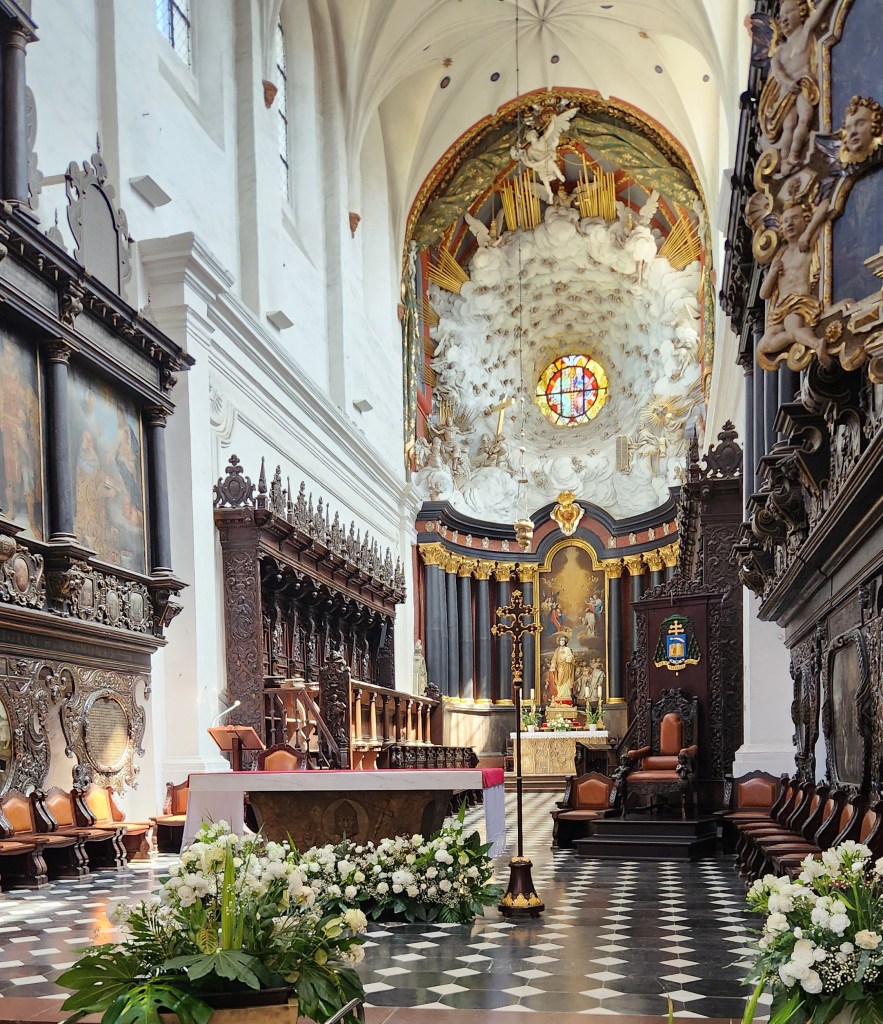
Oliwa Cathedral
Oliwa Cathedral
The Organ
The Organ Recital

Heading back to the sip, I tried to get a photo as we passed by the Lenin Shipyard, where Lech Walesa led the worker’s protest that eventually led to the fall of Poland’s USSR-supported communist regime in 1989, but I never got an unobstructed view. Back on the ship again, we sailed off in the evening toward Estonia.

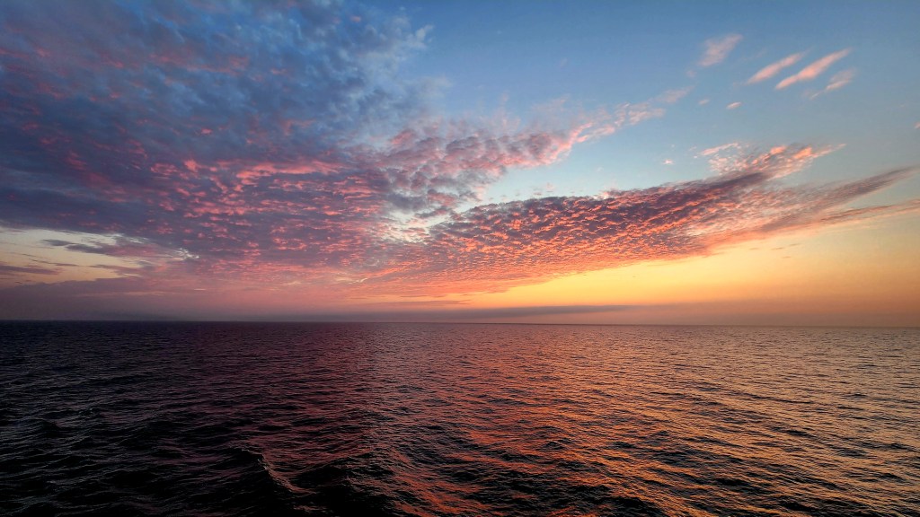
Sailing the Baltic Sea (Sunday, June 28, 2026): As you can see from the map above, the journey from Gdansk to Tallinn was the longest segment of the trip – so long, in fact, that we spent all day Sunday sailing. We enjoyed loafing about on the ship, watching the sea pass by as we reached sunset, and even took in one of the many on-board entertainment events, a British singer channeling the great divas of pop.
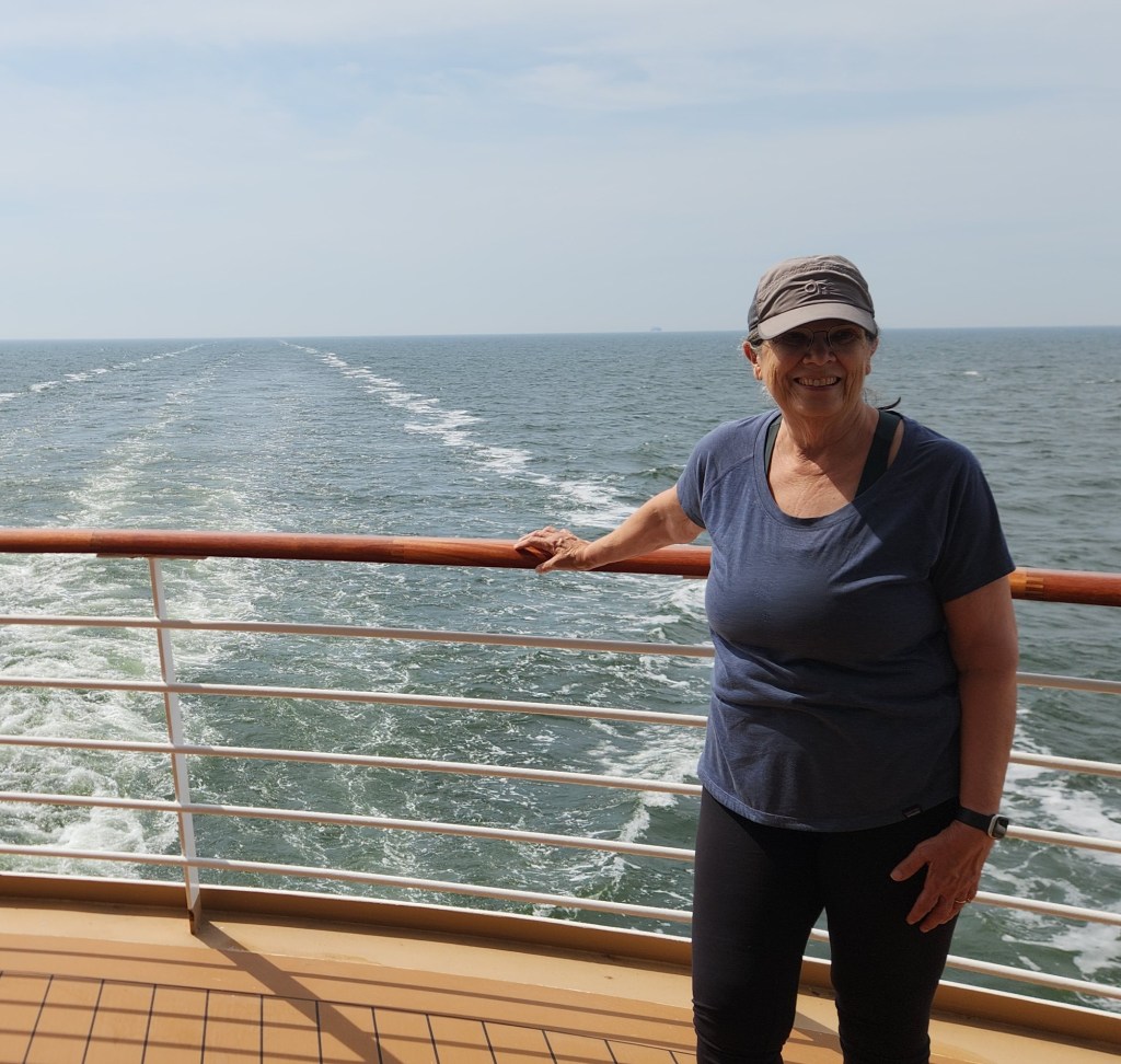
Sailing, sailing, over the open sea …
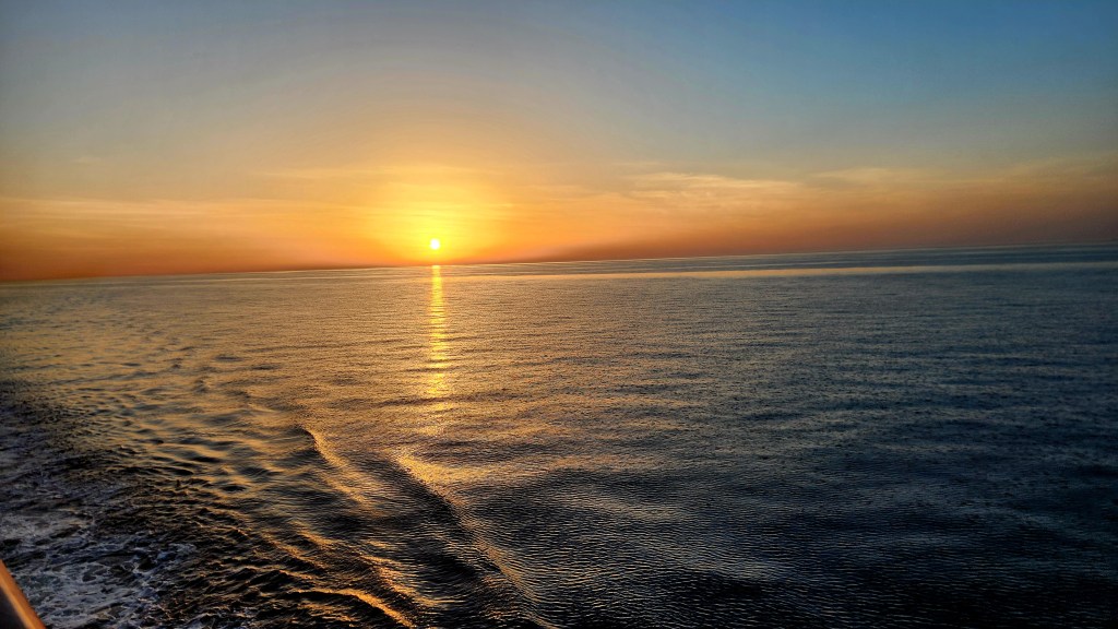
… and leaving the sunset behind
One of the Entertainments Aboard the Viking Sky

As we retired after the restful day, we were eager to get off the ship at our next interesting place.

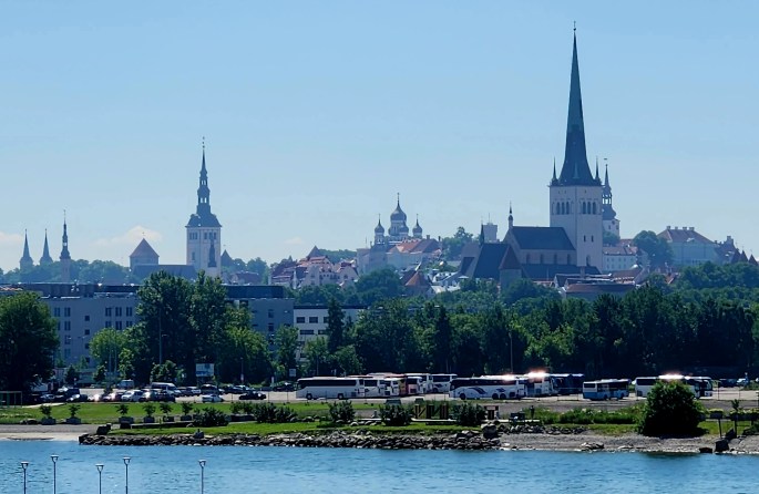
Tallinn, Estonia (Monday, June 29, 2026): The ship docked at the Tallinn Old City Harbor Cruise Terminal at 7 AM on Monday, and I got a nice photo of the Old City from our stateroom balcony.
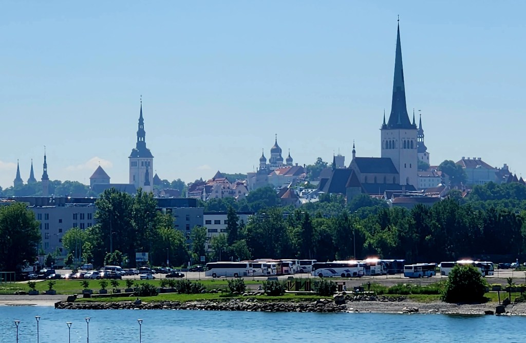
View of Tallinn from our Stateroom Balcony

I later learned that the photo had captured a number of historic landmarks: St. Olaf’s Church is the tall, needle-like gothic spire on the right side of the skyline, historically one of the highest structures in the world; St. Nicholas’s Church is the distinct slender tower with a baroque spire located towards the left-middle; and Alexander Nevsky Cathedral has the characteristic Russian Revival onion domes rising near the center of the horizon behind the trees.

After breakfast, we were off for the day’s tour of Old Town Tallinn. As we walked to the bus parking are, we passed by some interestingly shaped concrete structures piled along the oceanfront. The most loyal readers of my blogs may recognize that these are similar to those used in Crescent City, CA – tetrapods, designed by the US Army Corps of Engineers in the 1950s to serve as protection against heavy ocean waves – that I reported on in an earlier travelogue: Pat and Dave’s West Coast Wayfaring – PART 2: Points of Interest.
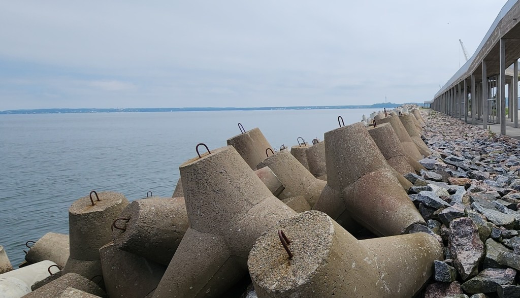
Concrete Structures to Protect the Wharf from Heavy Sea Waves

Tallinn is the capital of Estonia, and its well-preserved old town, a UNESCO World Heritage Site, is surrounded by a ring of 17th-century historic walls that were built to protect the city from invaders. Our bus dropped us off just outside the walls, and we proceeded with or guide to tour the Old Town. On our way, we passed by a stone fountain and the “Woman with a Basin” sculpture located in the Towers’ Square Park.
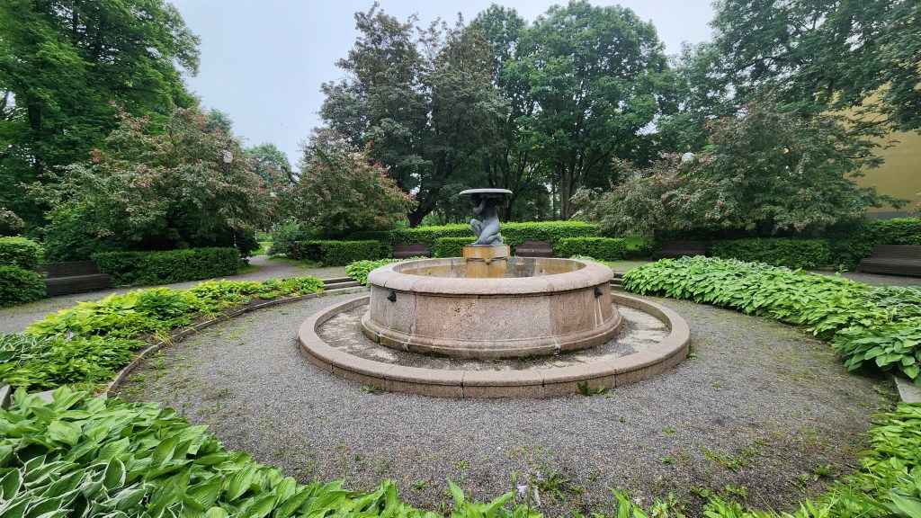
Fountain in Towers’ Square Park

The old walls have been preserved and fitted with walkways which probably provide some fantastic views, but they are not open to the public.
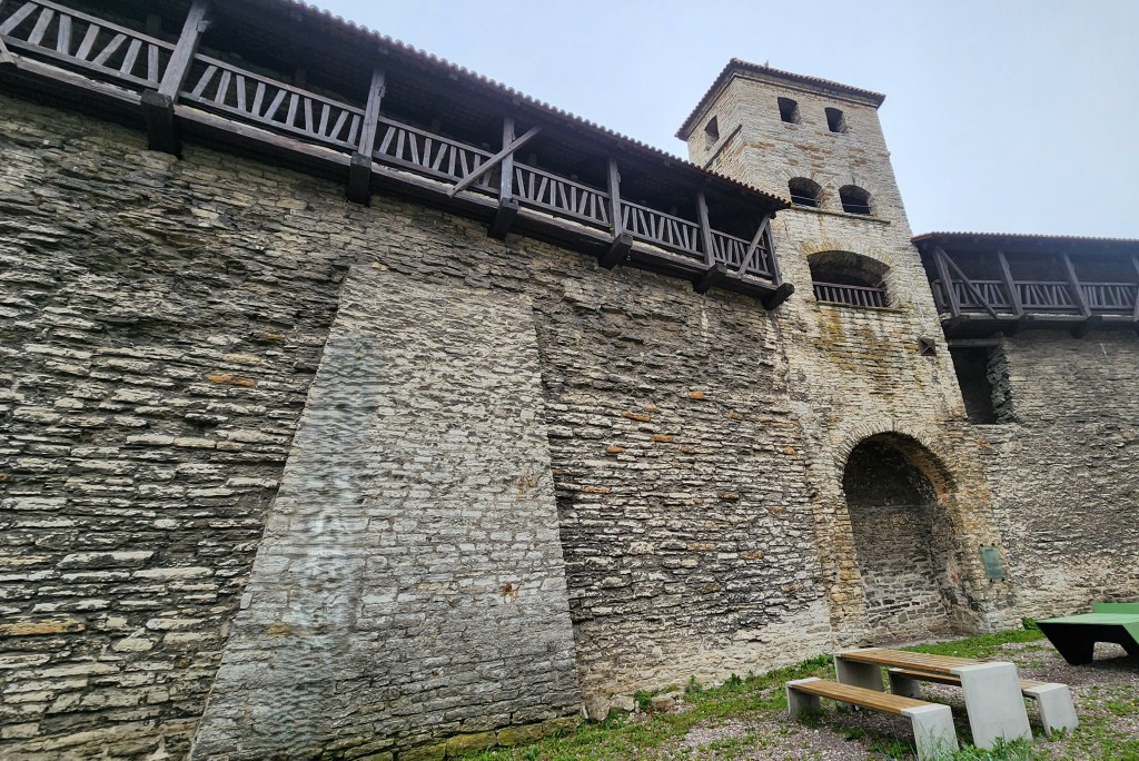
Tallinn Old Town Walls

Once inside the walls, we began our tour in the upper part of town. Our guide pointed out the different cobblestones: The roundish ones are from the 13th century, before stone cutting was practical, and the flatter ones are from the 16th century. As you can see, they have been very well maintained.
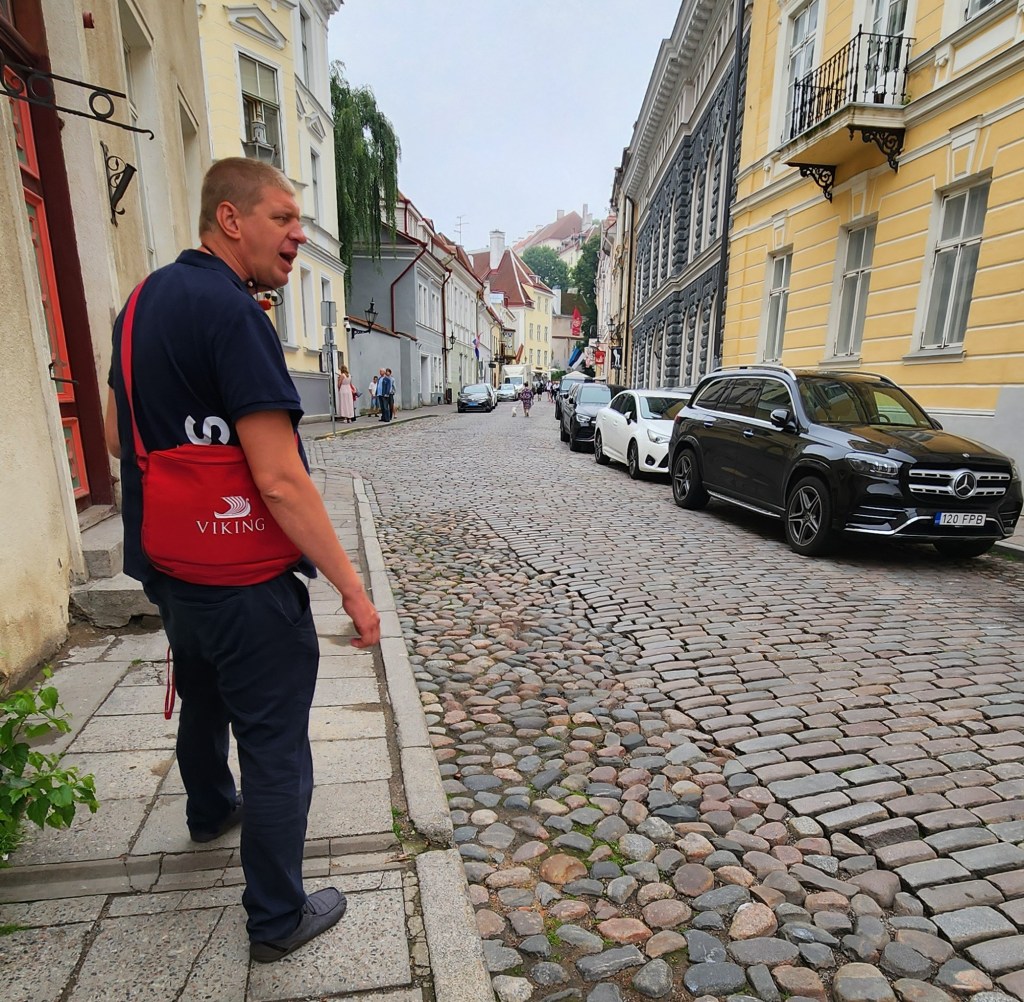
Walking Tour of Tallinn Old Town

ASIDE: The guide also told us some very interesting stories about recent Estonian history. Estonia first became independent of Russia in 1918, but was then annexed as one of the Soviet Socialist Republics. Independence from the USSR came on August 20, 1991, following decades of peaceful resistance in Estonia. The protests are now known as the Singing Revolution due to spontaneous night-singing demonstrations in Tallinn as well as a massive 1988 gathering of 300,000 people at the Song Festival Grounds and a historic 1989 Baltic Way human chain which stretched across the entire country. However, prior to 1991, under Soviet rule, foreign travel was strictly controlled and monitored. One requirement was that a traveler could not bring anything back to Estonia that they did not take with them when they left. Our guide’s mother once traveled to the US, bringing with her and declaring two toy pianos that she had labelled “Yamaha” with paste-on letters. When she returned with two actual Yamaha pianos, the customs inspectors were fooled by her exit declaration ad allowed the pianos in. Talk about ingenious and daring!

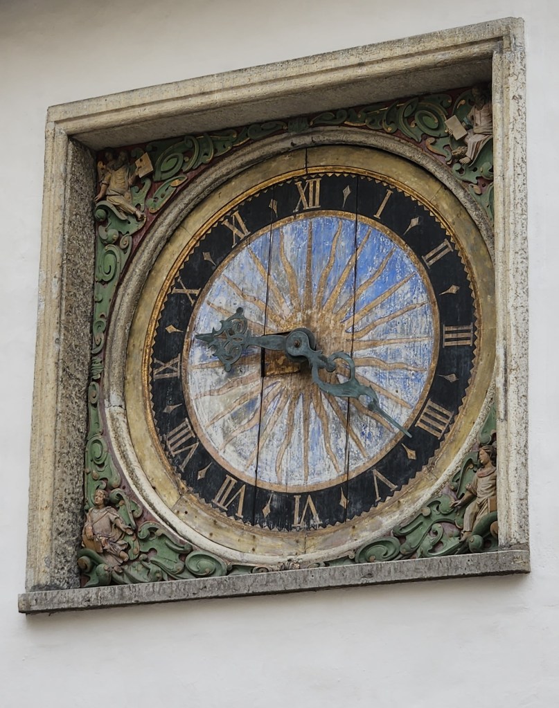
Anyway, back to the tour. We passed by the Church of the Holy Ghost, which included a famous clock face, built in the 17th century, the oldest public clock in Tallinn. It features a hand-carved wooden dial with a striking blue and gold sunburst motif and traditional Roman numerals.
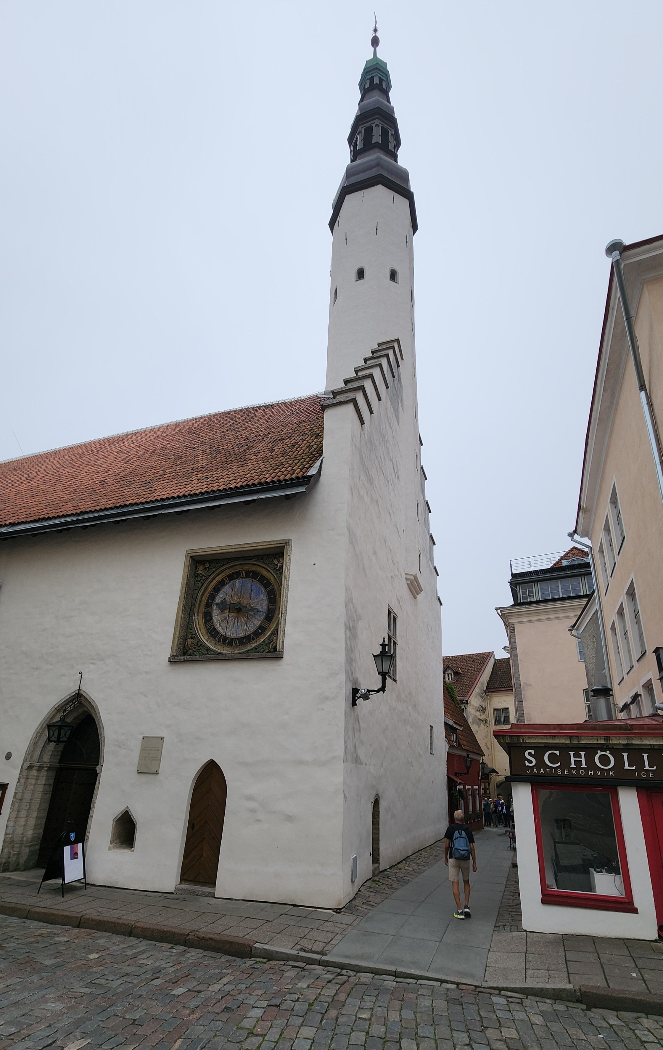
Church of the Holy Ghost
The Church Clock Face

Next came the Gothic-style Tallinn Town Hall, completed in 1404. It is the oldest surviving town hall in Scandinavia and the Baltic Sea region.
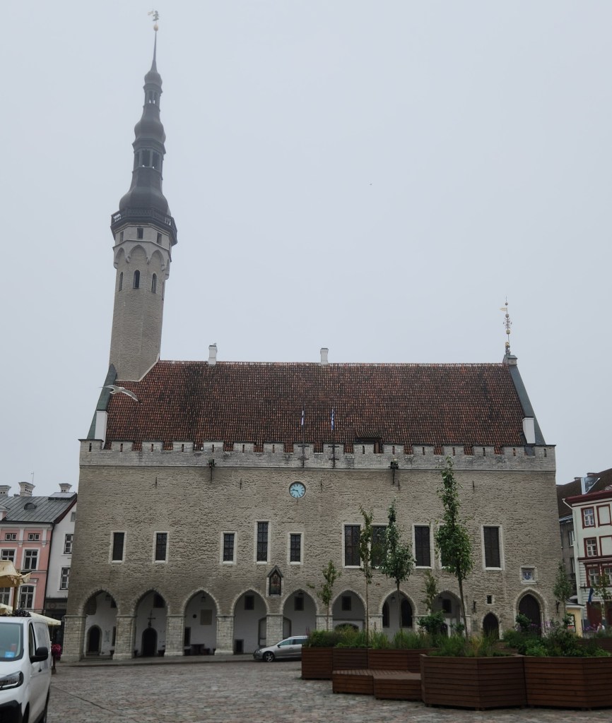
Tallinn Town Hall

Adjacent to the Town Hall is the appropriately named Town Hall Square, with many merchant kiosks and restaurants. It was also set up with temporary wooden planters and integrated benches designed to bring greenery and public seating into the historic square.
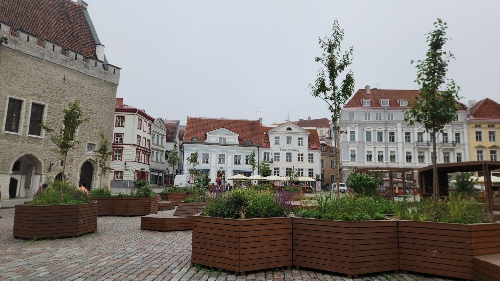
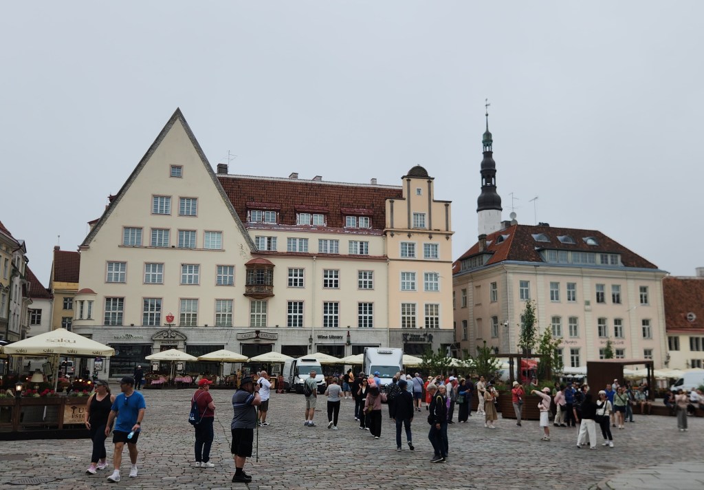
Town Hall Square
Town Hall Square

The Town Hall Pharmacy is one of the oldest continuously operating pharmacies in Europe, having been in operation since at least 1422. The pharmacy features a museum room displaying medieval and early modern medical instruments, drugs, and historical documents.
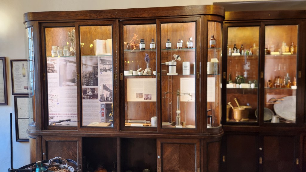
Tow Hall Pharmacy

I was impressed to see that the proprietors of one business in the square were not shy about expressing their opinion of the Russian invasion of Ukraine.
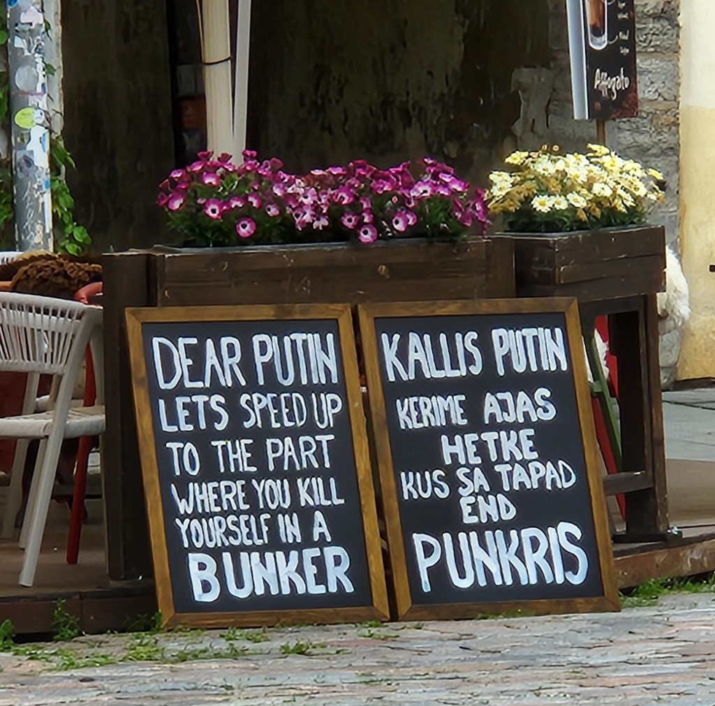
Not the nicest thought, but I surely agree with the sentiment

Pat also met a new friend in the square and had a brief chat about world affairs.
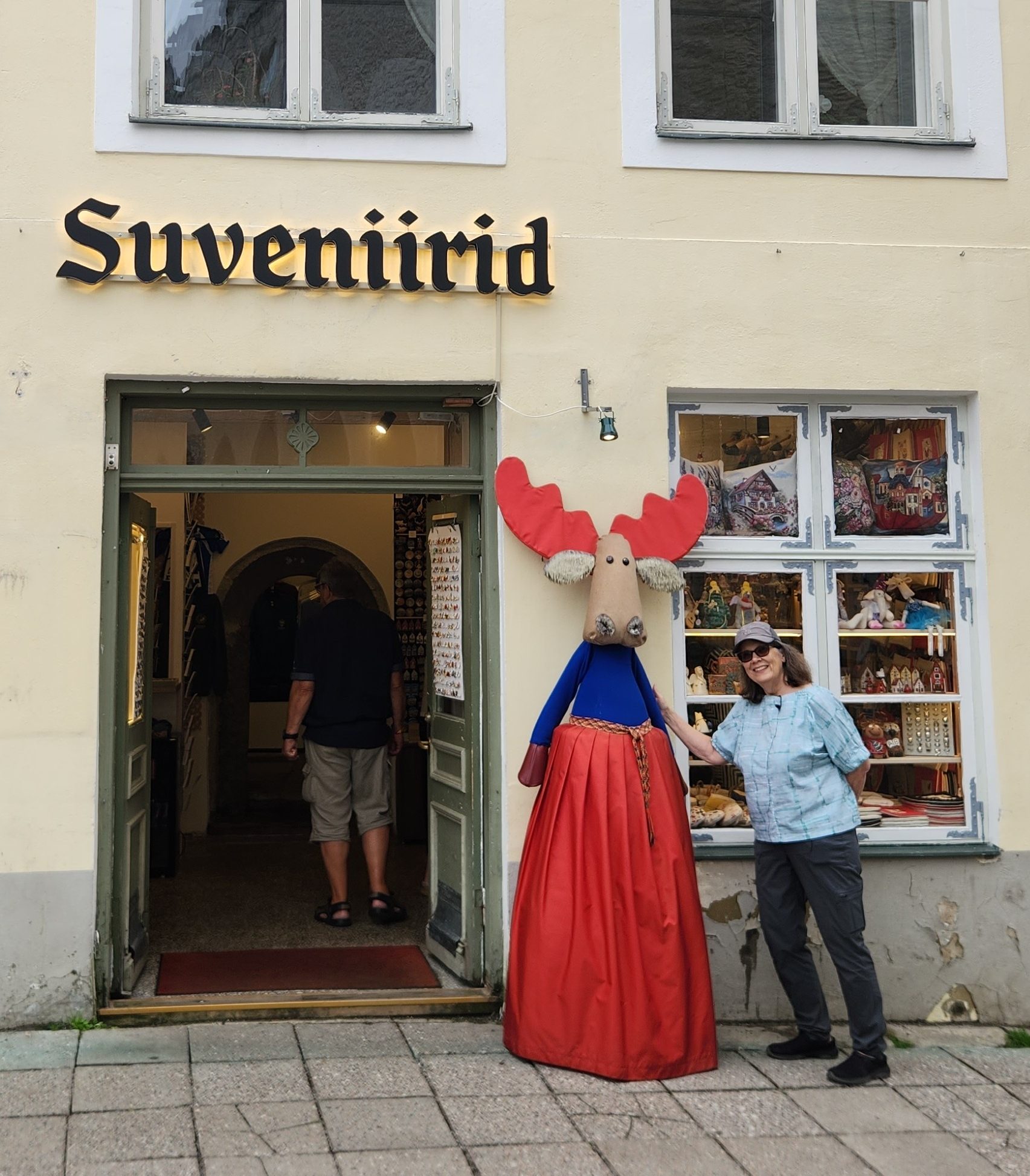
Friendly Conversation

Another well-known place near the square is the Olde Hansa restaurant, a popular medieval-themed restaurant designed to recreate a 15th-century Hanseatic merchant house experience, featuring staff in period costumes and traditional recipes.
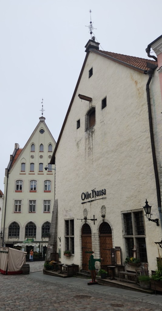
The Olde Hansa Reataurant

From the square, we passed along a courtyard passage known as “The Path of History.” This paved walkway features dates and key events from Estonian history etched directly into the stone.
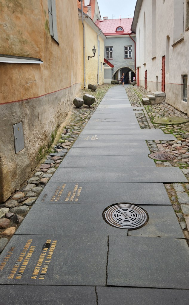
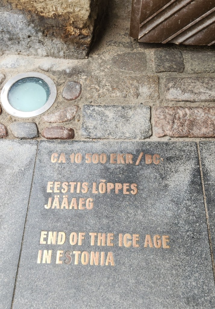
The Path of History
Key Event along the Path of History

We emerged onto St. Catherine’s Passage, which includes a display of ancient 14th- to 15th-century limestone tombstones mounted on the stone wall. These grave markers were collected from the ruins of the adjacent medieval St. Catherine’s Dominican Monastery, which dates back to the 13th century.
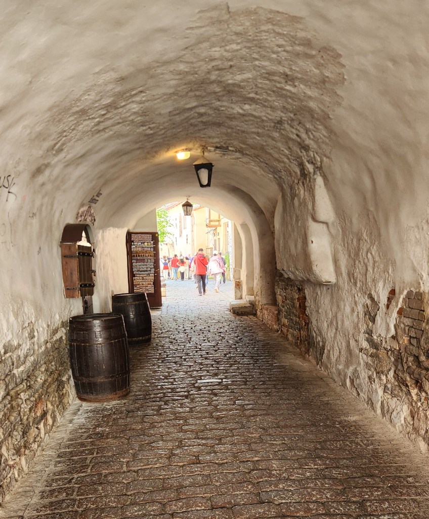
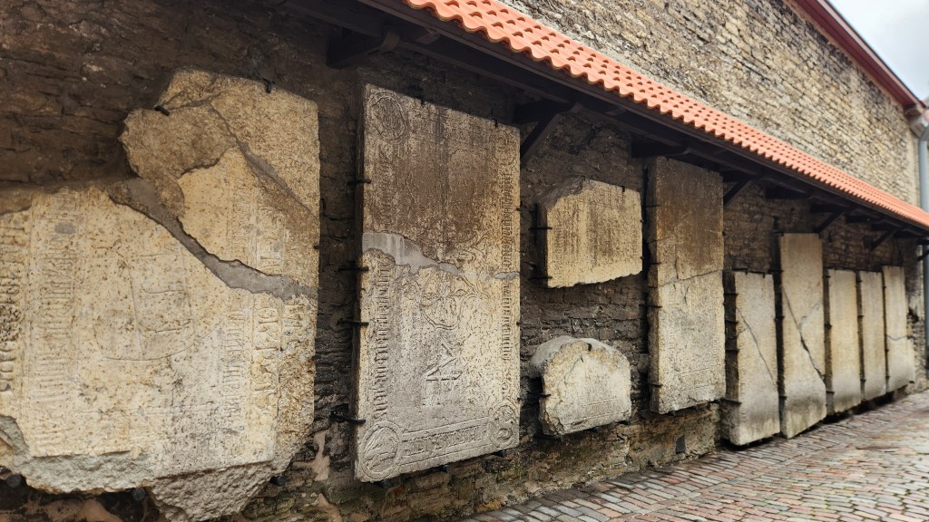
St. Catherine’s Passage
14th- to 15th-Century Tombstones

After St. Catherine’s Passage, we moved through the lower part of the Old Town, filled with shops and merchant guilds, including one of the earliest guilds formed by and for women.
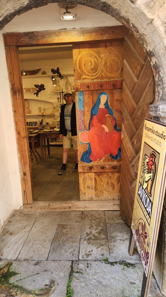
Women’s Craft Guild Building

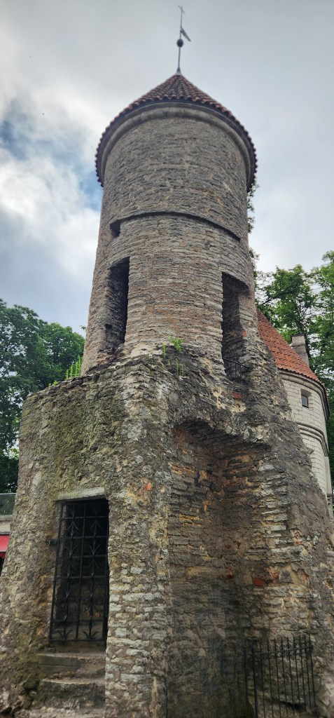
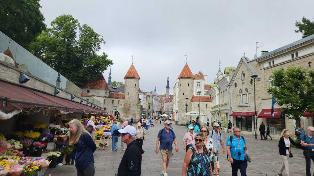
Next, we walked along the fortification walls to the historic Viru Gate, a famous pair of 14th-century stone defense towers serving as an eastern entrance to the UNESCO-listed Old Town. The vibrant outdoor Tallinn Flower Market sits just outside the stone towers.
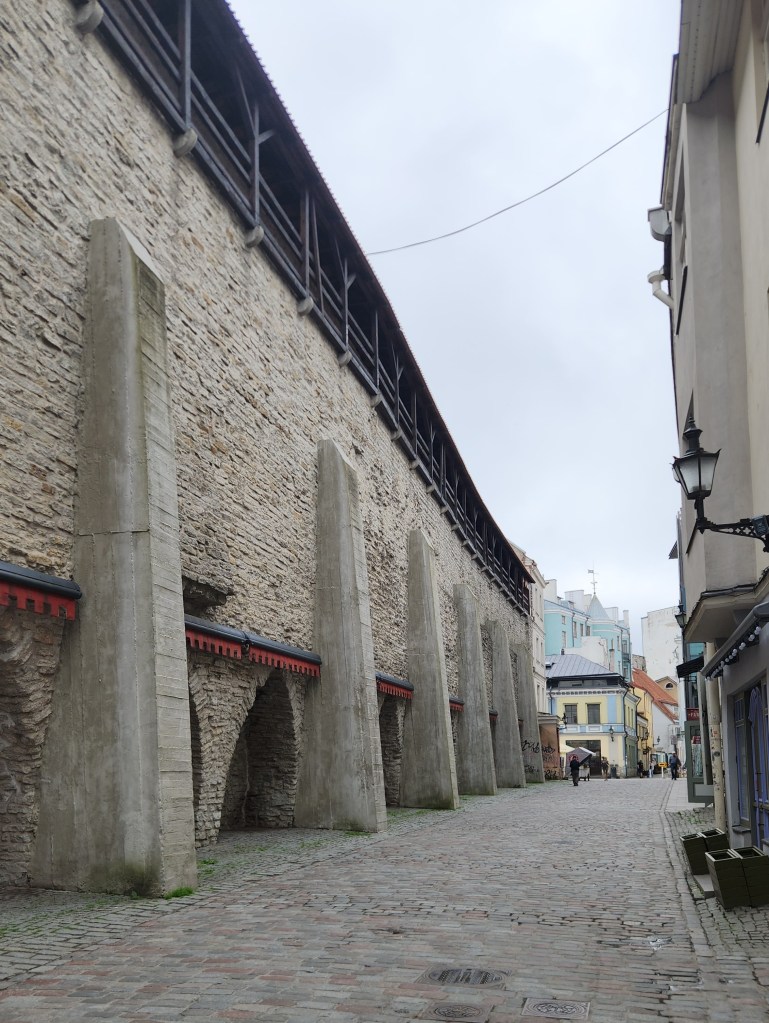
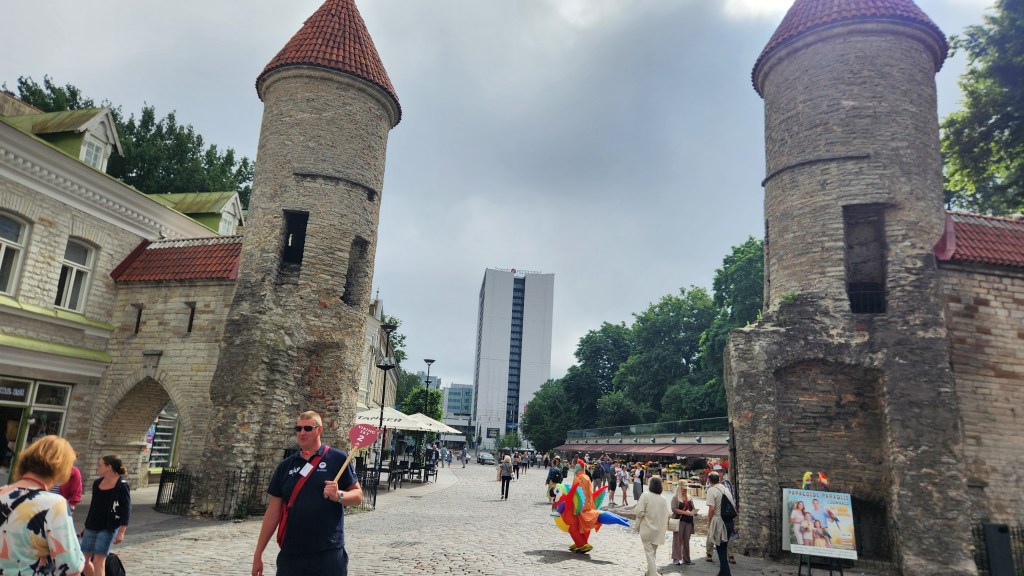
Route by the Old Town Walls
Viru Gate and Flower Market
One of the Viru Gate Towers
Flower Market and Viru Gate

After touring the old town, we had some free time, so we stopped for a coffee and a hot chocolate at an open-air restaurant. We could have stopped at a nearby world-famous famous restaurant, but we opted to pass on that one.
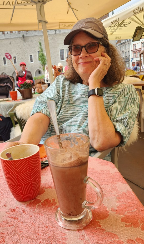
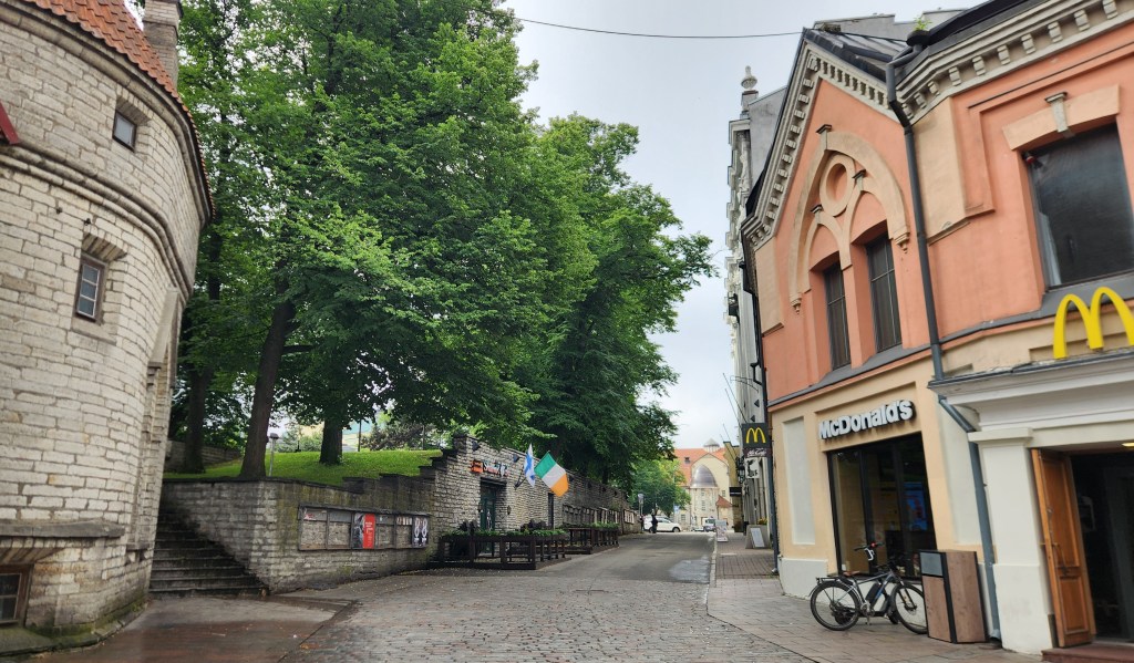
Restaurant in Old Town Square
The Old and the New …

Another place that caught my eye, and my breath, as a notably introverted Finnlander, was this Finnish karaoke bar. I had a hard time imagining any Finnlanders that I know being gregarious enough to do karaoke, but there must be some!
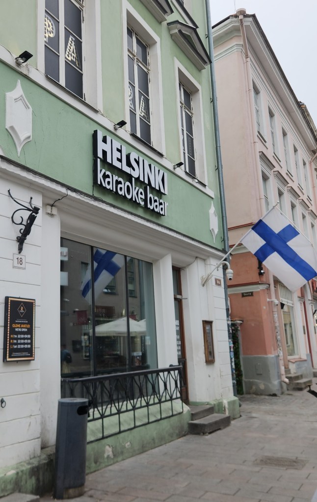
Finnish Karaoke!!??

Speaking of Finnlanders …

We had some time to speak one-on-one with our guide during the free time. His English was excellent, but he spoke with the exact same accent I’ve heard from many Finnish-American acquaintances. I asked how similar the Estonian language is to Finnish, which was my parents’ native language that I never managed to learn. While both languages are in the same group (Finno-Ugric) and share core vocabulary and grammar rules such as lacking prepositions and grammatical gender, he told us they differ significantly in sound systems, and have many words that sound the same but have very different meanings. He said he can understand simple phrases in Finnish, but anything complicated leaves him without a clue.

As a final photo from Tallinn, here’s an area that was used for the boating competitions in the 1980 Moscow Olympics.
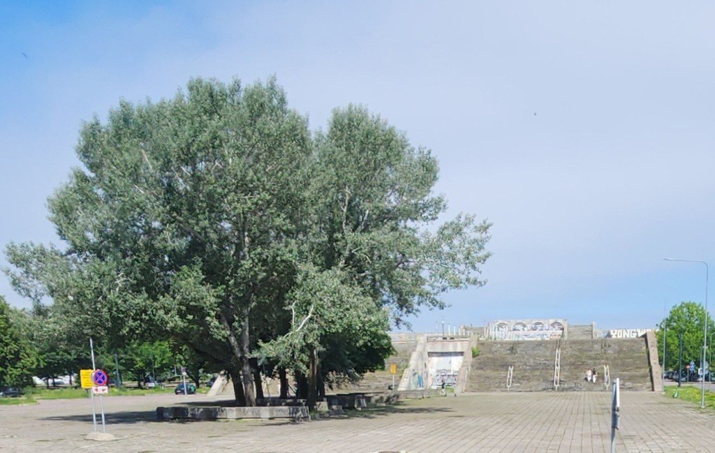
Site of Boating Competitions for 1980 Olympics

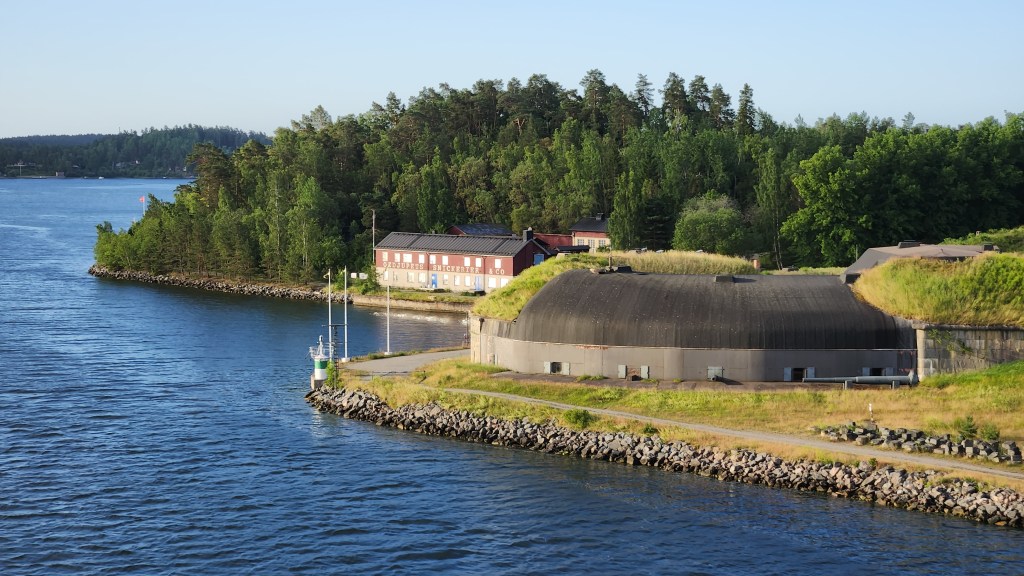
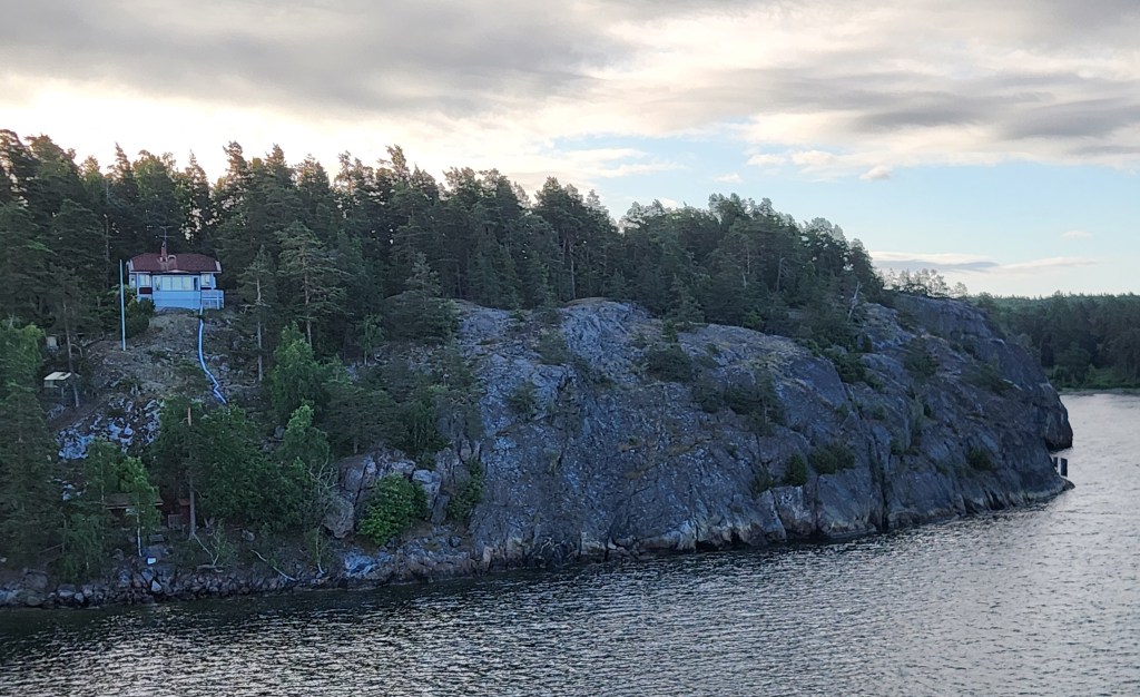
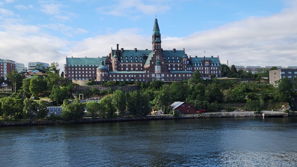
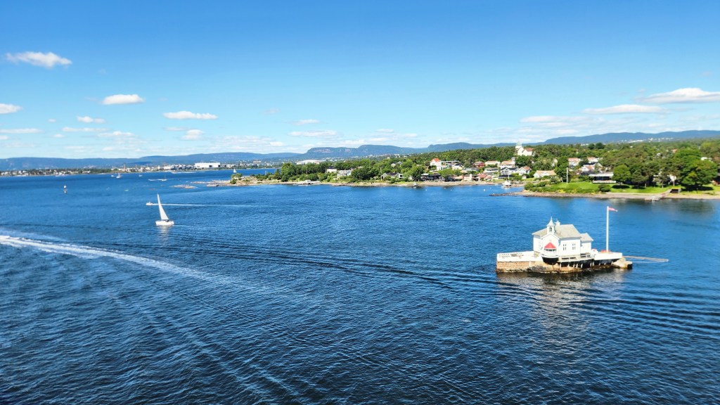
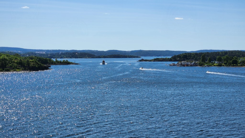
Stockholm, Sweden (Tuesday, June 30, 2026): Stockholm is situated within an archipelago containing the incredible number of 30,000 islands. Since the ship began passing through the archipelago early Tuesday morning, I got up at 5 AM to take photos. Here are some worth sharing:
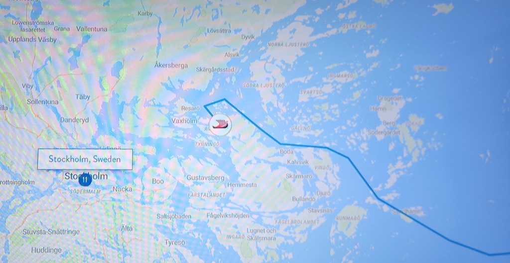
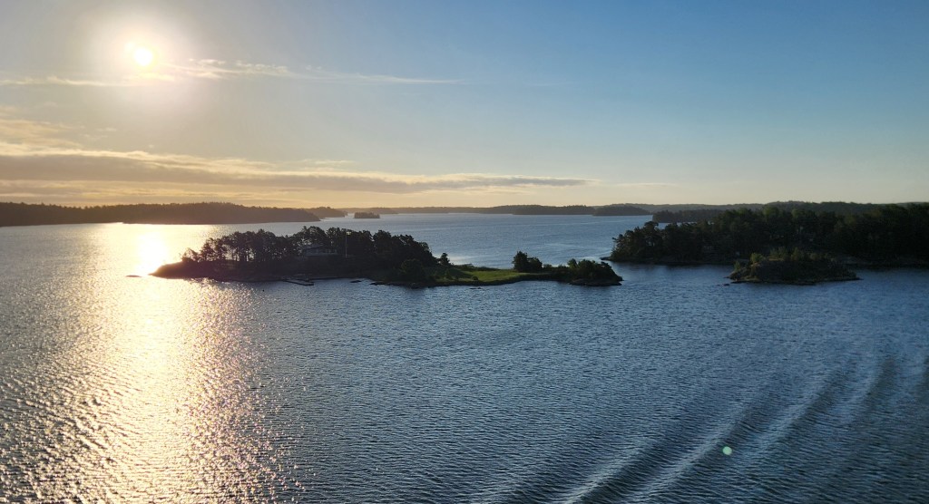
We Sailed Through the Stockholm Archipelago with its 30,000 Islands
Islands in the Stockholm Archipelago
Interesting Buildings in the Stockholm Archipelago
These Rocks are Very Similar to those on Minnesota’s North Shore of Lake Superior
Danvikshem, a monumental historic building located on Finnbodaberget in Nacka, just east of Stockholm

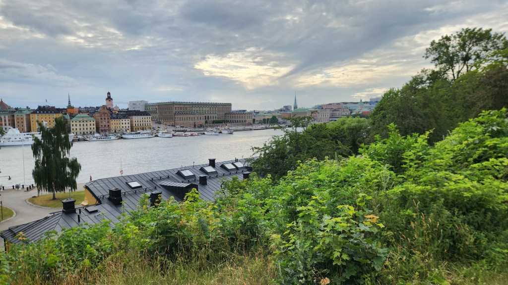
We docked at the pier at 8 AM and were soon off for a busy day of touring by bus and on foot. Our first stop was on a hill just above the ship’s location on the pier, providing a good look at the city. We learned that Stockholm extends over 14 islands linked by 57 bridges. Within the city, water from the freshwater Lake Mälaren flows into the Baltic Sea, and a lock system allows boat traffic into and out of the lake. The first, 5-foot-high lock was built in 1642, and has been periodically rebuilt many times to accommodate shipping needs. In addition, since the land is still rising after being pressed down by massive glaciers that once covered the area, the locks must be rebuilt every century or so to accommodate the increased height of the lake above the sea.
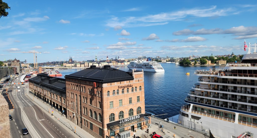
View of Stockholm (with Viking Sky to the right)

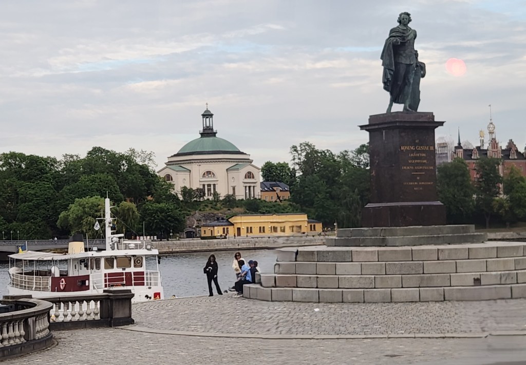
The bus then took us to Gamla Stan, the old town of Stockholm, which sits primarily on the island of Stadsholmen. The old town was founded in 1252 and is the oldest section of the city. The tour began at the Stockholm Palace, the official residence and major royal palace of the Swedish monarch.
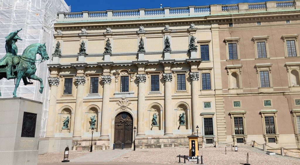
Stockholm Palace and Statue of King Charles Gustav

We then strolled the narrow, cobblestone streets to Stortorget, a historic square surrounded by old merchant homes built in the North German style.
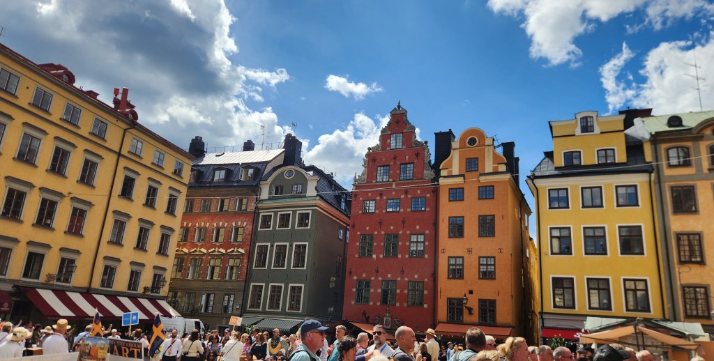
Stortorget Square

Near the square is the Finnish Church, a small, simple structure with a small, simple statue in its front yard. I managed to get a picture of the statue, but not one of the church, which was quite unremarkable anyway.
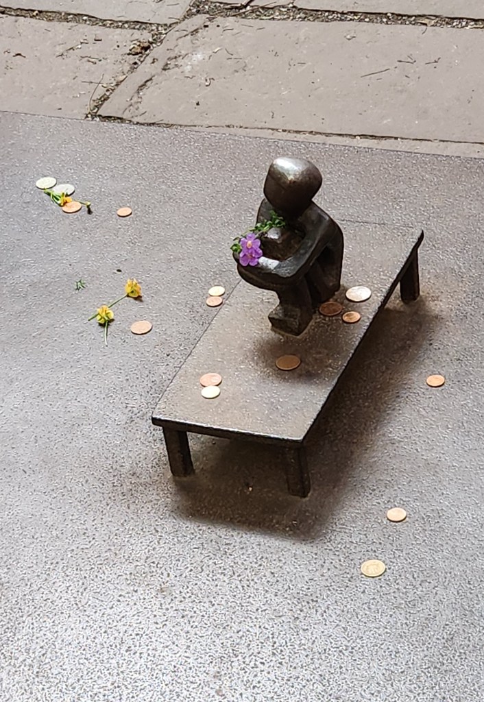
The Smallest Public Statue I’ve Ever Seen

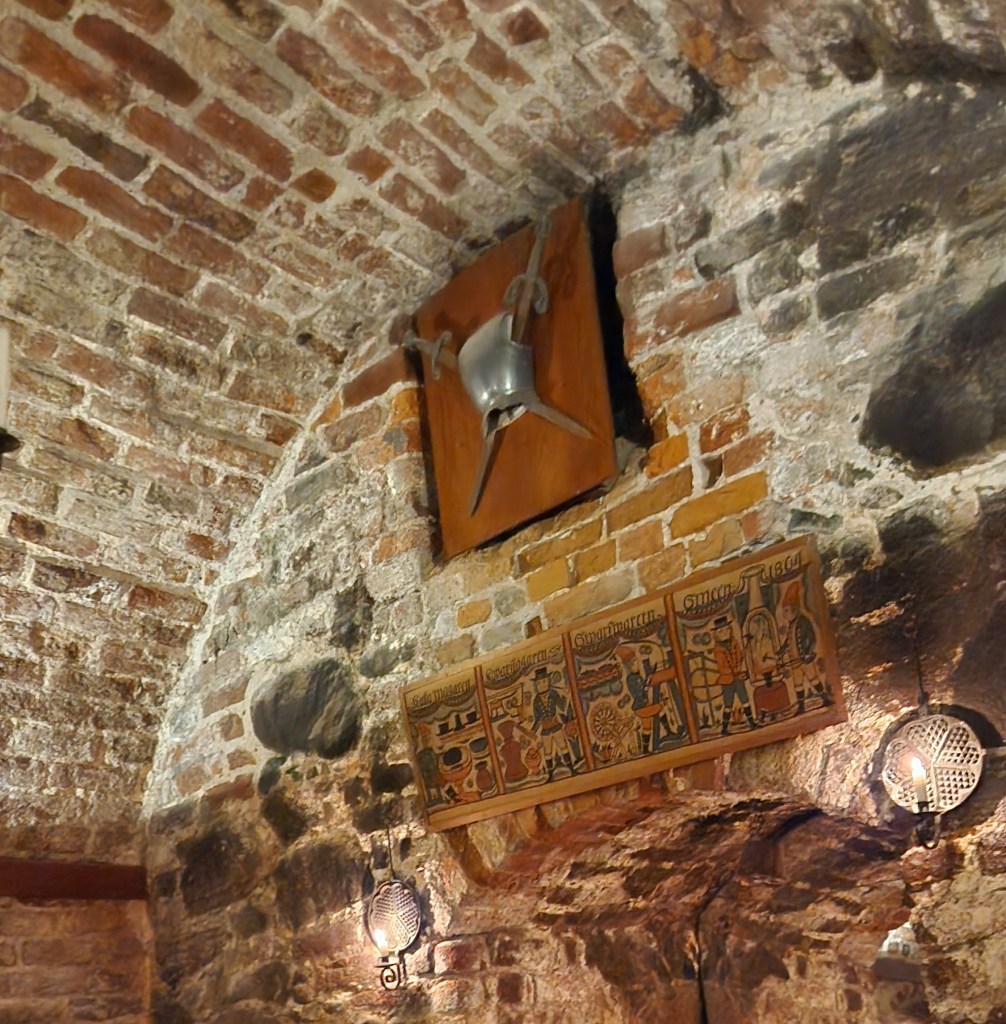
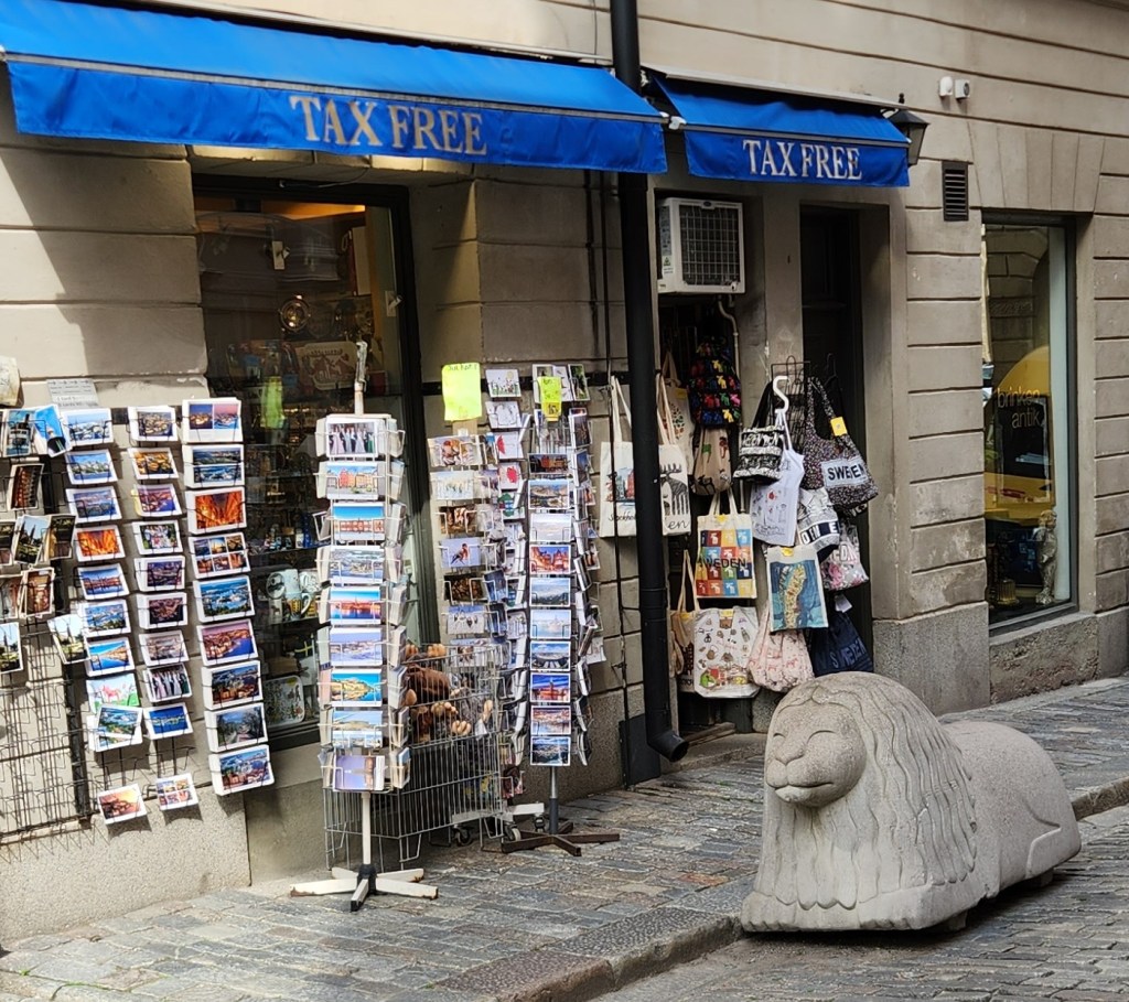
Along the way, we stopped at a restaurant that felt like a throwback to a previous century for a mid-morning snack.
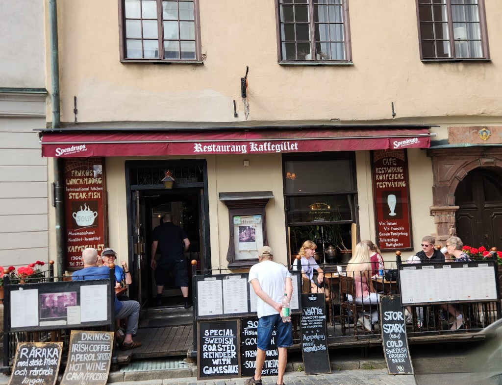
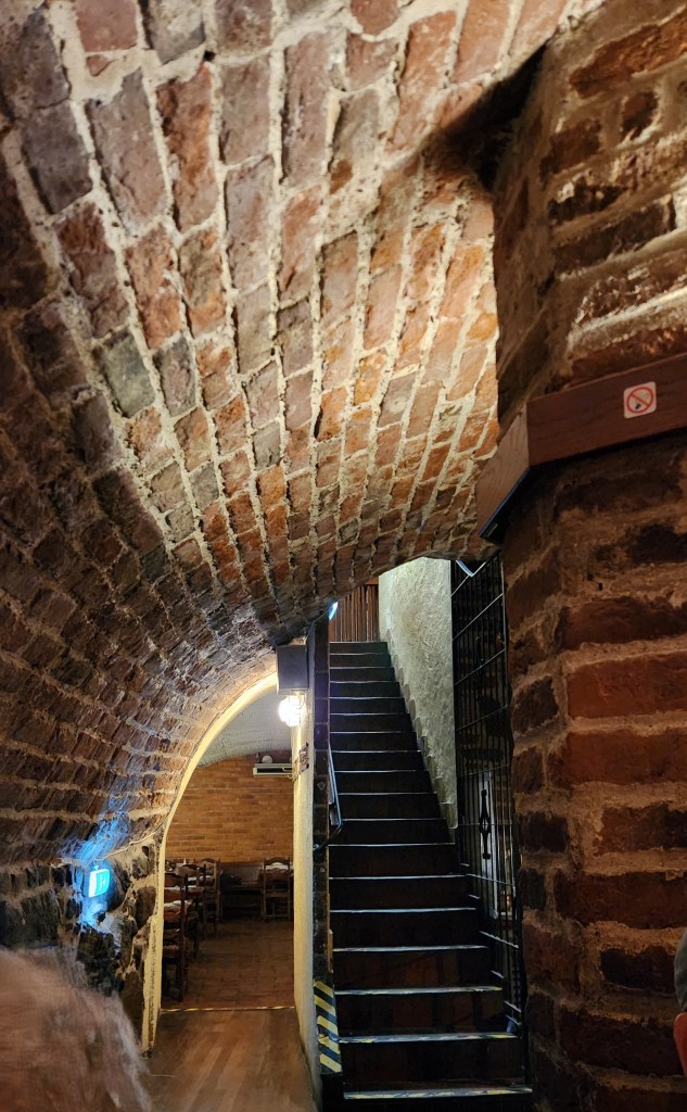
Looks fairly modern from the outside …
… but not inside!
Another Photo Inside the Restaurant
Interesting Street Statue near the Restaurant
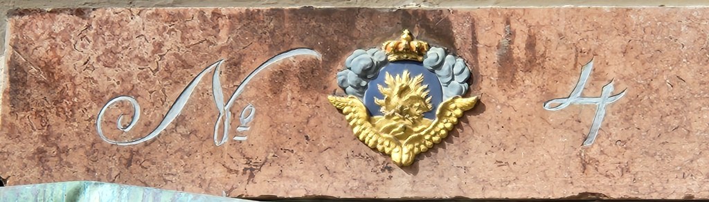
A Decorative Building Number

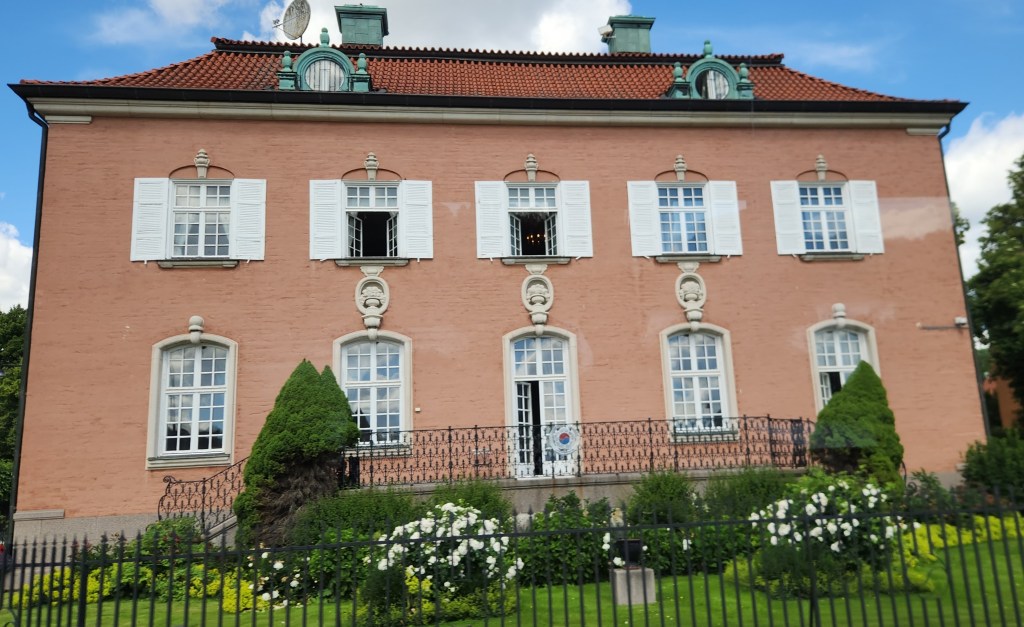
Our bus took us into a less bustling the part of Stockholm around Lake Mälaren and through the Diplomatstaden, or “Embassy Row.” We saw several intersting buildings before being dropped off at the Stockholm City Hall.
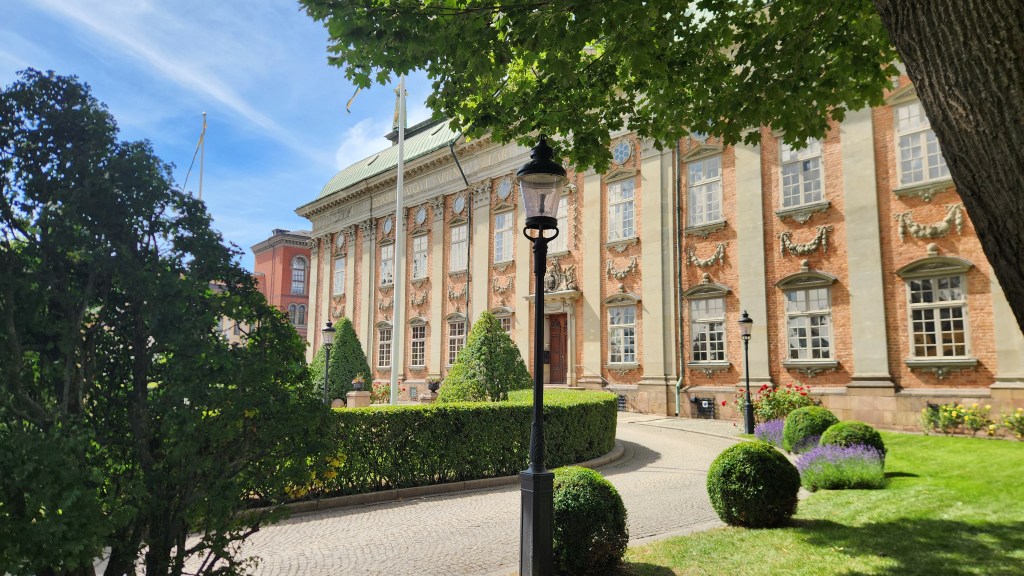
The House of Nobility (Riddarhuset), a historic 17th-century baroque palace
Republic of Korea Embassy in Stockholm’s

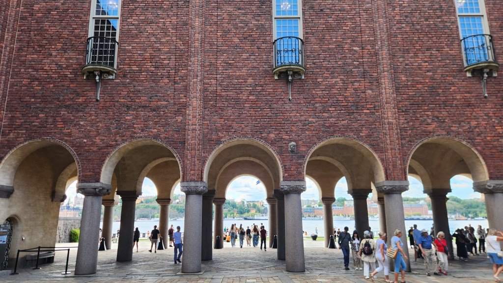
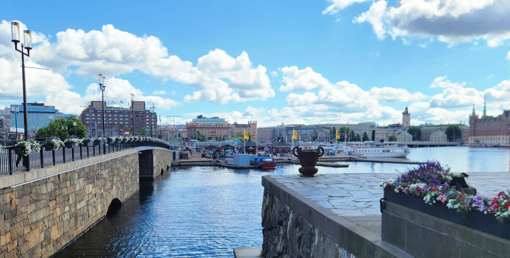
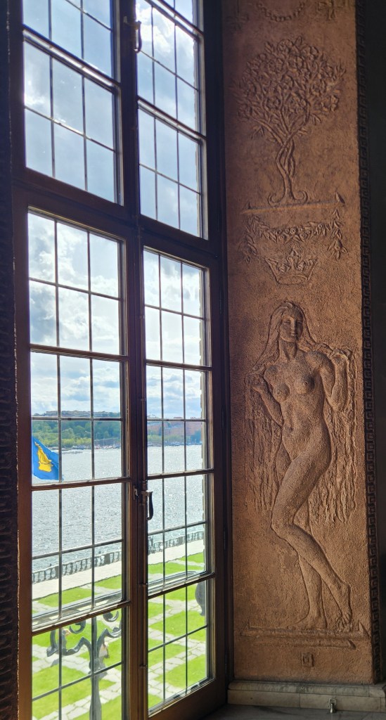
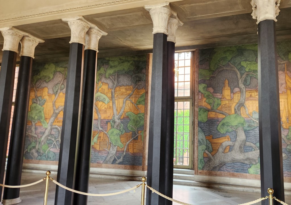
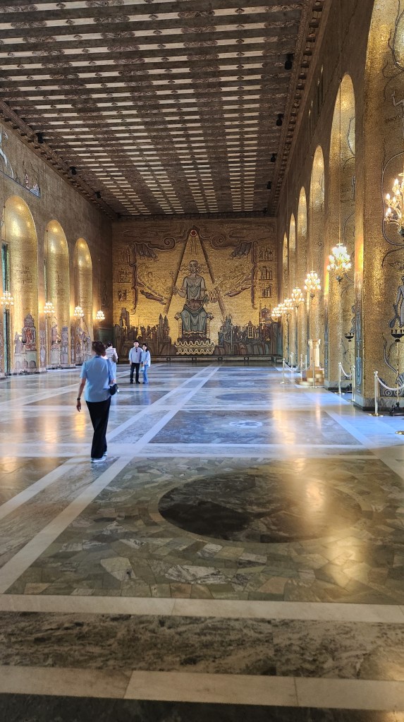
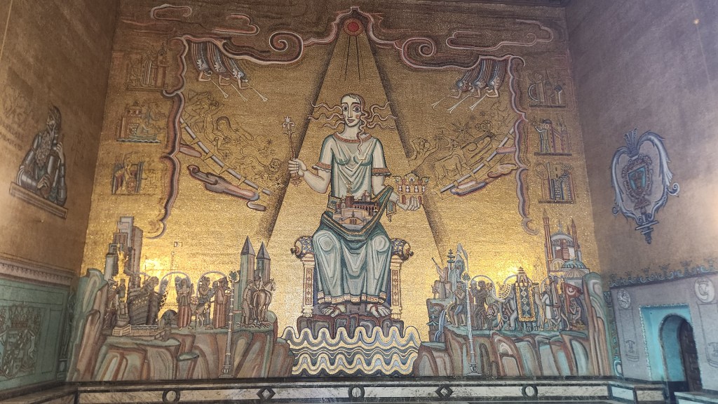
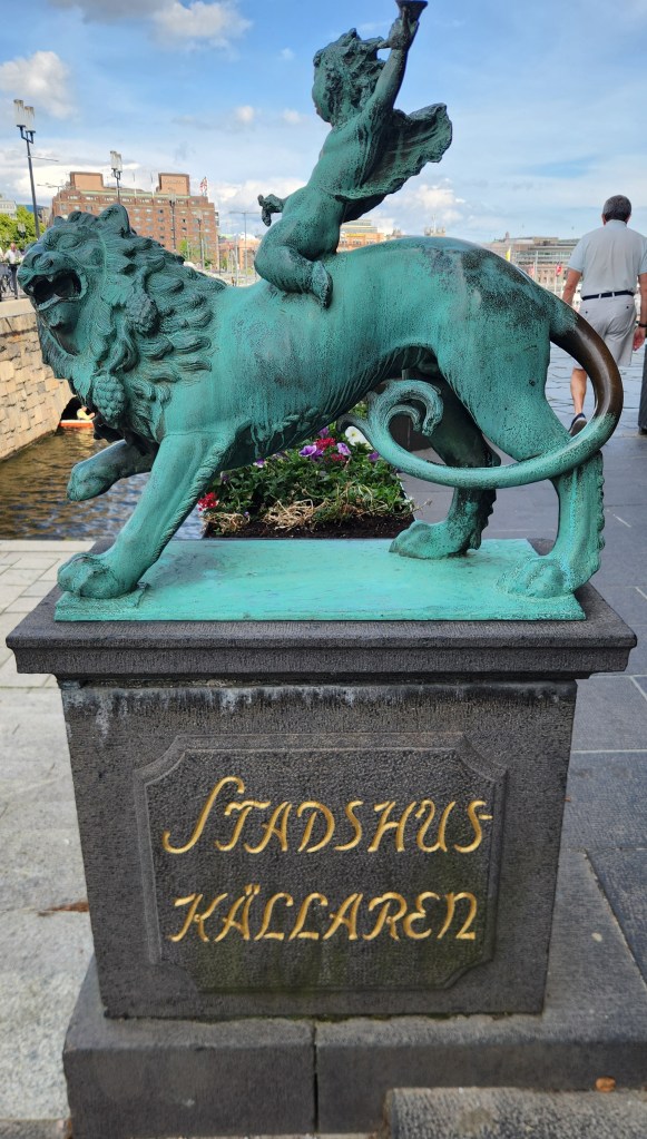
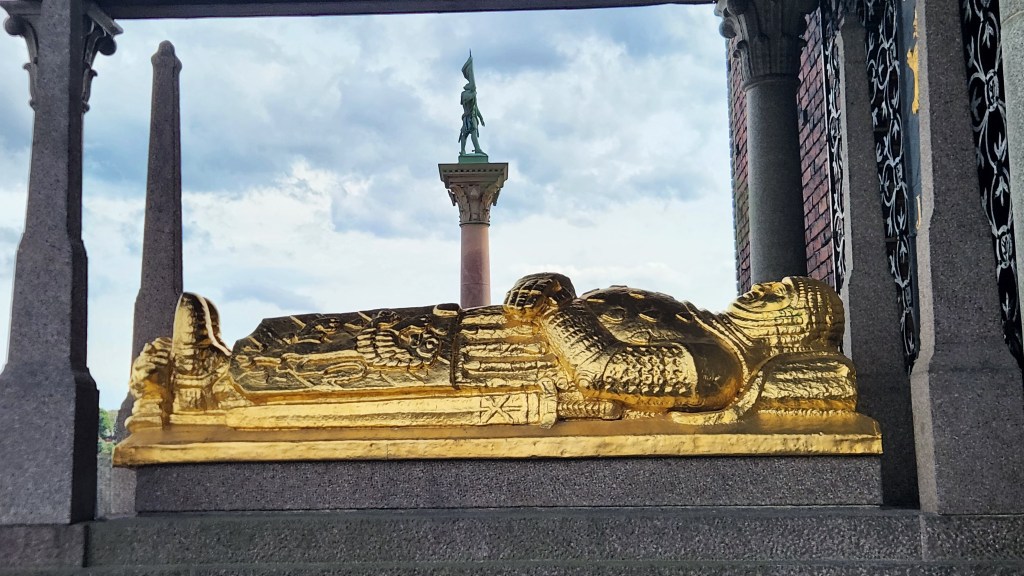
The City Hall, located on the shore of Lake Mälaren, is an amazing building. We actually visited there twice – once for a look around the exterior of the building and again later for a tour of the interior. While its official purpose is as the seat of the city government, it is famous as the location for the annual Nobel Awards dinner, where each year’s laureates are celebrated.
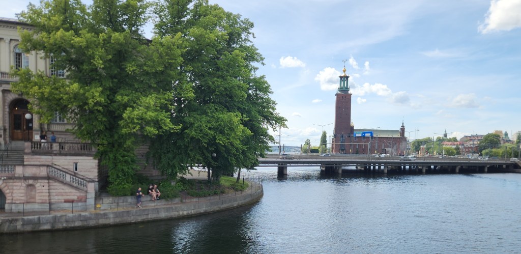
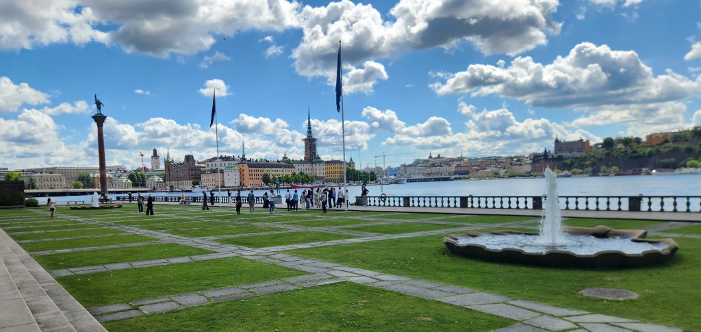
City Hall viewed from the Old Town
City Hall Plaza and Lake Mälaren
City Hall and Lake Mälaren
View from Rear of City Hall
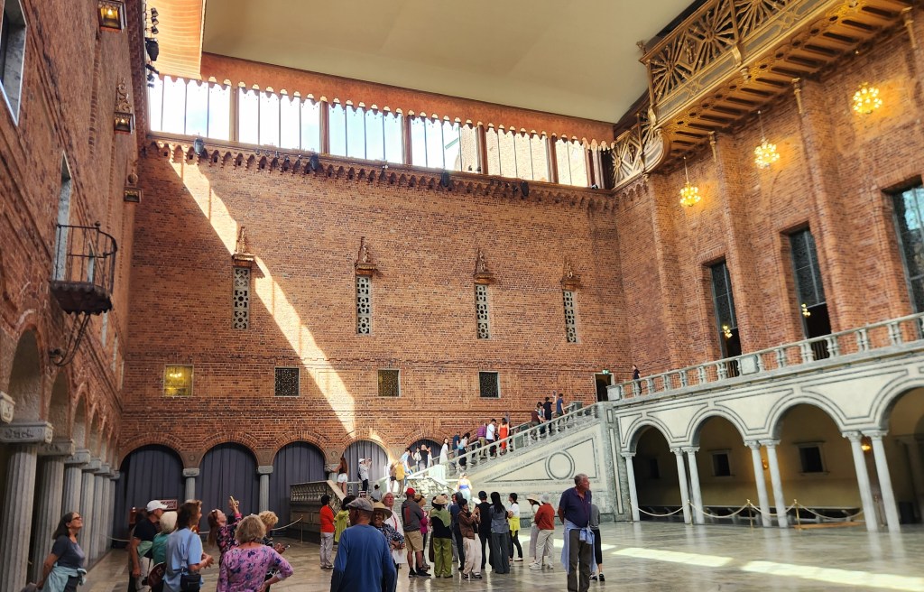
City Hall Atrium
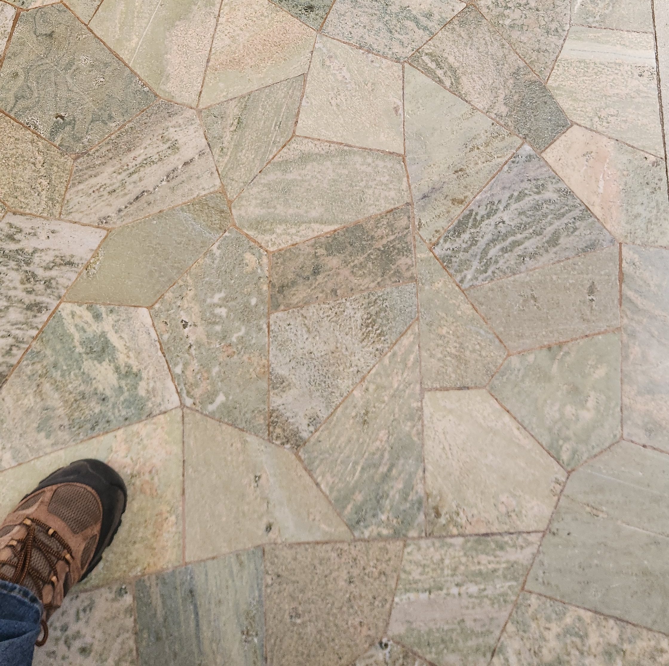
Floor of City Hall Atrium
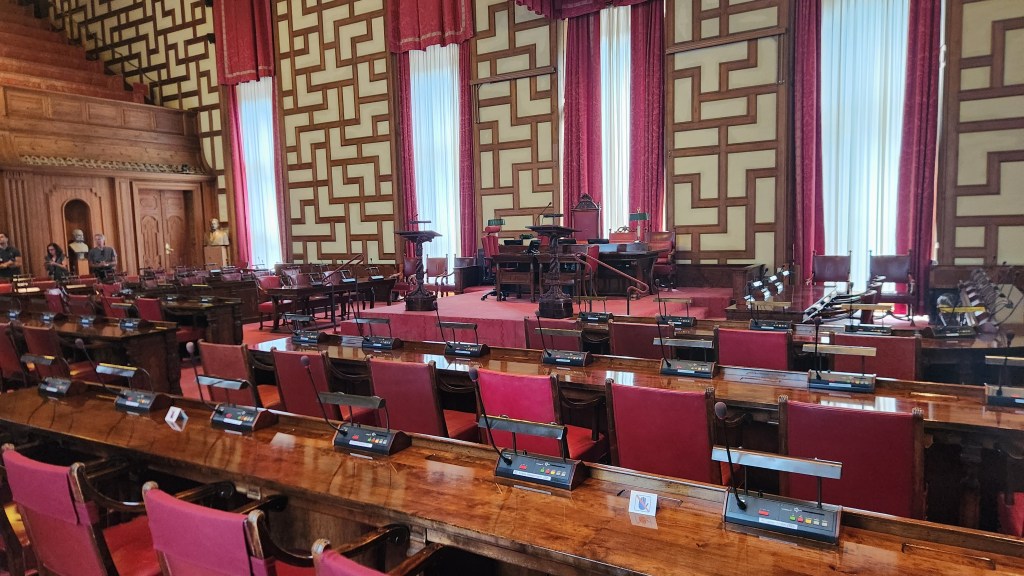
The City Meeting Room
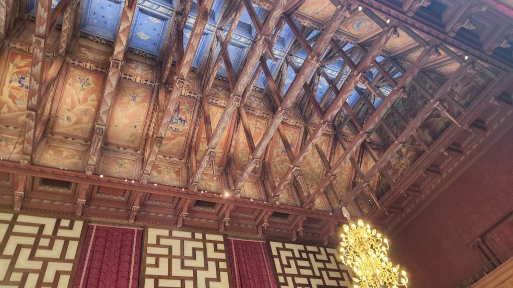
Here’s what the elected representatives see if they look upward
Example of Intricate Window Decorations
Hallway in the City Hall
Grand Ballroom in City Hall
Hard not to be impressed …
Statue outside City Hall
Mummy Displayed outside City Hall

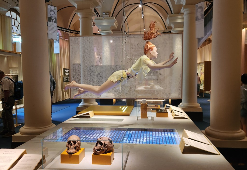
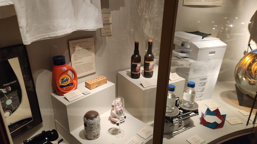
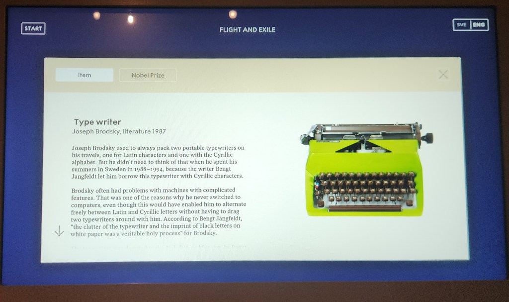
In between the two visits to City Hall, we visited the Nobel Prize Museum. This amazing place showcases every Nobel laureate since the first ones were awarded in 1901. Various exhibits provide information in many forms: plaques with written information, short videos highlighting the various awardees, statues, and a labyrinthine system on which a page describing every single laureate passes continuously through the entire building. We learned that Alfred Nobel was inspired to establish the Nobel Prize Foundation when he read an erroneously published obituary in a newspaper that deemed him “the merchant of death,” due to his invention of dynamite. Shocked by this characterization, as dynamite was only one of his several hundred inventions and was only intended to make heavy construction more efficient, he wanted his legacy to be very different from that characterized by the newspaper.
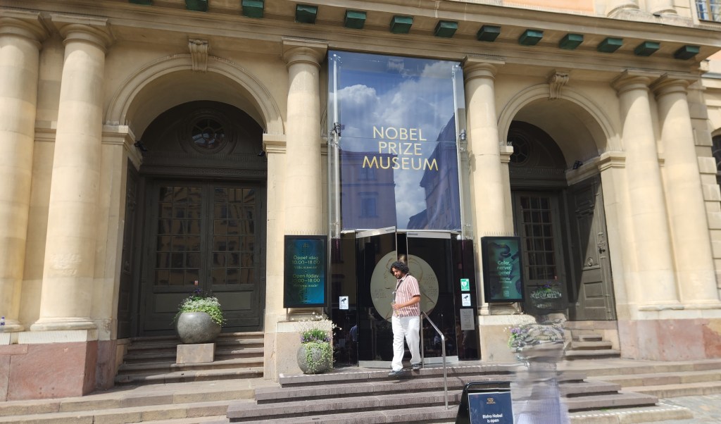
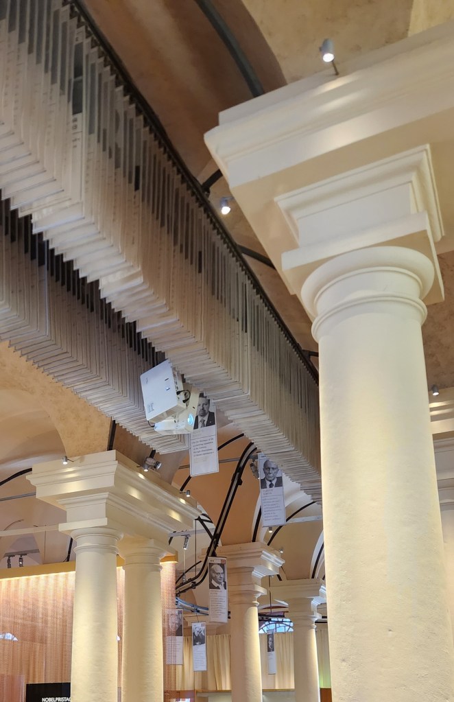
The Nobel Prize Museum
Pages for Every Nobel Laureate Continuously Travel through the Entire Museum
Exhibit in the Nobel Museum
Display of Items that Inspired some of the Laureates
Example of Exhibit for One of the Laureates
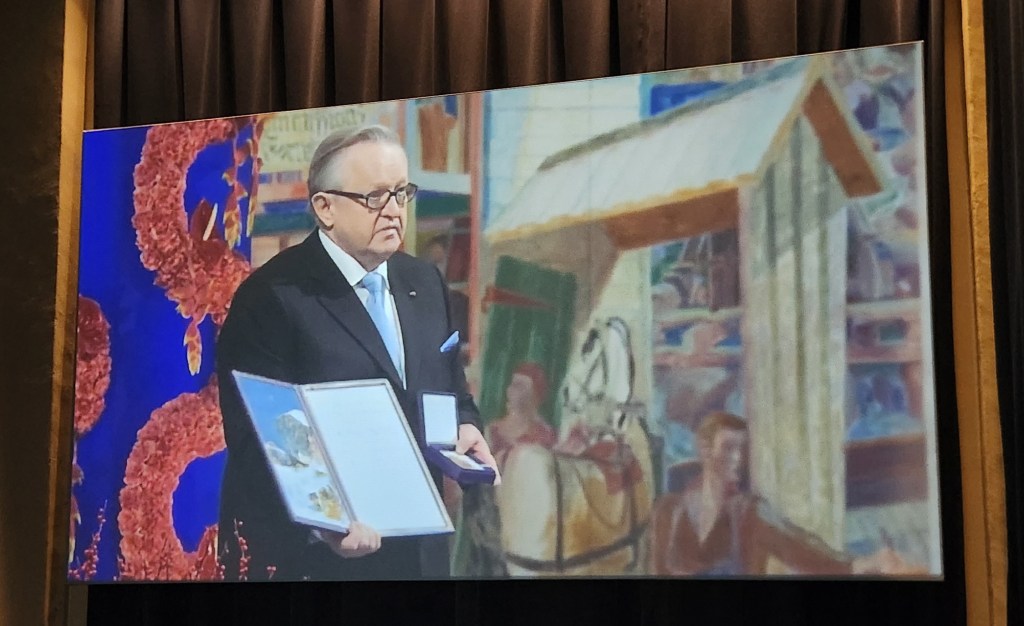
One of a Series of Videos, this one honoring 2008 Peace Prize winner Martti Ahtisaari of Finland

As usual, we tried to snap photos of the various sights we saw from our buses during the tours, with limited success. Here are a few that actually sort of turned out.
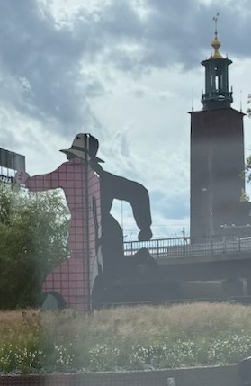
The Mr. Walker sculpture depicting the alter ego of the comic book hero The Phantom
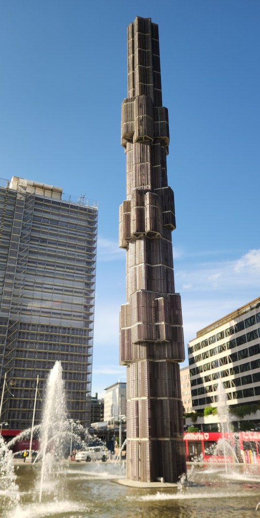
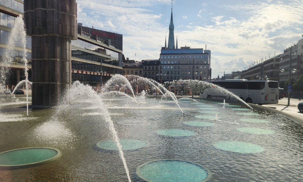
Sergels Torg, a famous public square in central Stockholm
120-Foot Glass Column at Sergels Torg
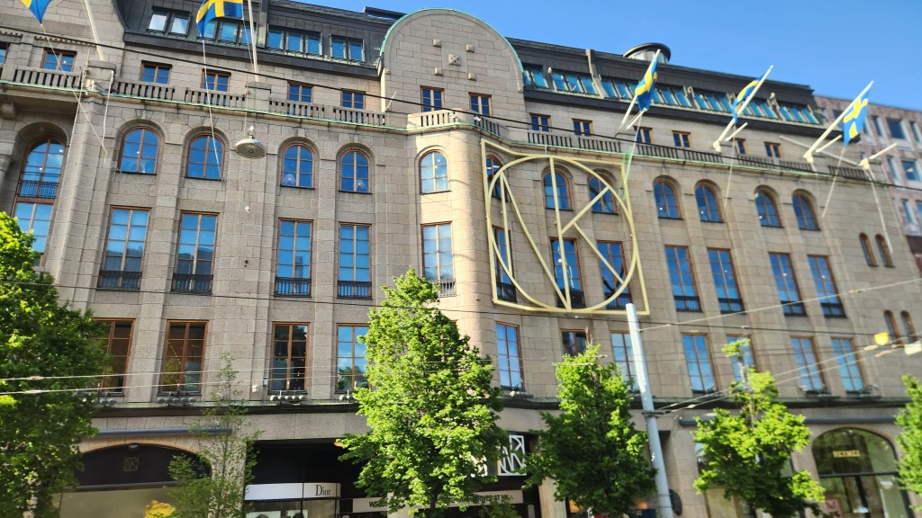
The historic Nordiska Kompaniet (NK) luxury department store built in 1915

As evening approached and we returned to the ship from the second of our two bus and walking tours, Pat and I actually each did something on our own. I went on yet a third tour to visit the Carl Johan church, located on the island of Skeppsholmen which was originally used as a base for the Swedish navy. Constructed between 1823 and 1842, it has now been deconsecrated as a church and converted into a vibrant cultural venue and concert hall renamed Eric Ericsonhallen.
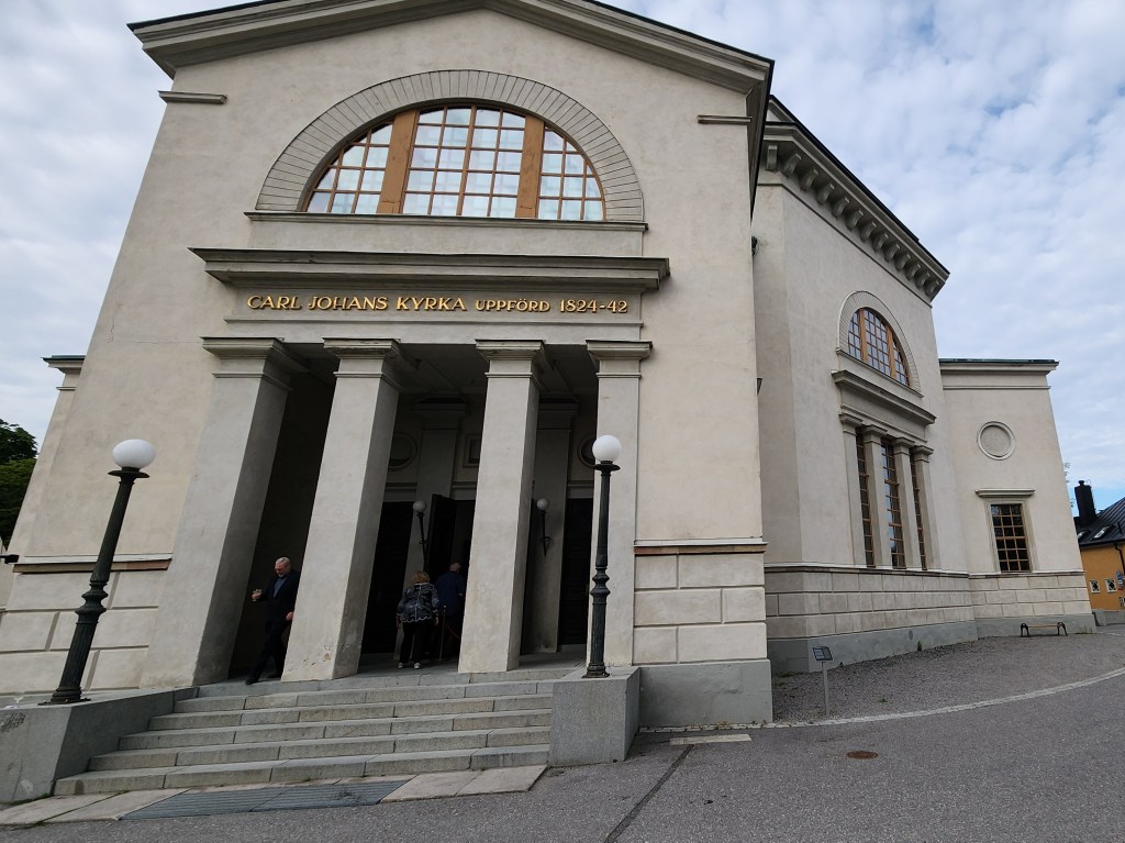
View of Concert Hall located on Skeppsholmen Island
Closeup View of Concert Hall
Looking back toward Old Town from Skeppsholmen Island
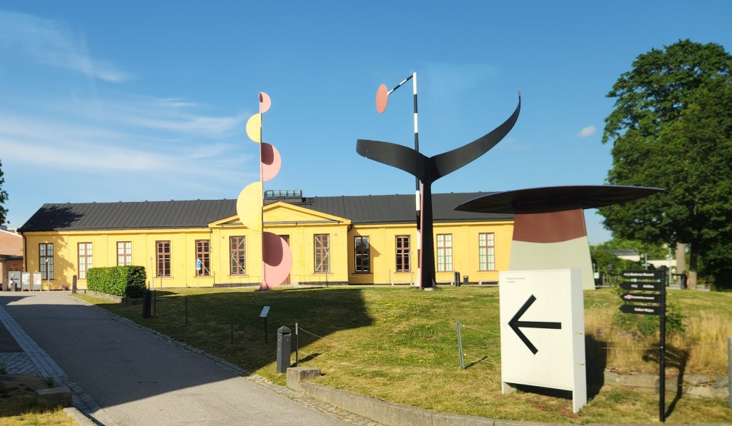
Museum of Modern Art located on Skeppsholmen Island

Upon arrival, we were treated to a glass of sparkling cider before settling in for a performance of Vivaldi’s The Four Seasons by some of Sweden’s leading musicians from the Stockholm Philharmonic Orchestra. Here are some photos and a brief video clip of the performance. I was too polite to stand up when taking the video, with the unfortunate result that it features the guests in the front row more prominently than the musicians. Oh, well … During the intermission, I joined the other guests in enjoying a tasting of locally made, seasonally inspired pralines.
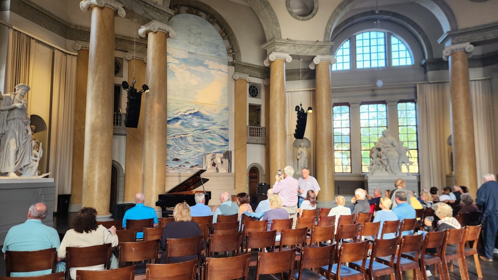
Interior View of Concert Hall
A Clip Fom the Concert

So, what did Pat do while I attended the concert? She got a massage at the shipboard spa. I presume she didn’t get any photos of that, which might have spiced up this blog post a bit, but I didn’t ask and she didn’t tell.

After dinner, we retired early since we needed to depart the ship at 3 AM Wednesday to head for the airport and begin our journey home. We had three flights – Stockholm to London, London to Chicago, and Chicago back to our home sweet home in Minneapolis. Fortunately, the trip was uneventful, and we were once again very pleased with our Global Entry membership as we sailed through customs at Chicago O’Hare.

Okay, that wraps up this travelogue. I hope you enjoyed it, and I also hope you’ll keep an eye out for future episodes as we gallivant off yet again to some very exotic locales in January and August of 2027. Not to give too much away, but they will involve travel to South America and Egypt!!

Thanks for reading, and farewell until next time …
Pat and Dave’s Vibrant Viking Voyage – PART 3: Denmark and Germany

Welcome back for Part 3 of my travelogue describing our recent Viking Ocean Cruise entitled “Viking Homelands.” Part 2 left off as we were departing from Oslo, Norway. This episode will cover our stops in Denmark and Germany, including locations 5, 6, 7, 7a, and 8 on the map of our itinerary:

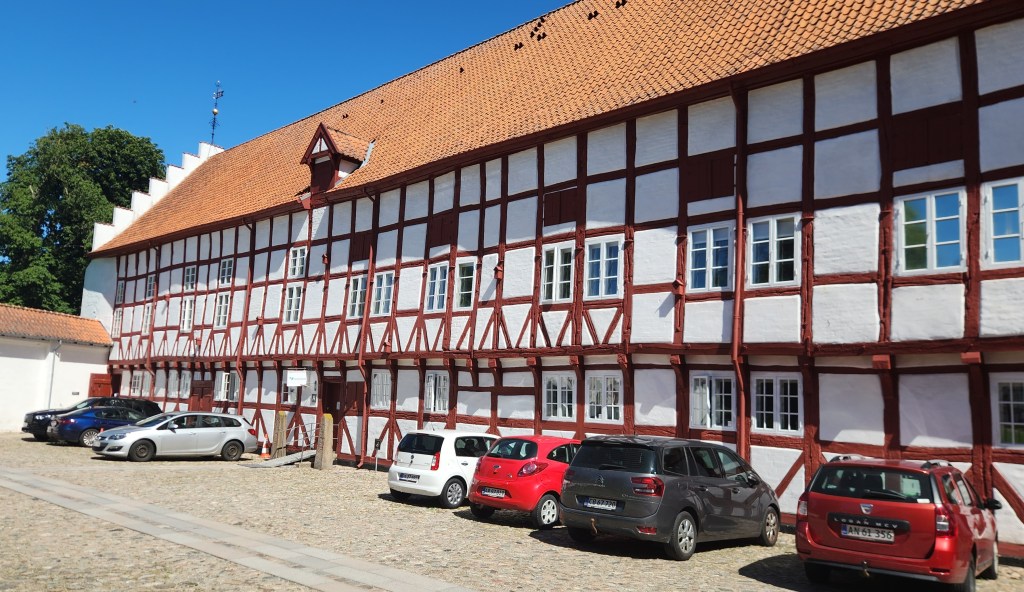
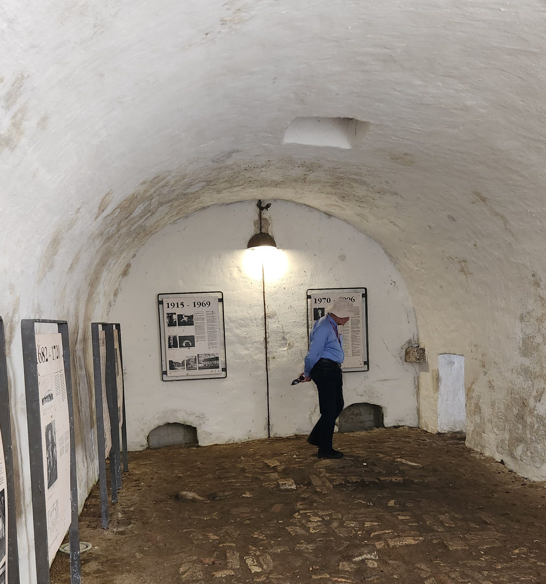
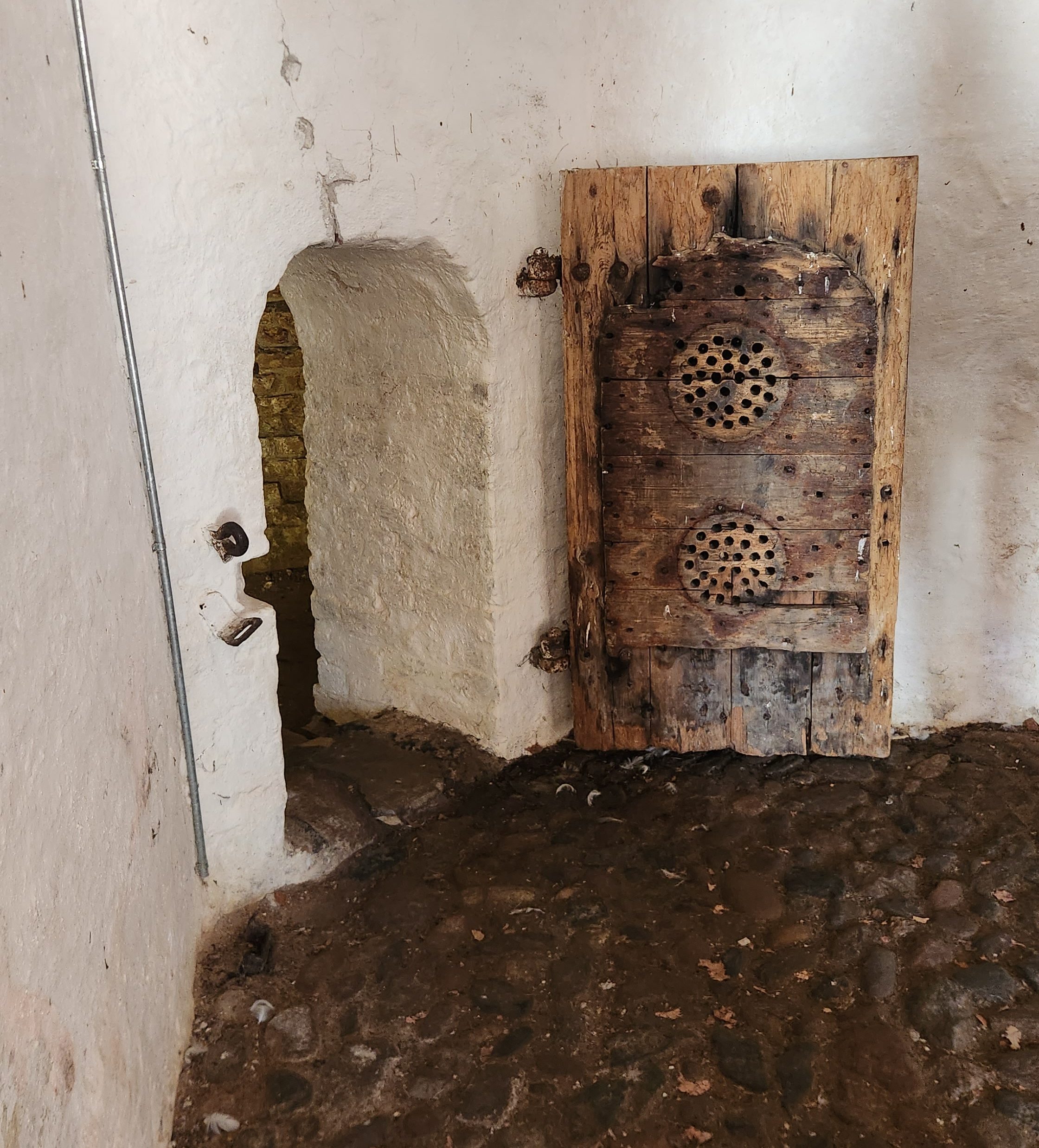
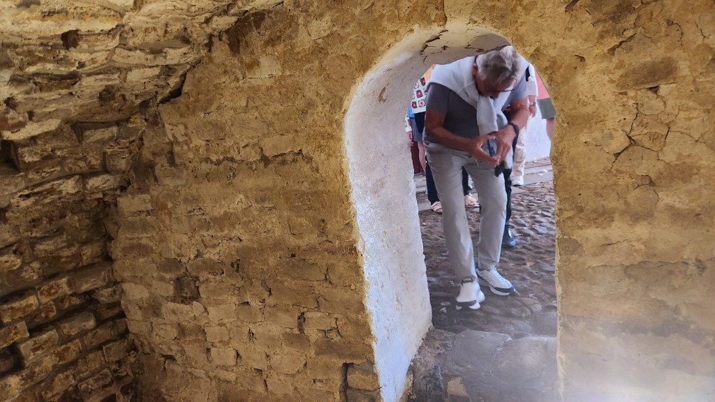
Ålborg, Denmark (Tuesday, June 23, 2026): Our ship arrived in the Ålborg harbor at 10 AM Tuesday, and we were soon off on a walking excursion through the old town to discover its trade roots and Viking heritage. Ålborg is the fourth largest city in Denmark, dating back to its founding as a Viking trading post during the late 900s. Our tour first took us to the Ålborghus Castle, a 14th-century fortress built using the traditional half-timber technique. Some of the dungeons have been preserved to provide visitors with a feel for the conditions in the old fortress, and a series of placards describes the castle’s history.

Ålborghus Castle seen from the back
Ålborghus Castle seen from the front
Storage Room in Ålborghus Castle
Exterior of Dungeon Cell
Looking out from the cell

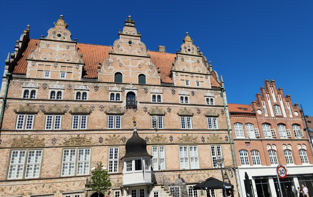
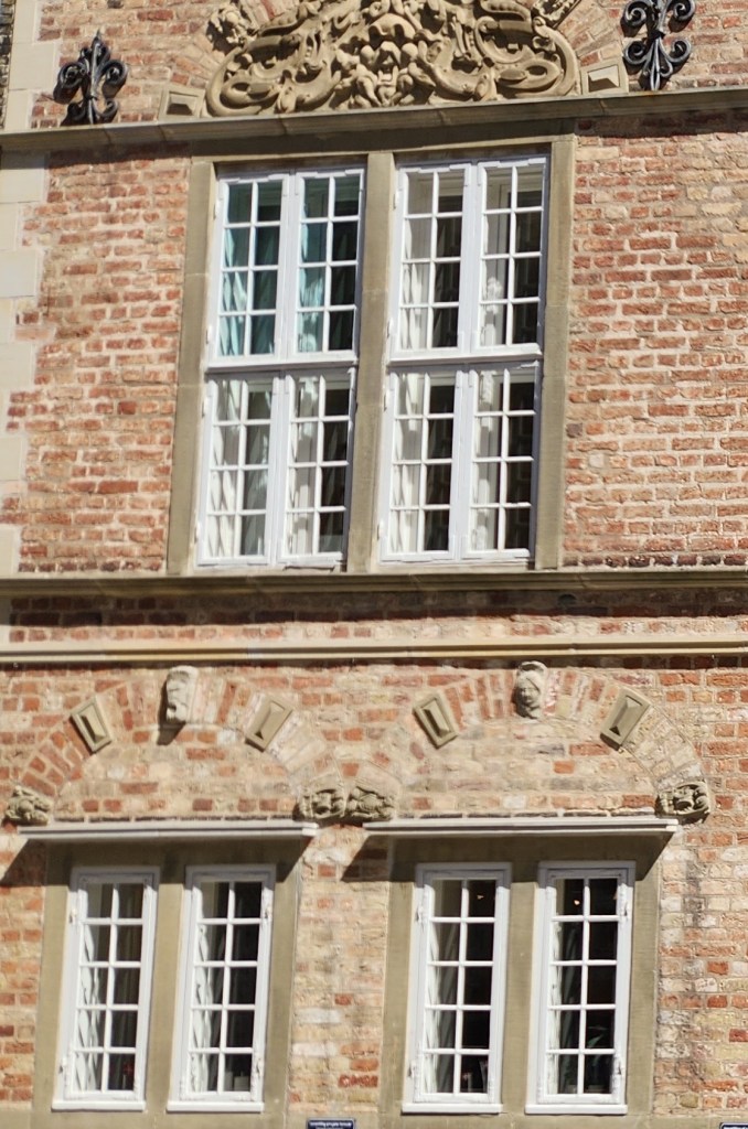
We then passed on to the Nytorv Square, a pedestrian plaza established in 1604 in the historic center of the old town. The Jens Bang house, built in the Nytorv Square in 1624 and noted for its gables, sculpted window décor, gargoyles, and a sculpture of Bang sticking out his tongue, is considered the finest privately owned Renaissance building in Denmark. Bang was famously snubbed by the town’s government and his statuesque renaissance home was never approved by the local gentry. The house has also housed the city’s oldest pharmacy for more than 300 years.

Jens Bang House
Details of Jens Bang House

We passed by many other historic buildings located in the central part of the old town, including the Old City Hall (built in 1762 in a Baroque and Rococo style), the Post Office/Telegraph building (1908), and the Budolfi Church or Ålborg Cathedral (dating from the 16th century) which now serves as the seat of the Lutheran Bishop.

Central Square of Old Town
Old City Hall
Budolfi Church
Budolfi Church
Post Office/Telegraph Building

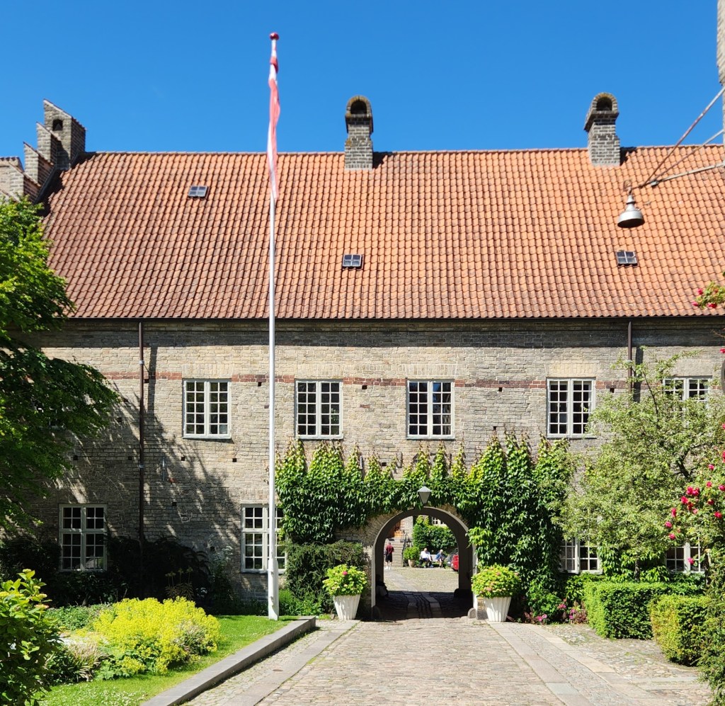
We spent a fair amount of time learning about the Monastery of the Holy Ghost, a medieval monastery dating back to 1431 which also served as a hospital for more than 500 years until the 1950s. While most of the monastery buildings have been converted to modern housing for senior citizens, the oldest part – the School Wing – has been preserved in its original state from the 15th century.

Monastery of the Holy Ghost

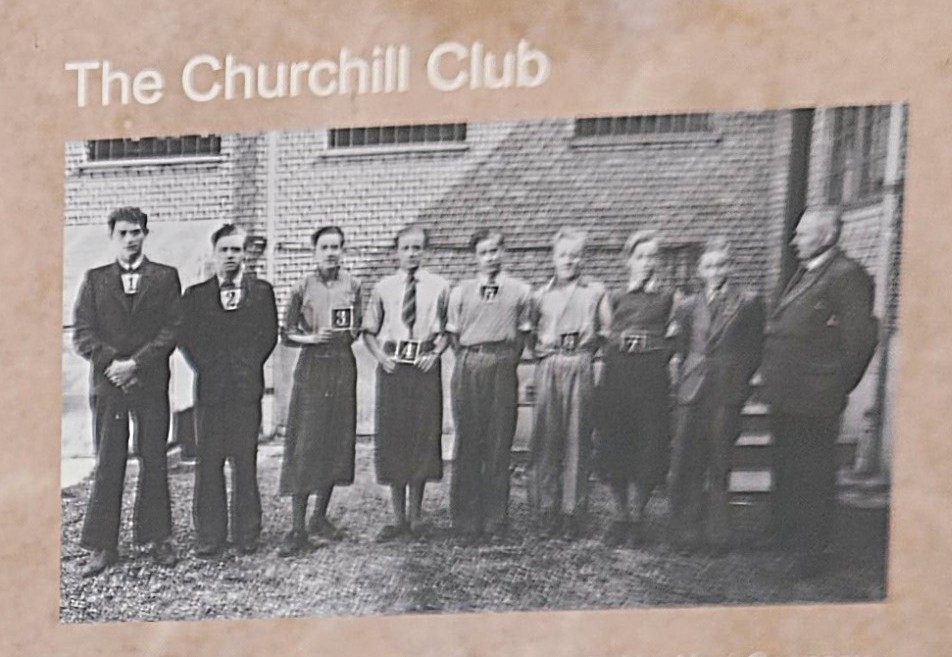
During World War II, a group of eleven grammar school students formed the Churchill Club, a secret resistance movement. Two of the boys lived in the monastery as their father was the vicar at the Budolfi church. The students used the monastery to plan sabotage missions against the occupying Nazi forces and to hide weapons stolen from the German Army, inspired by the acts of Norwegian resistance soldiers. They succeeded in carrying out 25 acts of sabotage before they were arrested by the Danish police on May 8, 1942, as Denmark’s official position was to cooperate with the German occupiers. Some of those acts of sabotage included stealing weapons and destroying vehicles, blueprints, and plane parts. The boys were fined and sentenced to prison terms ranging from one-and-a-half to five years. Even during their imprisonment, some of the boys managed to escape at night to continue their sabotage activities for some time, then sneak back into their cells before sunrise.

Members of the Churchill Club Secret Resistance

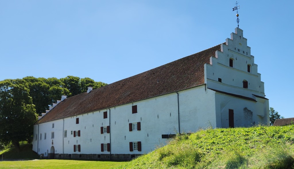
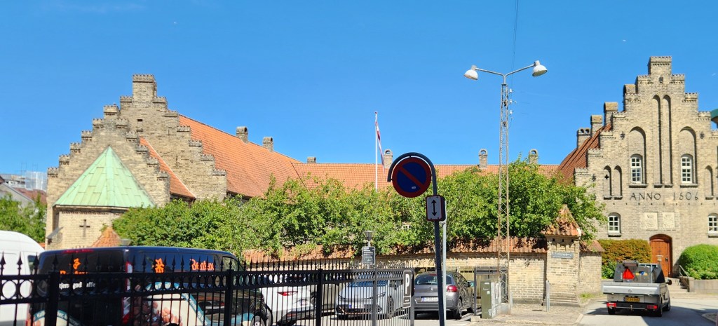
One amusing thing was an inscription on a hospital building reading “Anno 1506.” We learned that it originally read “Anno 1905” following a renovation to the hospital, but historians felt that was inappropriate for such a historic place and so the digits were rearranged.

Monastery of the Holy Ghost

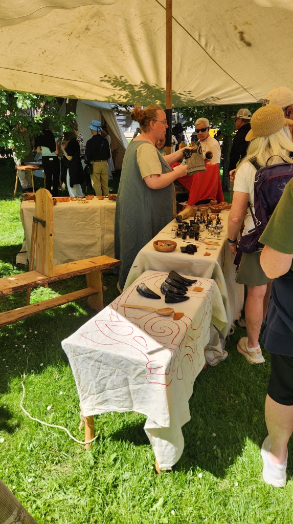
After the monastery, we walked through an area of residences and small shops and visited a local Viking market, a somewhat goofy place where people dressed in old-time garb made music and sold various Viking-themed foods and merchandise.

The Viking Village
The Village Piper

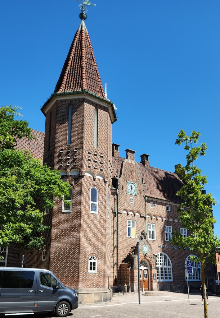
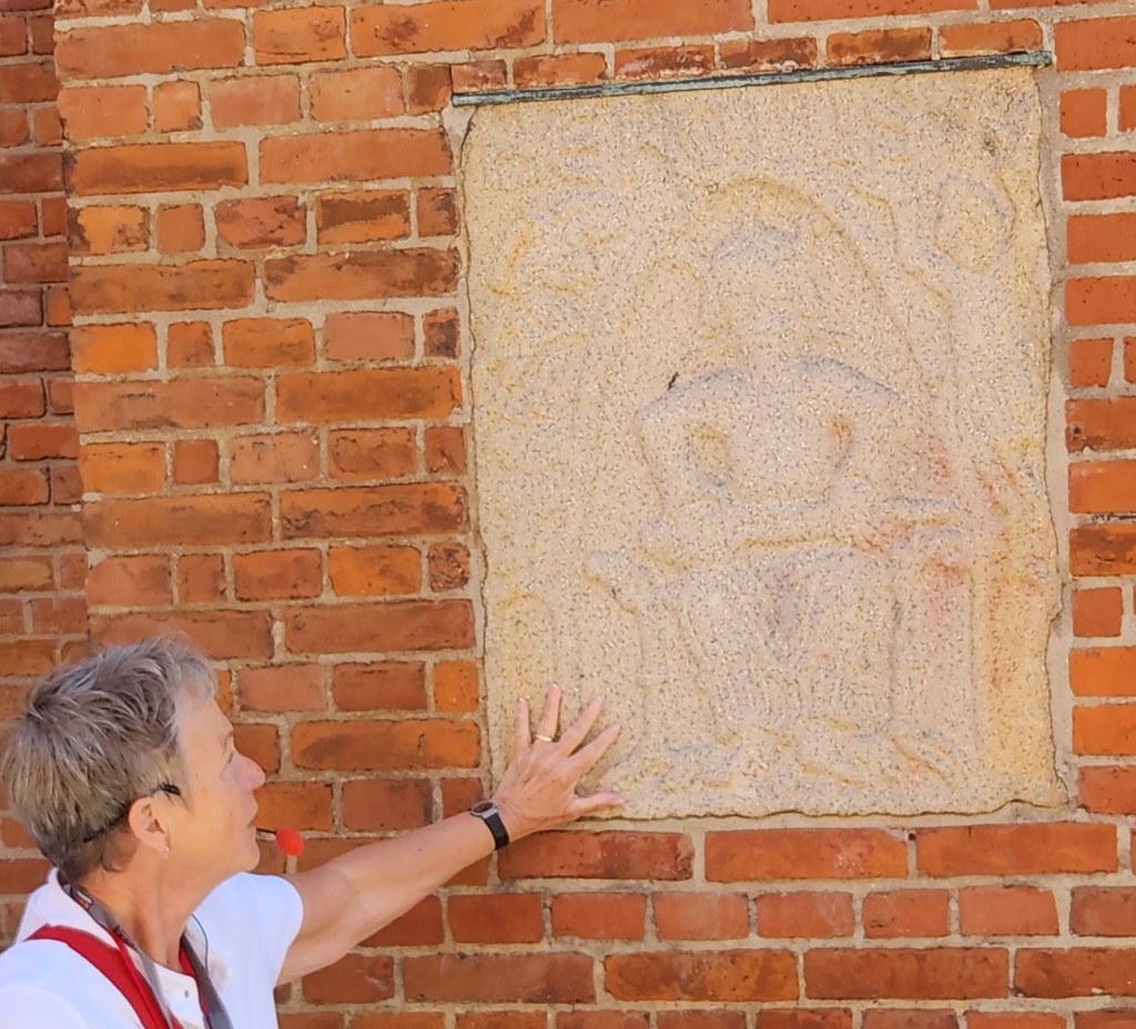
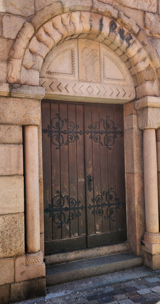
Next, we passed by the Church of Our Lady (Vor Frue Kirke), a Lutheran church built in 1878 on the site of a much older Benedictine monastery. The church is constructed in red brick and includes sandstone relief art and Romanesque portals which may have been preserved from the original monastery. The bell tower also houses one of the original church bells dating back to the 12th century.

The Church of Our Lady
Sandstone Relief
Romanesque Portal

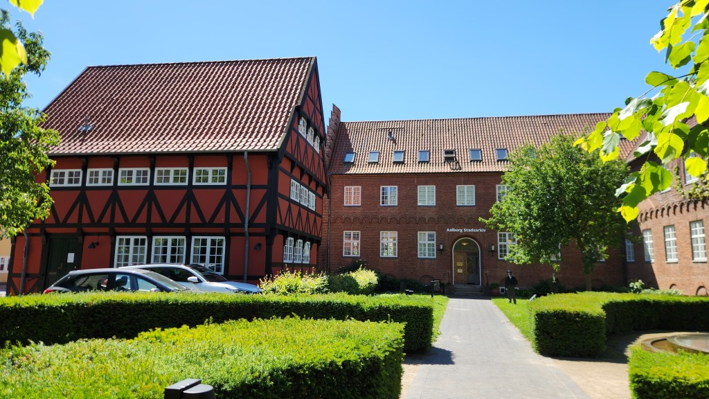
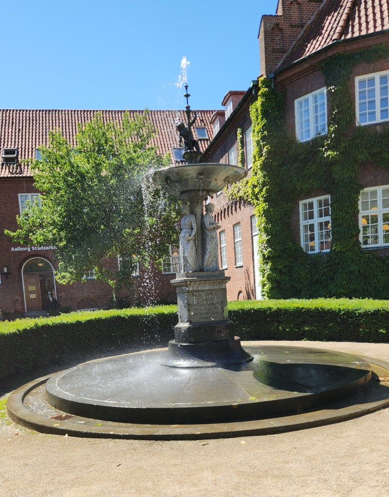
Heading back toward the harbor, we passed by the City Archives, featuring historic timber-framed architecture alongside red brick buildings and a lovely fountain.

City Archives
City Archives Fountain

I’ll also share a few photos I took of interesting sculptures and murals we saw at various points during the walking tour.

Sculpture in the Old Town
Building Artwork
Building Artwork

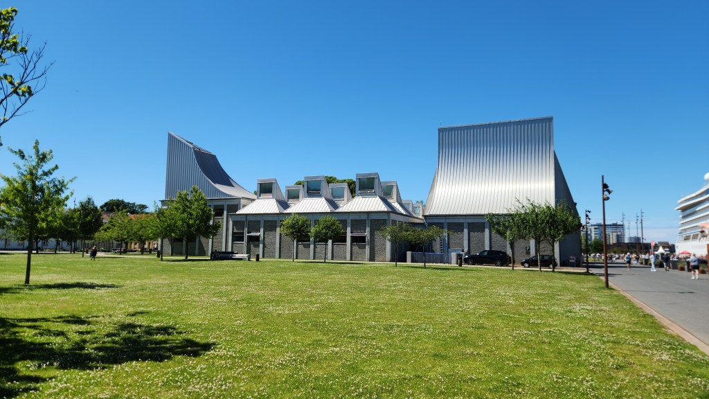
As we returned to the modern, renovated waterfront district, we passed by the Utzon Center. This ultramodern building was designed Jørn Utzon, the architect behind the Sydney Opera House. The center is directed towards promoting the significance of Utzon’s work and approach by organizing workshops, conferences and exhibitions and disseminating the results for the benefit of the architecture profession and the general public.

Utzon Center

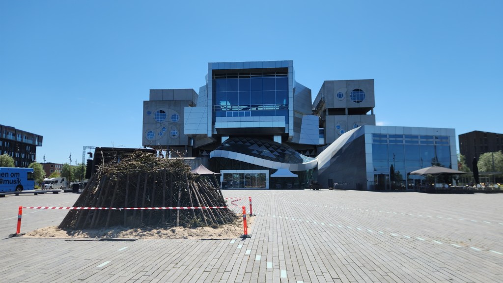
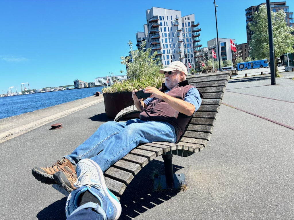
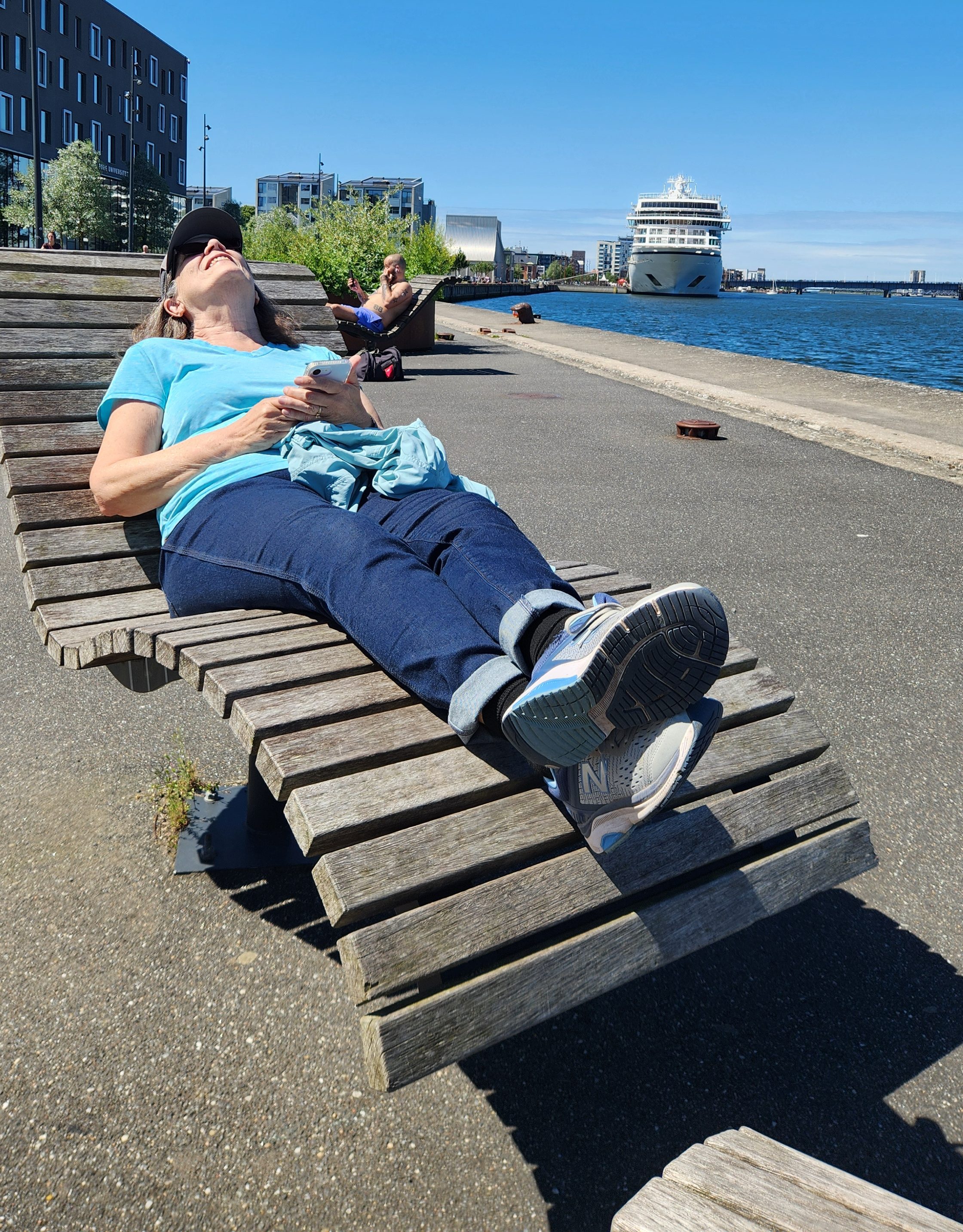
After the tour, we spent some time walking along the waterfront admiring the surroundings, including the Musikkens Hus, a major concert hall and music venue built in 2014 as home to the Ålborg Symphony; it also provides space for the Royal Academy of Music and the Ålborg University. We also sat in some interesting and very comfortable public chairs and admired the boat traffic in the harbor before returning to our ship.

Musikkens Hus, with Bonfire Setup for Summer Solstice Celebration
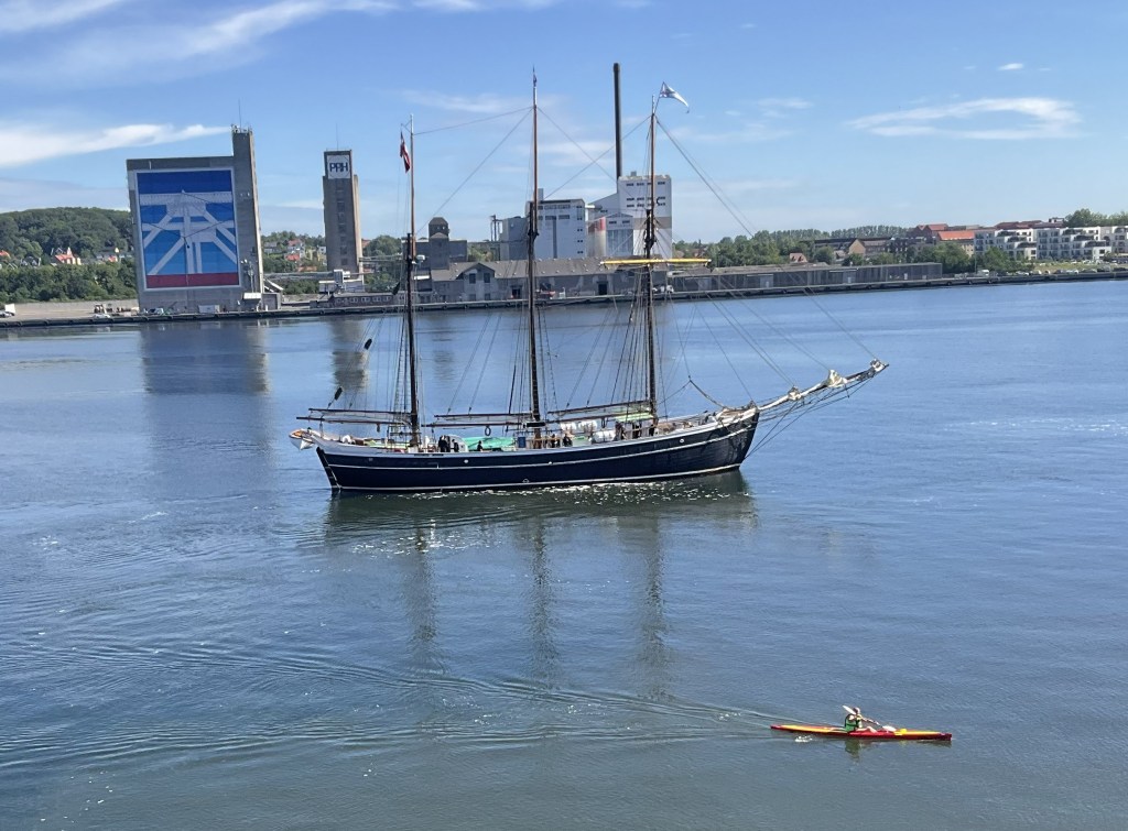
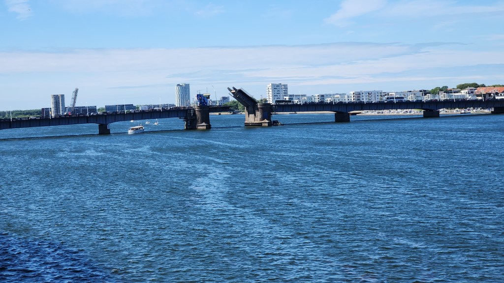
Boat Traffic in the Harbor

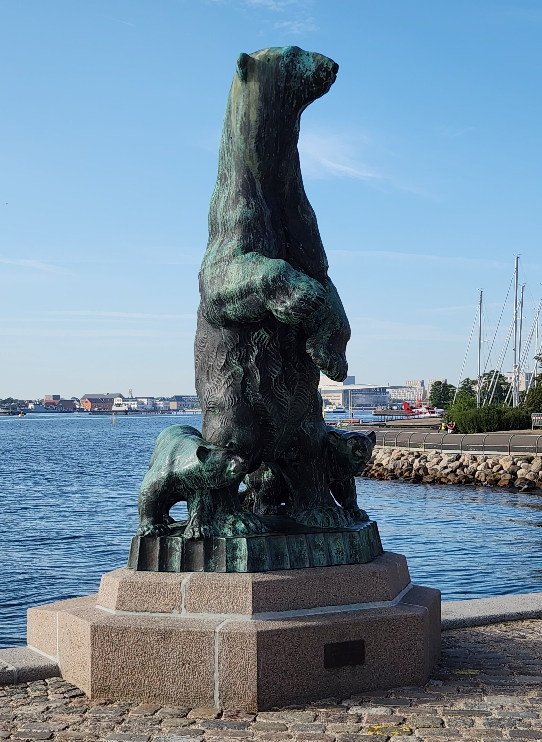
Copenhagen, Denmark (Wednesday, June 24, 2026): Our ship arrived in the Copenhagen harbor at 7 AM, and after the usual excellent breakfast on board we departed on a walking tour. The tour began on the Langelinie Pier where the ship was docked, and we soon came to a couple of nice statues. I’m sure every single reader will know exactly what the second one is.

Copenhagen Harbor
Statue of Bear on Langelinie Pier
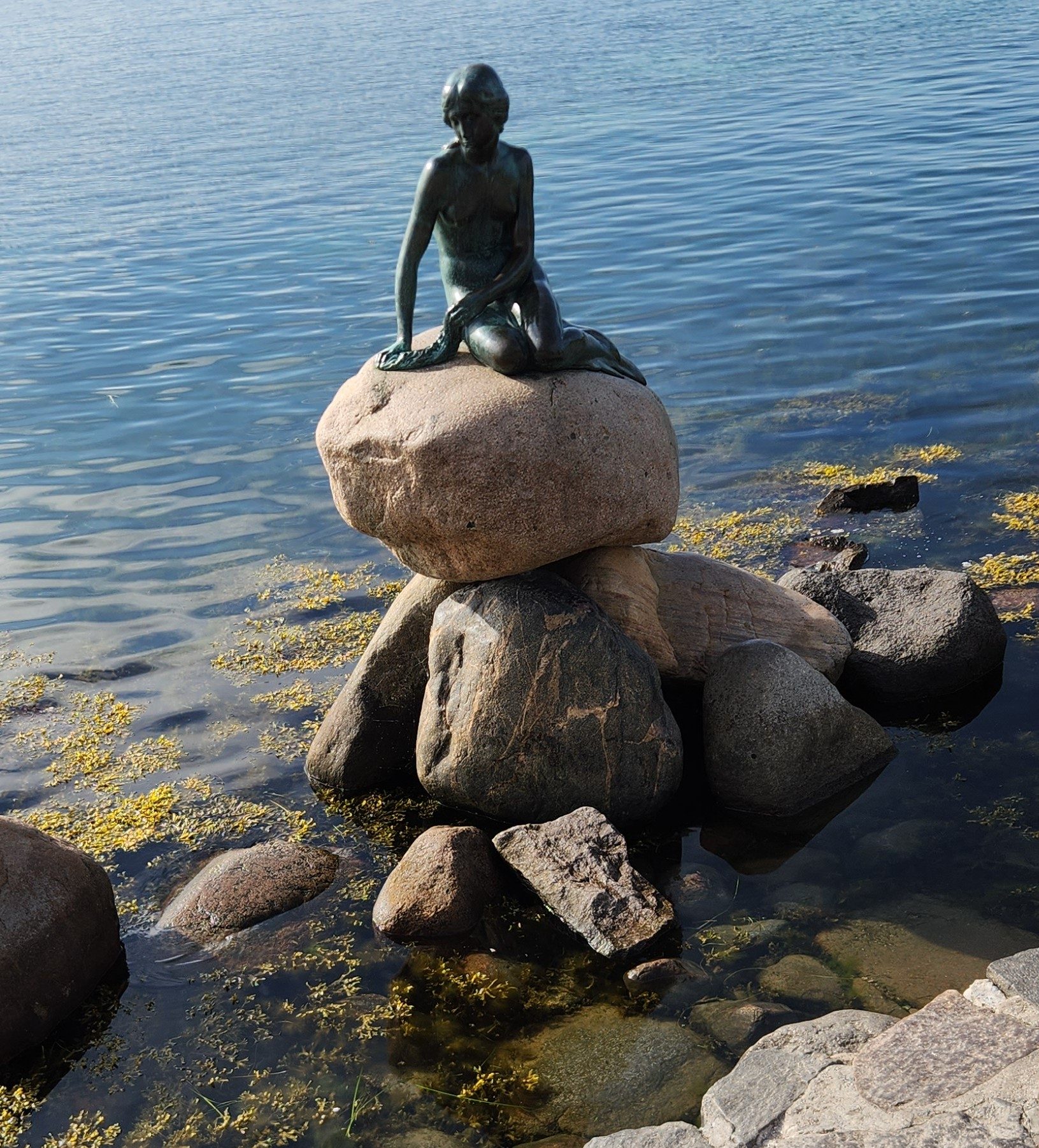
The Little Mermaid

Our guide told us that we were very lucky to have an unobstructed view of the Little Mermaid statue, still sitting serenely in the harbor since its unveiling in 1913, since more than a million people stop to see the statue every year. (In fact, when we passed by her again at the end of the tour the area was thronged with a hundred or more gawkers.) I’m quite disappointed in the quality of my photos – somehow the lighting conditions didn’t allow me to get a good one – but at least the statue commemorating Hans Christian Andersen’s fairy tale was all there.  At various times, since 1964, vandals have: decapitated her twice (the first head was never recovered, and a new one had to be made in 1968); sawn off an arm in 1984; used explosives to blow her off the stone base and into the harbor in 2003; drenched her in red paint protesting whale hunting in the Faroe Islands in 2017; painted her blue and white with the words “Free Abdulle” in 2017; tagged her with the words “Racist Fish” during global protests in 2020; and painted her with the white, blue, and red stripes of the Russian flag in an act linked to support for the invasion of Ukraine in 2023. And yet she endures!

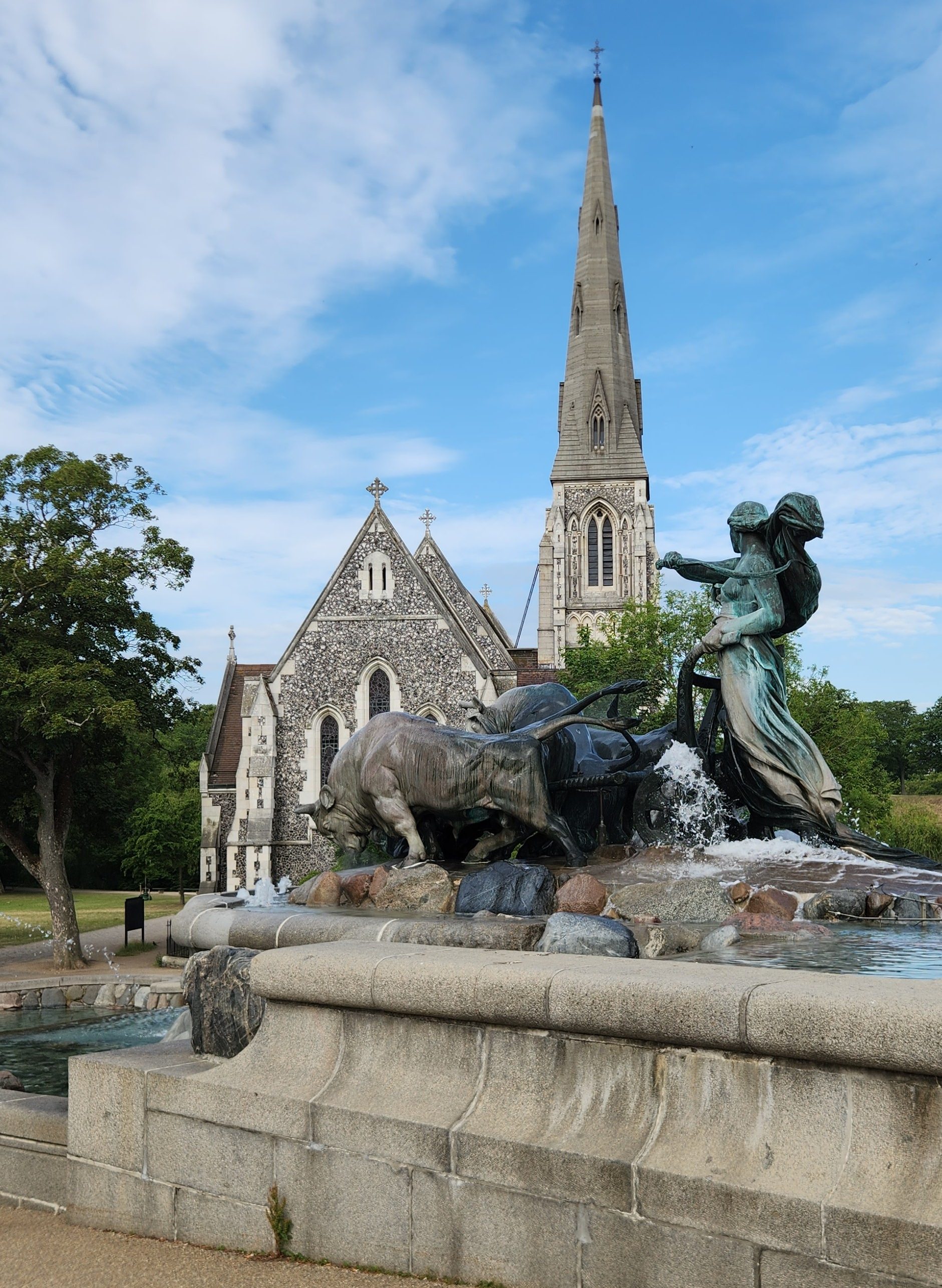
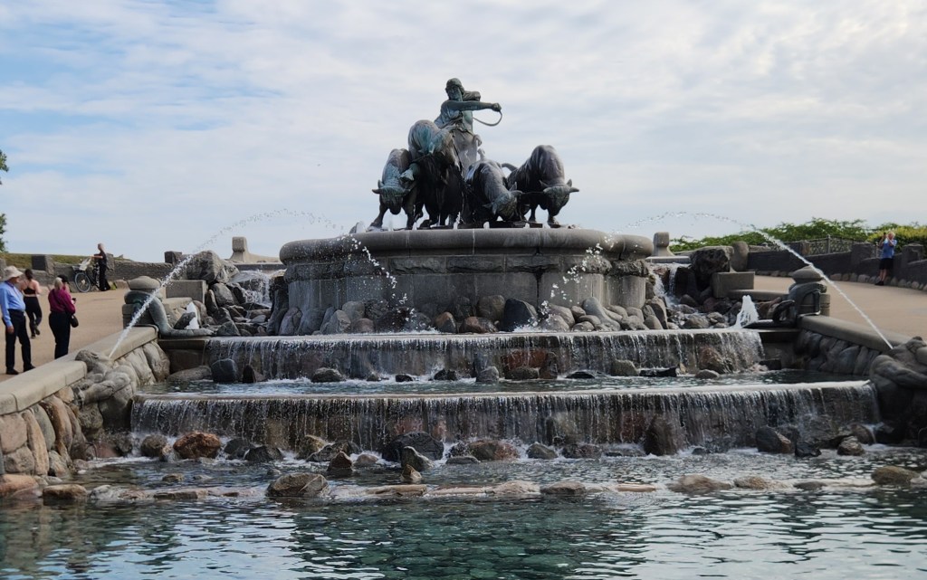
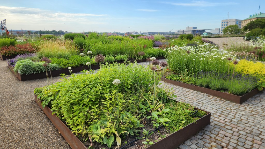
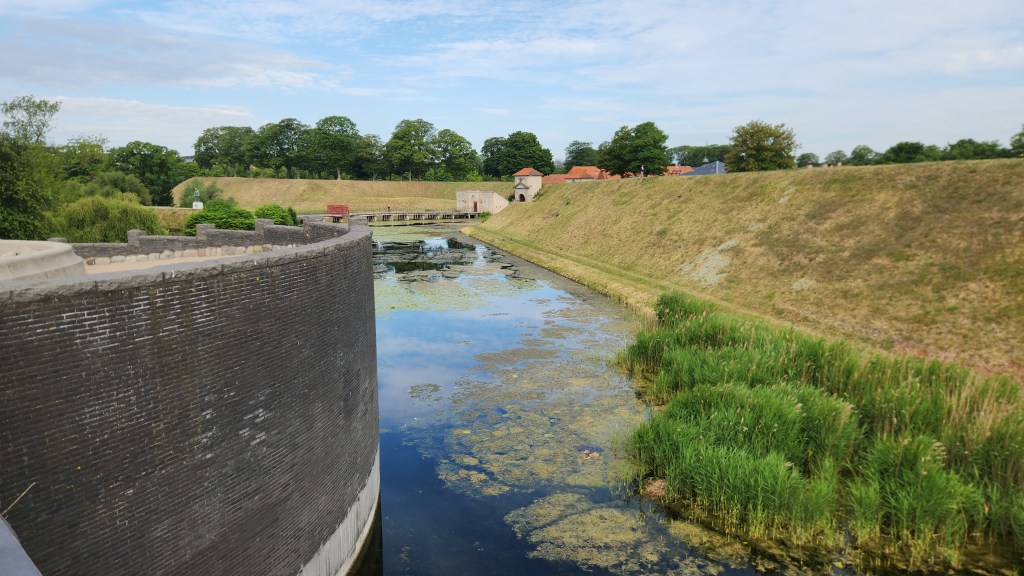
Our tour continued along the pier as we passed through the Amaliehaven, a public garden opened in 1983. We saw the ramparts of the Citadel (Kastellet, a 17th century star-shaped fortress with surrounding moats), Copenhagen’s largest monument (the Gefion Fountain, first inaugurated in 1908, featuring the Norse goddess Gefion driving four oxen), and the St. Albans Anglican Church, built in 1887.

Amaliehaven Gardens
Ramparts and Moat of the Citadel
Gefion Fountain and St. Albans Church
Gefion with her Oxen

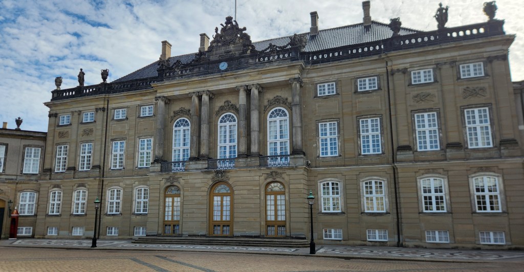
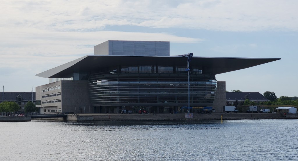
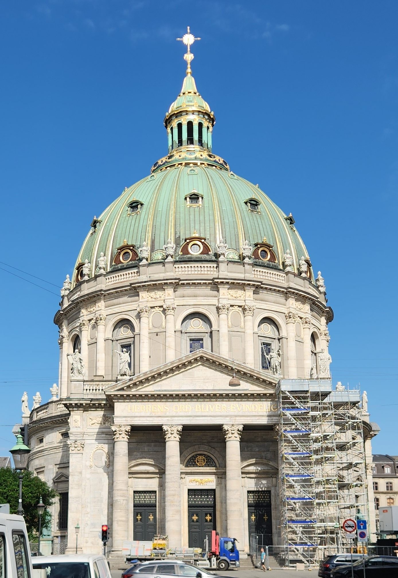
Next came the Amalienborg Palace, the winter residence of the royal family. Four identical Rococo buildings are arranged around a large octagonal courtyard with a central fountain. Amalienborg was originally built for four noble families, but after the Christiansborg Palace (see below) burned in 1794 the royal family bought the Amalienborg palaces and moved in. From the Amalienborg courtyard, we also had a good view of the New Opera House across the harbor, and on our way out of the courtyard we passed by the Marble Church, or Frederik’s Church, an Evangelical Lutheran church built in Rococo style between 1749 and 1894.

Amalienborg Palace
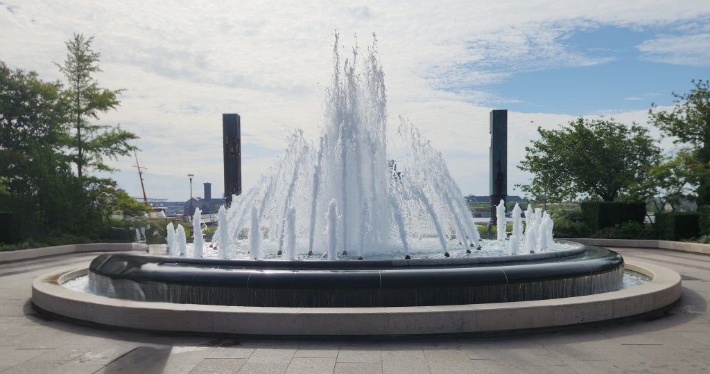
Fountain in Amalienborg Square
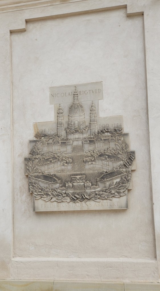
Plaque Showing the Original Amalienborg Layout
New Opera House
Marble Church

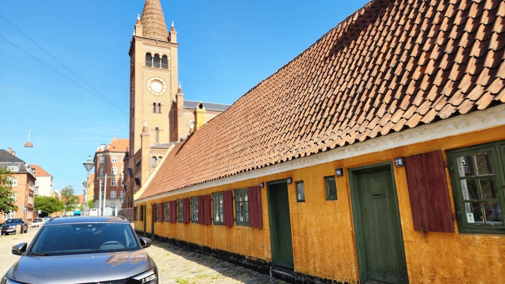
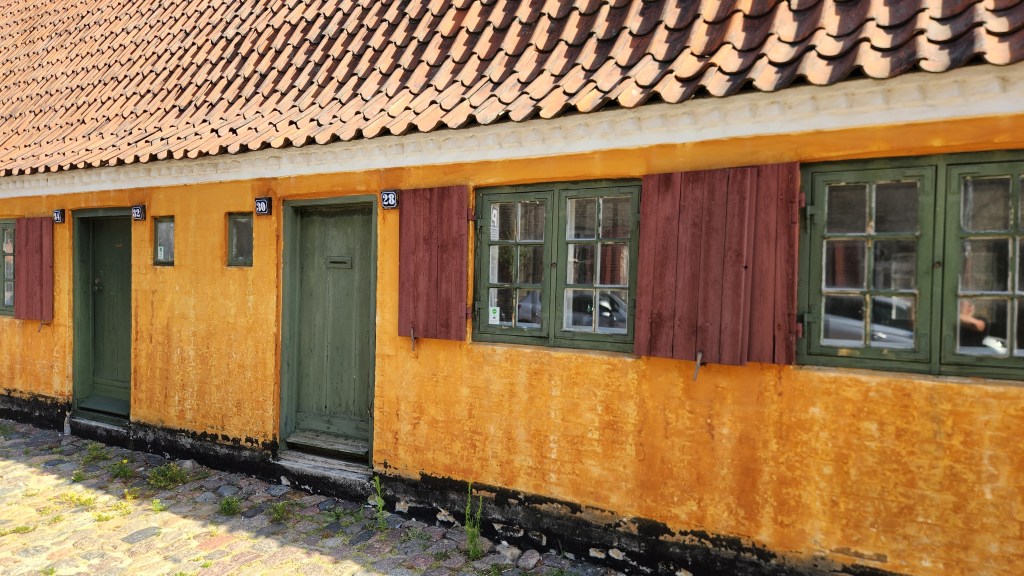
After the palace, we walked through the Nyboder district, which includes historic row houses originally built in the 17th century as naval barracks and still used for military family housing today. The buildings are iconic for their distinct “Nyboder yellow” color.

Nyober District Row Houses
Nyober Yellow Military Housing

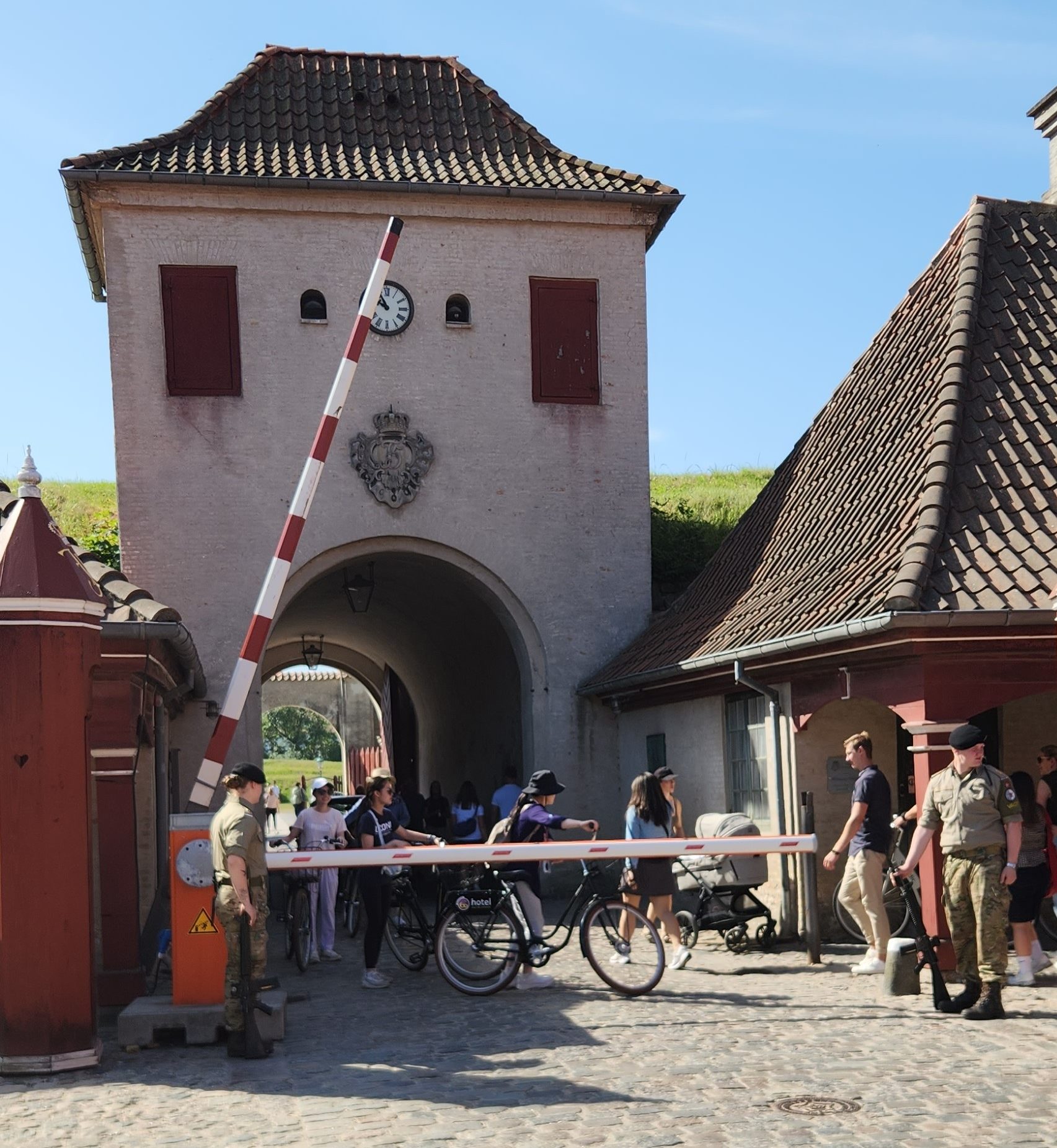
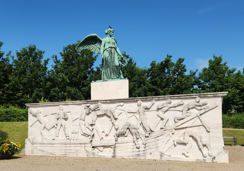
Leaving the Nyboder district, we walked to the public entrance to the Citadel – one of Europe’s best-preserved fortresses surrounded by eight moats, tall ramparts, and cannon bastions – and passed through the fortress to the pier. On the way back to our ship for lunch, we also passed by Maritime Monument (erected in 1928), commemorating civilian Danish sailors killed during World War I.

Moat of the Citadel
Citadel Entrance Gate
Maritime Monument

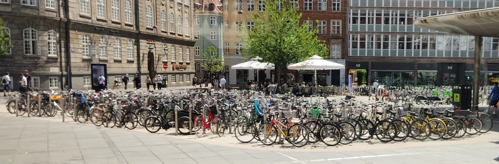
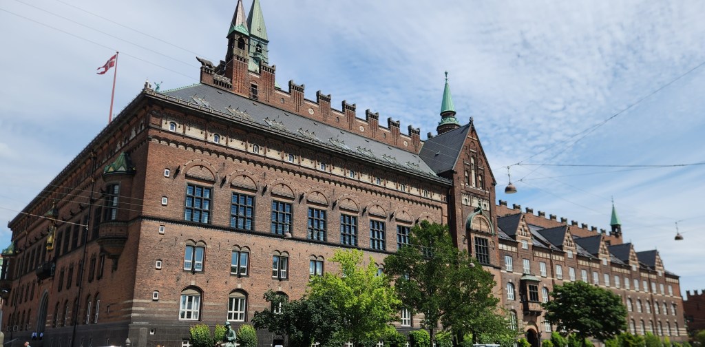
After lunch, we boarded a motorcoach for visits to the iconic Tivoli Gardens and the Christiansborg Palace, the seat of the Danish Parliament and house of the Queen’s Royal Reception Rooms. Along the way, I snapped a picture that says all one needs to know about the popularity of bicycles in Copenhagen, and another of the Copenhagen City Hall.

Bicycles seem to be very popular in Copenhagen
Copenhagen City Hall

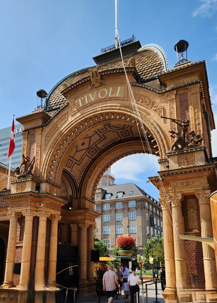
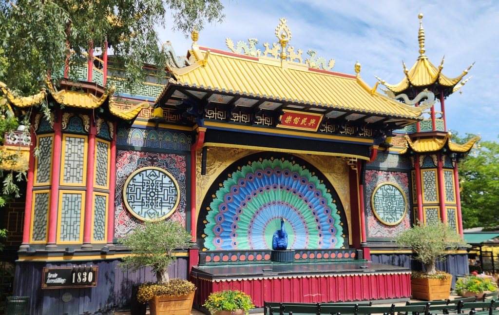
The Tivoli Gardens, the second-oldest operating amusement park in the world, opened in 1843. With 4.25 million visitors in 2024, Tivoli is the most visited amusement park in Scandinavia and second-most popular seasonal amusement park in the world. Our guide gave a brief introduction to the sights, and we were then free to explore the grounds. The buildings and grounds evoke the exotic style of an imaginary East, including the theater, bandstands, and flower gardens.

Entrance to the Tivoli Gardens
The Theater at Tivoli
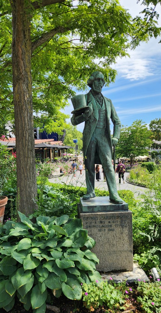
Georg Carstensen, Founder of Tivoli
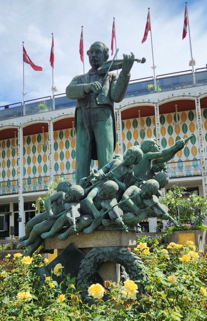
Statue Near Music Hall
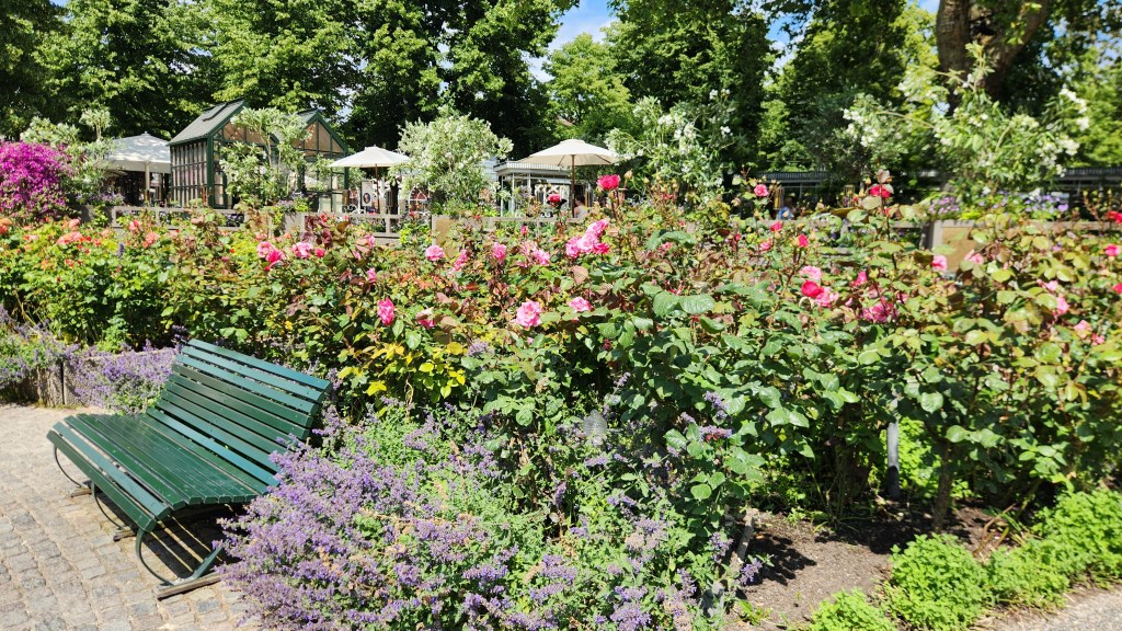
Riotous Gardens Abound at Tivoli
Too much cotton candy, perhaps?

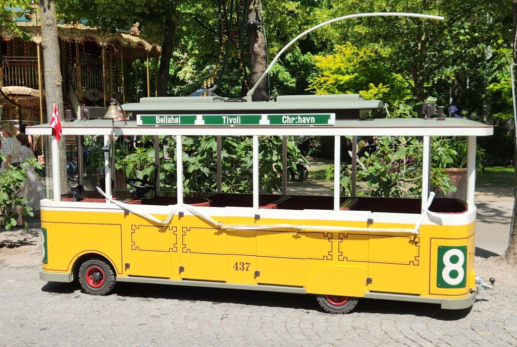
The iconic rides include the Roller Coaster (1914), the Ferris Wheel (1943), the Classic Carousel (1900), and the Vintage Cars (1959). Eschewing those tame attractions, we instead boarded this high-speed trolley for a dramatic race through the park, or at least a senior citizens version of that:

The Ultrafast Tivoli Trolley

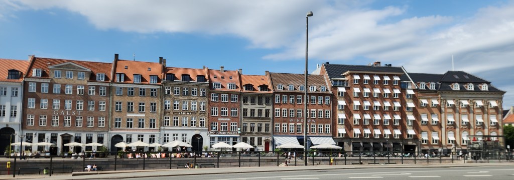
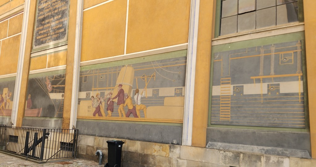
After leaving Tivoli, I snapped pictures of some impressive buildings along the Gammel Strand waterfront and the exterior murals of the Thorvaldsen Museum.

Buildings along Gammel Strand Waterfront
Mural at Thorvaldson Museum

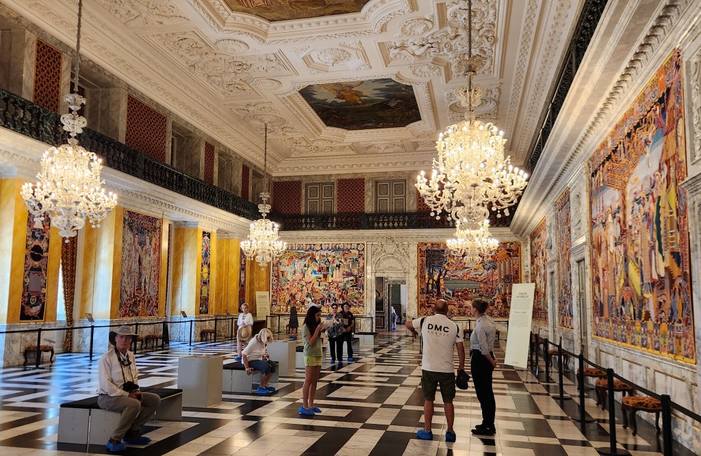
At the Christiansborg palace, we donned special booties to protect the impressive wood flooring before passing through dozens of magnificent rooms used for grand state dinners hosted by the King and Queen, including an entire room filled with tapestries that tell more than 1,000 years of royal history.

The Entry Foyer at Christianborg Palace
Pat in her protective booties, enjoying the artwork
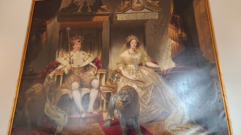
Royal Portrait at the Palace
Tapestry Room at the Palace
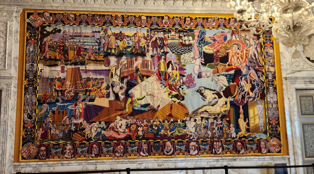
One of the Tapestries
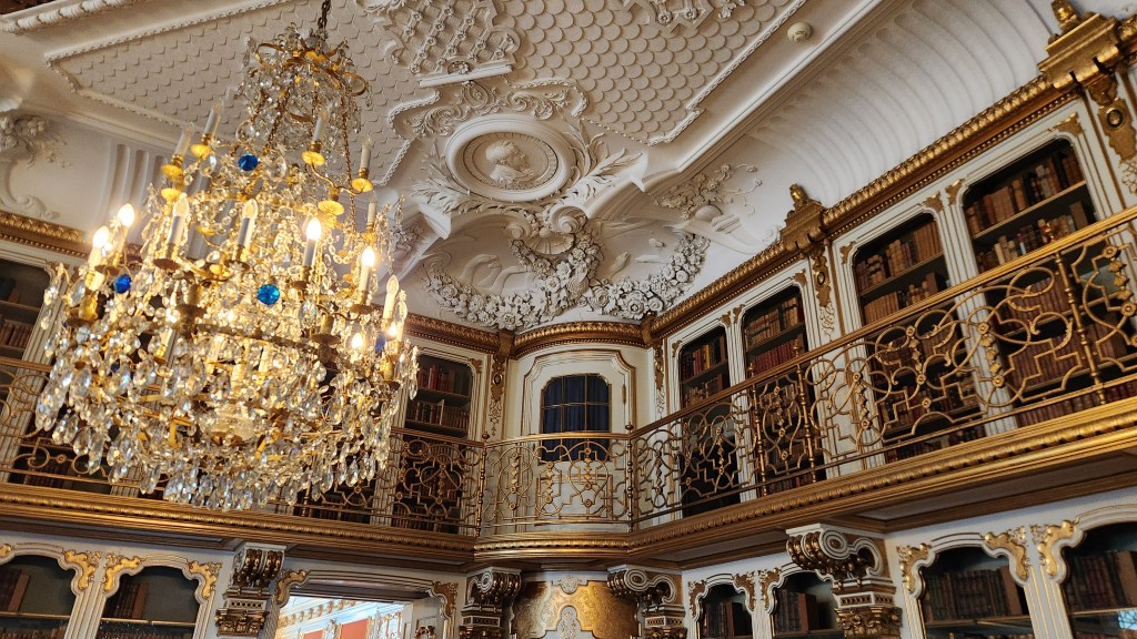
One of the many Grand Rooms at the Palace

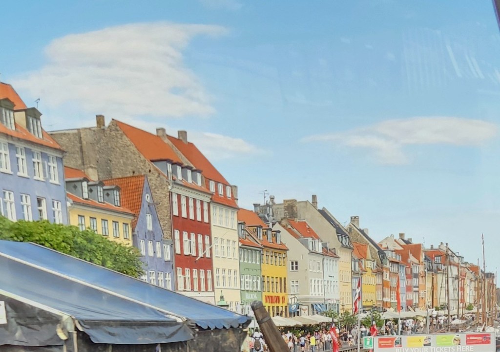
Finally, on our way back to the ship before setting sail for Germany, I took this photo of the colorful 17th and 18th-century townhouses lining the Nyhavn waterfront:

Townhouses Lining the Nyhavn Waterfront

Warnemunde and Berlin, Germany (Thursday, June 25, 2026): The ship docked in the Warnemunde harbor at 6 AM, and after breakfast we left for an all-day visit to Berlin, Germany’s capital city. After a short walk to the nearby railroad station, we boarded a train that took us to the center of Berlin. I didn’t get any pictures of the Warnemunde harbor, and the ones I took from the train on the way to Berlin and back are uselessly blurry, so the description below is focused solely on Berlin.

The first part of the tour was a motorcoach and walking tour during which we saw many reminders of the legacy of the Berlin Wall. I didn’t get many useful pictures due to the heavy traffic and preponderance of construction cranes, but I can tell you that the city was bustling with activity.

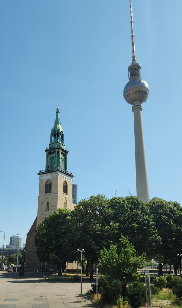
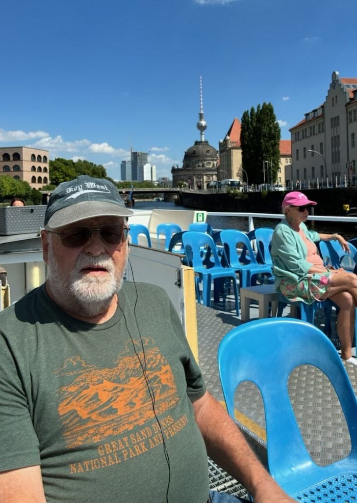
Here’s a picture taken in the Alexanderplatz, a large public square and transport hub in the central Mitte district of Berlin (formerly in East Berlin), showing the 1100-ft tall Berlin TV Tower, built in the 1960s, and St. Mary’s Church (Marienkirche), one of the oldest churches in Berlin.

Berlin TV Tower and St. Mary’s Church

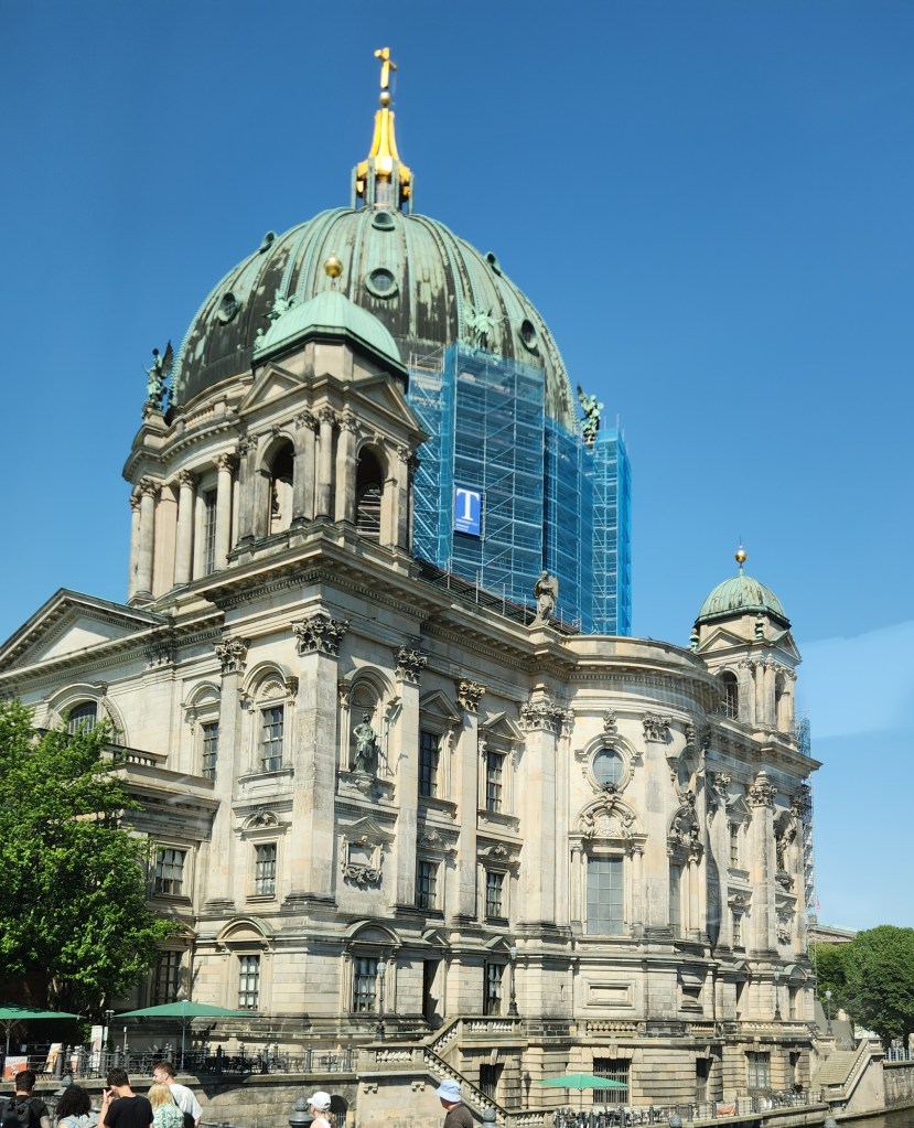
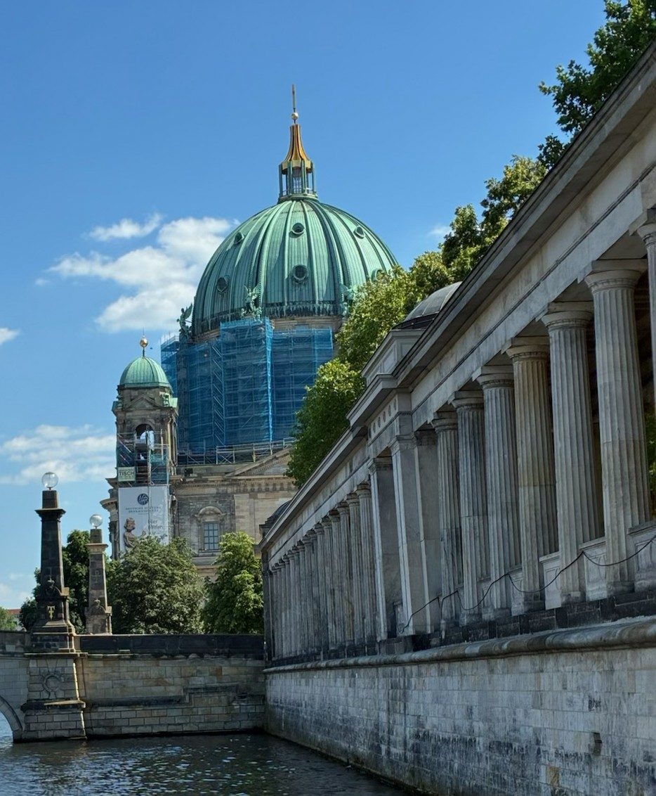
Here is the Berlin Cathedral (Berliner Dom) completed in 1905, the largest Protestant church in the country and known for its massive 320-ft dome. The cathedral is located on Museum Island, a UNESCO World Heritage site.

Berlin Cathedral

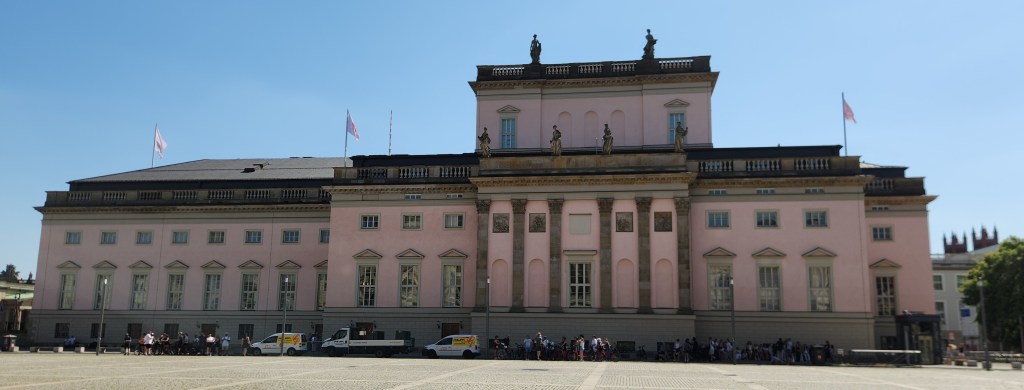
This is the Berlin State Opera (Staatsoper Unter den Linden), a historic opera house located on the Unter den Linden boulevard. Originally built in the 18th century by order of Frederick the Great, it is considered the oldest state opera in the world. The building was reconstructed in 1951 and 1955 after it was heavily damaged during World War II.

Berlin State Opera

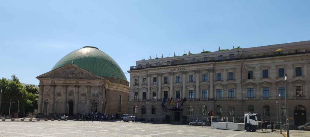
The photo below shows St. Hedwig’s Cathedral with its prominent green dome and the Hotel de Rome, formerly a bank headquarters, located directly on the Bebelplatz square.

St. Hedwig’s Cathedral and Hotel de Rome

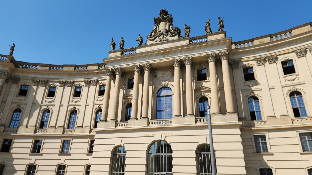
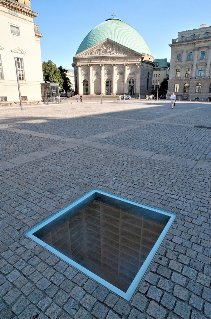
Next is the Old Library building in Berlin, also on the Bebelplatz square, which currently serves as the Faculty of Law for the Humboldt University. Humboldt University was established in 1809 and is recognized as one of Berlin’s oldest universities. It is historically renowned for its contributions to the natural sciences and has been associated with 55 Nobel Prize laureates. The library and the square are notable for being the site of the notorious 1933 Nazi book burning. A memorial now sits beneath the square consisting of empty bookshelves visible through a plexiglass covering to remind visitors of the vile act of the book burning. (My photos of the memorial did not turn out due to the lighting conditions, so I borrowed a photo from Wikipedia.)

Old Library where Nazis confiscated the books to be burned (now part of Humboldt University)
The “Missing Library” Memorial in the Bebelplatz Square (courtesy Wikipedia)

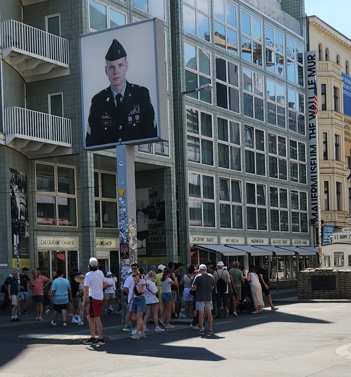
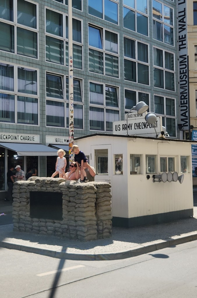
Some of the most interesting sites we saw were directly related to the Berlin Wall, especially Checkpoint Charlie, the only entrance point from the American sector of West Berlin into East Berlin.

Tourists Gathering at Checkpoint Charlie
Checkpoint Charlie

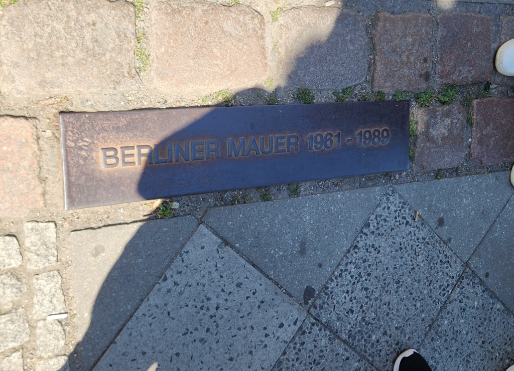
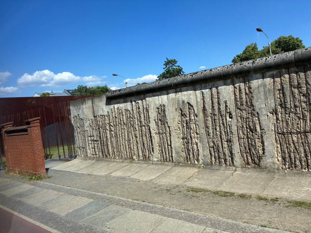
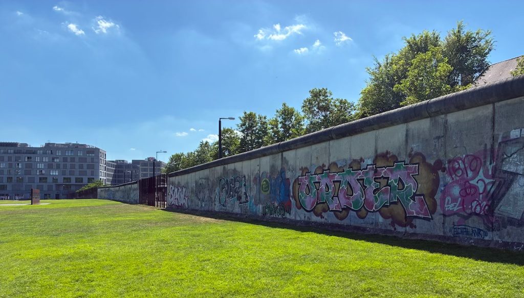
The infamous wall was torn down on November 9, 1989, following a major political blunder by an East German official who announced that citizens were free to travel to the West immediately. This historic mistake caused massive crowds to gather at the checkpoints, ultimately forcing guards to open the borders. The sudden fall of the wall that night marked the collapse of East Germany and paved the way for German reunification, which was officially finalized on October 3, 1990. Since that time, the former East Berlin has been changed by massive public works, infrastructure renewal, and social welfare integration by the German government. However, the former existence of the wall has been commemorated by various markers and lines that mark its entire length. One section of the old wall has also been preserved as part of an open-air museum.

Line Marking Position of the Berlin Wall
Remaining Remnant of Berlin Wall, as viewed from East Berlin …
… and from West Berlin

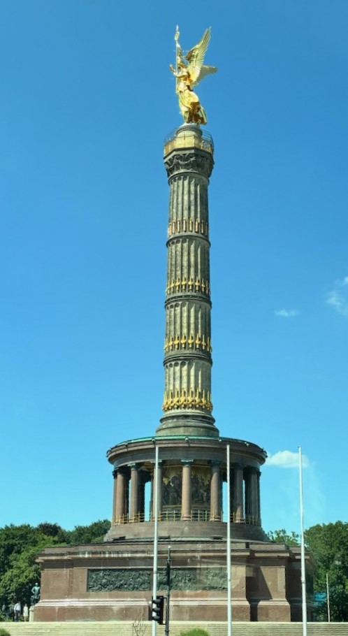
The Berlin Victory Column, featuring the golden statue of Victoria, the Roman goddess of victory, is located in the Tiergarten park. It was designed in 1864 to commemorate the Prussian victory over Denmark. Berliners often call the winged statue Goldelse, which translates to “Golden Lizzy.” The entire structure stands approximately 220 feet tall.

Berlin Victory Column

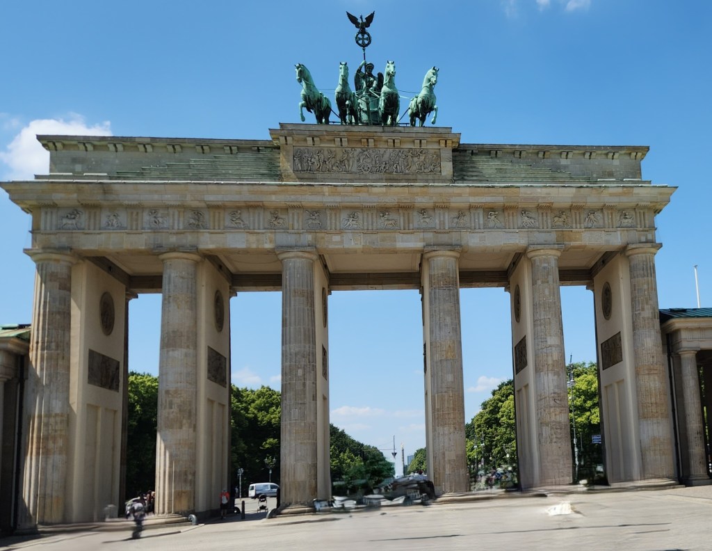
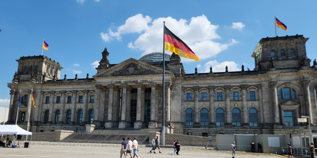
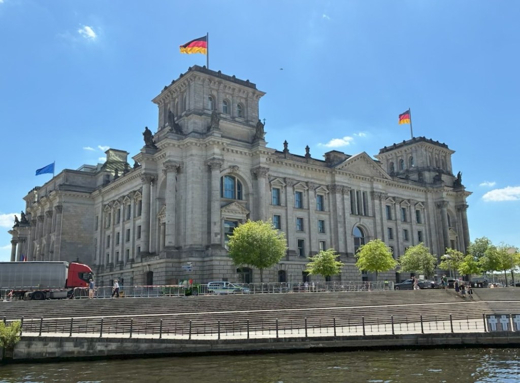
Another iconic site we visited is the Brandenburg Gate, a major site for major historical events. It was built from 1788 to 1791 by orders of King Frederick William II of Prussia. After World War II and during the Cold War, the Berlin Wall obstructed the gateway, and thus was a marker of the city’s division. Since German reunification in 1990, it has been considered not only a symbol of the tumultuous histories of Germany and Europe, but also of European unity and peace. Between the Brandenburg Gate and the Tiergarten stands the Reichstag. The Neo-Renaissance building was completed in 1894 and served as the seat of the German parliament until 1933 when the Nazis set fire to it and blamed the communists as a ruse for Hitler’s rise to power. The unused building was further damaged during World War II and became a museum during East German rule. After reunification, it was restored as the seat of parliament and has since become one of Berlin’s most prominent tourist attractions, drawing hundreds of thousands of visitors each year.

The Brandenburg Gate
The Reichstag

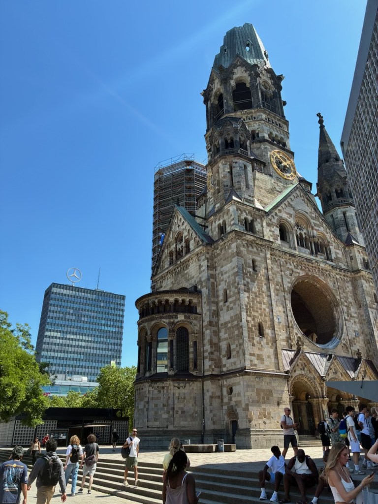
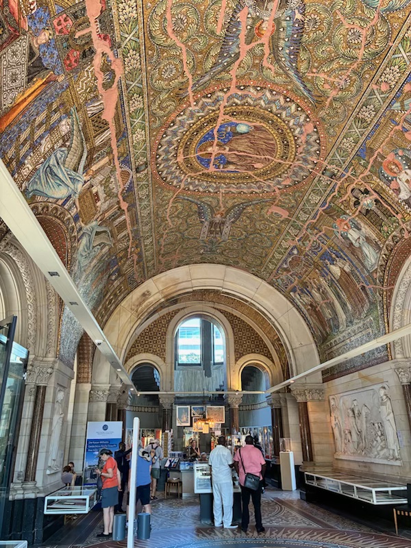
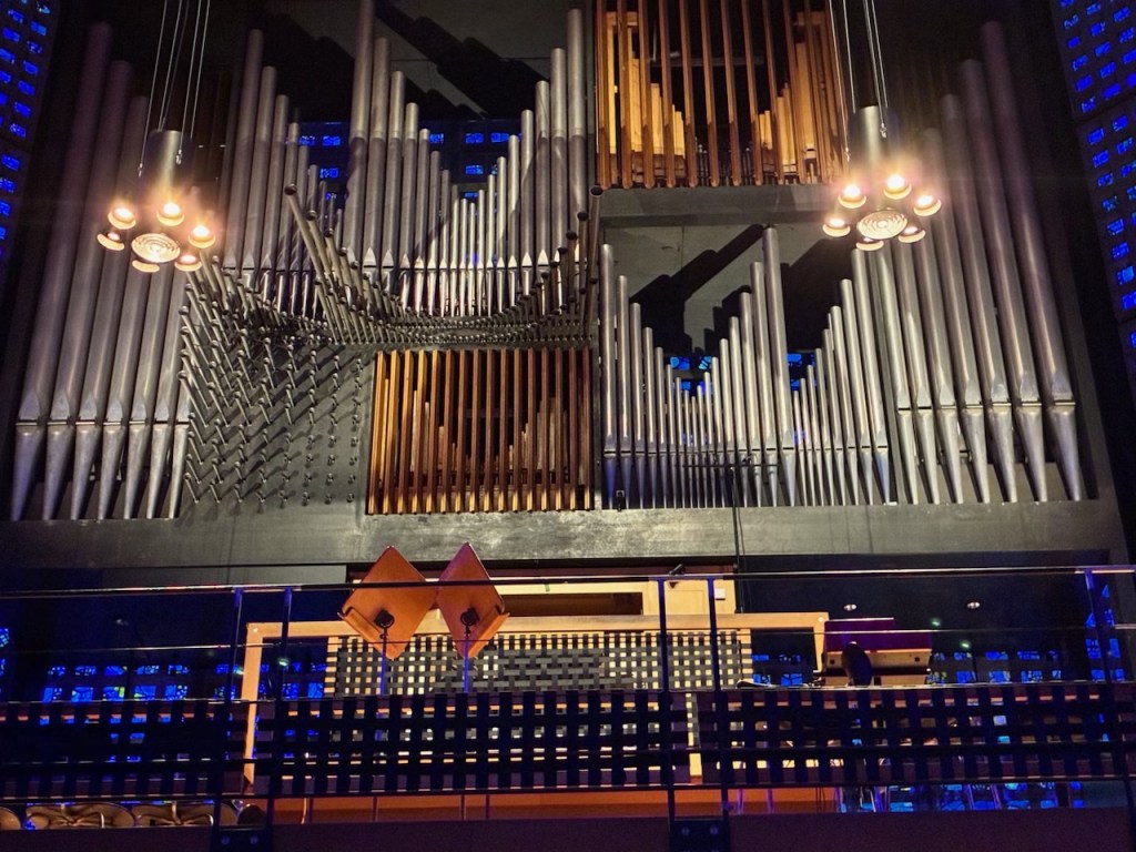
The tour included lunch at a Berlin restaurant followed by some free time, during which we visited the Kaiser Wilhelm Memorial Church, which features a striking ruined spire preserved from a 1943 bombing raid and never repaired so the world would never forget. The original Neo-Romantic style church was constructed between 1891 and 1895. A modern church, completed in 1961, stands beside the historical remains.

Kaiser Wilhelm Memorial Church
Kaiser Wilhelm Memorial Church Interior
Organ in Modern Church

The last part of the tour was a cruise along the Spree River, drifting past the Berlin Cathedral, Museum Island, the Reichstag and the striking architecture of the new government quarter. It was interesting to observe many of these sights from the different perspective of the river.

On the Spree River Cruise Boat
The Reichstag viewed from the River Spree
The Berlin Cathedral viewed from the River Spree

After the river cruise, we took the train back to our ship anchored in Warnemunde harbor. I’ll add a couple of final notes from the Berlin tour before moving on to our next destination.

Perhaps the most sobering site we saw in Berlin was the Memorial to the Murdered Jews of Europe, designed by architect Peter Eisenman. It covers 4.7 acres and features 2,711 concrete slabs called stelae arranged in a grid pattern. The memorial was inaugurated in 2005, 60 years after the end of World War II in Europe. An attached underground “Place of Information” holds the names of approximately 3 million Jewish Holocaust victims.

Memorial to the Murdered Jews of Europe

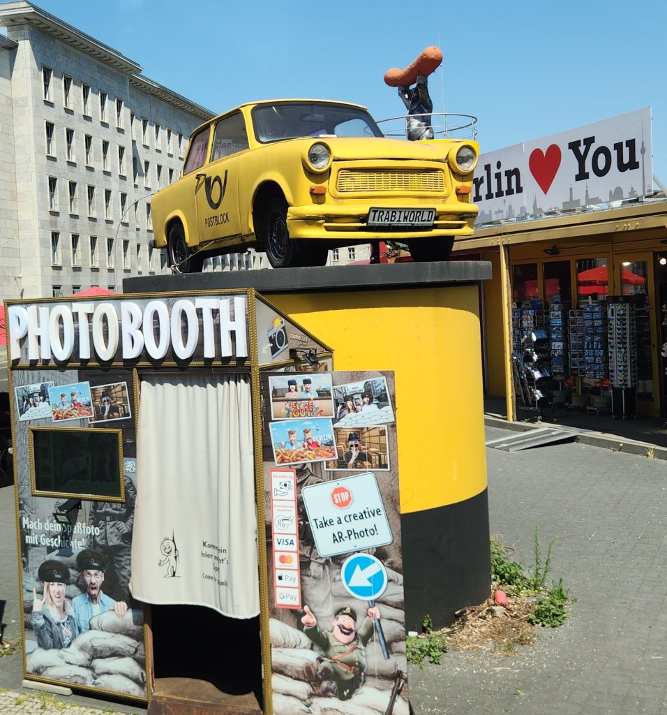
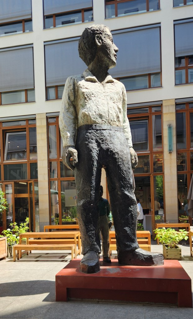
We also saw some more whimsical sites during our visit, including “TrabiWorld,” which commemorates the iconic yellow East German Trabant car and offers tourists the opportunity to drive one, and an interesting statue entitled “Big Man with Little Man.”

TrabiWorld
Big Man with Little Man

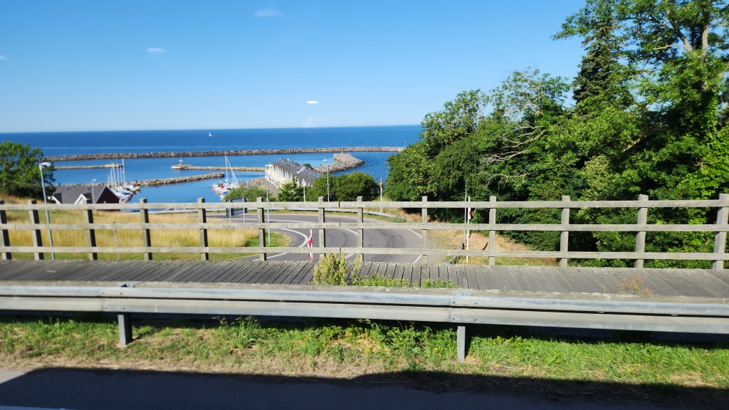
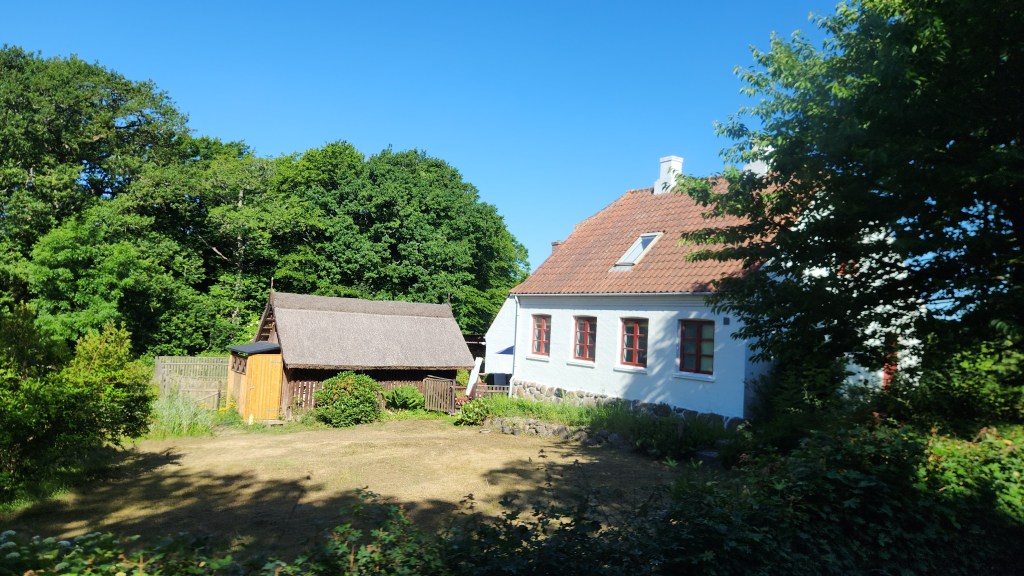
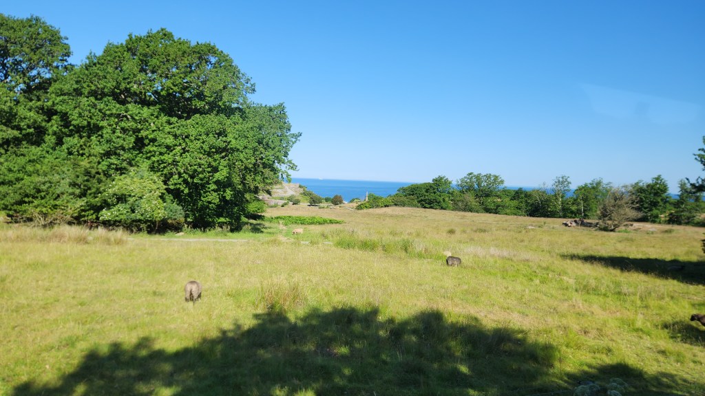
Bornholm, Denmark (Friday, June 26, 2026): Our ship docked in a lovely harbor on this Danish island in the town of Rønne at 8 AM. Our activity for the day was a motorcoach tour of the island where we observed the natural beauty and charming villages of the island. Bornholm is nicknamed Solskinsøen (Sunshine Island) and Klippeøen (Rock Island) for its weather and geology, respectively. The tour began as we passed through the lush green fields of the western coast and passed by Hammershus, the largest castle ruins in Northern Europe.

Leaving the Harbor in Rønne
Rural Home on Bornholm
Bornholm Countryside
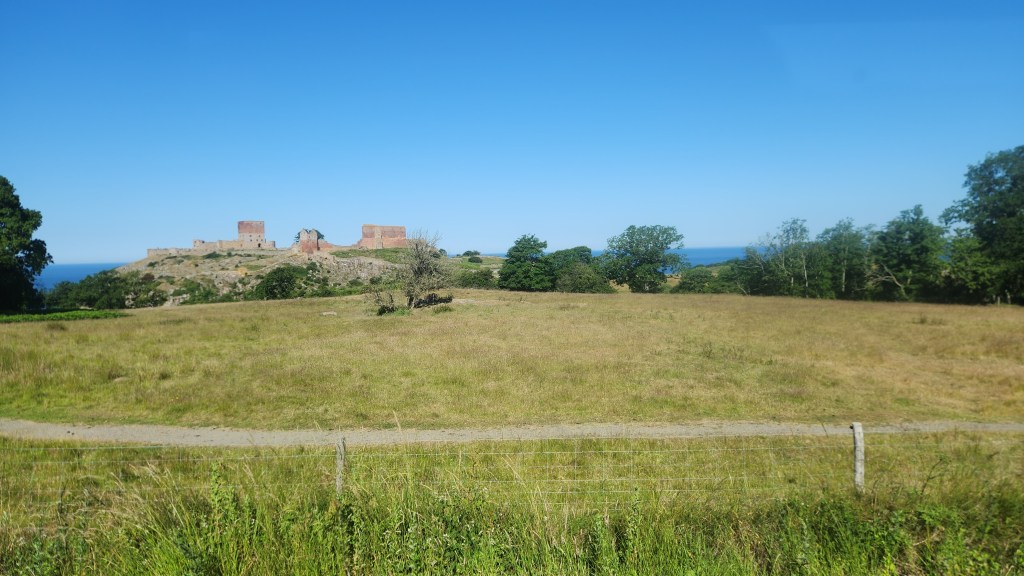
Hammershus Ruins

Hammershus dates back to the 13th century and is traditionally linked to the Archbishop of Lund, Jakob Erlandsen. The castle became a focal point in power struggles between the church and the Danish crown. After the destruction of Lilleborg in 1259, Hammershus rose in importance and became a key seat of authority on Bornholm. In 1522, the castle and the island were pledged to the Hanseatic city of Lübeck as debt security. During that period the fortress saw its last major expansion. Behind the strong ramparts were living quarters as well as a prison, chapel, kitchen, granaries, stables and even a brewery. One remarkable engineering feature is the system of two freshwater reservoirs built high above sea level. As artillery developed in the 17th century, the fortress gradually lost its military value and began to decay. In 1822, the ruins were declared a national monument, starting a long process of protection and conservation.

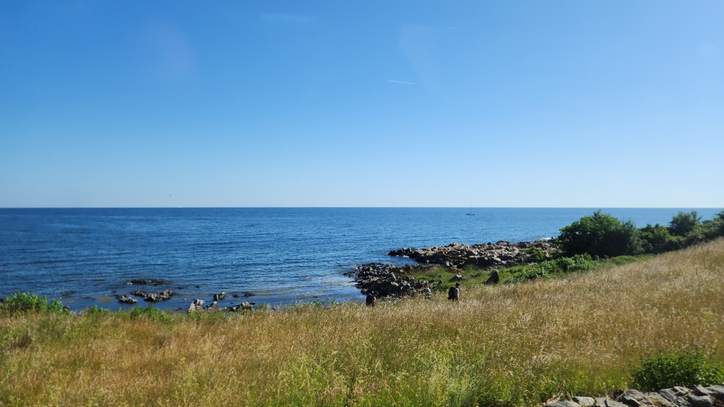
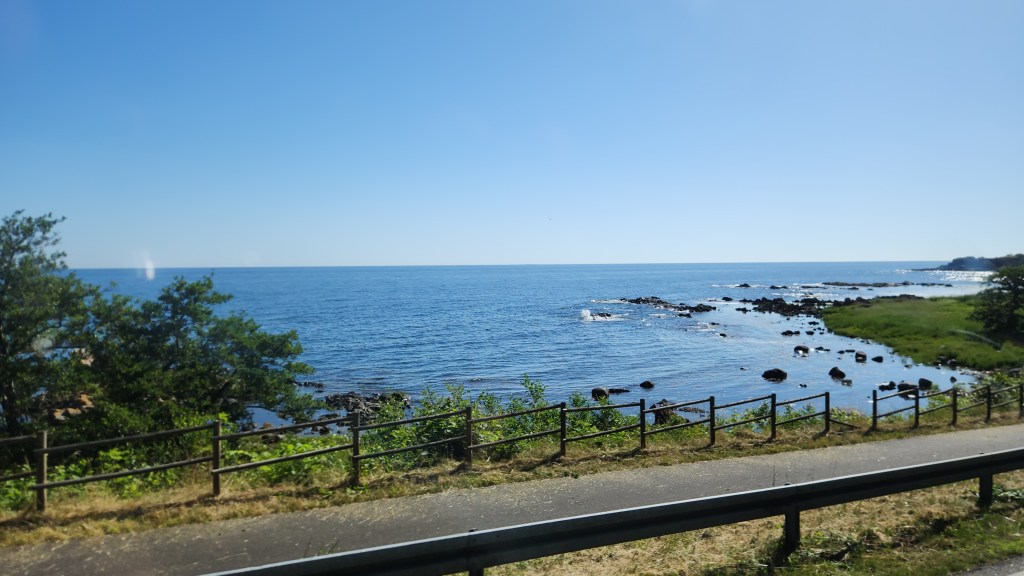
After the fortress, we continued along the island’s rugged northern side and passed through several small villages.

Bornholm Coast
Village on Bornholm
Borholm Coast

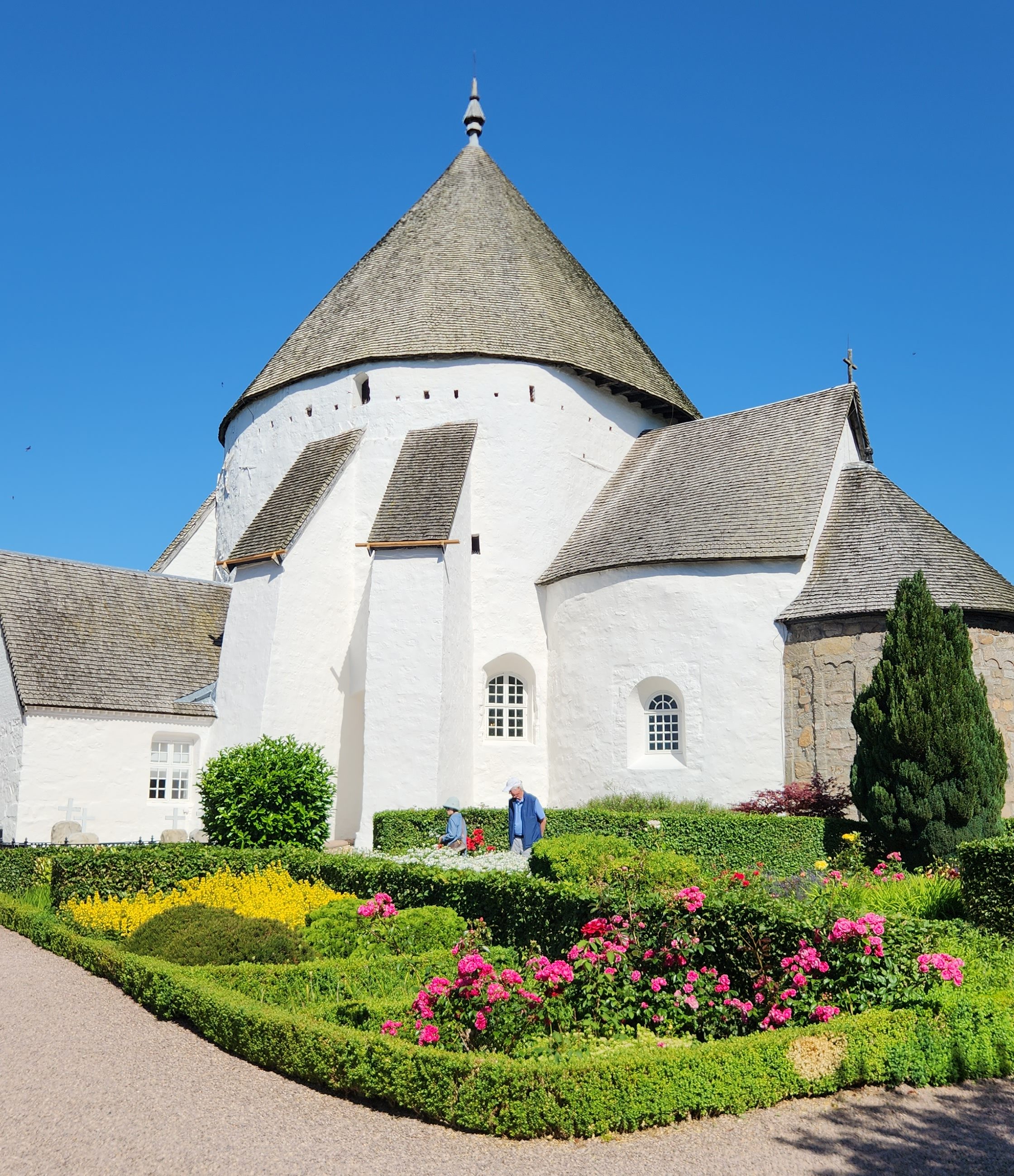
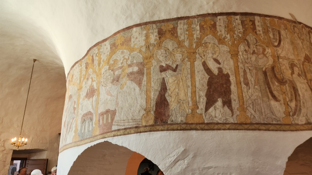
We then left the coastal road and visited one of the four round churches that can be found on Bornholm. These peculiar buildings were not just churches but also served as fortresses during times of conflict. The one we visited is the Østerlars Church, the largest and oldest of the four, constructed around 1160. The unique white, conical-roofed structure was historically designed with defensive features, including a top story used as a shooting gallery.

The Østerlars Church
Inside the Østerlars Church

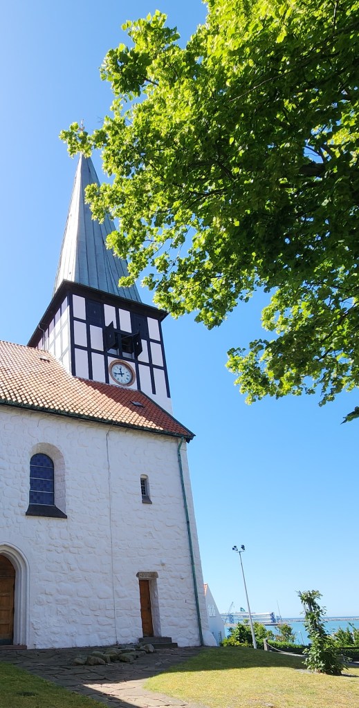
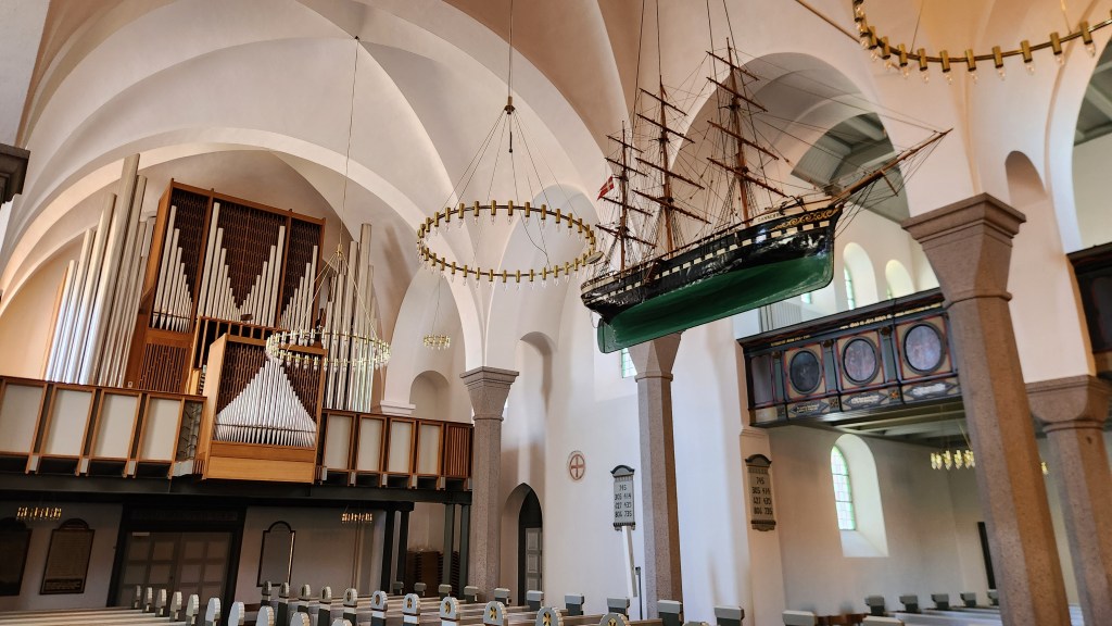
After the church visit, we traveled through the island’s interior back to the ship, then took a stroll through Rønne, where we visited St. Nicolai Church, which was originally built in the 1300s but has subsequently undergone additions and renovations over time.  A distinctive feature is the ship model hanging from the ceiling, reflecting a long-standing maritime tradition in Baltic churches.

St. Nicolai Church in Rønne
Inside the St. Nicolai Church

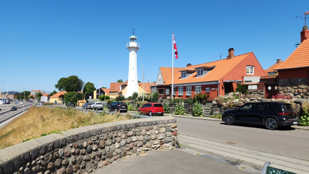
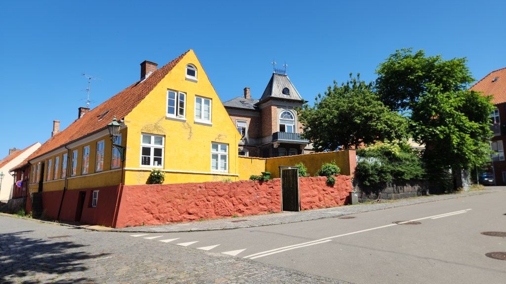
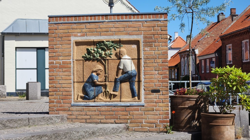
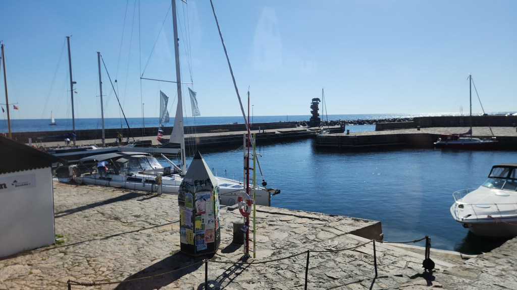
I took the following pictures as we strolled back to the ship in time for our late afternoon departure from Bornholm.

In the town of Rønne

As we sailed eastward on into the evening, I caught this nice shot of the setting sun.

And with that parting shot, let’s end this installment. When Part 4 appears on the website, we’ll find ourselves in Poland.

Stay tuned …

Pat and Dave’s Vibrant Viking Voyage – PART 2: More Norway

Welcome back for Part 2 of my travelogue describing our recent Viking Ocean Cruise entitled “Viking Homelands.” Part 1 described the pre-cruise extension activities in Oslo and Bergen, Norway. This episode will cover the beginning of the actual cruise. Here’s a map of the overall itinerary:

This Part of the travelogue covers our remaining activities in Norway, including locations 1, 2, 3, and 4 on the map.

Bergen, Norway (Wednesday and Thursday, June 17 and 18, 2026): At the conclusion of Part 1, we were still in Bergen on a beautiful sunny Tuesday (rare for Bergen) following our adventures with the goats and trolls on Mount Hoyen. The main activity on Wednesday consisted of a short bus ride from our hotel to our Ocean Cruise ship, the Viking Sky, anchored in the Bergen fjord near the famous Bryggen (wharf), getting the mandatory safety briefing, and getting settled into our cabin, where all our luggage was waiting for us. One of the best things about these Viking cruises is that there is no need for packing and unpacking as is the case with land-based travels. Once settled in, we simply enjoyed the comfort of our cabin and the ship’s amenities for the duration of the trip. As a fellow passenger put it: “they move the hotel to all your destinations.” (The ship is essentially identical to the ones we sailed on in our two previous Ocean Cruises, the Viking Star and the Viking Neptune. I included details about the Star in Pat and Dave’s Tremendous Tropical Trek, which you can take a look at if interested, so I won’t spend any time describing the Sky.)

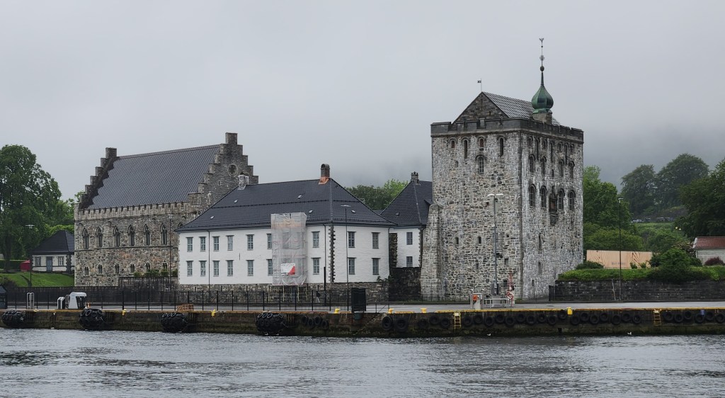
On Thursday morning, we embarked on a scenic coach tour of Bergen, which turned out to be somewhat repetitive after our tour on the previous Tuesday. I did get a better view of the Bergen Fortress that we visited on Tuesday and I discussed in Part 1, from across the harbor:

The Bergen Fortress

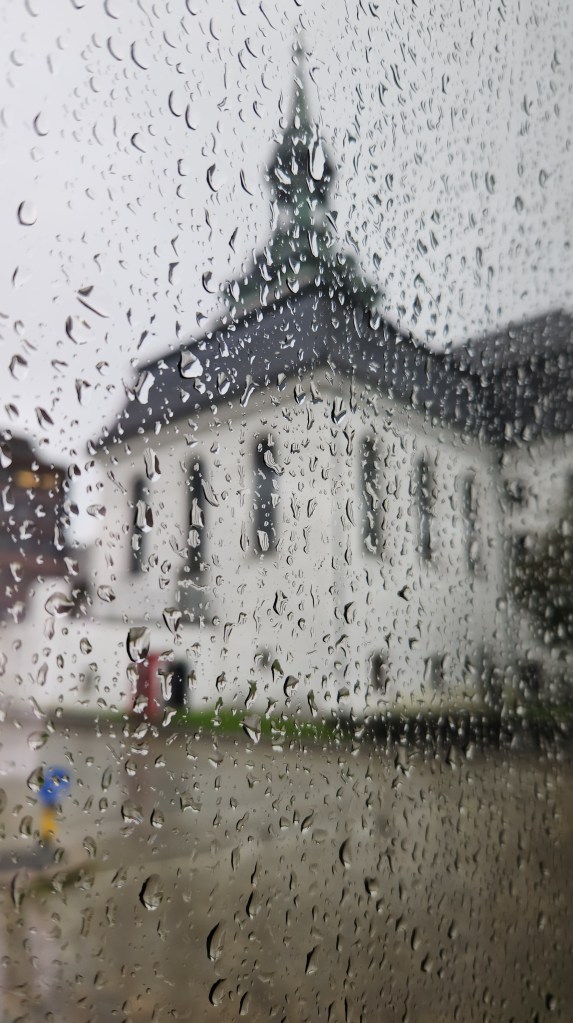
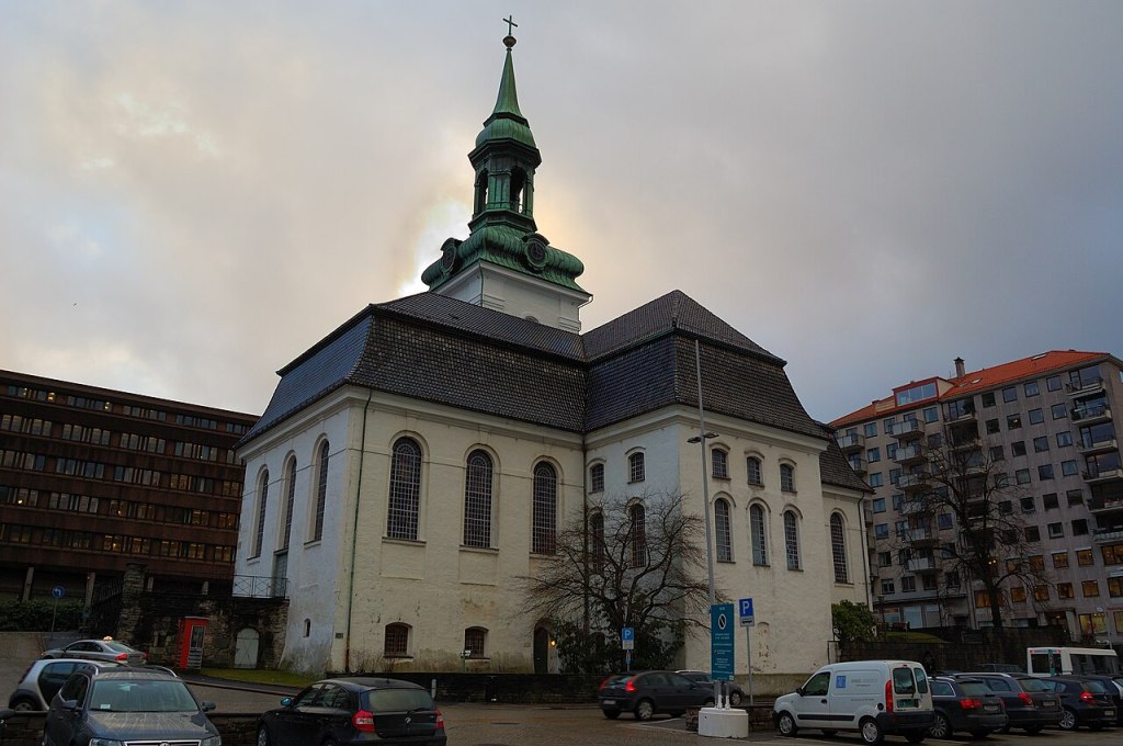
There were some new stops along the way, however. One of these was the New Church (Nykirken). The name comes from the fact that, when originally built in 1621, there were several older churches in Bergen. The church was built on the foundations of the medieval Archbishop’s Residence, originally constructed in the late 1200s but destroyed by fire in 16th century. My only photo of the exterior of the Nykirken illustrates what we understood to be typical Bergen weather, but I’ve added one from the internet to show the building more clearly.

A Soggy View of the New Church
The New Church (courtesy Wikipedia)

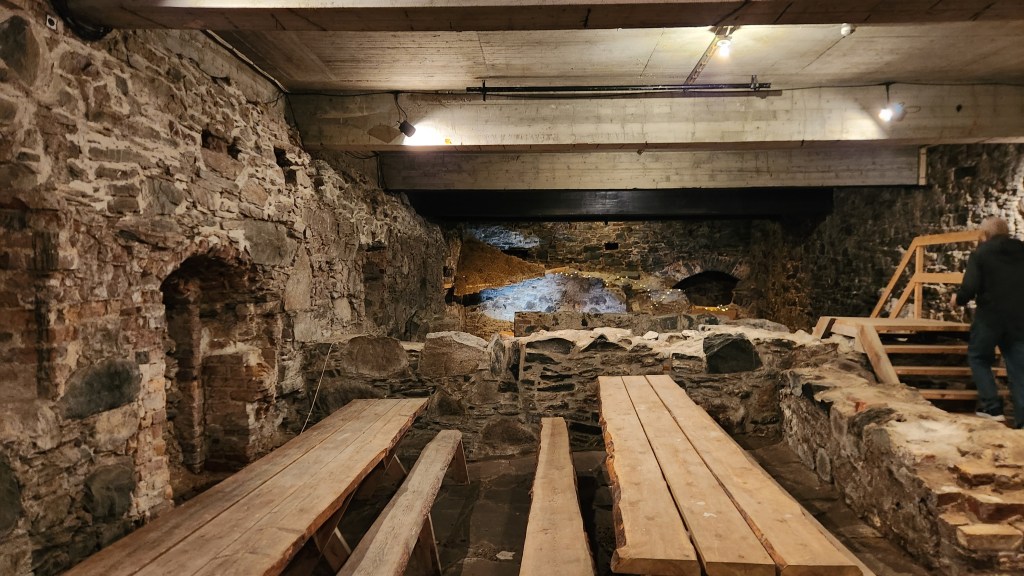
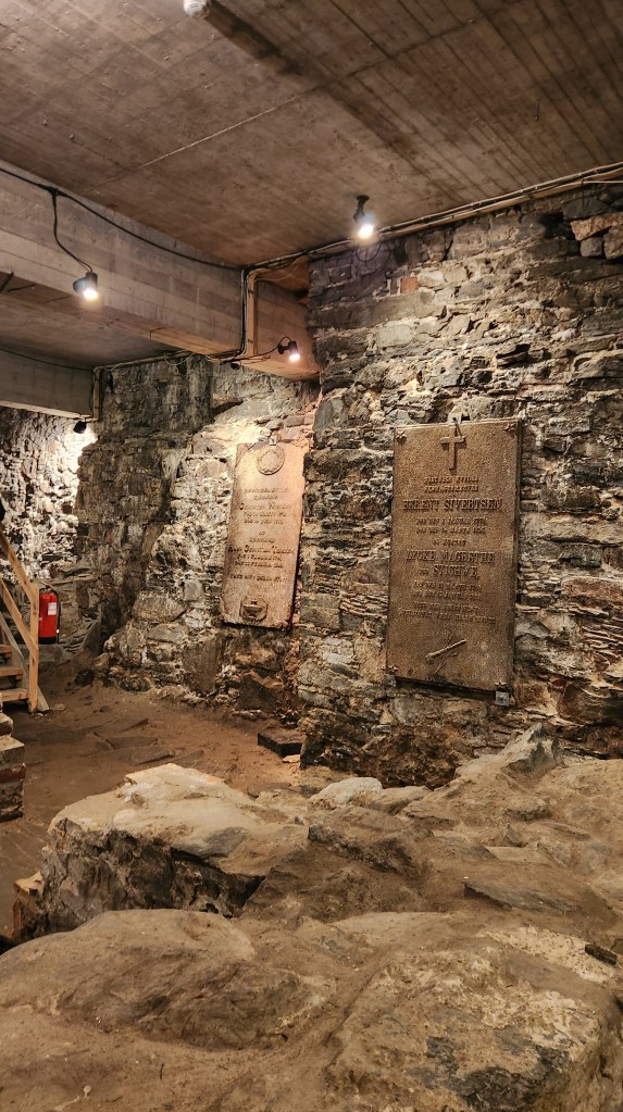
The ruins of the Archbishop’s Residence have been preserved beneath the church, and we were able to go inside to see the interesting artifacts.

Ruins of Archbishop’s Palace

Like much of Bergen, Nykirken has been rebuilt multiple times following devastating fires, most notably after a Nazi ammunition ship exploded in the harbor in 1944, which also destroyed many of the buildings in the harbor area. As an aside, though some claim the explosion was an act of sabotage due to its occurrence on Hitler’s birthday, it was apparently merely a tragic accident.

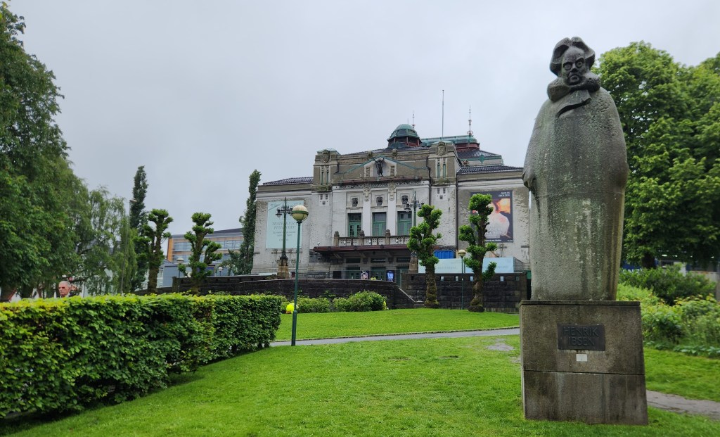
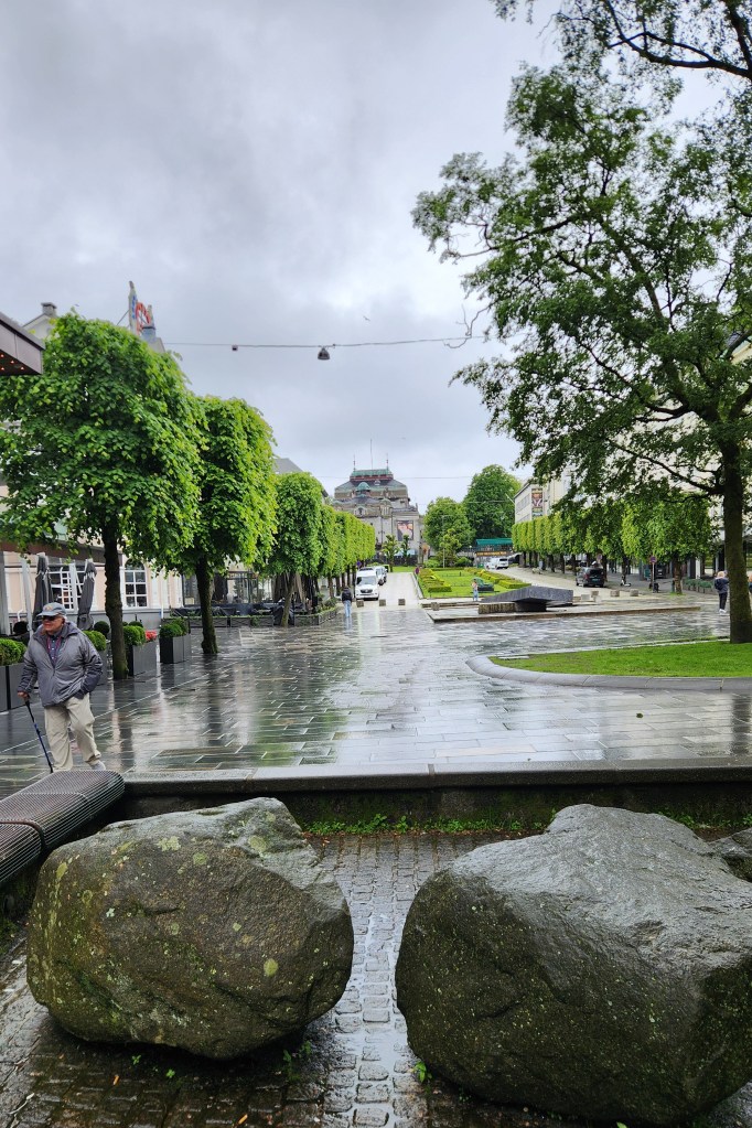
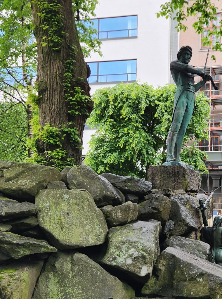
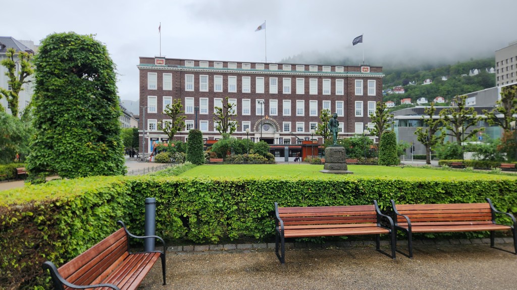
As you can see in the following photos, the rain stopped as we continued the tour. We walked past several Bergen landmarks, including: the National Theater, built with assistance from world famous violinist Ole Bull in 1850; the Telegraph Building, originally built for the telegraph system; and Ole Bull Plaza, a wide pedestrian avenue with a view of the National Theater.

The National Theater, Guarded by Henrik Ibsen
Ole Bull Plaza (National Theater in Background)
Ole Bull Serenading his Fans
Telegraph Building

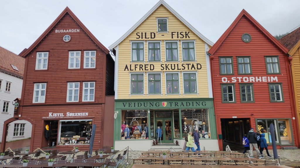
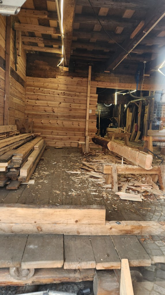
The tour ended at the Bryggen, or wharf, which features the buildings of the Hanseatic League, the powerful medieval confederation of merchant guilds and market towns in Northern and Central Europe. The League dominated maritime trade along the North and Baltic seas from the 13th to 15th centuries through control of major trade routes and secured vast economic privileges. Bergen was one of the four major trading post of the league beginning around 1350. For nearly 400 years, these German merchants dominated the city’s economy, maintaining a strict monopoly over the highly profitable stockfish (dried cod) trade until the 1760s. The iconic Hanseatic League buildings on the Bryggen have been maintained as a major attraction. Restoration of several of the buildings following the harbor explosion continues today, using the original plans and building materials.

Historic Buildings at the Bryggen
Restoration Work on a Bryggen Building (seen through a window)

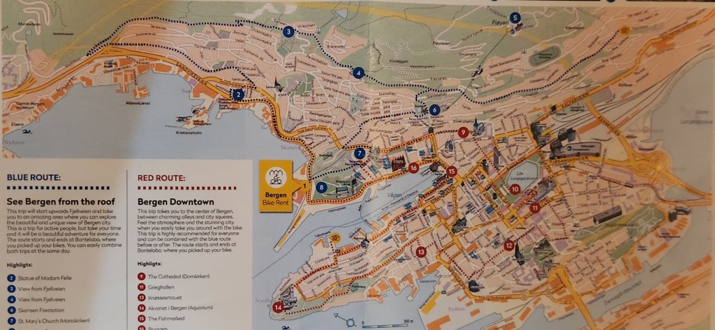
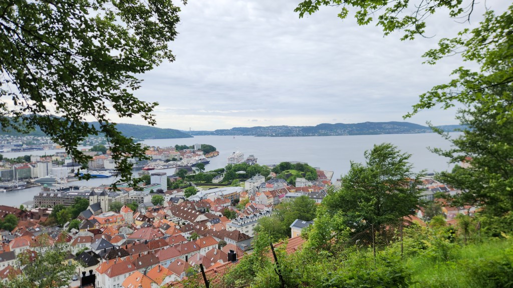
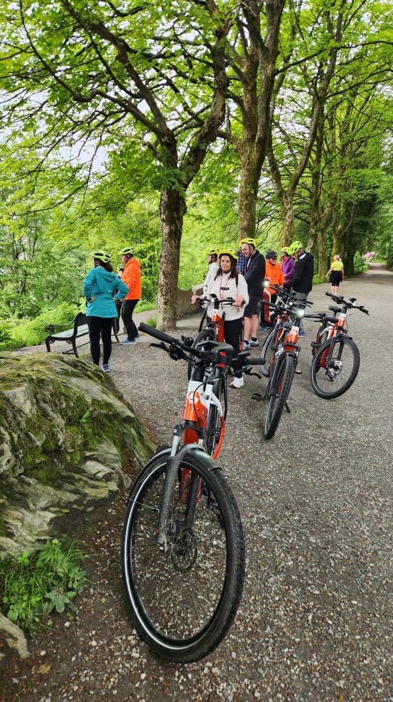
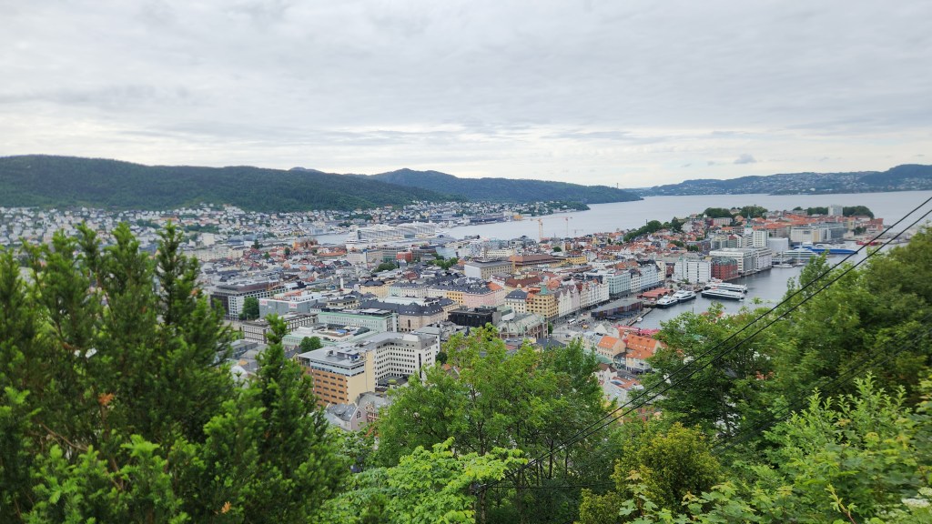
On Thursday afternoon, we went on a particularly enjoyable outing – an E-bike tour of Bergen with about a dozen other Viking passengers. The bikes were excellent and surprisingly easy to maneuver even when we traveled on old cobblestone streets. The tour covered about six miles with a dozen or so stops to gawk at the scenery and listen to our guide, starting from the pier a short distance from our ship, then winding uphill for beautiful panoramic views of the city, then descending back to the city center and returning to the pier.

Map of E-bike Tour — Blue and Red Routes
Overlook on E-bike Tour
The E-bikers at an Overlook

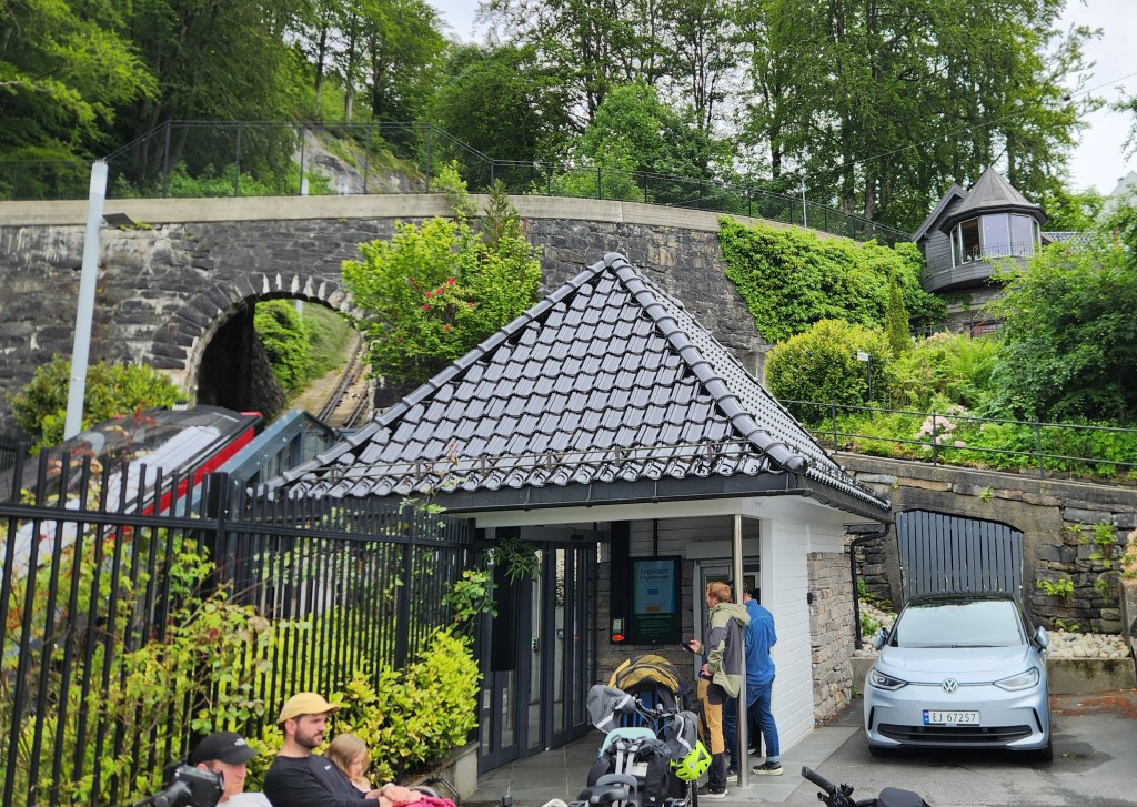
One especially interesting thing for me was when we stopped at a station on the funicular line where several parents were waiting to pick up their kindergarteners who were coming home from their school on the train.

Parents Waiting for their Kindergartners on the Funicular
Overlook on E-bike Tour
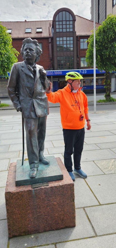
E-bike Tour Guide and Norwegian Composer Edvard Grieg
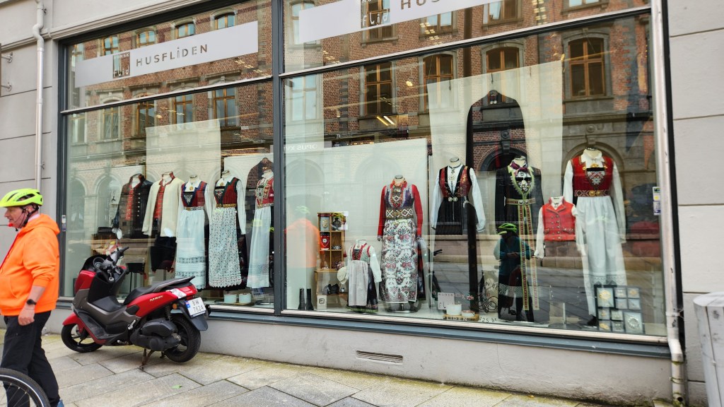
Shop Selling Traditional Dresses — Costing up to $10,000

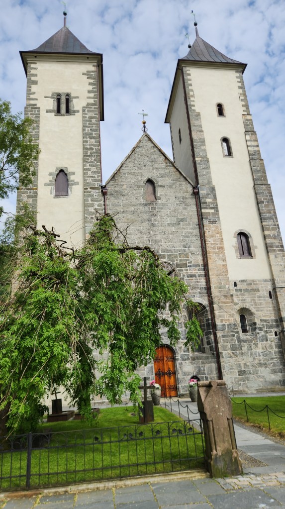
One of the stops was at St. Mary’s church (Mariakirken), a Romanesque style building constructed from about 1130 to 1180, which is considered the oldest remaining building in Bergen. It was historically known as the German church as it served the German merchants of the Hanseatic League.

St. Mary’s Church

Shortly after we were back on board the ship, it set sail for our next destination. I snapped this photo as we passed on into Thursday evening:

Leaving Bergen

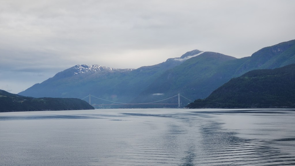
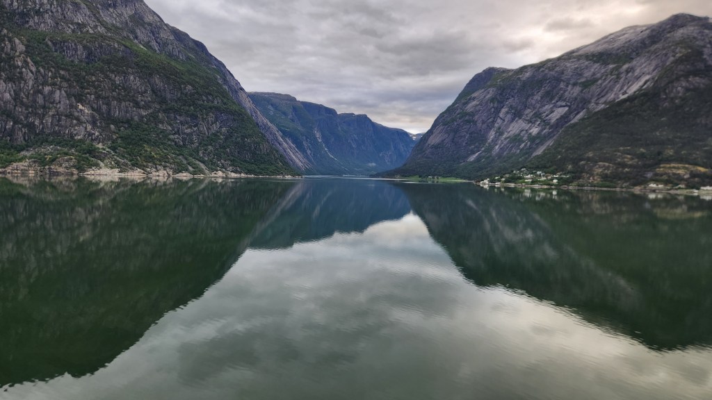
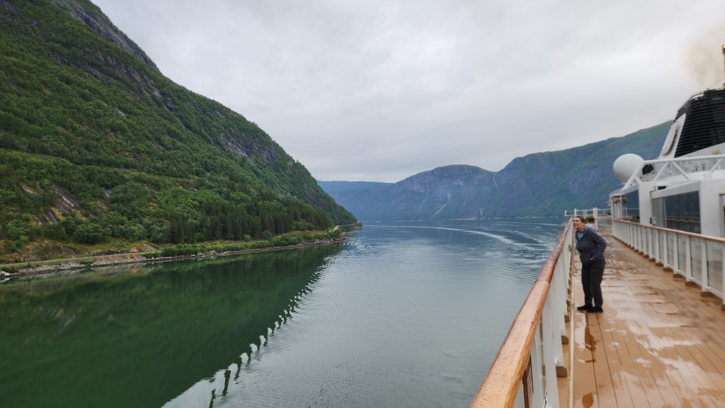
Eidfjord, Norway (Friday, June 19, 2026): Early Friday morning provided another opportunity to gawk and snap photos as we continued sailing along the Hardangerfjord toward our next docking location at Eidfjord.

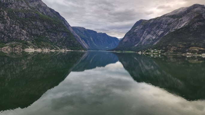
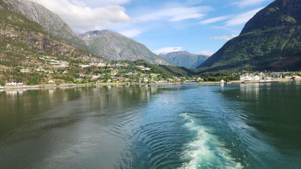
Sailing on the Fjord Toward Eidfjord
Pat Gawks at the Scenery
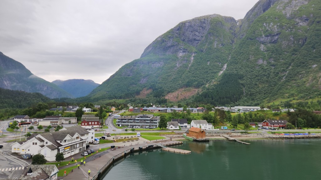
Eidfjord, Norway, viewed from our Balcony on the Viking Sky

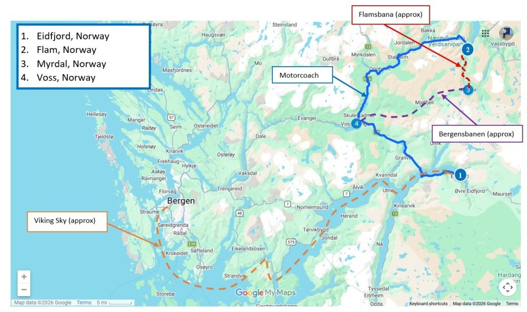
Once the ship had docked, we set off on a full-day excursion to Flåm, one of Norway’s most scenic coastal villages. Here’s a map showing how we got to Eidfjord and how we spent the day:

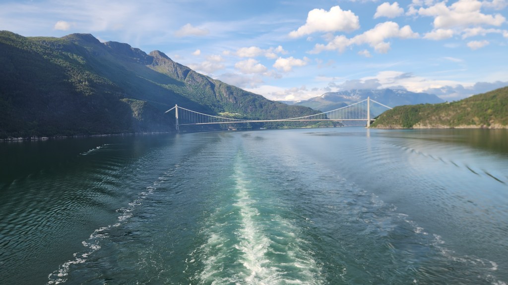
We boarded a motorcoach for a drive from Eidfjord to Flåm, soon finding ourselves crossing the fjord on an impressive suspension bridge and entering into an enormous tunnel – it was so large that it included a roundabout for following tunnels in multiple directions. After what felt like several miles, we emerged again into the countryside, crossing scenic mountain passes and driving through more manmade tunnels. About halfway along, we stopped to admire the Tvinde Waterfall cascading down a steep cliffside.

The Tvinde Waterfall

After the waterfall stop, our coach delivered us to Flåm, where we boarded the Flåm Railway – generally known as the scenic Flåm Railway for a good reason. The track climbs nearly 3,000 feet while passing through 20 tunnels and over numerous bridges on the way to Myrdal.

View from the Flåm Railway
Kjosfossen Waterfall viewed from Tourist Stop on Flåm Railroad

At Myrdal, we boarded the Bergenbanen train, once again passing through the spectacular vistas we saw on our way from Oslo to Bergen during the pre-cruise program. Our train ride this time ended at Voss, where we enjoyed lunch before once again boarding the motorcoach for our return to the ship. Along with the beautiful scenery, including yet another impressive waterfall, we saw a plethora of “marshmallows” dotting the farm fields – the local pet name for bales of hay or straw wrapped in white weather-resistant coverings.

View from Restaurant in Voss
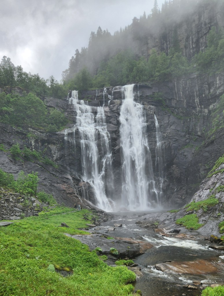
Skervsfossen Waterfall on Route from Voss to Eidfjord
Field of “Marshmallows” Near Eidfjord

As the ship headed back down the Hardangerfjord toward the North Sea, we contented ourselves with more delightful views of the passing scenery.

Sailing Away from Eidford
Sailing Away from Eidford down the Hardangerfjord

Stavanger, Norway (Saturday, June 20, 2026): After an overnight sail, we arrived in Stavanger at 7 AM for what proved to be a rather quick, half-day stop. While Stavanger appeared to be a lovely city with a world-famous Oil Museum, we opted out of the city tour for an alternate activity – a local sightseeing boat ride up the Lysefjord (“light fjord”, named for the lightly colored granite mountains that rise on each side of the fjord).

On the Tour Boat from Stavanger to the Lysefjord

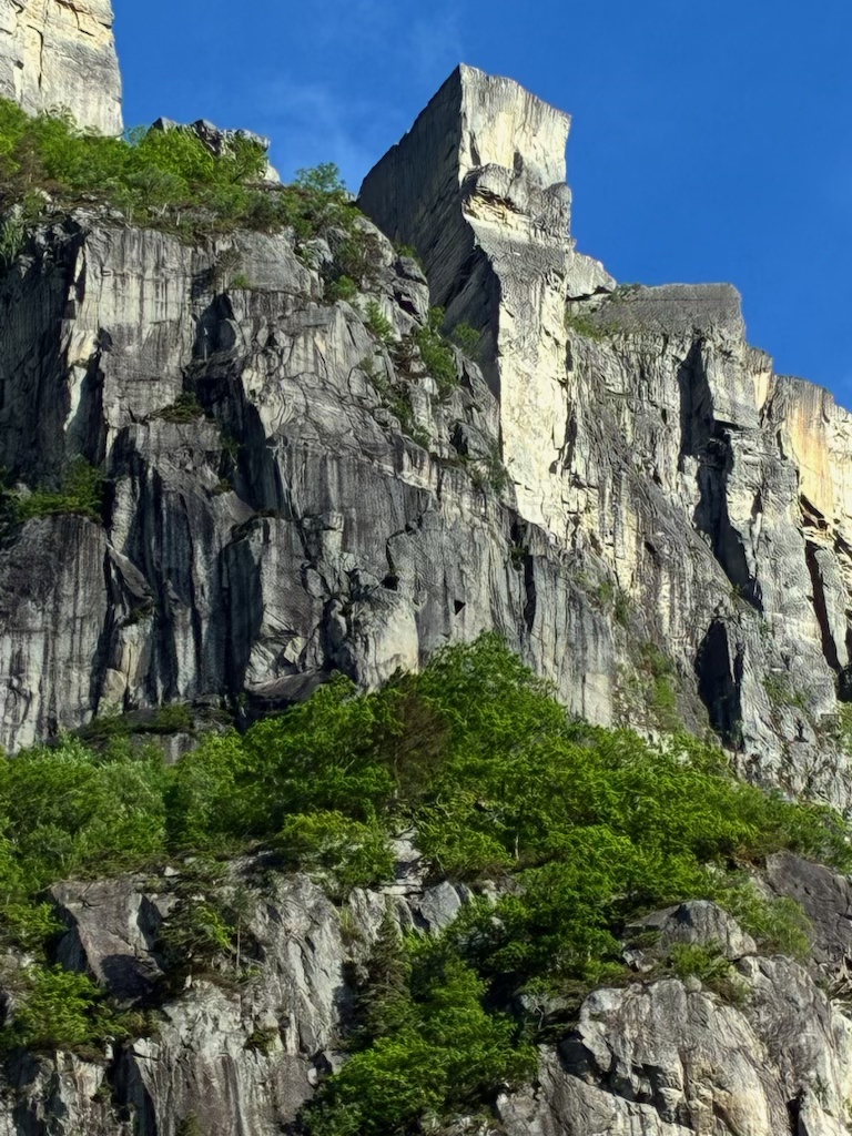
As our tour boat set sail from the Stavanger archipelago, the day was rather dreary, and it seemed as if our visit to the Preikestolen, (Pulpit Rock) might be a bit of a bust. However, as we approached the destination the clouds began to part and we were rewarded with bright sunshine as we passed alongside the famous rock. As you’ll see in the pictures below, the rock takes its name form its resemblance to a church pulpit.

Sailing up the Lysefjord toward Pulpit Rock
Yet another Beautiful Waterfall — this one on the Lysefjord
Pulpit Rock on the Lysefjord

As an interesting side note, we learned that Tom Cruise filmed one of his iconic Mission Impossible: Fallout stunts atop the Pulpit Rock (serving as a stand-in for the mountains of Kashmir), where Cruise’s Ethan Hunt character fights Henry Cavill and dangles from the 2,000-foot-high cliff. The filming required heroic efforts from helicopter pilots to bring in the actors and film equipment in the windy conditions. As sort of a reward for the cooperation of the Norwegian authorities, the world premier of the movie was later shown to an audience on top of the rock.

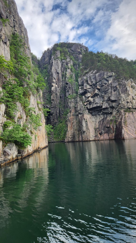
After ogling the Pulpit Rock, we sailed a bit farther up the fjord for a close-up view of an interesting cove as well as the chance to see a pair of goats that generally spend the summer in a cozy spot along the fjord.

Cove in the Lysefjord near Pulpit Rock
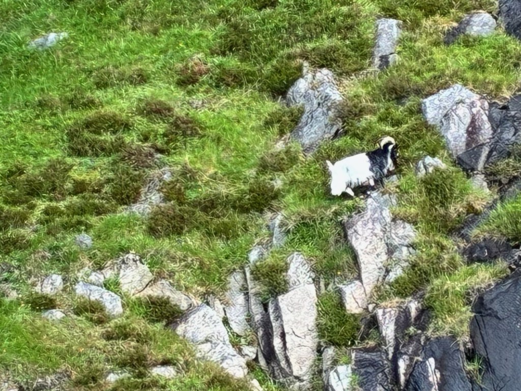
A healthy goat has a lush food supply for the summer

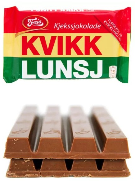
After the sightseeing, as the boat headed back toward Stavanger, we were treated to a lunch of Norwegian waffles with cream and sweet jams. We also purchased a couple of bars of an iconic Norwegian candy called the Kvikk Lunsj, which means just what it sounds like in English and is considered a necessity for hikers in Norway. While some compare it to a Kit Kat bar, any good Norwegian will tell you it is much better. We were told that Kt Kat tried to sue the Freia Candy Company for trademark infringement or some such thing but the court ruled that Kvikk Lunsj was developed and marketed before Kit Kat even existed.

A delicious Kvikk Lunsj atop an Inferior Kit Kat

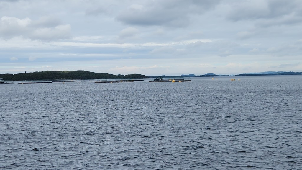
On the way back down the Lysefjord toward Stavanger, we passed by several fish farms, which looked to be quite sophisticated operations.

Fish Farms in the Lysefjord near Stavanger

Once back in Stavanger, we wandered about the town for an hour or so before reboarding the ship. Back on our ship, we headed off in the early afternoon for an overnight sail to Oslo. Here are some photos from the town and one more photo as the ship sailed away.

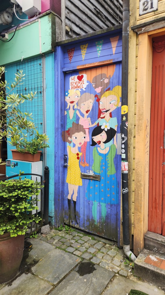
A shop in Stavanger caught my eye …
As did another one …
Street scene in Stavanger
Stavanger Cathedral, established in 1125 and rebuilt after 1272 fire
Interesting Sunbeam as we sail away from Stavanger

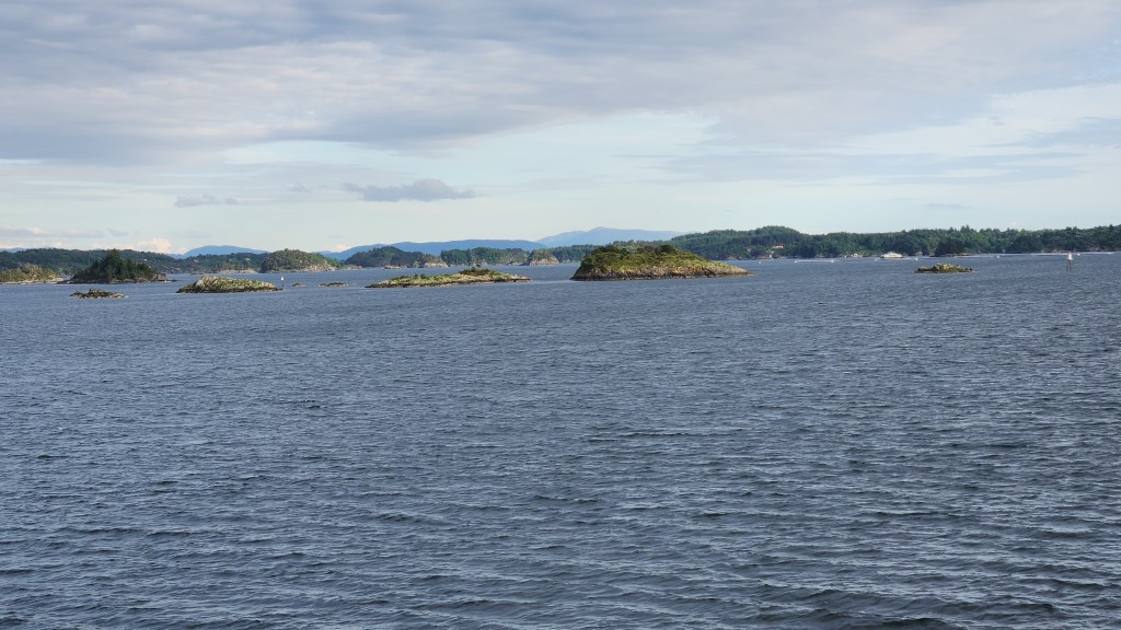
Oslo, Norway (Sunday and Monday, June 21 and 22, 2026): Our ship arrived in Oslo harbor at noon on Sunday. Our previous arrival, for the pre-tour program described in Part 1, had been at the airport, located far out in the boondocks. It was much more interesting to be able to see the Oslo archipelago as we sailed in.

Sailing through the Oslo Archipelago

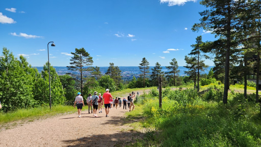
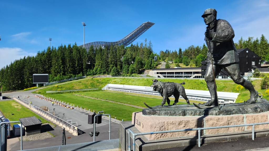
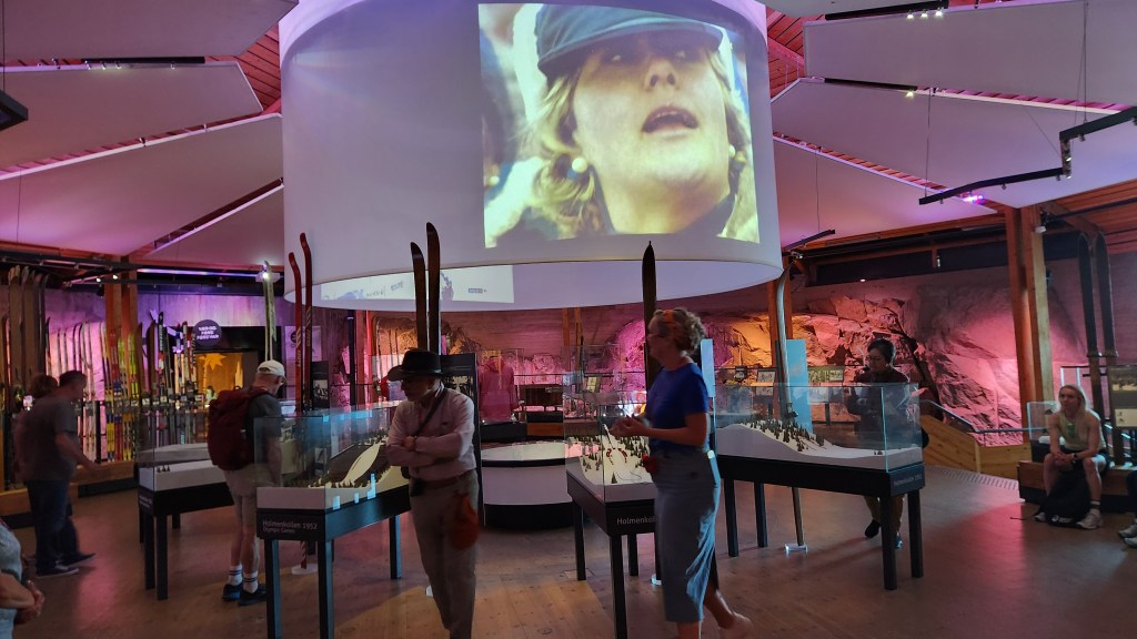
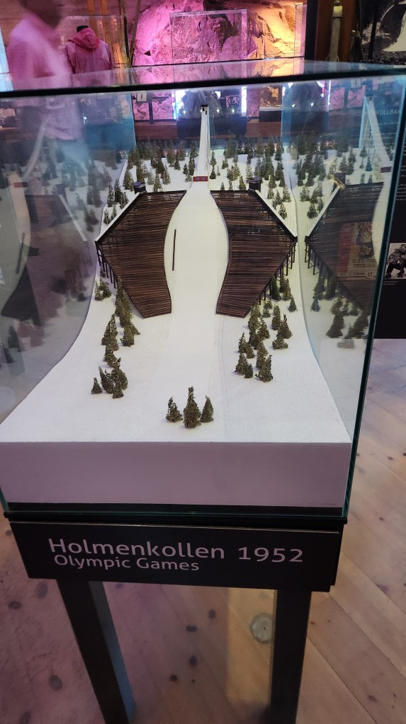
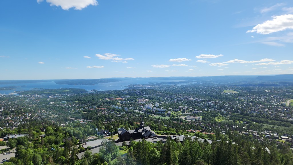
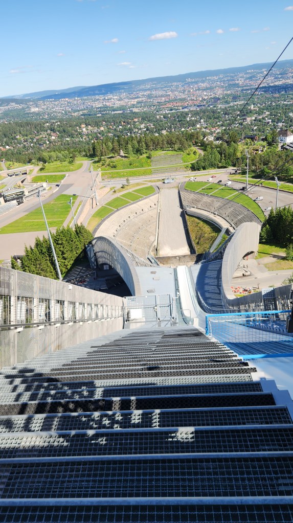
Our activity of choice for Sunday was a trip to the hills above Oslo to the Holmenkollen Park, a popular destination for Oslo residents, especially on a bright sunny day as we had. Our tour group went on a roughly 3-mile, leisurely nature hike through the park, eventually ending up at the world famous Holmenkollen Ski Jump and Biathlon facility. After a tour of the Skiing Museum at the site, we had a nice lunch and a dessert of Kvikk Lunsj bars. (I can confirm that – to my delicate palate – the Kvikk Lunsj was far superior to a Kit Kat bar.) After lunch, we went to the top of the ski jump for a spectacular view of the city, before returning to the ship.

The Holmenkollen Nature Park
The Viking group at the Holmenkollen Nature Park
King Olav V and his faithful dog watch over the Ski Jump and Biathlon Range at Holmenkollen …
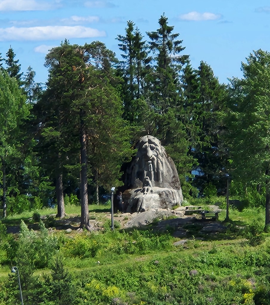
… while a Troll looks on from afar
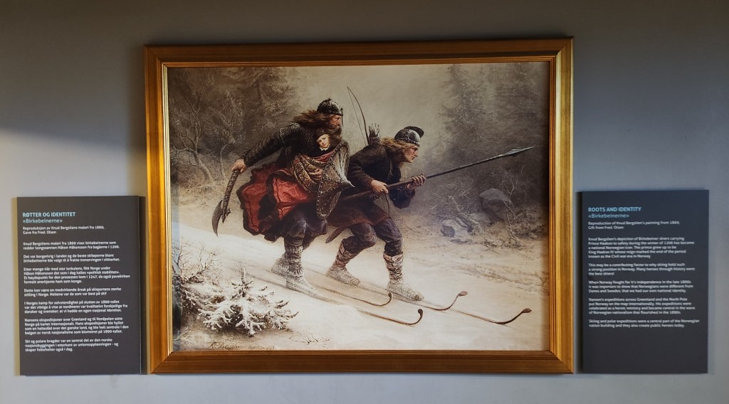
Exhibit at Holmenkollen — Birkebeiners Ski with the Infant Haakon Haakonson to Safety
Exhibits at the Skiing Museum at Holmenkollen
Exhibit at the Skiing Museum
View from the Top of the Ski Jump
A Ski Jumper’s View

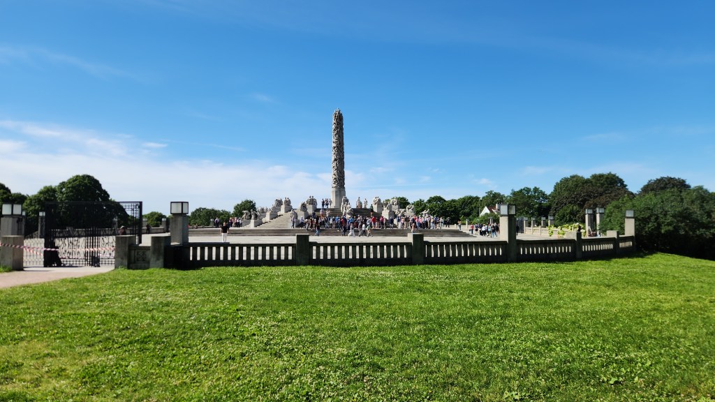
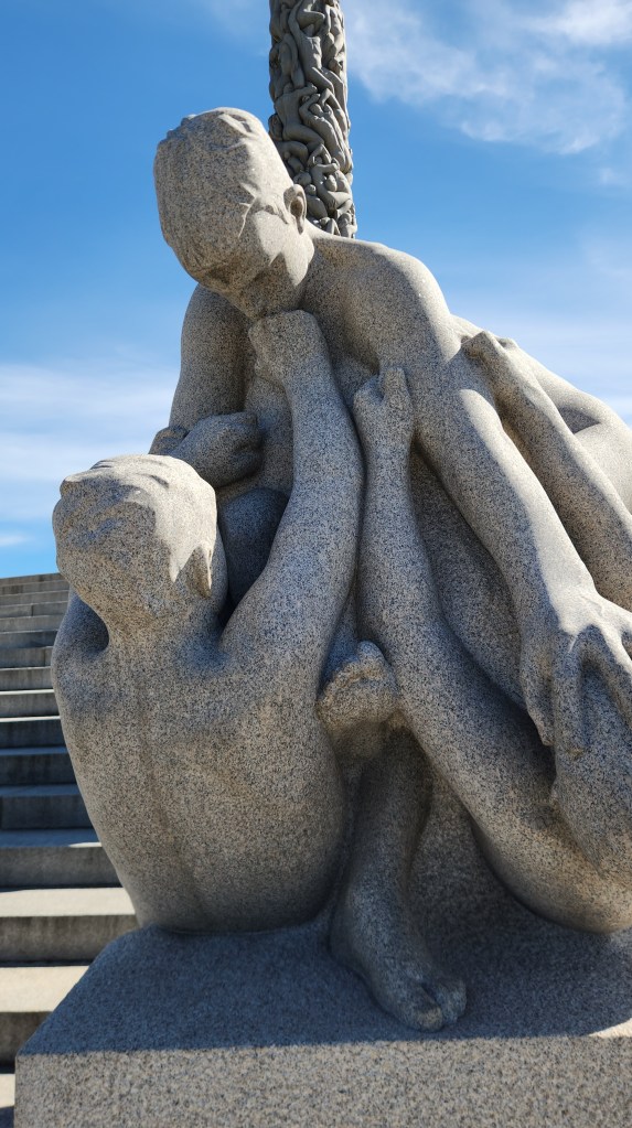
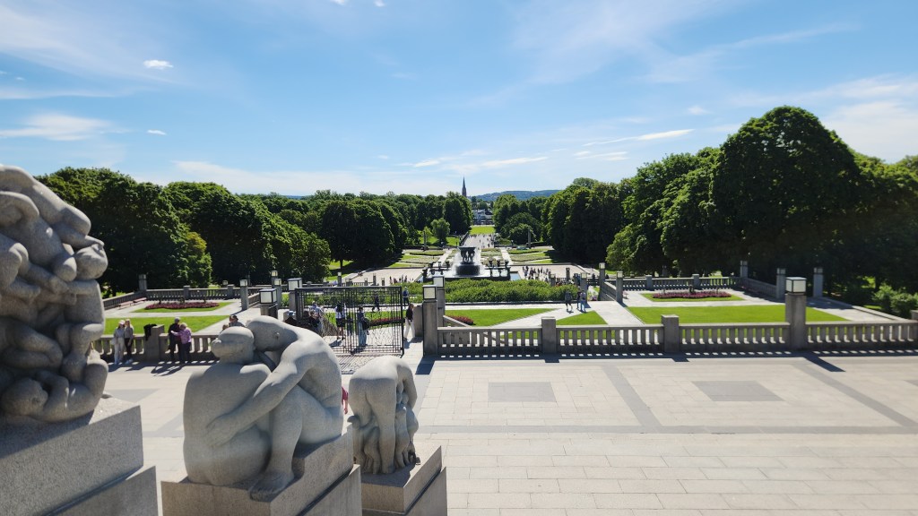
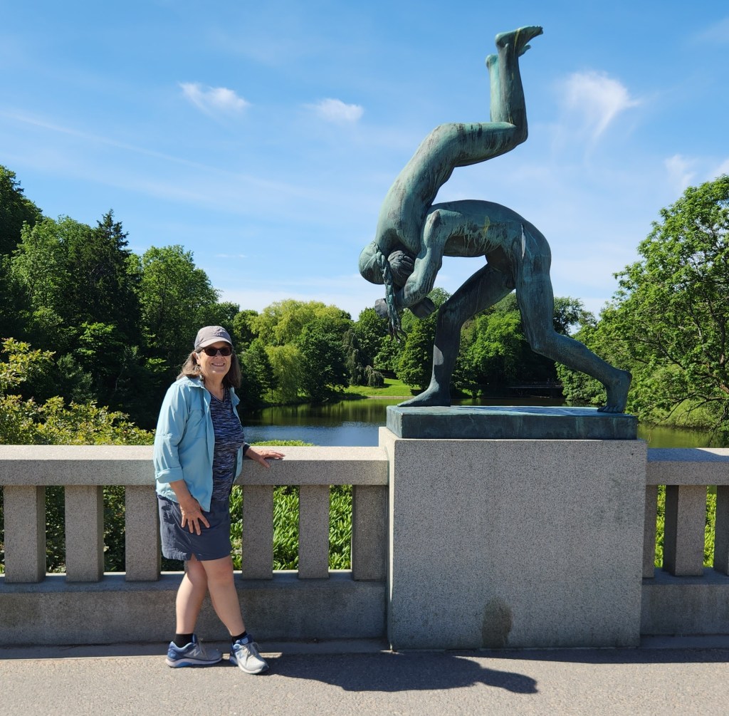
On Monday, our last day in Norway, we began with a motorcoach tour of Oslo including an extensive visit to the Vigeland installation at Frogner Park, which turned out to be an amazing, one-of-a-kind experience. In 1921, Norwegian sculptor Gustav Vigeland struck a deal with the city of Oslo. Vigeland gifted his lifetime’s work to the city in exchange for a combined home, studio, and creative freedom. The result of this extraordinary deal is the Vigeland installation, the world’s largest sculpture park made by a single artist, featuring 212 works by Vigeland. The sculptures are located on 80 acres in the center of Frogner Park and are mostly displayed within several major groupings:

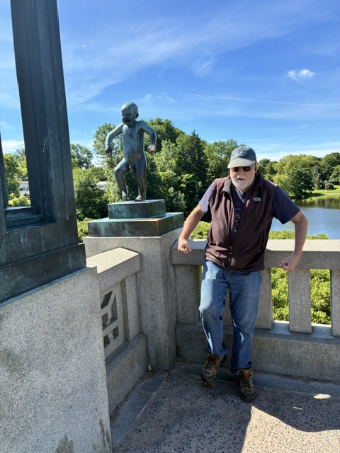
  • The Bridge contains 58 bronze sculptures portraying men, women, and children interacting, including the iconic Sinnataggen (Angry Boy). None of the individual sculpture actually was named by Vigeland, but the Angry Boy has become the popular name, and many visitors touch it for good luck.
  • The Fountain: Originally meant for the grounds of the Norwegian Parliament, it features 20 tree-group figures depicting various stages of life, from birth through old age.
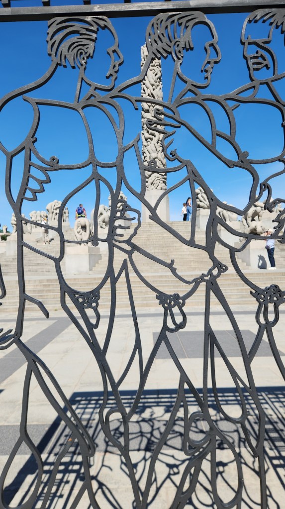
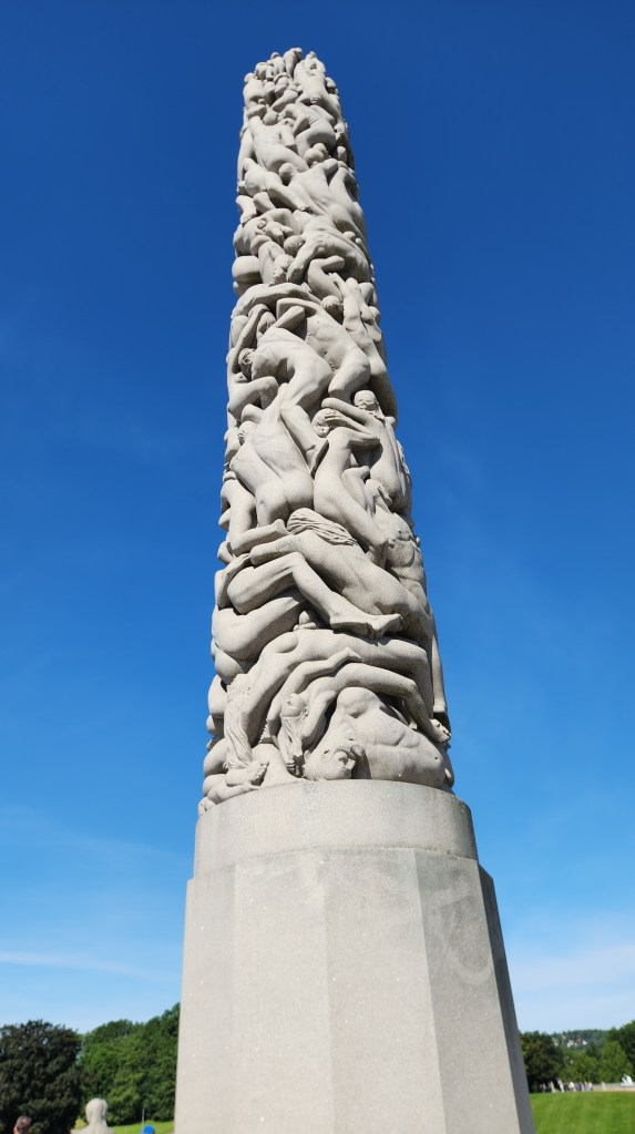
  • The Monolith: The centerpiece of the park, the monolith is carved out of a single massive block of granite. It features 121 entwined human figures reaching toward the sky, representing mankind’s longing for the spiritual and the divine.
  • The Wheel of Life: Found at the far end of the park, this bronze sculpture shows four adults and a child intertwined in a circle, symbolizing eternity.

Vigeland did not live to see the park fully completed before he died in 1943, but what he left behind is simply amazing.

The Monolith and Wheel of Life Groupings at the Vigeland Installation
One of the Gates at the Monolith and Wheel of Life
The Monolith
Some of the Figures in the Wheel of Life Grouping
The Fountain Grouping
Looking From the Wheel of Life toward the Bridge
Figure(s) in the Bridge Grouping
Has the Angry Boy found an Angry Old Companion?

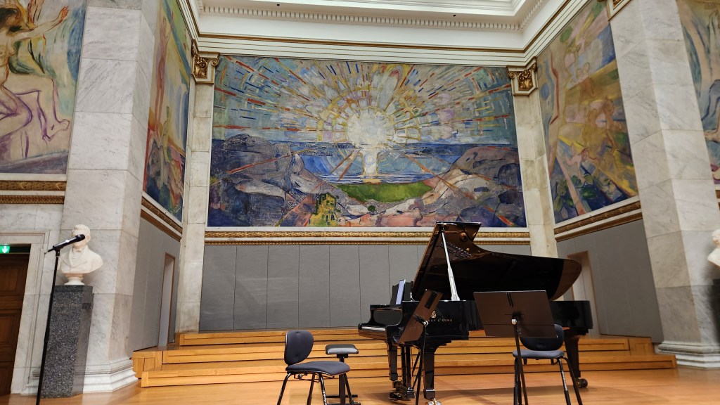
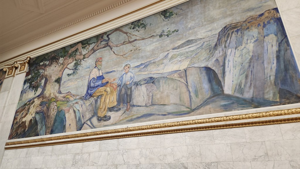
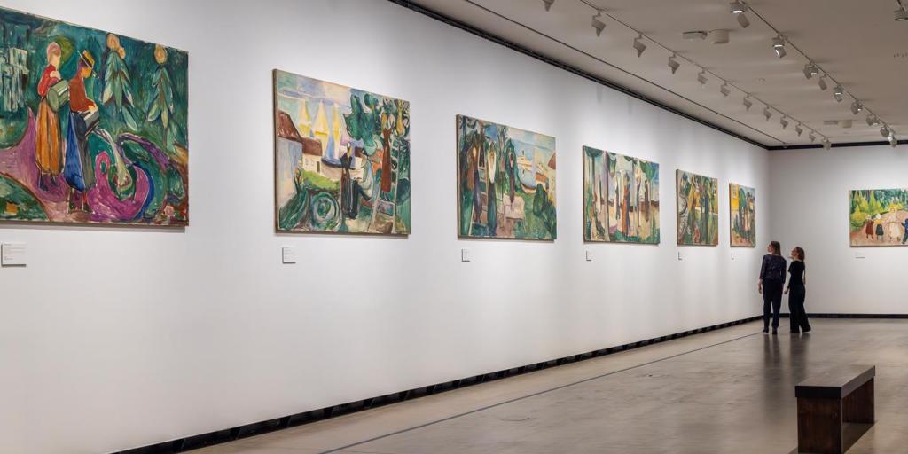
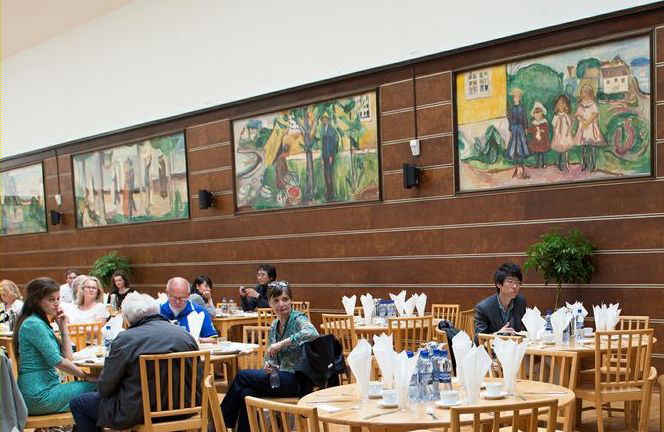
Our final activity in Oslo was a special classical music concert performed for Viking travelers. The University Aula is a prestigious ceremonial and concert hall of the University of Oslo, located on Karl Johans Gate in the center of the city. Built in the mid-19th century, the venue is world-renowned for its interior walls, which feature 11 monumental oil paintings by Edvard Munch, including his masterpiece The Sun. The concert was presented as the story of Peer Gynt, the famous Henrik Ibsen play based loosely on the life of his longtime friend, Ole Bull. The program featured Edvard Grieg’s music written to accompany Ibsen’s play as well as works by Mozart, Puccini, and others.

The Aula Stage and Munch’s The Sun
Another Munch Mural at the Aula
The Concert Musicians
The Concert Musicians and Singers

All in all, we were very impressed by Norway – not only for its stunning beauty and rich culture, but for its environmental leadership. We learned that 100% of new cars sold in Norway are all electric, as are about 80% of all cars on the road. The necessary electric car charging infrastructure is fully in place, providing hope that other countries will eventually be able to do so as well. Norway is powered entirely by green energy, including hydroelectric, wind, and solar. Even though the oil and gas industry is a major part of Norway’s economy, all fossil fuels are exported to other countries. Although only a small country (population 5.6 million), Norway supplies 2% of the world’s crude oil and 3% of its natural gas, and the revenues from these exports are funneled into its sovereign wealth fund for the good of the Norwegian people. The wealth fund exceeds $ 2 trillion and holds stakes in approximately 7,200 companies worldwide, effectively owning about 1.5% of all listed companies on the planet. The fund’s substantial earnings are used to support the national budget including investments in infrastructure, while the large principal value is saved ; the principal is saved to ensure long-term wealth for future generations.

But now it’s time to move on, and when I begin work on Part 3, we’ll find ourselves in Denmark.

Stay tuned …

Pat and Dave’s Vibrant Viking Voyage – PART 1: Introduction and Pre-Cruise Program

Preamble

It’s hard to believe, but it’s already time for another episode in my ongoing series of travelogues documenting our domestic and international travel experiences. As past readers will know, the domestic travelogues have been road trips (either with the RV we formerly owned or with one of our two our electric cars) while the international travels have mostly been with the Viking River Cruise or Viking Ocean Cruise lines. We took our first Viking River Cruise on the Danube River back in 2018 (before I started blogging about our travels), and we enjoyed it so much that we’ve continued to patronize Viking. Just to be clear, I am not a paid influencer and receive no compensation of any type – Pat and I are purely and simply great Viking fans. So here I go again, this time documenting an Ocean Cruise denoted “Viking Homelands.” (Thus the latest in my somewhat goofy series of alliterative titles, using the word “Viking” for both the cruise line and the destinations.)

As sometimes happens, we did not get off to an auspicious start. We were booked on a Delta flight from MSP to Newark at 9:14 AM on Friday, June 12, and a connecting flight from Newark to Oslo. However, at about 7 PM Thursday evening, as we were getting ready to retire before an early morning Lyft to the airport, we received an email notice that the flight to Newark had been canceled. Somewhat anxiously, I called the Viking Travel Emergency number and we were soon rebooked on a 3:55 PM United flight to Frankfurt and a connecting flight from Frankfurt to Oslo. However, when we arrived at the departure gate on Friday afternoon, we learned that the Frankfurt flight had been delayed because the plane could not get to the departure gate – blocked by a Delta plane at the adjacent gate as well as airport construction activities. We finally took off two hours late and – big surprise – missed the connecting flight due to the long line at the passport control checkpoint in Frankfurt. After another call to the Viking Travel Emergency number, we were rebooked again on a later flight. We eventually arrived in Oslo feeling sleep deprived after a very long travel day but ready to start on our Vibrant Viking Voyage.

So, let’s get this travelogue started, shall we?

Pre-Cruise Program

The Ocean Cruise portion of the trip began in Bergen, Norway, on June 17th, but we had also booked a four-day pre-cruise extension program that began with a day in Oslo and included a trip to Bergen on the world-famous Bergensbanen railway and a day of sightseeing in Bergen prior to boarding the cruise ship. This Part 1 of the travelogue describes the highlights of the four-day pre-cruise program.

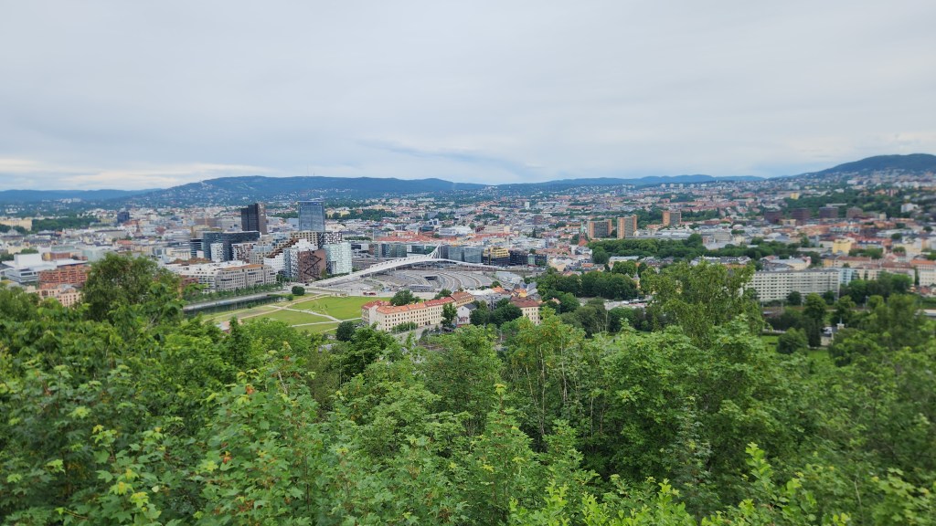
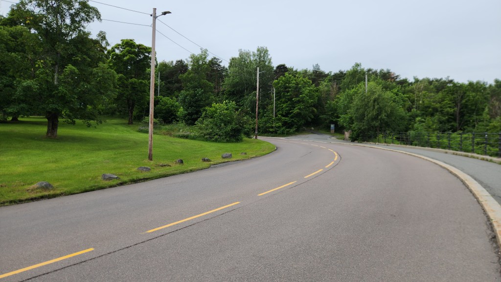
Oslo, Norway (Sunday, June 14, 2026): The first activity was a four-hour scenic motorcoach and walking tour of Oslo. Highlights included a stop at an overlook point with a fantastic view of the city and a visit to the Royal Palace. The overlook is located close to a place in the road referred to as “The Scream curve,” in recognition of the spot where famous Norwegian painter Edvard Munch was walking and came upon an eerie scene of the sunset over Oslo, inspiring his world-famous painting.

Overlook of Oslo
The Scream Curve

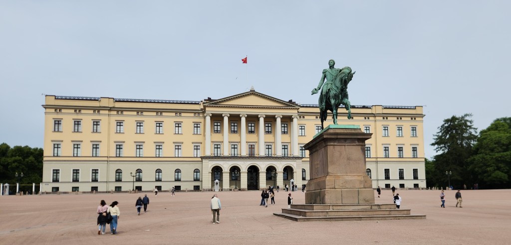
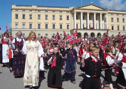
On our way from the overlook to the Royal Palace, home of current monarchs King Harald VI and Queen Sonja, our guide gave us a brief Norwegian history lesson. We learned that Norway had been ruled by Danish and Swedish kings from the fourteenth century until its independence in 1905. However, on May 17, 1814, Norway adopted a constitution establishing the ruling Parliament but retaining the king as a ceremonial leader. After independence, the Norwegian people still wanted a king. Somewhat ironically, Prince Karl of Denmark was asked to fill that role, which he did, but only after a national referendum confirming him as the Norwegian people’s choice. To emphasize continuity with Norway’s medieval kings (prior to Danish rule) he adopted the name Haakon VII. The palace itself was built by Swedish King Karl III Johann, who also became the king of Norway when Sweden was awarded Norway as a prize following the defeat of Denmark in the Napoleonic wars. A huge statue of Karl Johann on his steed stands in front of the palace, facing Oslo’s main street, Karl Johann Gate. On Constitution Day (May 17), a parade runs from downtown Oslo to the palace, with the participants wearing the so-called “bunad,” the traditional costume of Norway. The 54-acre public Palace Garden surrounds the palace, and we enjoyed a leisurely stroll through the garden before resuming the coach tour.

Oslo Royal Palace
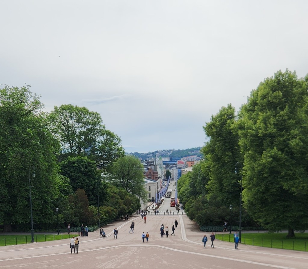
Karl Johann Gate viewed from the Royal Palace
Children’s Parade on May 17th 2005 (courtesy Wikipedia)
The Palace Garden

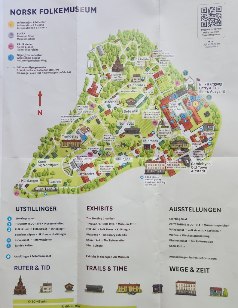
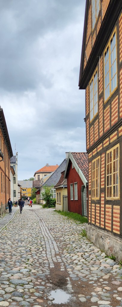
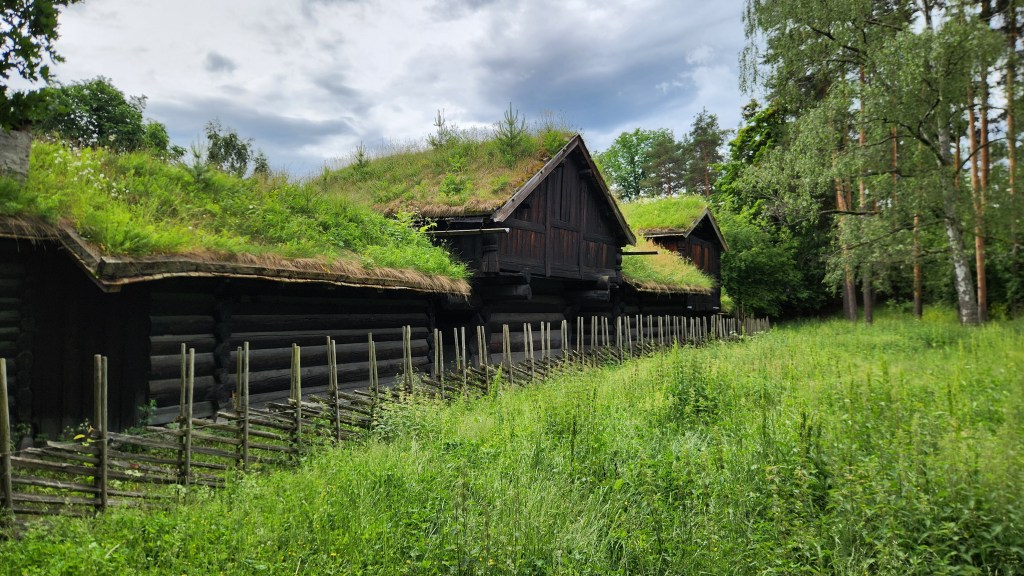
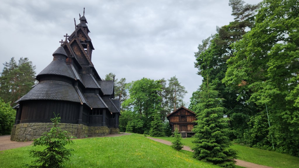
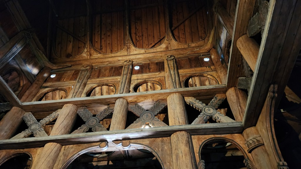
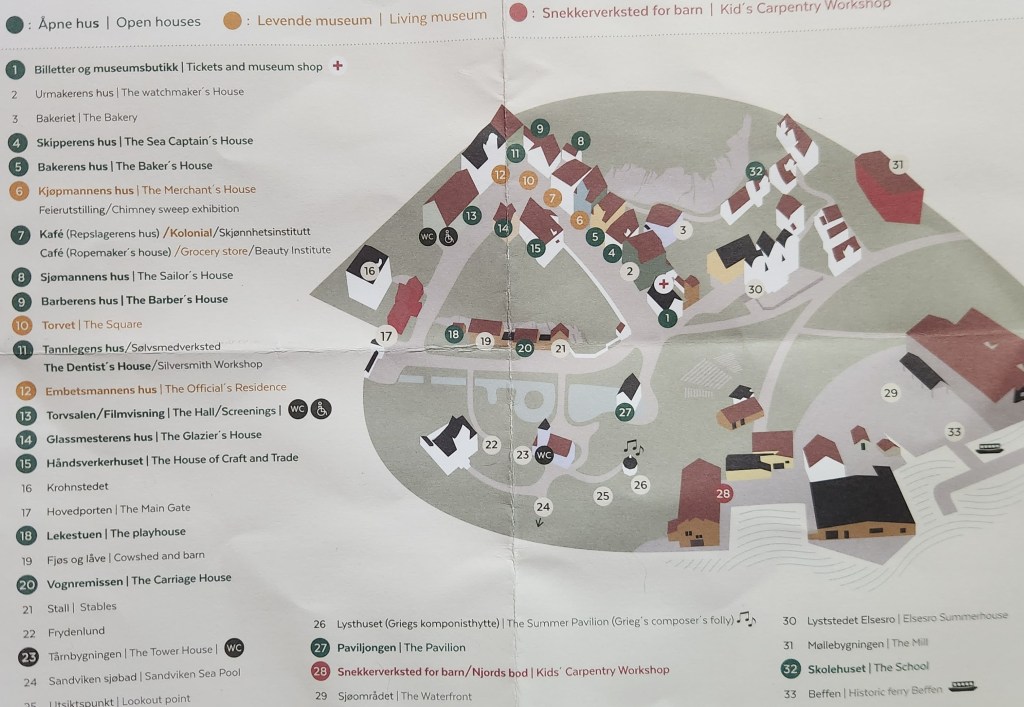
After the Royal Palace, we traveled to the Norwegian Museum of Cultural History (Norsk Folkemuseum), located on the Bygdøy peninsula. This is an open-air museum, featuring over 150 historic buildings relocated from across Norway, including a 13th-century stave church, so named for the “staves” that support the church building.

Norsk Folkemuseum Brochure Map
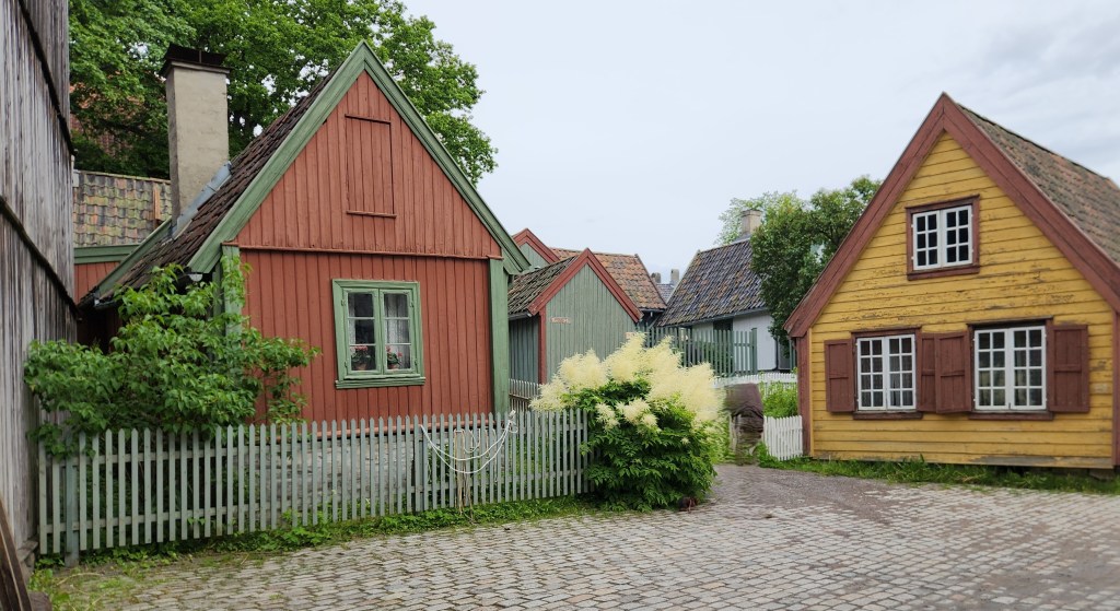
Museum Buildings
Cobblestone Street
Old-Time Green Roof Technology
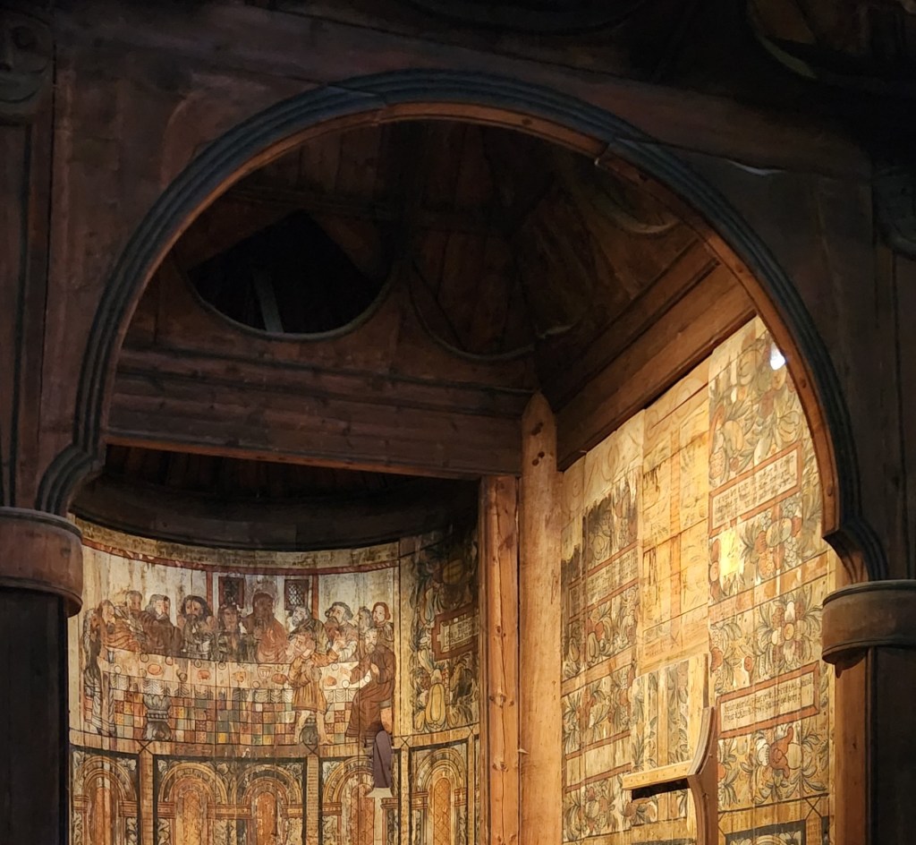
The 13th Century Stave Church
Inside the Stave Church
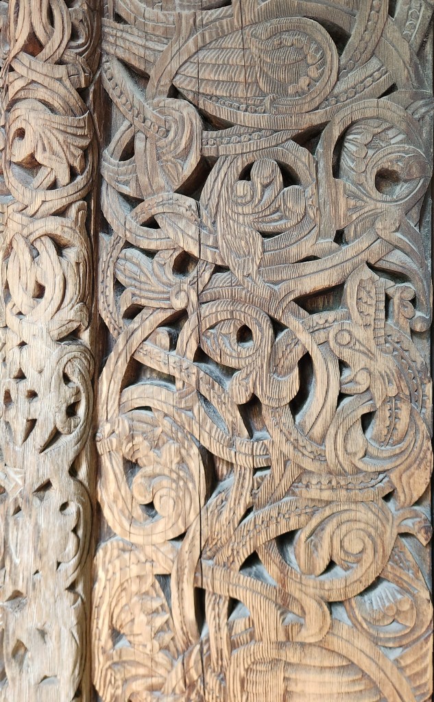
Wood Carvings in the Stave Church
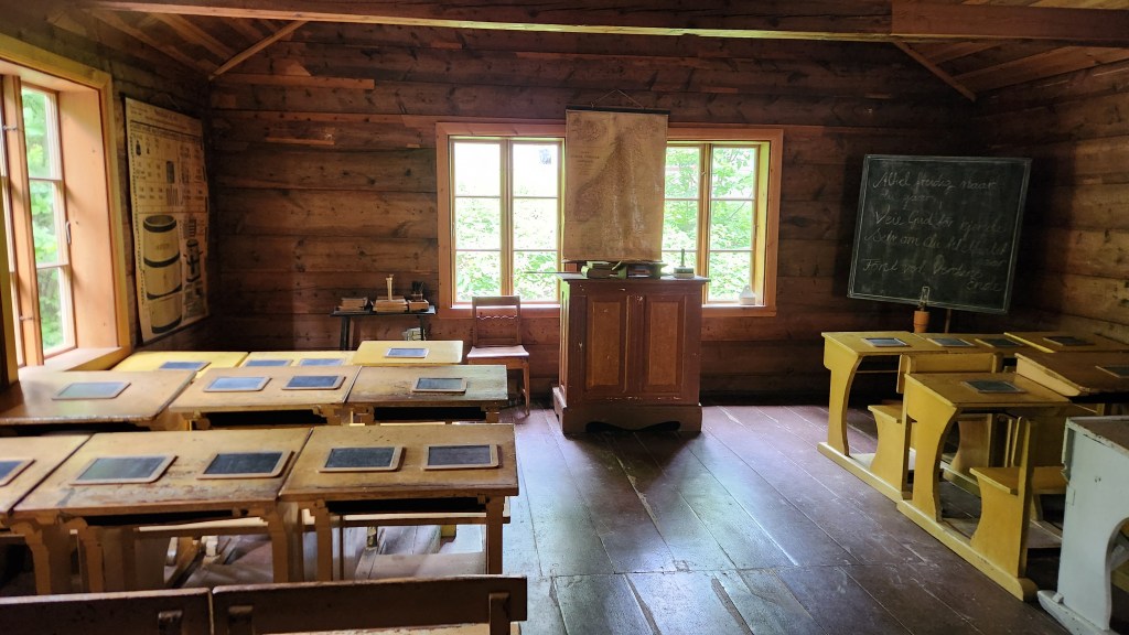
Old School House
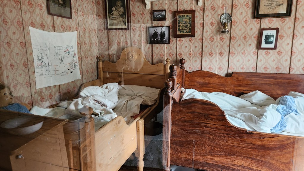
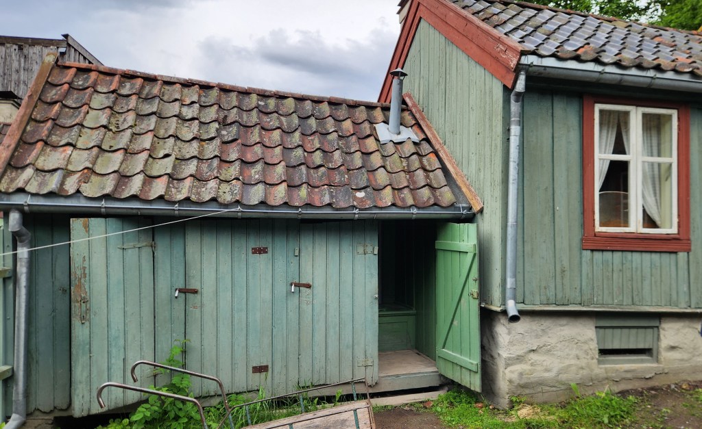
Living Quarters
Modern Rest Room Facilities?

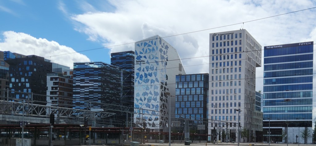
As we drove back to the hotel, we passed by many interesting buildings, including the so-called “bar code” area of Oslo, inspired by the look of the buildings, which include many of Oslo’s financial and technology businesses as well as housing units.

The Bar Code Area

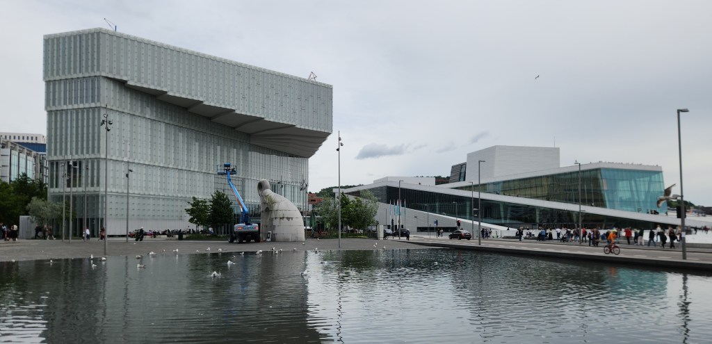
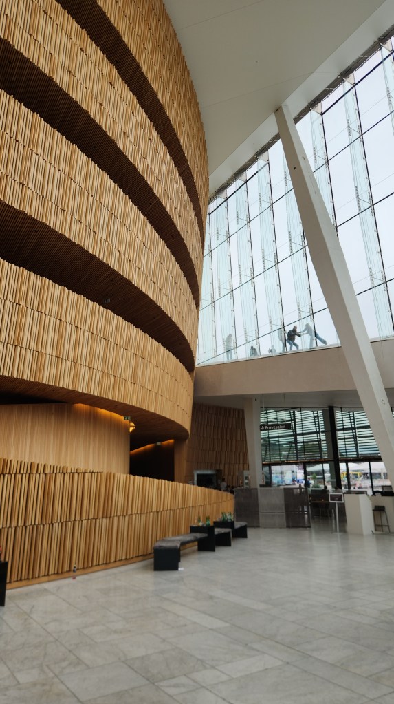
After the coach tour we spent several hours on our own exploring the area around our hotel, including the impressive Opera House and other areas adjacent to the Oslo fjord. (Although we think of a fjord as a deep, narrow, and winding sea inlet flanked by steep cliffs or mountains, which we’ll get to in the next Part of the travelogue, in Oslo’s case it merely refers to the sea inlet – more or less a generic word for “inlet” or “bay.”) The roof of the Opera House is designed for people to walk on, providing beautiful views of the area.

Oslo Library (left) and Opera House (right)
Interior of Opera House
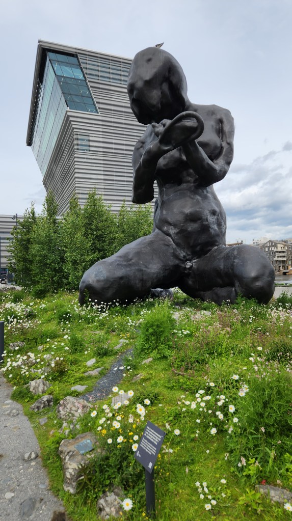
Wildflower Garden and Sculpture (The Mother) by the Fjord
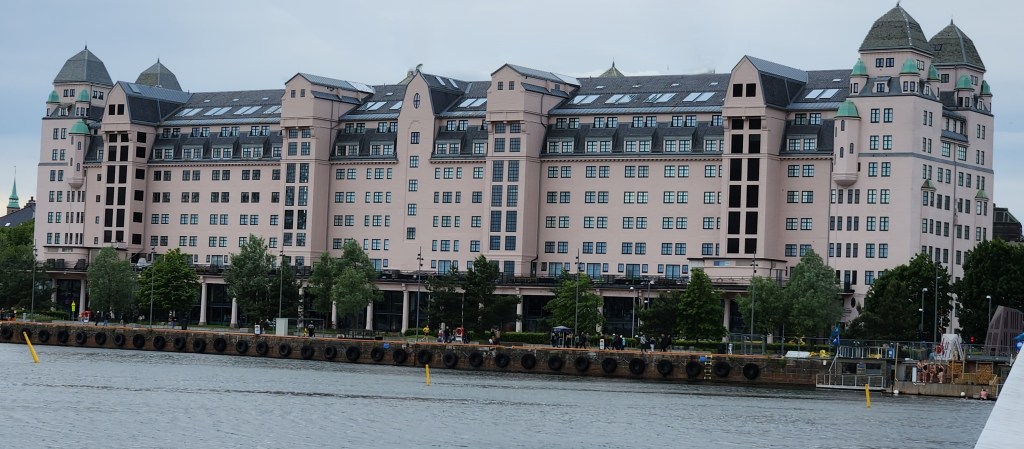
Office Building Across the Fjord from the Opera House

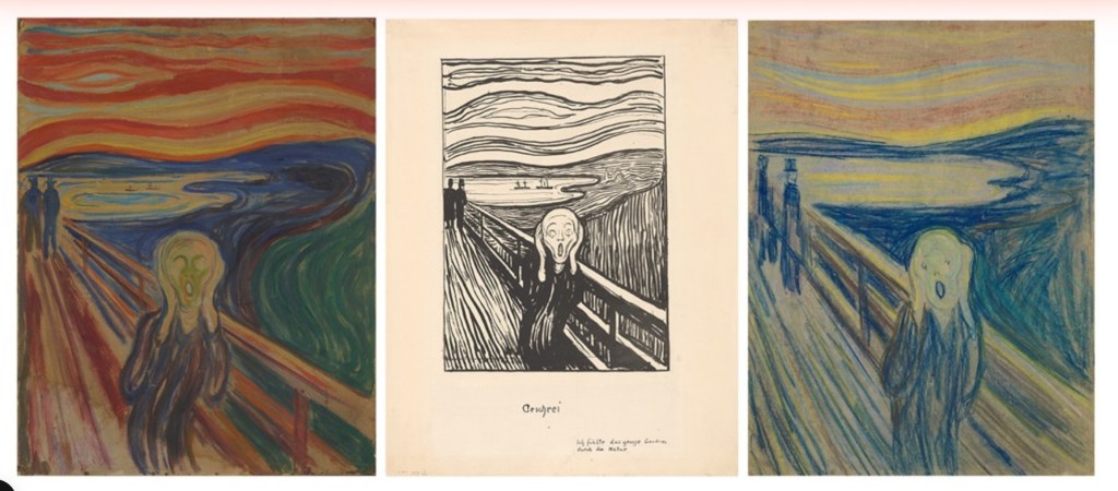
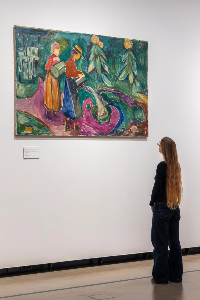
Along the way, we stopped for a couple of hours to tour the Munch Museum. The current museum building opened in 2021 and houses much of the collection bequeathed by Munch to the city of Oslo, including a staggering total of 28,000 artworks and 42,000 unique museum objects. While Munch is best known for The Scream, three versions of which are displayed at the museum, he was a prolific artist who worked in multiple media and formats. Among the most impressive of his works are 12 giant murals commissioned by the Freia Candy Factory to decorate the dining hall for their workers. These were temporarily on display at the museum. For some strange reason, I failed to take any photos at the museum, so I borrowed the following pictures from the museum’s website. (Hopefully they won’t sue me for copyright infringement!)

Three Treatments of The Scream (Courtesy Munch Museum website)
One of the Twelve Freia Murals (Courtesy Munch Museum website)
Temporary Display for the Freia Murals (Courtesy Munch Museum website)
The Murals in the Freia Chocolate Factory Dining Room (Courtesy Munch Museum website)

Although I will bet that most readers are familiar only with The Scream, as was I before touring the museum, the variety and depth of Munch’s works is simply amazing, and I would recommend this museum as a must for visitors to Oslo.

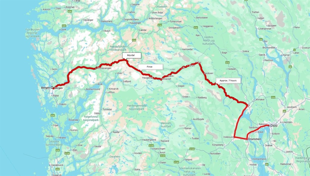
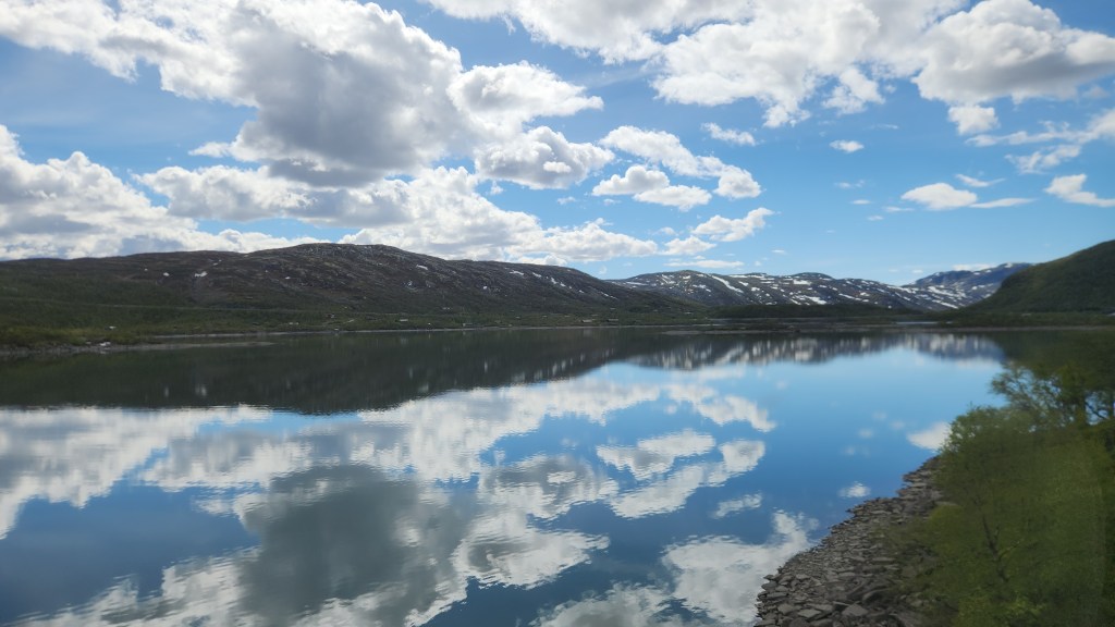
The Bergensbanen Railway (Monday, June 15, 2026): After a lazy Monday morning, we joined our tour group as we walked from the hotel to the railway station and boarded the 12 PM Oslo to Bergen train. The Bergensbanen line is a 308-mile-long railway connecting Oslo and Bergen. It is the highest mainline railway in Northern Europe, crossing the Hardangervidda plateau at 4,058 feet above sea level. The railway took about 15 years to build, officially opening in 1909 as the first year-round transport between Norway’s two largest cities, and was fully electrified by 1964. The route passes through 182 tunnels, the longest of which is the 6.4-mile long Finsetunnelen, which sits at 4009 feet above sea level. The journey took about 7.5 hours and was far and away the most scenic train ride I’ve ever experienced, with breathtaking fjord and mountain vistas. Here are a few photos taken from the train, none of which do justice to the actual views. (There were some spectacular waterfalls along the way, but I didn’t get any decent photos of those as the train raced along, so you’ll just have to go and see them for yourselves.)

Route of the Bergensbanen Railway
View from the Bergensbanen Train
View from the Bergensbanen Train near Hardangervidda
View from Bergenbanen Train

One interesting bit of trivia we learned along the way is that the scenes of Planet Hoth in Star Wars: Episode V – The Empire Strikes Back were filmed on the Hardangervidda plateau and glacier due to its reliably frigid winter conditions.

Bergen, Norway (Tuesday, June 16, 2026): On Tuesday morning, we headed off for a coach and walking tour of Bergen, passing by the famous Bryggen (wharf) area, where the Hanseatic League established a trading port in the fourteenth century, and various points of interest in the city.

The Bryggen in Bergen

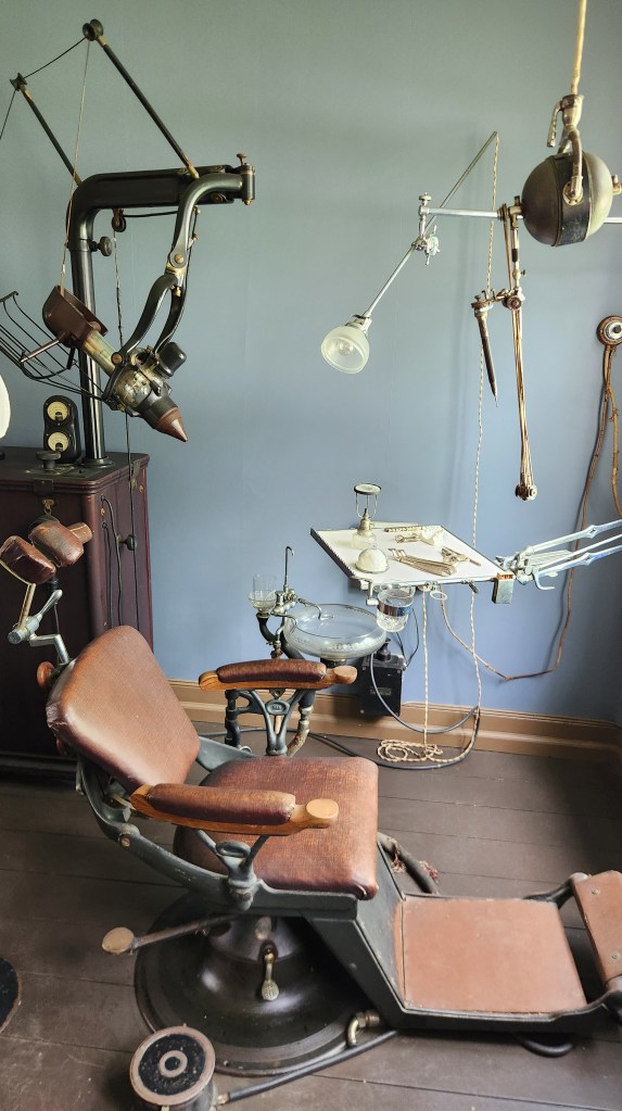
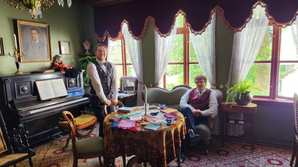
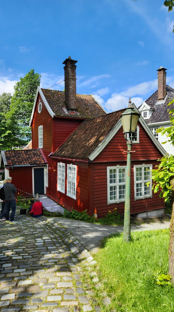
We stopped for a walking tour of the Old Bergen Museum (Gamle Bergen), consisting of some thirty historic buildings (built between 1700 and 1900) relocated from the city center. Costumed volunteers put on a short play in the main square in which a young bride-to-be was forced to have all her teeth extracted by a dentist and replaced with a false set. We learned that this was a common practice in Bergen in the 18th and 19th centuries to avoid problems later in life, and that the patients were generally given cocaine as an early form of anesthetic. After the play, we wandered through the village before reboarding the coach.

Old Bergen Museum Brochure Map
Old Bergen Museum Town Square
The Dentist’s Office
Two Entrepreneurs of the Hanseatic League
At the Old Bergen Museum

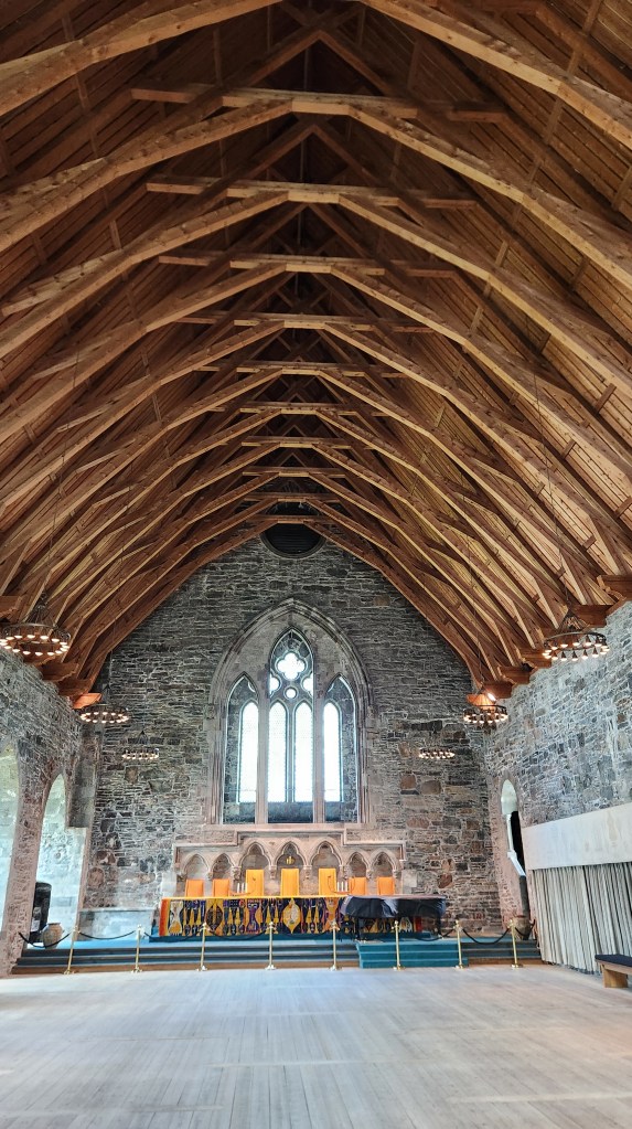
Next, we traveled to the Bergen Fortress, built in the 13th century when Bergen was the capital of Norway. The fortress remains an active military site under the command of the Royal Norwegian Navy, but the grounds are largely open to the public and function as a popular historical landmark and park. The major attraction is Haakon’s Hall, built by King Haakon Haakonsen between 1247 and 1261, a magnificent stone building used as a royal residence and banquet hall. It is the largest and oldest surviving stone building of its kind in Norway. The hall has been beautifully restored and serves as a venue for various Government and private functions.

The Reception Room in Haakon’s Hall

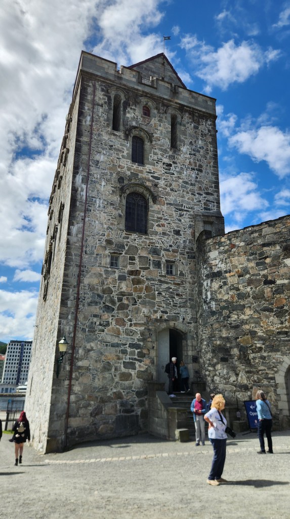
The Rosenkrantz Tower was constructed in the 1560s by Governor Erik Rosenkrantz, incorporating older 13th-century masonry. It served as a heavily fortified residence and a symbol of royal authority.

Rosenkrantz Tower

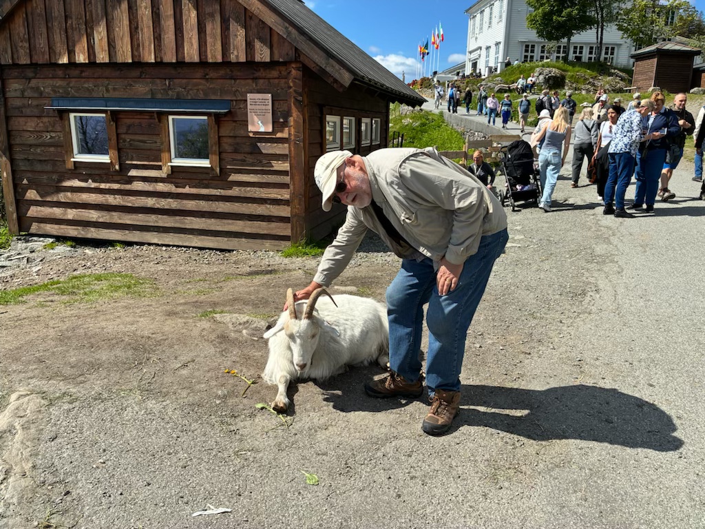
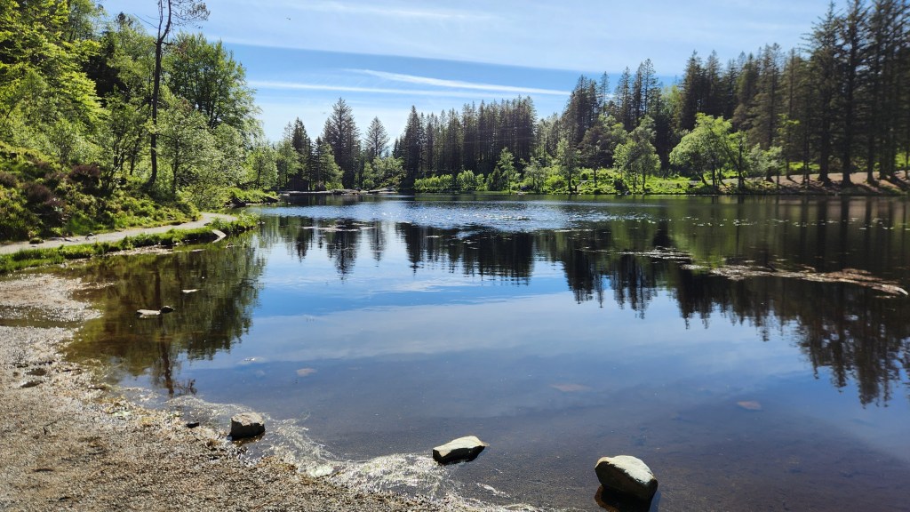
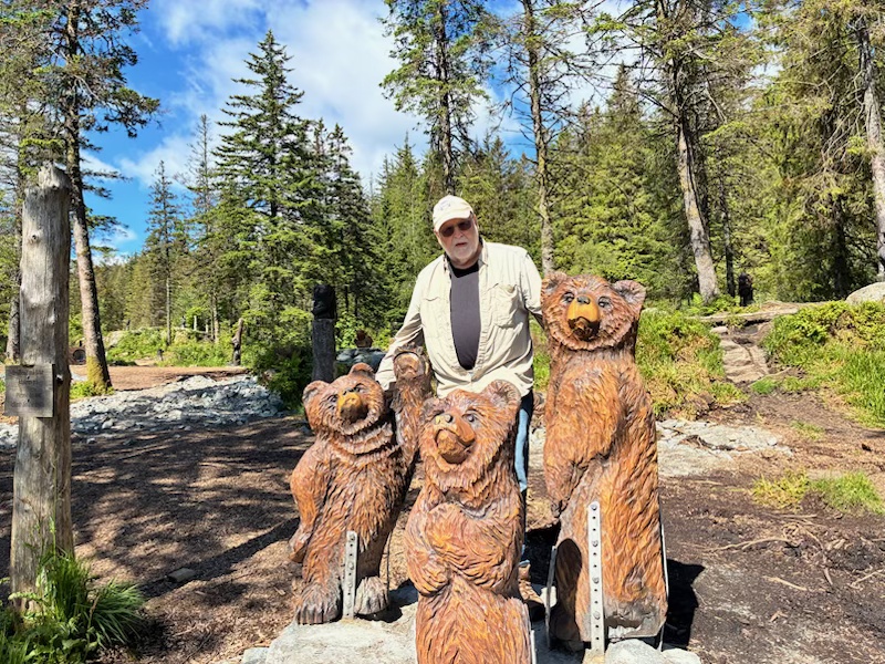
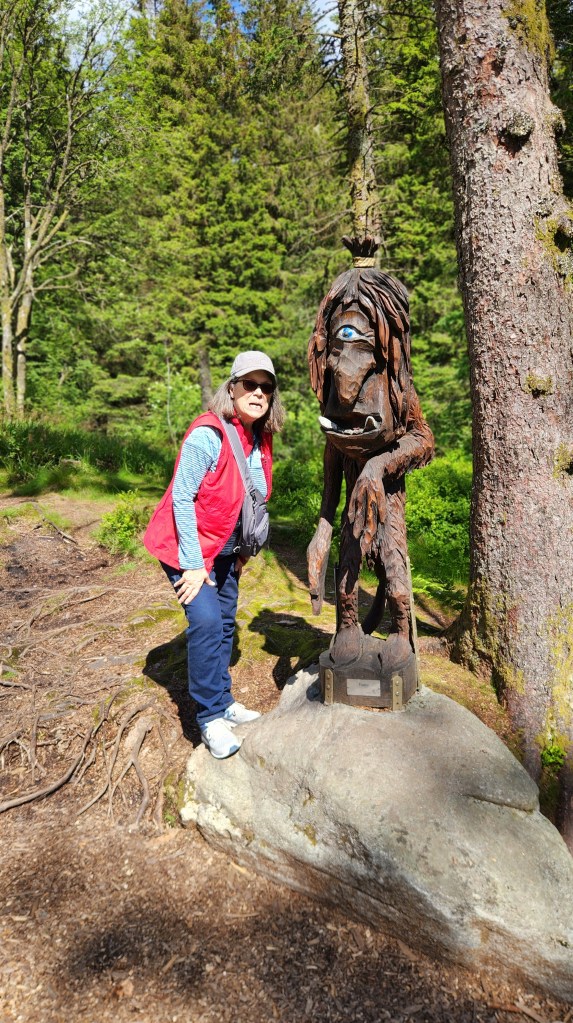
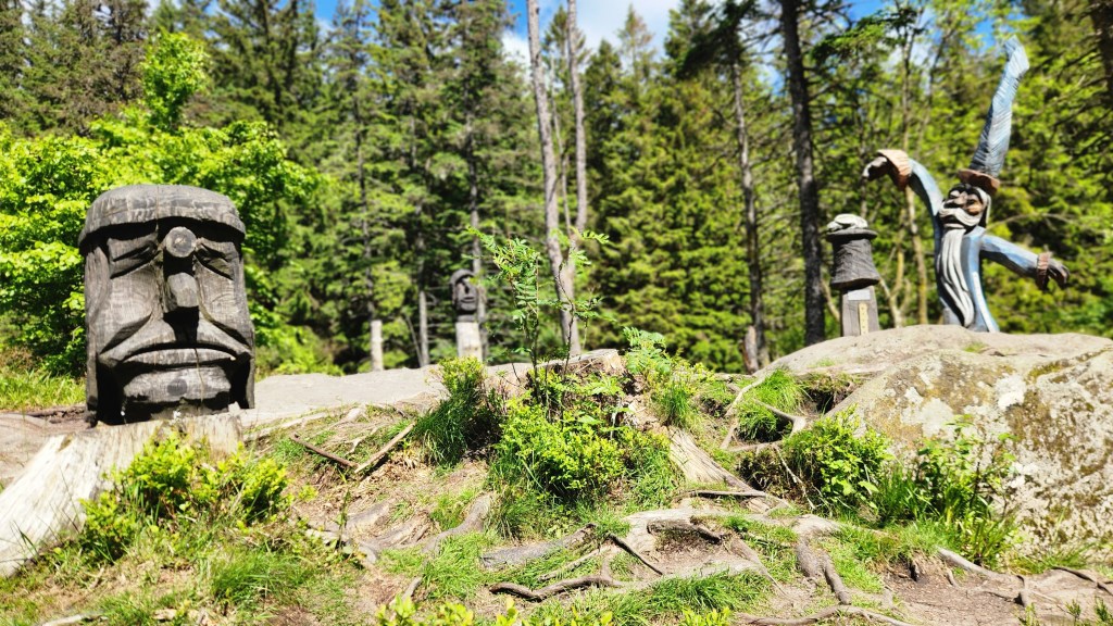
After the tour, we had free time to explore the city. We took the opportunity to ride a Funicular which travels from the city center to the top of Mount Floyen, where we had an excellent lunch (pea soup for me and fish chowder for Pat) before exploring the mountain top area. The scenic views were spectacular – and very lucky, as Bergen has rain for something like 250 days a year – and we also enjoyed petting the local goats, hiking to a lovely lake, and visiting the whimsical Troll Forest. We learned that trolls are very prominent in Norwegian folklore, and the oddly shaped hills and mountains are said to be the remains of trolls caught in the sunlight.

Bergen Funicular Arrives at Mt. Floyen Station
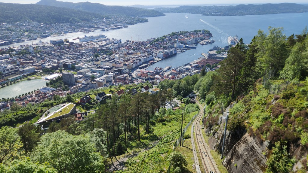
View of Bergen from Mt. Floyen Funicular Station
One of the Floyen Goats (or one old goat pets another?)
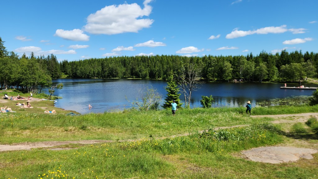
Lake on Mount Floyen
There also were Bears!
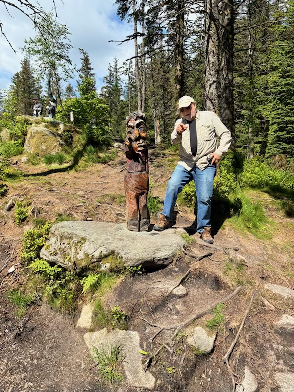
In the Troll Forest
The Trolls Rule!
Trying to get on this guy’s good side …
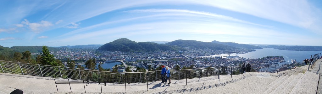
Panoramic View of Bergen from Mount Floyen

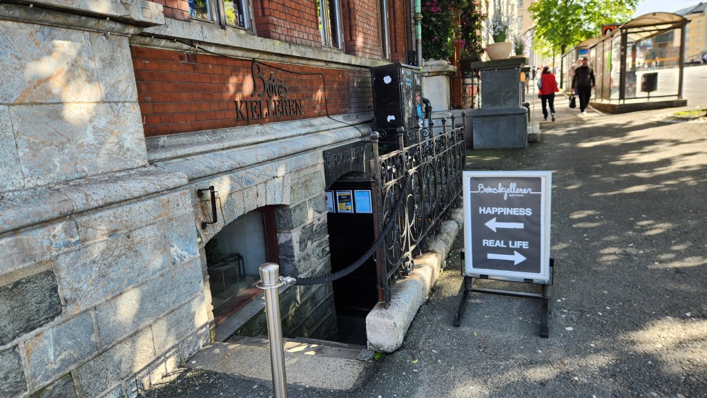
This concluded the pre-cruise portion of the journey, as we prepared to board our ship anchored in the Bergen harbor on Wednesday morning. But I’ll leave you with one final scene of a bar we passed on our way back to the hotel that may capture the spirit of at least some Bergen residents:

Okay, that’s it for Part 1, although there will be more about both Oslo and Bergen in the next Part. I hope you enjoyed the read and will come back for future installments covering the entirety of the Ocean Cruise. Stay tuned …
Pat and Dave’s Mediterranean Moments – PART 4: Athens and Classic Greece

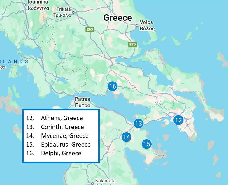
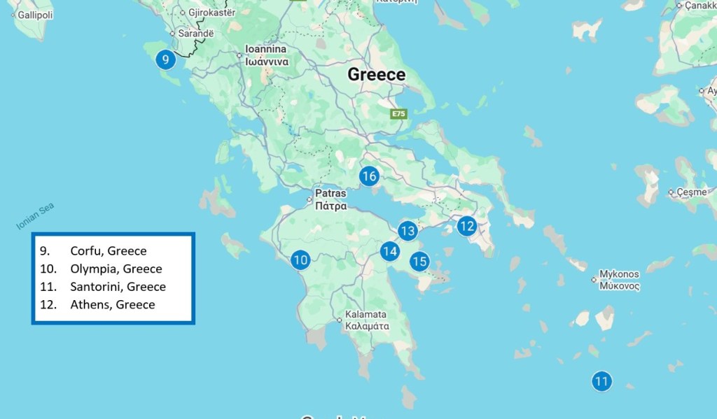
Welcome back for the concluding Part 4 of this travelogue series. Part 3 ended as we returned from our first tours of Athens for our final night abord the Viking Neptune, anchored in the Port of Piraeus. Here’s the final map of the journey, showing the places I’ll describe in this narrative.

Now let’s continue the story …
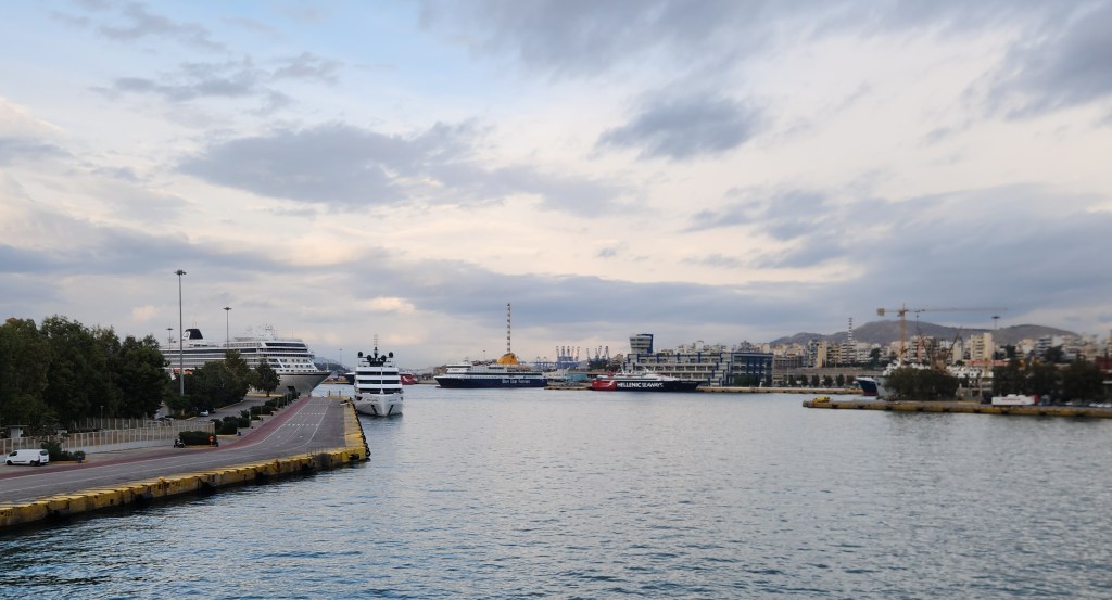
Athens, Greece (Sunday, November 9, 2025): Before we left the ship, I took one last photo of the port.

View from the Port of Piraeus

After breakfast, Pat and I and some 25 or so fellow travelers departed by bus for what the Viking itinerary called “The Full Acropolis Experience.” Before I describe that, here’s some very abbreviated history. Athens is one of the oldest named cities in the world, having been continuously inhabited for some 5,000 years. It became the leading city of ancient Greece in the first millennium BCE. The Acropolis (roughly translated as “high city”) sits on a rocky outcropping overlooking the city. Ancient Greeks built several impressive temples and monuments there, including the Parthenon, the Propylaea, the Erechtheion, and the Temple of Athena Nike, in the fifth century BCE. Over the following centuries, Athens fell under the control of various empires, including the Macedonians, Romans, Byzantines, Latins, Venetians, Florentines, and eventually the Ottomans, in the 15th century.

The Ottomans had little interest in ancient Greek cultural sites and began using the Parthenon as a storage site for gunpowder. During a siege by Venice in 1687, the Temple of Athena Nike was dismantled by the Ottomans and its materials used to fortify the Parthenon. Then, a Venetian mortar shell hit the gunpowder cache in the Parthenon, causing an explosion that severely damaged the structure. The Venetians briefly occupied the city before abandoning it once again to the Ottomans. Significant portions of the remaining structure were looted during the following years, and Athens lost much of its wealth and power. During the 18th century, the city began to regain its stature, but the ruling Ottomans still had no interest in ancient Greek culture.

Enter one Thomas Bruce, 7th Earl of Elgin, a rather shady British nobleman who became ambassador to the Ottoman Empire in 1798. Lord Elgin cut a controversial deal with the Ottomans under which he had about half the surviving Parthenon sculptures, as well as sculptures from the Erechtheion, the Temple of Athena Nike, and the Propylaea, removed and shipped to Britain in order to establish a private museum on his personal estate. However, the ship laden with these treasures sank in a storm off a Greek island shortly after sailing, and much of the cargo was lost. Elgin mounted a costly recovery effort, eventually bringing all of his booty back to England, but he incurred so much debt that he was forced to sell the entire collection to the British Museum in London in 1816, where they are proudly displayed to this day as the “Elgin Marbles.” (As a side note, Pat and I saw the impressive display at the British Museum back in 2016 during a Rick Steves tour of London, where our guide defended Elgin’s acquisition as a noble effort to save them from looting under the Ottomans, with no mention of his less-than-honorable intentions.)

In 1983, the Greek government formally asked the British government to return the collection to Greece and listed the dispute with UNESCO, but the British government and the British Museum declined UNESCO’s offer of mediation. In 2021, UNESCO called upon the British government to resolve the issue at the intergovernmental level, but so far nothing has been resolved. A large part of the British argument for retaining the collection has been that the Greeks had no suitable place to properly display them and did not have the capability to properly maintain them. Which finally brings me to the first stop on our “Full Acropolis Experience” tour – The Acropolis Museum in Athens.

The Acropolis Museum is a beautiful, modern structure located a short walk from the Acropolis hill. It was completed in 2009 to replace an older museum and to house all of the artifacts found on the Acropolis, specifically including the missing pieces of the Parthenon, Erechtheion, Temple of Athena Nike, and Propylaea that now reside in London. Here is a photo of one portion of the Parthenon display, with some of the original pieces alongside plaster models of the pieces that will hopefully be returned by the British Museum someday:

One of the Parthenon Statue Segments — Museum of the Acropolis
More Examples

It was hard not to believe that the original marbles belong here, in Greece, next to the Acropolis, and not in a London museum, no matter how hard the British may try to justify past ethical lapses.

Moving on, the museum is also chock full of other gorgeous artifacts from the Acropolis, such as those below. (Unfortunately, I only managed to get these few photos due to the congestion, but hopefully you can get a feel for the place.)

Column Bases — Museum of the Acropolis
Exhibit at the Acropolis Museum

After the museum tour, our group walked up the hill to the Acropolis itself to marvel at the 3,000-year-old structures as well as stunning views of Athens and its surroundings. Since I’ve already written more words than I had originally intended, I’ll simply show the photos, which as we all know are worth a thousand words each.

The Parthenon
The Erechtheion
Ancient Stones on the Acropolis
View of Athens from Acropolis Hill
View from Acropolis Hill, including Theater of Dionysus and Museum of the Acropolis
View of the Herodion Odeon from the Acropolis

Following the Complete Acropolis Experience, our bus transported us to a hotel called the NJV Athens Plaza, where we would spend the next days while completing our tour of Classic Greece. The hotel is conveniently located in the well-known Plaka District of Athens, next to Syntagma Square, a popular and busy square which is also adjacent to an Athens Metro stop and the Hellenic Parliament Building. There are also multitudes of nearby shops, restaurants, museums, and other interesting sites in the vicinity, some of which I’ll describe below.

After we checked into the hotel, I strolled over to the Hellenic Parliament building to watch the hourly changing of the guard ceremony, a fascinating ritual in which two Evzone (Presidential Guard) sentries stationed outside the building are replaced by fresh troops. The Presidential Guard is an elite ceremonial unit founded in 1868 to guard the Tomb of the Unknown Soldier in front of the Parliament. The elaborate uniforms and the ceremony’s choreography trace back to Greek resistance fighters who battled the Ottoman occupation; their shoes include hobnails designed for traction in the snowy, mountainous regions of Greece, and the “pompoms” on the toes are said to have once concealed knives for defending against their enemies. Here’s an edited video of the ceremony that I took while watching (unfortunately my vantage point was not directly in front since I arrived too late for a prime, central viewing spot) and some photos I took afterward.

Changing of the Guard
The Fresh Guards in Place
Memorials at Tomb of the Unknown Soldier
Hellenic Parliament and Tomb of the Unknown Soldier

Interestingly, when we passed by the Parliament the following Tuesday, the guards were wearing different uniforms as seen below, which I later learned were the cold-weather version rather than the ceremonial version worn on Sundays.

Guards in Cold-Weather Uniforms

I checked out the area around the square before returning to the hotel, telling Pat I’d found a good place for a quick dinner. However, by the time we got back there it had closed, so we wandered around for a half hour before deciding on a nice outdoor dining spot for some tasty Greek pizza.

Corinth, Epidaurus and Mycenae, Greece (Monday, November 10, 2025): At 7:30 Monday morning, we departed for a bus tour of ancient sites on the Peloponnese Peninsula. We stopped along the way near Corinth, where we saw a 4-mile-long canal that connects the Ionian Sea with the Aegean Sea, cutting through the narrow Isthmus of Corinth, which separates the peninsula from the Greek mainland. The first attempt to build a canal there was made by Roman Emperor Nero in 67 AD, but an actual canal was not completed until 1881. Since it is much too small for modern ships, it has little commercial value today, but tourists like me love to see it anyway.

The Corinth Canal

After the canal, we traveled on to Epidaurus, where we visited the Sanctuary of Asclepius, a famed healing center of ancient Greece where early physicians learned much about the human body and how to treat the ailments of the time. Many Greek physicians (possibly including Hippocrates?) learned their trade at the sanctuary, named for Asclepius the Healer, said to be a son of the god Apollo and reportedly born in Epidaurus. The site includes an impressive Odeon, or theater, which is still used for performances today due in large part to its excellent acoustics, as well as a museum displaying many artifacts from the sanctuary.

Theater at Sanctuary of Asclepius
I forgot to mention … it was raining
Display at Epidaurus Museum
Statue of Asclepius the Healer
Artifacts at Epidaurus Museum
At Least Pat Kept her Head …

After Epidaurus, we stopped for lunch at a family-owned restaurant before driving on to Mycenae, which was one of the major centers of Greek civilization in the second millennium BCE. It was a military stronghold, an acropolis, that dominated much of southern Greece, Crete, the Cyclades and parts of southwest Anatolia. Multiple grave sites have been found in the surrounding area as seen in the photo below, and archaeological exploration is ongoing.

Architectural Site at Mycenae

We climbed up the hill and passed through the Lion Gate to view the foundations of Agamemnon’s Palace, the Tomb of Agamemnon, and the Treasury of Atreus. I was especially impressed by the precise masonry work in which enormous stones were fitted together precisely to create the impregnable walls of the fortress. The fact that such works could be built 3,000 years ago is a tribute to ancient Greek technology. Once again, I’ll try to let the photos do the talking …

The Lion Gate — Entrance to the Fortress at Mycenae
Interior of Lion Gate
Massive Stones Placed by Ancient Masons
Ruins of Agamemnon’s Palace
View from Fortress at Mycenae
This Feline was Enjoying the View

Our final point of interest was a huge underground chamber nearby, perhaps a tomb built for one of the noble inhabitants of the palace. Once again, what impressed me was the massive scale of the construction.

Underground Chamber
Interior of Chamber

The return trip was slowed by brutal traffic as we neared Athens, and we didn’t make it back to the hotel until 5:30 PM. Pat wasn’t interested in any dinner, so after a brief rest, I ventured out into the square to take in the ambience as well as some very non-Greek food (the details of which I will only mention in private to anyone who presses me for details).

Delphi, Greece (Tuesday, November 11, 2025): We departed the hotel at 7:15 for another bus trip, this time to the site of the ancient Oracle at Delphi. Fans of the Greek classics know that the Oracle was responsible for all sorts of tragedies, as various protagonists went to learn their fates and then spent years trying in vain to prevent them from occurring. Luckily, no such tragedy has befallen us, as the Oracle was not in during our visit. Her place of business was beautiful, however – yet another example of the amazing architectural achievements of the ancient Greeks.

The site, in the shadow of Mt. Parnassus, was originally sacred to Gaia, the Earth goddess, but later became a temple to Apollo, who, in some myths, killed Gaia’s serpent child, Python, to claim the site from her. Our first point of interest was a replica placed at the location of the Omphalos, or “navel of the world,” believed by the ancient Greeks to be the center of the world, discovered by two eagles dispatched by Zeus.

Replica of the “Navel of the World” at Delphi

From there, we climbed up the hill to see the entrance to the Temple where the Oracle received visitors, the magnificent theater, and the site of an ancient race track where chariot races were held, not to mention spectacular views of the surrounding countryside.

Entrance to The Oracle’s Temple
Walls and Remnants at Delphi Site
Remnants at Delphi Site
Theater at Delphi Site
Overlook of Theater and Scenic Surroundings
Massive Blocks with Ancient Inscriptions
Closeup of Inscriptions
Impressive Masonry Work

After touring the site, we proceeded to the adjacent Delphi Archaeological Museum, where we saw the original Omphalos along with many other ancient artifacts.

Model of Delphi Site in Ancient Times
Original Omphalos at Delphi Archaeological Museum
Statue at Delphi Archaeological Museum
Display of Artifacts at Delphi Archaeological Museum
Column Base at Delphi Archaeological Museum

After a very filling lunch at another family-owned restaurant, the Omphalos Tavern, we headed back toward Athens. The return trip took even longer than Monday’s trip as traffic approaching from the northwest was even more brutal, and we didn’t make it back to the hotel until after 8 PM, making for quite a long day. We again dined at a restaurant near the hotel, enjoying actual Greek fare this time.

Athens, Greece (Wednesday, November 11, 2025): All of the organized Viking activities were over at this point, leaving us a day to wander about Athens at our leisure. We began the day by wandering around the Plaka District; the sites we saw included some ruins uncovered during excavation for the Metro system, Hadrian’s Arch, the ruins of the Temple of Olympian Zeus, the Panathenaic Stadium (site of the first modern Olympics in 1896), the Zappion Exhibition and Congress Hall, and the National Gardens.

Ruins Uncovered During Metro Excavation
Hadrian’s Arch and View of Acropolis Hill
Hadrian’s Arch — Opposite View
Ruins of Temple of Olympian Zeus
Panathenaic Stadium
Panathenaic Stadium Vital Statistics
Pathway in National Gardens
Foliage in National Gardens
1848 Century Hermitage for Gardener, now a Children’s Library
Exhibition and Congress Hall Near National Gardens
Acropolis Hill Viewed from Exhibition and Congress Hall Grounds
Acropolis Hill Viewed from Walkway Near National Gardens

After that, we visited the nearby Museum of Ancient Greek Technology, which we were inspired to do by our earlier visit to the Archimedes Museum in Olympus as well as general awe at the technological achievements we’d seen over the past days. The museum had many impressive exhibits about ancient Greek inventions – such as an early computer, a hydraulic pump, an endless screw, a machine for creating enlarged or reduced copies of objects, even wine-serving robots! – as well as an extensive collection of ancient musical instruments.

Ancient Computer for Calculating Dates
Ancient Hydraulic Fire Pump
Ancient Hydraulic Endless Screw
Replicas of Ancient Wine-Serving Robots — 3rd Century BCE
Ancient Instrument

We then had a lunch of pita sandwiches at a small bistro before continuing to wander through the Plaka District, encountering various interesting buildings and other sites along the way.

Interesting Building in Plaka District
Orthodox Church in Plaka District
Statue in Plaka District

We capped off the day with our final Greek meal at the nearby Ella Restaurant before returning to the hotel at 8 PM for an early night’s sleep.

Final Thoughts: We got up Thursday morning at 3 AM, had our final included breakfast, and sleepily boarded a shuttle van which delivered us to the Athens International Airport. After a 29-hour trip (from wake-up in Greece to crash in our condo, including layovers in London and Chicago along the way), we returned safely back to our Minneapolis home. Since our return, I’ve been reflecting on the outstanding experience we had on the trip and appreciating how fortunate we are to be able to enjoy so many such experiences during our Golden Years of retirement. At the same time, having returned from the birthplace of democracy to a nation whose founders took their inspiration from the ancient Greeks, I feel somewhat depressed by the efforts underway by the current US administration to rewrite history, to retreat from the ideals set forth by those founders, and to undo the progress we as an immigrant nation have made over nearly 250 years to better define and more fully achieve those ideals. But the trip also helped me put the current situation in perspective. The first, though imperfect, democracy was established in ancient Athens starting in 507 BCE, 2532 years ago. Over the subsequent millennia, there have been many setbacks and steps forward throughout the world, yet the dream of democracy still persists. Now is not the time to give up hope. I urge all my readers to stay strong and help turn the tide in the right direction again.

Okay, that’s it for our monumental Mediterranean Empires tour. I hope you enjoyed the read and will come back in the future for more of my travelogue series.

Pat and Dave’s Mediterranean Moments – PART 3: Corfu, Olympia, Santorini, Athens

Welcome back for Part 3 of this travelogue series. Part 2 concluded as we sailed away from Kotor, Montenegro, down the Adriatic Sea toward Greece. Here’s a map showing the places I’ll describe in this part of the travelogue: Corfu, Olympia, Santorini, and Athens, all in Greece.

Now let’s continue the story …

Corfu, Greece (Wednesday, November 5, 2025): After sailing overnight from Kotor, we docked in the Corfu Cruise Port Terminal on the island of Corfu (known as Kérkira in the Greek Language) at about 8 AM on Wednesday. Here’s a map showing the Island and our docking port:

Our shore excursion began with a bus trip through the countryside to the Kanoni viewpoint, a popular lookout spot high above the harbor of Corfu Town named for the old cannon facing the sea. From there, we had beautiful views of the Straits of Corfu and the Greek mainland in the distance. The most famous island near Corfu town is called Mouse Island, supposedly for its mouse-like shape; the island is famous for its Byzantine church and connection to the Odyssey legend. Closer to shore sits the 17th century Vlacherna Monastery, situated nearby on a separate islet connected to the mainland by a causeway.

View from Kanoni Viewpoint
The Kanoni

The bus then delivered us to the Corfu Town marina. Across the water we could see the Old Fortress, built by the Venetians in the 15th century on a site originally fortified by the Byzantines in the 12th century. The fortress was isolated from the mainland by a large moat and was used for successful defense of the city during multiple sieges by the Ottomans in the 16th century. The fortress has two towers, or peaks, which gave rise to the name of the Island – the Byzantine Greek word “Koryfó,” meaning “city of the peaks,” refers to the two peaks of the old fortress.

Corfu Town Marina
The Old Fortress

We then had a brief walking tour before setting off on our own to explore the city. Here are some of the sights we saw.

Greek Orthodox Church in Corfu Town
Interior of the Church
Government Buildings in Corfu Town
Main Square in Corfu Town
“,,, a Church I Passed Along the Way …” (with apologies to The Mamas and Papas)
And Another One …

Of particular interest to me was the so-called New Fortress. It was built after the first major Ottoman siege of 1537 to provide additional fortification for the city, beginning in the mid-1570s. We were told that it was open to the public for tours, so we spent about an hour wandering around its periphery trying to find the entrance, but when we finally found the ticket booth, it turned out to be closed for renovations.

Rear Walls of the New Fortress
Symbol of the Venetian Republic
Main Gate to New Fortress
Sculpture at the Old Fortress
New Fortress Walls Near Public Entrance

We still enjoyed the outing, however, which carried us through a good portion of the city before we returned to the marina to catch a Viking shuttle bus back to our ship. Here’s a final look at the Straits of Corfu as the ship sailed off for our next destination.

Leaving Corfu

Olympia, Greece (Thursday, November 6, 2025): On Thursday morning the ship docked at the port in Kotakolon, on the northwestern edge of the Peloponnese Peninsula. Kotakolon serves as the main port for access to the ancient site of Olympia. Here’s a map showing Corfu, Kotakolon, and the ancient site:

From the port, we departed for a 20-mile, 40-minute bus ride to the ancient site of Olympia, where the original Olympic Games were held every four years from 776 BCE until they were abolished in 393 AD by the Roman Emperor Theodosius I, who banned pagan festivals like the Olympics as part of his efforts to suppress paganism and promote Christianity.

We spent a couple of hours on an extensive tour of the site, which was definitely among the highlights of the trip. I’ve included photos to try and portray the vast extent of the site and the amazing degree to which the ancient ruins have survived for up to 2,800 years. ’ll also pass along some of the interesting tidbits we learned from our local guide:

  • The Olympic athletes were all male and competed in the nude, slathered with oil and covered in dust, with the aim of paying tribute to the god Zeus. Women were banned under penalty of death, except for the priestess of Demeter, goddess of fertility, who had a reviewing stand next to the stadium altar. One exception to the death rule was Kallipateira of Rhodes — she disguised herself as a male trainer to watch her son compete but, when caught, was pardoned because her father, brothers, and son were all Olympic champions.
  • There were, however, separate competitions for unmarried women known as the Heraia Games, in honor of the goddess Hera, in which the participants raced a shorter course at the Olympic stadium while clad in costumes with short skirts.
  • During the celebration of the games, the Olympic truce (ekecheiría) was announced so that athletes and religious pilgrims could travel from their cities to the games in safety.
  • The prizes for the victors were olive leaf wreaths or crowns.
Ancient Olympics Site
The Prytaneion — Seat of Dignitaries and Site of Celebratory Feasts
Mosaic Illustrating Chariot Raceing
Site of the Running Stadium with Viewing Stand

The path to the stadium is lined with bronze statues known as Zanes, which were paid for by athletes who cheated during the games. Known as the walk of shame, the walls feature inscriptions by the miscreants including their names and the misdeeds for which they were being punished, such as bribery, lying about their city-state, or other acts against the integrity of the games. The display was a reminder to all athletes entering the stadium of the importance of honesty and integrity.

Walk of Shame
Description of the Zanes

After our tour of the Olympics site, we strolled into the nearby town of Olympia for lunch and a brief stop at a small museum dedicated to Archimedes. Photos were prohibited, so I can’t show any of the exhibits, but they were quite impressive, detailing many of the Greek genius’s inventions and relating the sad story of his death at the hands of a Roman soldier during the siege of Syracuse in 212 BCE, despite Roman orders to spare his life. (NOTE: We later went to a much larger ancient technology museum in Athens that also featured Archimedes; I’ll describe that in Part 4.)

After the shore excursion, we were driven back to the ship for departure shortly after 3 PM. I took this photo of the Port as the ship was preparing to depart:

Kotakolon Port

Santorini, Greece (Friday, November 7, 2025): On Friday morning around 9 AM, the Neptune dropped anchor in the waters off the island of Santorini, or Thi̕ra in Greek. Santorini in its present form was created by an enormous volcanic eruption circa 1600 BCE. The eruption destroyed the Minoan settlement at Akrotiri, as well as communities and agricultural areas on nearby islands and the coast of Crete with subsequent earthquakes and tsunamis. What remained behind is a partial caldera, the hollow that remains after a volcano disgorges its contents. Here’s a map of the island showing its configuration and the Neptune’s anchor point.

For our shore excursion, we boarded a tender boat operated by the local Greek authorities, which deposited us on shore. We then boarded a bus for a zig-zagging trip up the steep slope to the rim of the caldera and the capital city of Fira and then on to the village of Oia (pronounced “ee-ya”). In Oia, we had a brief walking tour before heading off for exploration on our own and lunch at a nice café, where we had lamb and Moussaka accompanied by an excellent Santorini wine. The village is known for its beautiful vistas, cliffside whitewashed buildings, blue-domed churches, and stunning sunsets over the caldera. (Unfortunately, the overcast skies hampered the views and we had to leave before dark so did not see the sunset. Such is life …)

View of Oia and the Caldera
View from Oia — Caldera Basin and Viking Neptune at Anchor
A Couple of Gentlemen Enjoying the Vibe in Oia
Oia Church and Clock Tower
Church in Oia
Park Area in Oia

Earthquakes caused by a nearby underwater volcano have damaged some buildings over the years, such as this house we saw as we wandered around.

“Captain’s House” Damaged by Earthquake

As in many Greek towns, cats are to be seen all over the place. Donkeys are also still used to transport goods from the harbor below, and we were lucky enough to encounter some during our stroll along the main pedestrian street.

Cat Roaming the Main Pedestrian Street of Oia
A Tribute to the Donkeys
Donkeys Delivering Goods in Oia

I was particularly taken by the remains of a castle on the edge of the village and naturally had to clamber around taking photos.

Remains of the Old Castle
View of the Sea from the Old Castle

Once it was time to return to the ship, we took a very steep cable car ride down to the harbor below Oia. Two other tourists who rode in the same cable car with us seemed scared nearly witless, but to me it was a suitable thrill to cap off a thrilling day.

The Cable Car Ride — Going Down
Looking Up from the Harbor

In the harbor, we caught another tender boat that returned us to the Viking Neptune. Here are a photo I took from the tender and one final look back at the harbor and Oia as the Neptune began to sail away shortly after 5 PM.

Buildings Near the Harbor
Looking Back at Oia from the Ship

Athens, Greece (Saturday, November 8, 2025): Our ship arrived in the port of Piraeus, the largest of three ports serving the capital city of Athens, at 8 AM Saturday morning. Shortly after, we left for a half-day shore excursion to the city of Athens during which we saw the major sights out the bus windows before stopping for a thorough tour of the National Archaeological Museum. I’ve included some photos from the museum below. (I didn’t get any good photos from the bus, but don’t worry – you’ll see plenty more of Athens coming up in Part 4.)

National Archaeological Museum in Athens
Archaeological Museum Exhibit

After returning to the ship, we set off again by bus back into Athens for a very enjoyable tour of the city on E-bikes, along with some 18 fellow Viking passengers (all senior citizens like us). For the most part, our ride followed spacious pedestrian boulevards, though we did need to intermingle with cars in a few areas. While a couple of the wobblier riders had spills and suffered minor scrapes along the way, nobody was seriously injured. The main difficulty was starting to ride again after our various stopping points because we had to ride so slowly, often dodging among hordes of pedestrians and motorbikes. Pat and I were unscathed, although her bike died about halfway through. Luckily, our guide, a fit young man some thirty or forty years younger, traded bikes with her and pedaled manually up some of the steepest hills. Here are some photos of the spectacular scenery we encountered during the ride.

E-Bike Tour Near Odeon of Herodes Atticus
Site of Ancient Agora Viewed During E-Bike Tour
Site of Ancient Cemetery Viewed During E-Bike Tour
The E-Bikers with Acropolis Hill in Background

Then it was back to the ship again via the Viking shuttle bus.

Okay, that’s it for Part 3. I hope you enjoyed the read and will come back for Part 4, which will cover the post-cruise extension in Athens including the most famous sites of Classic Greek culture.

Stay tuned …

Pat and Dave’s Mediterranean Moments – PART 2: Slovenia, Croatia, Montenegro

Welcome back for Part 2 of this travelogue series. Part 1 concluded in Venice, Italy, as we had returned to our ship after a brief jaunt into the city to begin the Ocean Cruise portion of the trip. (I’m not going to spend time discussing the ship, the Viking Neptune, since it is nearly identical in layout and features to the Viking Star, on which we sailed previously in 2023. I described that ship extensively in “Pat and Dave’s Tremendous Tropical Trek, Part 1,” so readers interested in learning about Viking Ocean Cruise ships can click on this link.)

Here is a portion of the overall journey map showing the places I’ll describe in this part of the travelogue: Koper Slovenia, Zadar and Dubrovnik, Croatia, and Kotor, Montenegro.

Now let’s continue the story …

Koper, Slovenia (Saturday, November 1, 2025): After sailing overnight from Venice, we docked in Koper harbor on Saturday morning and departed for our shore excursion to the Old Town. Koper is the fifth largest city in Slovenia and the main urban center of the Slovene coast. The Port of Koper is the country’s only container port, a major contributor to the local economy and a popular destination for Mediterranean cruise lines. It was originally built on an island (Goat Island) by Roman settlers around 500 AD. Land reclaimed from the ocean in modern times now connects the city directly to the mainland. The city was a trading partner with Venice as early as 932 AD and eventually became a capital city of the Venetian Republic in 1278. After the fall of Venice, Koper became part of the Austrian empire in the late 18th century, then was assigned to Italy after World War I and to Yugoslavia after World War II. Slovenia became an independent country in 1991 following the dissolution of Yugoslavia.

On our walking tour, we strolled through the Old Town where we saw some remnants of the old city walls, and a mix of old and new buildings, and many shops and restaurants.

City Park with Olive Tree
Portion of the Old City Wall
Monument Dedicated to the Olive Tree
Street Decoration Depicting the Old City

This photo is of the Prešeren Square, including the Muda Gate (completed in 1516), and the Da Ponte Fountain (1666), modeled after the Rialto Bridge in Venice.

Prešeren Square

The tour ended at the main square, still known as Tito Square. Our guide explained that Tito, despite his many years as a dictator, is recognized by city residents as the man who saved their parents and grandparents from “slavery” under the Austrian Empire. The main buildings in the square are the Praetorian Palace and the Koper Cathedral.

The Praetorian Palace is a 15th-century Venetian Gothic structure. It was built on the site of an earlier municipal hall that was destroyed during a major revolt in 1348, and an incomplete replacement building that was destroyed in 1380 when the city was sacked and burned in 1380 by raiders from Genoa. It currently houses the Koper city government and a wedding hall.

Praetorian Palace

The 12th century Cathedral of the Assumption of the Virgin Mary was built in the Romanesque style, with three naves, each with an apse. Changes and additions continued until 1392, including the Gothic western facade. After an earthquake in 1460, the facade was redesigned in 1488, with the addition of Renaissance elements.

Cathedral of the Assumption

The adjacent 177-foot Bell Tower was originally part of a Roman fortification. I jumped at the chance to pay eight Euros (with senior discount!) to climb 204 steps to a platform at the 140-foot level, where I enjoyed beautiful panoramic vistas of the city and the Adriatic Sea. On the way up, I saw the oldest functioning bell in Slovenia, which was cast in Venice in 1333, though I couldn’t get a good picture of it due to the protective grating.

The Bell Tower
Tito Square Viewed from Bell Tower
Koper and Adriatic Sea Viewed from Bell Tower
The Old Bell

After I joined Pat in the square again (she had no interest in climbing the tower due to her acrophobia), we went back to the Cathedral to hear a beautiful organ concert. Here’s a video clip for your visual and aural enjoyment, and as a close to this segment about Koper.

The Cathedral Organ Concert

Zadar, Croatia (Sunday, November 2, 2025): On Sunday, our ship docked in the harbor of Zadar. Zadar was originally built on an Island with a moat separating the walled city from the mainland. It is the oldest continuously inhabited city in Croatia, dating to prehistoric times. Zadar was laid out as a settlement by an ethnic confederation of Mediterranean and Indo-European people known as Liburnia in the 9th century BCE. I found this interesting list of historical affiliations on Wikipedia:

  • Liburnia (9th century BC – 59 BC)
  • Roman Empire (59 BC – 476)
  • Byzantine Empire (476–800)
  • Carolingian Empire (800–812)
  • Byzantine Empire (812 – 10th century)
  • Kingdom of Croatia (10th century – 1202)
  • Republic of Venice (1202–1358)
  • Kingdom of Croatia (1358–1409)
  • Republic of Venice (1409–1797)
  • Austrian Empire Habsburg monarchy (1797–1804)
  • Austrian Empire Austrian Empire (1804–1805)
  • Napoleonic Italy (1806–1809)
  • France Illyrian Provinces (1809–1813)
  • Austrian Empire Austrian Empire late Austria-Hungary (1813–1918)
  • Kingdom of Italy (1918–1946)
  • Italy (1946–1947)
  • Yugoslavia (1947–1991)
  • Croatia (1991–present)

Our shore excursion began at the modern pier, which has two unique and innovative features. The first is a large representation of the solar system, lit at night by solar-powered lights, which we unfortunately did not see since we sailed away before dark. It consists of true-scaled discs representing the sun and the planets, as shown in these photos.

Zadar Pier
The Solar System Display
Close-up of Mercury, Venus, Earth, and Mars
Earth Closeup

The second feature is the “sea organ,” consisting of tubes embedded in the concrete and extending into the sea, such that the wave action of the water creates lovely, soothing sounds.

Sea Organ on Zadar Pier

From the pier, we walked through a scenic park into the main city and on to the nearby Old City.

City Park in Zadar
Old Building Now Used for Government Offices
Orthodox Church — Note Distinctive Cross
Church of St. Donatus, 9th Century

The Cathedral of St. Anastasia was originally built as a basilica in the 4th and 5th centuries. Much of the currently standing three-nave building was constructed in the Romanesque style during the 12th and 13th centuries. The cathedral was heavily damaged during a siege of Zadar by the Venetians and Crusaders in 1202. For the entire 13th century, the building was under repair. It was reconsecrated in 1285, although the new building was not completed until 1324.

Cathedral of St. Anastasia
Cathedral Entrance
View of Old Town
Roman Column in Forum Area
Ruins of Roman Forum

The tour ended at the ruins of the ancient Roman forum, after which we returned to the ship, which sailed off for the next stop shortly after 3 PM.

Dubrovnik, Croatia (Monday, November 3, 2025): Dubrovnik is a spectacular, walled city near the southernmost border of Croatia and Montenegro. The city dates to approximately the 7th century, when the town known as Ragusa was founded by refugees from Epidaurum, an ancient Greek city under Roman rule at the time. Ragusa was a protectorate of the Byzantine Empire and later part of the Republic of Venice. Between the 14th and 19th centuries, Dubrovnik ruled itself as a free state. As the capital of the maritime Republic of Ragusa, it achieved a high level of development, particularly during the 15th and 16th centuries, as it became notable for its wealth and skilled diplomacy. During this time, the city was governed by a series of Rectors elected to one-month terms by the noblemen who ruled over the city.

Dubrovnik was almost destroyed in a devastating earthquake in 1667 but was rebuilt. More damage was sustained in 1991 during the Croatian War of Independence, when Dubrovnik was besieged and shelled by the Yugoslav People’s Army for seven months. However, extensive repair and restoration work in the 1990s and early 2000s completely restored the old wall and the damaged buildings. Known as “The Queen of the Adriatic,” Dubrovnik is one of the most popular destinations in the Adriatic and in Europe.

Our shore excursion on Monday was a walking tour of the Old Town. Access to the walled Old Town is via the Pile Gate, built in 1537. The gate has a drawbridge, since the entire Old Town was originally surrounded by a moat.

Dubrovnik Old City Walls
The Pile Gate to the Old City

Naturally, we went to see a Cathedral. Construction of the Cathedral of the Assumption was begun in 1671 and completed in 1713.  

Cathedral of the Assumption
No Bikinis Allowed in the Cathedral

The Franciscan Church and Monastery is a religious complex featuring a historic church, a tranquil cloister, a library with over 70,000 manuscripts, and one of Europe’s oldest continuously operating pharmacies, dating back to 1317. The monastery is a significant cultural and historical landmark, showcasing a mix of Romanesque, Gothic, and Baroque architectural styles.

Cloister of the Monastery
Museum of the Monastery

The Jesuit staircase, similar in appearance to the Spanish Steps in Rome, is a popular tourist destination, in part because the infamous “Walk of Shame” scene in Game of Thrones was filmed there. We saw many GOT souvenir shops throughout Dubrovnik.

The Jesuit Staircase

The Church of St. Ignatius of Loyola, a Baroque-style church, is located at the top of the Jesuit staircase, next to the Jesuit college. It was built between 1699 and 1725.

Church of St. Ignatius of Loyola

The Old Town harbor was the original access point for seagoing vessels. During the plagues in Europe, the city officials required that all new arrivals had to stay in isolation from the city to determine whether or not they were sick. Not knowing what duration might be most appropriate, they settled on an isolation period of forty days, or “quaranta” in Italian. Henceforth, a protective stay in isolation became known as “quarantine.”

Dubrovnik Harbor — Across from Quarantine Building

After the tour, we roamed all around the city and traversed the inner periphery of the city walls. Public access to the walls is available at a cost of 40 Euros per person. Given the overcast skies, which limited visibility and most likely obscured what would have been spectacular views on a sunny day, we elected to forego that activity. Here are some of the memorable sights from our wandering.

Main Street of the Old City
Typical Old City Street
View of the Old City Walls
Ancient Fountain

One of the things we saw was a ritual in which a man throws out grain for the local birds every day at noon. The birds begin gathering on the rooftops shortly beforehand and descend on the booty in a frenzy when the man appears. I found it quite fascinating, but Pat was creeped out by the Hitchcockian scene.

The Daily Noon Bird Feeding

Eventually we returned to the ship, docked at the cruise ship pier, where I took a few photos.

View of Dubrovnik from the Ship
View of the Dubrovnik Bay

The ship sailed off for the next destination shortly after 8 PM.

Kotor, Montenegro (Tuesday, November 4, 2025): Kotor is a medieval city, designated as a UNESCO World Heritage Site, nestled between limestone cliffs and a bay. For our shore excursion, we walked with a local guide through Kotor’s network of cobblestone streets. In the main square, we viewed the Venetian walls that surround the city. Constructed in 1420, they have been reinforced through the centuries and are well-preserved today.

Old City Walls and Entrance Gate
Old City Walls

We visited the 12th-century Romanesque Cathedral of St. Tryphon, a remarkable repository of 14th-century frescoes and valuable artifacts. Over the centuries, the building has suffered earthquake damage—as evidenced by its mismatched towers, one of which was rebuilt with meager funds after a tremor. It was particularly interesting because of the Byzantine and Orthodox influences on the architecture, although it is a Roman Catholic church.

Cathedral of St. Tryphon

Next, we visited the city’s Maritime Museum, which houses many artifacts of Kotor’s history.

Maritime Museum
Maritime Museum
Maritime Museum
Maritime Museum

After the tour, we walked along the city walls and enjoyed the spectacular views of the mountainous terrine and the ruins of ancient Roman and Venetian structures and fortifications. Not only was the sky clear and sunny, but access to the walls was free, so this compensated somewhat for missing the wall walk in Dubrovnik.

Ancient Dwellings Viewed from City Wall
View from City Wall
Fortification on Old City Wall
Great View from Here
As I said …

Access to Kotor from the Adriatic requires a sail of some 20 miles through a winding passage as illustrated in these maps.

The Approach to Kotor
Relief Map of Kotor Area

Given the limited access to Kotor harbor, the ship dropped anchor in the bay and we used the Viking Neptune’s tender boats to go into town for our excursion and to return to the ship. I took this photo and video from the ship as the last tender returned. (This is one major difference between the Neptune and the Star – the Star had no tender boats.)

Tender Boat Returning to Viking Neptune
Tender Boat Being Lifted to Storage Bay

And, for a finale, here are a couple of photos as the ship sailed away from its anchor point in the bay.

Sailing Away from Kotor
Old Structure on Channel to Kotor

Okay, that’s it for Part 2. I hope you enjoyed the read and will come back to read future installments:

  • Part 3 will cover the rest of the Ocean Cruise, with shore excursions in Greece (Corfu, Olympia, and Santorini).
  • Part 4 will cover the post-cruise extension in Greece.

Stay tuned …

Pat and Dave’s Mediterranean Moments – PART 1: Overview and Italy

Preamble

Here comes another in my ongoing series of travelogues documenting our domestic and international travel experiences. Since the fall of 2018, I’ve produced fourteen of these travelogues (see INDEX). As past readers will know, the domestic travelogues have been road trips (either with the RV we formerly owned or with one of our two our electric cars) while the international travels have mostly been with the Viking River Cruise or Viking Ocean Cruise lines. We took our first Viking River Cruise on the Danube River back in 2018 (before I started blogging about our travels), as a direct result of watching hundreds of TV ads prior to episodes of the dramas we love to watch on PBS. We were so impressed with Viking that we’ve now taken four more cruises: Switzerland to Paris via the Rhine and Mosel (River Cruise), Ft. Lauderdale to the Panama Canal and back (Ocean Cruise), Spain, Portugal, and the Douro River (River Cruise), and most recently, another Ocean Cruise which is the subject of this travelogue. With that, let’s get to it.

The Itinerary

The Ocean Cruise portion of the trip was entitled “Empires of the Mediterranean,” and we also booked a pre-cruise extension in the Italian Lakes region and a post-cruise extension in Greece.  Here’s a map of the journey indicating the various places we visited along the way.

Part 1 of the travelogue (the one you’re now reading) covers the pre-cruise extension in Italy. So, let’s get started …

Stresa (Tuesday, October 28 – Friday, October 31, 2025): Our flight from the US landed at Milan Malpensa International Airport shortly before eight AM Tuesday morning, where we were met by Viking representatives and dispatched along with some twenty other Viking guests for a thirty-mile chartered bus trip to our first destination, the town of Stresa on the shores of Lake Maggiore. The hotel we’d been booked into, the Grand Hotel des Iles Borromees, was indeed quite grand as you can see in these photos:

The Grand Hotel des Iles Borromees
The Hotel Entrance
Hotel Stairway
Some Classic Sculptures in the Hotel (and one Neo-Classic?)
The Hemingway Bar

The Hotel is named for the Borromean Islands (Iles Borromees) and is well-known as the place where Ernest Hemingway stayed while on a ten-day pass from the Milan hospital where he was convalescing from war wounds in 1918. The hotel, the city of Stresa, and Lake Maggiore feature prominently in his novel A farewell to Arms, published a decade later, and he subsequently returned to the hotel many times. The Hemingway Suite (room 105, next to the room he stayed in), and the Hemingway Bar still commemorate the world-famous author.

We arrived at the hotel around ten AM local time Tuesday, then strolled around the scenic town while waiting for our room to be available. Once we eventually checked into the room in the early afternoon, I crashed due to exhaustion from no sleep during the previous 24-hours. Pat was in much better shape, having managed several hours of sleep on the flight. Once I came to again, we went out for another stroll around town, enjoying some gelato and stopping for a few items at a small grocery store along the way.

Stresa City Monument
Lake Maggiore view (our Grand Hotel on the left, Isola Bella on the right)

Borromeo Islands (Wednesday, October 29, 2025): On Wednesday, we traveled by boat with a local tour guide to the three nearby Borromean Islands. Interestingly, the islands do not have any piers or docks – the boats simply slide up onto the rocks until they are far enough out of the water to stay put.

Interesting Boat Landing Method

The islands are named for the House of Borromeo, an Italian noble family that started as merchants around 1300 and became bankers in Milan after 1370. The family accumulated wealth and power over the years, acquiring the islands in the early 16th century and eventually establishing a quasi-state in the Lake Maggiore region. We learned that in each subsequent generation of the family, the first-born son inherited the title and properties of the father, the second born entered the church hierarchy, and the third served in the military. (Daughters had to marry well, of course.) The most famous of the second born was Charles II Borromeo, who served as Archbishop of Milan from 1564 to 1584, was made a cardinal in 1560, and was canonized in 1610, in large part due to his reverence for “humilitat,” or pious humility, and for his reforms to the Catholic church. When Napolean invaded Milan in 1797, all lands and privileges of the Borromean State were revoked except for the Borromean Islands. Interestingly, Napoleon and wife Josephine were frequent guests at the Palazzo Borromeo, described below.

Our first visit was to Isola Bella (the Beautiful Island), named for Isabella D-Adda, wife of Charles III Borromeo (not the Saint). He began building the Palazzo there in honor of Isabella in 1632. After a pause due to plague in Milan, the palace and the adjoining gardens were completed by his heirs in 1671. Later additions and a new northern facade were finished by Vitaliano X Borromeo in the 20th century, so the palace complex is considered to have been fully completed in its present form in 1959, at which time it was opened to the public. The palace and gardens are absolutely stunning as you can see in the photos below. One ironic aspect is the family crest, prominently emblazoned throughout the palace, including the word “humilitat.” We found it hard to swallow the notion that this ostentatious display of wealth was supposed to inspire humility.

Isola Bella and Palazzo Borromeo
Model of Palazzo Borromeo
The Music Room
The Grand Ballroom
Walls Filled with Paintings
One of Dozens of Tapestries
The Grotto
The Gardens — East End of Island
Elaborate Mosaics on Wall
View of Stresa from Palazzo Gardens

Next, our boat took us to Isola dei Pescatori (Fisherman’s Island), which is now the only inhabited Borromean Island. It is named for its fishing village, which had a population of 208 in 1971, but also includes many shops and restaurants to serve the tourist trade. We enjoyed an excellent lunch of local fish at a restaurant called Chez Manuel.

Main Street on Fisherman’s Island
Promenade on Fisherman’s Island (nearly empty in off-season)

The final visit of the day was to the one known as either Isola Superiore (Big Island) or Isola Madre (Mother Island), the largest of the three. As early as the ninth century, it included a church and a cemetery, and olives were cultivated there. In 1501, Lancillotto Borromeo introduced cultivation of citrus fruits using plants brought from Liguria and a gardener to tend them. He also began construction of the family residence on the island, which was extended in Renaissance style in the 1580s by Renato I Borromeo.

However, the main attraction is the extensive English style botanical gardens, begun in the late eighteenth century. The gardens contain impressive collections of cypress, rhododendron, camellia, wisteria, pampas grass, dogwood, magnolia, maple, and even bamboo and palm trees, all of which have adapted beautifully to the microclimate of Lake Maggiore. There are also large numbers of freely roaming parrots, peacocks, pheasants, and other birds.

“Walk of the Dead” on Site of Ancient Cemetery
Bamboo Trees
Sage Grass
Family Residence Courtyard
Boathouse
Ancient Boat Replica (our guide called it a Kayak)
A Beautiful Italian Supermodel Posing
Free Range Peacocks (or Pheasants?)
Family Chapel
Family Chapel

By the time we were ready for dinner, the overcast skies we’d had during most of the day had turned into a steady rain, but we donned rain gear and headed back into town for dinner at a nice place called Ristorante Pizzeria Mamma Mia.

Como and Bellagio (Thursday, October 30, 2025): On Thursday morning, we boarded a bus for a trip to the city of Como, located at the southwestern tip of Lake Como (whose shape reminds me of a running man). We spent a brief time in Como, where we strolled along the main street, visited the cathedral, and stopped for a tasty gelato. I would have loved to ride on a neat looking funicular, but there wasn’t enough time, as the boat was due to leave for Bellagio shortly.

The church is described as the last Gothic cathedral built in Italy. Construction began in 1396 (on the site of the earlier Romanesque cathedral dedicated to Santa Maria Maggiore) ten years after the foundation of the Milan Cathedral. Construction work did not finish until 1770 with the completion of the Rococo cupola. The imposing west front was built between 1457 and 1498 and features a rose window and a portal between two statues of Pliny the Elder and Pliny the Younger, natives of Como.

Como Cathedral
Como Cathedral
City of Como with View of Funicular

After the brief stop in Como, we boarded a boat for a trip to Bellagio, located at the midpoint of the two “legs” of the lake. The boat zigged and zagged from one side to the other for close-up looks at some of the impressive villas along the shorelines and for a fleeting view of a lovely waterfall on the east side of the left “leg.”

Lake Como from Boat
Villa on Lake Como
Waterfall Near Village on Lake Como
George Clooney’s Villa — under renovation
Villa on Lake Como
Park in Bellagio

In Bellagio, known as the “Pearl of Lake Como,” we strolled through the town and visited a nice park with impressive views of the lake before stopping at a food truck for some pita wraps.

View of Lake Como from Park in Bellagio

On the way back, the boat made a more direct route to Como, where we boarded the bus again for our return to Stresa. That evening, our group of travelers enjoyed a lovely dinner at a restaurant in Stresa.

Venice (Friday, October 31, 2025): We departed the hotel in Stresa at 8:25 AM for a seven-hour bus trip to the port terminal at Fusina, located across the Venetian Lagoon from the island city of Venice. After boarding our cruise ship, the Viking Neptune, and checking into our stateroom, we departed again for a ferry trip across the lagoon to visit the city. Unfortunately, it was after four PM by the time we reached the Viking destination dock in Venice, leaving time for only a very brief visit before returning to the ship again. At least we did manage to see some of the most iconic sights in Venice during that time, including the Bridge of Sighs, the Doge’s Palace, and San Marco square before strolling through some of the busy, crowded streets in the vicinity. Of particular interest to me was the Renaissance era (1493-1499) Clock Tower in San Marco Square, with its astronomical clock, changing Roman numerals, and automated figures who ring the bell every hour.

San Marco Square, Doge’s Palace, and Bridge of Sighs
Clock Tower in San Marco Square
Bridge of Sighs
St. Mark’s Basilica in San Marco Square
Glassware in Venice Shop
San Marco Square After Dark

Okay, that’s it for Part 1. I hope you enjoyed the read and will come back to read future installments:

  • Parts 2 and 3 will cover the Ocean Cruise, with shore excursions in Slovenia, Croatia, Montenegro, and Greece (Corfu, Olympia, and Santorini).
  • Part 4 will cover the post-cruise extension in Greece.

Stay tuned …

Pat and Dave’s Intrepid Iberian Interlude – PART 4: Favaios, Lamego, Porto, Quinta Da Aveleda

Welcome back for the final episode of this narrative of our recent trip to the Iberian Peninsula. Part 3 described three of the shore excursions we took during the river cruise, leaving off in Pocinho on November 15th. This episode describes the last four shore excursions and our trip back home.

Favaios and Quinta da Avesado (November 16): On Saturday the 16th, we disembarked from the Helgrim at 8:30 AM for a 50-mile bus drive through the beautiful Douro valley to the town of Favaios. In Favaios, we visited a wine producing cooperative, a bakery, and a museum, before traveling to the Quinta da Avessada, an impressive vineyard where we were served an excellent lunch. After lunch, we returned to the ship, which had sailed downstream from Pocinho to Folgosa while we were on the shore excursion. After reboarding, the ship sailed on to Peso da Regua where we docked for the night. Here’s a map of the day’s travels:

Favaios is the home of the Adega Cooperativa de Favaios, which was our first stop on the excursion. Adega is a cooperative that produces a popular fortified wine known as Moscatel, produced from the Muscat grapes that thrive in the plateau more than 1,000 feet above the Douro River (Favaios lies at an altitude of 1,800 feet). The cooperative includes some 100 member vineyards that supply the grapes during a short harvest season, typically from late September to mid-October. The cooperative has developed an ultramodern, computer-controlled processing facility that produces well over a million bottles of Moscatel each year, although the majority are the very popular 55 ml “shot” sized bottles that the Portuguese love to mix with beer. The cooperative has an aggressive expansion planned to add another hundred member vineyards and double the processing capacity to account for the ever-shorter harvest season due to the undeniable impact of climate change. The process is similar to that for Port wine, which I described in Part 2 of this series – the highly-sugared grapes are fermented in large stainless-steel vats before fortification with aguardente and then aged in wooden barrels for several years. Our tour of the facility concluded with a tasting of several glasses of Moscatel; we were sufficiently impressed to buy a couple of the little “Favaita” bottles to take home.

The Adega Cooperative in Favaios
Fermenting Vats
Aging Barrels and Sample Wine Bottles
The Delectable Favaito Muscatel

After the wine cooperative, we strolled down the street with a local guide to a bakery where bread is baked fresh daily. Eight bakeries in Favaios create 8000 loaves of the famous Four Corner Bread daily, by hand, using only four ingredients, and bake them in ovens fueled by pine branches. The loaves are distributed by the bakeries to bread shops throughout the region, and they sell out the entire lot every day. We watched as a skilled baker demonstrated the time-honored technique for kneading the dough into a time-honored shape. After witnessing the demonstration, I was delighted to sample the freshly baked bread and satisfy my watering mouth.

a Favios Street
The Favaios Bakery
Four Corners Bread Dough

The final stop in Favaios was at the nearby Core Museológico Favaios, the Bread and Wine Museum. Among the exhibits there was a display of the thick grape root stock from America, to which the native wine plants were grafted in the 1800s to combat the deadly infestation of the phylloxera worm that nearly killed the wine industry.

Near the Wine and Bread Museum in Favaios
Museum Display — American Roots for Grafting Native Grapes

We then rode the tour bus for about 18 miles south to a beautiful vineyard called Quinta da Avessado. This winery is located at the highest point in the demarcated Douro region (1970 feet altitude) on a large, flat plain. Over 90% of the grapes grown on its 60-plus acres of vineyards are supplied to the Adega Cooperative for production of Moscatel. The vineyard and its facilities (including a 100-year-old building) were very beautiful, and we were treated to an excellent lunch, naturally including some of the wines produced from the grapes grown there. As a bonus, we were serenaded by an accordion player as we ate (luckily he had a better technique than my father).

Symbol of the Quinta da Avassado Winery
Quinta da Avassado Vineyards
Wineglass-shaped Fountain at Quinta da Avasseda
Homage to the Olden Days
Wine Tasting in the Aging Room

Lamego (November 17): After a night at the Regua pier, we set off at 8:30 AM for a tour of the town of Lamego. While we were enjoying the excursion, the Helgrim set sail again, moving downstream to Entre-os-Rios, where it waited for the excursion participants to return at 12:45. Here’s a map of our shore excursion journey:

Lamego was first settled before the Roman occupation of the Iberian Peninsula and is known for its historic city center. Legend holds that the first Portuguese Cortes (an assembly of nobility, clergy, and bourgeoise) was held in Lamego in 1143, proclaiming Alfonso Henriques as Portugal’s first King. Subsequent Cortes were called and dismissed by the King at will at places of his choosing.

Our first stop was the Sanctuary of Our Lady of Remedies, built in 1750. The church houses an unusual and somewhat controversial statue of a breast-feeding Madonna commissioned at the request of the Bishop of Lamego in the 16th century, initially intended as a shrine to ensure fertility and later seen as a cure for various diseases. The Sanctuary sits at the top of a hill overlooking the city center, accessed by an imposing staircase with 686 steps and beautiful porcelain artworks depicting various historical or religious scenes. Pilgrims hoping to be blessed or cured would climb these steps on their knees to show their devotion before reaching the Sanctuary and kissing the Madonna statue. The church includes many other artworks as well, including a statue of baby Jesus that the nuns carefully dress from head to toe, including stockings.

Sanctuary of Our Lady of Remedies
Inside the Sanctuary
Artworks in the Sanctuary, including Baby Jesus Statue

After touring the Sanctuary, we descended the steps to the city center, which provided the stunning views pictured below. Nerd that I am, I tried counting the steps on the way down and came up two off from the official 686, though I’m sure the guidebooks have the correct number.

View from the Sactuary Plaza
One of the Ceramic Tile Murals
View of the Sanctuary from Below

Once in the city center, we visited the Cathedral, which was founded in 1129 and still serves as the seat of the diocese of Lamego that was originally established in about 570. From the city, we had a good view of the medieval castle built in the 12th century by Ferdinand of Leon.

Cathedral of Lamego
Artworks in the Cathedral
Hilltop Castle in Lamego

In the city, we bought a purse and a wallet made from cork — Portugal is the world’s leading cork producer, accounting for over 60% of world supply, and Lamego had a lovely shop that specialized in cork products. As we were leaving town, I noticed some odd-looking trees, which are a type of oak with no leaves. Cork-producing oaks are the most valuable type in Portugal, but there are also many evergreen oaks and quite a few of these Dr. Seuss-like ones.

Unusual Oak Tree in Lamego

After a long drive through the impressive Portuguese countryside, we reboarded the ship at Entre-os-Rios. Once all the excursion passengers were aboard, the Helgrim resumed sailing downstream to its starting point at the pier in Vila Nova de Gaia where it docked for the night.

Porto (November 18): On Monday the 18th at 8:30 AM we left the Helgrim at its dock in Porto for a short bus ride to a bridge across the Douro River linking Vila Nova de Gaia, or just Gaia as the locals call it, and Porto. There we met up with a local guide who led us on a walking tour of the city. The map below shows some of the interesting places we saw on the excursion.

Our tour stops and points of interest included the following.

  • We began by crossing the Luis I bridge (location 4 on the map above) from Gaia into Porto. Here are some photos looking downriver and upriver from the bridge.
The Luis I Bridge connecting Porto and Gaia
Looking Downriver from Luis I Bridge
Looking Upriver from Luis I Bridge
  • The Cathedral of Porto (location 7). Construction of the Cathedral began in the second half of the 12th century and work continued until the 16th century. There were major Baroque additions in the 18th century, and further changes were made in the 20th century.
Porto Cathedral Viewed from the Northeast
Porto cathedral and Monastery Viewed from the West
Cathedral Interior
Cathedral Altar
Monastery Cloister with Ceramic Tile Murals
Monastery Room with Ceramic Tile Murals
Ceiling in the Monastery
Is she looking for the way to Santiago de Compostela? The shell symbol marks the route.
  • Sao Bento Railway Station (location 8). This is a major rail hub serving all of Portugal.  Construction of this building began in 1904, and the entry hall includes beautiful ceramic panels illustrating the history of Portugal.
The Railway Station
Railway Station Entry Hall with Ceramic Tile Murals
The Murals Illustrate the Story of Portugal’s History
  • Various streets of the city, including Rua des Flores (Flower Street), a major shopping boulevard. Here are some photos illustrating the architecture, especially the lovely balconies and ceramic tiles.
On the way from the Cathedral to the Railway Station
Shop and Apartments near Flower Street
Restaurant and Apartments near Flower Street
Well-kept or renovated apartments sell for six figures in Porto
  • A plaza (location 9) dedicated to Prince Henry the Navigator (1394-1460), regarded as the main initiator of the Age of Discovery during which Portugal explored much of the world.
Prince Henry the Navigator

After the walking tour, we took a water taxi across the Douro River and walked back to our ship moored at the Gaia Pier, arriving about 12:15 PM.

The Water Taxi Dock

Note that the map above also shows the location of Graham’s Port Lodge, which we visited back on November 12 as described in Part 2 of this series.

Quinta da Avaleda (November 18): After lunch aboard the Helgrim, we disembarked for our final shore excursion at 1:45 PM. We rode a tour bus with a small group of passengers to visit the beautiful winery of Quinta da Aveleda and its amazing garden.

The main building was built in 1671 by a wealthy Portuguese family. Manoel Pedro de Guedes, an important Porto politician, inherited the property and established the estate in 1870, including the vineyards and the incredible garden. The Guedes family still owns the estate and uses the main house for family gatherings, but the estate is open for public tours and has become a highly popular tourist destination. After touring the garden, we sampled several wines produced under the Casal Garcia brand from grapes grown throughout Portugal, but the garden was the truly amazing aspect of the estate, including granite buildings, vineyards, a lake, a teahouse, fountains, gothic ruins, streams, oak trees, camelias, azaleas, eucalyptus, and sequoias. I’m sure readers are getting tired of my verbose descriptions, so I’ll just leave off with some of the photos I took.

The Commercial Winery Building with Gift Shop
Beautiful Rhododendron (I think)
The Camellias were Blooming Early due to Warm Weather
Stairway to Heaven?
An Old Oak Tree (but no yellow ribbons …)
Strolling Down the Garden Path …
Hunting Lodge and Fountain
Hunting Lodge Ceiling
Vineyards seen form the Garden
Vineyards by the Garden
The Family Home, originally dating from 1671
A Lovely and Appropriate Mascot

The trip home (November 19-20): Why did it take two days to get from Porto to Minneapolis? Well, we had a glitch, the one and only disappointment of the entire trip. We left the Helgrim at 3:30 AM on Tuesday the 19th, boarding our Viking bus and heading for the Porto airport to catch a 6 AM flight to Frankfurt, Germany, from where we were booked on an 11:15 AM Lufthansa flight to MSP. All went smoothly through boarding at Porto, but once all the passengers were on board and the doors closed, the pilot announced that our flight would be delayed due to a problem with one of the runways in Frankfurt. So, there we sat, for well over an hour, and by the time we finally took flight and arrived in Frankfurt, our MSP flight was long gone. After attempting to navigate some incredibly long lines at several Lufthansa service counters, we received emails explaining that we were now booked on the 11:15 flight the next day and that we were receiving vouchers for an overnight stay in a nearby Frankfurt hotel. Off we trudged to find the hotel shuttle bus, which deposited us at the Intercity Hotel at 12:22 PM. Unfortunately, our luggage was still in the baggage queue at Lufthansa, including our clothes and toiletries as well as my medications, so we had to go without. Luckily, Pat had a travel toothbrush, so at least Pat didn’t have to abide my schnitzel-tinged breath all night. Thankfully, the voucher did cover dinner and breakfast, but we had to pop for our own lunch.

The only upside to this glitch was that our Wednesday flight to MSP was only about two-thirds full, so we were able to spread out comfortably. I watched a couple of movies while Pat dozed across the aisle, and the flight was uneventful. Once at MSP, we had our first test of the Global Entry system that we enrolled in last spring. After landing, we each submitted a request using the Global Entry apps on our phones, receiving electronic receipts that allowed us to whisk through a special customs line in a matter of minutes – definitely worth the $100 fee, which is good for five years and also includes the TSA PreCheck system for boarding flights.

After another Lyft ride from MSP, we made it back to our condo at 5:01 PM on Wednesday, a mere 31 hours after leaving the Helgrim, rather tired but exceedingly pleased with our Intrepid Iberian Interlude. I hope readers have enjoyed the journey as well.

OK, that’s a wrap. Thanks for reading, and stay tuned for more adventures in the future!

Pat and Dave’s Intrepid Iberian Interlude – PART 3: Mateus Palace, Castelo Rodrigo, Salamanca

Welcome back for Part 3 of this narrative of our recent trip to the Iberian Peninsula. Part 2 described our travel from Lisbon to Porto, via Coimbra, and our journey up and down the Douro River. In this episode, I’ll describe three of the shore excursions we took during the river cruise.

Mateus Palace and Gardens (November 13): On Wednesday the 13th, after sailing from Vila Nova de Gaio to a pier near Lamego, we disembarked at 2:30 PM for a 20-mile bus drive to the Mateus Palace located in the Mateus parish of the city of Vila Real. After touring the palace and its magnificent garden, we drove back to the ship, which by then had sailed further upriver to Pinhão and docked for the night.

The Mateus Palace was built around 1740 on the site of an estate originally built in the early 1600s by a family of wealthy vineyard owners. The third-generation owner, António José Botelho Mourão, had it designed and constructed by Nicolai Nasoni, an Italian architect widely-known for his work throughout Portugal. It was designated as a National Monument in 1910 and is now a major tourist attraction. The interior decoration includes intricately carved chestnut wood ceilings, furniture from several periods, 17th and 18th century paintings, and an impressive library with hundreds of books.

The Mateus Palace and its Reflecting Lake
Wing of the Mateus Palace
Decor, Including Painting, Cabinet of Drawers (with secret codes for opening each drawer), and Chairs
Oak Carving above Window
The Library
Library Artifacts
Oak Ceiling

The palace is surrounded by an immense garden originally planted in the 1700s, then modified in 1870 and expanded in 1930. In the 1950s and 1960s, the garden area was extensively modified and a lake was added to act as a mirror reflecting the manor house. A dense planting of chestnut and oak trees was added in the 1970s. Amazingly, the garden is overseen by a single, full-time gardener, though our guide told us that he has help from multiple volunteers.

One Small Segment of the Enormous Garden

We arrived back at the Helgrim at 7 PM, just in time for the usual sumptuous Viking dinner.

Castelo Rodrigo (November 14): We spent the morning and early afternoon of Thursday the 14th sailing upstream to Barca d’Alva, then disembarked for a tour of an ancient town called Castelo Rodrigo.

It is believed a castle and village were founded on the site in the 6th century and subsequently inhabited by Romans and Moors before being conquered by King Alfonso IX of Leon in the 1200s. Alfonso had the city fortified and the walls reinforced, placing Count Rodrigo Gonzalez de Girón in charge of its defense, and he became its namesake. It was incorporated into the Kingdom of Portugal in 1297, ceded by Leon to King Denis after extensive battles. The fortress and walled fence were rebuilt, and 13 turrets, a keep, a fortified entrance gate, and moats were constructed by Denis in the 14th century. It has been listed as a National Monument since 1922. Our tour group strolled through the town on the cobblestone streets, visiting among other places a medieval church, the ruins of an ancient synagogue, and a lovely shop where we bought some delicious roasted almonds.

Castel Rodrigo Keep
Mothyer Church of Our Lady of Rocamadour
Doors — made as small as possible to conserve heat
Building with Ancient Hebrew Inscription

The church, Mother Church of Our Lady of Rocamadour, located on the path to the famous shrine, Santiago de Compostela, and marked by images of seashells, was established in the 12th century by the Brothers Hospitallers. It contains some interesting artwork as shown in the photos.

Church Altar
Was the Conqueror a Giant, or was he Riding a Pony?
St. Sebastian is honored in the Church

On the way back to the ship, we passed by acres and acres of almond and olive trees, both of which are major products in the areas outside the Douro Valley. Back on the ship, we were treated to a Flamenco Dance exhibition by a trio of professional dancers to cap off a lovely day.

Orchards near the Agueda River (Portugal/Spain Border)
Closeup of Orchard (sorry for the blur — the bus was moving fast)
Flamenco Troupe Visits the Helgrim

Salamanca, Spain (November 15): On Friday the 15th, we left the Helgrim at its dock in Barca d’Alva at 8:30 AM for a bus ride to Salamanca, Spain. While we and a majority of the 102 passengers traveled to Salamanca, the Helgrim began the return journey down the Douro, and we eventually returned to the ship at its overnight position in Pocinho at 9:20 PM.

The earliest human habitation of Salamanca occurred in the first millennium BCE, and the earliest stable settlement in the 7th century BCE. As throughout Spain, the city was subsequently occupied by Romans, Alans, Visigoths, and Moors before being recaptured by Alfonso VI of Leon in 1085. It is known for its two Cathedrals and for the University of Salamanca, and these were the primary focus of our tour. The Old Cathedral of Salamanca was built between 1120 and 1236. The adjacent New Cathedral was built between 1513 and 1733. The first school buildings were established nearby to the Old Cathedral in 1134, and it was officially founded as a university in 1218, and many of its current buildings were constructed from 1401 through 1611. Here’s a map of the Old City:

After strolling to the Plaza Mayor with our Viking guide, we had some free time to explore the area before joining a local guide at the entrance to the New Cathedral. This was far and away the biggest and most magnificent church we saw on the entire trip, rivaling anything I’ve seen anywhere in Europe. Maybe the photos below will give you a feel for it, but the scale was so grand that I couldn’t really capture the essence of it with my puny little cell phone.

Plaza Mayor in Salamanca
Statue Commemorating Salamanca Artisans
And One for Salamanca laborers
New Cathedral of Salamanca
New Cathedral Door
New Cathedral of Salamanca
New Cathedral Organ
One of Many Shrines in the New Cathedral
The Cardinals’ Seats in the New Cathedral
Crypts in New Cathedral Floor
Altar in the Old Cathedral
The Old Cathedral of Salamanca

After the Cathedral, we strolled with our guide among the University buildings where our guide told us some interesting stories about the history of the place. Many of the building walls sported names and dates inscribed with bull blood; these were written by doctoral students to celebrate and commemorate the day when they survived a days-long period of isolation and intense study followed by severe questioning by the professors to earn a degree. (And I thought my Ph.D. orals were tough!) The University Chapel has exceedingly ornate carvings around the entry door, including a skull on top of which a frog is perched. Many of the carved images, including the frog, were intended as a warning to the students that misbehavior of any sort while attending the University was forbidden (I didn’t quite “get” the frog connection myself). This frog became world famous, and souvenir frogs of all sizes and colors are sold at gift shops throughout the city and in the wider region around Salamanca.

One Building of University of Salamanca
Inscriptions on the Walls in Bull Blood
The University of Salamanca Chapel
Detail of University Chapel Facade (with famous frog highlighted)

We then followed our guide along Rua Mayor back to the Plaza Mayor before boarding the bus back to the ship, catching a glimpse of the crumbling old walls as we drove past.

The Old Walls of Salamanca

OK, that’s it for Part 3. In the final episode, I’ll describe the last four shore excursions we took during the river cruise and our travels (and travails) getting back home to Minneapolis.