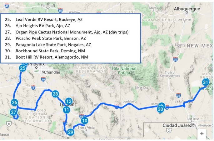
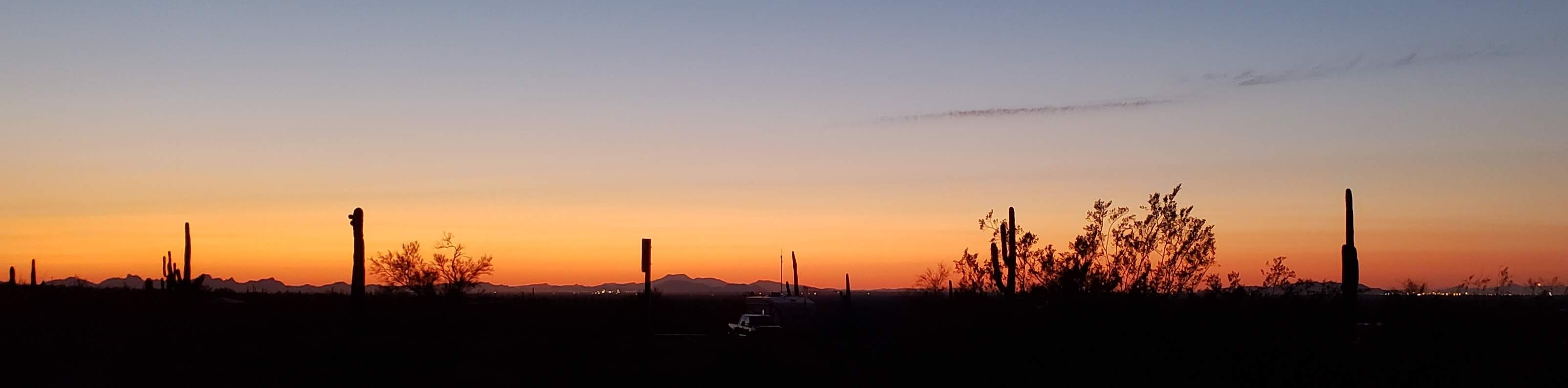
Our last episode ended at the Leaf Verde RV Resort in Buckeye, AZ, on March 14. In this post, I’ll pick up the narrative from there. First, here is a map covering the locations described in this installment. The numbers are starting to look a bit jumbled as we double back near places we stayed earlier on, so you should just focus on location numbers 25 through 31. As you can see from the map, we are generally easing back toward the east as our Sojourn winds down toward the finish.
March 15 – 16 (Monday – Tuesday): After posting PART 8 of the Sojourn, we stayed for two more days at the Leaf Verde Resort (location 25 on the map). The highlight was a visit to the Estrella Mountain Regional Park, located about 15 miles east-southeast of the RV park.
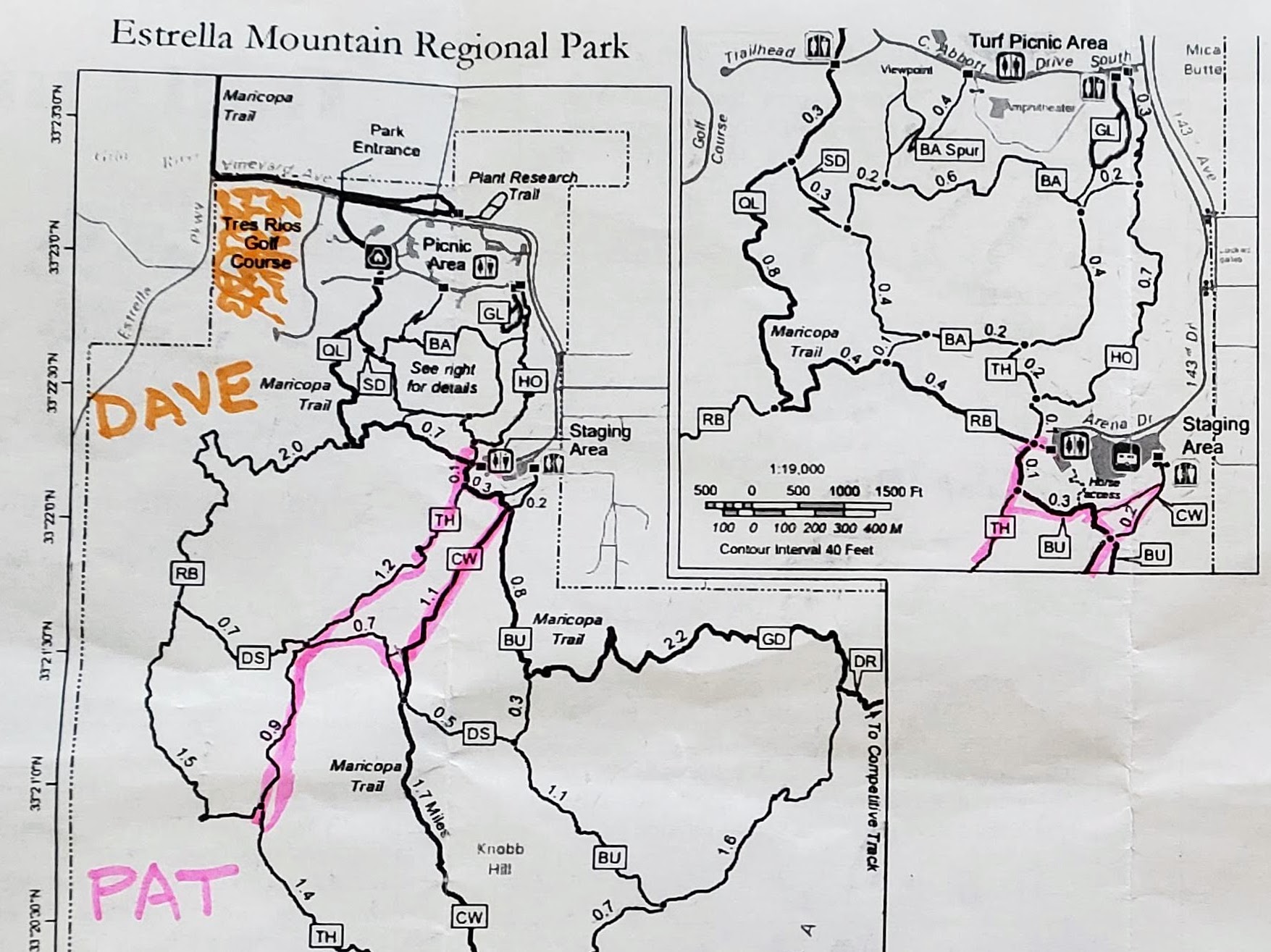
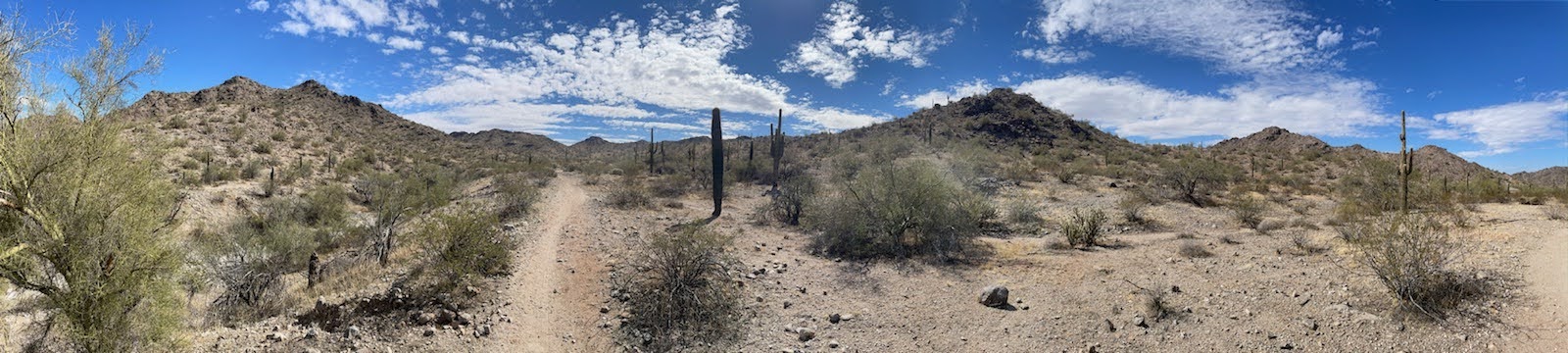
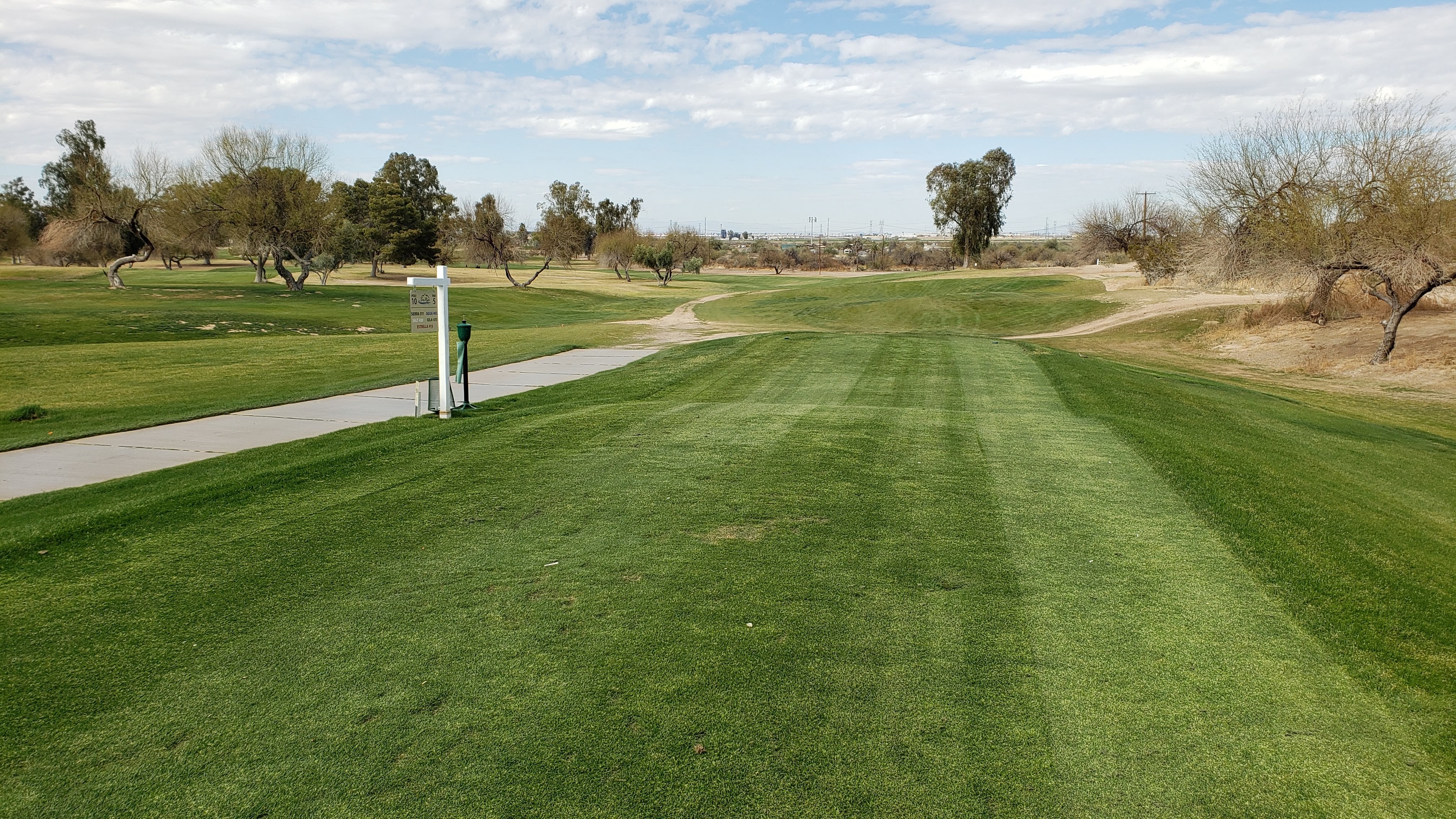
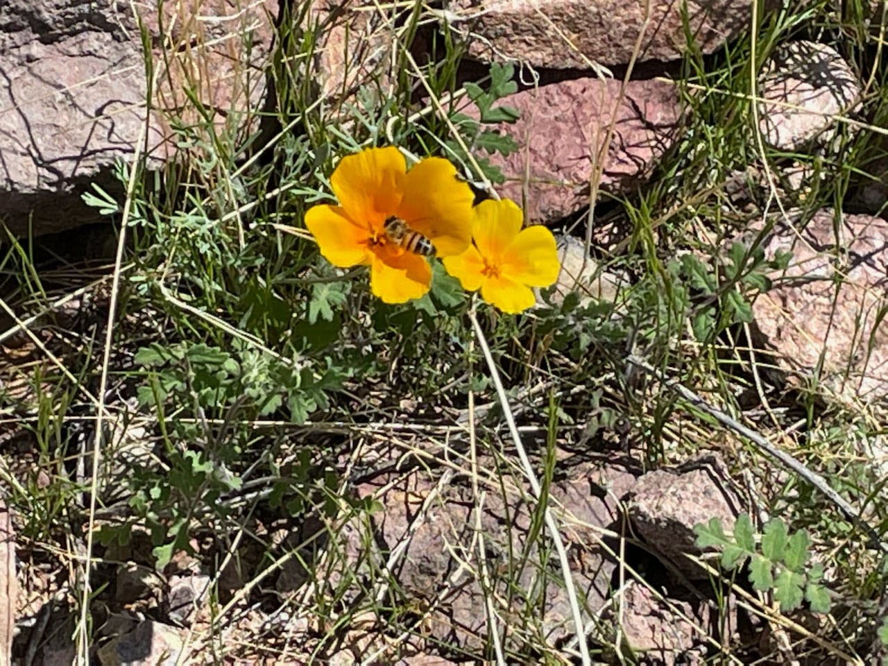
Pat enjoyed a nice hike along the Toothaker Trail and the Crossover Trail, shown on the map above. Meanwhile, I seemed to be just gadding about in some random manner in a different part of the Regional Park. A closer look at the map explains all, though, as one notices that the Estrella Regional Park includes something called the Tres Rios Golf Course. Here are some photos we each took that day – Pat’s illustrate the beauty on display from the hiking trails, while mine illustrates a different sort of beauty. I think she had the better of it in terms of healthful activity, but I managed to feed my addiction with a decent game while only losing one ball.
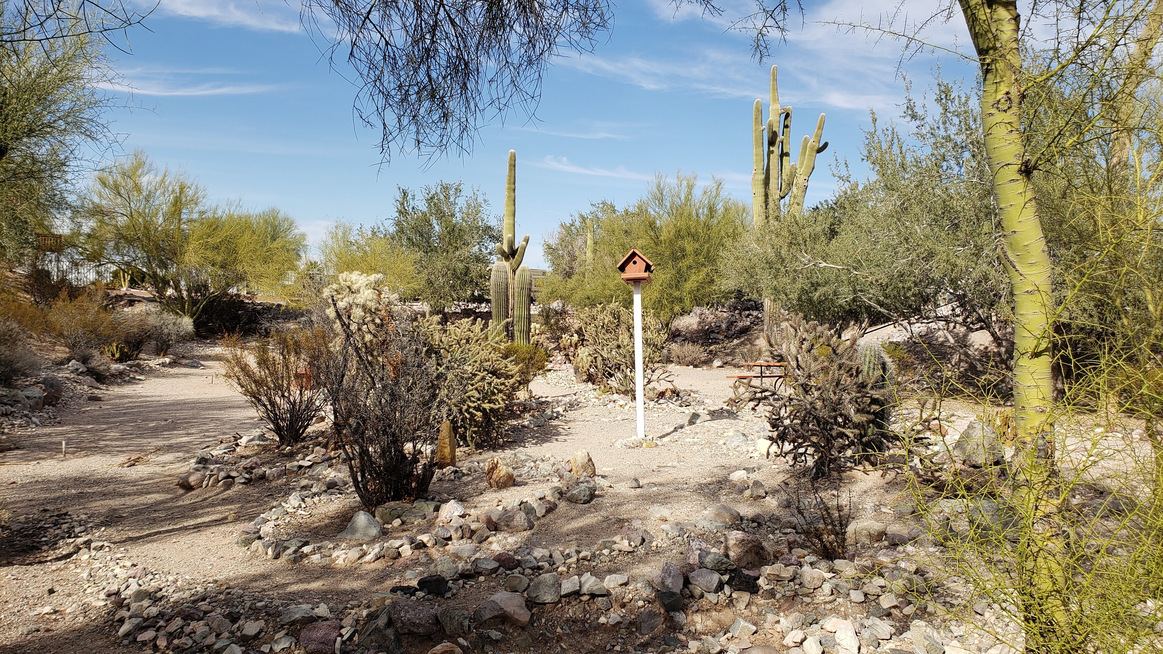
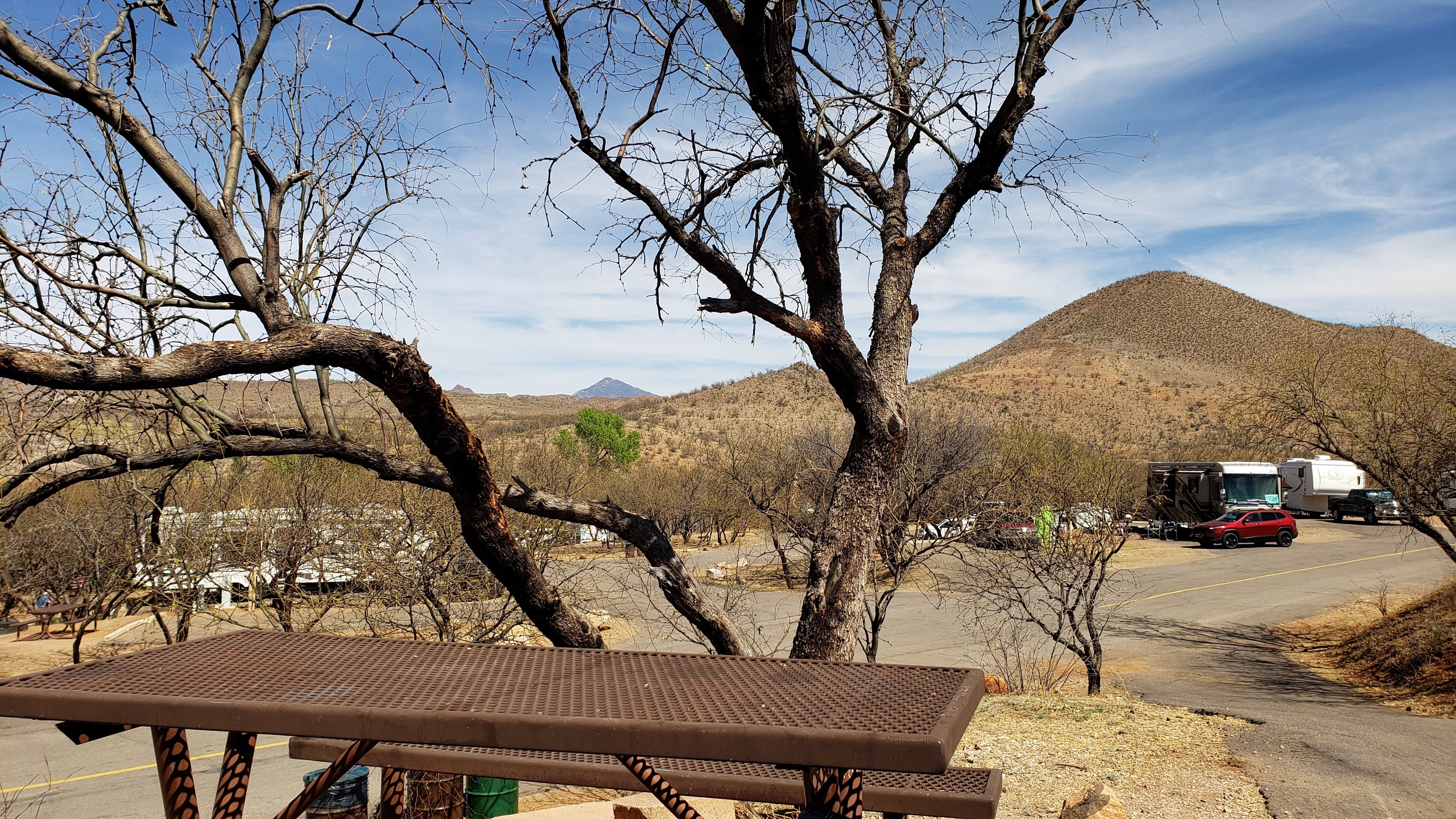
March 17 – 20 (Wednesday – Saturday): March 17 is not only St. Patrick’s Day, but is also our anniversary. This year was our 42nd. After exchanging “Happy Anniversary” greetings, we motored off to the Ajo Heights RV Resort (location 26 on the map above). The RV park is considerably smaller than the Leaf Verde Park, with about 50 well-spaced sites that blend into the desert landscape. There is even a pretty desert garden in a low-lying area adjacent to the gravel access road leading to our site. We felt very comfortable there, glad to get away from the more hectic surroundings of the previous week.
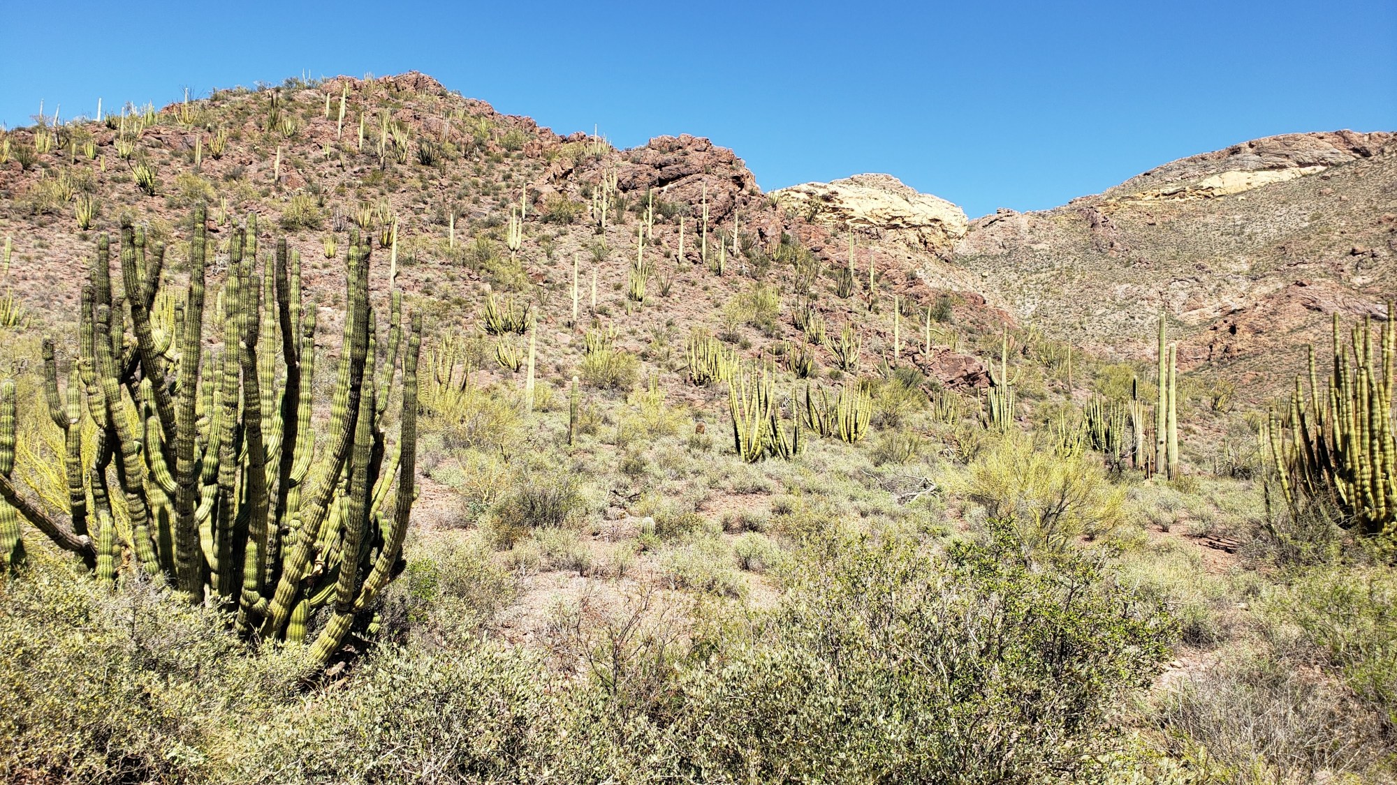
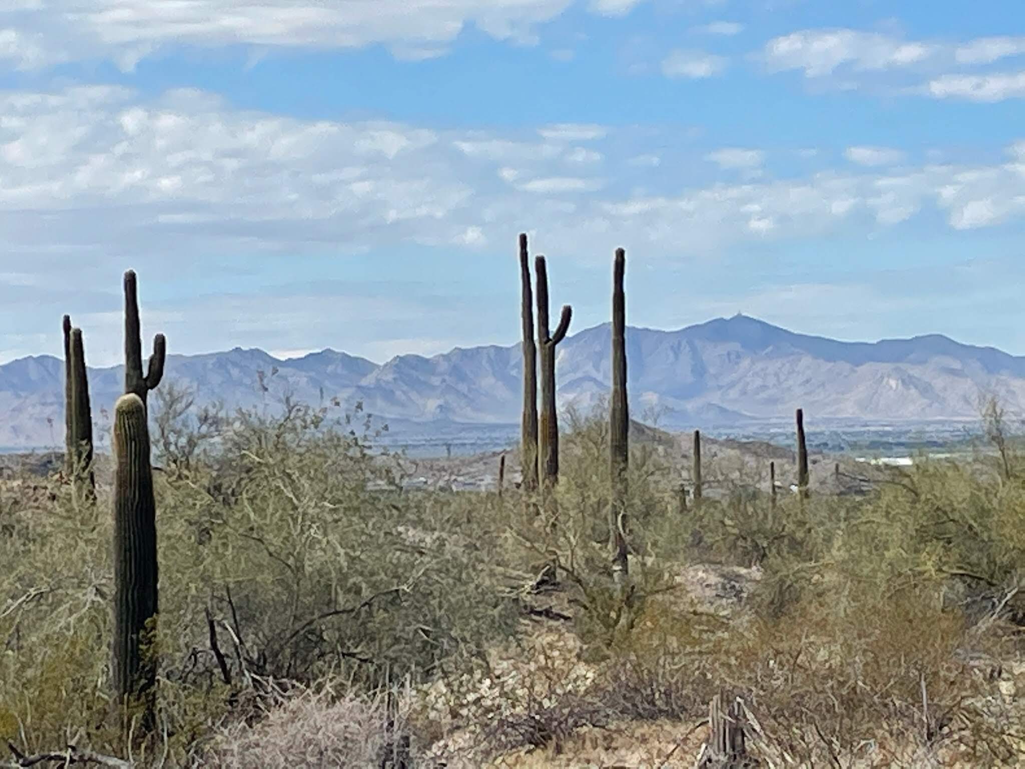
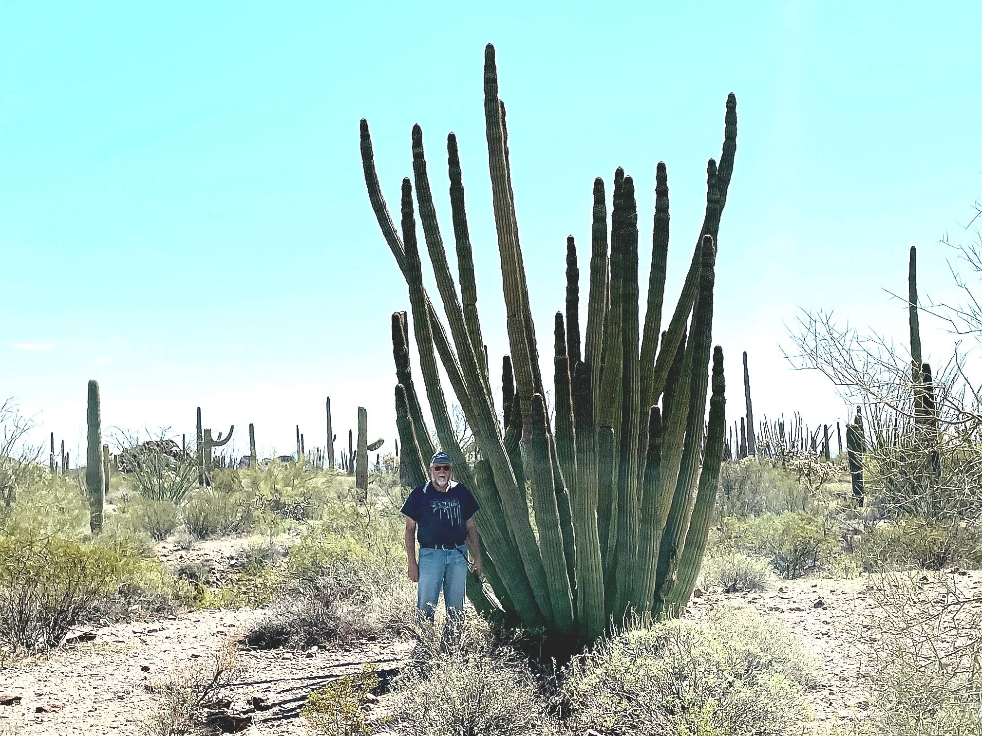
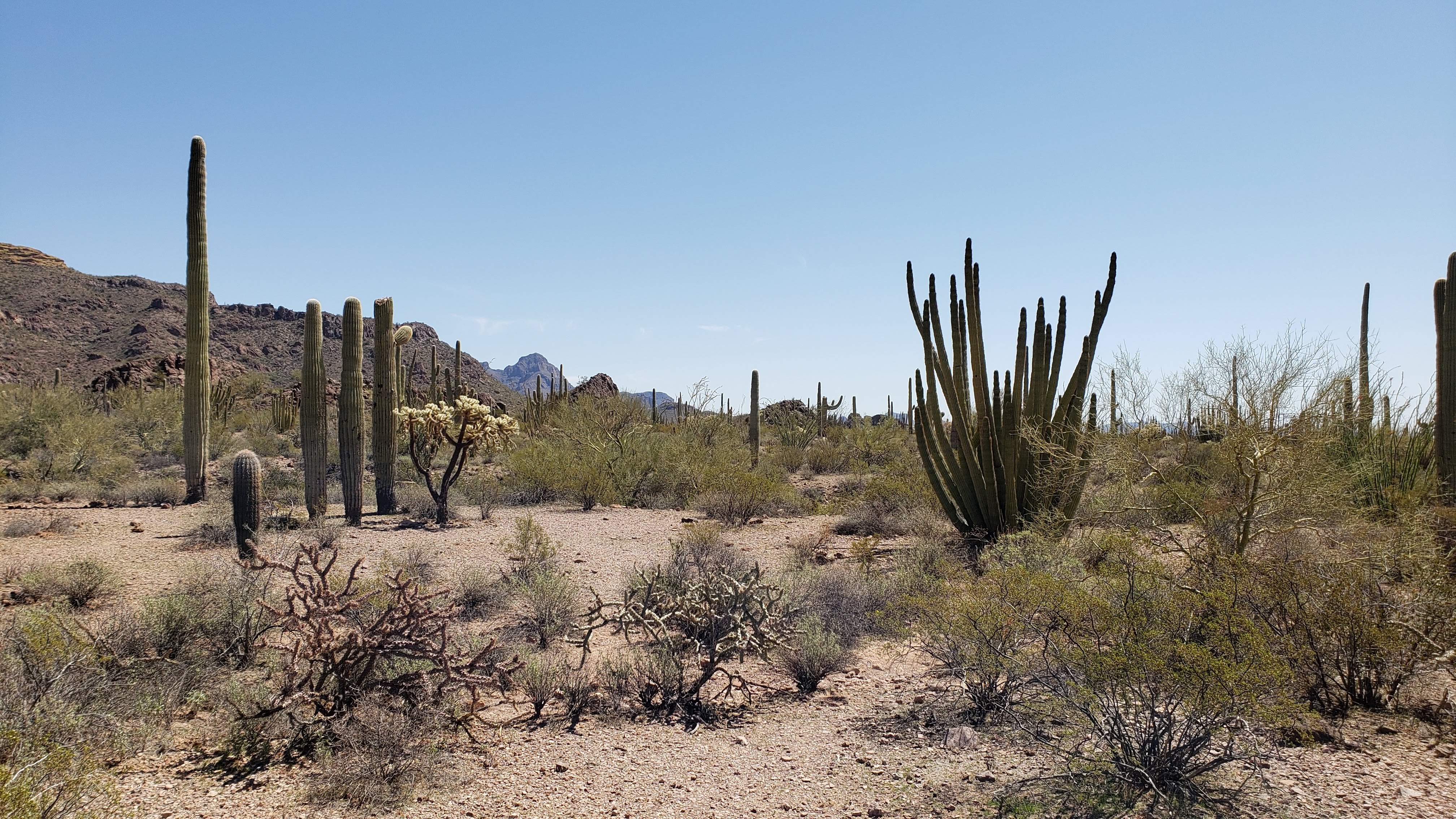
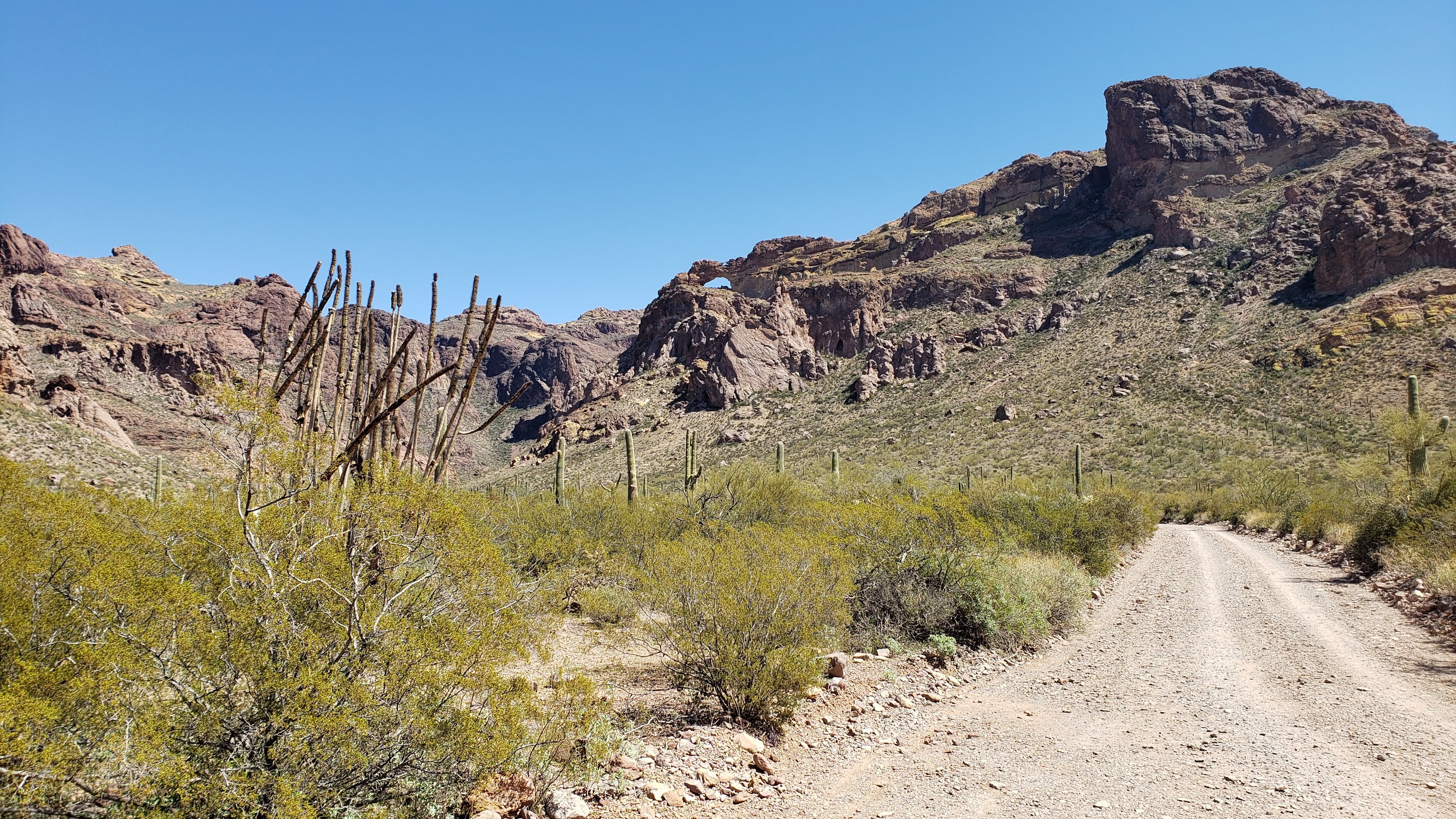
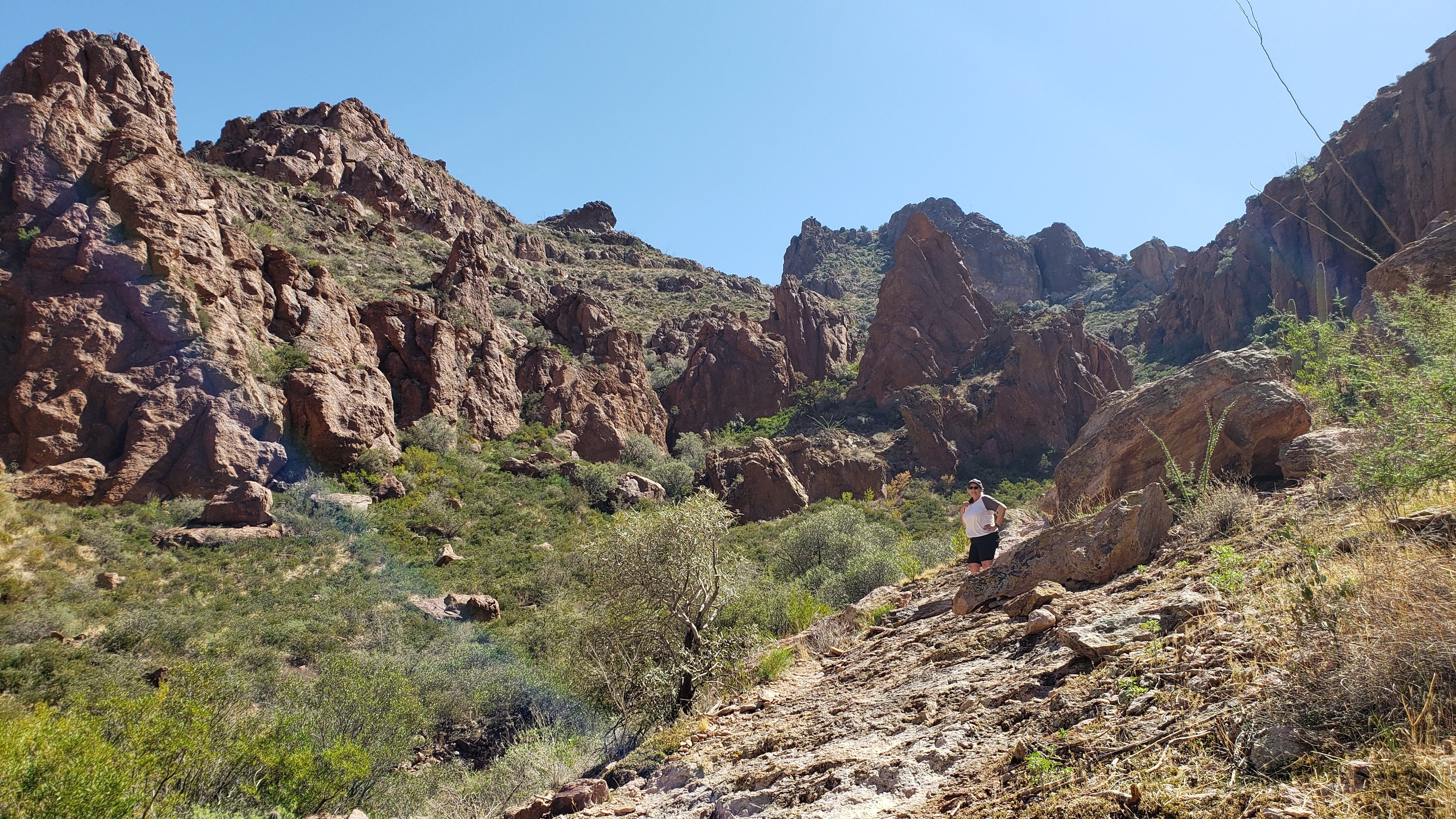
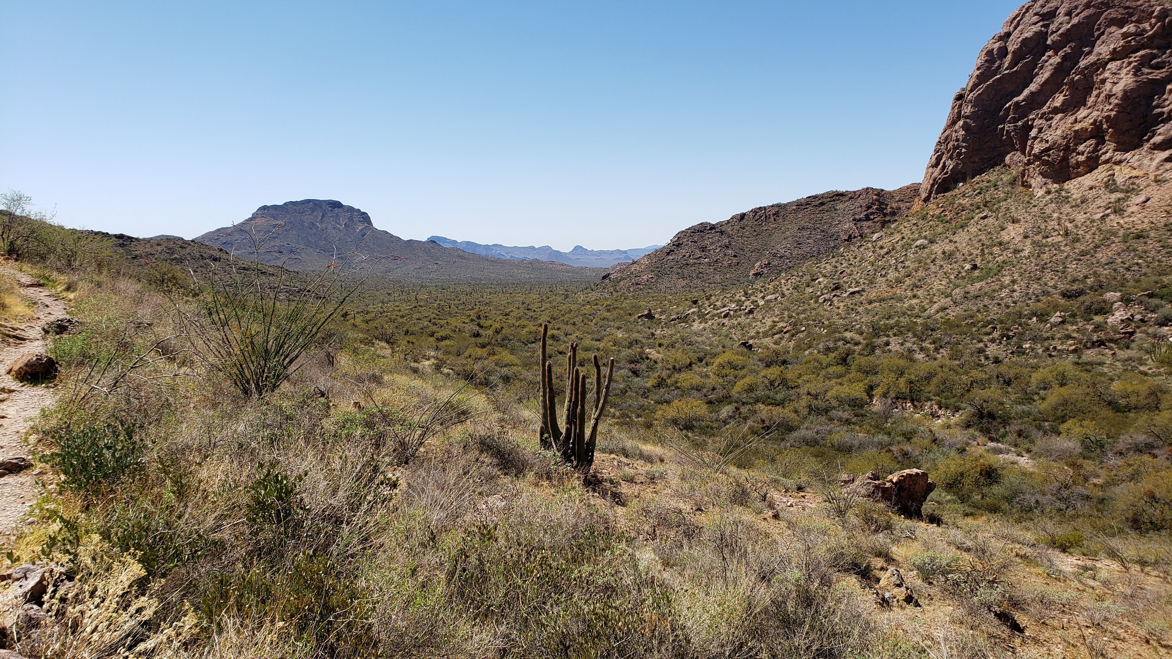
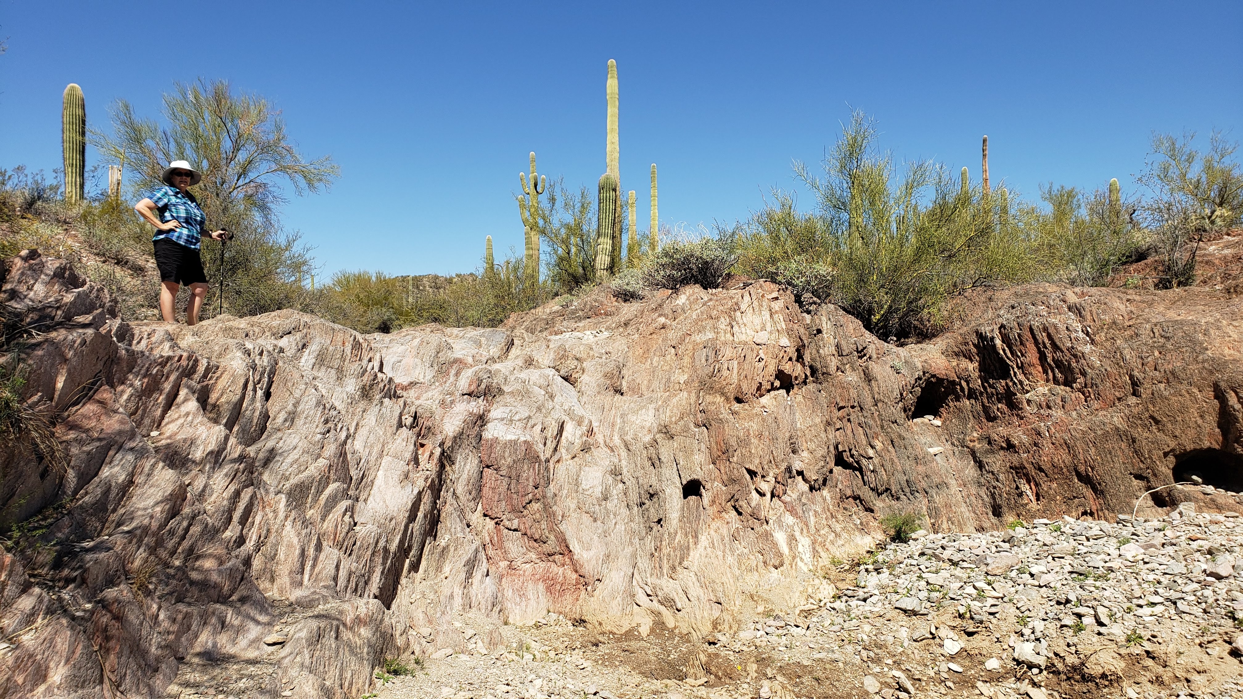
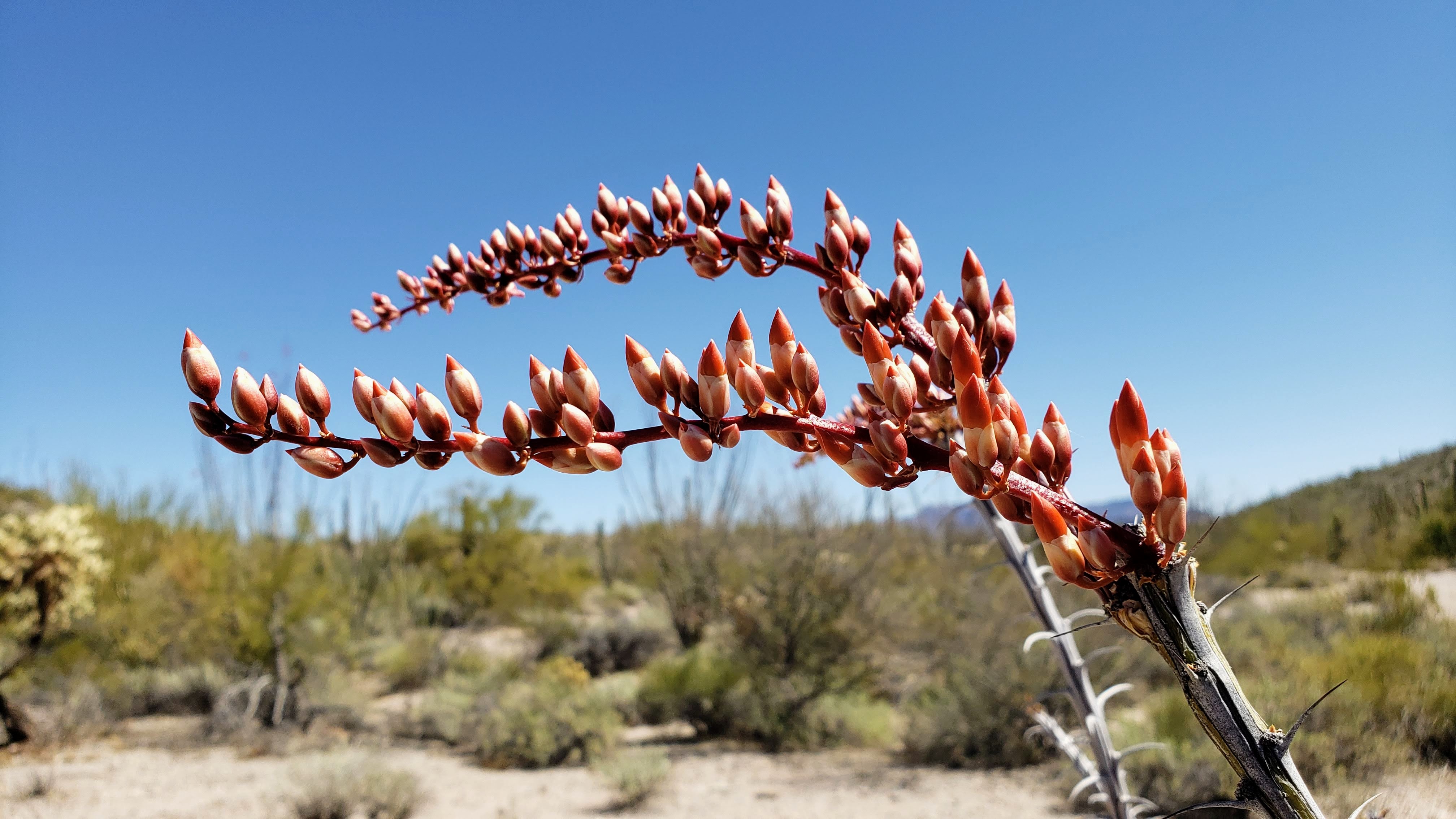
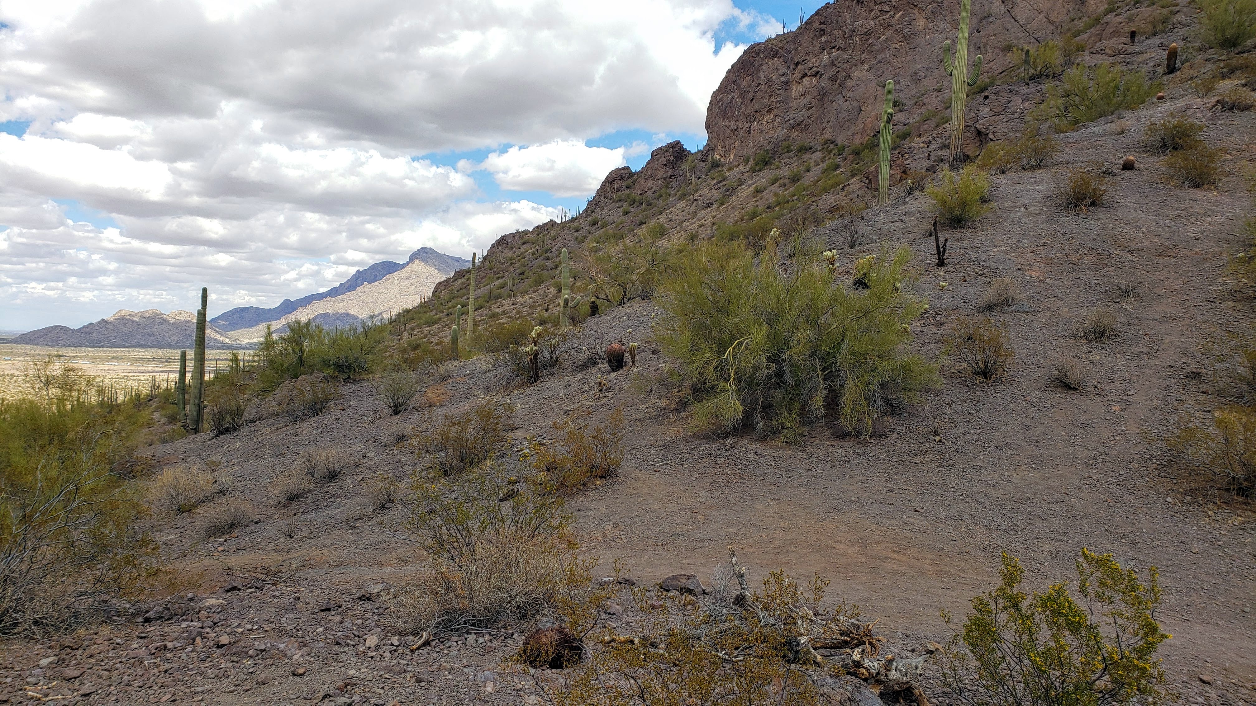
The primary attraction near Ajo is the Organ Pipe Cactus National Monument (location 27 on the map). We drove down there on both Thursday and Saturday, spending several hours each day. On Thursday, we drove around the Ajo Mountain Loop and hiked the Arch Canyon Trail, and on Saturday we drove along a portion of the Puerto Blanco Drive and hiked a portion of the Red Tanks Tinaja Trail. Both days we encountered stunning desert vistas and a variety of plant life. The most unique feature of the National Monument is, not surprisingly, the Organ Pipe Cactus. This species is particularly well suited to high desert heat, and the National Monument is essentially the only place in the US where they grow. (There is a much larger range for these cacti in Mexico.) There are also a tremendous number of Saguaro cacti, even more than we saw in Saguaro National Park while in Tucson, and they looked much healthier to us.
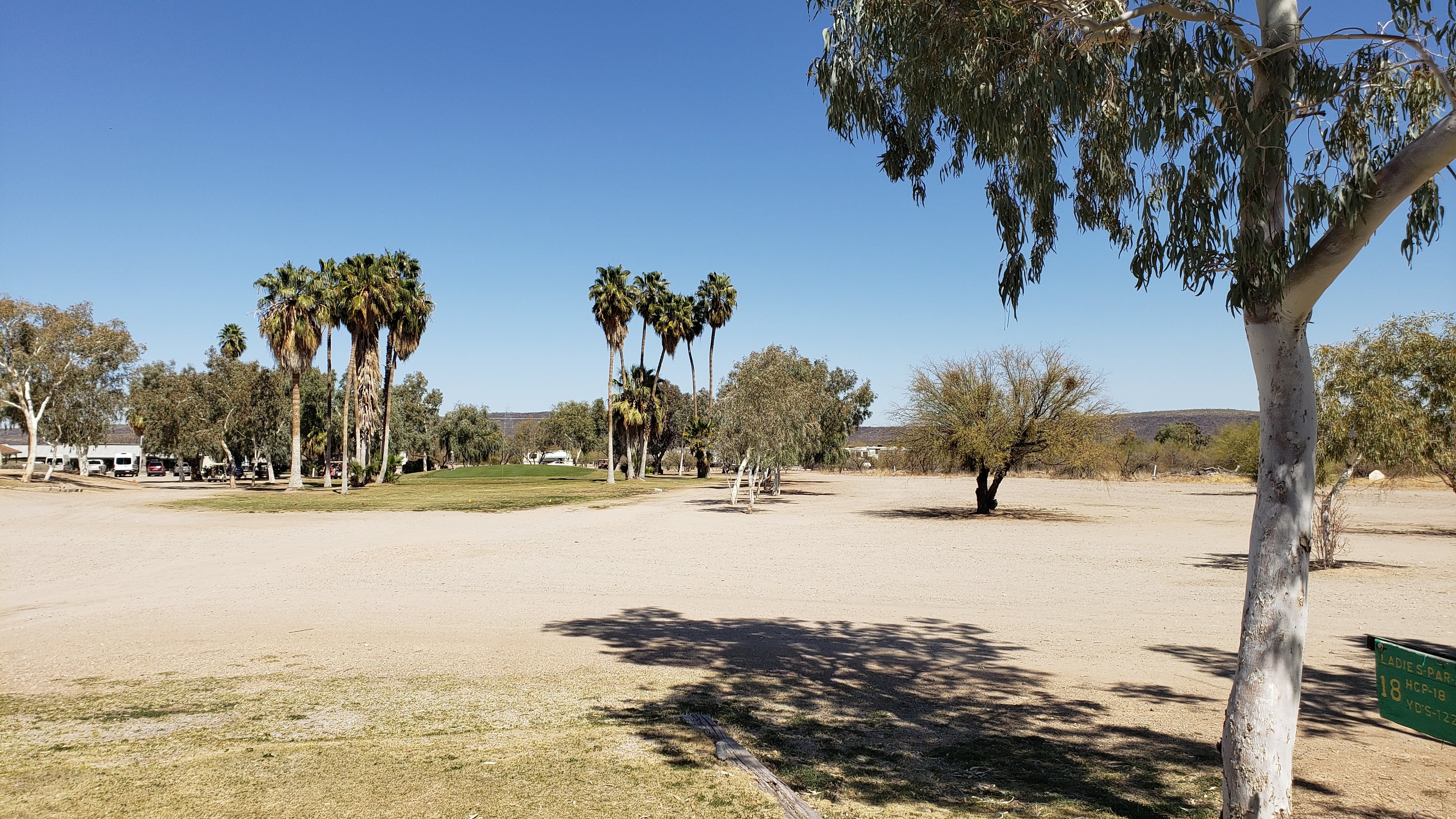
One interesting thing happened on Thursday as we were hiking back to our car along the Arch Canyon Trail. Two jet airplanes appeared out of nowhere and streaked across the sky at an incredibly low altitude, perhaps 200 or 300 feet. One of them was flying so low it needed to bank sharply to fit between two low mountains as it disappeared from our view. Another thing, almost as exciting, was that as we drove through downtown Ajo on our way back from the Monument, we stumbled across a sign pointing the way to something called the Ajo Golf Course. Naturally, we needed to investigate. It was a little tacky and run down, but not surprisingly I ended up playing 18 holes there on Friday. I scored quite well, and didn’t lose a single ball. Looks like I’ll make it back home with golf balls to spare after all.
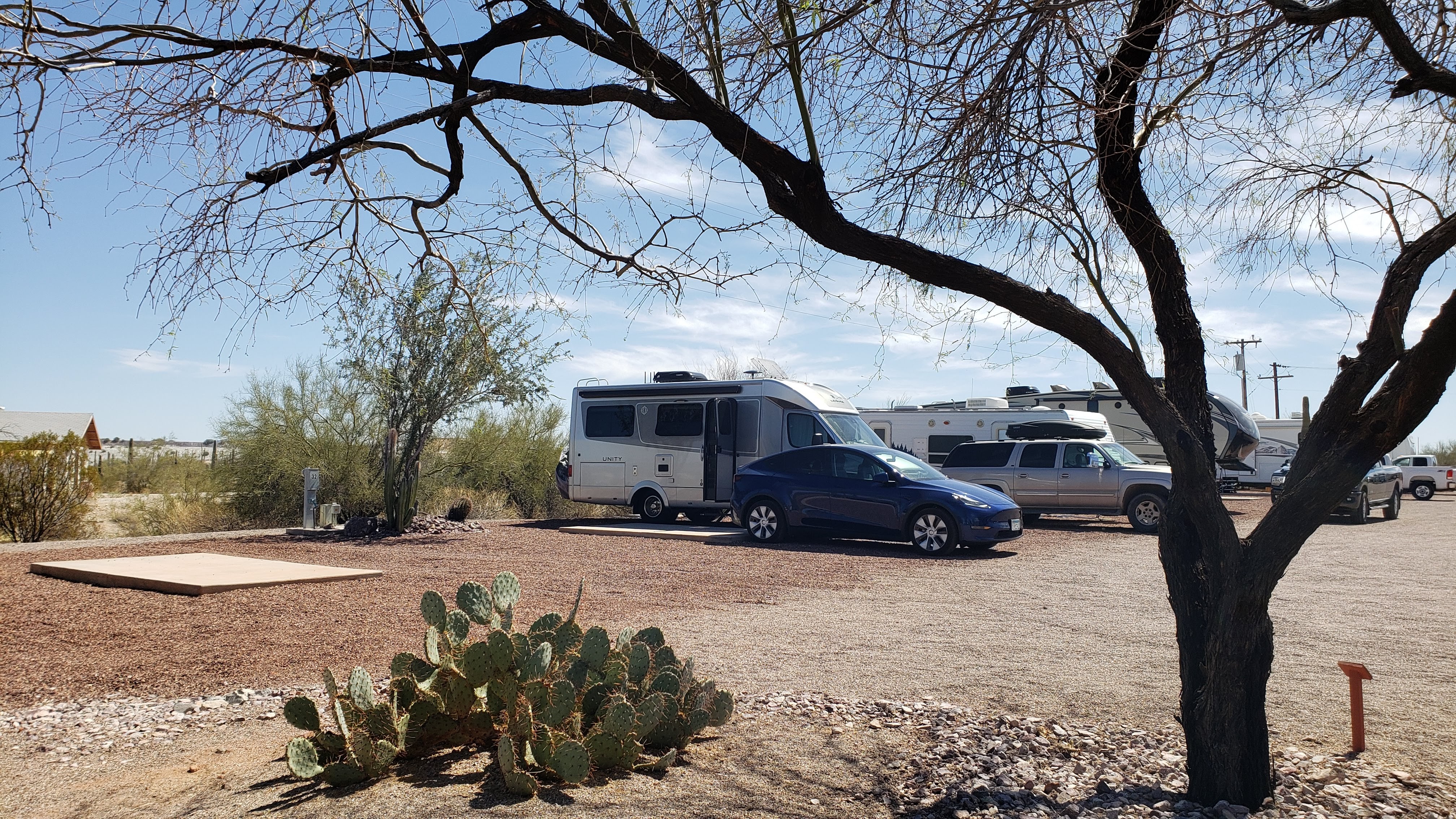
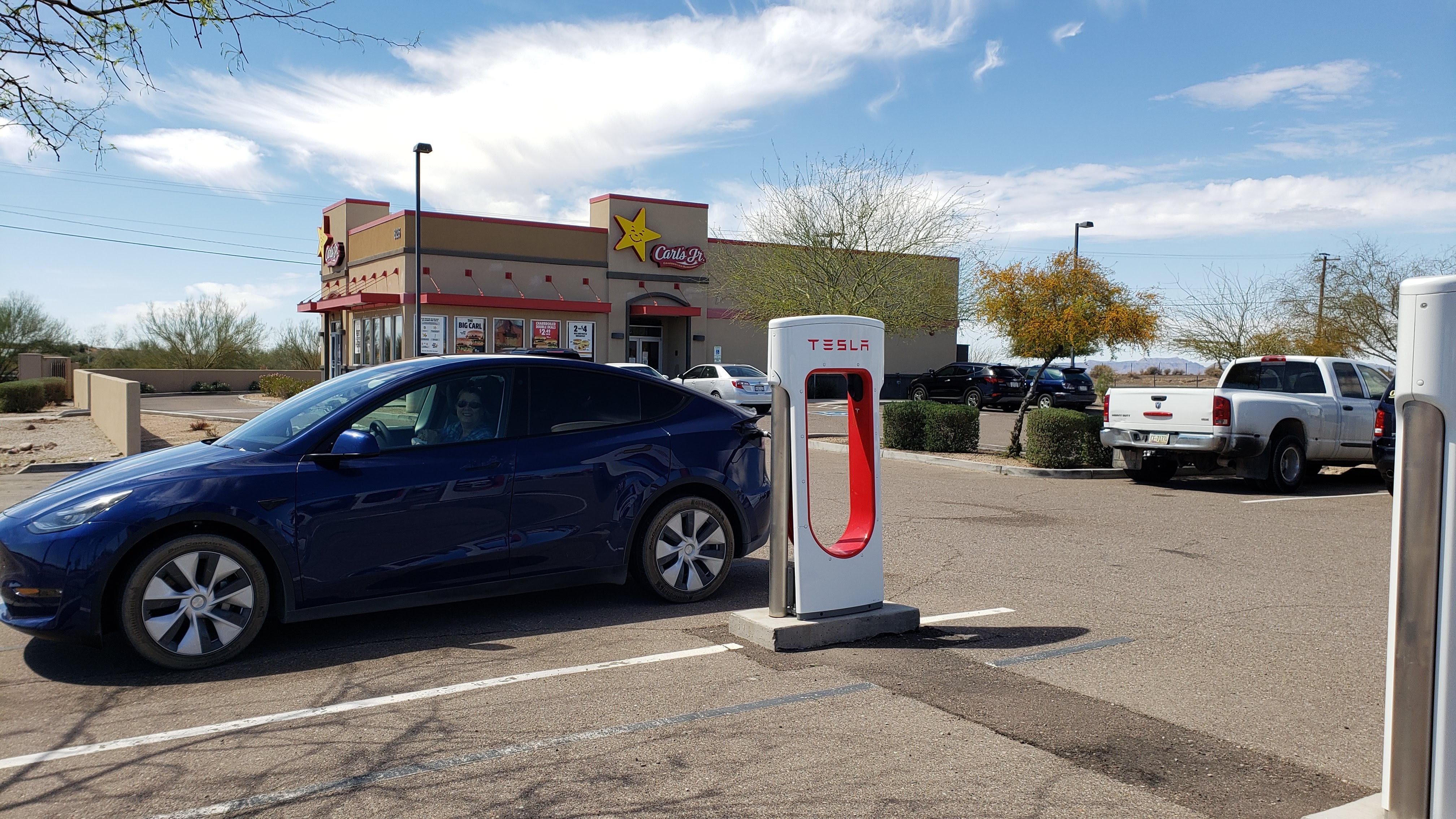
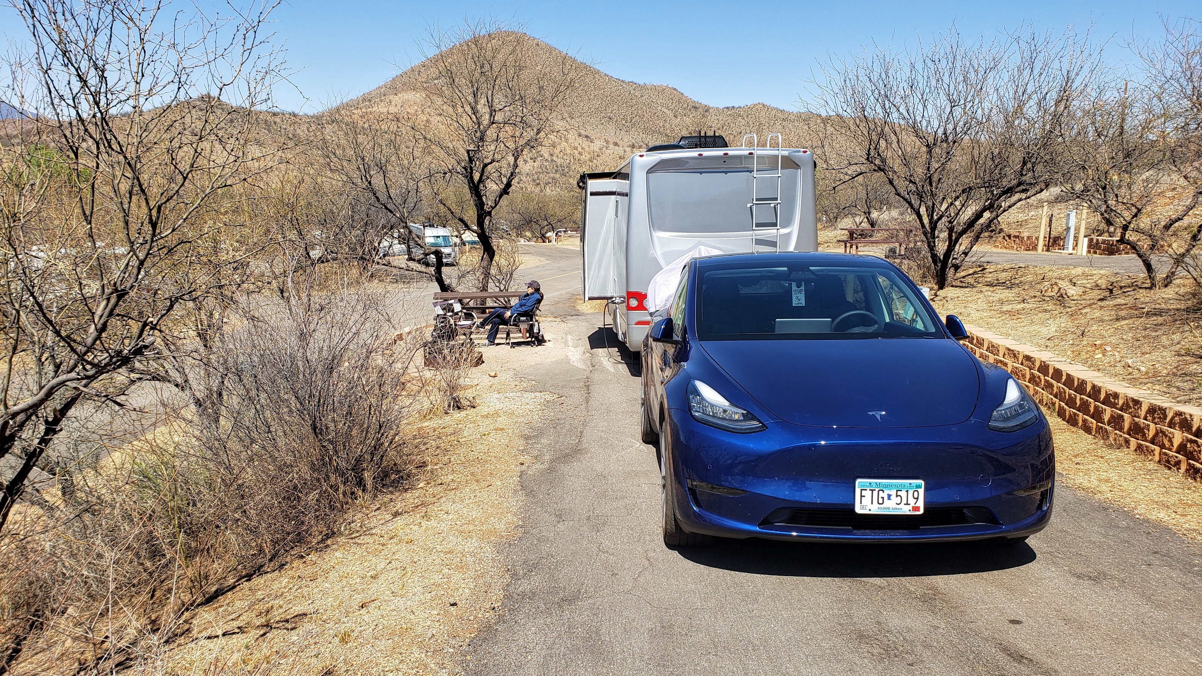
Since we got the Tesla, we have mostly been recharging it at our RV campsites using either the 15-amp exterior receptacle on the RV or the separate 50-amp circuit provided for bigger RVs. Charging with the 120 VAC, 15-amp circuit takes quite a long time, whereas the 240 VAC, 50-amp circuit charges about 6 times faster. However, for some reason, the 50-amp circuit at the Ajo Heights park did not work. So, on Saturday, after visiting Organ Pipe and returning to Ajo, we decided to drive 20 miles further north to Gila Bend, where there is a Tesla Supercharger station. The Supercharger, at 400 VDC, provides hundreds of amps and charges the car more than 10 times faster than a 240 VAC 50-amp circuit. Besides, Superchargers are often located at or near fast food restaurants – in this case Carl’s Jr. Thus, we were able to simultaneously charge the Tesla with healthy, life-sustaining direct current electricity, and our own bodies with unhealthy junk food. What could be better than that?
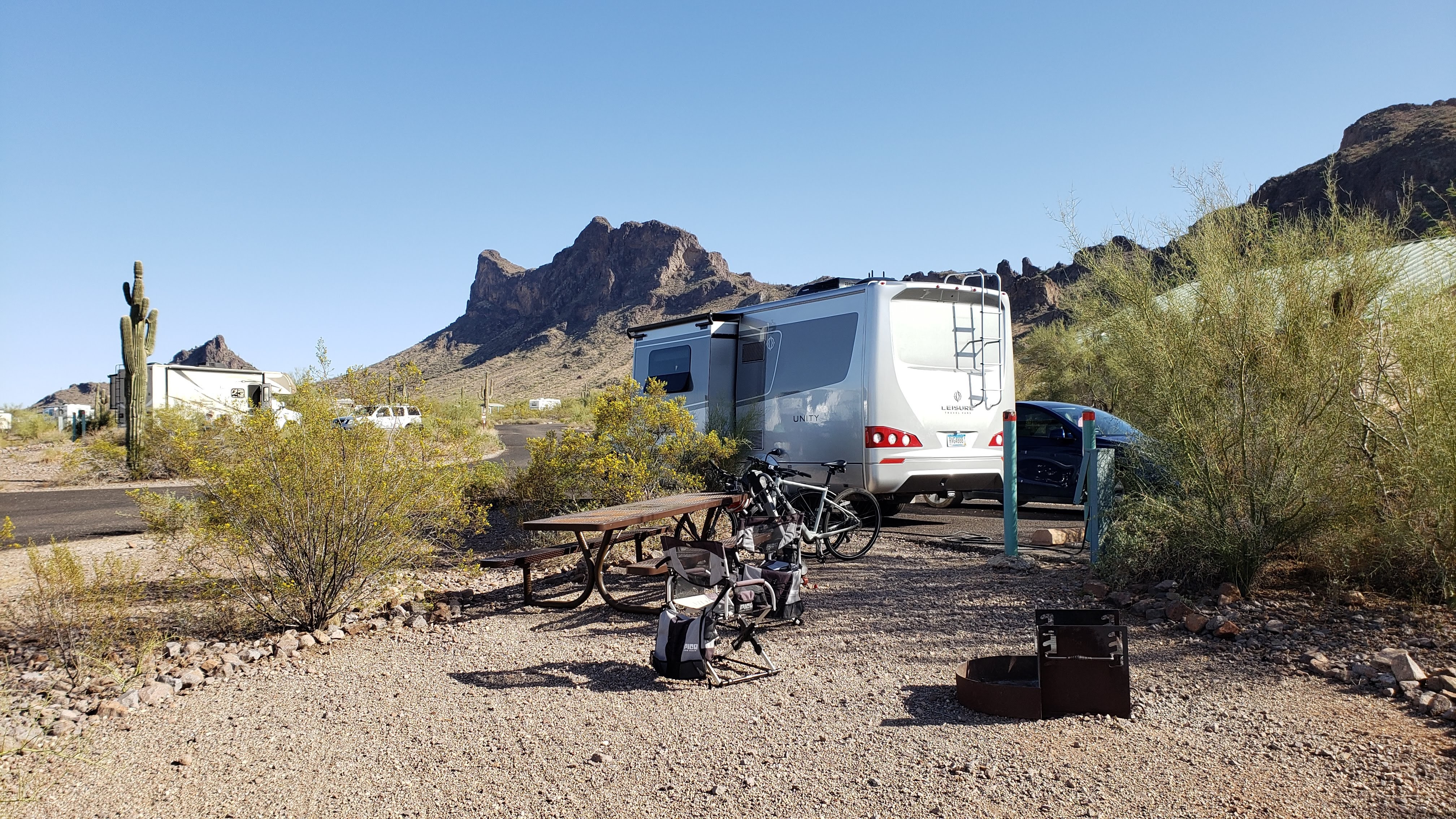
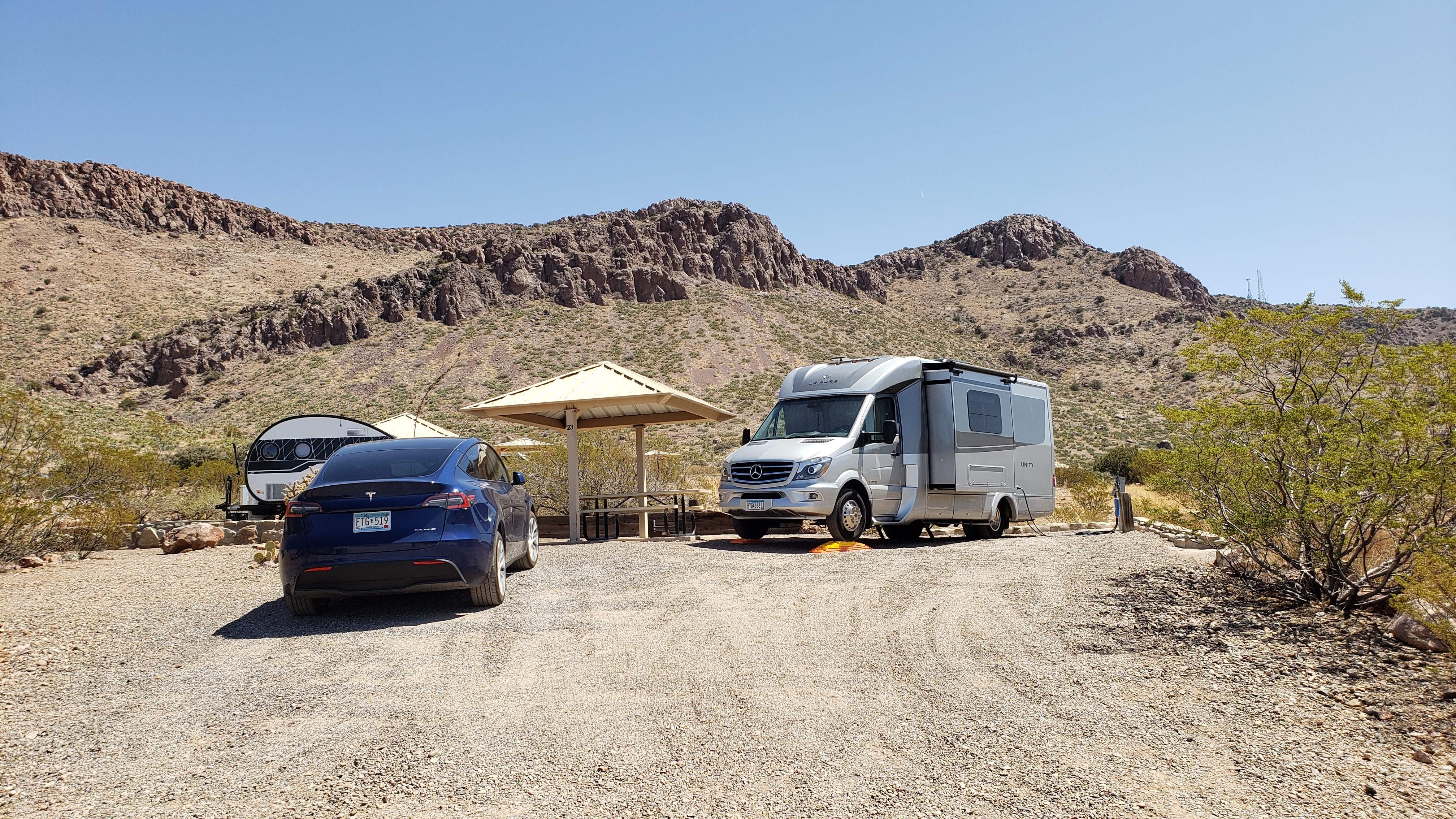
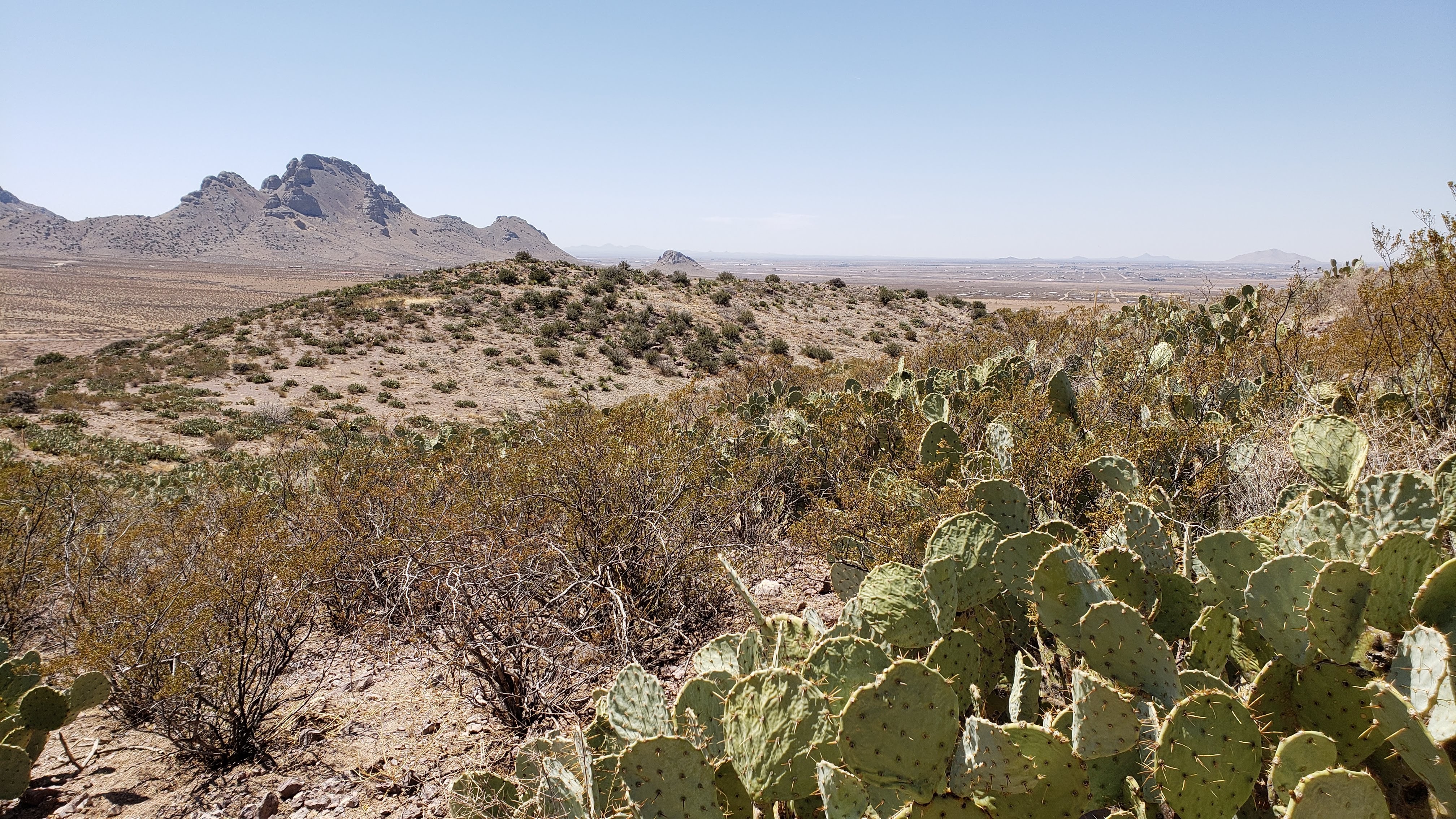
March 21 – 24 (Sunday – Wednesday): Our next stop was the Picacho Peak State Park (location 28) near Benson, AZ. This is another place that we visited during our 2018-2019 Excellent Adventure, and we were pleased to visit there again. We had a spacious site near the restroom building, but the park staff requested that campers not use the shower facilities – the park water supply is very limited due to some sort of water tank issue. We didn’t mind at all, though, because we have taken to showering in our RV to avoid unnecessary contact with potential Covid spreaders. We enjoyed our stay at Picacho Peak, including biking around on the park roads and hiking along the ridgeline of the mountain. On our previous visit, we hiked a trail on the east end of the park. This time, we hiked a trail that starts on the west end, but only went a mile or so and then returned in deference to my aching feet and knees.
On Monday, we drove into Tucson to a place called the A1 Mattress Factory, where we ordered a new custom-made mattress for the RV. This was all in accordance with a plan Pat had hatched based on info posted on a Leisure Travel Vans Facebook users’ group. The plan was inspired by the sadly sagging state of the original mattress (in-laws Allen and LeAnne can attest to this), and she just couldn’t stand it anymore. Amazingly, the A1 people were able to buy the materials, make the mattress, and install it in the RV as I drove through Tucson on Thursday on my way to our next destination.
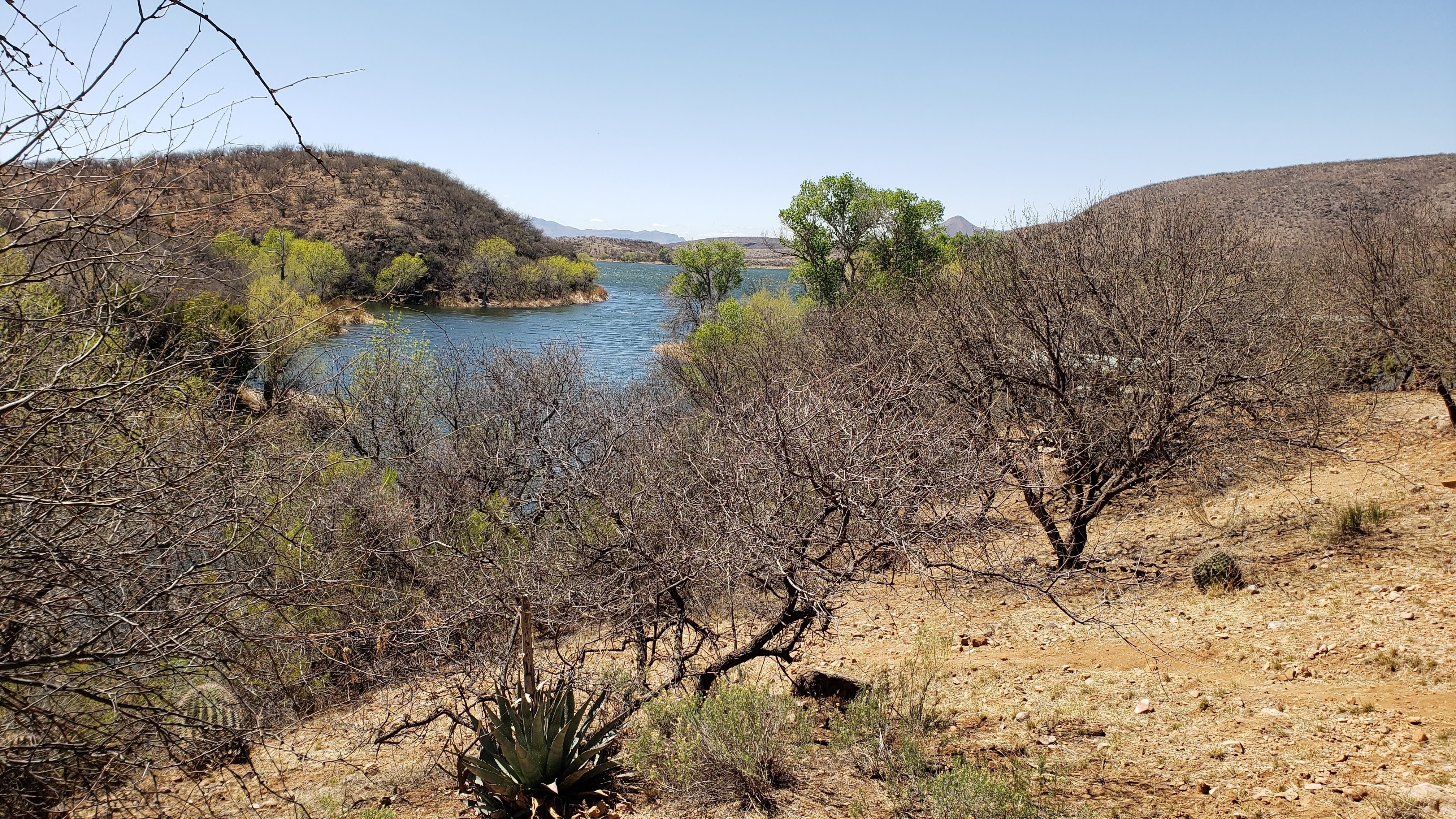
March 25 – 29 (Thursday – Monday): On Thursday, after picking up the new mattress, we drove to the Patagonia Lake State Park (location 29) near Nogales, AZ, another beautiful example of the Arizona Park system. The park entrance road winds through a lovely valley and provides a bird’s eye overlook of Patagonia Lake.
We again had a site that was well spaced from our neighbors, providing a peaceful feeling even with the campground fully occupied. (Except for the loud partiers in a camping cabin on the hill behind us, but they only stayed one night.)
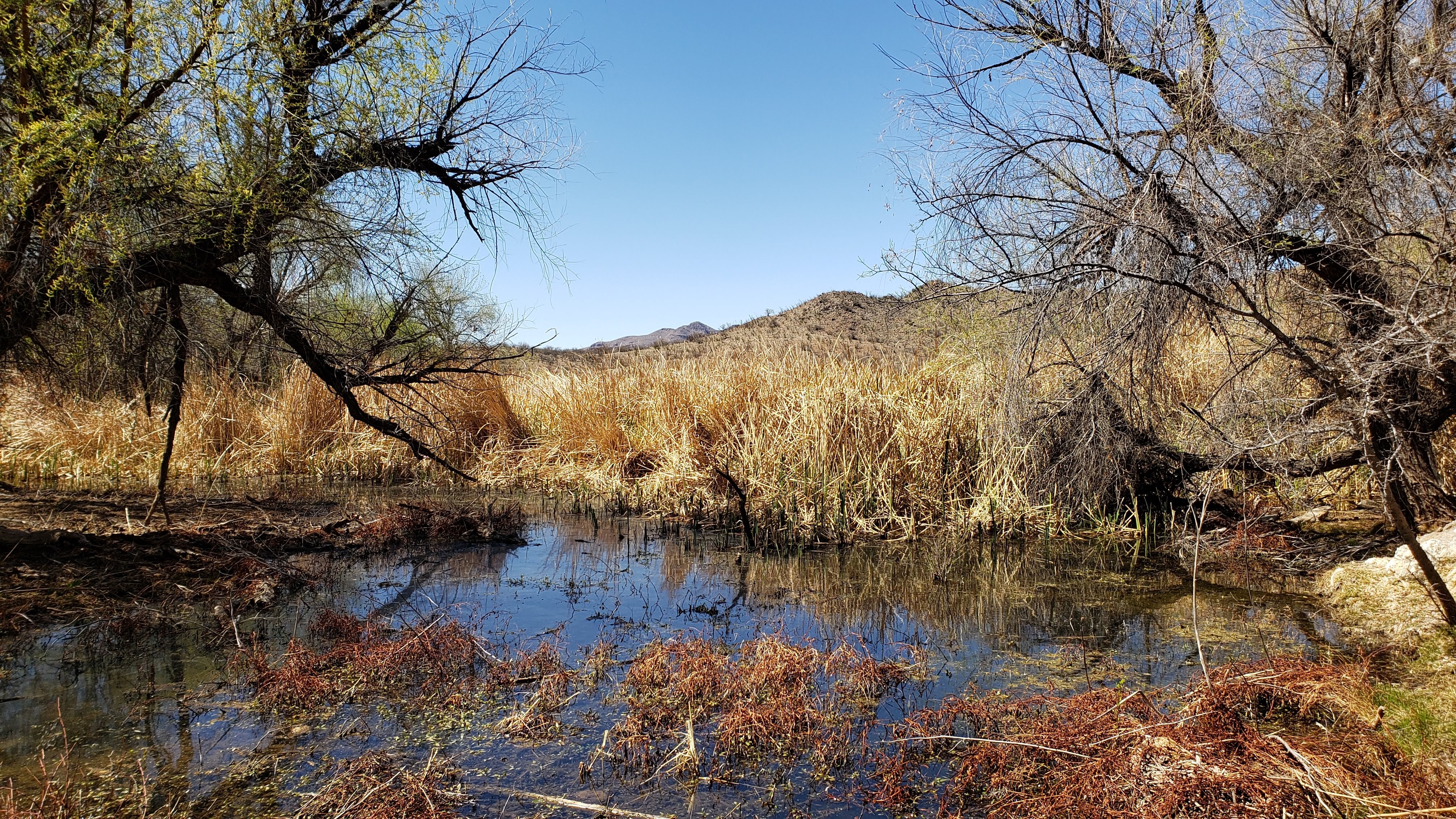
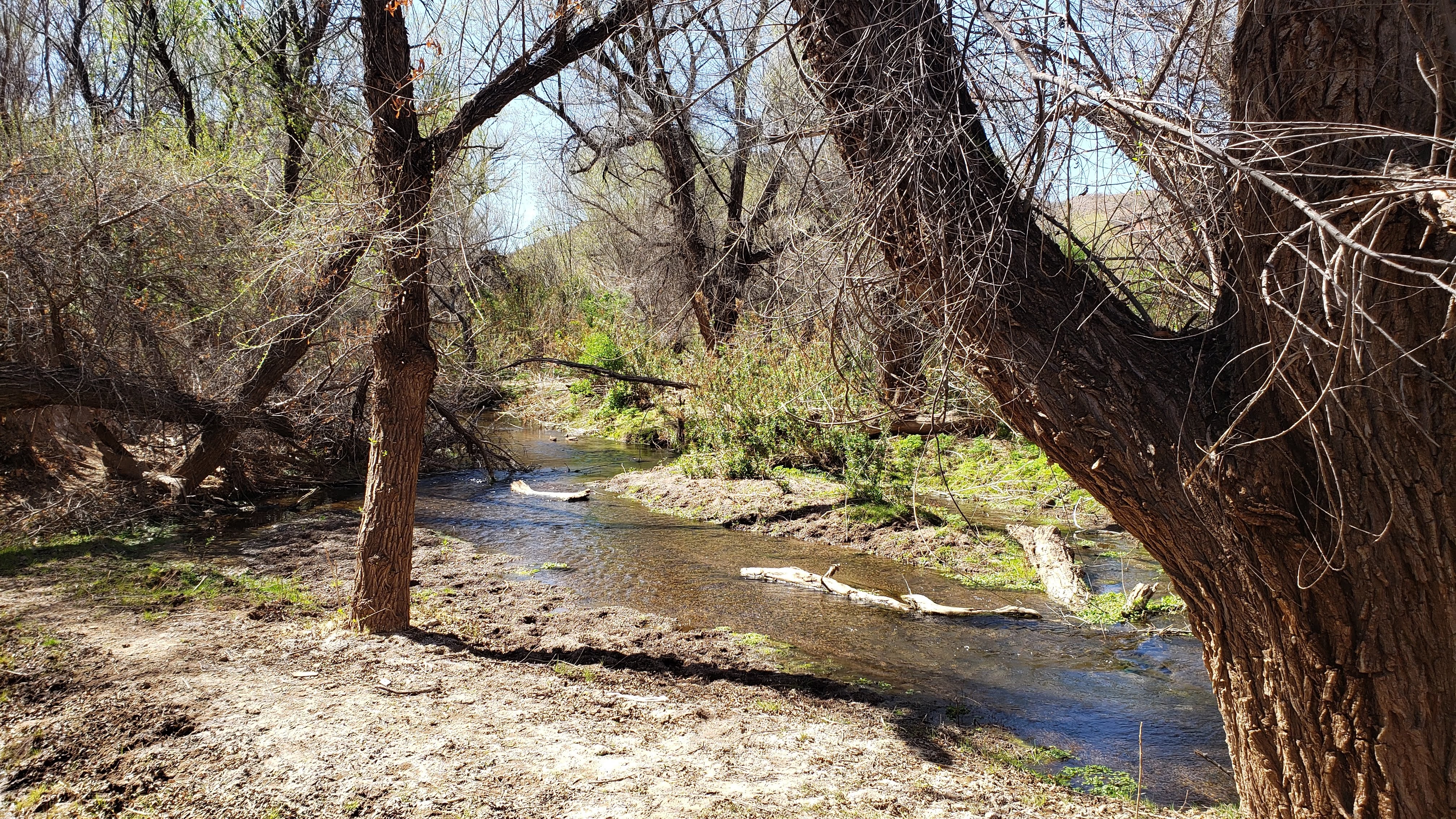
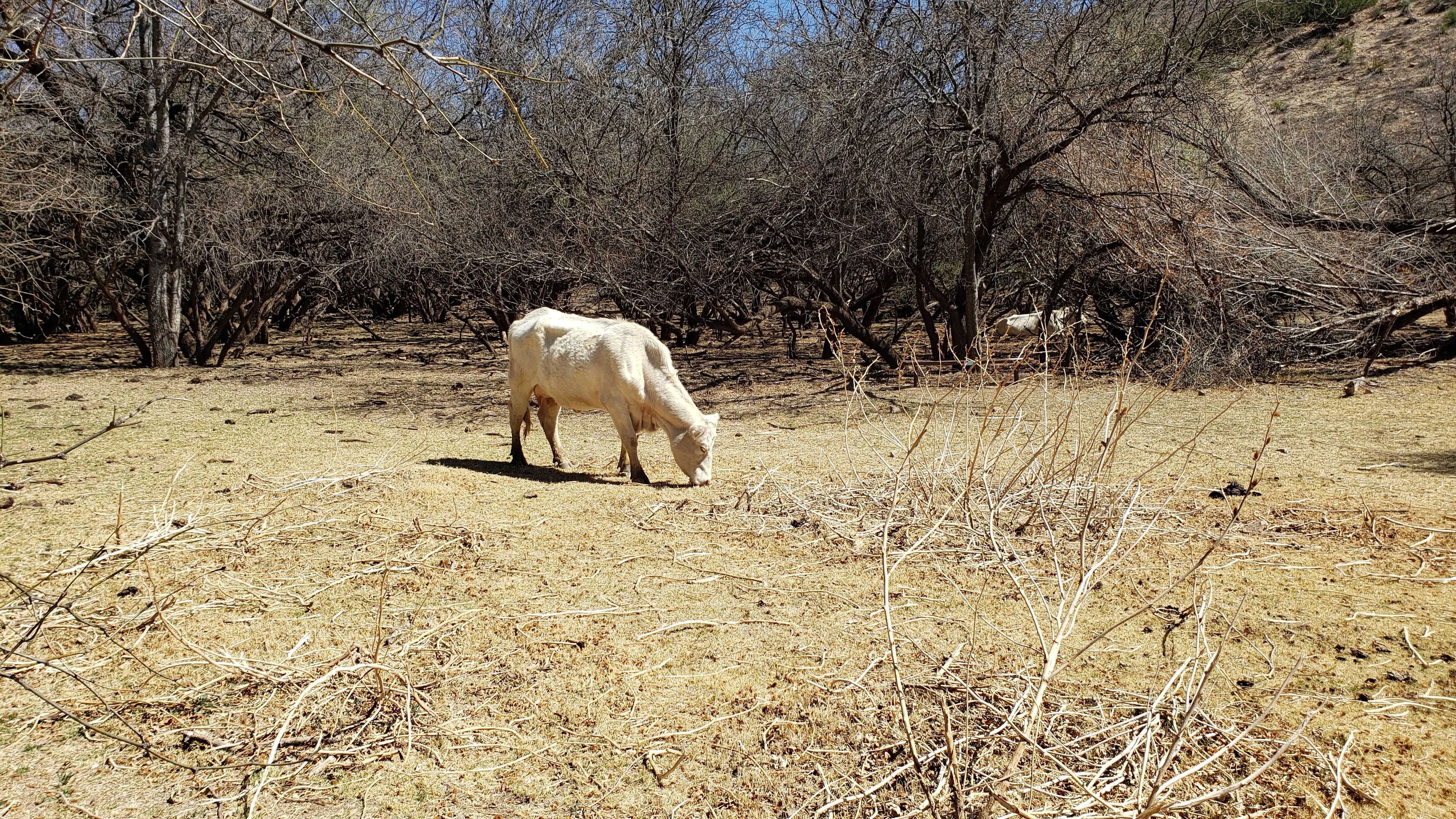
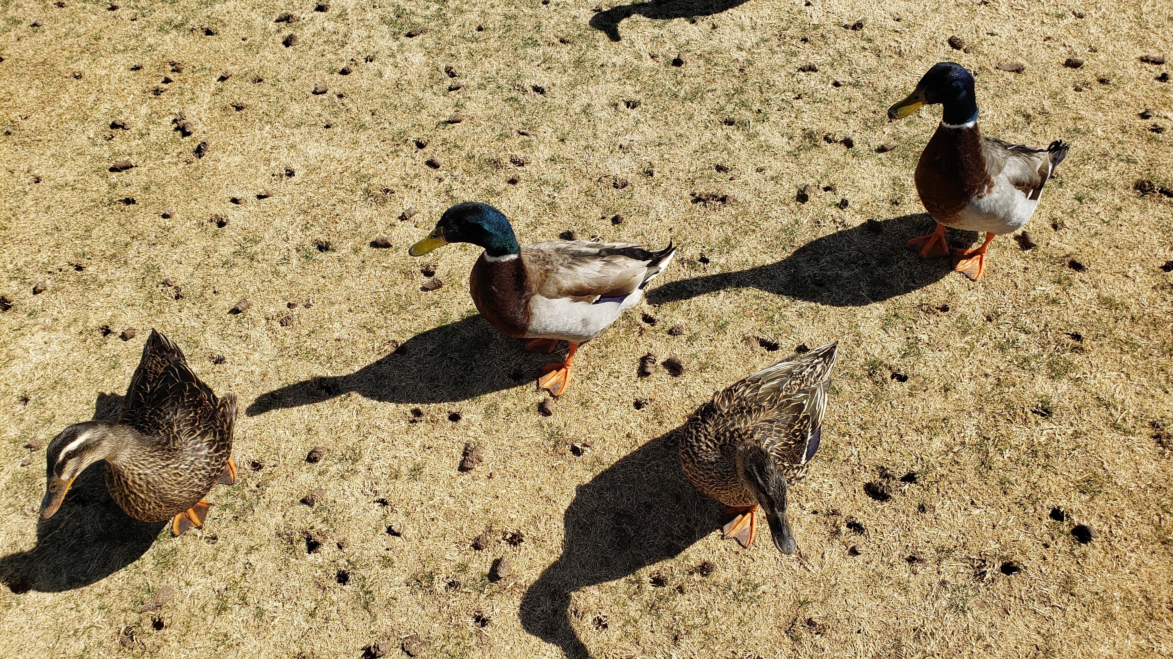
We spent our time at the park hiking along the so-called Bird Watching Trail that ran next to Sonoita Creek and walking along the campground roads to look at the lake and the various picnic areas. It was interesting to learn that there are over hundreds of bird species in the park. We saw several of them, and even some very large flightless ones that lolled around, free-range style, in the vicinity of the birding trail.
We did some grocery shopping in Nogales on Friday, and on Monday we drove to Tubac to have lunch with Minnesota expat friends Gordon and Michele. All in all, we enjoyed our stay, with one niggling exception. There was no WiFi and no cellular coverage anywhere in the park. As a result, we found ourselves up early on Saturday and Sunday mornings, something like Marlon Perkins on the old Mutual of Omaha’s Wild Kingdom program, driving out of the park, “stalking the elusive cell tower.” We eventually found a spot about ten miles down the highway toward Nogales, near the humorously titled Nogales International Airport (with naught but a dozen single engine prop planes and a pair of twin-engine ones parked on the tarmac), where we got a good enough cell signal to download some books, grab the daily New York Times crossword and Spelling Bee, and play a few Words with Friends games. While we truly did like Patagonia, I was happy to move on to someplace with actual internet access.
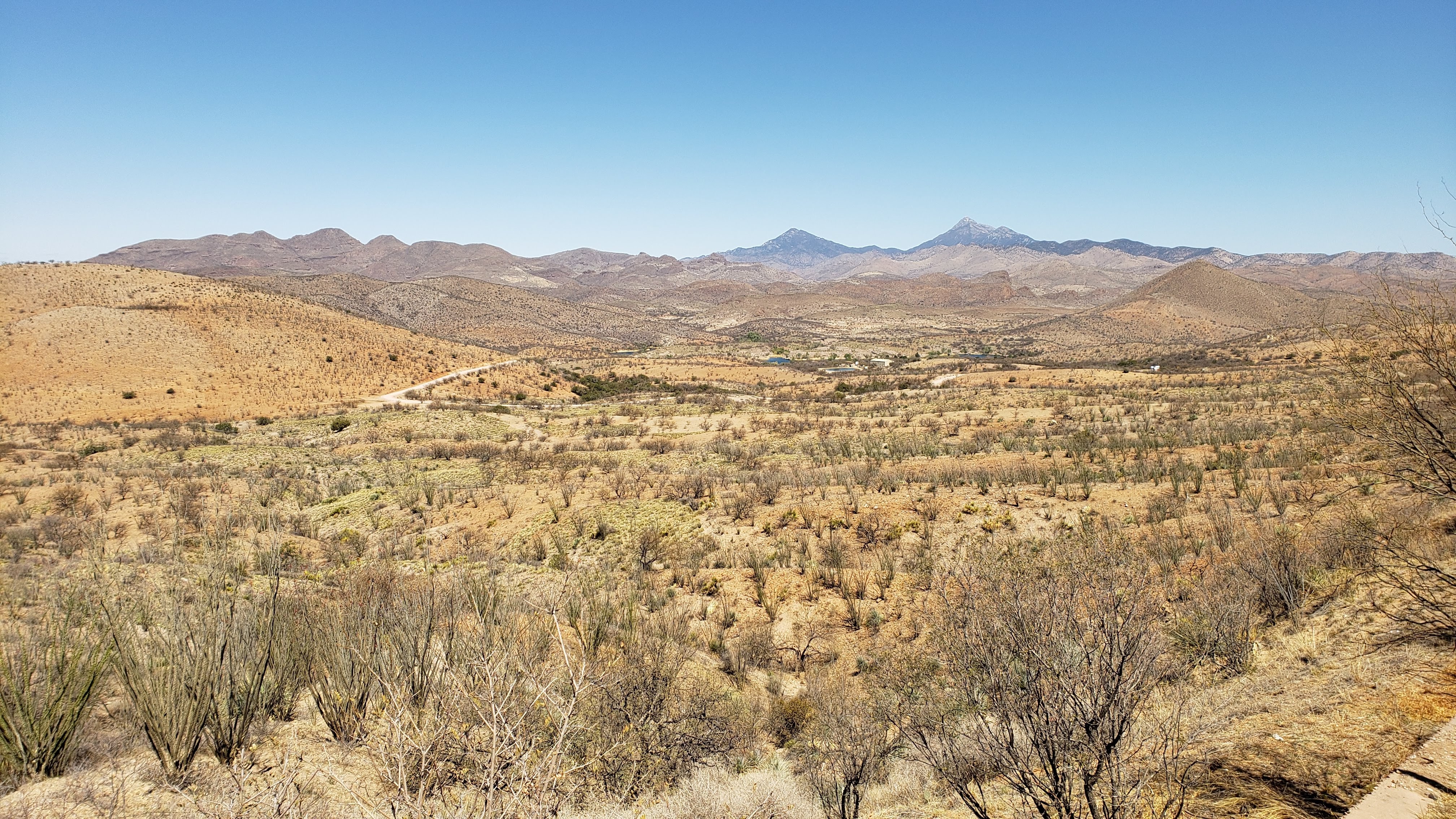
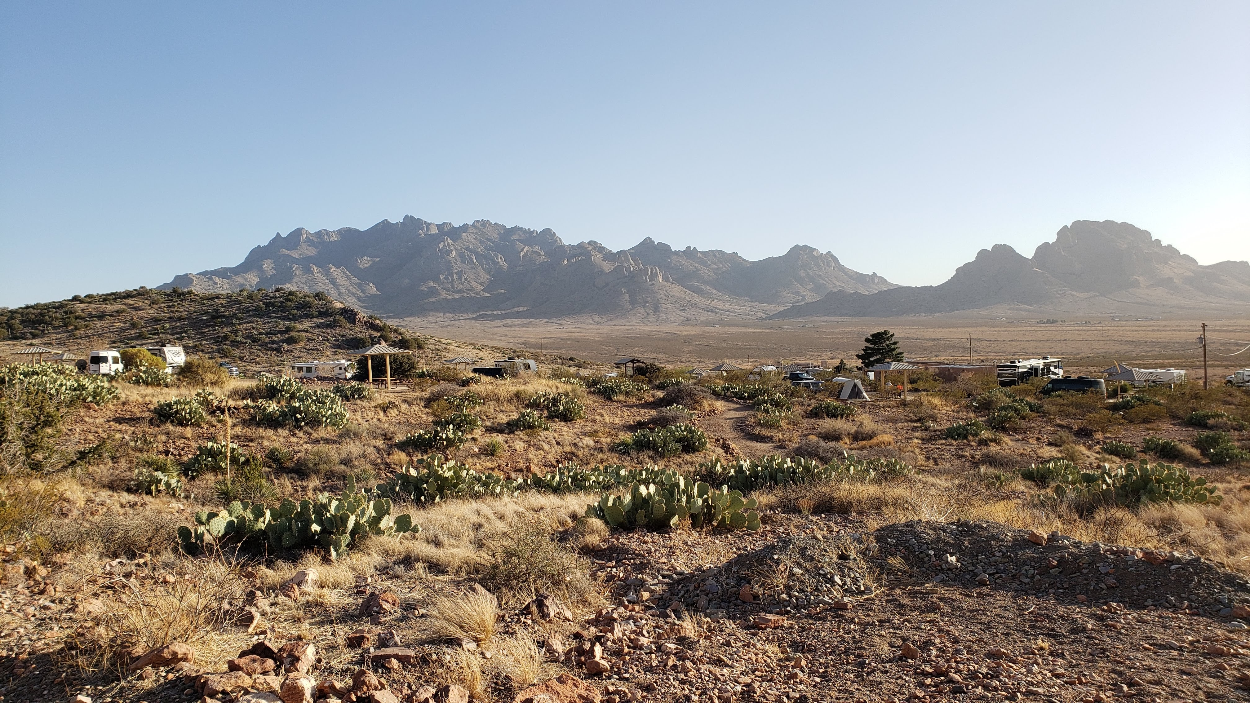
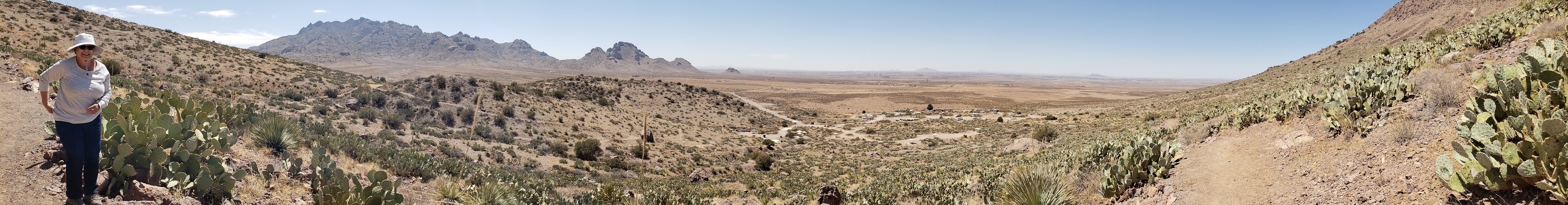
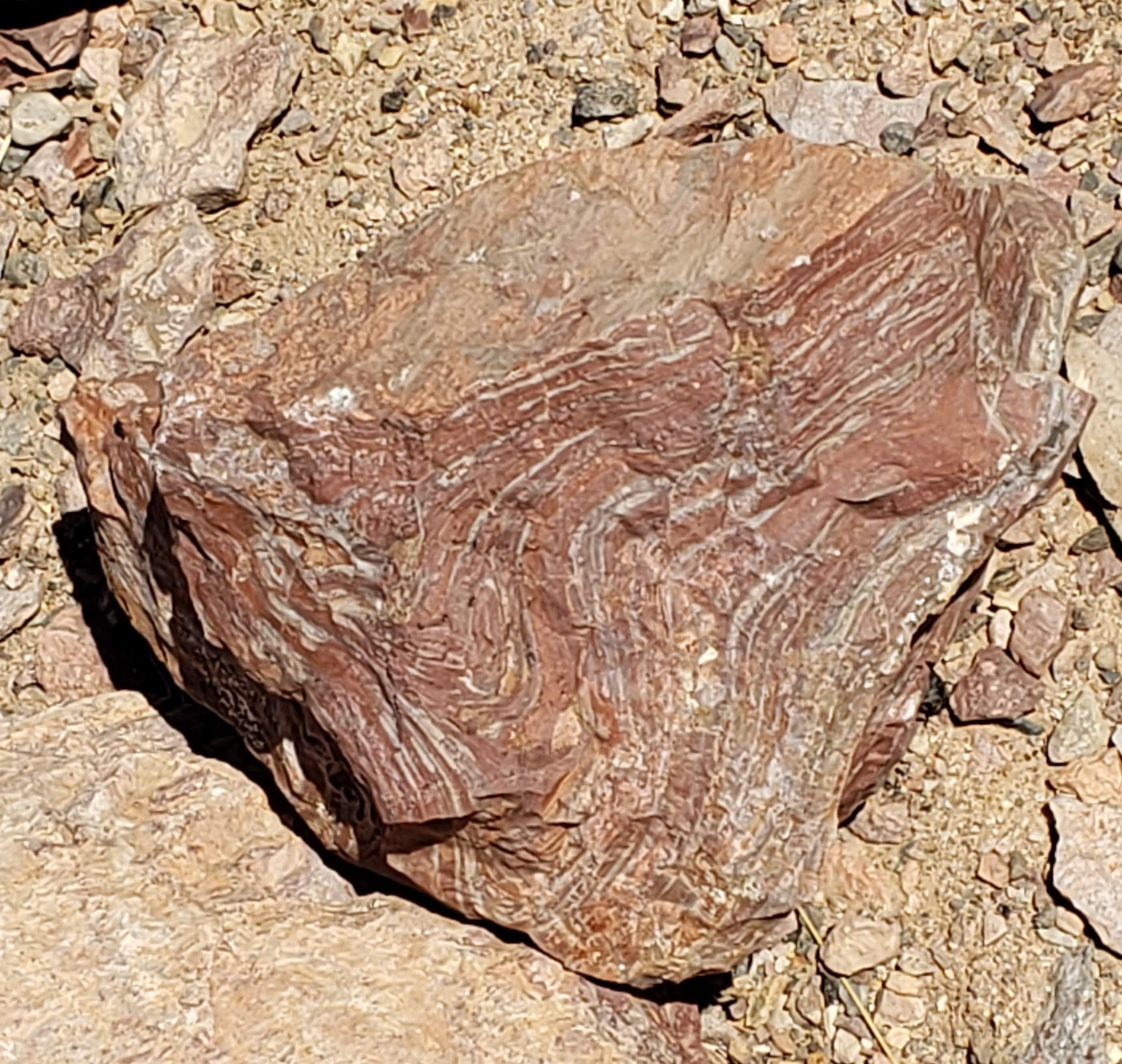
March 30 – 31 (Tuesday – Wednesday): On Tuesday, we departed Arizona (in the wake of Governor Ducey’s cancellation of the mask mandate) and drove to the Rockhound State Park (location 30) near Deming, NM. Readers may recall that we stayed at the Wolf RV Park near Deming on our way west. The Rockhound State Park is located about 5 miles southwest of that RV park, so we were quite familiar with the town of Deming. Like most state parks we have visited during our Sojourn, we were very impressed with Rockhound. Our site was very large and well isolated from the other campers, well-landscaped with interesting desert plants, and provided lovely vistas of the nearby Florida mountains and the desert terrain. There was a nice desert garden adjacent to the campground and a hiking trail that wound through the mountain foothills. Visitors were encouraged to collect samples of the rocks and minerals – agates, quartz, Jasper, thunder eggs, geodes – and several hikers carried rock hammers. It reminded me of my mother, who often referred to herself as a rockhound and had her own rock hammer. I’m sure she would have loved the place.
Did I mention that we were familiar with Deming? Did that familiarity include the Rio Mimbres Golf Course? Yes, it did, so I was once again on the course on Wednesday afternoon. I drove the ball as well as I ever have, putted lights out, lost zero balls, and would have had a fantastic round except that my approach shots sucked. In a show of solidarity, several friendly fellows came to console me after I played another stinky one on the 7th hole.
The only negative aspect of our stay at Rockhound was the wind. Each evening, it began to howl so fiercely that I thought the RV might roll over. The constant swaying felt a bit like our trip from Isle Royale in 5-foot waves several years back, and I couldn’t get a decent night’s sleep, even with the new, very comfortable mattress.
April 1 – 2 (Thursday – Friday): On Thursday, we headed for Alamogordo, NM, to stay at the Boot Hill RV Resort. Readers may again recall that we stayed at the Mountain Meadows RV Park on our way west, only about 5 miles from the Boot Hill park, and that we visited the White Sands National Park while there. Our plan was to stop at White Sands again on our way to Boot Hill. However, we again encountered events beyond our control on Highway 70. On the way west, we nearly skidded off the highway in a snowstorm as we passed over the mountains near Las Cruces, as I reported in PART 2 of this series. This time, we sailed smoothly through that mountain pass only to find the entrance to White Sands blocked by a bad traffic accident. I had to stop and wait in the RV for a half hour or so, along with dozens of other cars, as a helicopter flew in to evacuate someone who had presumably been severely injured. I even snapped a photo of the chopper taking off.
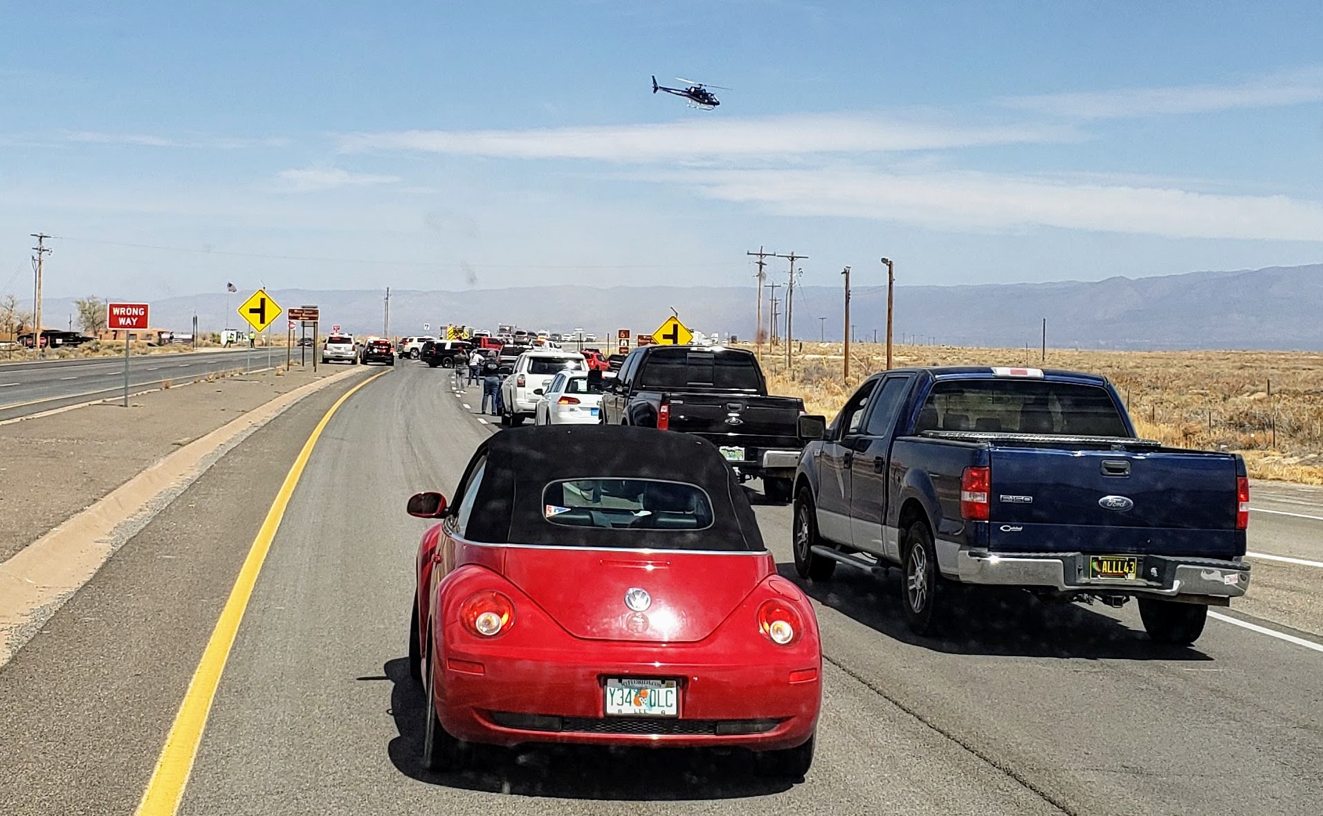
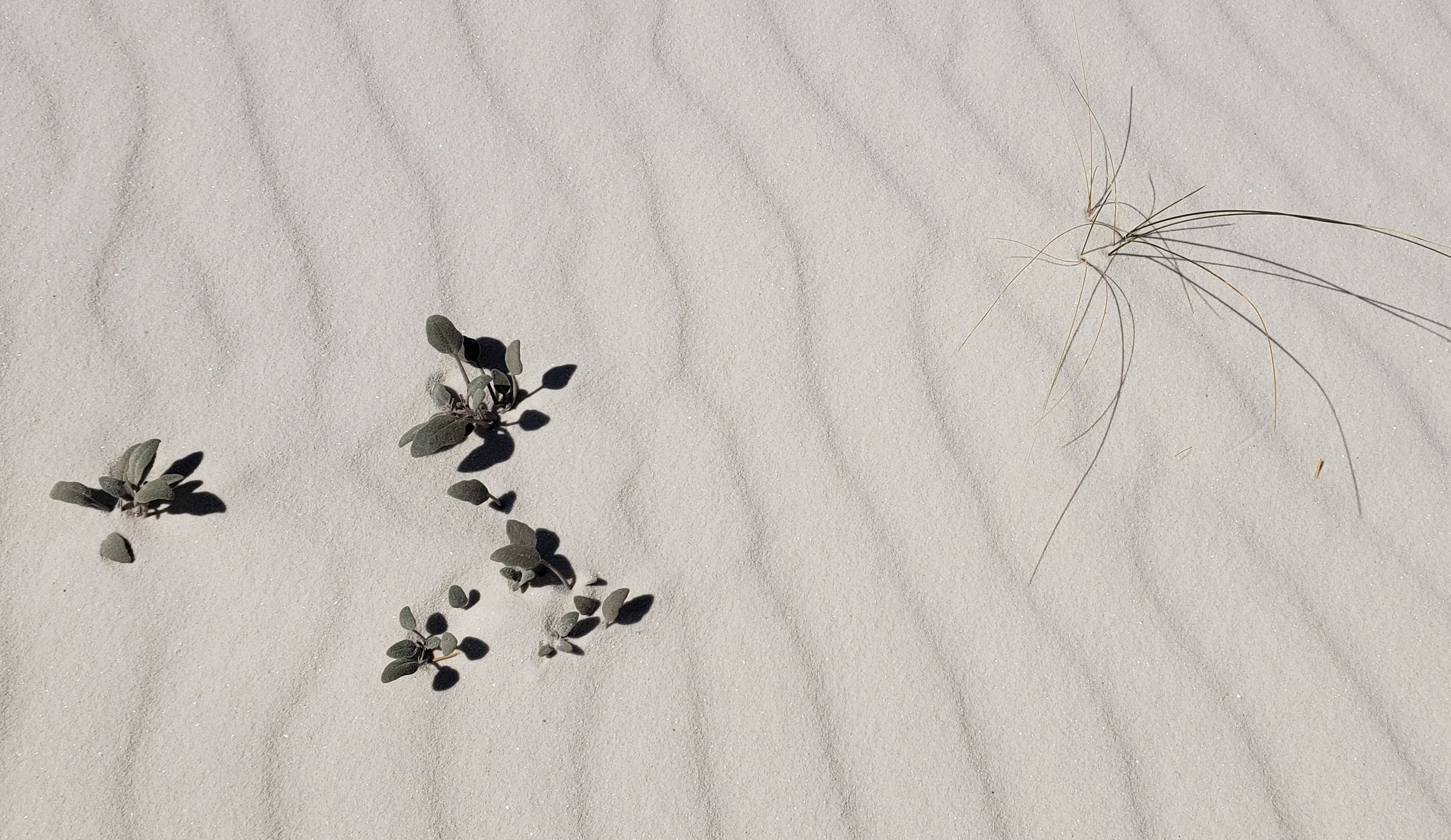
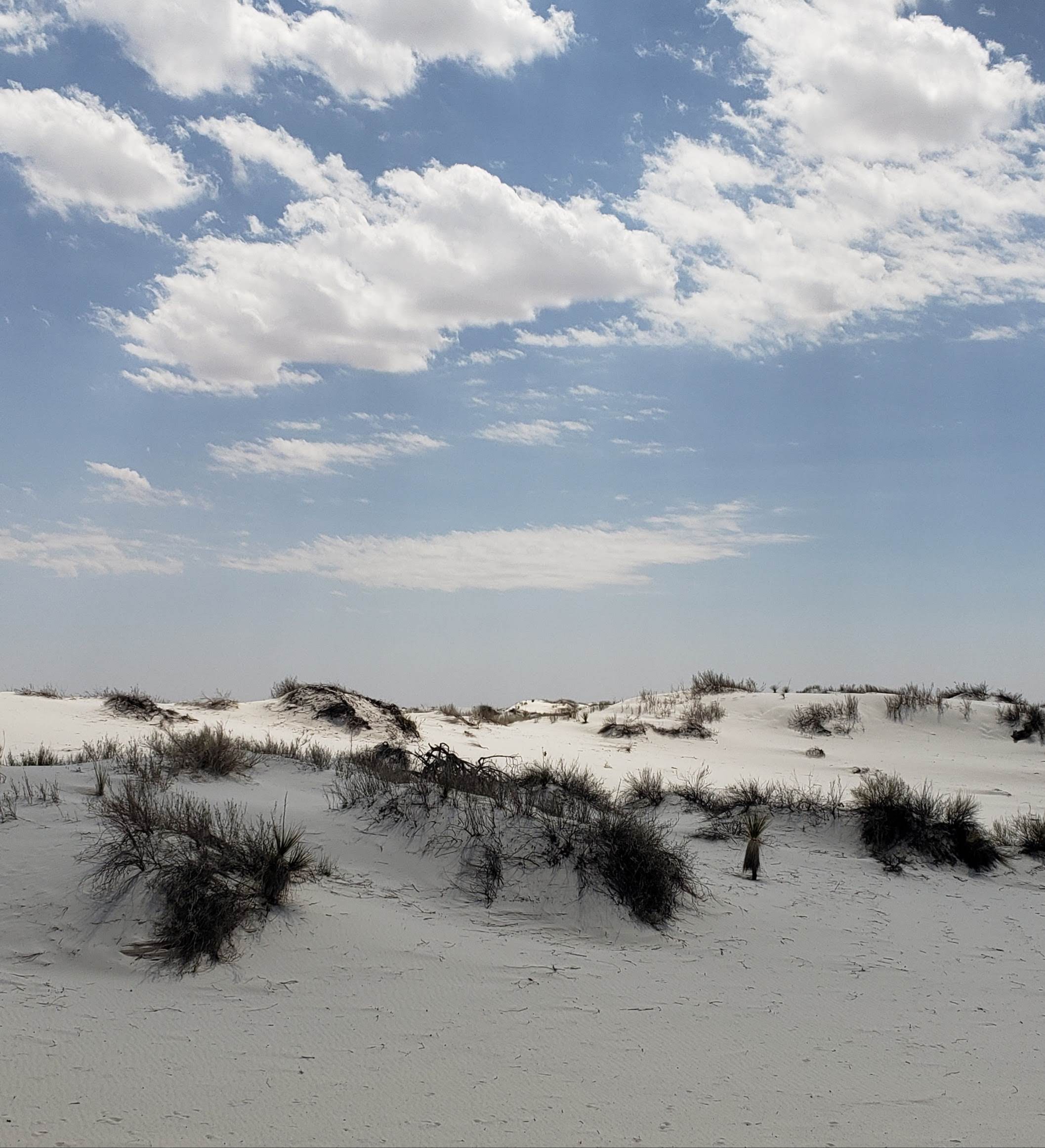
Traffic was then routed around the crash site on a gravel road adjacent to the highway, so entry to the National Park was impossible. So, we skipped White Sands and drove directly to Boot Hill. It’s a nice enough place; not nearly as nice as the various state parks, but it does have a laundry, so we were able to do a huge load accumulated since we last washed at Leaf Verde. With that chore completed on Thursday, we did go back to White Sands on Friday. This time we were able to drive the Tesla all the way along the unpaved road that was too rough for the RV back in October, and we hiked along a couple of trails that we didn’t get to the last time. Our experience this time was quite different, since there was virtually no wind, in stark contrast to our previous visit. I find White Sands fascinating and unique, so I had to take a bunch of pictures, but I’ll only post a couple since they look a lot like the other ones from PART 2.
So here I am, banging away at my computer on Friday night, and that brings us up to date. We are still feeling safe and well, and starting to look forward to getting back home (and getting vaccinated). Stay tuned as the adventure continues …

63 here today!
Nice cow shaped bird…..
See you soonest.
S
LikeLiked by 1 person
GREAT NARRATIVE.
STAY SAFE.
LikeLiked by 1 person