
Our last episode ended at the Boot Hill RV Resort in Alamogordo, NM, on April 2. This post picks up the narrative from there.
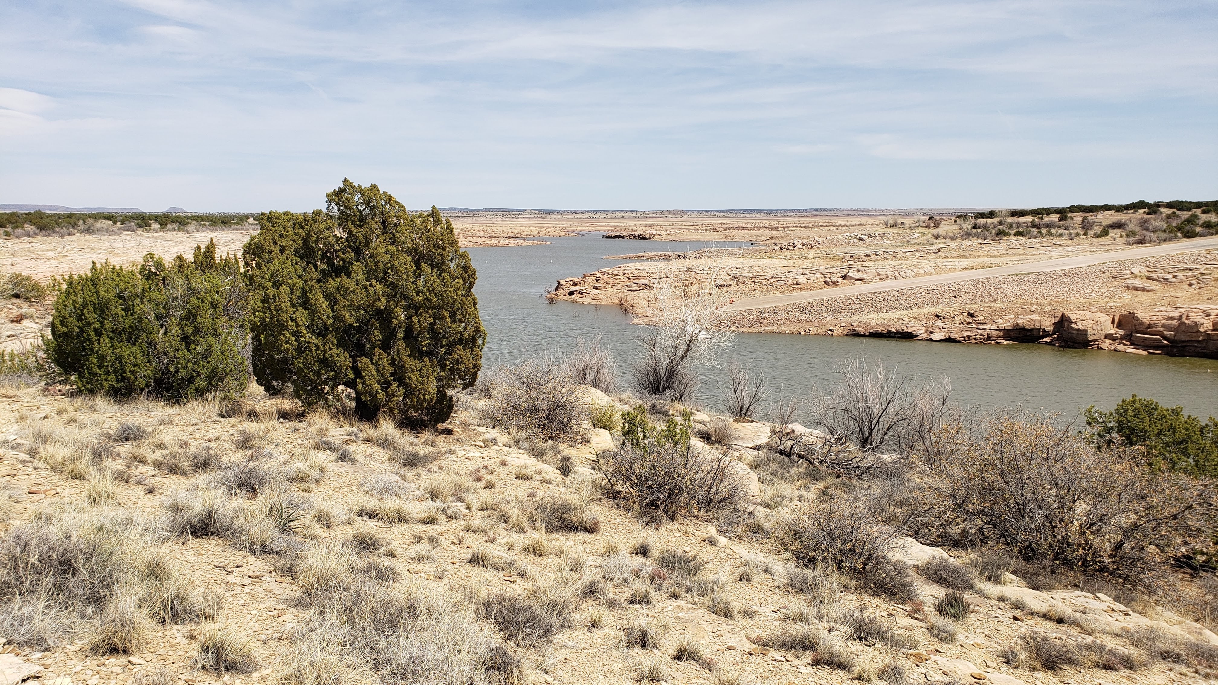
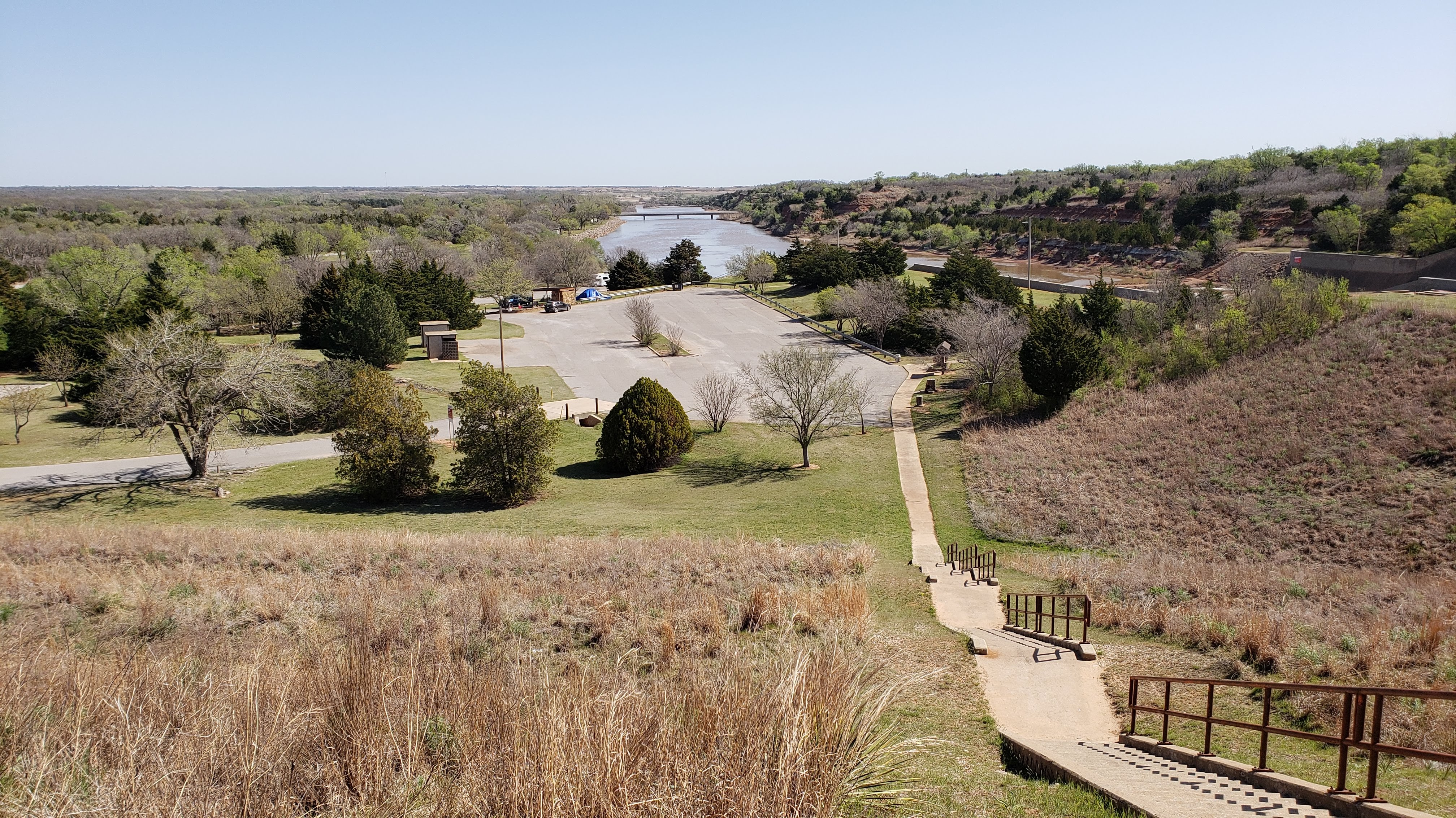
April 3 – 6 (Saturday – Tuesday): We left the Boot Hill park Saturday morning and travelled to the Santa Rosa Lake State Park near Santa Rosa, NM. The park is situated around a large lake formed by a dam in the Pecos River, constructed by the US Army Corps of Engineers in the early 1980s. There is a nice overlook, also built by the Corps of Engineers, that provides some interesting views of the lake and the surrounding terrain.
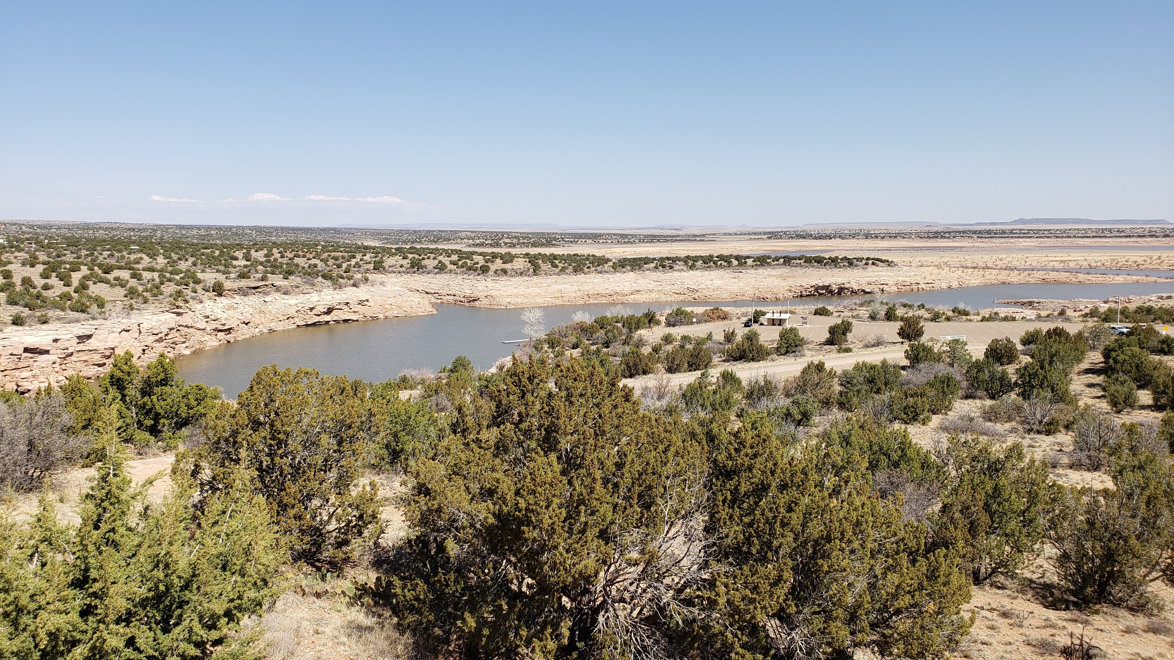
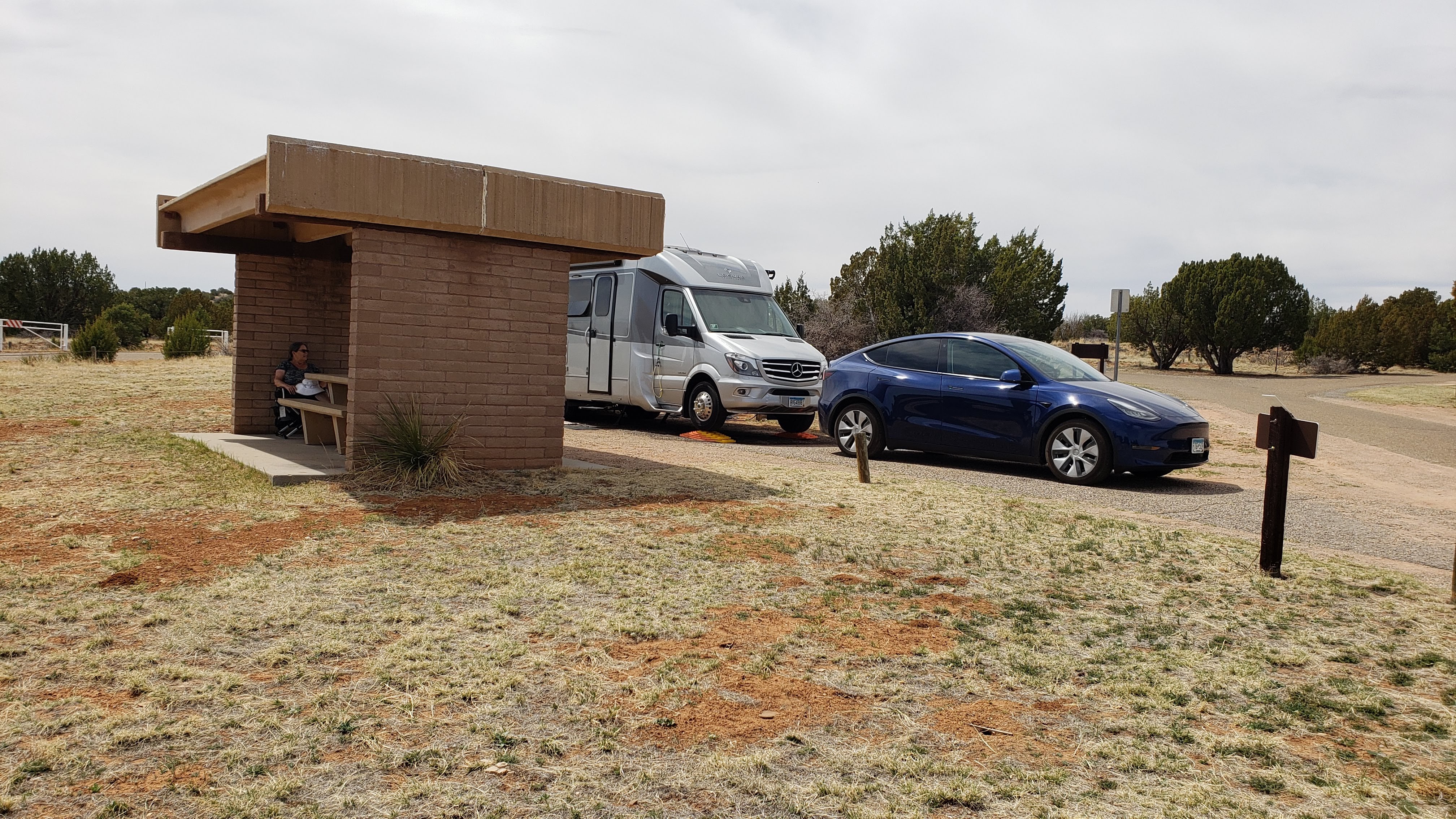
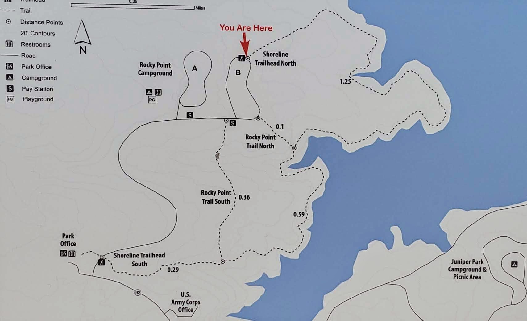
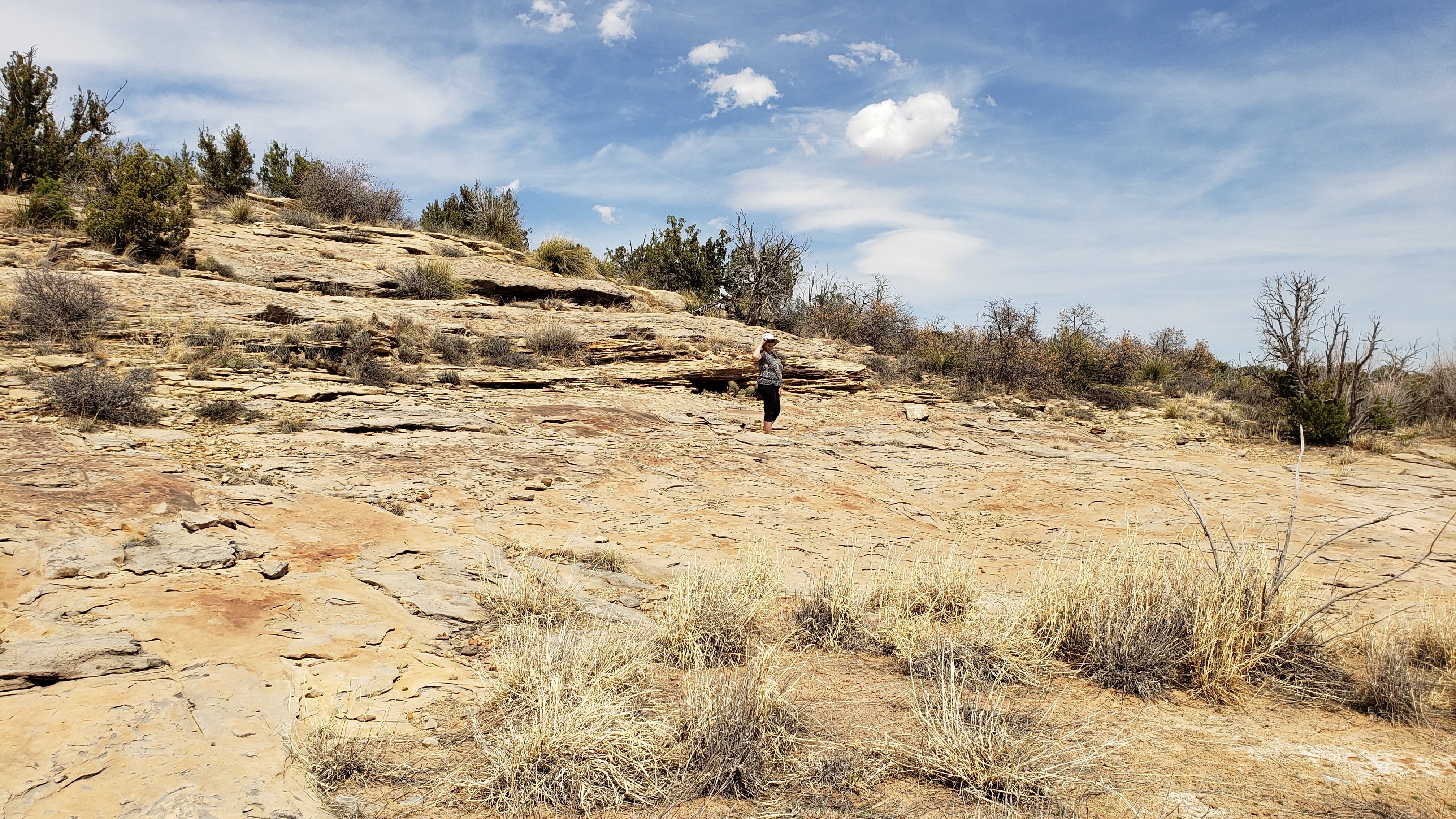
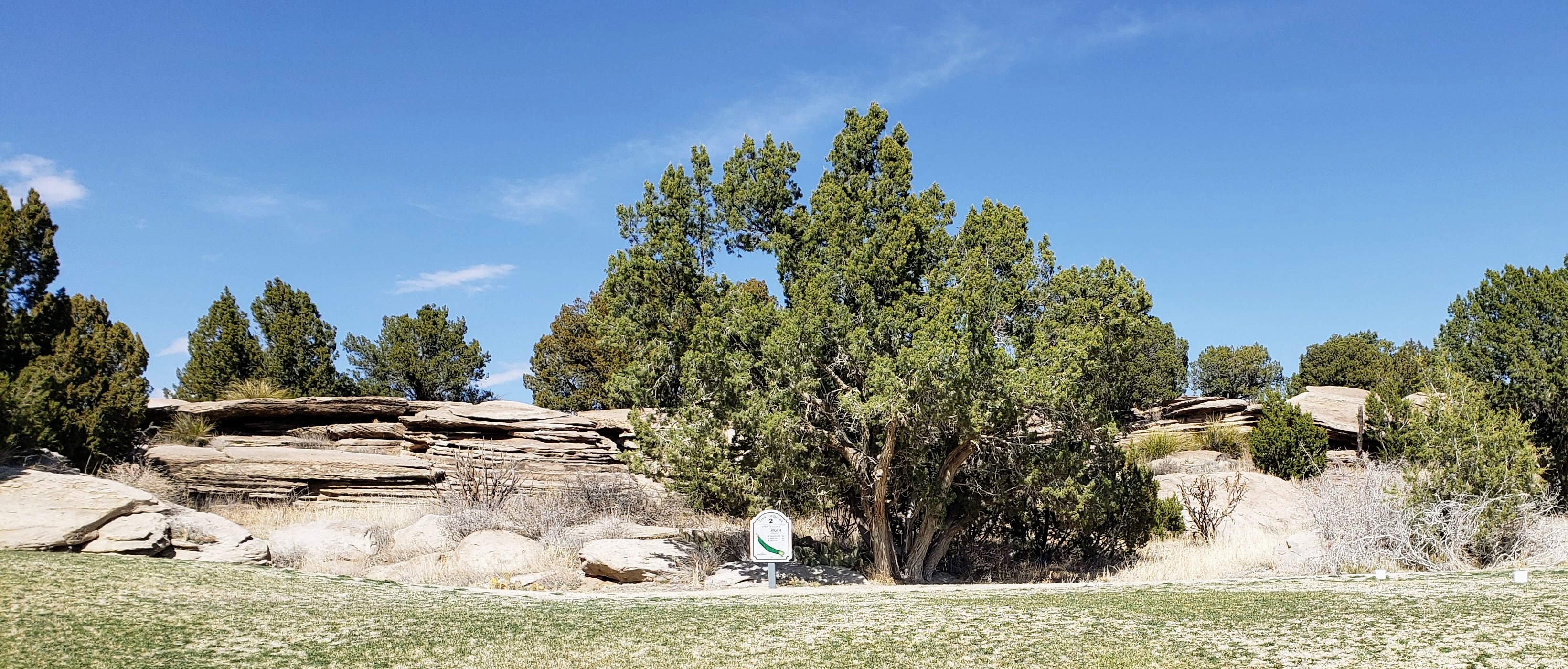
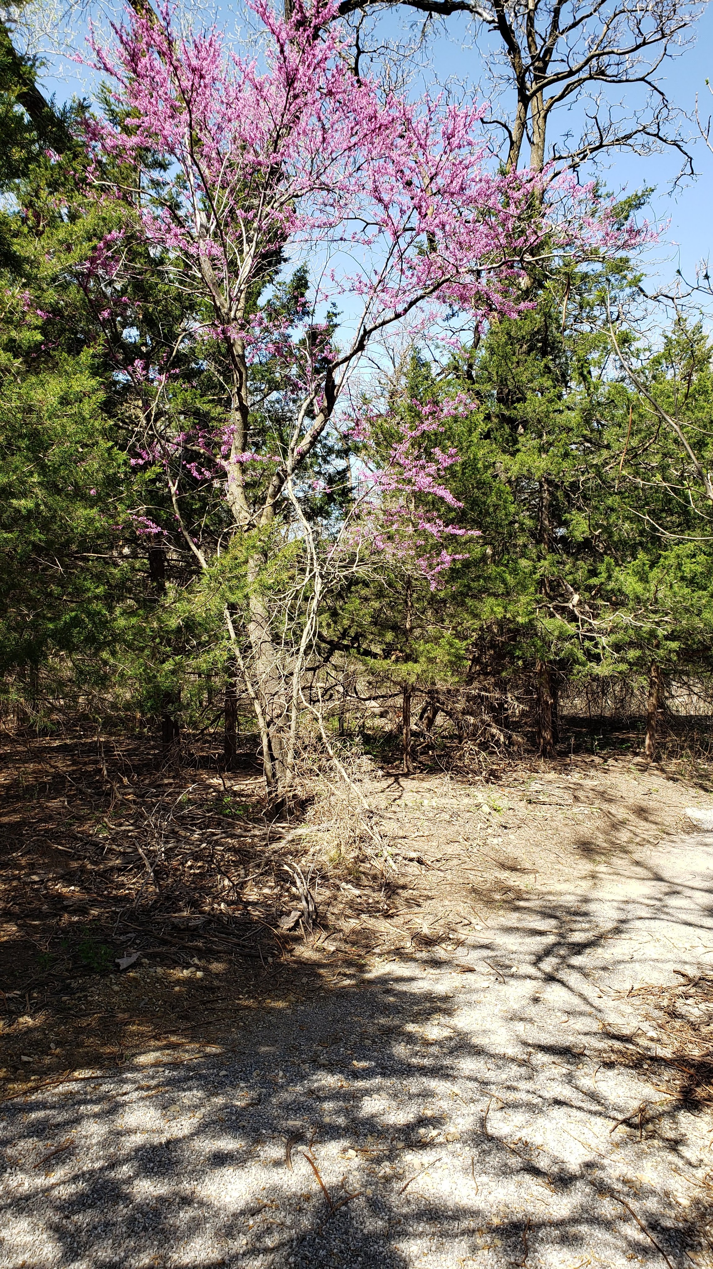
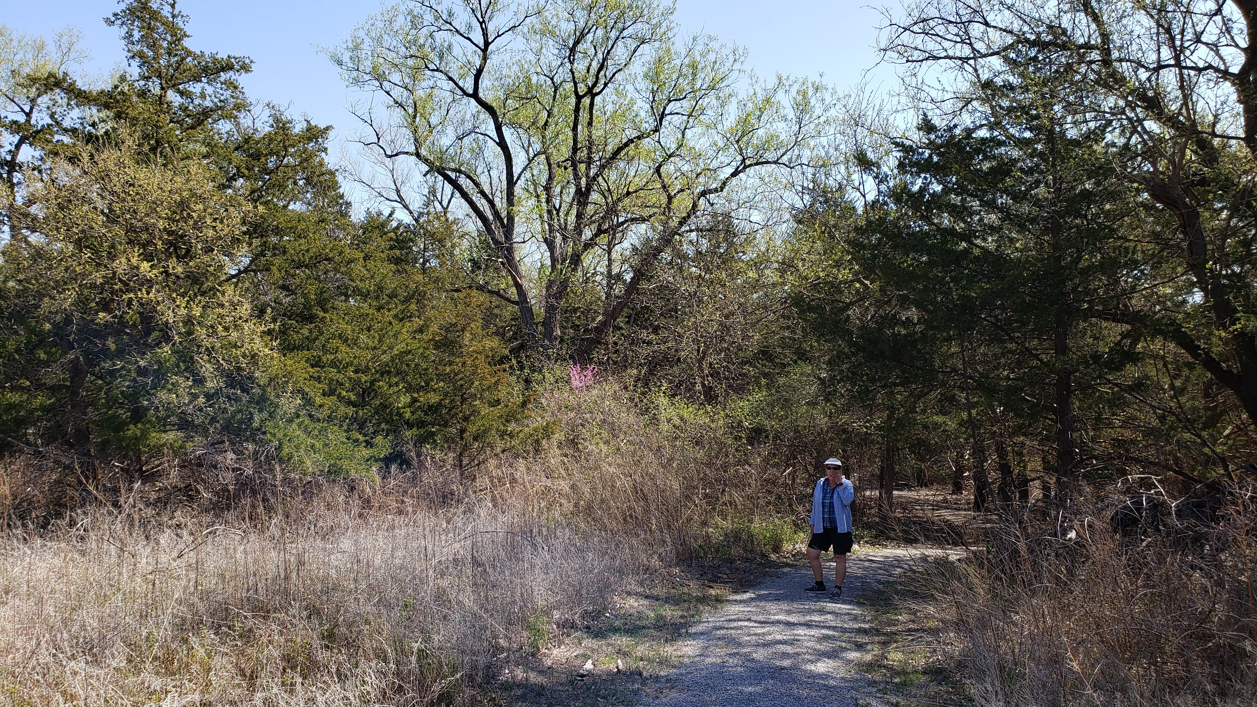
Our RV site was very nice – well spaced away from the other campers and only a short walk from the restroom facilities. There is a nice hiking trail that leads from the campground to the lakeshore, passing through forests of juniper trees. It seemed to me there were two types of junipers as illustrated below, but I’m not enough of a horticulturist to tell if they are actually different species. (Perhaps brother-in-law Dennis Arthur can tell – we used to call him “Horti Culture” due to his extensive knowledge of all types of flora.) We hiked on various parts of the trail on Monday and Tuesday and thoroughly enjoyed exploring the area.
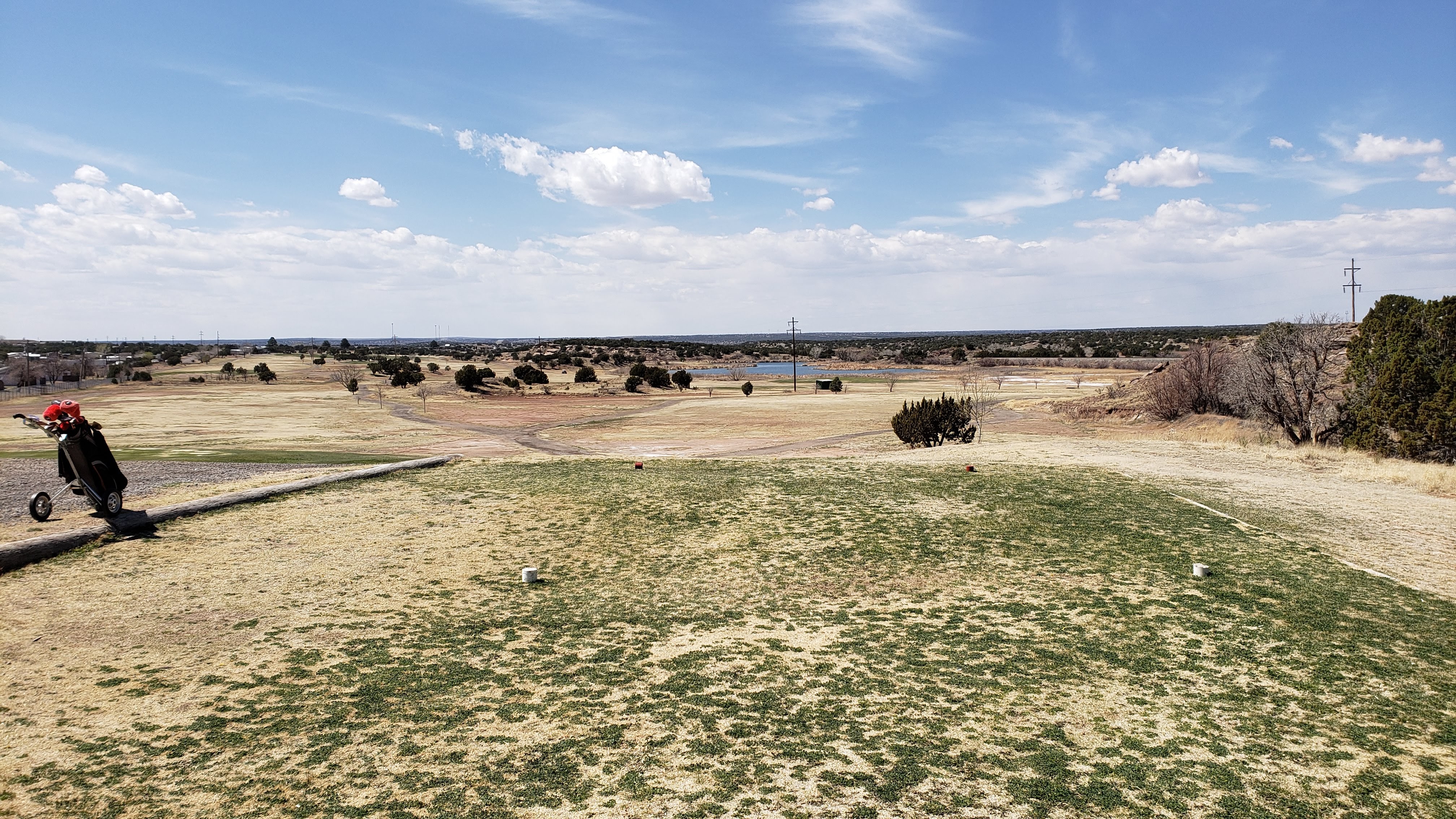
So what did we do on Sunday, you may wonder? On the drive from Alamogordo, the RV had provided a warning message that it was time to add some DEF (diesel exhaust fluid), so on Sunday we drove the Tesla into the nearby little town of Santa Rosa to buy some. As we were driving to the gas station, my sharp-eyed spouse spied a sign for nothing other than a GOLF COURSE. I kid you not; I had no idea there would be a course in such a dinky burg. So, after we returned to the state park and I poured 2.5 gallons of DEF into the RV, Pat suggested that I ought to go back to town and play golf. She didn’t have to say it twice. When I got to the nine-hole course, not surprisingly called the Santa Rosa Golf Course, I found the small building that passes for a clubhouse completely empty. I stood around in my mask for five or ten minutes wondering what to do, and eventually an elderly gentleman came puttering over in a golf cart and came inside to greet me. In response to my query, he told me I could indeed play 18 holes, but all their motor carts were in use. So, I rented a pull cart – what the Scots and Brits call a “trolley” – and headed for the first tee. The course layout was quite interesting and the tees and greens were pretty nice, but the fairways can only be called a complete disaster. A local rule allows adjusting your lie, but even so it was sometimes hard to find a tuft of grass to play from. But I was undaunted, once again driving the ball beautifully and putting well, but hitting “fairway” shots that were at best indifferent and often just plain stinky. As I was preparing to tee off on number one for my second go-round, the elderly fellow puttered over and told me that someone had returned one motor cart, which I was welcome to use if I so desired. And boy, did my aching feet so desire at that point. The only trick was that I could not drive the cart in the fairways but had to stick to the cart paths and walk out to my ball to hit a shot. Even so, the second circuit was easier to handle, and I even shaved off a few strokes due to improved approach shots.
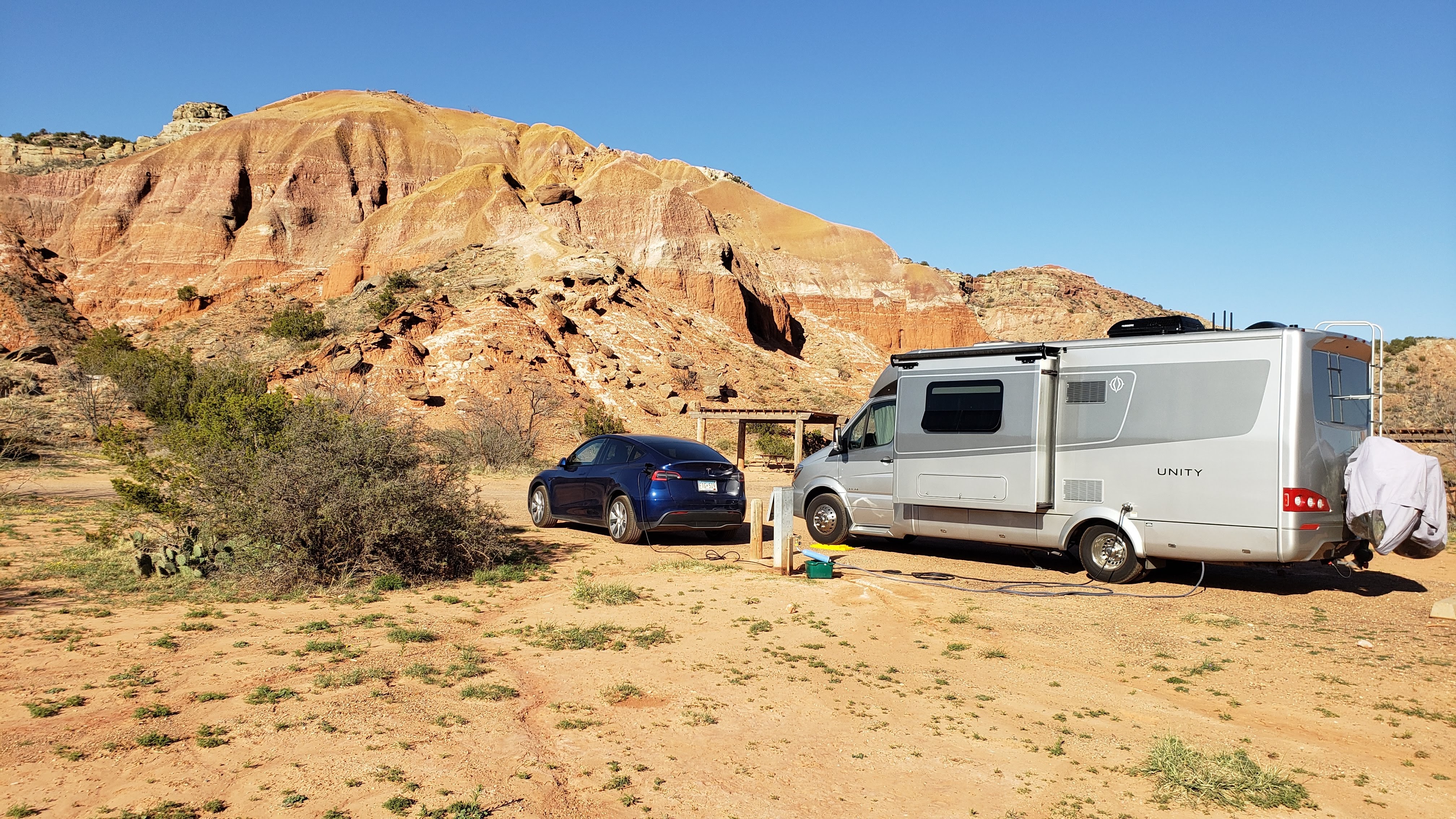
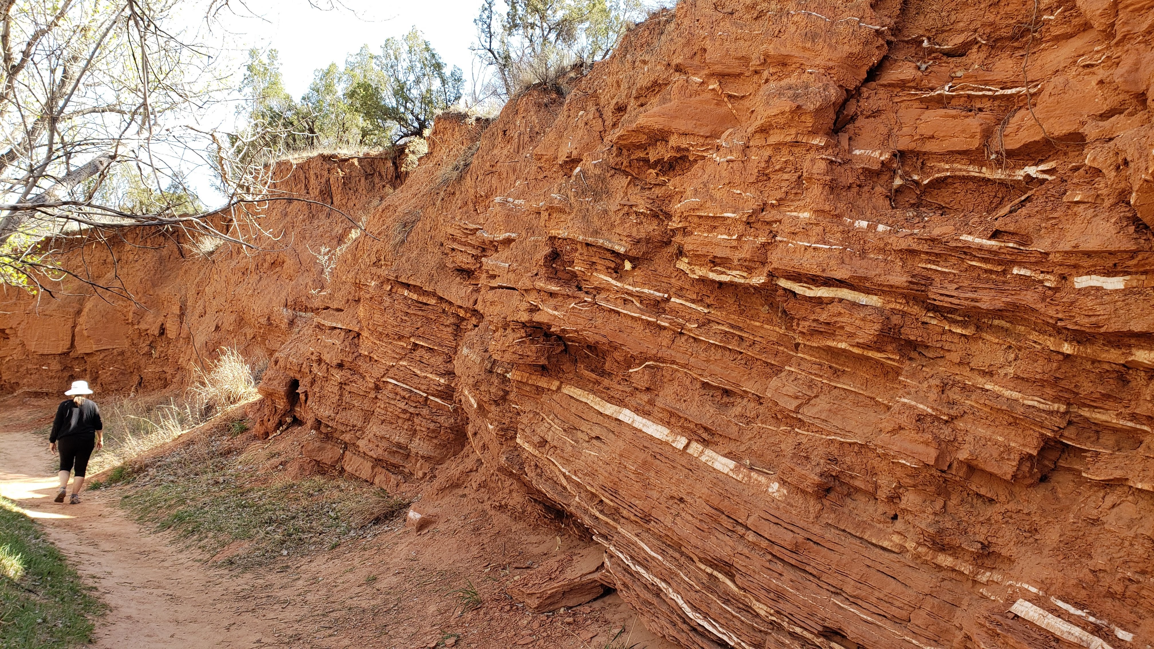
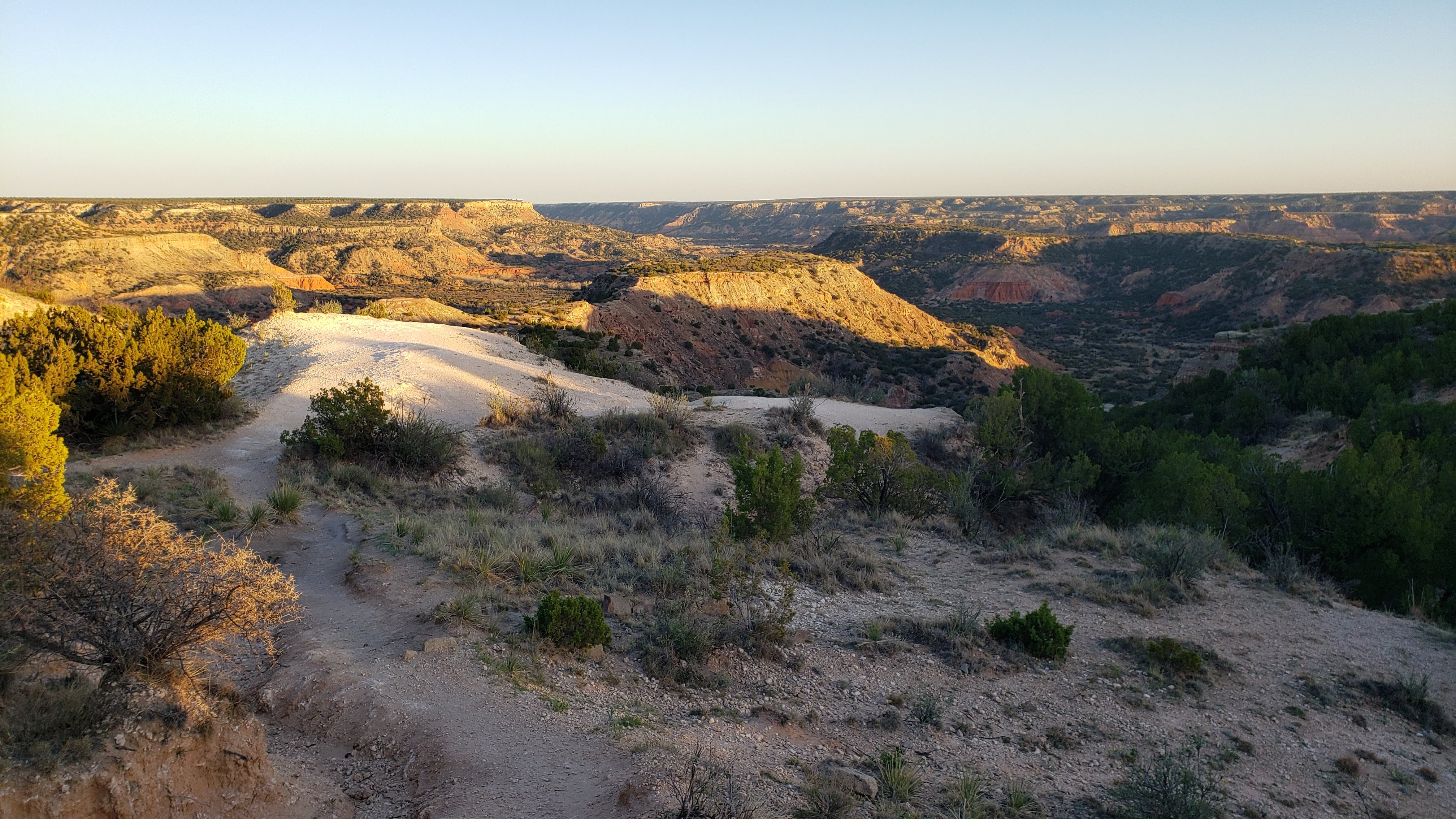
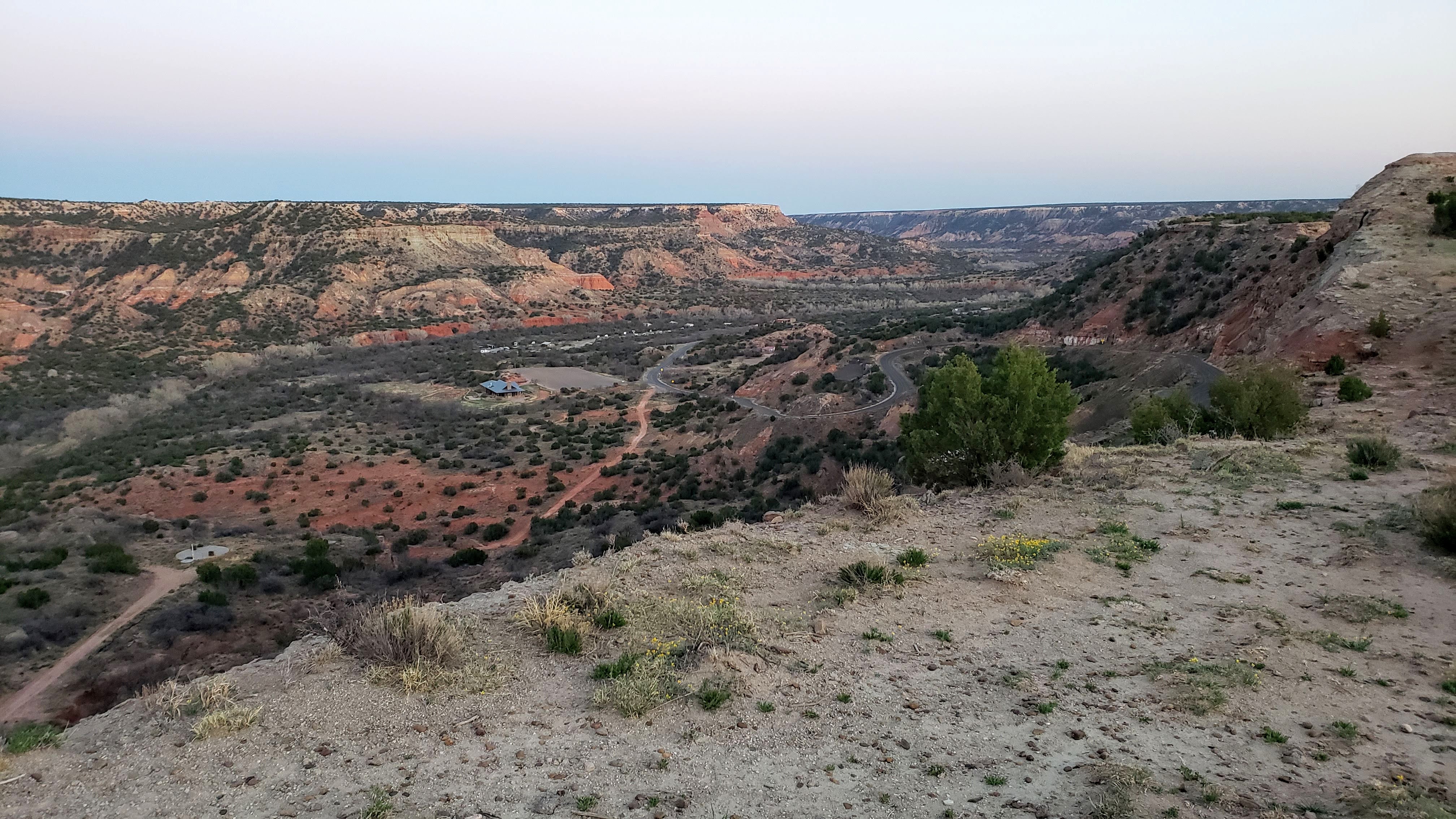
April 7 (Wednesday): On Wednesday, we departed New Mexico and drove to the Palo Duro Canyon State Park in Canyon, TX. We visited Palo Duro on our Excellent Adventure back in 2018 and found it so impressive that we really wanted to stop back for another visit. However, we weren’t so sure that going to Texas, where Governor Abbott had just demanded that everyone stop wearing masks and try to infect as many people with Covid as possible, was such a good idea. On the other hand, we knew from our previous visit that the RV sites are well spaced, and the park is located at the bottom of a huge canyon, far from any sizable towns. Also, when we looked at booking a site, we could only get one for one day. In the end, we decided that the risk of visiting was small, so off we went. On the drive to the park, we stopped at a grocery store in the town of Canyon, just southwest of Amarillo. We were prepared to just turn around and leave if the place was filled with maskless Covidiots. But, much to our relief, virtually no one was following the Governor’s reckless order – all the store personnel and all but one or two shoppers were masked and distancing.
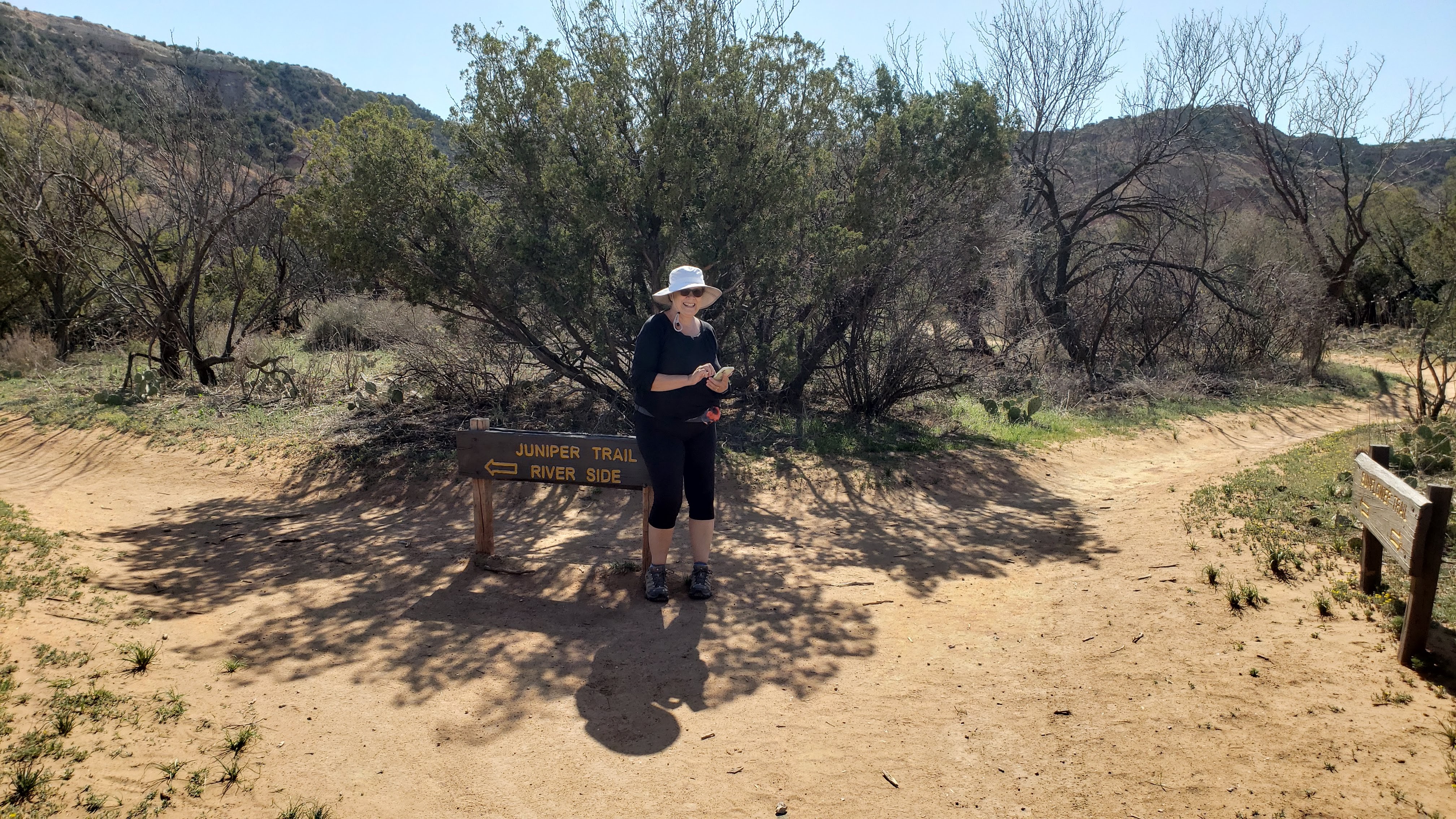
But let’s move on to the State Park. Palo Duro Canyon, the second largest canyon in the US, is billed as the “Grand Canyon of Texas.” After checking in at the main gate, there is a spectacular road with multiple hairpin turns and switchbacks that winds down some 800 feet to the canyon floor. Back in 2018, Pat nearly had a heart attack sitting in the passenger seat of the RV, but this time she quite enjoyed the drive in the Tesla. On our previous visit, we stayed at the Hackberry Campground, located about halfway along the north-south road within the canyon. This time, we stayed at the Mesquite Campground at the southernmost end of the canyon, in a wide-open site situated near a dramatic sandstone cliff. The campsite view alone was enough to justify a return to Palo Duro.
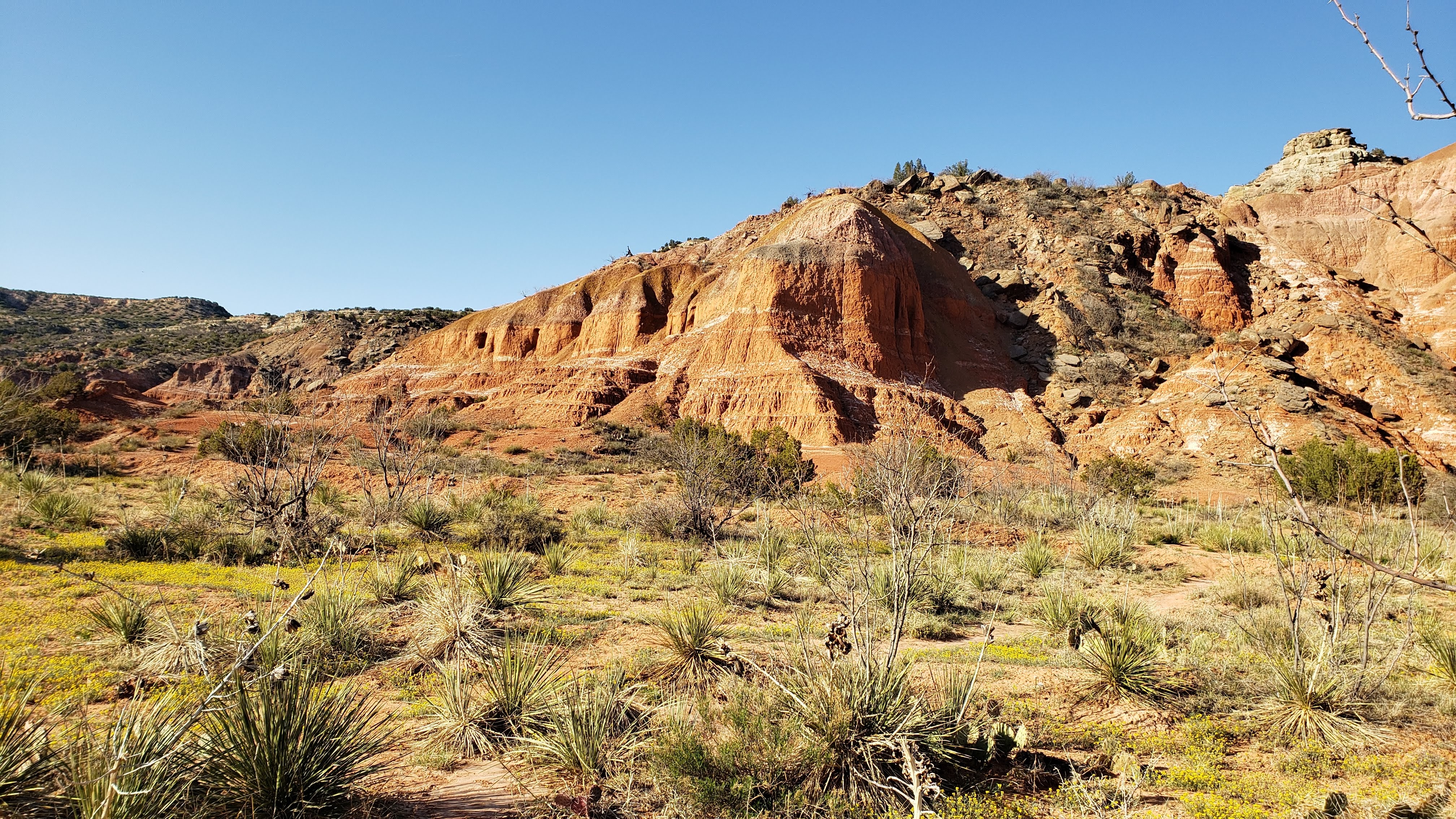
Once we were settled in, we took a long walk along some interesting hiking trails that provided good views of the widely varying terrain and vegetation. We intended to hike about 2 or 3 miles in deference to my tender feet, but the trail maps were so confusing that we ended up circling around on several of the trails trying in vain to get back to our RV site. In the end, we walked about 6 miles, and though my feet weren’t happy, it was an excellent experience.
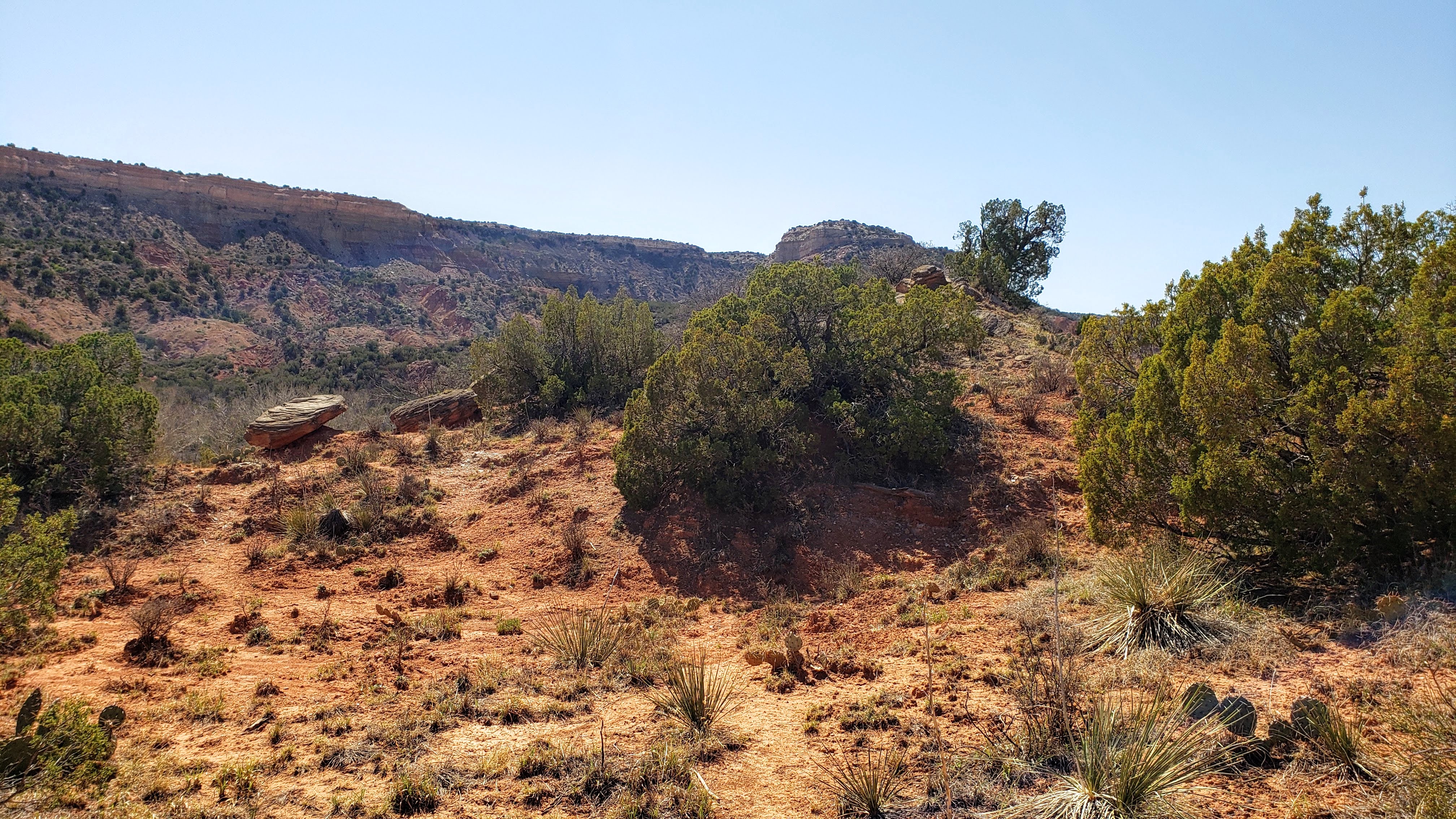
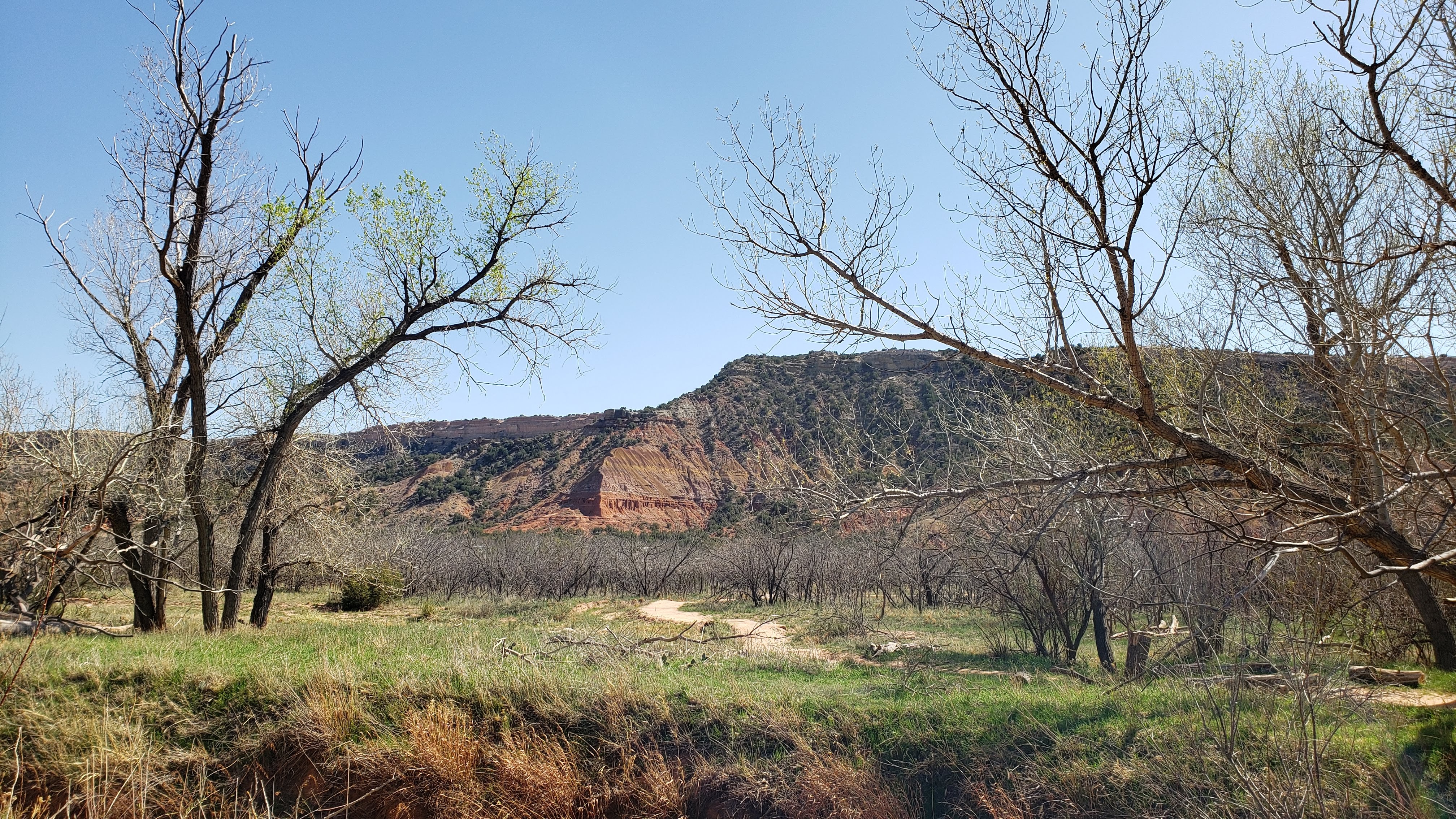
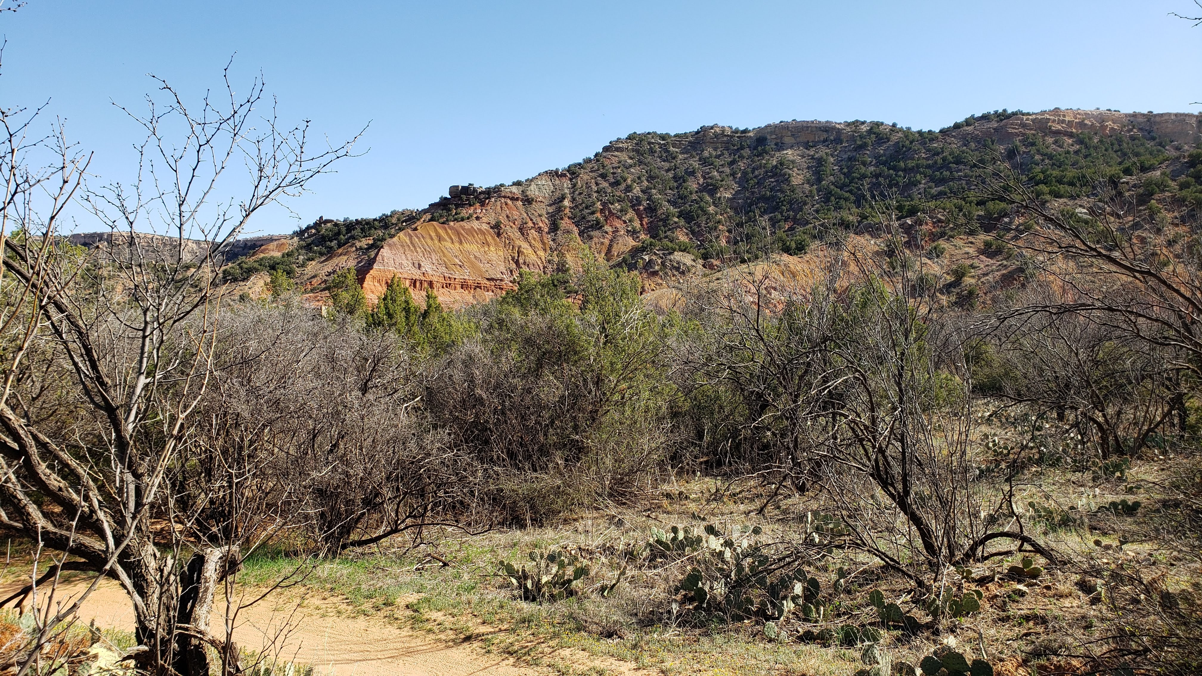
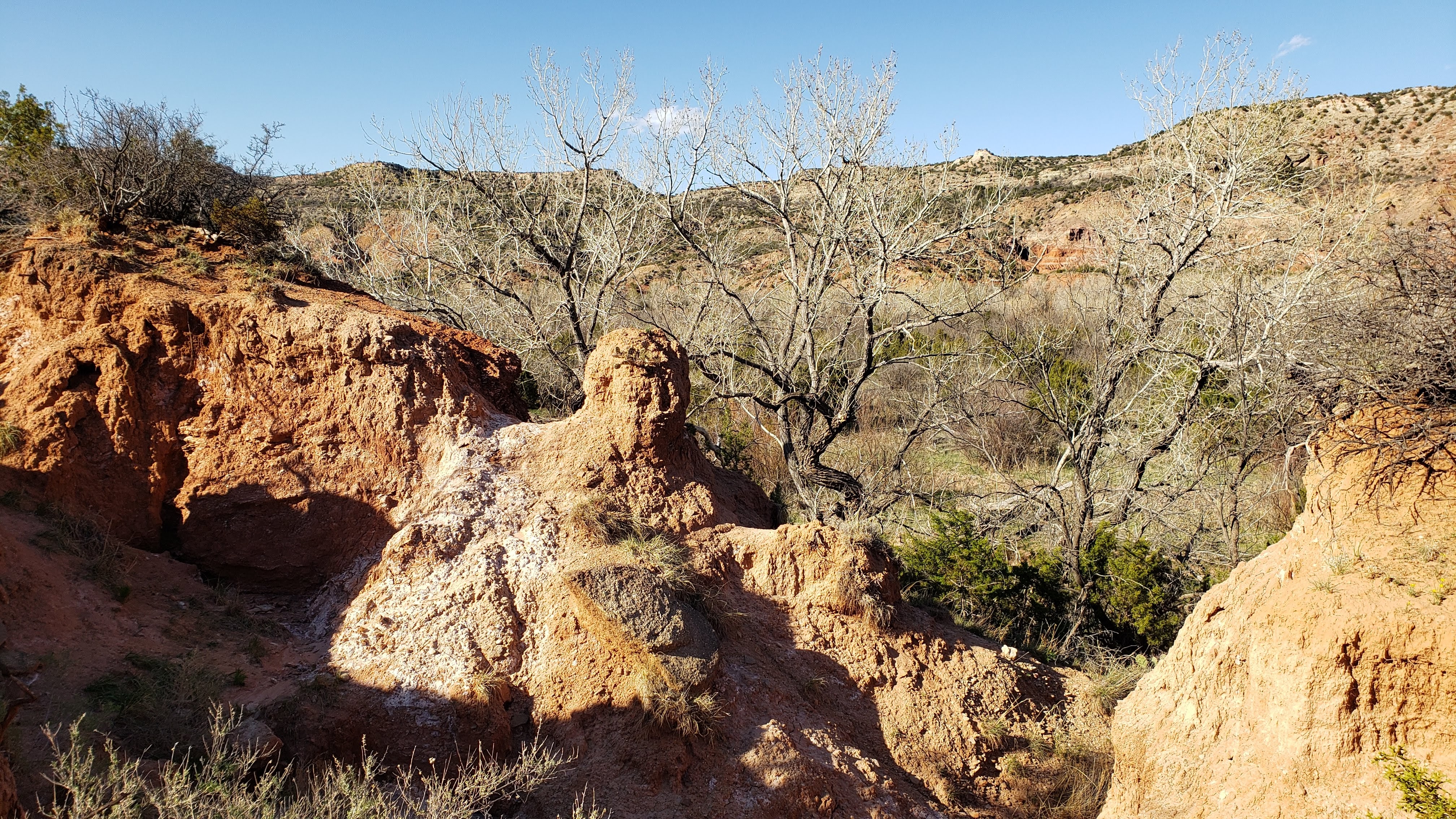
Once I felt sufficiently recovered from the hike, I drove the Tesla back to the canyon rim to get a few snaps from two of the spectacular overlooks, which added another exclamation point to our return visit.
April 8 – 9 (Thursday – Friday): On Thursday, we motored northwards to the Boiling Springs State Park near Woodward, OK. This is another place we had visited back in 2018, and in fact, I booked the exact same RV site we stayed at the last time. (That’s sort of a Saari thing to do, by the way.)
Boiling Springs is a nice enough park, but the real attraction is – you guessed it – the golf course located just east of the park entrance. On Friday, while Pat tooled around the park on her bike, I played a somewhat frustrating game of golf. The first ten holes may have been the best I have ever played in my life, with excellent drives and approach shots and decent putting. But then I shanked one into a sand trap on hole 11 (from a perfect lie in the fairway), blasted the ball twenty yards over the green, and reverted to form again for the remaining holes. I ended up with a decent score, but what a round it could have been! anyway. I decided to give up the stupid game again, at least until we get back home to Minnesota.
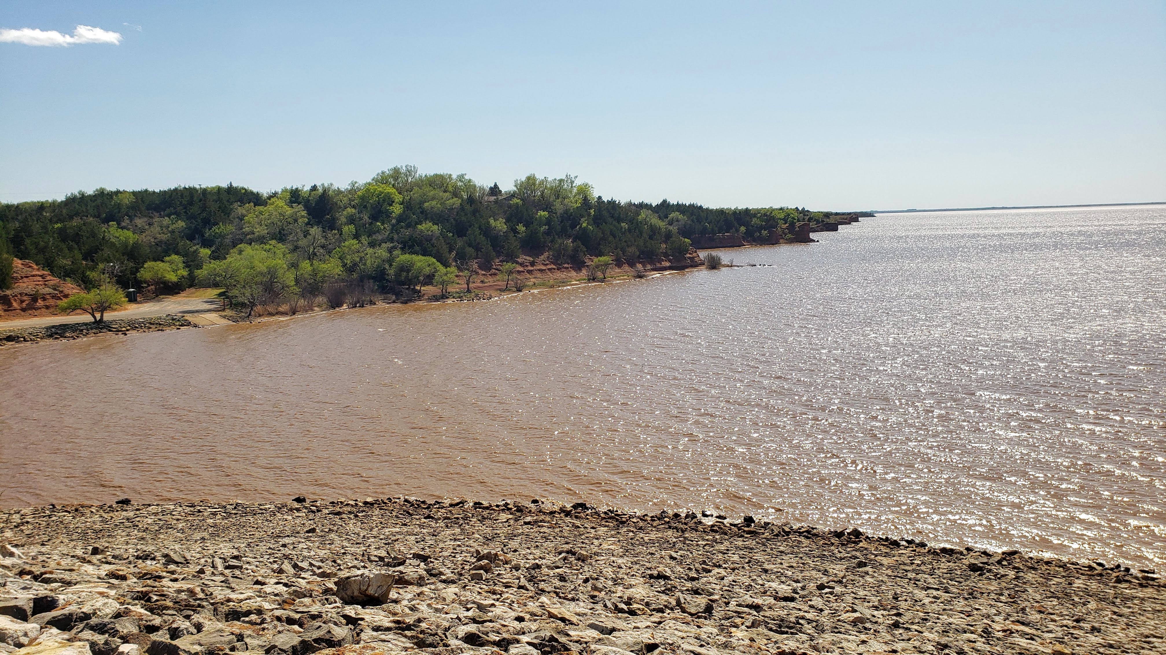
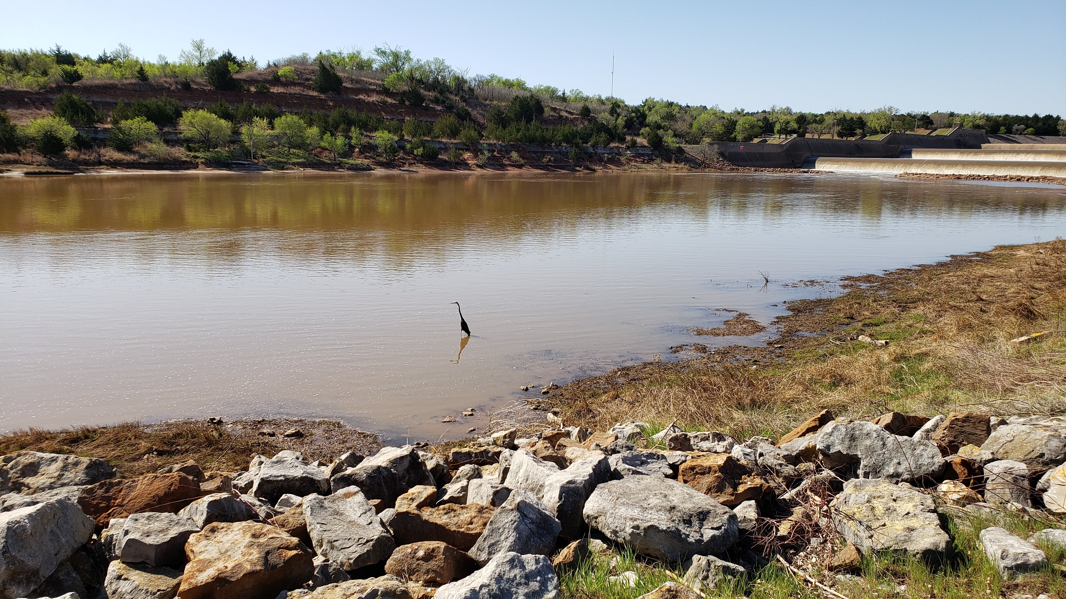
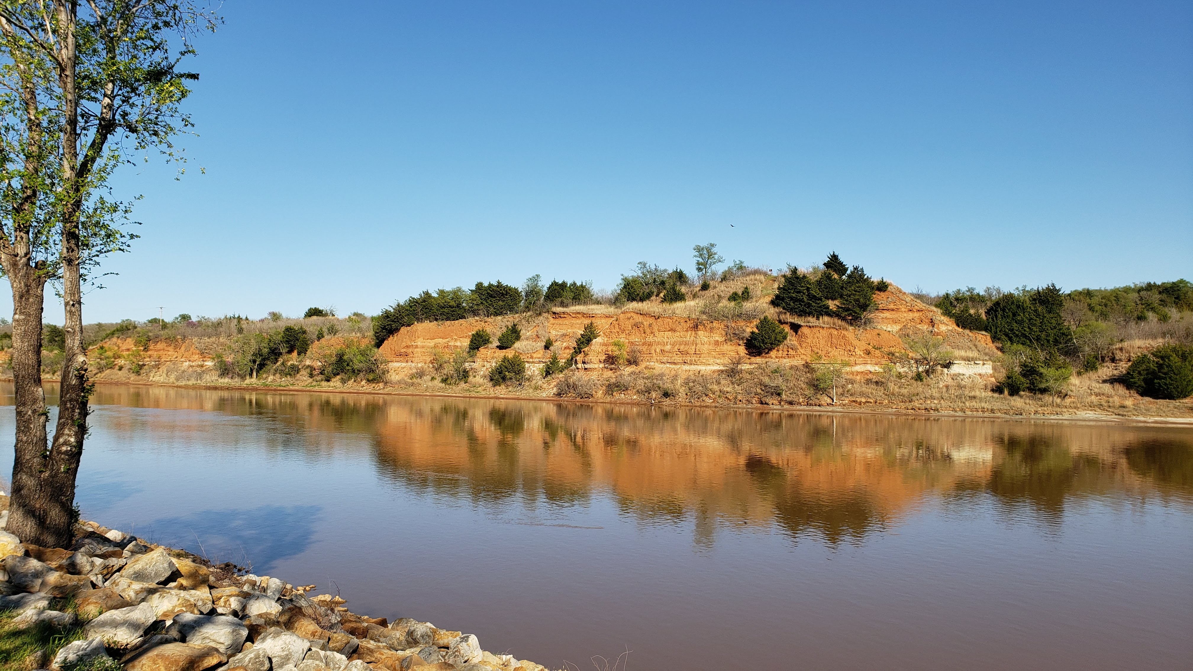
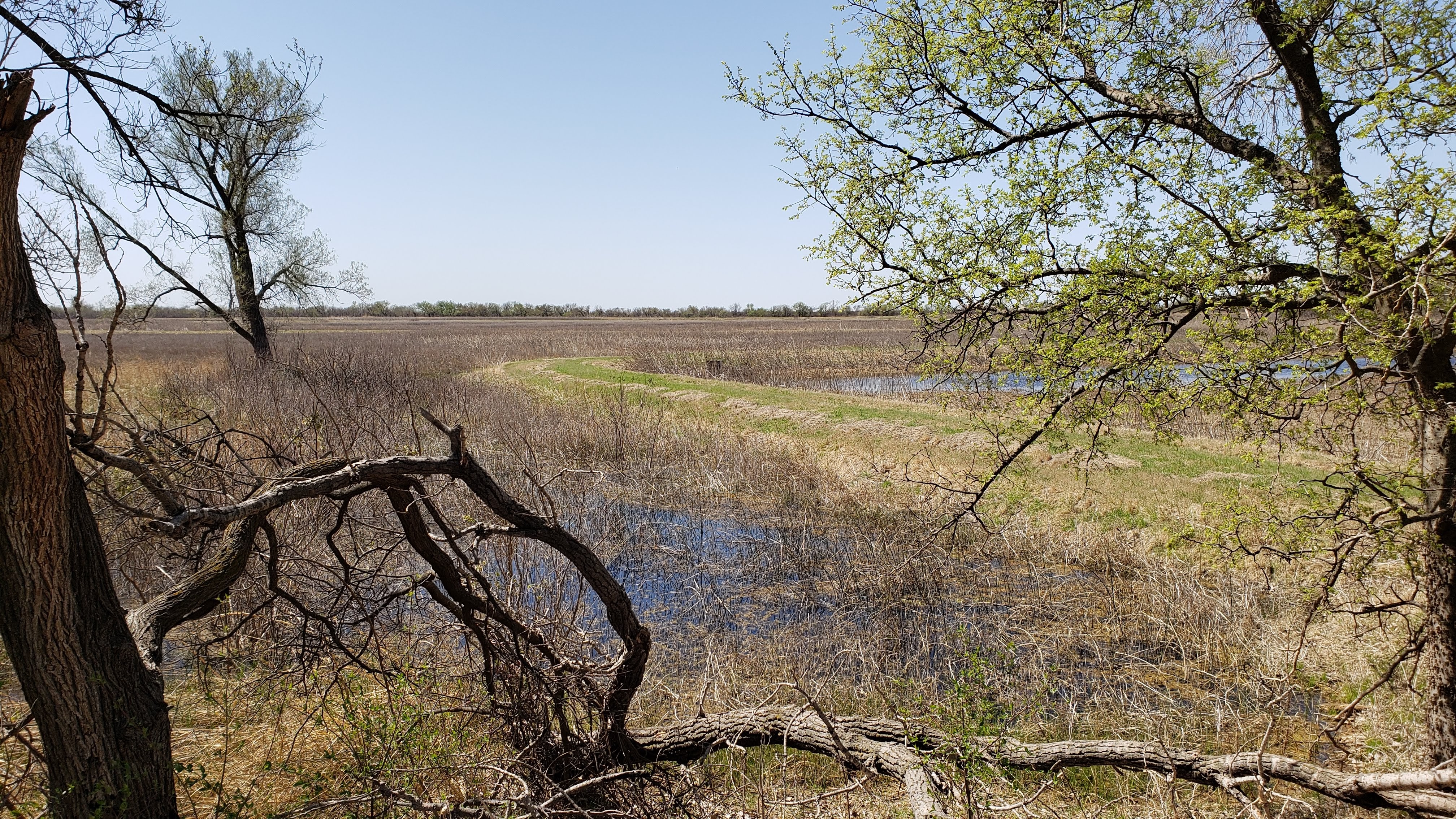
April 10 – 11 (Saturday – Sunday): On Saturday, we continued our string of visits to state parks, this time the Great Salt Plains State Park near Jet, OK. Our site was very nice, located on the bank of the Salt Fork Arkansas River just downstream of a large dam built by the Corps of Engineers in the 1960s for flood control and water storage. The dam formed the 8,690-acre Great Salt Plains Lake, considered a saltwater lake as its salinity is about half that of the world’s oceans. We spent much of our time walking around the campground area and the dam, resulting in quite a few nice photos as shown below.
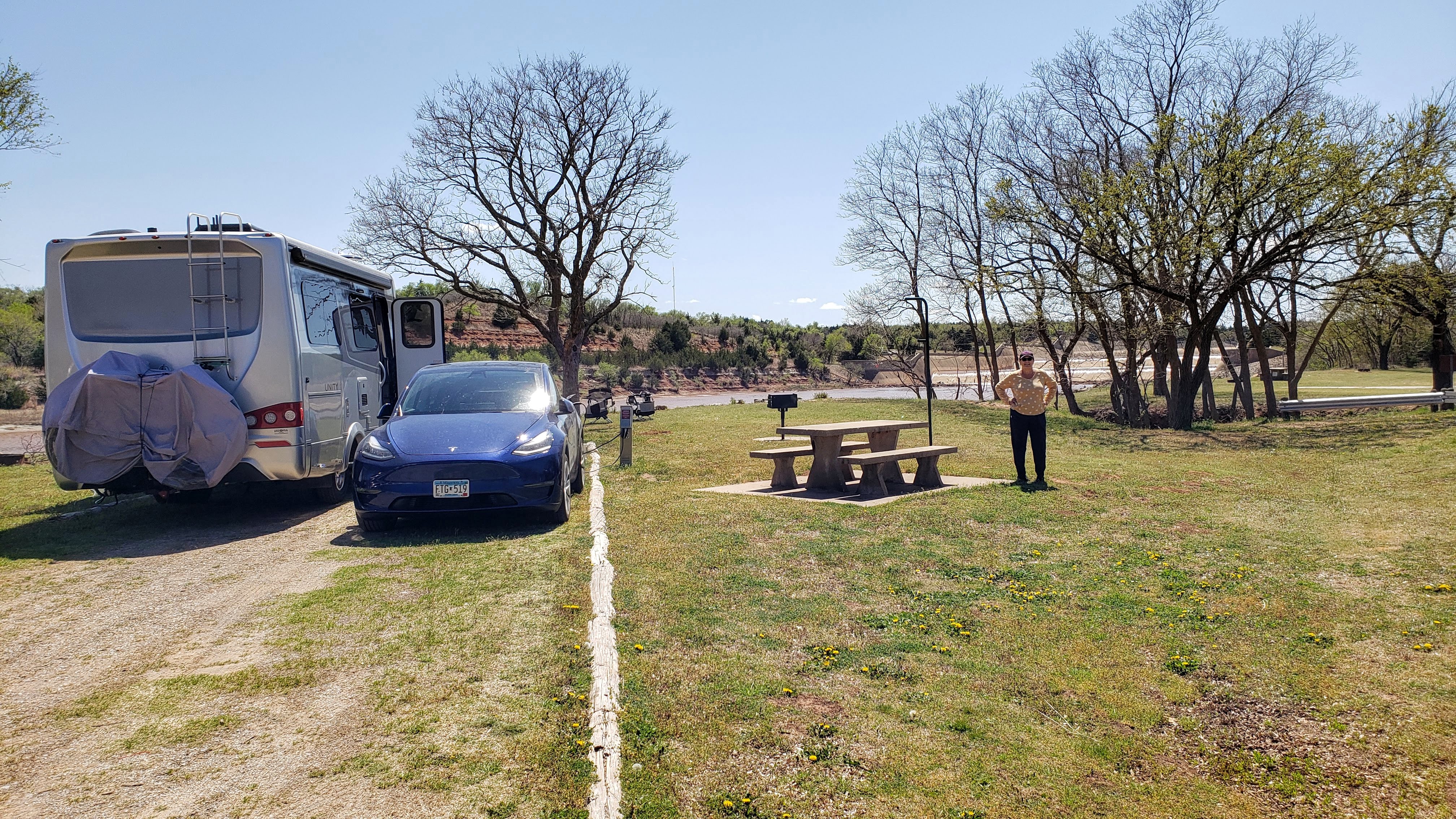
We set up our foldable Pico Chairs right on the river bank and enjoyed watching herons, cormorants, pelicans, and hawks as they soared, glided, waded, swam, and otherwise just looked elegant and marvelous. The river was chock full of fish, and the splashing sounds were nearly continuous as they leaped out of the water to catch the presumably tasty morsels flying by. I caught one of them on video as I sat by the river, as you can see below.
On Sunday, we drove to the nearby Salt Plains National Wildlife Refuge, where we hiked along a nature trail and took a leisurely drive among the marshlands.
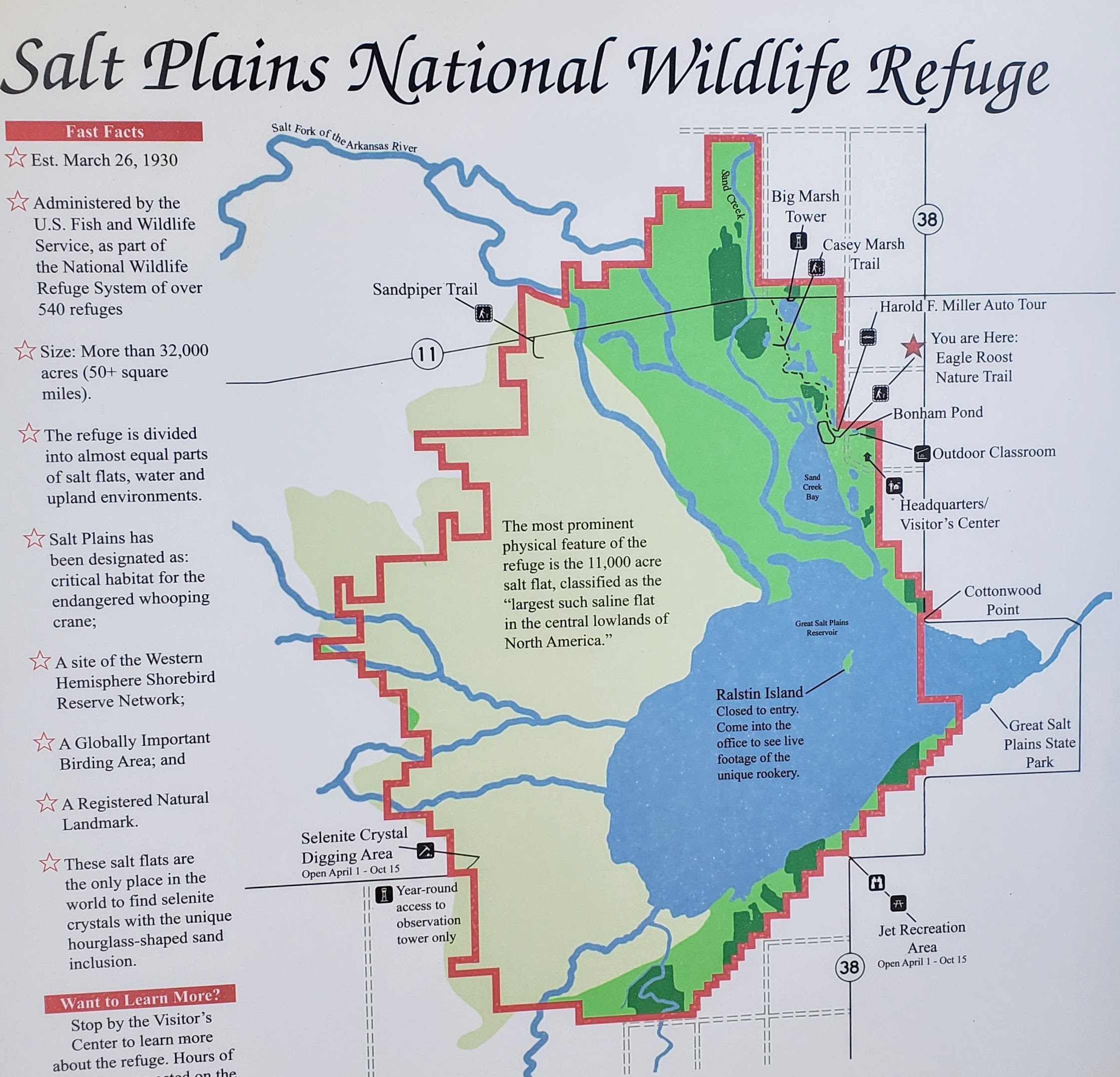
We were hoping to visit the Great Salt Plains, remnants of an ancient ocean that once covered much of Oklahoma, but we couldn’t actually figure out how to get there. There is also a “crystal dig” area where one can find hourglass-shaped crystals, supposedly unique in the entire world. Maybe we’ll have to come back someday to look for these attractions. We enjoyed our stay, although it was quite windy and very hot (mid-80s) on Sunday afternoon.
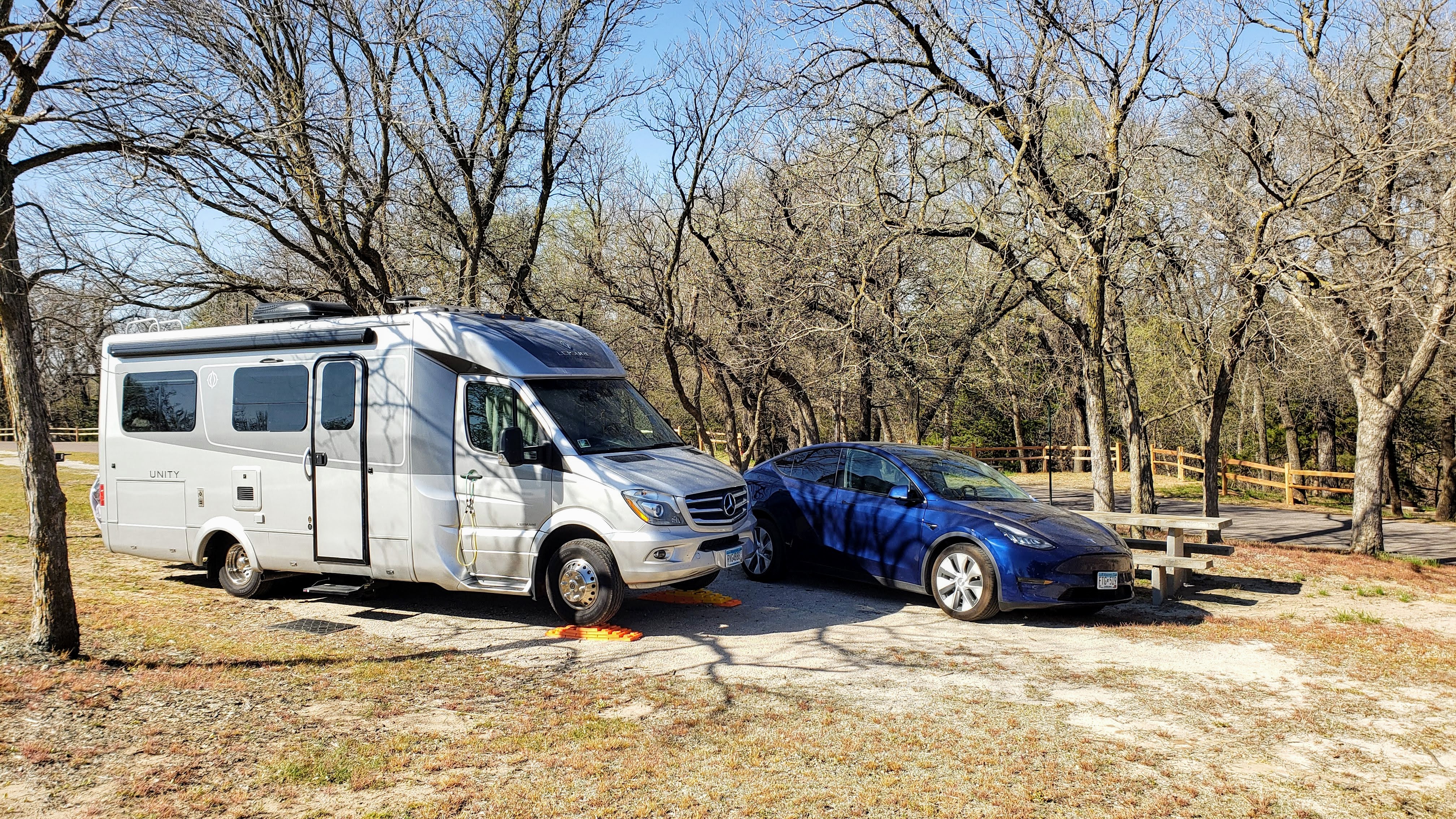
April 12 – 13 (Monday – Tuesday): On Monday, we drove to the El Dorado State Park near El Dorado, KS. Did I mention that it was windy at Great Salt Plains? Well, the wind kept up as we drove away, intensifying as we drove, and I felt battered and beaten when we finally arrived at El Dorado, which turned out to be rather disappointing. While there was nothing wrong with the park per se, it had to be the most boring place we’ve stayed during the entire Sojourn. We stayed at the Bemis Creek Campground, about 5 miles from the park headquarters, and we were the only campers staying there. The campground is situated between a nice lake, unsurprisingly called El Dorado Lake, and an occasionally busy highway. There are about 30 RV sites with water and electricity, but other than walking around the two road loops and sitting outside on our foldable Pico Chairs, there is nothing at all to do – no hiking trails, no suitable biking, just nothing. Apparently, the place is big for fishing and hunting, and now is not the season for either of those activities. t was also about 30 degrees colder than it was in Great Salt Plains. Our big activity here? We went to El Dorado for lunch at Burger King (drive-through), bought wine at a liquor store, and stopped for a stroll at the city park on the Willow River. Whoopee!
April 14 – 15 (Wednesday – Thursday):
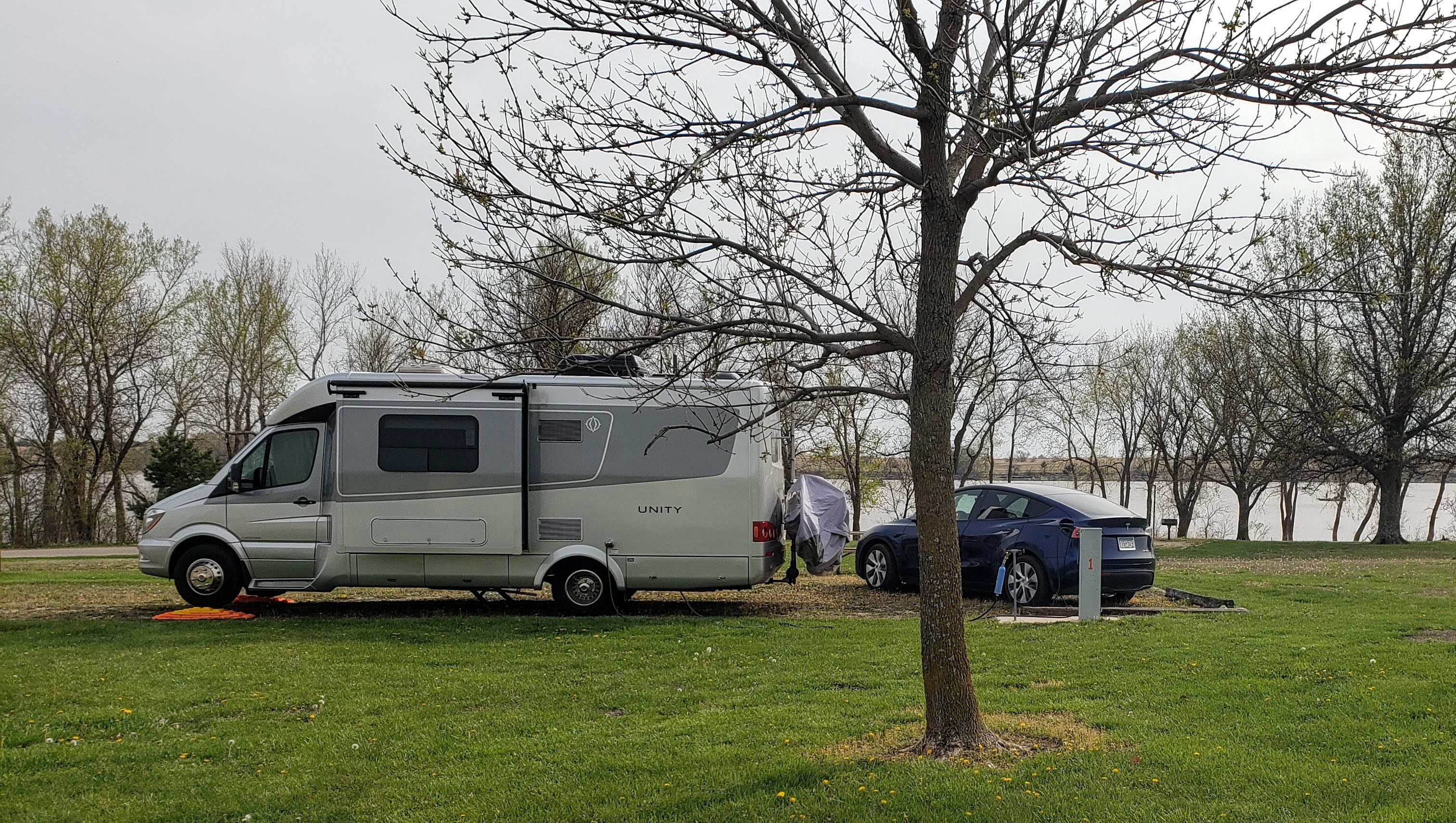
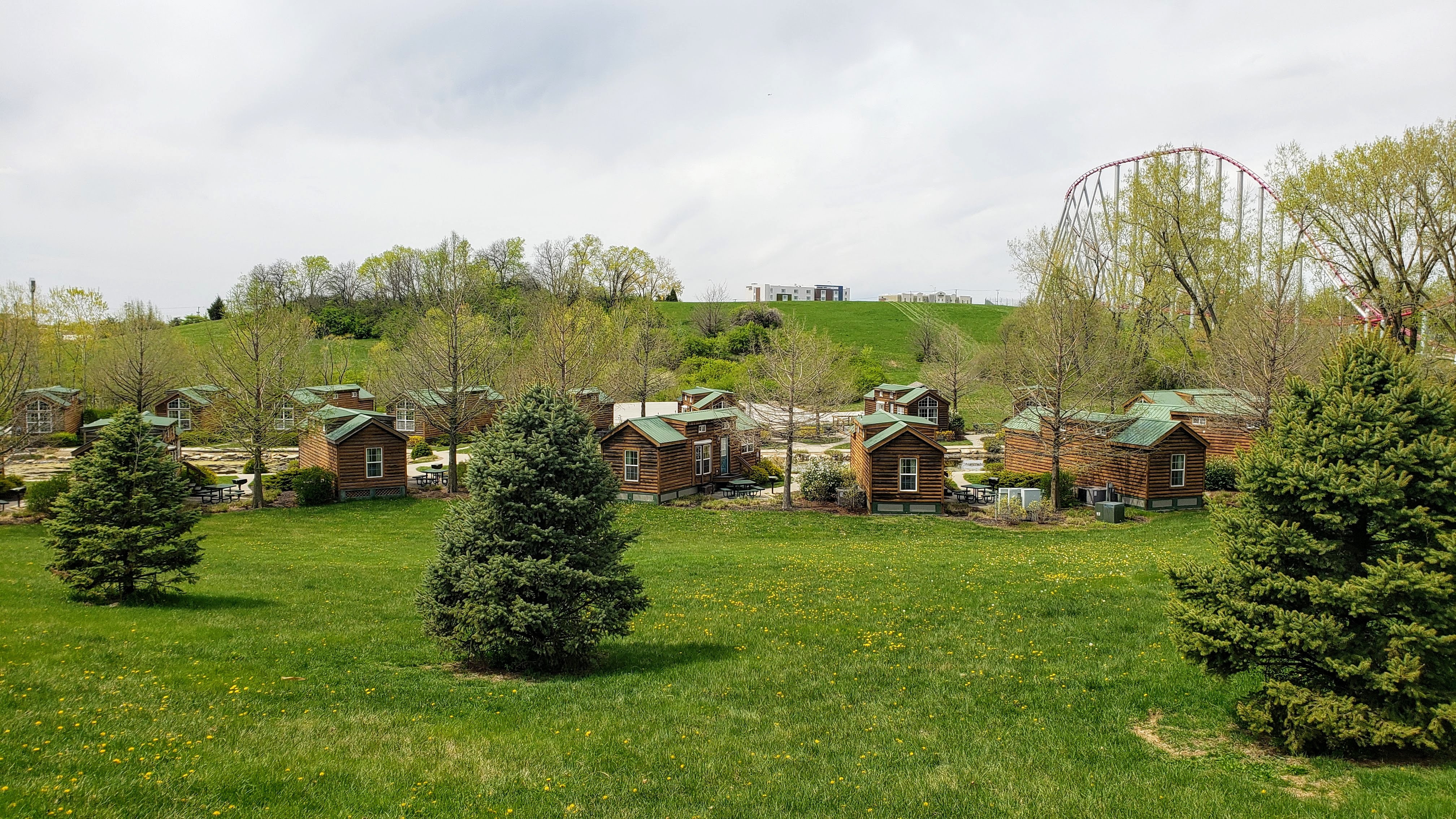
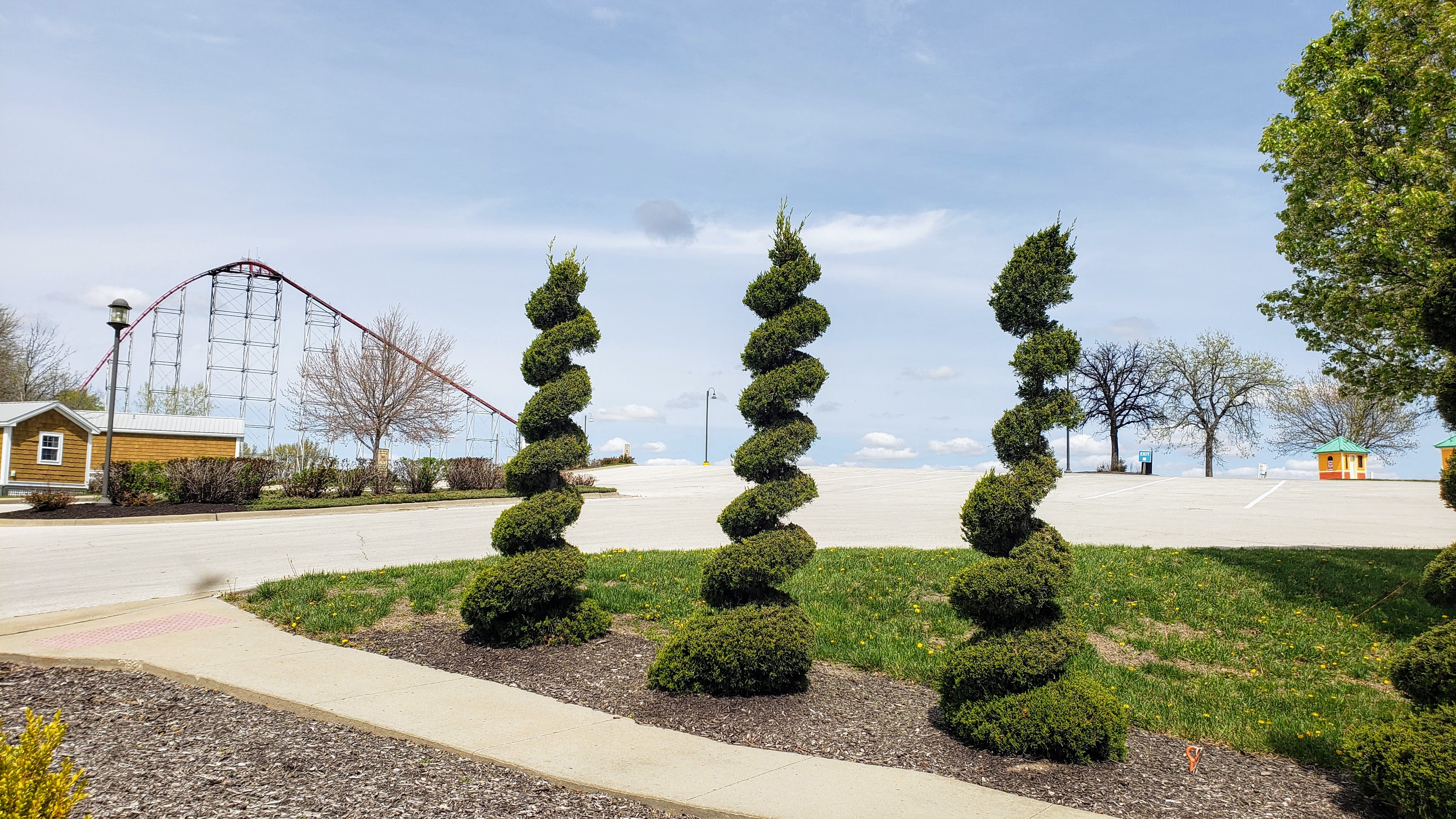
On Wednesday, we motored off again, this time to the Worlds of Fun Village near Kansas City, MO. With a name like that, how could we go wrong? The RV park gets its name from a giant amusement park, billed as the largest in the Midwest, situated right next door, and the place is probably an absolute zoo when the amusement park is open. Luckily for us, the amusement park is closed until May 22, most likely due to Covid. According to their website, operations were somewhat limited last year and the park closed immediately after Labor Day, apparently earlier than usual. As a result, only about 25% of the 83 RV sites were occupied, leaving us in a very well-spaced site. (None of the 43 cabins at the Village were occupied, presumably due to Covid restrictions.) The Village operators asked several Covid screening questions before allowing us to check-in, masks were required in the office and restroom facilities, and the laundry was open by appointment only for individual campers. So, we felt good that they were taking the pandemic seriously, and we felt very safe staying there. On the other hand, there wasn’t a lot to do other than walk around the Village, which we did a few times. We did drive the Tesla to a nearby RV dealer on Thursday to purchase a new support strut for the RV entry door – because the original one broke off in a fierce gust of wind back at Great Salt Plains.
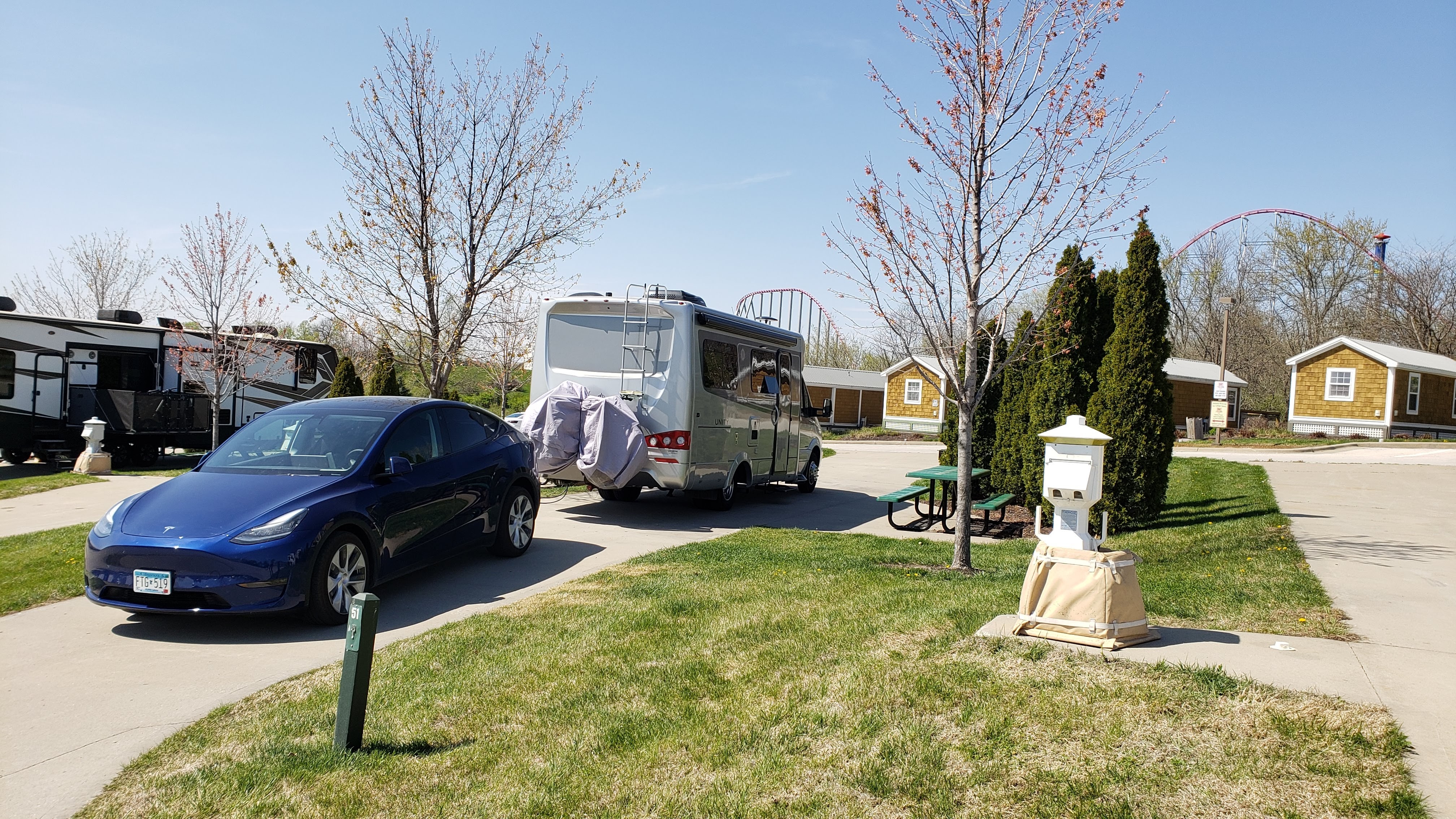
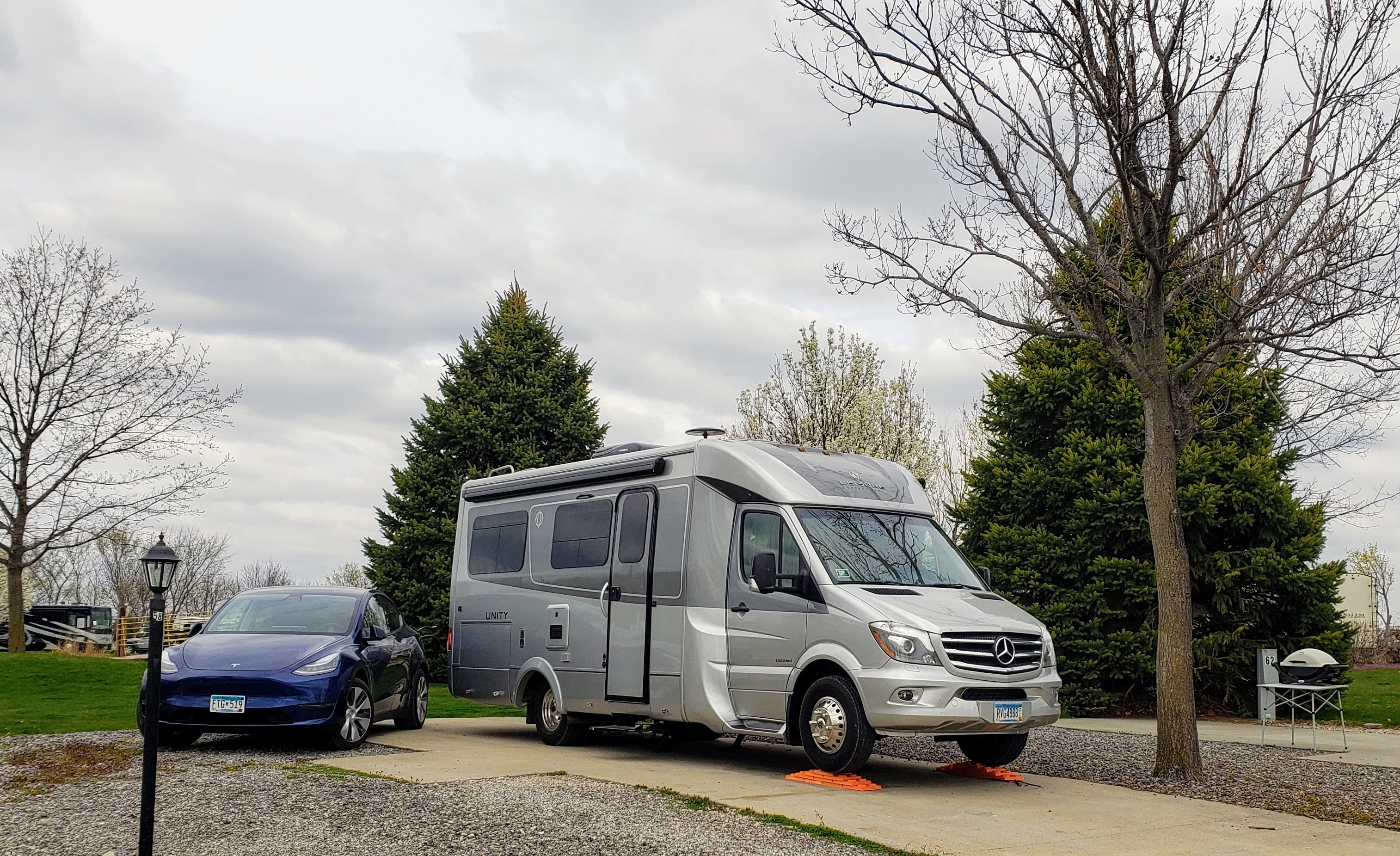
April 16 (Friday): On Friday, we drove to Griff’s Valley View RV Resort in Altoona, IA, just northeast of Des Moines. The total drive was 200 miles, at least 190 of which were on the freeway (I435 and I35). Traffic was light for the most part, though there was a bit of a snarl in Des Moines itself. Griff’s, however, has a very rural feel, and our site was nicely located near a fishing pond and grassy area. A nice building with restrooms, laundry, and recreation room was located just a short walk away. The only problem with the place is that they have no interest in masks or social distancing whatsoever. But we’ve learned how to stay isolated, and we of course wore our masks in the office and restroom facility anyway.
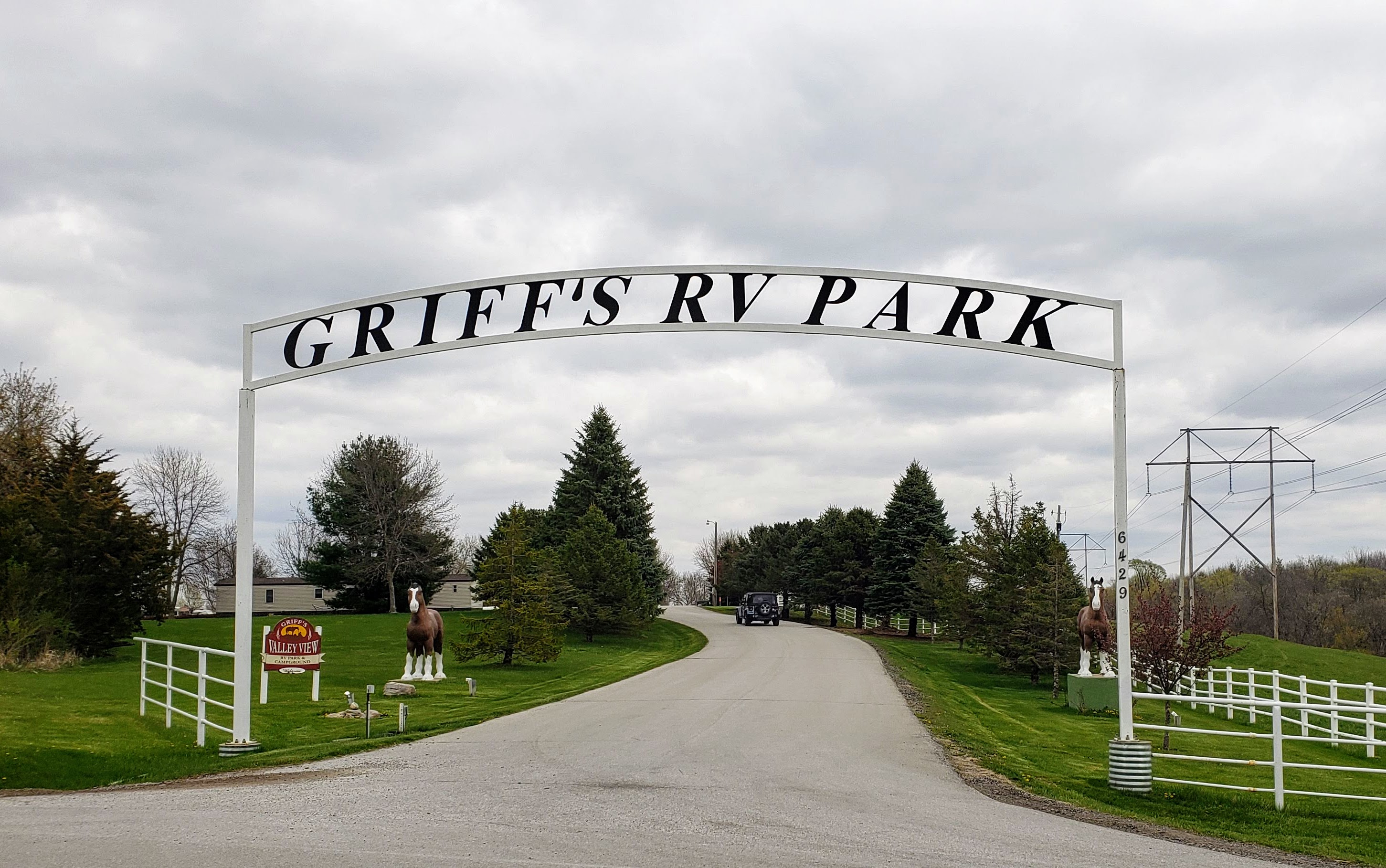
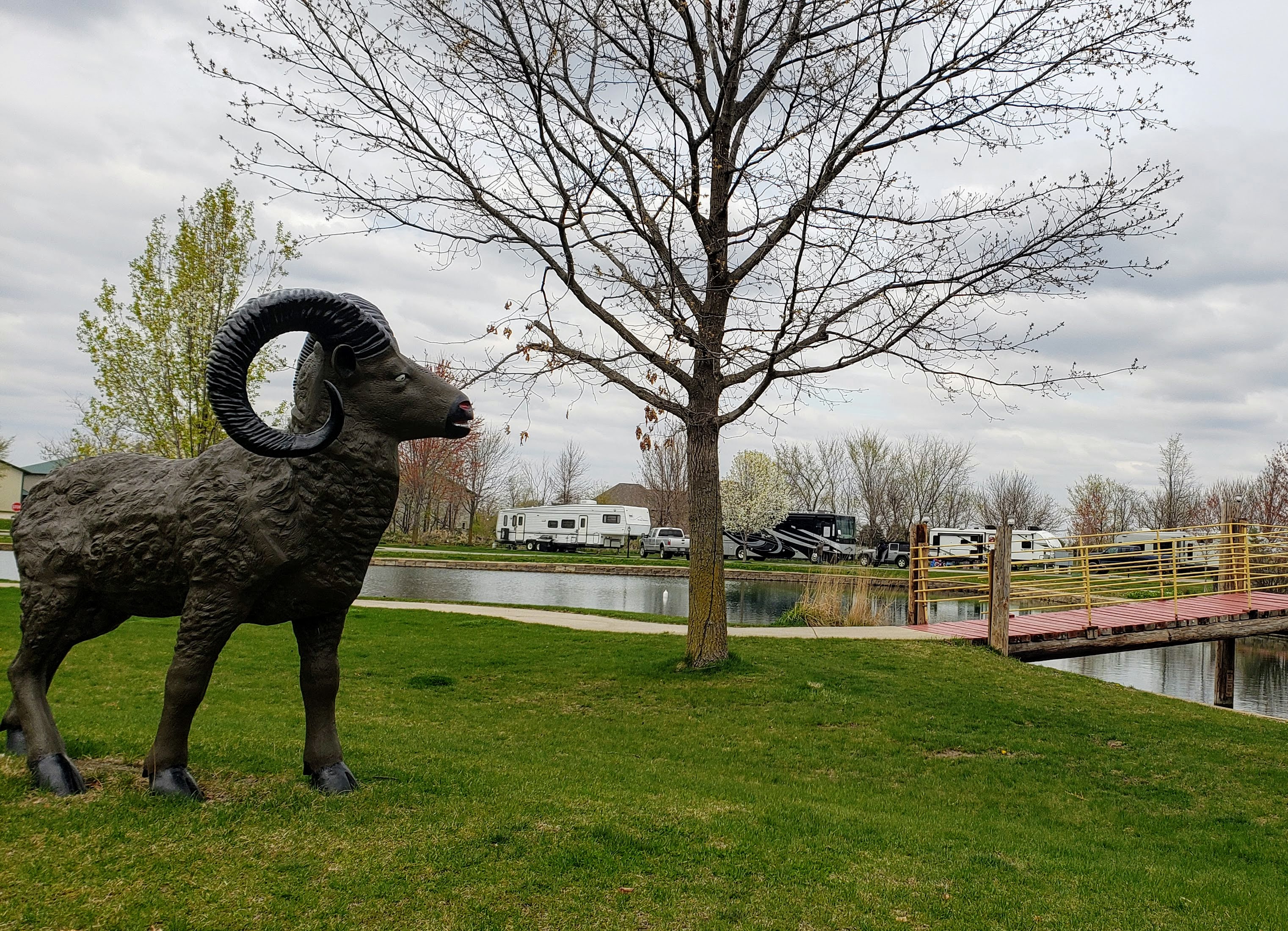
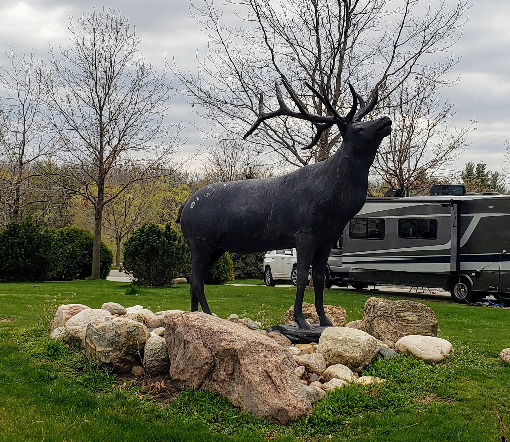
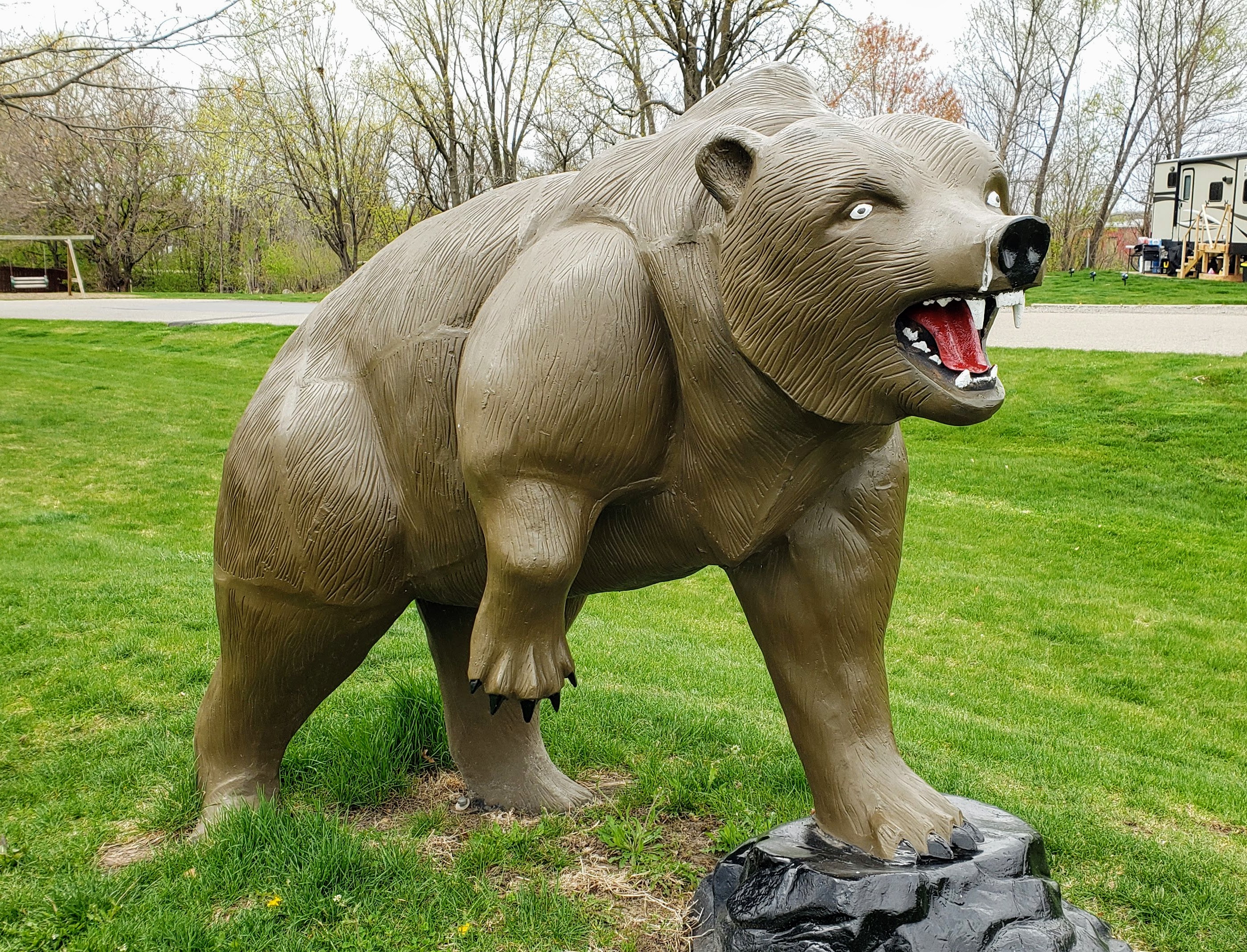
The park office is located at a farm and feed store operation known as Griffieon Farms, immediately to the north of the park. My guess is that the owners decided to convert part of their farmland into the RV park to diversify their holdings. Whoever designed the place apparently has a thing for animal statues.
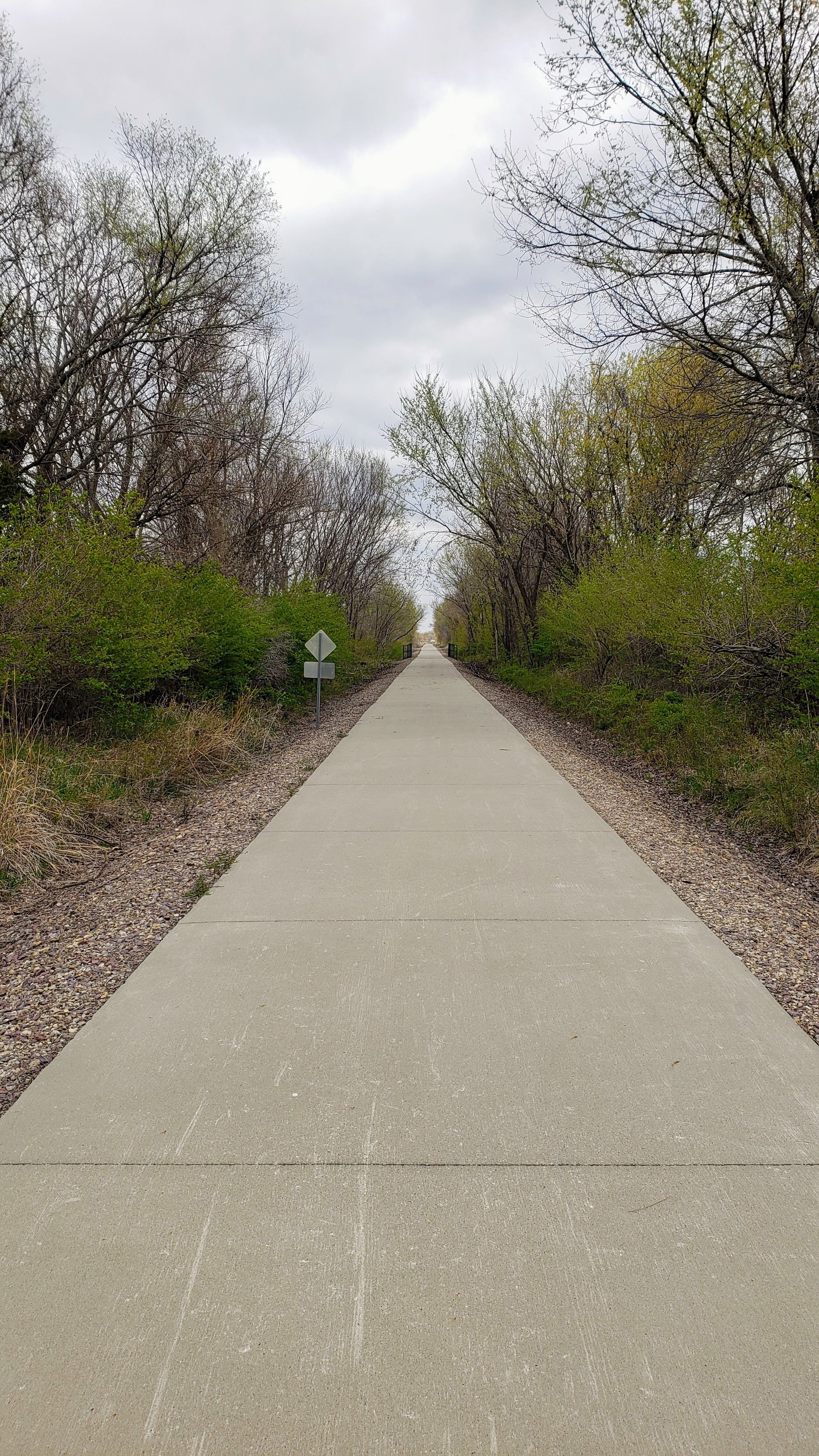
There was also an excellent bike trail adjacent to the park, and we would have loved to do some biking, but since we were only staying on night it didn’t seem worth the effort to get the bikes off the rack just to put them back on again in an hour or so. Besides, it was a tad chilly for biking. (It’s pretty pathetic that low 50s seems chilly to a pair of hardy Minnesotans, but I guess we’ve gotten soft from spending our winter in warm climates.) I’d have to say this would be a nice place to stay sometime in the post-pandemic future.
April 17 (Saturday): Our original plan was to stay at Griff’s for two nights, but I got an e-mail from the Minnesota Vaccine Team on Tuesday letting me know that I am eligible for a vaccination. (Pat hasn’t gotten the word yet, but hopefully she will soon.) After a half hour of poking away at the computer, I had scheduled a vaccination at the Roy Wilkins Auditorium in St. Paul at 6:10 PM on Saturday. Given this excellent news, we cancelled the second day’s reservation at Griff’s so I could get to St. Paul in time for my appointment. As a result, we drove off Saturday morning toward the Airlake Self Storage facility in Lakeview, MN. We’ve decided to store the RV there for the time being, for several reasons, including that we are not planning a winter RV trip in 2021-22. After unpacking the RV, leaving it behind to rest and recuperate, we departed in the Tesla toward our Minneapolis condo, still feeling safe and well, and looking forward to getting vaccinated.
So, dear readers, that brings us to the end of our (Sorta) Safe Sojourn. Look for one last post shortly, in which I’ll provide a final map and a brief summary of the trip.

Enjoyed your adventure except for all the brown ground.
Email rear golf on Thursday morning coming to you.
LikeLike